This is an edited version of an article that was originally produced for a UK paddlesports magazine. It follows a canoe trip we made to the Bowron Lakes in British Columbia in 2002 :
The road stretched to the far horizon as we headed North up Highway 97 along the old gold prospectors’ route towards Williams Lake, Quesnel and the Bowron Country. Endless forests melted into the distance; a thousand lakes shimmering in the September sunshine as we progressed up the Fraser Valley. It was the start of our Canadian wilderness odyssey; the few roadside settlements became ever more makeshift and further apart. Interesting names such as 100 Mile House, Horsefly and Big Bar Creek stood as a testament to the turbulent boom and bust days of gold exploration.
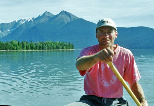
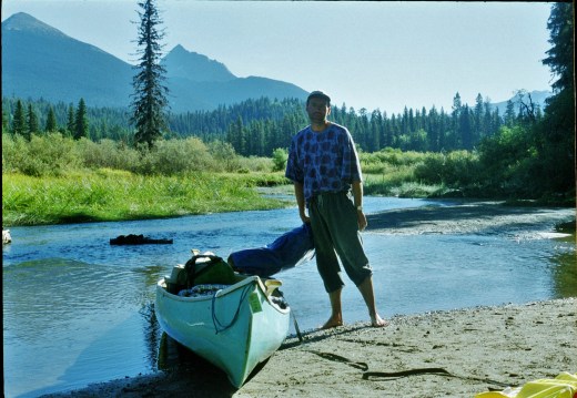
Two years previously my brother, Ken, had moved out to British Columbia with his family to start a new life in the Shuswap Lakes Region, midway between the high ranges of the Rockies and the Coast Mountains. Being a keen wilderness enthusiast, I jumped at the opportunity of coming out to see Ken for an adventure off the beaten track. At this time I’d been thinking more of a backpacking trip but was really excited when Ken suggested the prospect of undertaking the famous Bowron Lakes canoe circuit around the Caribou Mountains in central BC. Previous to that my canoeing experience had been confined to a 2 day jaunt down the River Wye in Herefordshire. The is promised to be an altogether more exciting enterprise indeed.
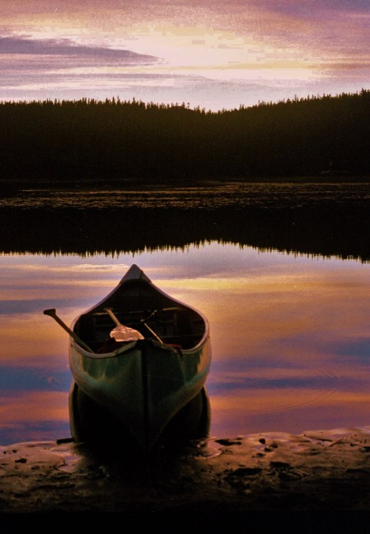
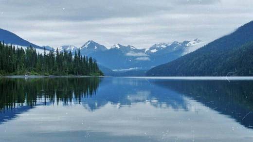
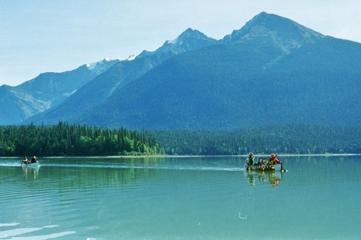
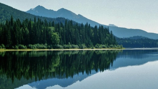
The Bowron Lakes, created by a geological anomaly, form a unique 116 mile chain through the Caribou Mountains, a wilderness area of 120,000 ha in central BC. The lakes are linked together by a series of rivers and 11km of portage trails, which allows paddlers to start and finish at the same place. The Lakes derive their name from John Bowron, a gold prospector and pioneer from nearby Barkerville, centre of the 1860s gold rush.
The whole area is now designated a Provincial Park by the Government of BC. In the wild interior, mountains rise to over 2000m. Old growth forests of subalpine fir and spruce provide a home to many wild creatures including caribou, moose, elk, lynx and otters. Ospreys and Eagles also abound around the Circuit. Perhaps of greatest interest (and of concern to me) were the many grizzly and black bears which inhabit the wilderness areas.

After a long day on the road we arrived at the Forest Service campground. This was my first introduction to camping in the Canadian wilderness. Eventually I fell asleep, the wind creaking the firs and constant thoughts of hungry bears eating campers disturbing my listless slumbers.
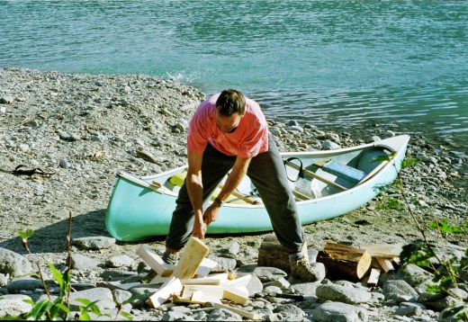
Daylight revealed that our location was not so remote and that in fact, our camping place was surrounded by other campers and trailers. Ken had made all the arrangements. He was on some special dietary fad at the time which, he explained, involved eating lots of “fresh food”. This consisted of an enormous array of vacuum packed steaks, chicken, salmon and pulses, all of which filled a couple of large cooler boxes. Other canoeists eyed us with envy and suspicion from behind their meagre stashes of freeze-dried gunk. I imagined too that the bears might be getting quite excited about our steaks, especially after they’d had to chance of getting “high” in an open canoe for a couple of days.
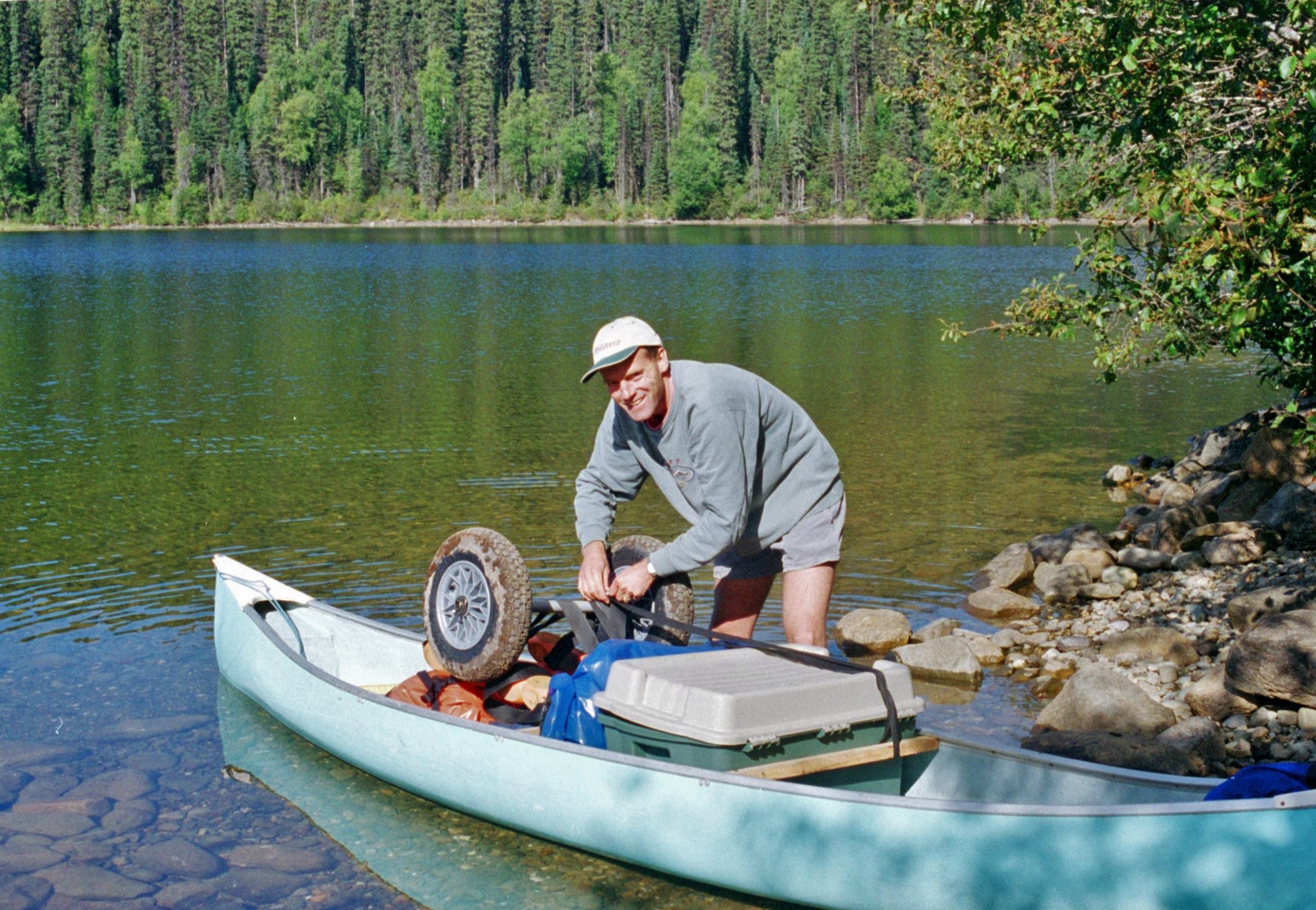
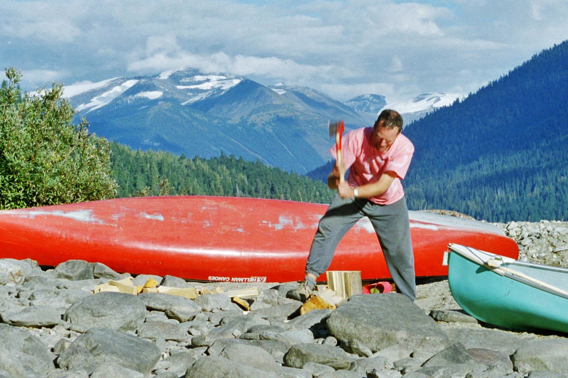
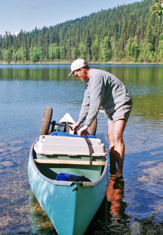
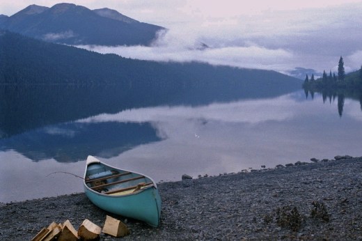
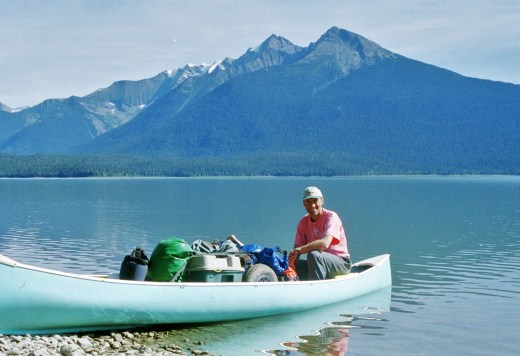
By this time I’d established that my brother’s experience of wilderness canoe travel was even less than my own; it was obvious that a big play wasn’t to be placed upon showing off to other canoeists. Our trusty “prospector” canoe had been picked up at a garage sale for 50 dollars. Makeshift bits of plywood had been thrown in as seats and there wasn’t a drysack to be seen anywhere. “Bin liners are ideal for that sort of thing”, Ken assured me. I conjured up images of capsizing in the fast flowing, icy waters of the Bowron River, miles from help, with broccoli, steaks and sleeping bags all floating off down the river. After a tense standoff we agreed to compromise and headed off to a local store to pick up a couple of drysacks. Now we were up with the professionals and I knew that we could handle anything.
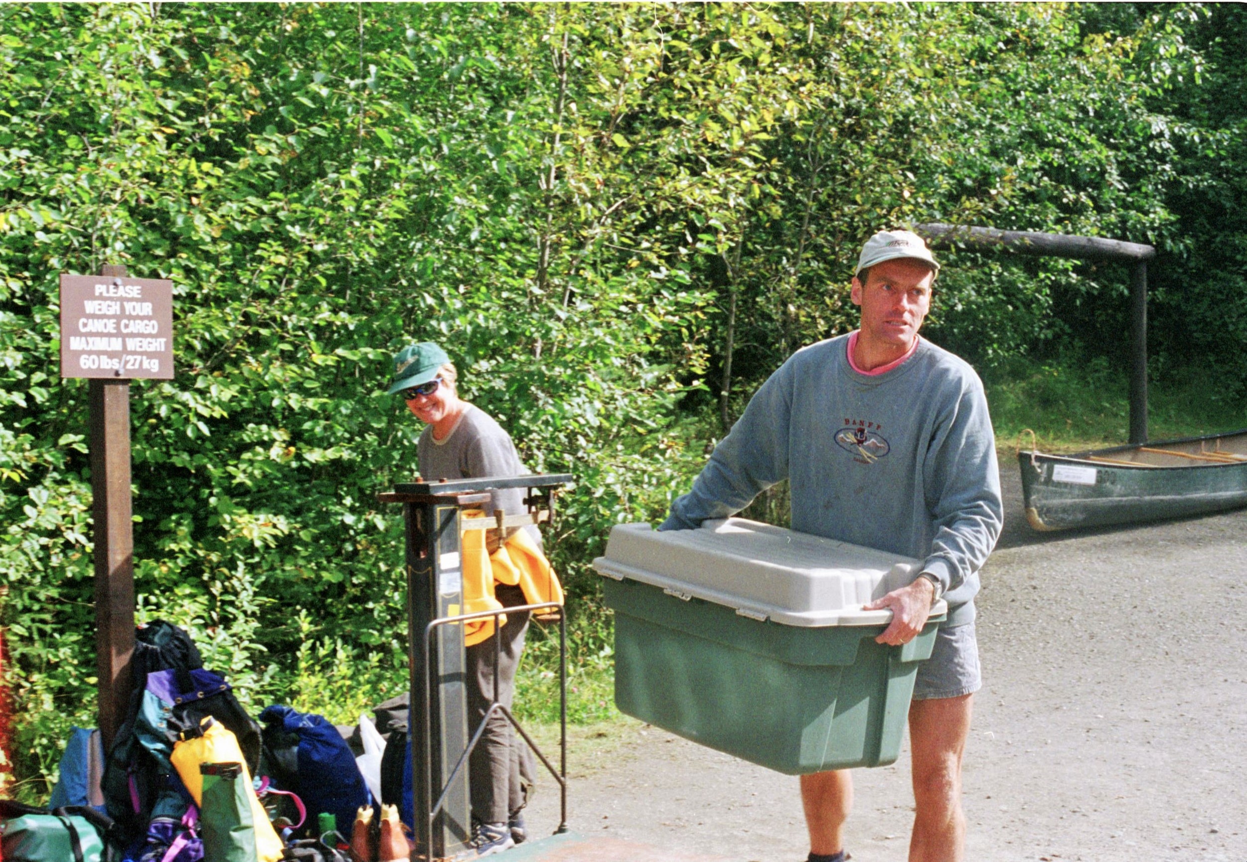
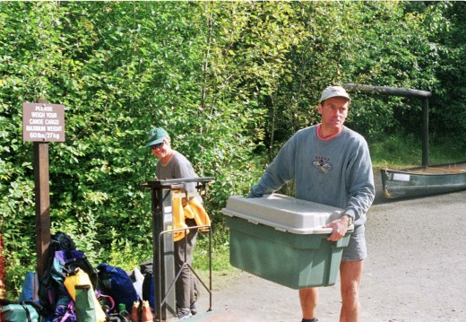
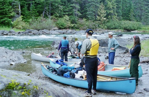
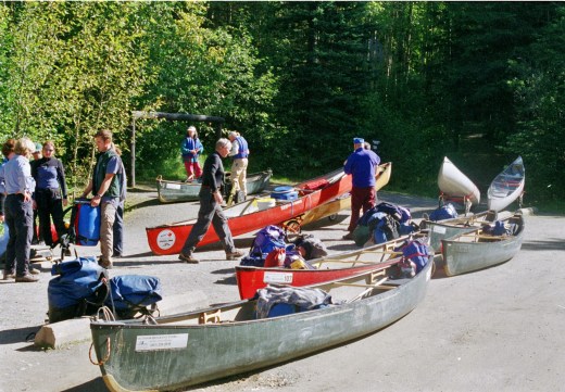 Admissions to the Canoe Circuit are strictly limited by BC Parks Department to reduce pressure and disturbance to wildlife. Would-be canoes are subjected to a degrading weigh-in ritual to check that the weight of gear stashed in the canoes will not cause damage to the portage trails. Strangely enough though we could carry as much as we liked in a backpack and so (for the purposes of the weigh in), out came the broccoli, the steaks and the pulses. Later we heard stories of clandestine park officials hiding on portage trails with mobile scales to check that people weren’t carrying too much. During our visit fortunately, these stories proved unfounded and anyway, the stack of food could only go down with each passing day.
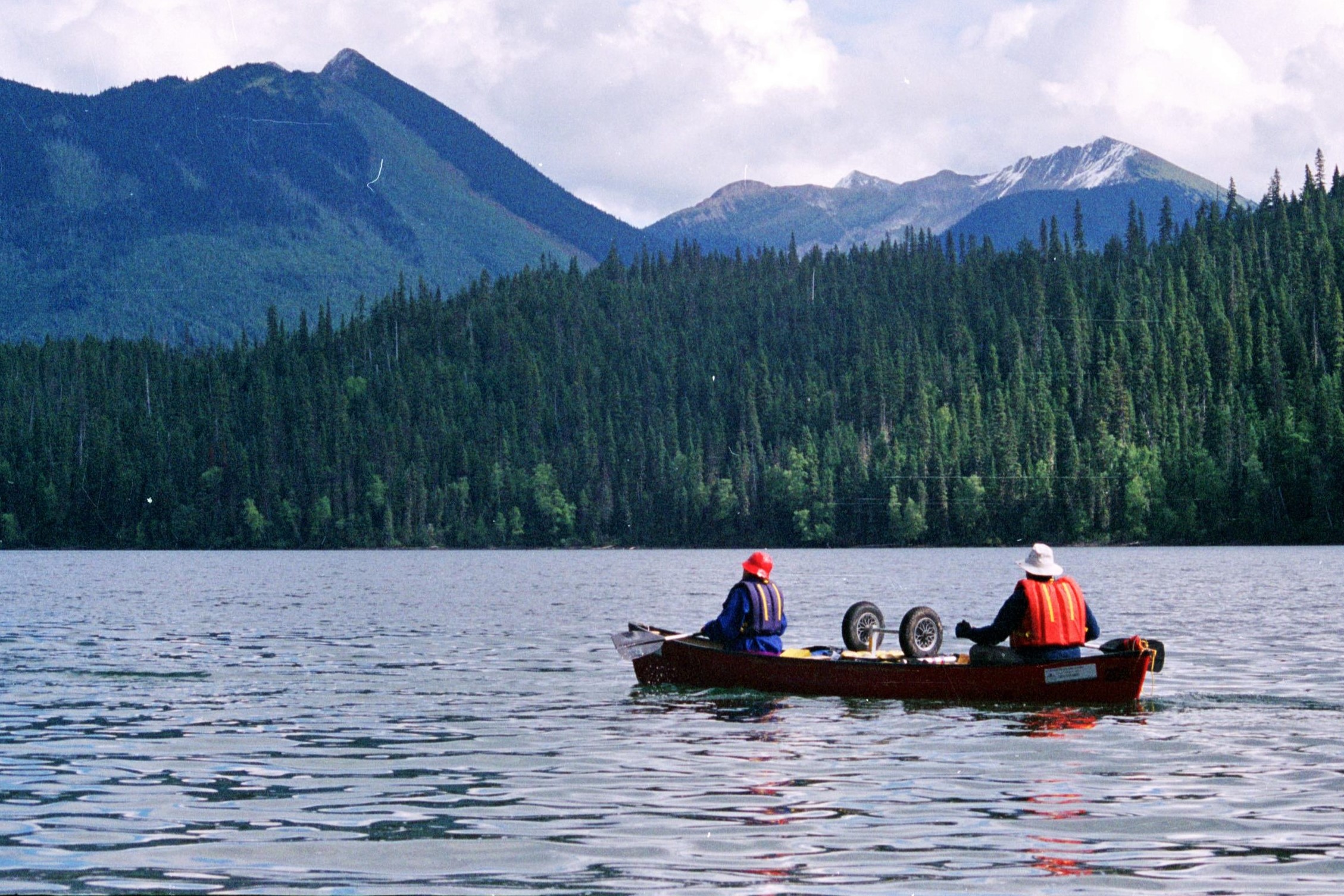
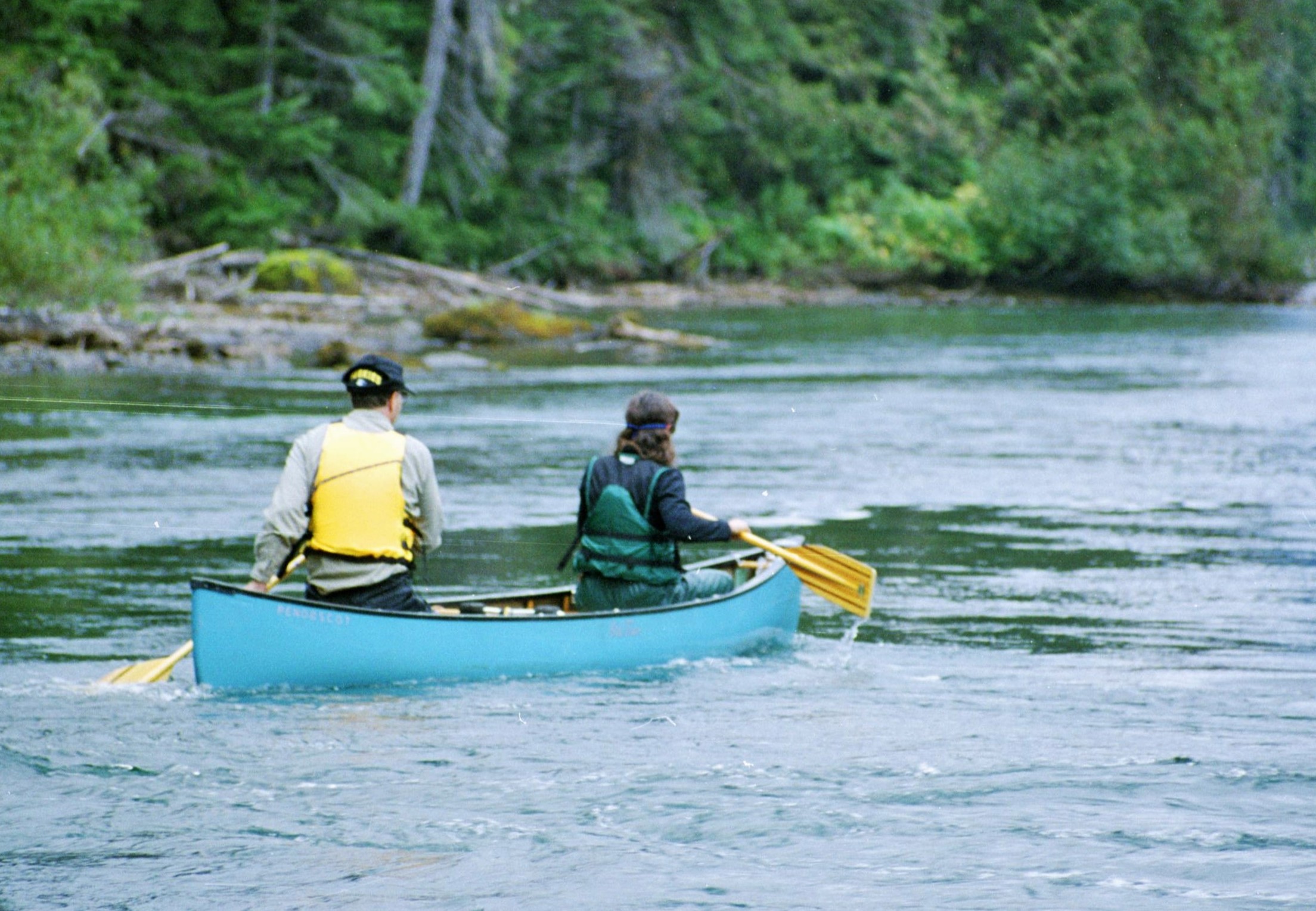
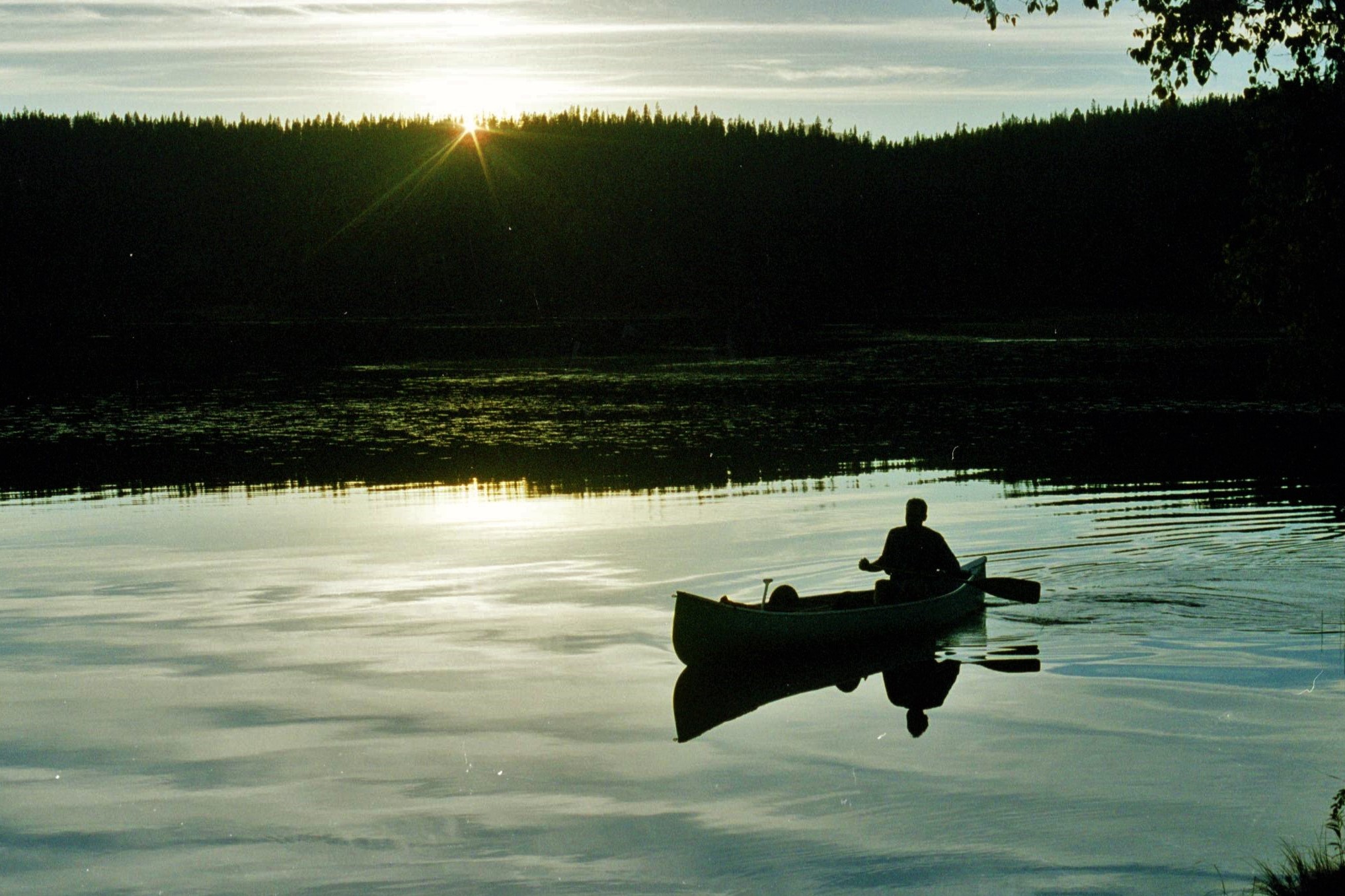
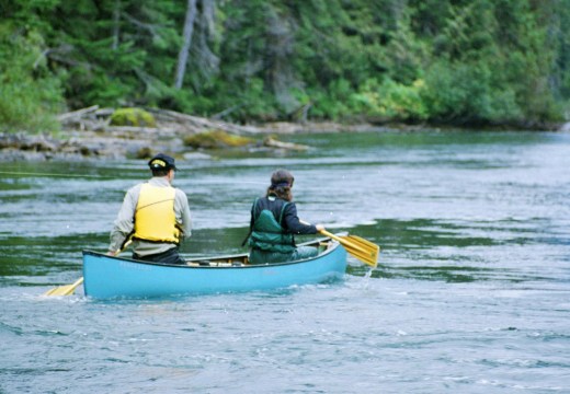
We headed off, a dishevelled pair, pushing our canoe upslope on the first portage, away from the crowds and their latest designer outfitted gear. We flattered ourselves thinking that we looked like the real mountain men. The route commences with 5km of unrelenting uphill toil until Kibbee Lake, the first one, is reached. Our hired portage trolley (our one other concession to modernity) proved to be a blessing and our canoe bumped along the forest trail quite happily. Soon we were waterborne and paddling off into the start of the first lake, the start of the real adventure.
We were keen to get passed the first lake and over the next portage by nightfall. Portages are potential places to meet bears and meeting a female grizzly with cubs is not a prospect to be relished. The park authorities advised us to sing or talk loudly as we wended our way through the forest, the idea being that the bears would be more scared of us than we were of them. Whilst not consciously admitting to being scared, Ken and I always seemed to maintain a healthy banter on these sections and an aerosol pepper spray was always kept handy as a last resort.
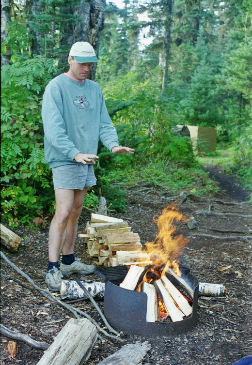

We were soon on our second lake, Indianpoint, and established a pleasant camp in a peaceful bay. Things had turned colder and a wind had got up as we huddled around our meagre campfire, hoping that this wasn’t going to set the tone of things to come. An eerie cry of a loon (Canada’s National bird) echoed across the dark waters. The daylight died and the campfire momentarily grew brighter, competing with the spots of rain for supremacy. We turned in. The night-time noises played tricks with our minds, feeding paranoia about wild animals. We lay still in out tent hearing a repeated “thud”, “thud”, somewhere close by in the undergrowth. Investigation later proved this to be pine cones falling down and hitting the aluminium roof of the pit latrine.

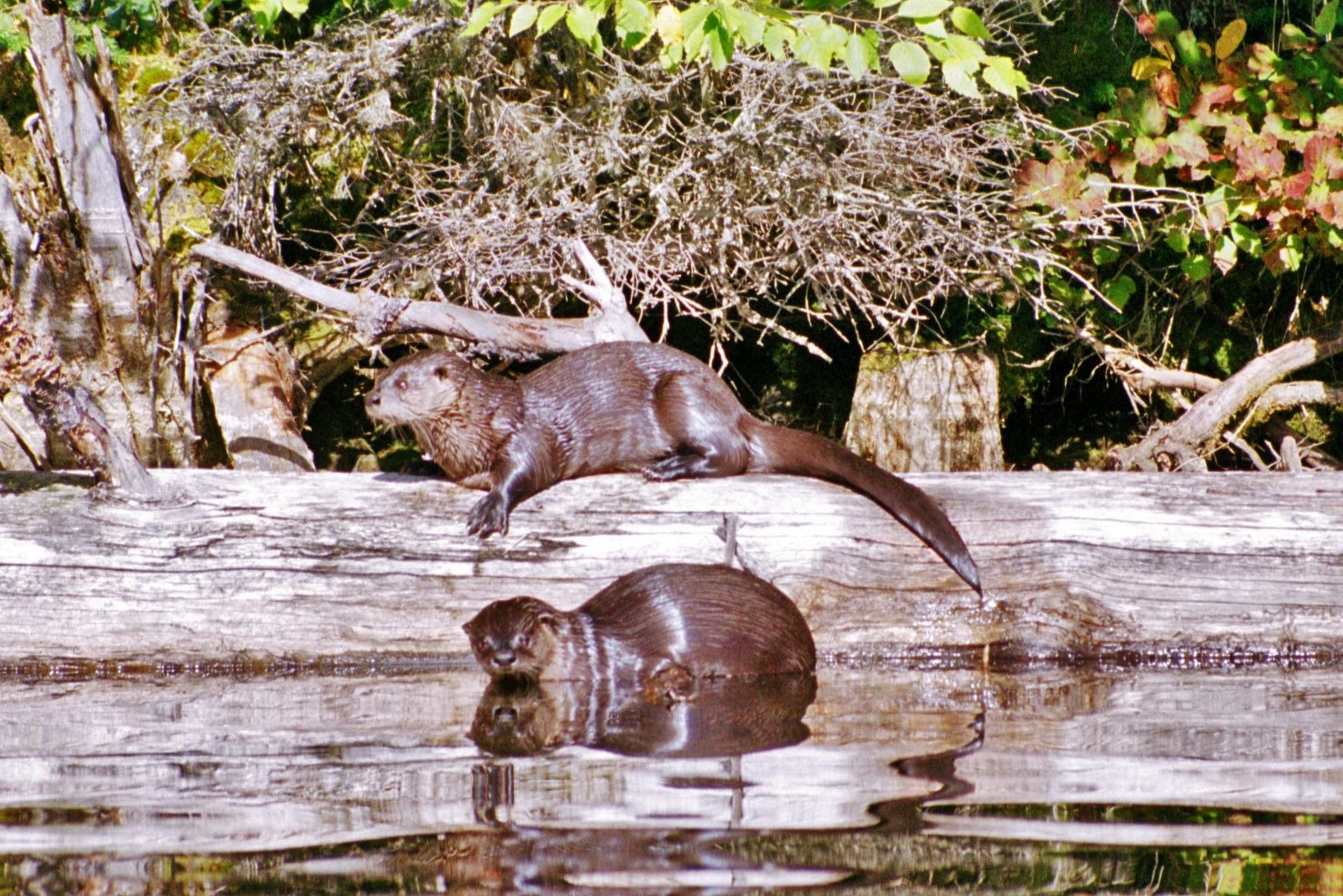
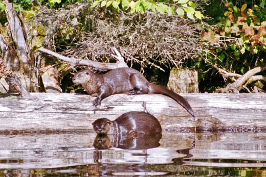
The next day heralded a bright start; an effervescent autumn morning, still, steaming waters reminiscent of some New World Avalon. As we paddled through the misty waters, something stirred, not Excalibur, but a curious river otter eager to investigate our canoe and its human contents. First one then two; the otters hauled out of the water and observed us from a tree branch with detached amusement. We paddled a bit closer and I clicked off several shots with my zoom lens at close quarters. A quick splash and our aquatic friends disappeared into the murky waters.
An open canoe in the Canadian wilderness is a great platform to view wildlife and we were constantly amazed by the never-ending pageant of creatures that accompanied us on our travels; eagles, beavers, ospreys diving for fish…enough to send the most seasoned twitcher scrabbling for binoculars. Every day it was all there for the taking; just sit back and enjoy the show.
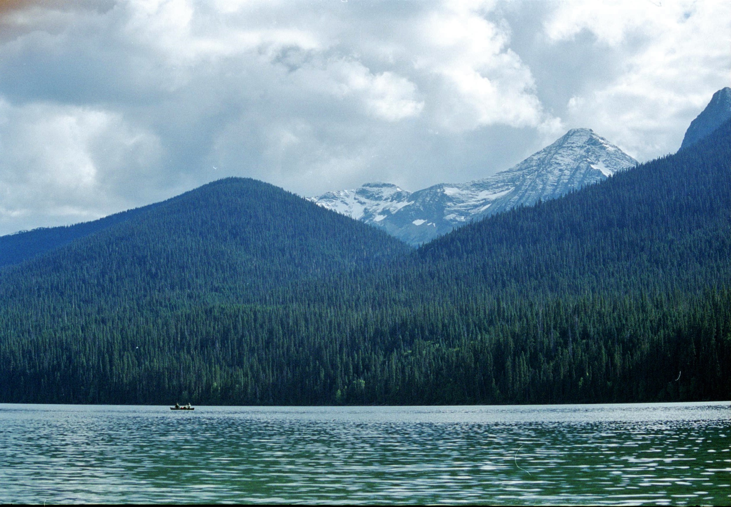
Another portage took us to Issac Lake, which at 42km, is the longest lake in the chain. Turning the first corner of the lake, we took a short cut and soon found ourselves hitting heavy swell. Suddenly we realised just how far offshore we had gone. “Don’t worry”, said Ken, “This canoe can float, even if it does capsize!” Greatly reassured by this and forgetting everything I’d ever read about hypothermia and the unlikely prospect of rescue, we paddled boldly onwards for the second night’s camping on the beach at Moxley Creek.
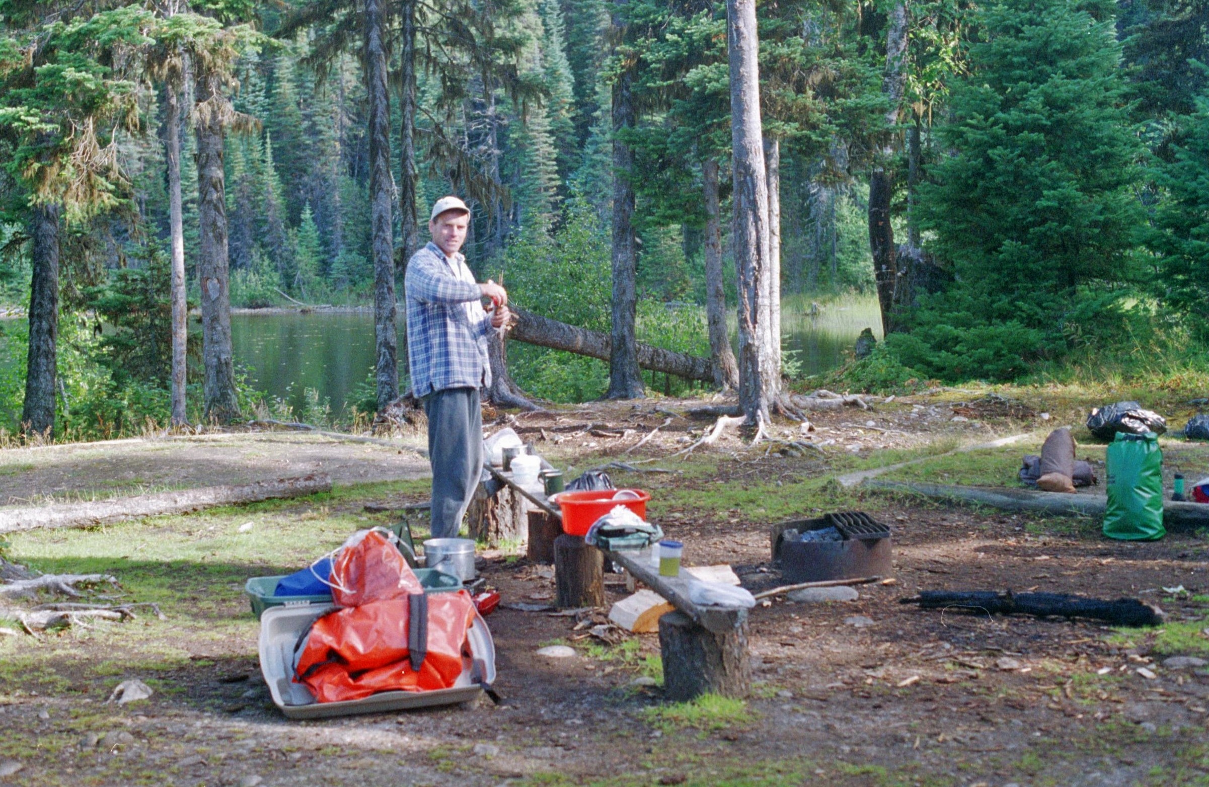
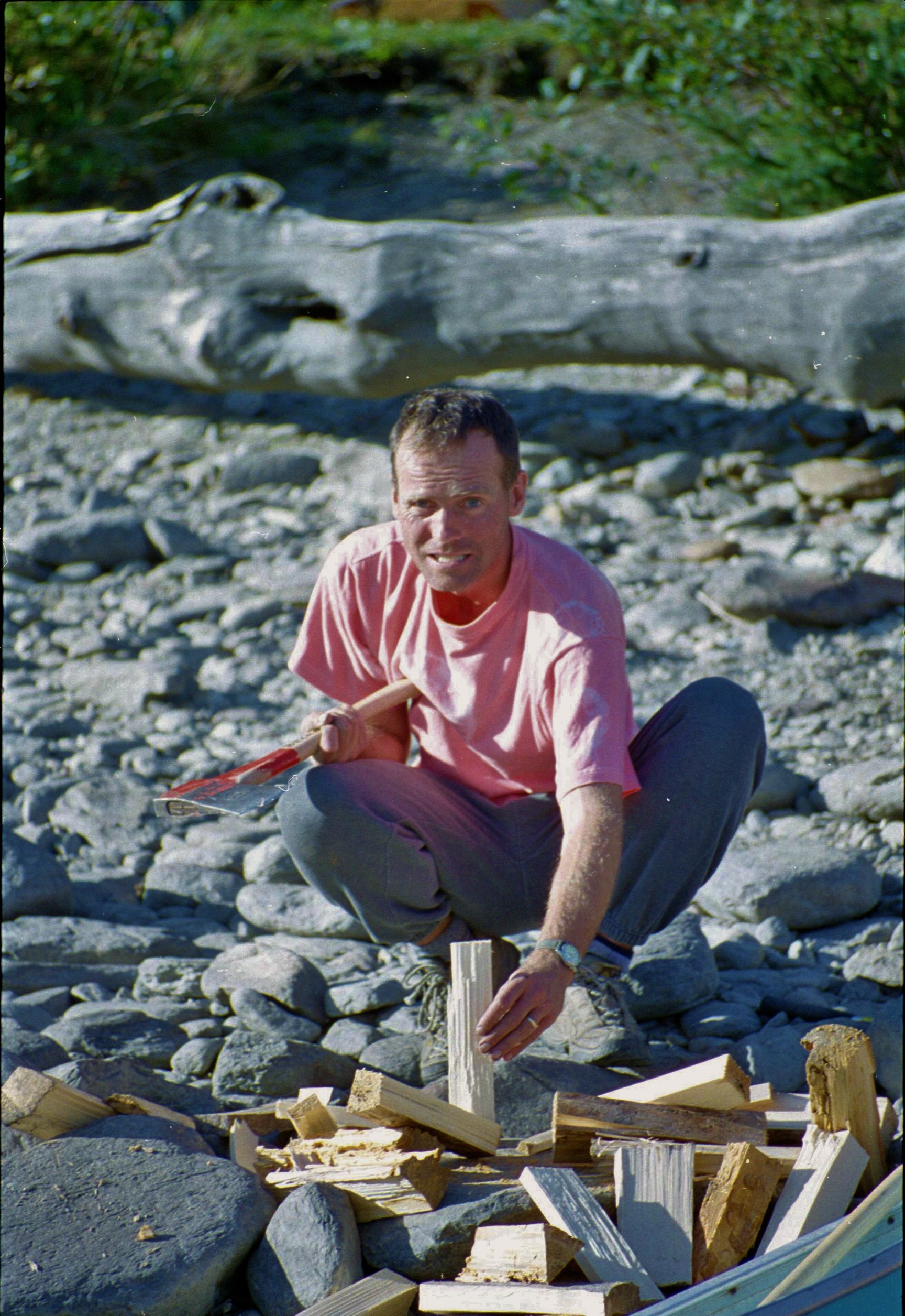
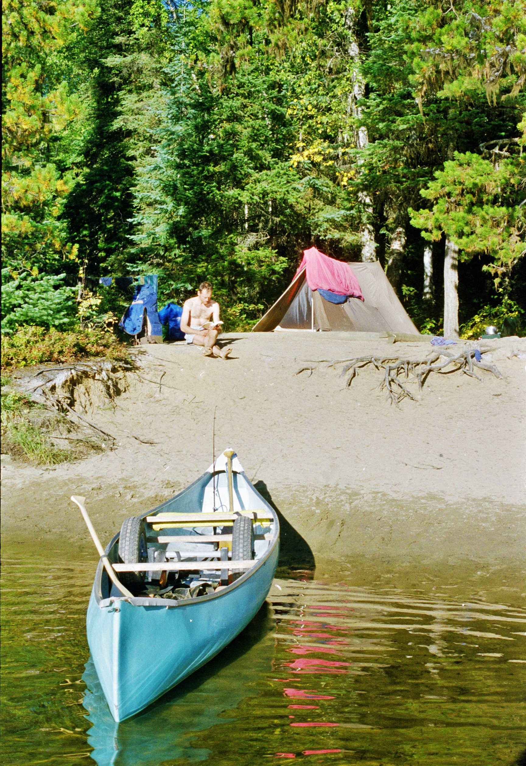
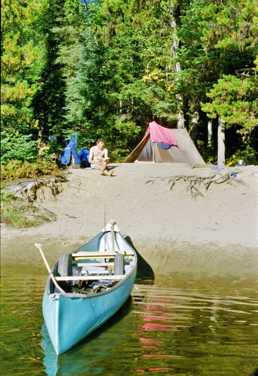
There are around 45 basic camp sites around the Canoe Circuit, which the Park authorities insist that visitors must use. Each of these sites includes a tent pitching area, a pit latrine, a cooking ring for campfires and most importantly, a bear-proof cache or storage box for food. Given that our vacuum packed steaks were getting a bit on the fresh side by this time, I was quite glad of the bear caches; I just didn’t want to camp too close, that’s all. Park guidelines suggested that we should camp 50m away from the food. The trouble was that they never designed the campsites so that this was possible. In fact 10m away seemed to be more like the norm.
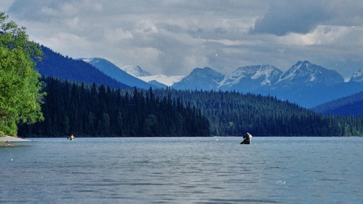
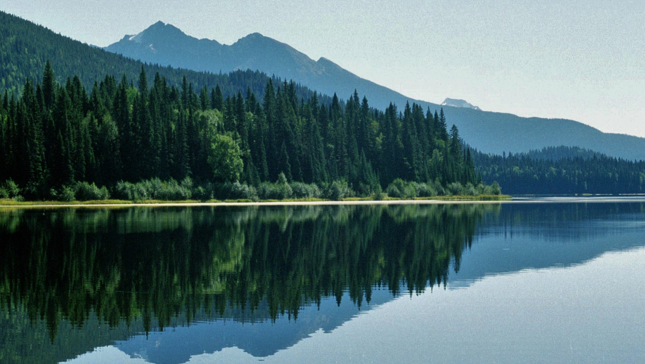
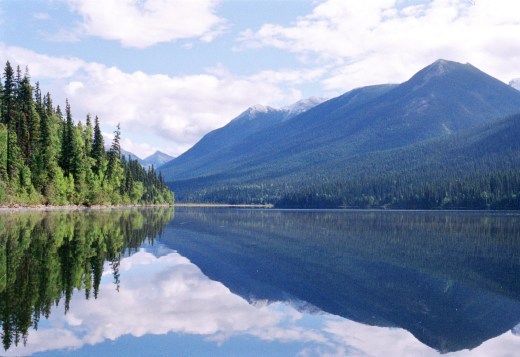
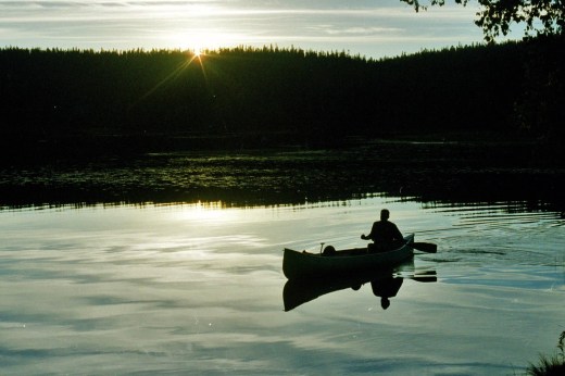
In September visitor numbers to the Bowron Lakes are considerably down from July and August. It’s hard to understand why; at this time of year the colours are changing as the Fall sets in and the aspens turn a brilliant orangey-yellow. Skies can be crystal clear and the ubiquitous mosquitos have finished their seasonal assault. This makes for a mellow, contemplative trip; vistas of mountains, glaciers and waterfalls increasing every day in their splendour. Once again we fell asleep to the haunting cry of the loon and awoke to the sound of gently lapping water, rising mist heralding the start of another perfect day in the Canadian back country.
The morning after we enjoyed a long paddle two-thirds of the way down Issac Lake , the glaciers and snow domes of the Caribou mountains growing even nearer and more spectacular. As the day went on however, skies started to darken, heralding the possible approach of stormier conditions up ahead.
That night we camped up and found ourselves sharing a secluded camp spot with a couple from Seattle, Washington. We shared a pleasant evening around the campfire, swapping tales of our respective countries. Our American friends also seemed intrigued to find 2 brothers in the wilds of Canada, one with a Scottish accent and one with a South African accent. (Ken had married a South African and had lived there for over 10 years). We bid each other good night and bedded down as the spots of rain started to turn to a flood, finally extinguishing the dying embers of our campfire. We fell asleep, the sound of heavy rain against the tent.

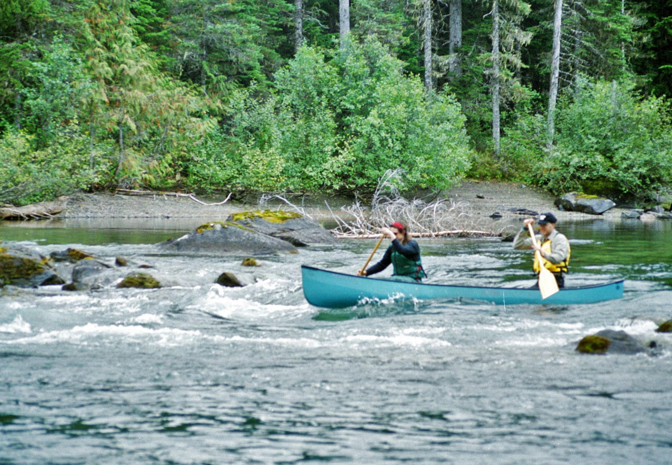
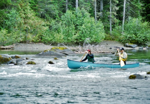
Fortunately things had dried up the next day. The next major challenge of the trip was to negotiate the Issac river rapids, where fast flowing water exits from the lake. The first section of this is a straightforward chute which is complicated by a 90 degree turn where the current splits into two directions in an eddy. We took a risk and ran the first section of the rapids, fully laden and with all our gear. Fortunately we did not capsize, although we did have a close encounter with a rock and shipped quite a bit of water in the standing waves.
Lower down, the river gets just a little too wild to run as it cascades over a series of falls and through foaming pools. Again we took to the portage trails, encountering our first canoeist logjam of the trip at the takeout. This gave us a much earned respite and the chance to chat to other adventurers. We enjoyed the company, knowing that by the time we got to the open water, the crowds would have dispersed. By this part of the Circuit, the portage trails had deteriorated considerably and rolling our canoe along the uncompromising rutted trail seemed more akin to taking a gun carriage into the Napoleonic wars. At last though we managed to fight our way out of the tangled morass and lurched into the still inviting waters of McLeary Lake, passing the solitary remains of an old trapper’s cabin.
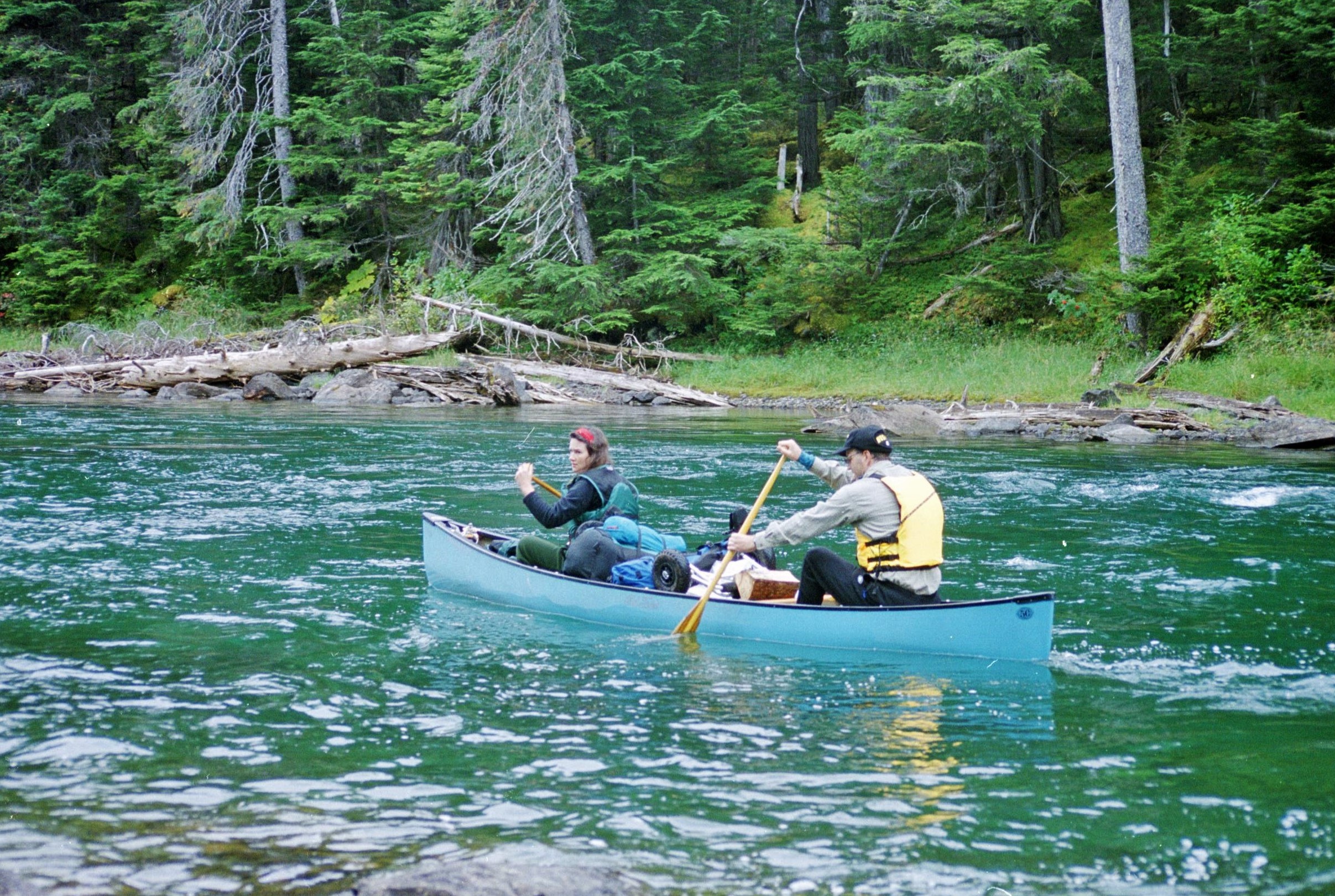
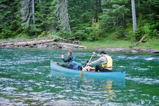
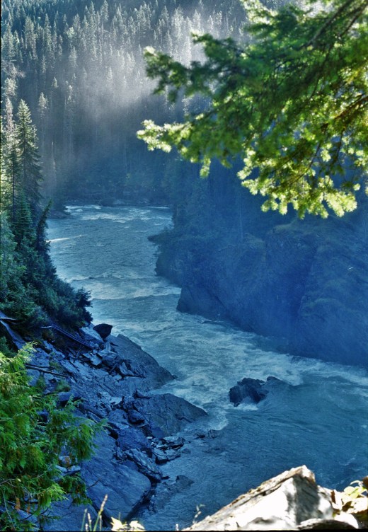
Soon we began to notice the canoe being pulled along in the flow as McLeary began to empty into the silt laden waters of the Caribou River. By now we were feeling more cocky and self-confident about our ability to control the canoe in a current. Ken navigated down the river, carefully avoiding deadheads (upright tree trunks hidden in the silty waters) and sweepers (trees overhanging the current from the riverbank).
For a second we relaxed our guard on the outside of a fast flowing bend; before we knew it a strong current was trying to drag us under a sweeper. We sat, pinned, our efforts to struggle free upsetting the boat making it liable to tip us into the icy waters if we carried on this way. Thoughts of wet broccoli and dripping sleeping bags once more clouded my mind and then suddenly, as if by some act of divine intervention, we lurched free and continued our river descent through the bluey, silty, river waters. Once again our attention turned to more mundane thoughts of bears, having been told that this was a good spot to view them.
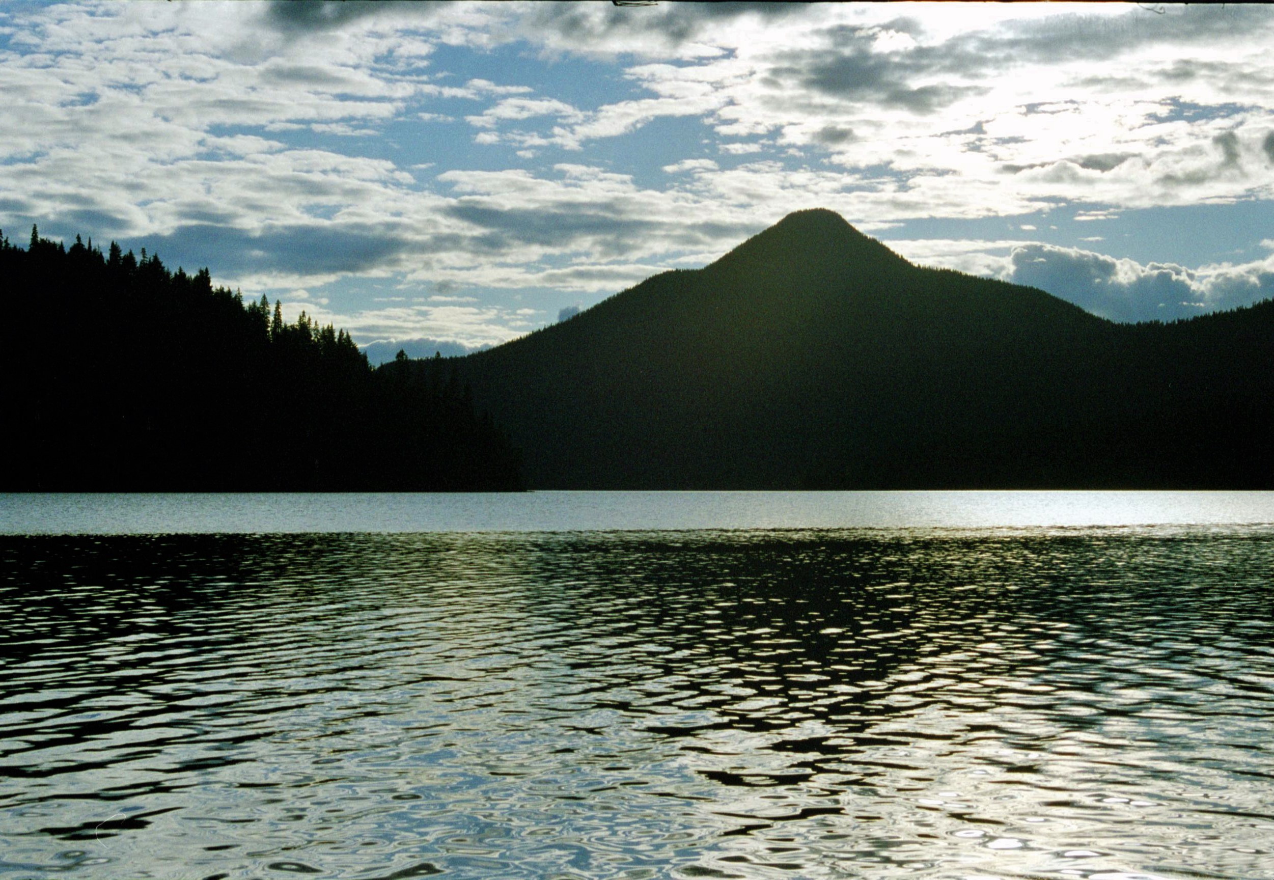
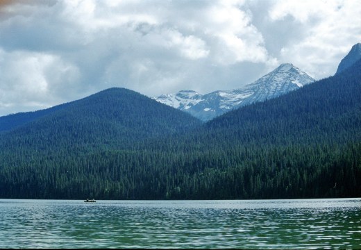
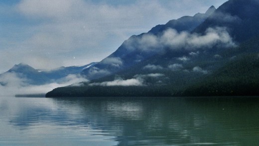
 The tranquil waters of Lanezi Lake provided a welcome contrast from all this excitement. Once again we were able to relax and appreciate the fjord-like splendour of our surroundings. By now we well over half way around the circuit, most of the major obstacles having been ticked off, just time to take it easy, do some fishing and generally chill out. Our tentative attempts at fishing had so far yielded no results to supplement our diet of (by now, very) “fresh” food. Meanwhile we watched in awe as the freeze-dried brigade plucked fish after fish effortlessly from the waters. So that’s what they’d been planning all along.
That night the campsite seemed a veritable metropolis compared with the previous nights; representatives of most of the globe’s creeds, cultures and ethnic minorities were in attendance. Once again we enjoyed the Bohemian “craik” and paddlers’ tales of places afar; one more we felt humbled in the presence of so many well outfitted gear freaks.
One group exhibited an almost fanatical ability to rig up complex tarp systems overhanging their tents for no apparent reason, relying on miles of rope, elastic shock cord and conveniently placed trees. Ironically it turned out to be bone dry that evening and there was a large unused cook shelter anyway. However it takes more than necessity to dampen the human need to be inventive and to create unnecessary work. We shared “fresh” steak barbecuing facilities with a couple of German old-timers, pouring scorn on the freeze-dried fanatics and their fishing skills; merely a case of good luck we convinced ourselves.

Another day again beckoned fine and bright, the morning mist burning off tom reveal the full wonders of creation. Ispha Mountian stood tall and resplendent above the waters of the lake, growing ever more impressive as we headed west. The country from here on, by contrast, became less steep and progressively more undulating. As we glided through the placid waters I fancied that I caught the momentary whisper of a chainsaw somewhere far off in the distant forest; could it be my mind playing tricks or was the turbulent world of “civilisation” not quite as far awa as we would like to think ?
On through the passage marking the end of Lanezi Lake and into the shallower forest fringed waters of Sandy Lake, the high mountains now receding further into the background. Soon Sandy Lake again was narrowing as it again turned into the Caribou River, a gradual flow indicating that there were more exciting things to come not too far downstream.
We’d been told that tiny Una Lake, just off the main circuit was a beautiful, chilled-out sort of place to spend the night; little could we imagine just what a sheltered and relaxed oasis this would turn out to be. As it turned out, it’s not a good idea to carry on any further down the Caribou River from this point. Suddenly, rounding a bend in the river, one is confronted by an uncompromising yellow warning sign graphically depicting an unfortunate canoe and its occupants trundling over an abyss.
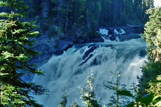
It’s still half a mile from this point to the hundred foot high Caribou Falls but if one is foolhardy enough to ignore this sign and carry on downstream then one is mincemeat and deservedly so. Even from the take out, several hundred metres upstream, we could hear an ominous roar of water in the distance and the imaginary cries of unfortunate paddlers. It’s just like you see in every good Wild West adventure when the good guys are being chased by the baddies and escape by leaping into the river, just managing to hook onto a tree branch before being swept over the falls.
Not wanting to get too closely acquainted with the falls, we turned into the peaceful waters of Una Lake and camped out on a beautiful beach under the pines. The water was warm enough for swimming now and it was most welcoming to have a good scrub down after all our maritime toil. Playful red squirrels chirped overhead in the firs and entertained us with their cheeky and vocal acrobatic displays.
We took the pedestrian option and paddled across the still waters of the lake to the start of the Caribou Falls Trail, one of the few walking routes in the Park. We strolled peacefully through the dappled, shady old growth forest, feeling less concerned now about the bears and their unwelcome attentions. Soon the distant sound of the Falls grew in resonance to become an omnipotent boom, reverberating through our heads and the surrounding back country. Over the brow of the hill we found ourselves staring down at the foaming torrents, churning water cascading into the abyss, 150ft below. The river continues from here into the distance down a steep canyon, through a series of further falls. Feeling more fortunate now with our lot, we turned and headed back to camp and the prospect of more “fresh” food.

Another peaceful evening was passed under the stars of the Canadian Wilderness, reflecting on the meaning of life, glories of the Cosmos and adventures past and present. That night we shared our campsite with two Canadian guys, a father and son, who entertained us with their intimate stories of the wilds, fishing trips and general enthusiasm for all things outdoors. These guys also seemed to have a most laid back approach to outdoor camping and boasted wonderful facilities including comfy chairs, collapsible dinner table and everything but the kitchen sink. Relaxed appreciation of the wilderness rather than goal orientated machismo seemed to be very much the order of the day.
That night Ken heard a rustling and daylight revealed a perfect set of moose prints going right past the tent. Once again morning mist upwelled. Ken awoke early and disappeared on some solo voyage off into the mists, as if on some ethereal Arthurian quest.
Next day saw a slow start for us; we dawdled over our usual morning tasks, reluctant to leave this beautiful campsite in such a pleasant spot. Eventually, about 11 o’clock, we got under way, soon having to take our canoe out of the water for the short portage into Babcock Lake. Babcock was yet another perfect lake and we were amazed to see a perfect rainbow effect on the surface of the water, a veritable kaleidoscope of colours seemingly pursuing us on our path across the lake. We were intrigued by this trick of the light. Ken and I speculated that it could be caused by pollution from one of the park patrol’s power boats; this seemed hard to believe in this carefully nurtured pristine wilderness. On further investigation we found out that the refraction effect seemed to be caused by millions of tiny particles of suspended sediment, though we were unable to find out any explanation as to what these particles might comprise.
Over another short portage and now into Spectacle Lake, we were starting to see more boats now. A larger number of people seemed to do just the Western end of the circuit. We hauled out on a spit of land for lunch and made up a satisfying brew. Across the waters a couple of canoes drifted by, the unmistakable sound of a radio chattering away, yet another sign that civilisation was no longer quite so distant. Ken, (non-judgemental as ever) was incensed and started cursing, “The bloody radio… these people have no idea what wilderness is about. The sooner they f*** off back to their city condos the better!”
Later on despite going around the side of many small islands to avoid them, we again encountered the same group. By now however the emphasis seemed to have changed with live performance being the order of the day. Unmistakable the sounds of “Michael Row the Boat Ashore”, “Kumbya” and assorted other gospel numbers echoed across the waters. Ken, not renowned for his religious zeal, grew increasingly angry at what he saw as being desecration of the wilderness and its holy silences. We made for a small secluded site by the shore, hoping that the gospel squad would not wish to join us by the campfire for another singalong.
Just as the gospel group paddled past, Ken stood fixedly out on a point of land above the shoreline and then, quite suddenly (and to my intense surprise and embarrassment) without any warning, bellowed out at the top of his voice; “Shut the f*** up !!!”
Off every distant mountain, every tree, every rock and every shining pine needle; around and around, the whole wilderness reverberated to this primordial call… Then only silence; the deep profound silence of the wilderness; a silence so deafening that one might hear a bottle of Coors being opened in Vancouver. Seconds ticked by… the gospel singers recovered their composure and regrouped, before once again recommencing their vocal assault; only this time (with the certain knowledge that there were agnostics and blasphemers present) with renewed gusto and urgency. Ken gave up and sulked instead. The gospel singers paddled on. It was only later on that we realised there was some likely significance (beyond our immediate surroundings) to the presence of the radio broadcasts and the communal singing in this untamed, wilderness environment.
Putting these events to the back of our minds, we found a beautiful campsite virtually to ourselves, until our two Canadian friends from the previous campsite, paddled in just before nightfall. We watched in awe as a moose came to down to drink in the fading light, oblivious to our presence. An osprey dived overhead and plucked a fine trout from the water; a brilliant afterglow heralded our second last camp of the trip.
 In the wee small hours of the night, Ken, forever an insomniac, woke me up and ushered me out of the tent. To my amazement the sky shimmered green; vertical waves of the Aurora, cascading down through the Cosmos to the North. A magical scene as timeless and profound as the Canadian wilderness itself. We felt a tinge of pity for our gospel singer friends who might be too preoccupied with the practicalities of sleeping to see this true manifestation of God’s work.
Unbelievably, yet another perfectly calm, picture-postcard morning dawned in the Canadian wilderness, but this morning was to be significantly different from any other.

We were heading through the Bowron Marshes, a complex network of river channels and home to much wildlife, including moose, beavers and (at this time of year) bears on the hunt for spawning salmon. We had only just finished marvelling at the sight of a golden eagle, perched on a dead tree stump, when we made out the unexpected though unmistakable drone of an outboard motor. “Sounds like a powerboat”, said Ken. “…Buggers should know it’s illegal in the Park…”
Around the corner loomed the sinster bulk of the Park Rangers’ boat. A thick-set guy at the helm eased off on the power, before slowing the boat to a snail’s pace. Masked ominously by Ray Bans, he peered down over the gunwale at us, “You guys got your park permits?”, he demanded; the first voice of petty officialdom for many days. Worse things were to follow…
“…So you won’t have heard then,” he continued theatrically. “Weird things have been happening; The World Trade Centre in New York – the Twin Towers have gone…blown away ! The Pentagon’s been hit… Some guys just took over planes and flew them right on in there; anyone’s guess as to how many have been killed… Who knows just what Bush is going to do next ? …You can sure bet some ass is gonna get kicked pretty hard. This is war, man!”
It was September the 17th 2001; six days after the dreadful events that shook America to its foundations and changed history forever. At last, the saga with the radio broadcasts and the gospel singers started to make sense; for the last few days we’d been living in blissful ignorance, unaware of unfolding World geopolitics. “Have you guys got your flights back home booked?” the ranger enquired somewhat menacingly before drifting off into the network of channels, chuckling nervously to himself.

The imaginary perils of the wilderness and exploits of hungry bears somehow suddenly all but paled into insignificance. We were dumbstruck, fighting a growing nausea and a strong desire to turn around 180 degrees and head away from this crazy world which we call civilisation. We desperately tried to make small talk, trying hard to blot out terrifying events being replayed in minds whirring in overdrive. A family of muskrats distracted us briefly, swimming around like a shoal of turbocharged aquatic hamsters on speed and obviously oblivious to the horrors unfolding in the wider world.
An uneasy silence crept upon us as, finally, Bowron Lake stretched out in front of us, the open waters heralding the final chapter of our wilderness adventure. Smoke rising vertically in the distance announced the presence of the few trekkers’ lodges and campsites at the far end of the Lake. By now we’d accepted the inevitable and made good speed down the Lake to a painted pontoon which marked the final take-out.
I sat on the pontoon in a contemplative mood, the canoe and gear now safely out of the water and Ken busily setting up a final night’s camp somewhere in the woods up above. A rustle in the vegetation above me and then, suddenly directly in front of me, stood a lynx, casually lapping water from the Lake. I watched in stunned silence for over five minutes whilst this great cat of the Canadian wilderness sauntered nonchalantly by the shore, glanced me disdainfully up and down, before casually slinking back into the undergrowth. I was so bewitched by the spectacle that I even forgot to take any photos.
So that was it; we’d done it; 116km of paddling through some of the wildest and most spectacular terrain on the planet. That evening Ken, broke his strict fad diet and (despite the menacing turn of World events) we enjoyed a couple of well-earned beers at an old trapper’s cabin which doubled as an outfitters and local hostelry; a nice change indeed from our now diminished supply of “fresh food”. I think that we were both amazed that we had survived, stayed more or less upright and had not contracted food poisoning.
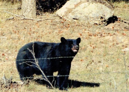
The next morning we headed off early and back into the troubled world of men; the wilderness of steaming lakes, mountains and forests forever etched onto our minds. On the way home we did pass one (somewhat forlorn) roadside bear. This specimen, though, was not however the terrible monster I had in mind; if anything the poor, mangy creature was diminutive in stature and appeared pretty lacklustre about the prospect of homo-sapiens as food. The bear lumbered casually up to the open car window, before glaring at us condescendingly and then heading off about its business. Scary? – I don’t think so; as recent events had proved, our own species were far, far more dangerous and unpredictable creatures.


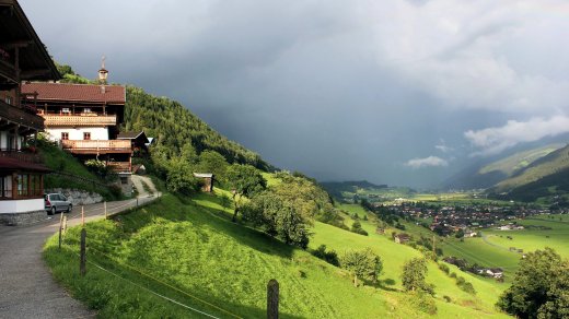
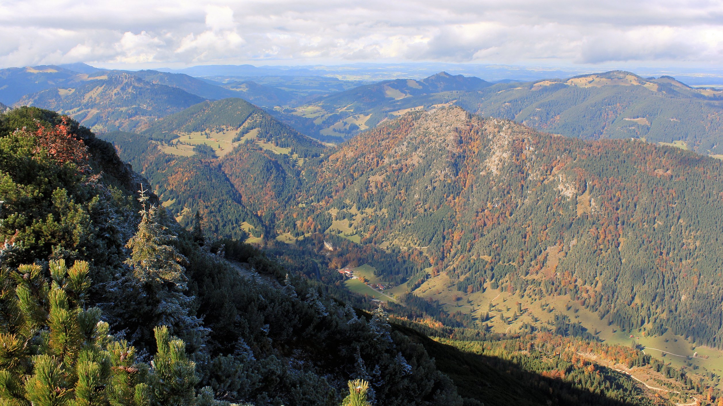
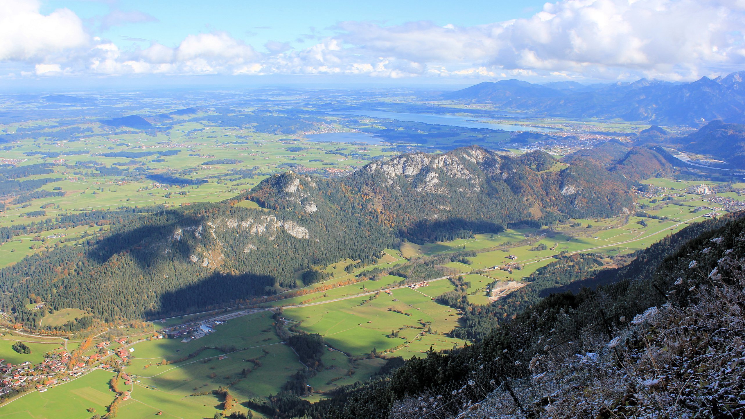
 Although the original mine where these gems were found is remote and hard to access in a precipitous mountain gully, it is still possible to find small stones amongst the gravel and alluvial outwash in the stream close to the Alpenrose Alm in the Hachbachtal. Whilst this can provide many hours of amusement (and frustration) it’s not guaranteed to yield so much in the way of results as we found to our cost. However, emeralds and minerals from the Tauern Fenster area are on display at the Alm and also in the superb geological museum at nearby Bramberg im Wildkögel where we were staying.


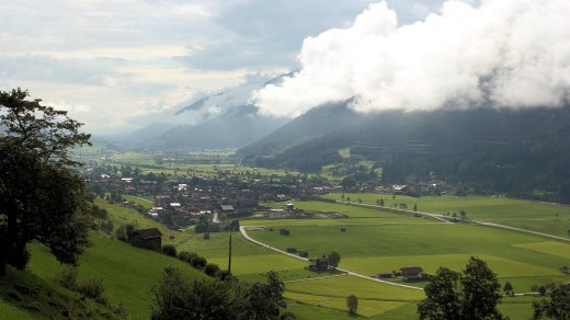
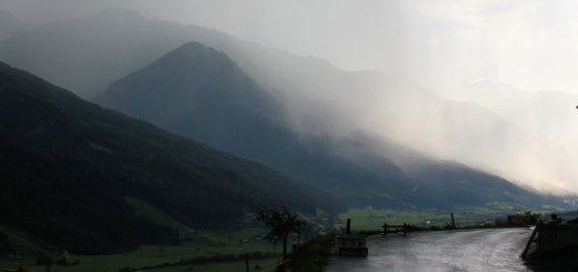
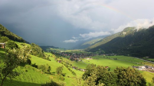
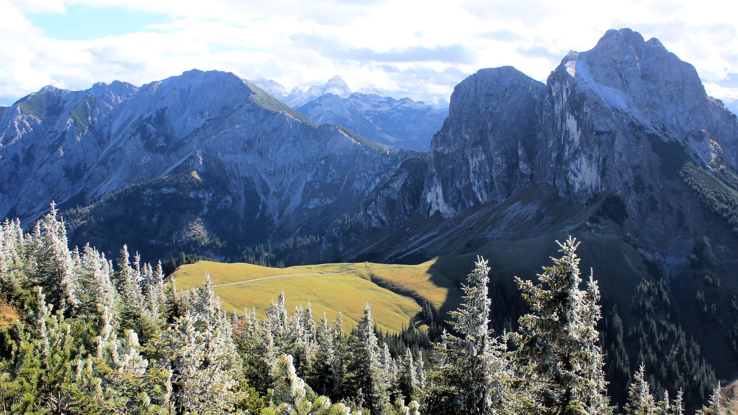
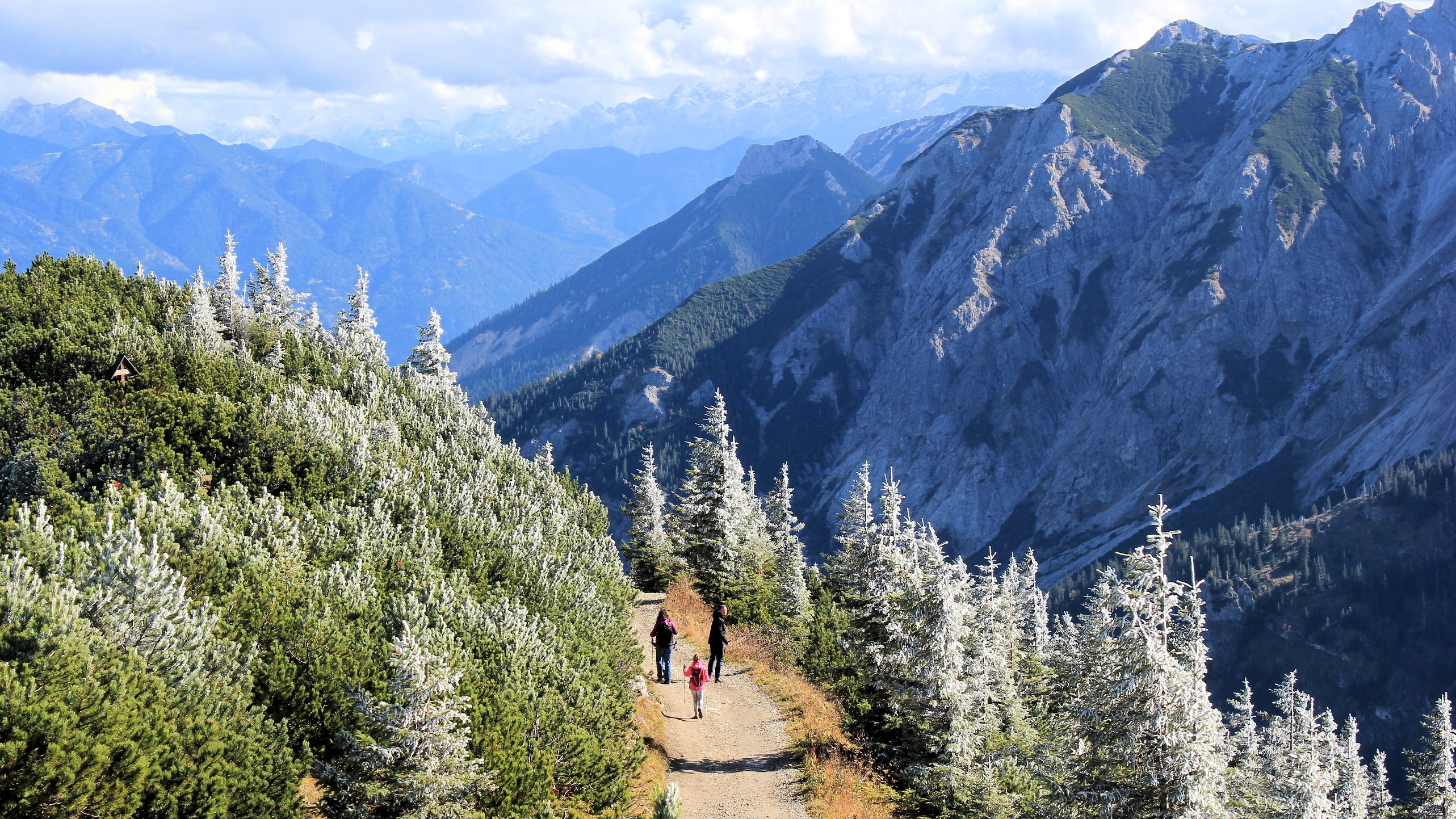
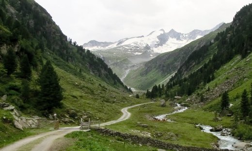
 There are however reminders that traditional lifestyles and farming patterns do continue in the Höhe Tauern despite increasing “resortification” tendencies and outside commercial interests. The centuries old alm tradition, a form of transhumance whereby cows are moved to high pastures for grazing each summer, still continues to this day and is responsible for much of the biodiversity and diverse cultural landscapes which are encountered in the Höhe Tauern.