Scottish Light and Land:

There’s something unique about Scottish light and how it compliments the landforms – just like the Scottish people (and indeed people everywhere), landscapes too have their changing moods, their storms and periods of calm when they shine radiantly like the sun.  I always feel that the Scottish countryside always looks most dramatic in changable conditions with a low angle sun, particularly late or early on in the season – when detail and form in the landscape are illuminated by shafts of light beaming down from the heavens like giant spotlights. Although the term “dreich” was invented by us Scots to describe, perhaps unfairly, our dull and frequently inclement weather, it certainly does not always apply as you’ll see. As evidence of this, here are a random selection of landscape pictures from around the country, many of which I took far back in the mists of time:

DSCN0619DSCN0671DSCN0724DSCN2310DSCN2361DSCN2345DSCN2457DSCN2454DSCN2446Picture2

Posted in In Scotland, Mountain Treks, Trees & Greenspaces, Wild Places | Tagged , , , , , , , , , , , , , | Leave a comment

On Top of the World – Two years in Solu Khumbu, Nepal

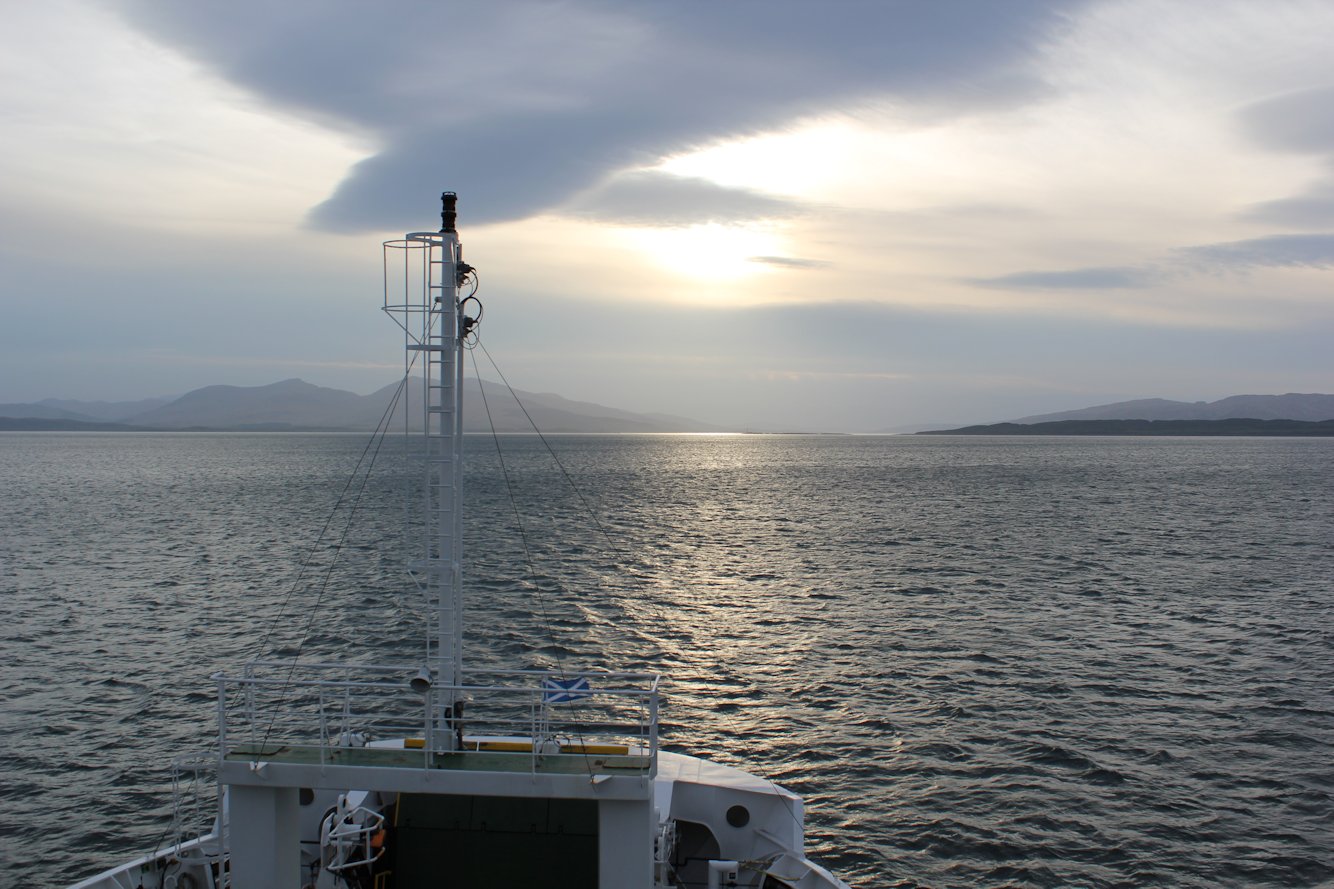
Sometimes it’s the old adventures that are the best ! Having recently got around to scanning some old slides (it only took me 30 years !), I’m now finally able to share some of these journeys from the 80s and 90s. Back in the early 1990s, I was fortunate enough to have the chance to spend an interesting couple of years living in the Solu Khumbu Region of Nepal (I once briefly covered this topic previously – hopefully the pictures and description here provide a better overview).

When I arrived in Nepal in 1991 I’d just recently left university having studied Geography and Natural Resources Management – back then, it really seemed the whole world was my oyster and I was looking for new experiences and adventures; the more remote and exciting the better. I’d always been fascinated by Nepal and the Himalayas in general, having read endless books about the Sherpas and expeditions to climb Mt. Everest  and so I wasn’t going to give the chance a miss. 

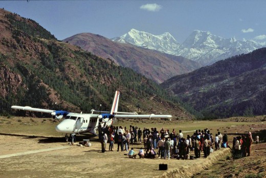
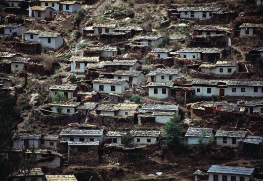
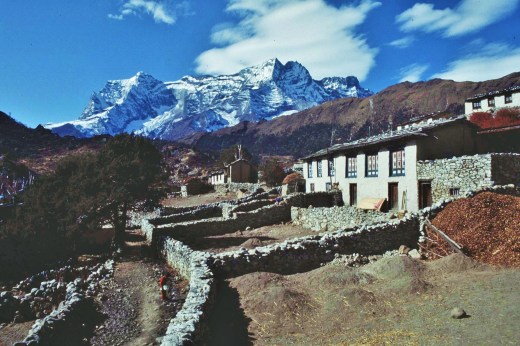
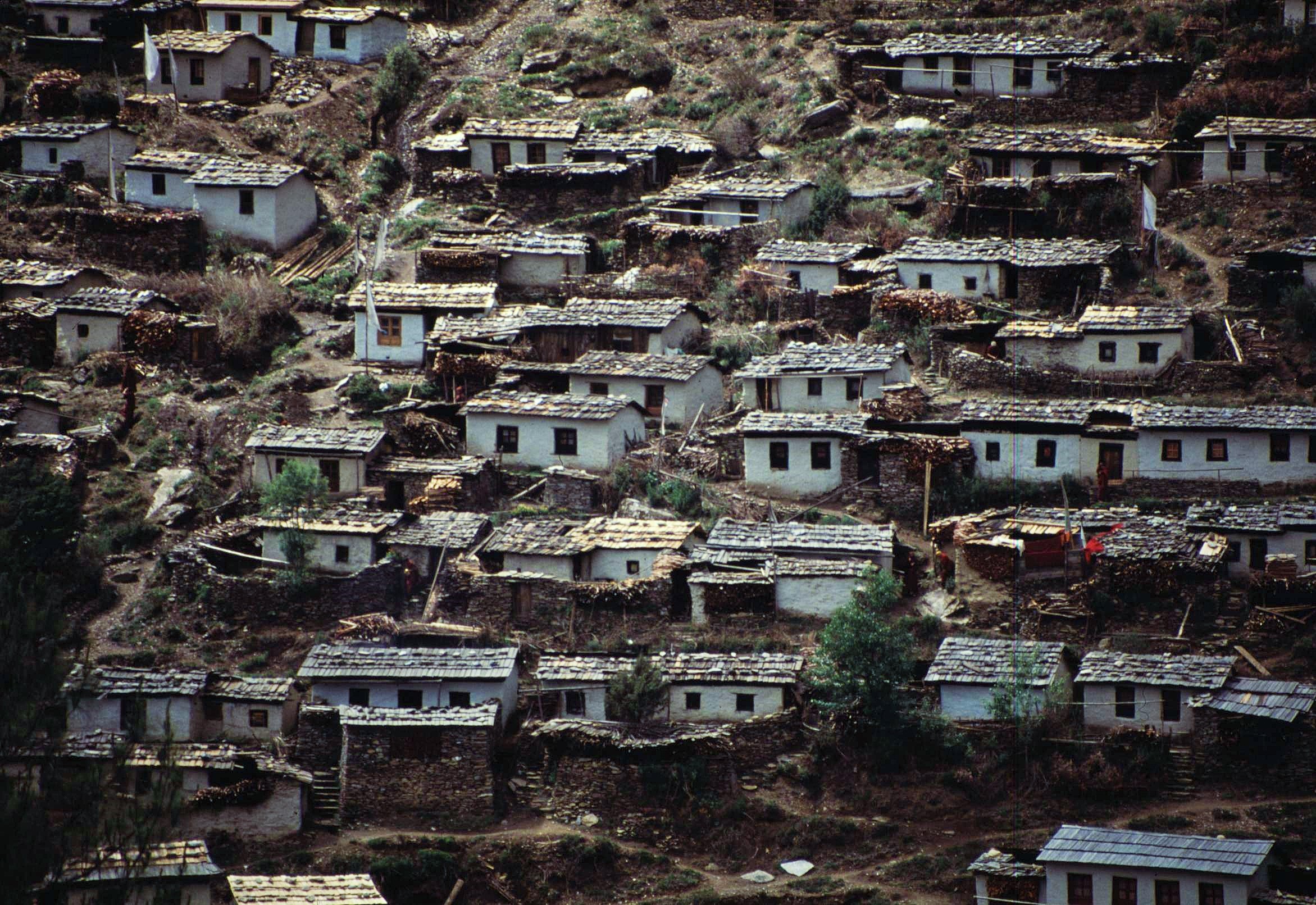
I worked in Nepal for 2 years as a VSO Volunteer with the Community Forestry Development Program and was based in the characterful village of Phaplu near the District center of Salleri, which is located in a remote valley at around 2,500m in the Solu region. Although you can now get there by a tortuous road trip from Kathmandu, at that time it was accessible only by a hair-raising flight onto a grassy ski-jump of a runway carved out of the side of a mountain below a Buddhist monastery. The only alternative to this was a long, cramped bus ride on winding mountain roads to the small town of Jiri, followed by a tough 3 day tramp over 4,000m high mountain passes. Even by the standards of the Scottish Highlands, Phaplu was remote.

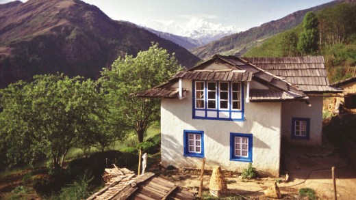
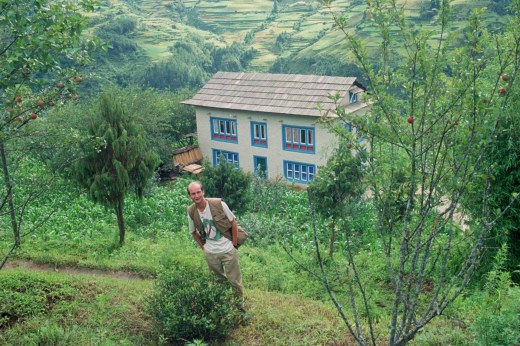
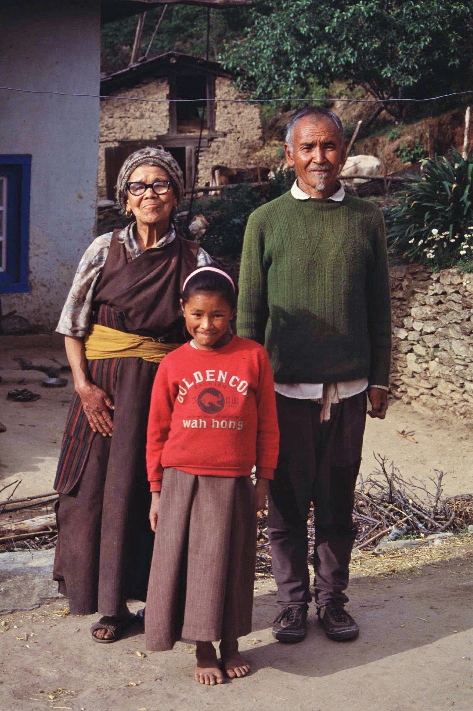
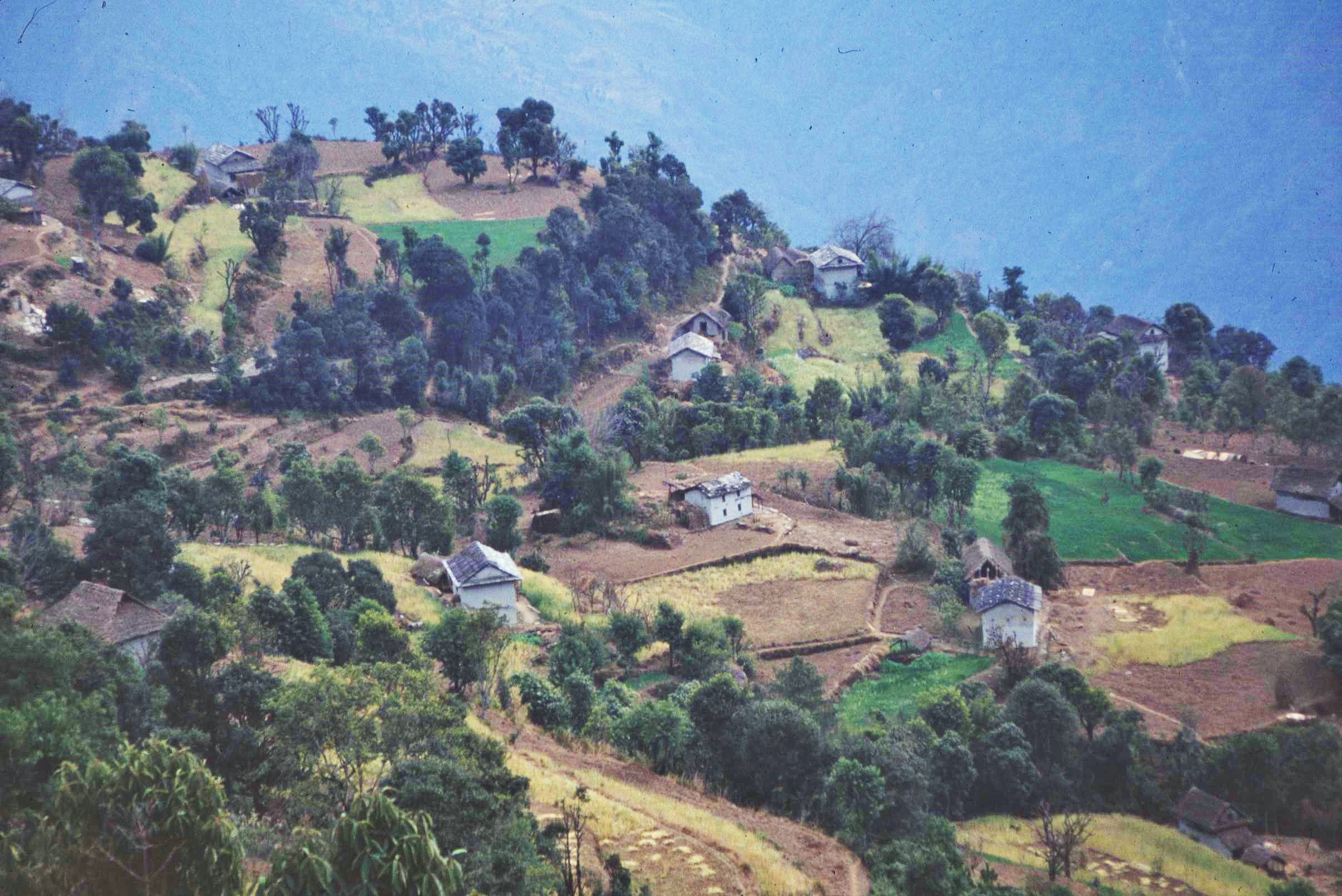
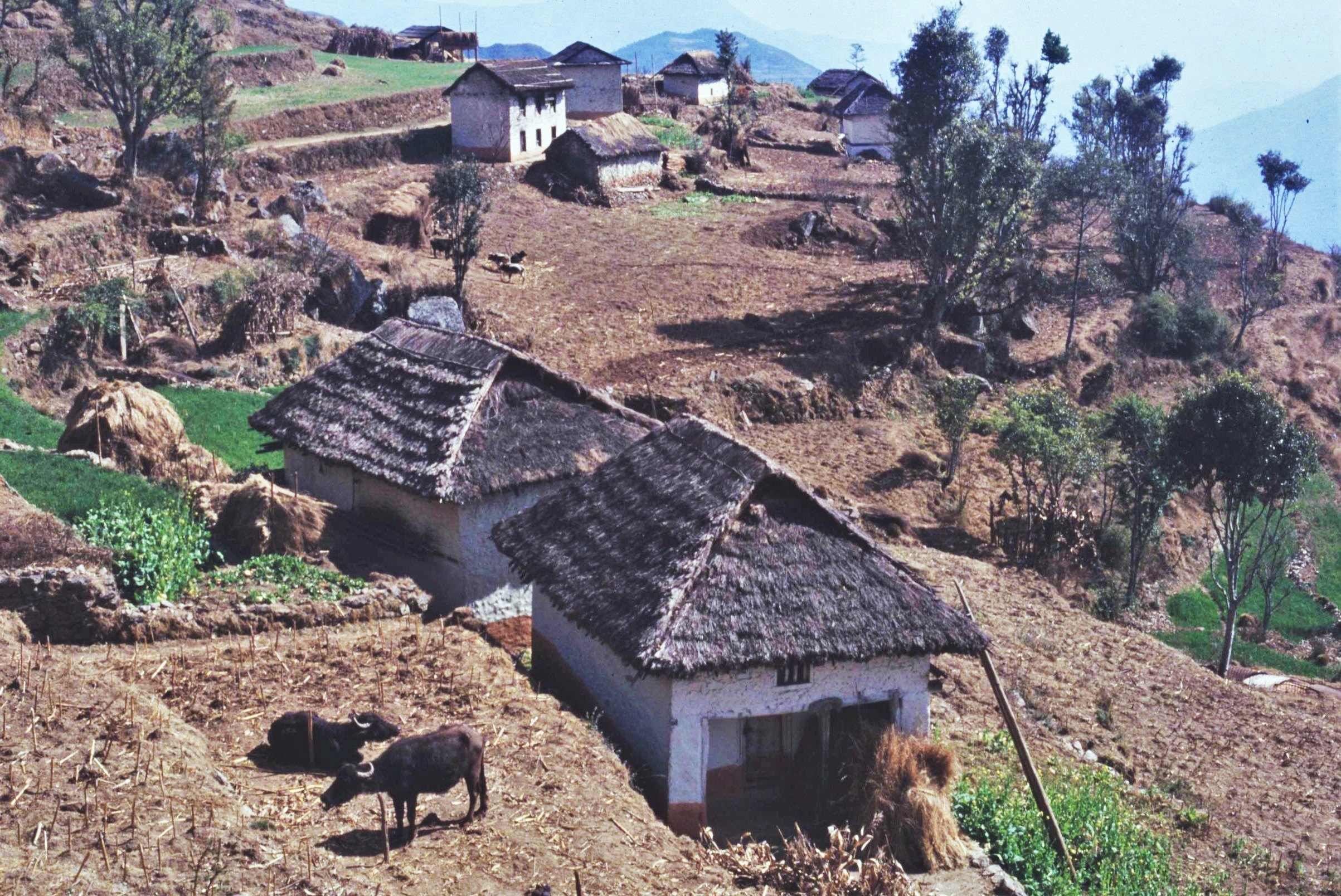
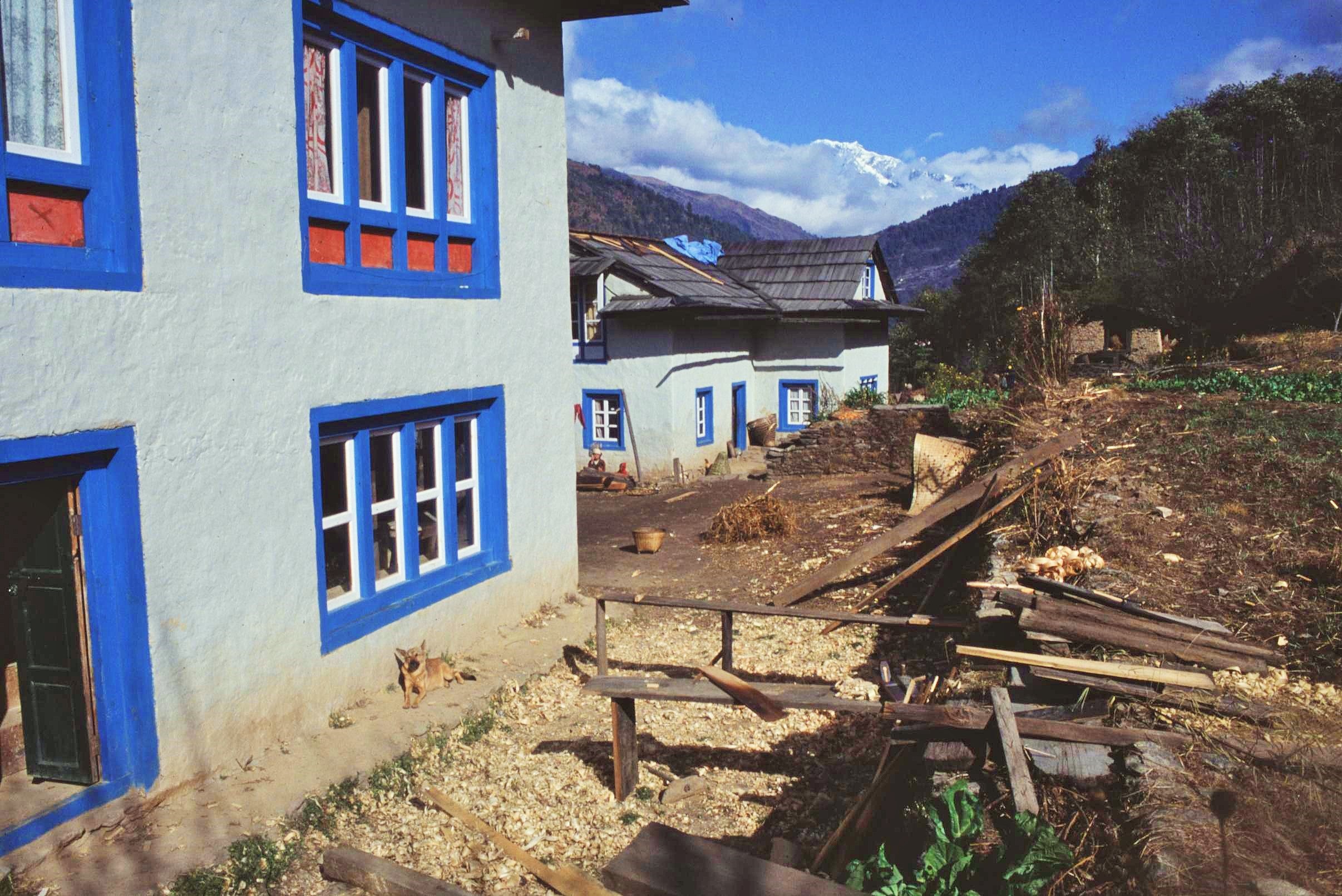
Following a little bit of searching around, I was lucky enough to find a great place to live in a cheerful looking and recently constructed Sherpa house just a couple of hundred meters below the village. The owners of the house, an aging Sherpa couple, had just constructed it for their son to live in; however he had moved away to Kathmandu, whilst their other son lived nearby in the village. The couple had small subsistence farm, or smallholding, where they grew a variety of basic crops such as maize, potatoes and wheat, set amongst apple orchards and peach trees. 

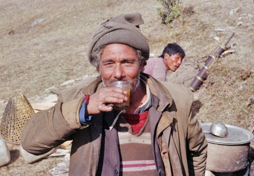
I often used to go around to the old couple’s house to collect much needed provisions, particularly potatoes, or milk from the resident cow. This always turned out to be a major social event – the couple’s faces lighting up with excited shouts of “Raksi ! Raksi !” when I appeared at the door (raksi of course being the local Nepali moonshine, which my landlord produced in copious quantities from his own illicit still). “No !”, was certainly not considered an acceptable answer in these circumstances. Consequently, I’d usually end up staggering out a few hours later, head spinning and shortly to be followed by an uneasy realization that I’d left the potatoes behind. Then the whole cycle would repeat itself the very next day.

Phaplu was situated a couple of miles up the valley from the District capital of Salleri. This was generally where I went to do most of my “big” shopping – there were of course no supermarkets or large shops there and so most provisions were purchased from the weekly market in the town. This was another big social occasion – it being virtually guaranteed that you would bump into any number of acquaintances and be invited for tea in the various emporiums that encircled the market place. The Nepali people are almost always open and friendly and are keen to have a chat and a laugh. It’s almost impossible to feel lonely there, or to be alone for that matter. However, that can also be a problem in itself to us more antisocial Westerners.

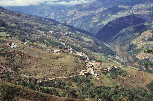
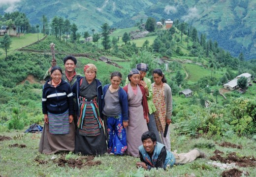
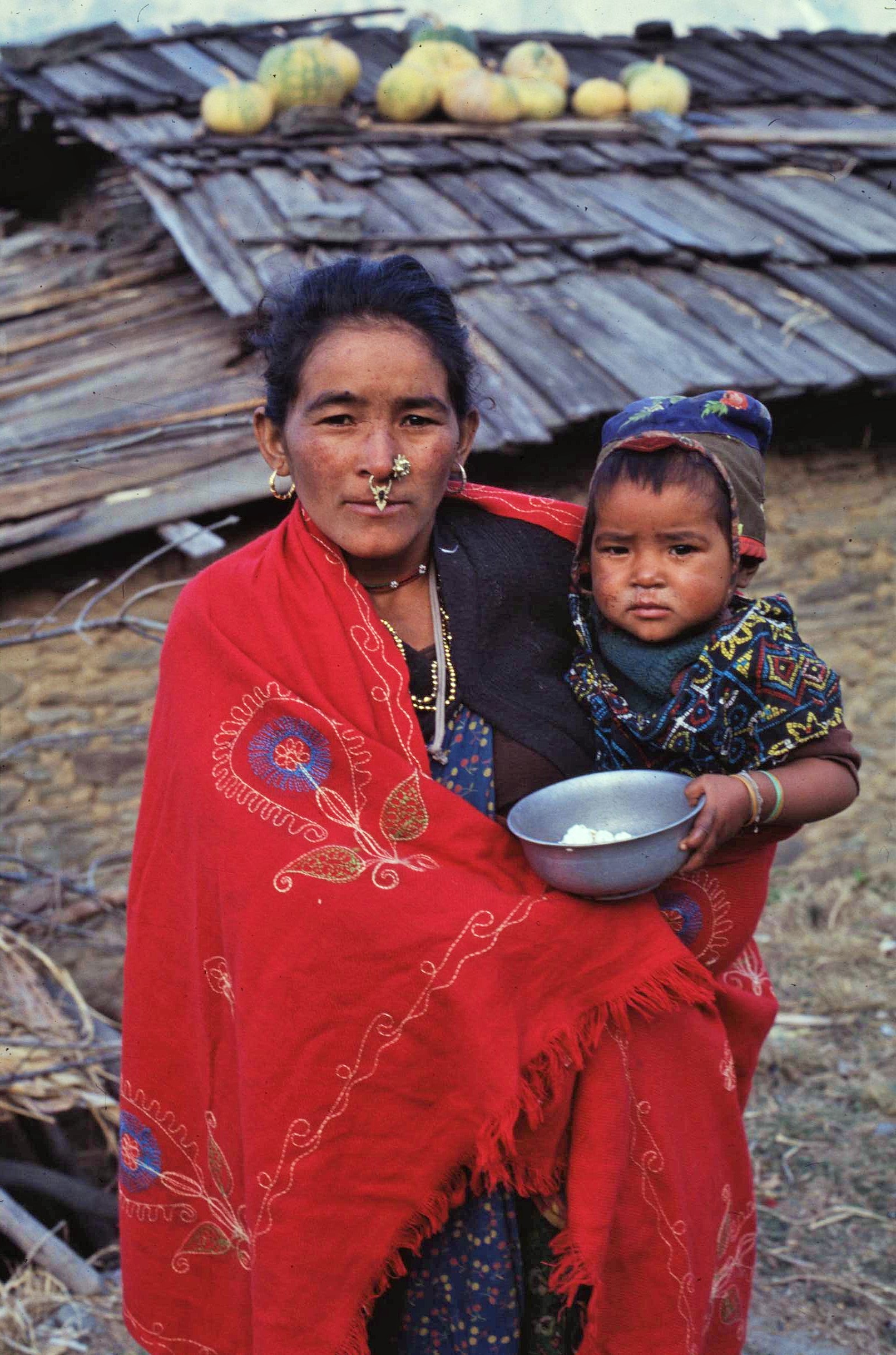
In terms of population structure, the Solu Region boasts a very diverse composition with many different ethnic different groups living side by side in relatively close quarters, the makeup of the communities changing markedly between one locality and another. Many of the villages found in lower elevations in the South of Solu comprised of largely Hindu populations including higher caste groups such as Brahmins and Chetris.  Other villages were the strongholds of independent hill tribes of more Mongolian origins and appearance, such as Tamangs and Gurungs as well as small groups of Rai people. These groups often possessed their own distinct language, culture and traditions, although most people nowadays speak the Nepali language as well, which is taught officially in all schools.

The forest office where I was working as a VSO volunteer was also based in Salleri. It certainly couldn’t be described as a great hub of activity by any stretch of the imagination, unless of course the boss was in town – which in reality wasn’t that often ! The week after I arrived, the first District Forest Officer was chased out of town by an angry posse for some supposed political shenanigans. It took quite along time for his replacement to be arranged, however when that happened it did mark a considerable improvement in the administrative arrangements. 

My other colleagues were a somewhat eclectic bunch (or a motley crew depending on your perspective) comprising of local forest guards and rangers from other parts of the country. Although the pace was often frustratingly slow, the staff there slowly warmed to me, the strange westerner, in their midst. The working routine, for want of a better term, was unpredictable to say the least; sometimes after days of inactivity and when I’d given up pretty much all hope of anything happening, my colleagues would knock unexpectedly at the door at 6am inviting me to join them immediately for a week’s fieldwork in a remote part of the District – it was all or nothing it seemed.

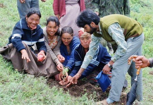
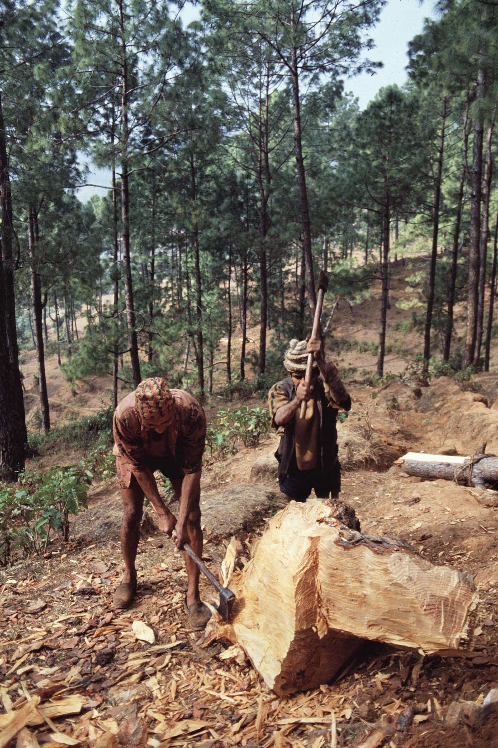
Our work involved developing and supporting local community forest user groups around the District to give local people more say in how forests were managed. We were also undertaking work to regenerate existing natural forests and to establish new plantation areas – this was a complex task in reality as it involved retraining poorly paid (and often, less than motivated) government staff. Originally the emphasis of community forestry in Nepal was upon the establishment of plantations of exotic species. However, these were often of little use to local people and were susceptible to pest and disease problems. In the longer term it was found to be better to focus efforts upon the regeneration of the natural forests though better management and through excluding grazing animals – developing a local sense of forest ownership by local people was key to this.

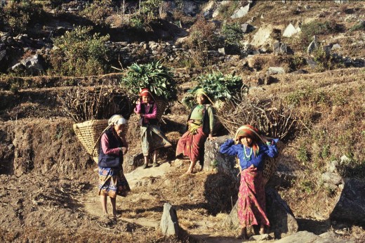
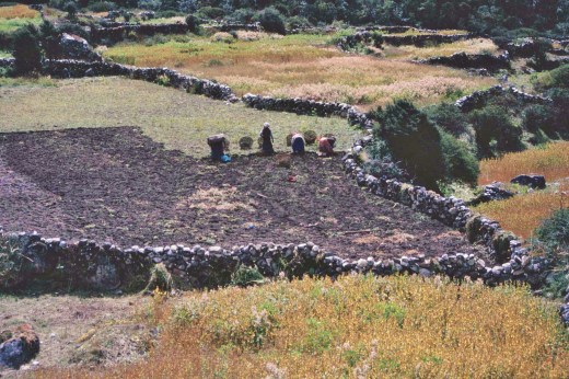
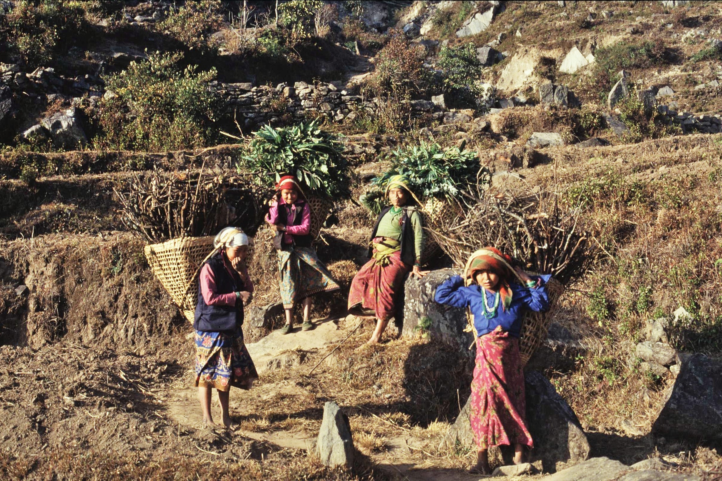
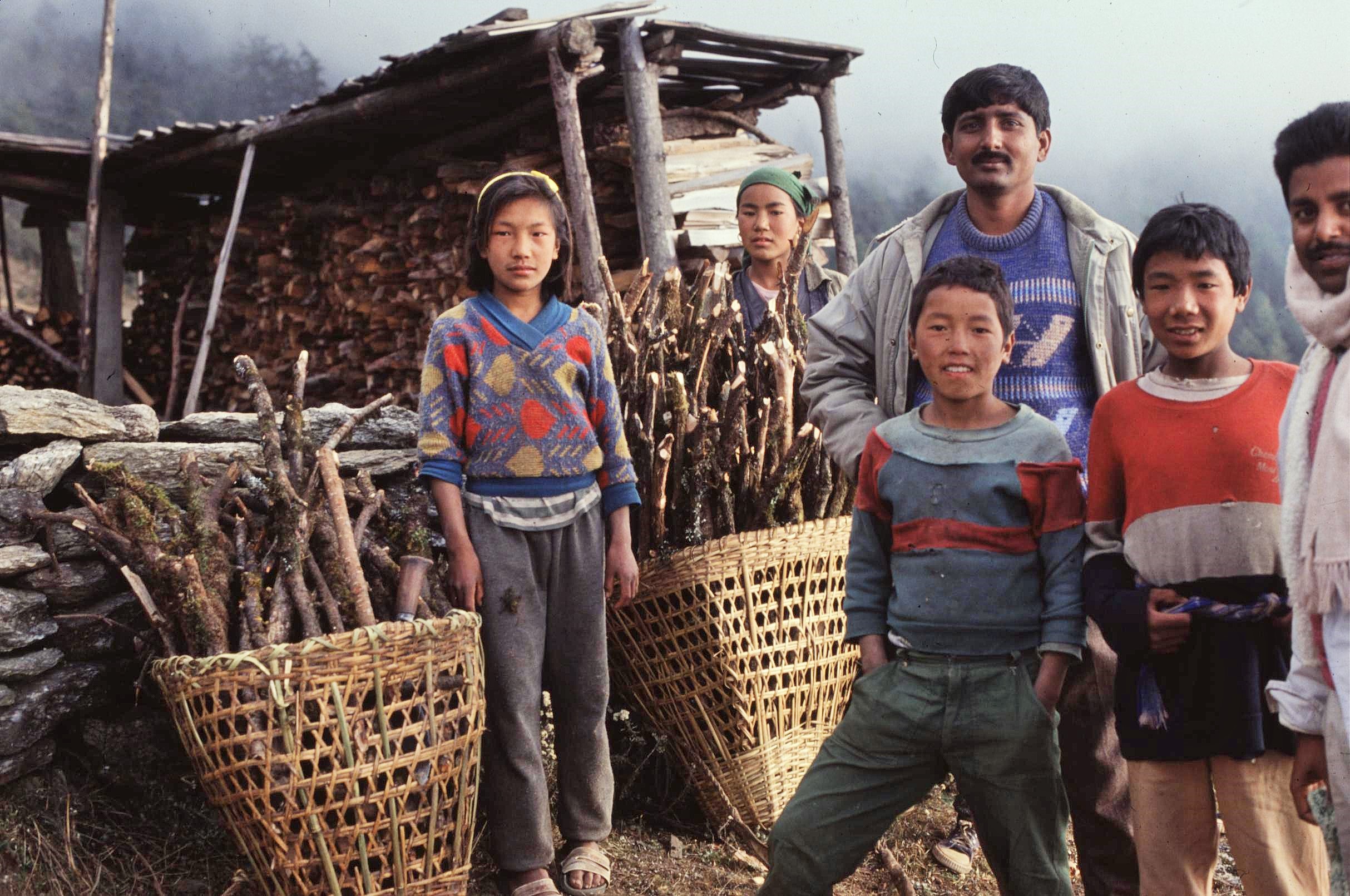
In the typical middle hills areas, people just have to live on what they can produce from the land themselves. In these areas, there is no social security or financial safety net for families – sometimes the nearest hospital being located over 3 days tough walk away. People are dependent upon forest products for fuelwood and as fodder for their everyday existence – mostly it’s the women who do this work and who have a detailed knowledge about the forest. This can create difficulties in some communities when it comes to consulting local people as the women are often more passive in public meetings and traditionally let the men do the talking.

Deforestation in Nepal has meant that terraced fields and even whole villages are more vulnerable to being swept away by landslides and erosion, particularly during the summer monsoon period. By contrast, the Middle Hills landscape has traditionally been much more forested with hedges, fodder trees and cover crops to supply local demands and help to reduce erosion issues. 

Initially government policy resulted in the the forests being nationalized and they were fiercely protected by government forest guards. However this was seen to be largely unsuccessful, as the people then had no sense of ownership of their forests. Sometimes corrupt staff would even extort money out of people caught cutting wood, for turning a blind eye to what would otherwise mean, a prison sentence or a high fine for those caught in the act.  The whole system gave locals little incentive to manage their forests sustainably. 

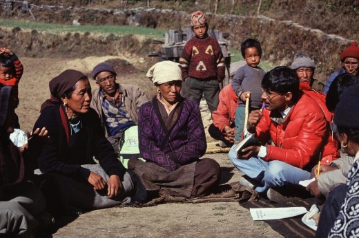
The forest rangers were therefore being retrained from a “policing” role to acting as community facilitators, which wasn’t an easy task. Huge cultural variation existed in the District, each ethic group having a different social structures and power dynamics. In some villages with a larger Hindu population, the people attending the meetings would generally be men. This created challenges, as it was the women who often possessed a detailed knowledge of the forest and who could bring about change through their daily routines and activities, such as by not allowing cows and goats to graze certain areas. 


To rectify this the forest rangers were involved in training workshops to encourage greater participation of women in the community forestry process, thereby encouraging them to have a greater say in meetings. This wasn’t such a problem for the Sherpa communities where the women generally possess an equal social status to the men. It was often however more a problem for the forest rangers themselves, who usually came from a different cultural perspective and who would tend to relate better to their own kind.

Training events also involved getting out into the forests and talking with locals who were collecting firewood and fodder. The aim was to understand where resources were coming from and how they could then be managed more sustainably. The hope was that the forestry staff could learn to listen to the local people and to better understand their needs, thereby helping them to develop realistic management options for the long term.

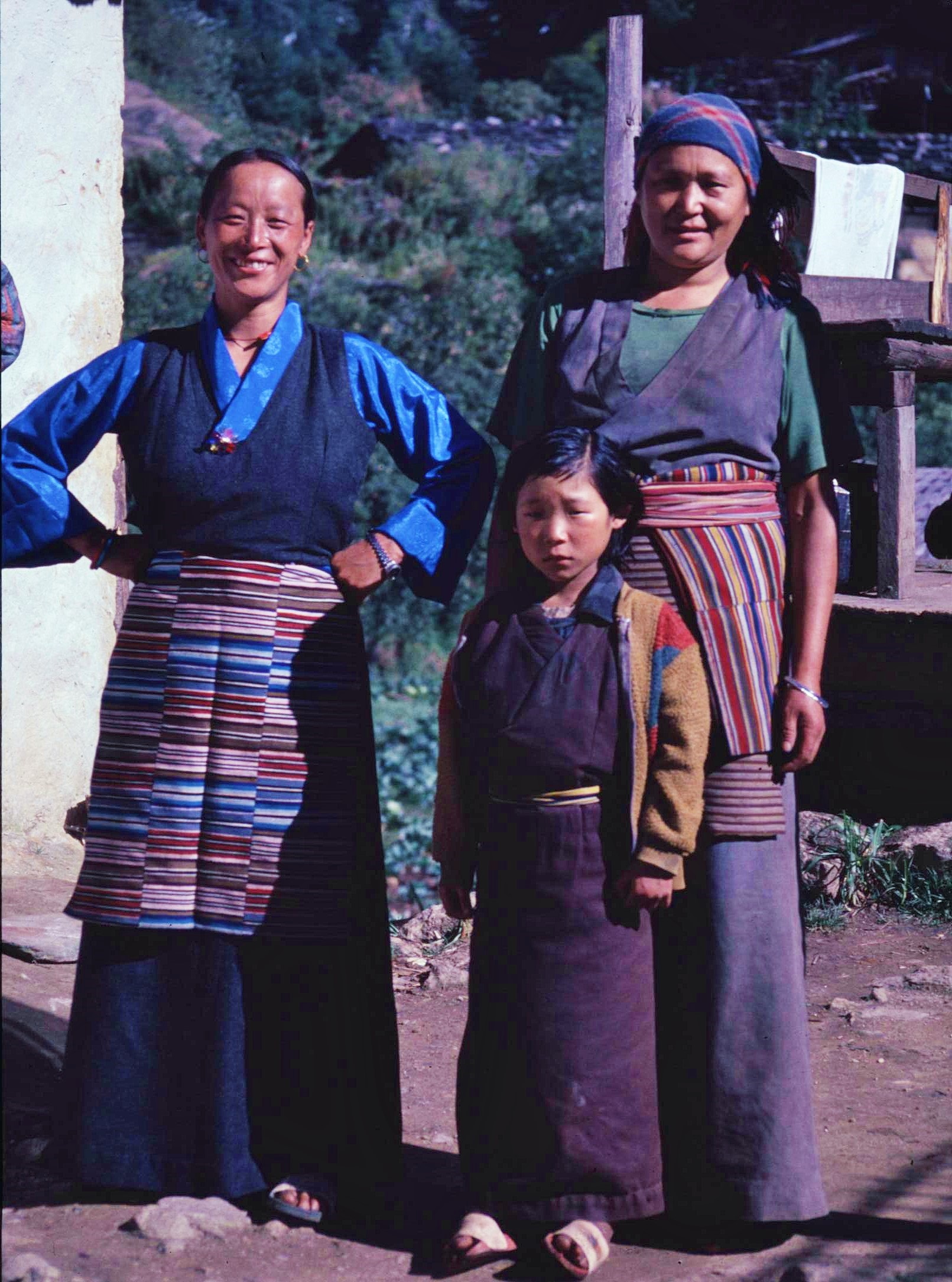
Phaplu, the village, where I lived was mainly characterised by its Sherpa population. The Sherpas form a distinct ethnic group in their own right who migrated over the high passes from Tibet a few hundred years ago to settle in the Region. Whilst Sherpas are best known for their involvement in trekking tourism and climbing, many also make their living of the land, particularly in the Solu area where I was based. Often these Sherpas have not had the same economic opportunities as their relatives in the Khumbu to the North who have benefited more from tourism. 

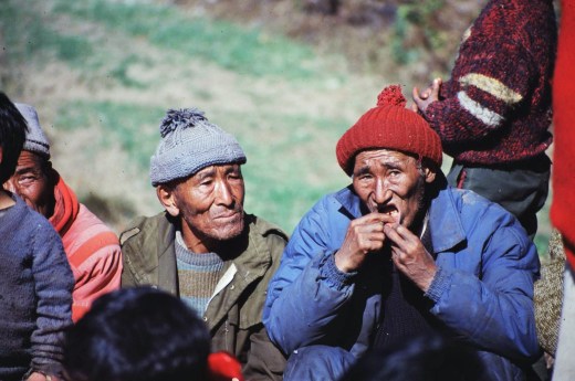
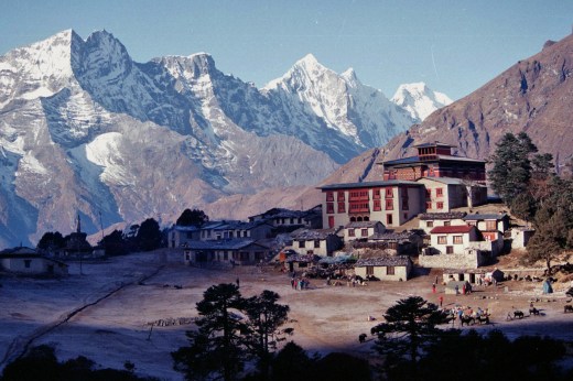
Generally, I felt very comfortable in the company of the Sherpas who were generally good natured, open and quick witted and a pleasure to be amongst. In some other communities, however I sometimes felt more of an object of curiosity, particularly in remote places where Westerners were less often encountered.The Sherpas are Tibetan Buddhists and aspects of Buddhism dominate the cultural landscapes and everyday lives of the Sherpas.  Most villages have a small Buddhist temple or “gompa”, sometimes with a resident Lama. There are also some bigger Buddhist monasteries in the area, particularly at Tuten Chulin near Jumbesi on the Everest Trail , which boasts a population of a few hundred resident monks. 

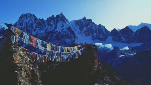
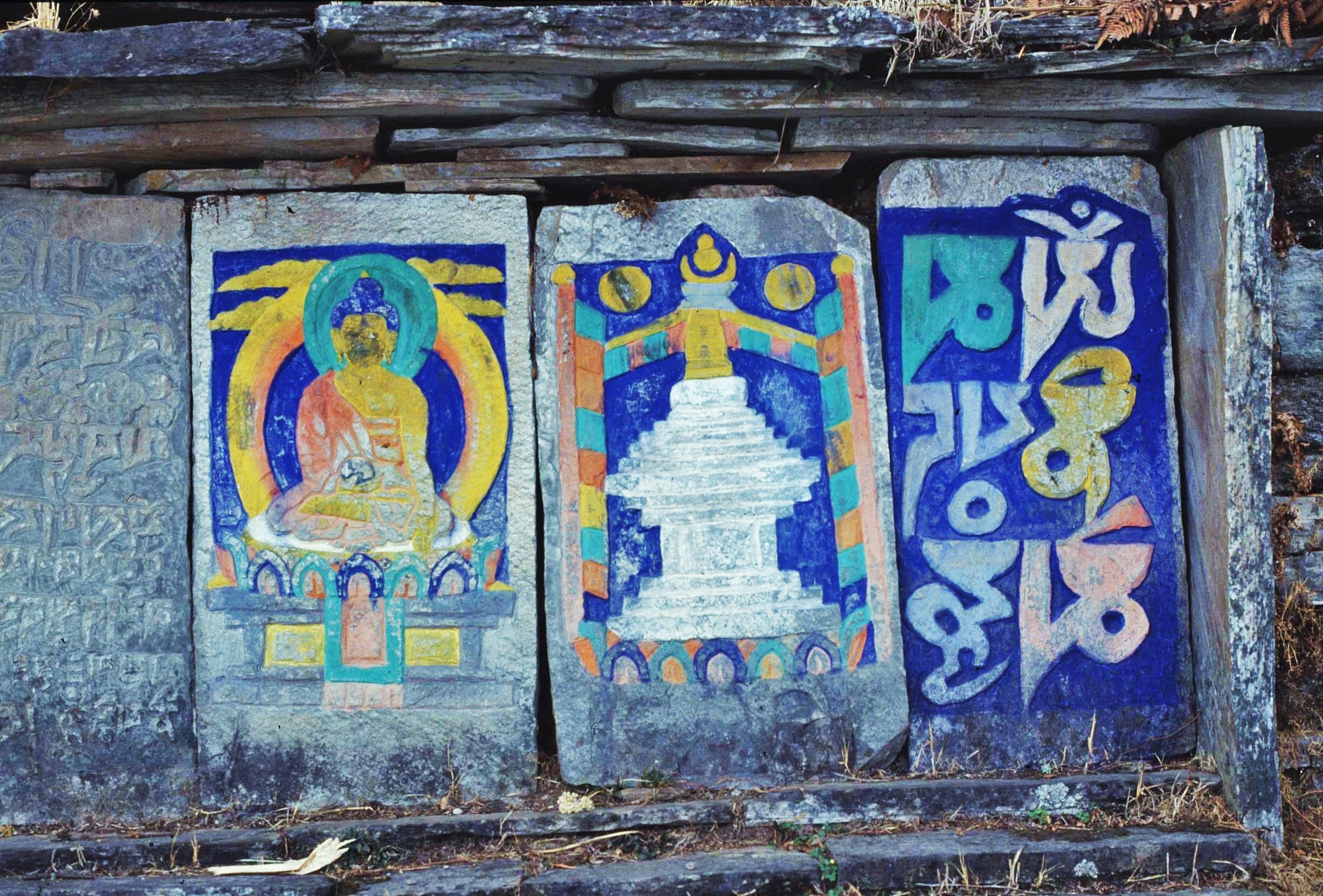
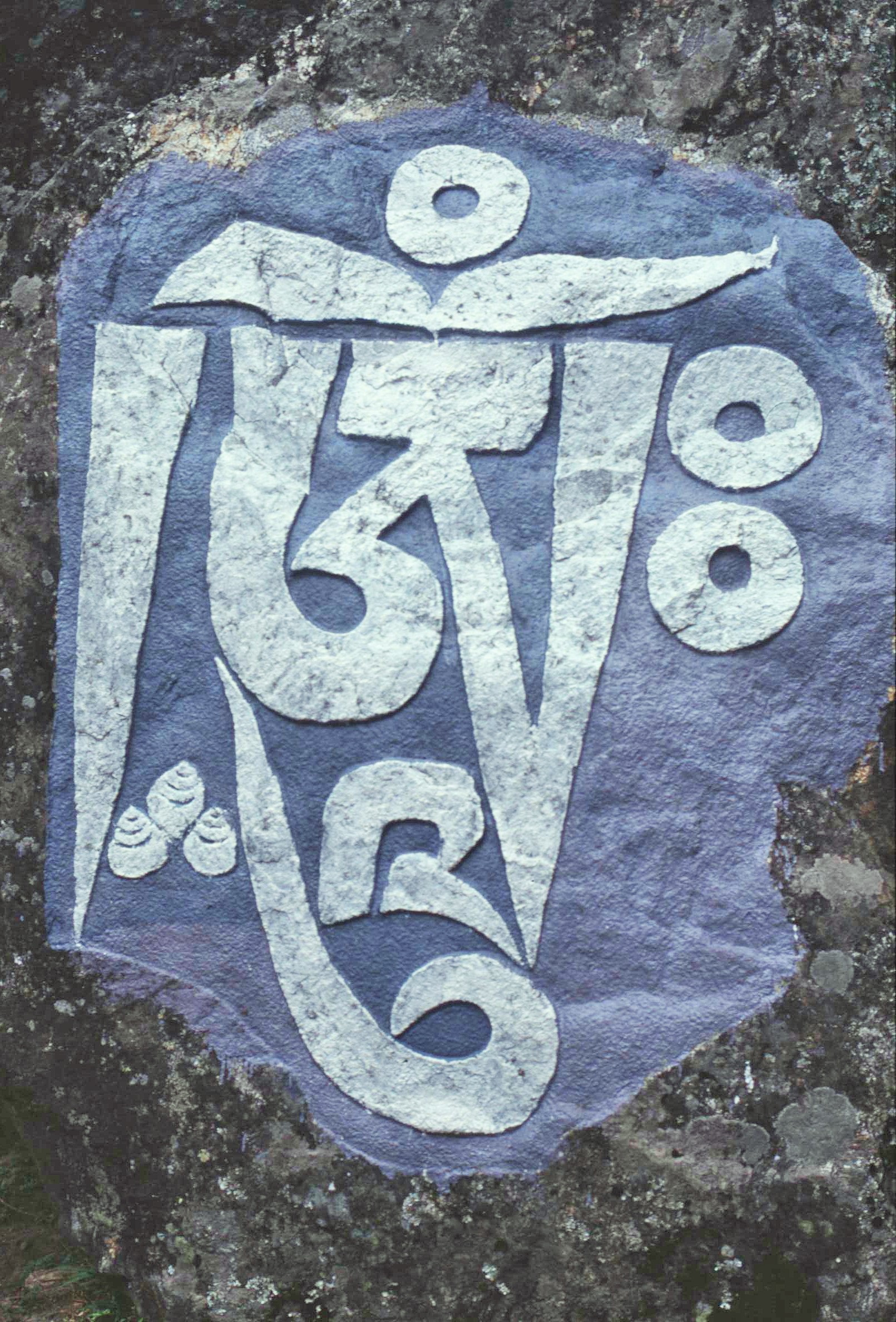
Aspects of Tibetan Buddhism are evident throughout the whole landscape, which functions effectively as a giant mandala, or model of the cosmos, connecting together sacred monuments and local power places through a network of well worn paths. Along trails, you will frequently encounter “mani walls” – comprising of carved stones bearing Buddhist symbols and the ever present “om mani padme hum” mantra. In addition, there are stupas, which are larger dome shaped constructions, often contain religious relics or important texts. These structures should always be passed on the left or circumnavigated in a clockwise direction according to Tibetan Buddhist practices. The mani walls also frequently include prayer wheels which are spun by all passers-by using the trails.

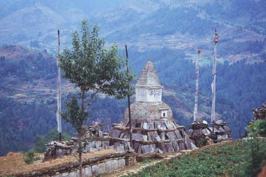
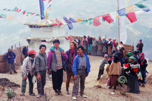
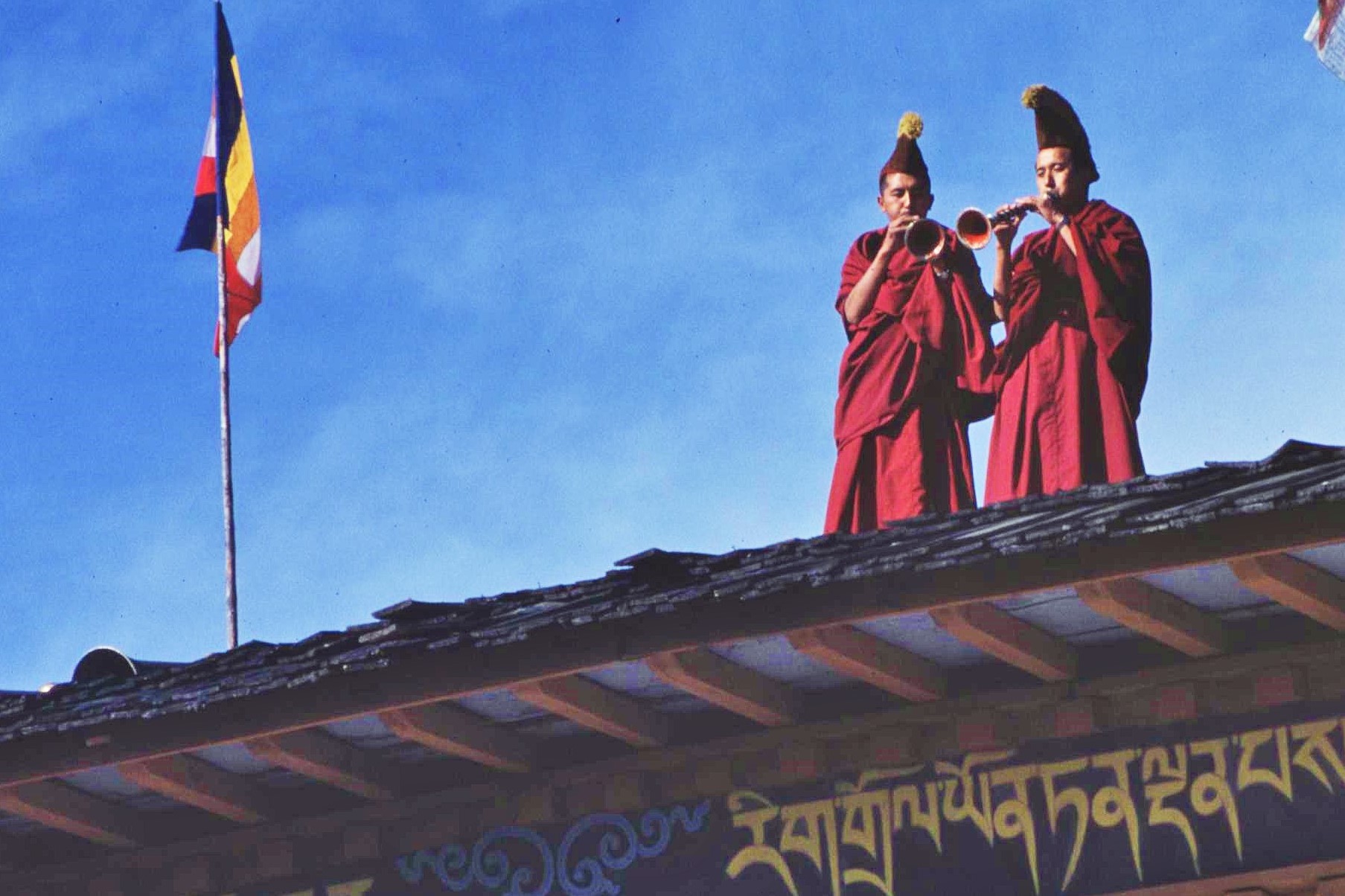
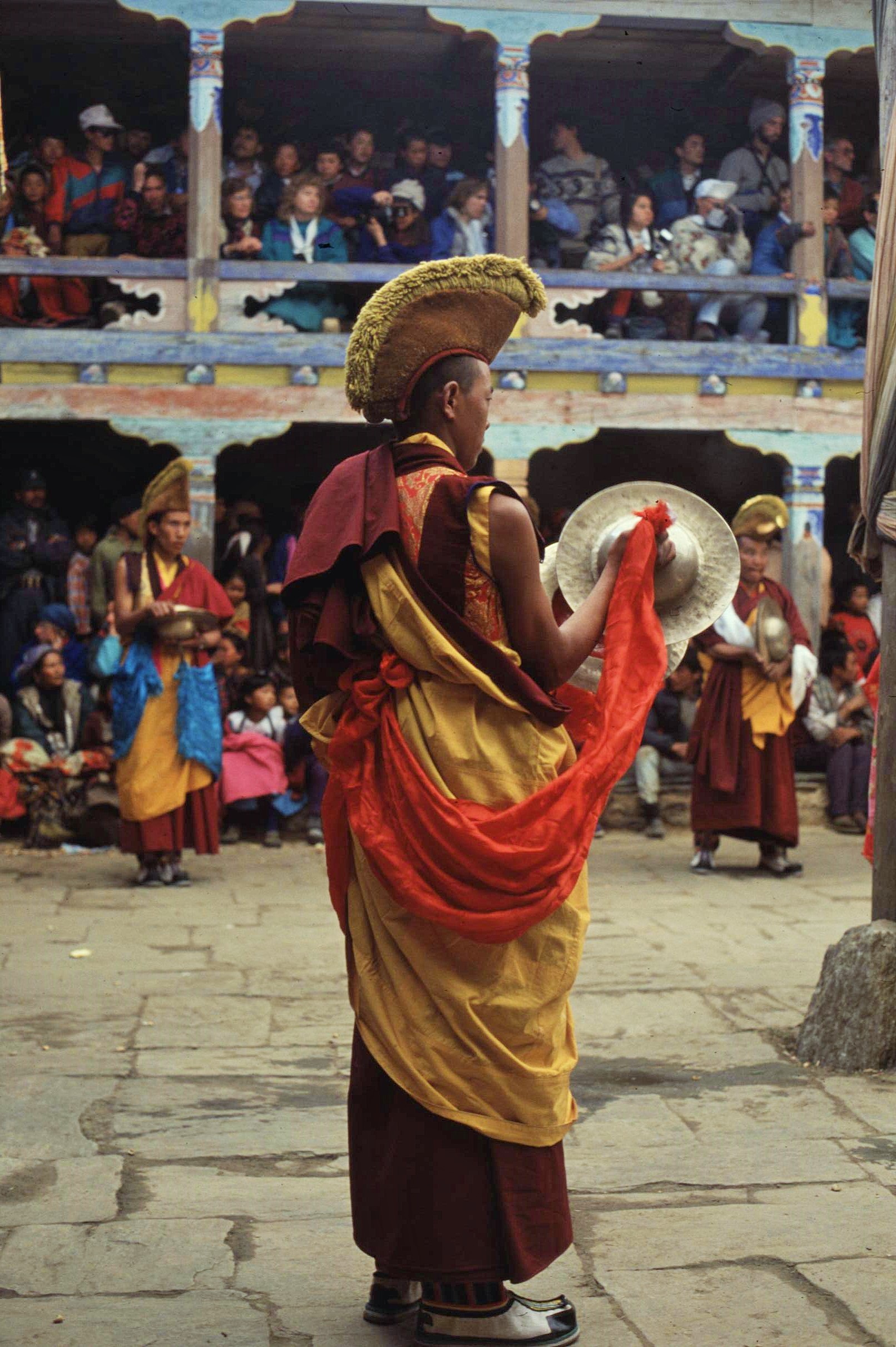
Chiwang Gompa was our local monastery and is situated dramatically on a cliff top overlooking the valley above Phaplu. Every year Chiwang pays host to the Mani Rimdu Festival. This is a 3 day spectacular where Tibetan Buddhist monks celebrate the prevalence of Buddhism over the pre-Buddhist Bon-po religion of Tibet through enactments and dances which feature an array of dazzling outfits. In reality, Tibetan Buddhism is strongly influenced by its more animistic predecessor and has incorporated elements of symbology and traditions from the Bon Religion; this is perhaps similar to the way that Celtic Christianity adapted some of the more nature based elements of former pagan religions in ancient Ireland and Scotland.

In addition to its significance for Tibetan Buddhism itself, the festival at Chiwang Gompa is also a big social gathering for the local Sherpa people, with much drinking and dancing going on into the wee small hours – away from the more auspicious formalities going on in the gompa itself of course. Without a doubt, the Sherpas are always up for a party – with chang, a type of local rice beer, or more potent “raksi”, flowing liberally on such occasions, sometimes with highly undesirable consequences. A friend of mine, for example, observed two somewhat inebriated monks in an argument about whose monastery was the better – eventually the whole thing degenerated into chaos when one of the affronted duo took a swing at the other. I’m not sure which of the duo won the contest in the end but it certainly wasn’t a good advert for “the Path”.

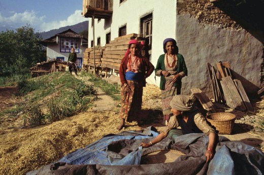
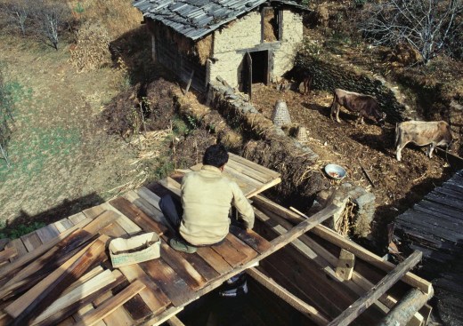
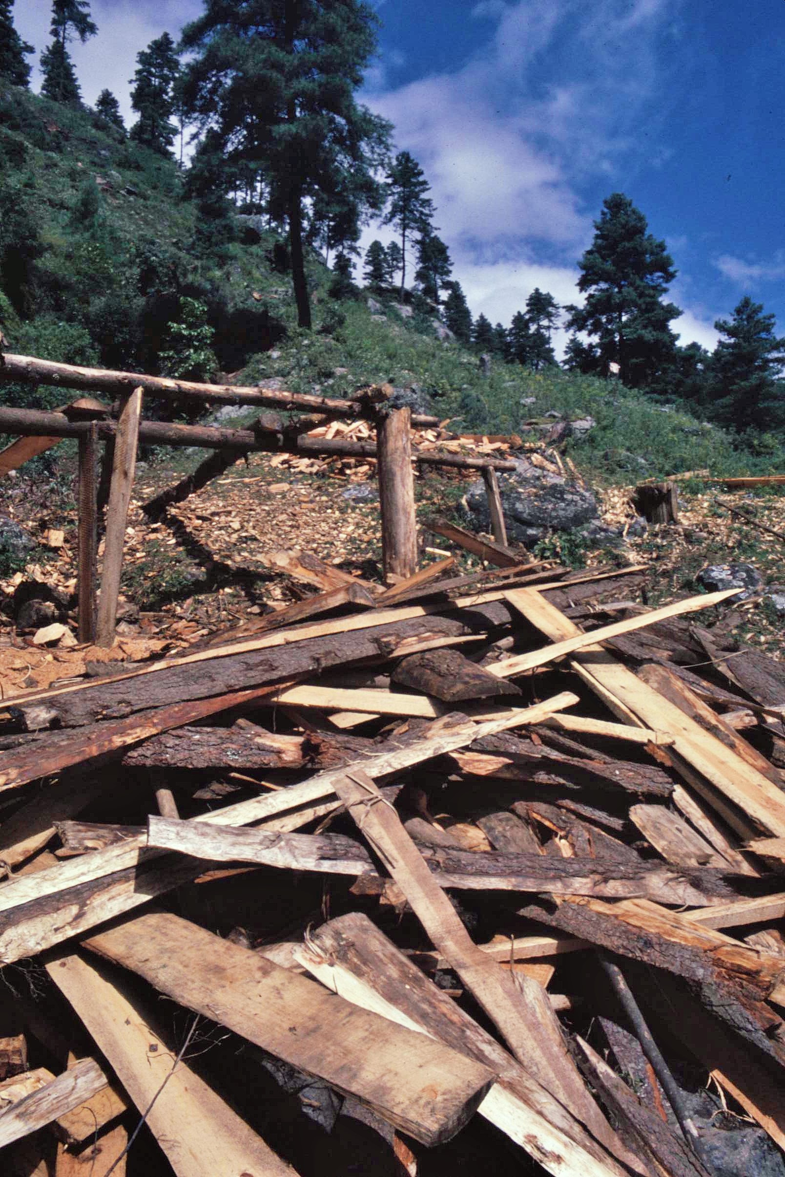
Away from such grandiose events, much of my life in Solu focused upon the immediate surroundings of the house and the smallholding where I lived. There was always some activity going on; whether it was milking the cow, harvesting maize or the fruit trees, winnowing the grain or routine maintenance work such as replacing the wooden tiles on the roof, something which occurred every few years. The scene was always changing according to the seasons; vivid green and lush during and after the monsoon, through to more washed out hues of tan and russet in the dryer winter and spring months. Likewise the routines of the place alternated in tune with these seasonal cycles.


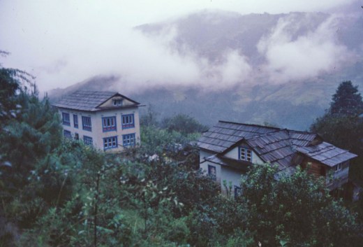
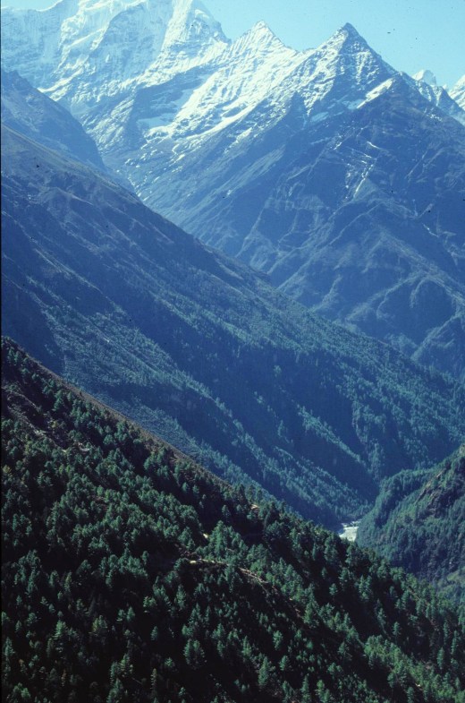
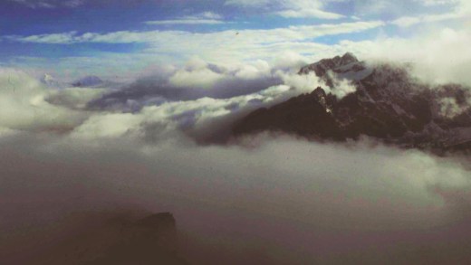
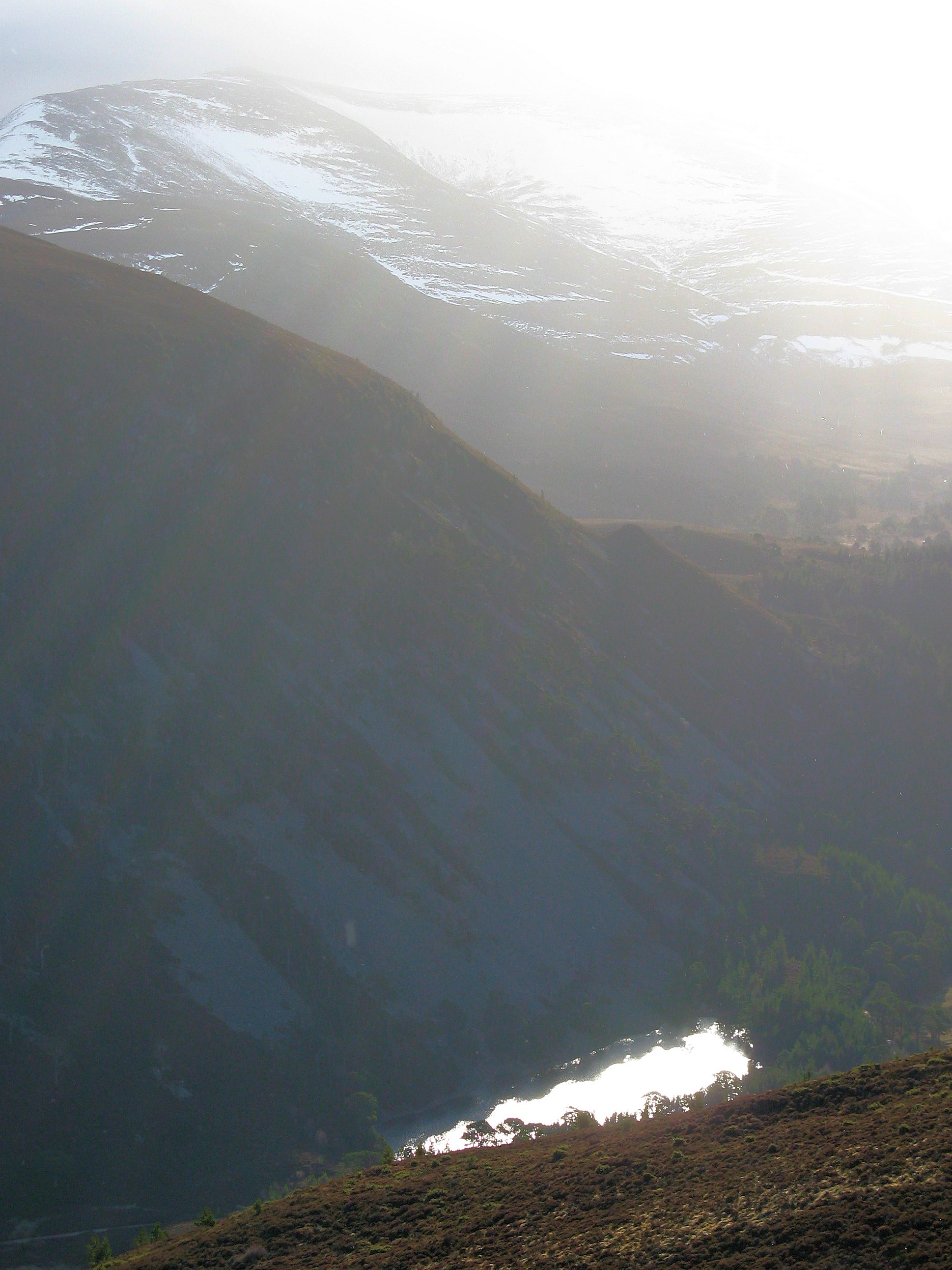
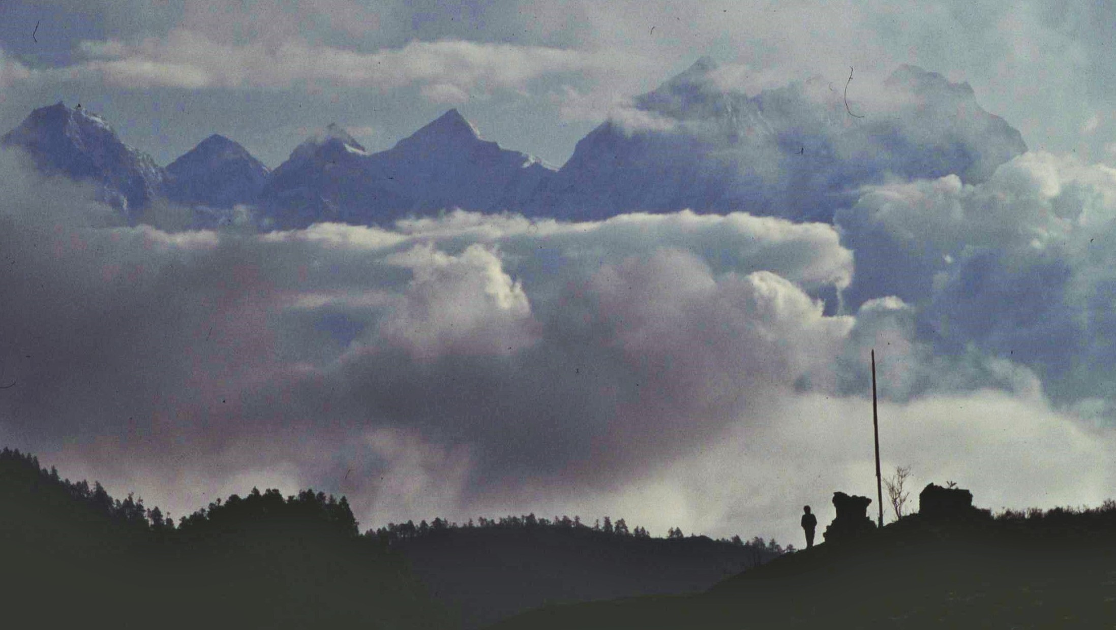
Along with the agricultural routines, the views across the valley from my balcony also varied with the seasons and climatic patterns. When it was clear, particularly during the autumn and spring, there was a tremendous vista up the valley to soaring 7000m snow peaks of Numbur and Karyolung, suspended between somewhere remote between earth and sky. During the summer monsoon, however, the world collapsed inwards to the immediate confines of the valley; clouds scurrying along below eye level and then billowing up to engulf the house in their conforting mass.

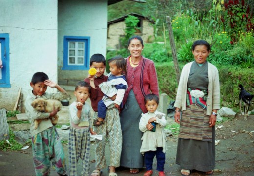
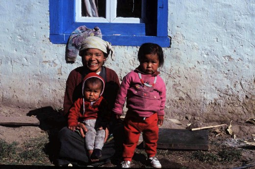
Whatever the season, however, there were always friendly locals around to chat to;  Sherpa ladies keeping their small kids amused, people doing various jobs about the place or my landlord checking up to see how his latest batch of “raksi” was doing. There were also some farm dogs, one of which always having litters of pups and which was a greater scavenger, another which used to follow me on walks up the hill, until it was sadly killed by a wild predator of some unknown description. A particularly soft one was selected to be a guard dog and was chained up half starved, a thing that I found hard to accept.

Sometimes there were strange goings-on, like the two men in fancy dress who woke me up by unexpectedly blowing trumpets and reciting incantations outside the house in the middle of the night. The next day they appeared at the door wanting a contribution for this unrequested and unannounced service. I asked my landlord and he explained to me that they were the local “ghost busters” and that they had been there to exorcise the house of evil spirits. They apparently visited all the village house once a year and would receive payment in rice (or, if you were a foreigner, in cash of course !).

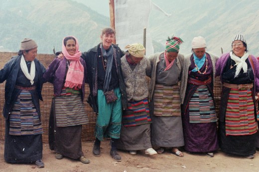
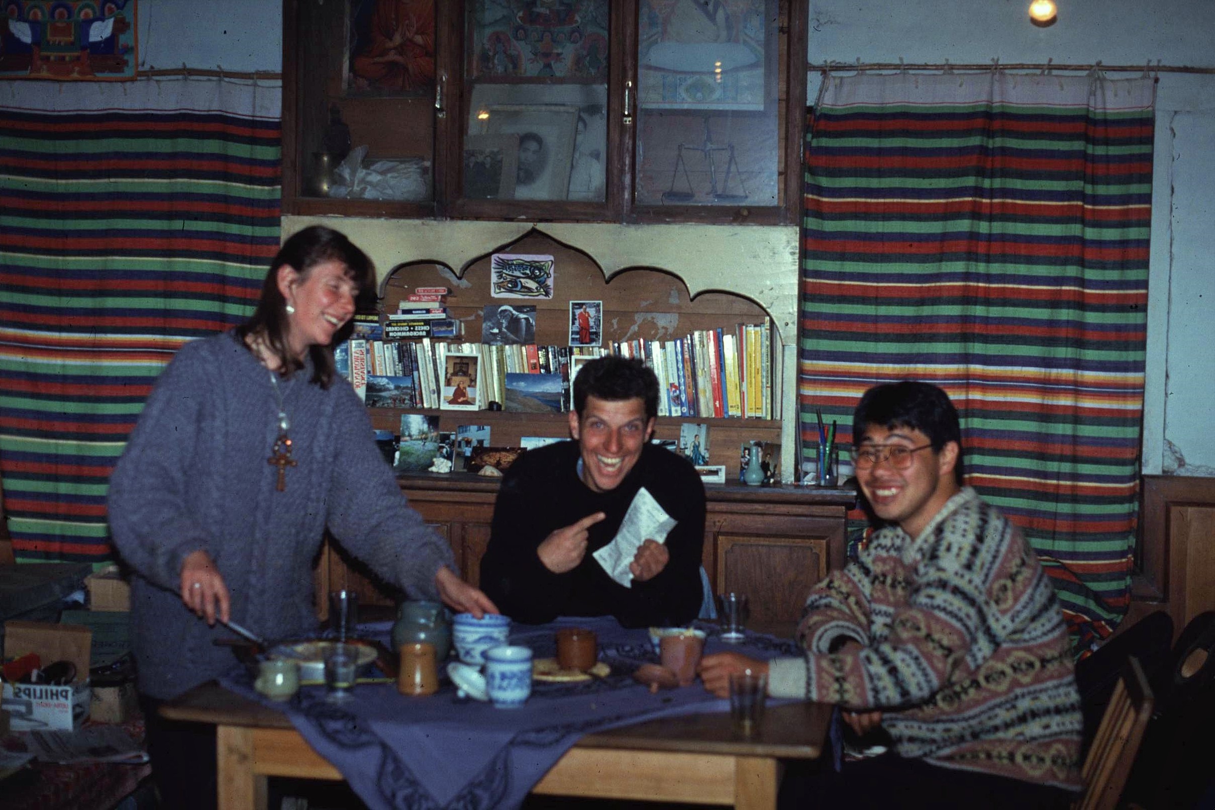
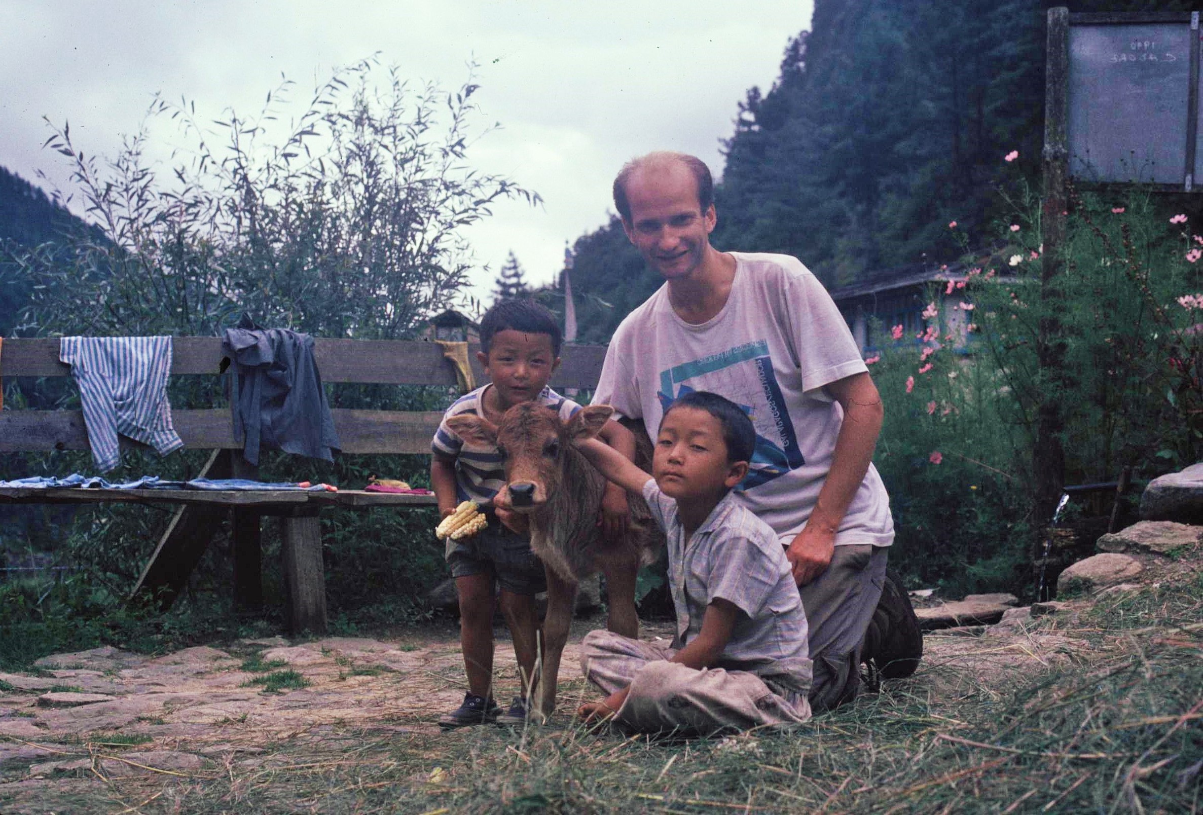
It was also nice to have some other company around, including fellow VSO volunteers Sharon and Martin. The lived in a house just within a stone’s throw and were always good company. Sharon was working as a public health advisor in the local health clinic and was always a great source of enthusiasm and motivation whenever the going got tough (usually telling me it was my fault for ever thinking of complaining) – her partner Martin worked as an English teacher in the local primary school. There were also one or 2 other overseas residents including Toshi, who I spoke to in Nepali (our only mutual language) and a couple from Switzerland who were working for a local hydro electric project. 

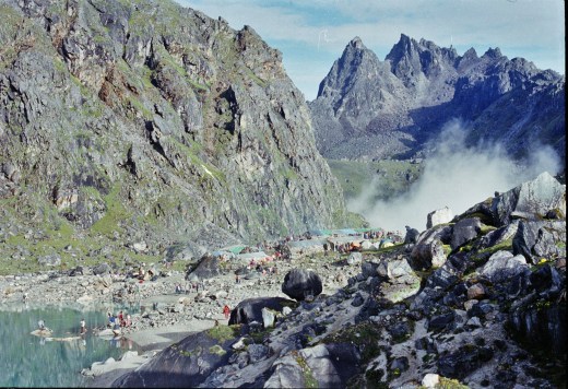
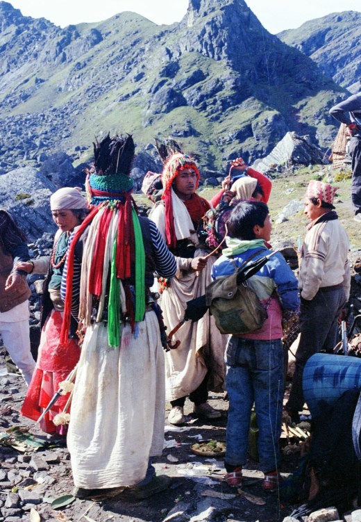
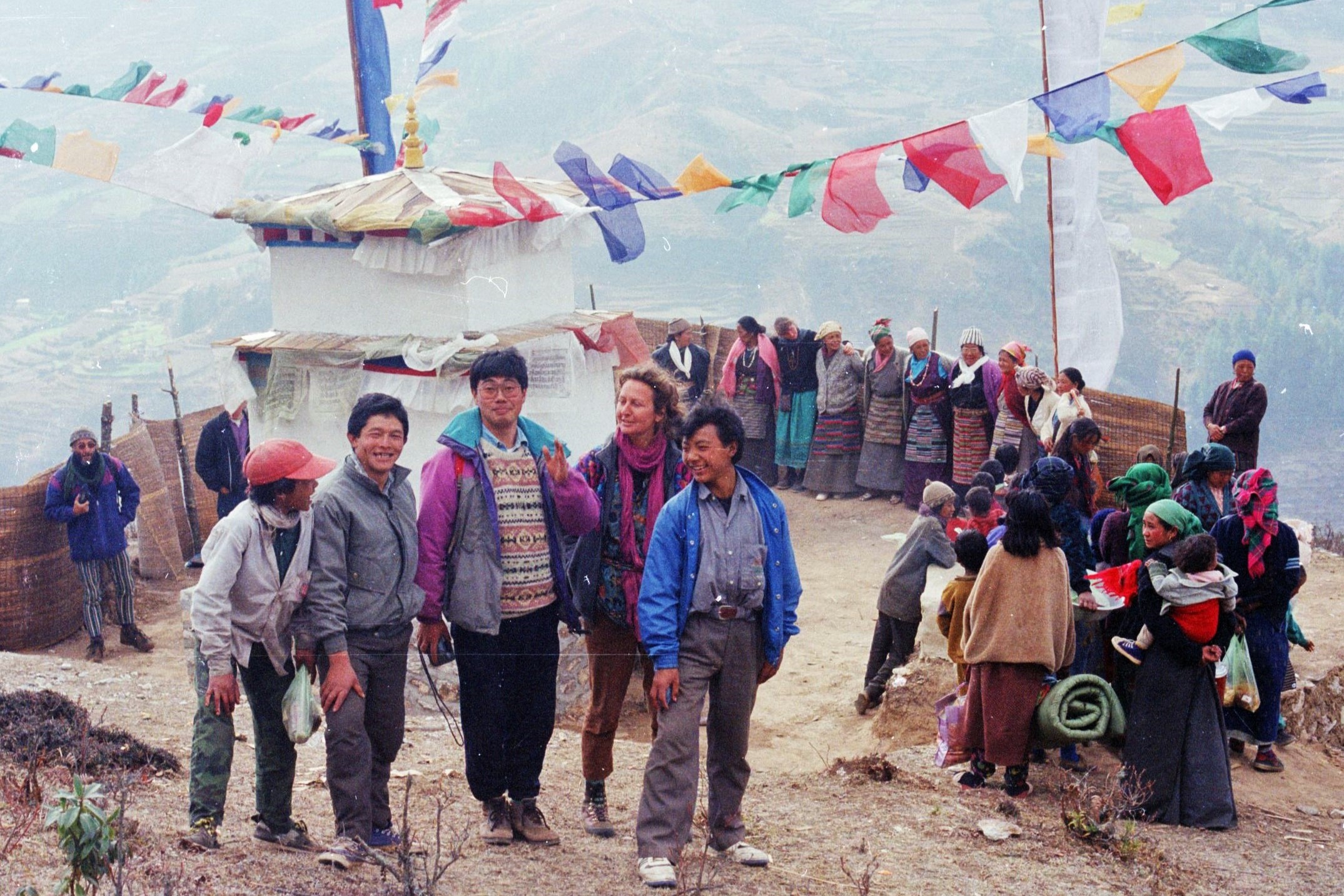
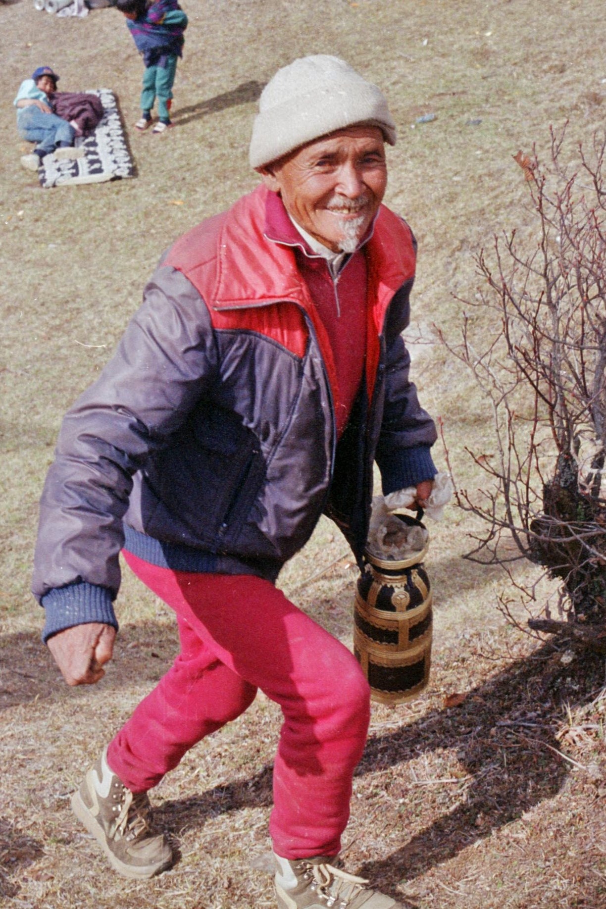
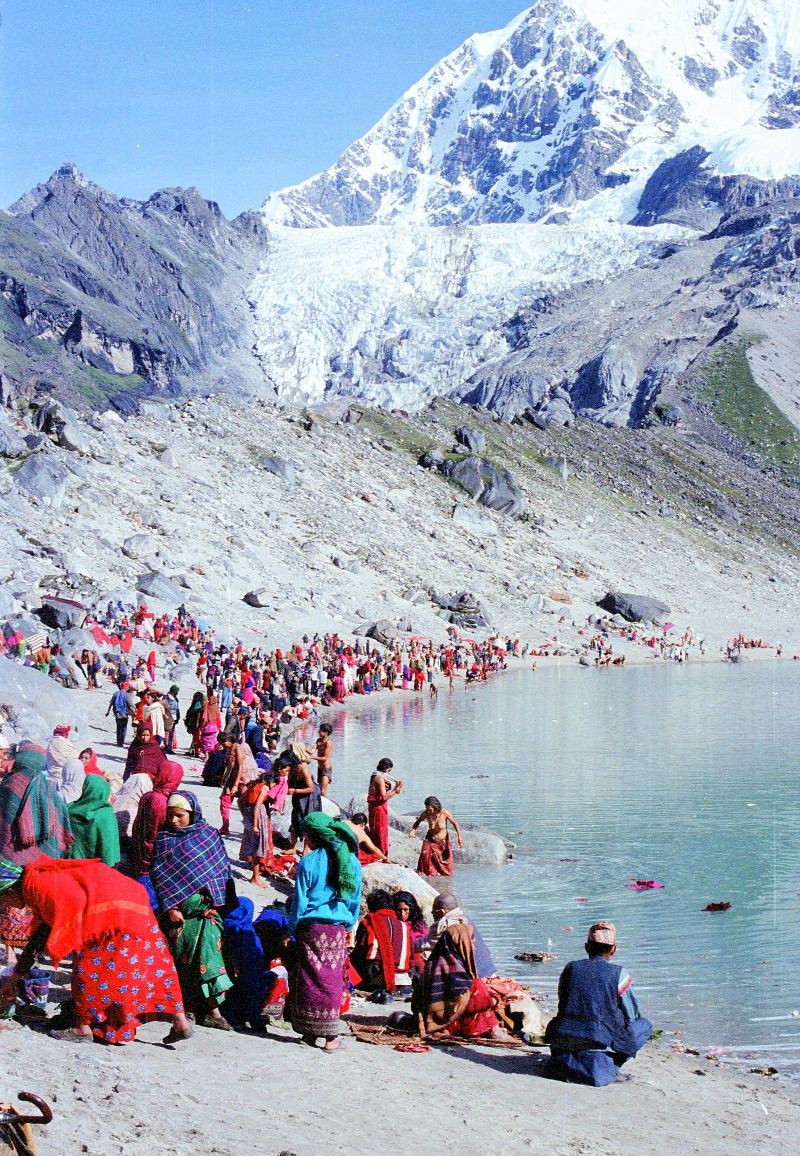
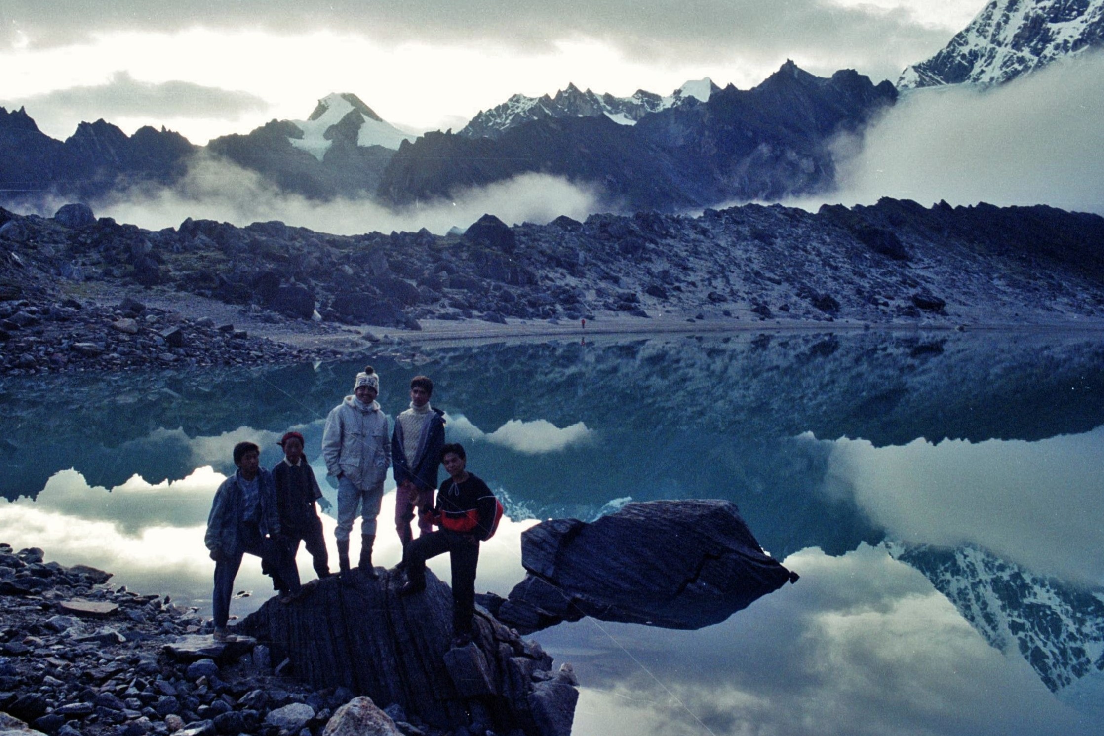
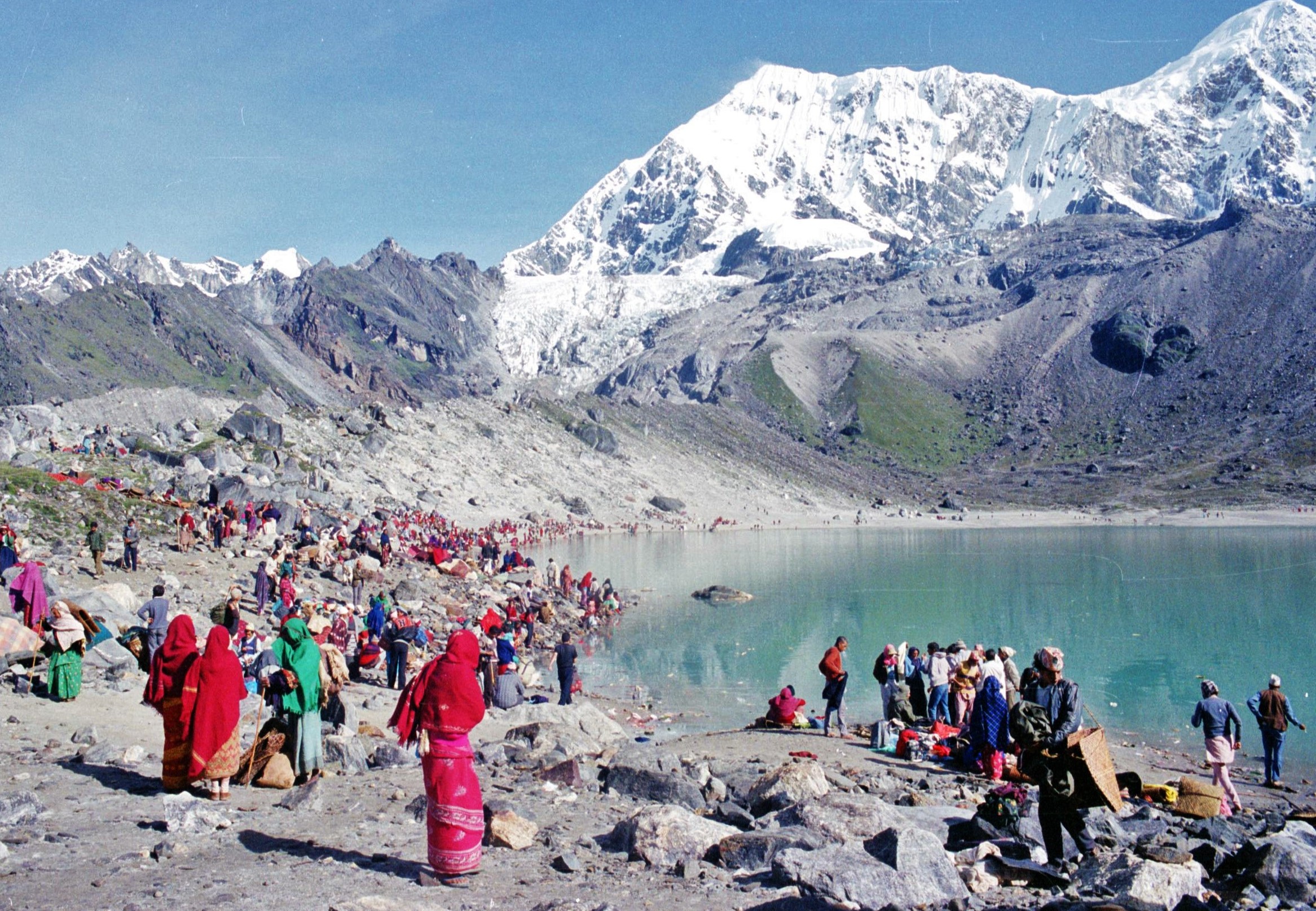
One of the social highlights of the year in Solu was the Dudhakunda festival which was located by a glacial lake at over 5000m under the watchful peaks of Numbur and Karyolung. On midsummer night we partied here here in the full moonlight accompanied by a mad assortment of humanity; shamans drumming and dancing, Hindu sadhus stoned out their heads and trendy young Sherpa guys blasting out Michael Jackson on their ghetto blasters, whilst knocking back copious amounts of “chang” and “raksi”.

The Dudhakunda Lake is a sacred power place for both Hindus and Buddhists; some people, even in their 80s, had walked (or been carried) 3 days or so over rough trails just to get to this spot which is 5000m in altitude, believing that if they persevered, their karma and their reincarnation in the next life would benefit. In the night, far off in the distance, over the plains towards India, we could see amazing electrical storms erupting out up the cloud inversion stretched out below. The devout pilgrims, circumnavigate the lake and then bathe in the waters at dawn – I must admit to giving that one a miss.  What a wild experience that was; a party like no other that I’ve been to before or since.

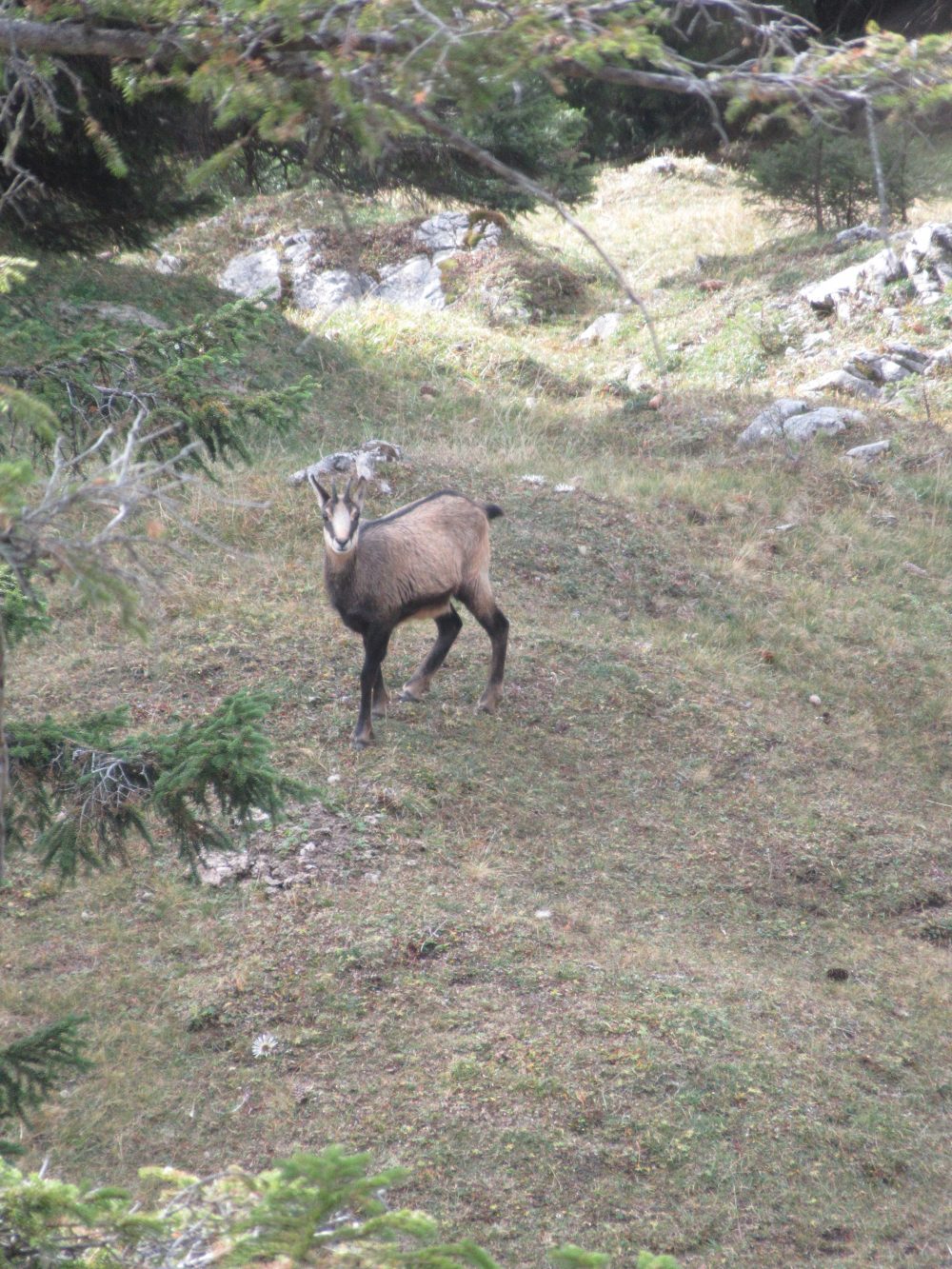
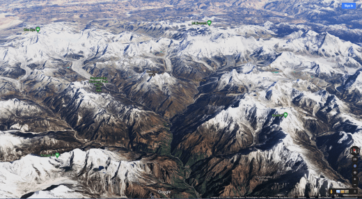
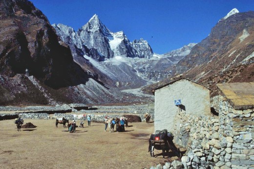
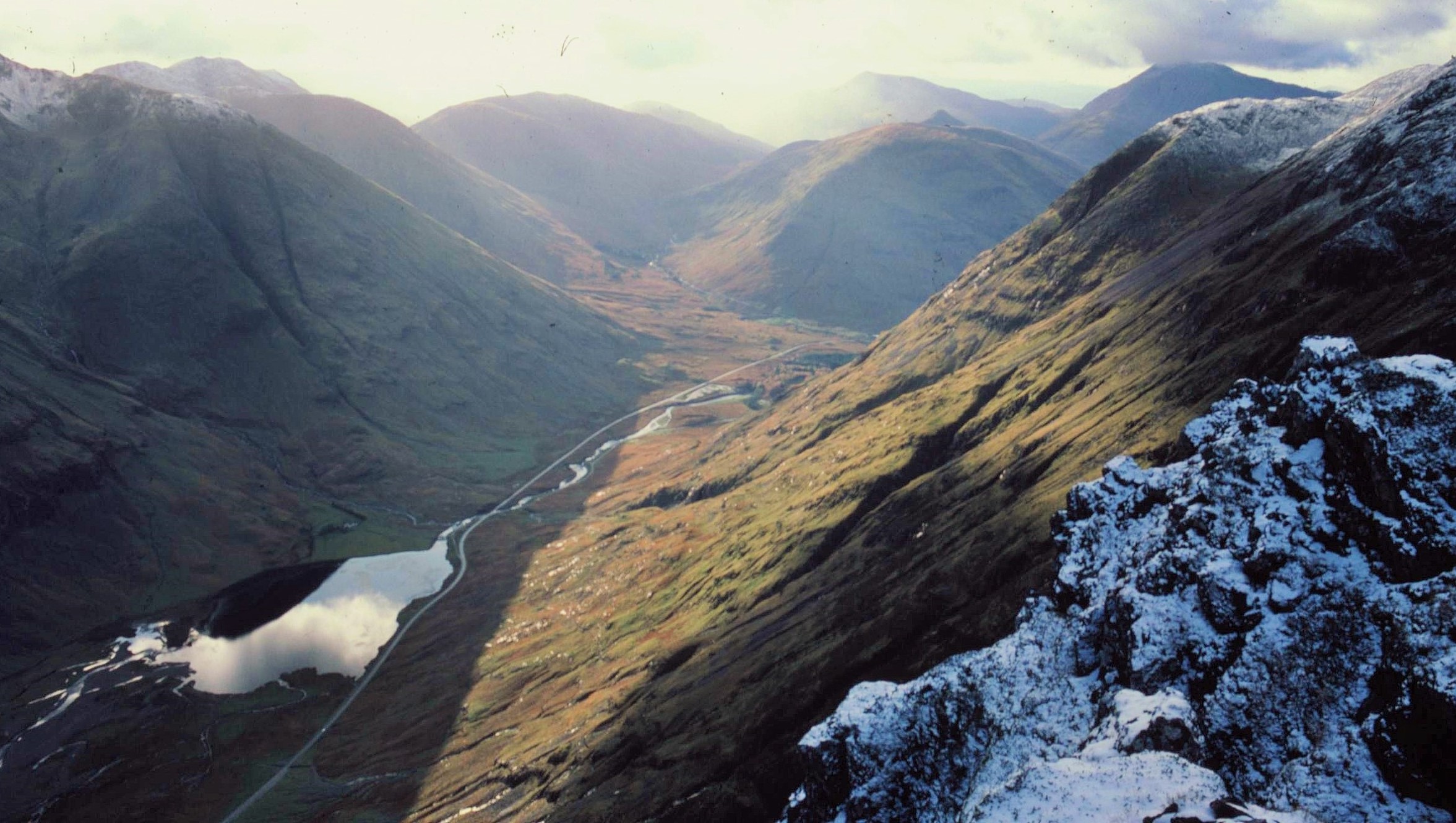
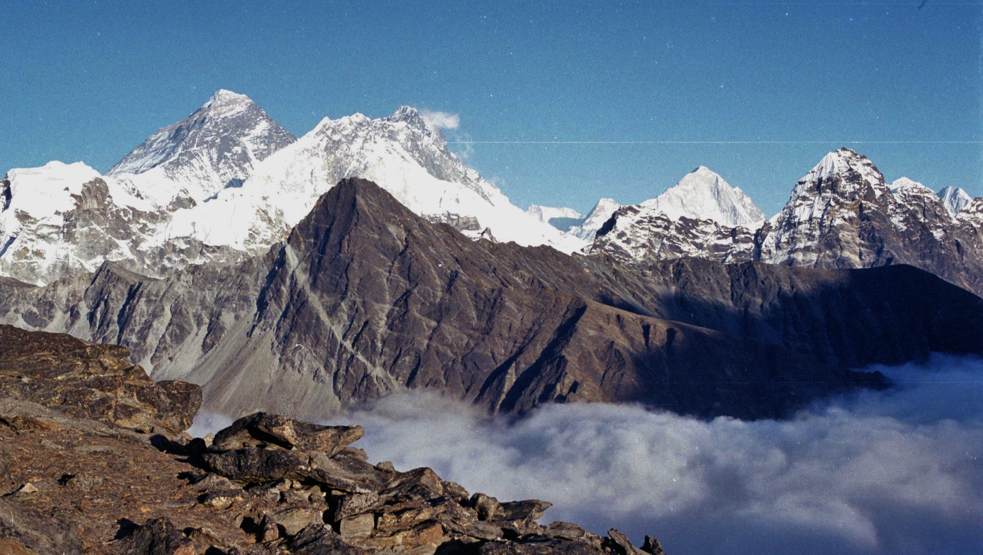
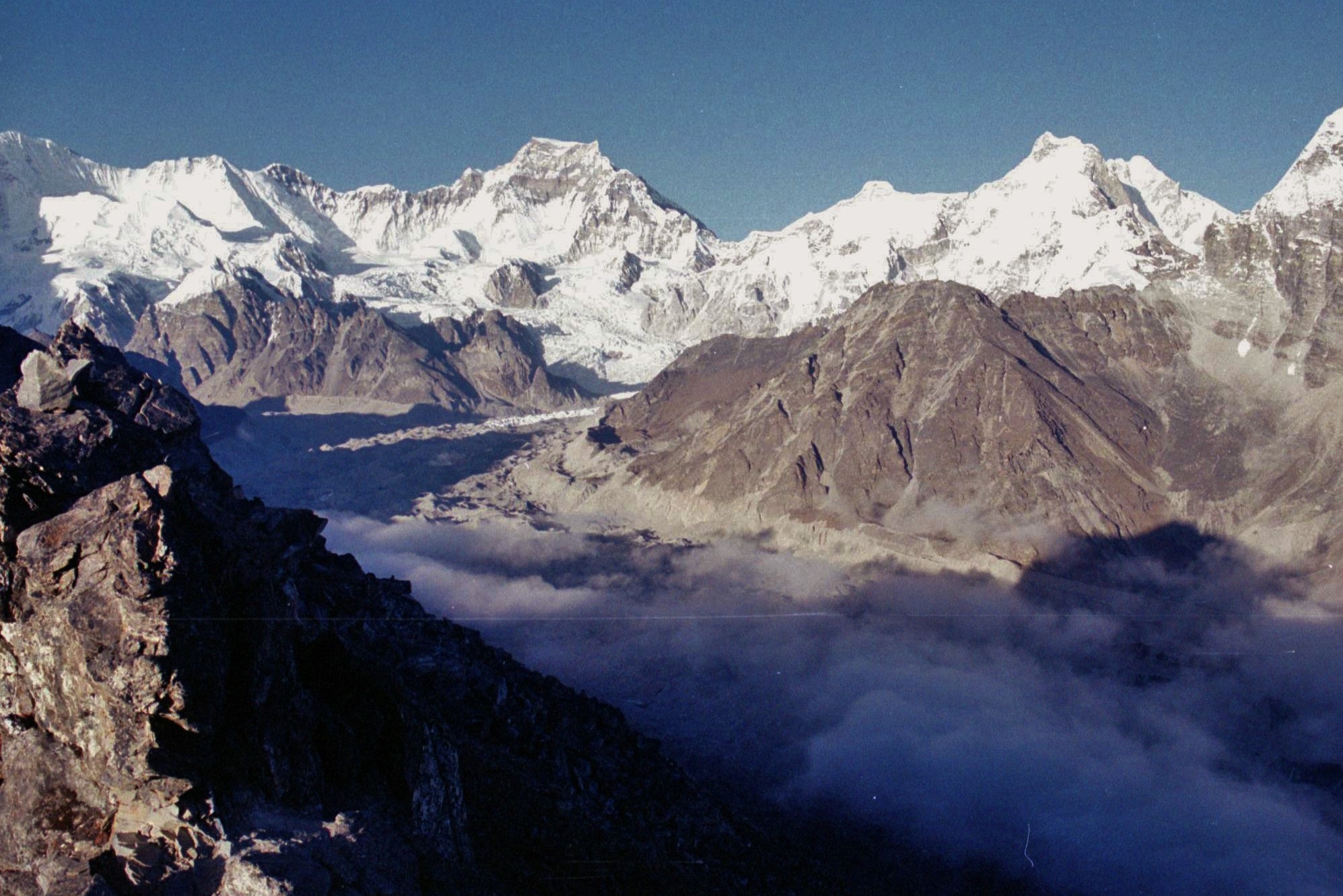
There’s a great walk along the top of the ridge above Phaplu behind the Chiwang Gompa with views across to the mighty 8000m peaks of the Khumbu region including Makalu, Lhotse and Everest itself (the highest mountain on earth, first climbed by Sir Edmond Hilary and Sherpa Tenzing Norgay back in 1953). Although it doesn’t appear far away as the crow flies, the scale of the landscape is indeed deceptive and vast. To reach the Khumbu from Solu requires a walk of 3 or 4 days, with a knee jarring descent of over 1000m from Traksindo La pass to the village of Jubing in the Dudh Kosi Valley with its banana trees and sultry climate.


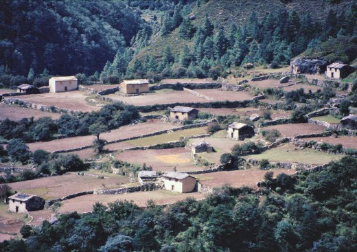
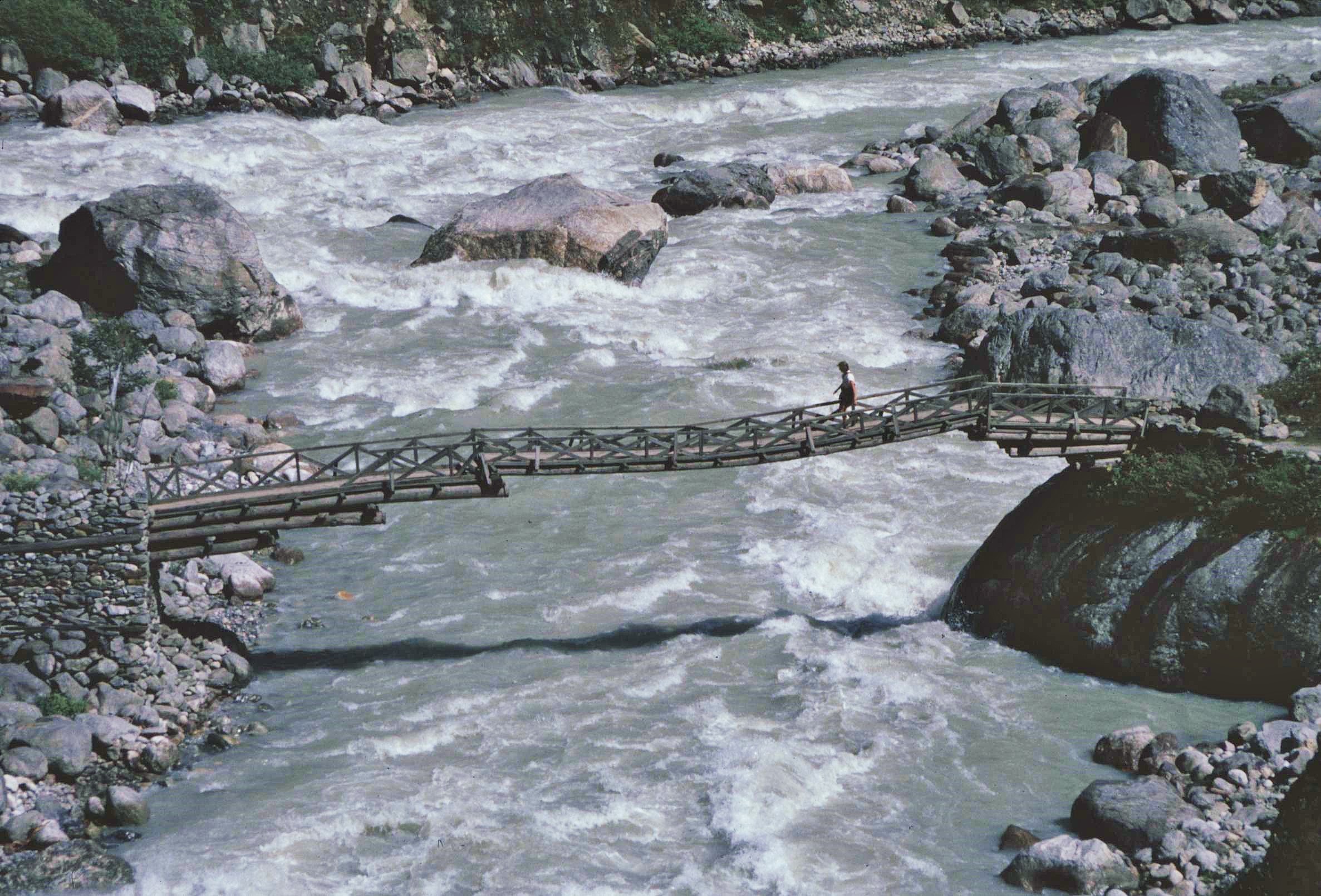
From Jubing the trail winds up the main valley of the Dhudh Kosi through a landscape of small Sherpa and Rai villages, terraced fields and through some dense forests away from the settlements. The path is often steep with precipitous drops down to the Dudh Kosi. I used to sometimes trek this path alone to get to the Northern part of the District and this was the only part of the trail which unsettled me. In one more remote section of trail, the bodies of a couple of trekkers had been found lying in a steep gully, the cause of the fatalities unknown. Generally though, Nepal is very safe for trekking and the people you will encounter will either be hospitable or curious about you. However I know from my own experience that it can be easy to take a tumble from the trail and to suddenly find yourself in a tricky situation. It really then makes more sense then to trek in company rather than alone.

Traversing the Dudh Koshi Valley it’s possible to bypass the tourist hub of Lukla with its famous and unfeasibly steep airport runway. This is generally the gateway for tourists to the Khumbu Region and the start of the Everest Base Camp Trek. It is generally full of tourists scrabbling around to get much prized plane tickets to Kathmandu or sitting around dejectedly because their flights have been can cancelled for days on end, due to bad weather or other unforeseen events. The more sensible visitors, with time on their hands, will do the long walk out (or in) from Jiri, through Jumbesi and the Solu Region to the South. Admittedly this involves a great deal of up and down against the natural grain of the land. By comparison with the Khumbu, the Solu area where I was based, is much less touristed and the long trek in is a great way to get a taste of real Sherpa and Nepali culture amidst beautiful landscapes. Meanwhile a steady stream of small aircraft disgorge their payloads of crazed adrenaline junkies making for Everest Base Camp at breakneck speed – sometimes with disastrous effects in terms of inevitable acclimatization issues and potentially acute mountain sickness.


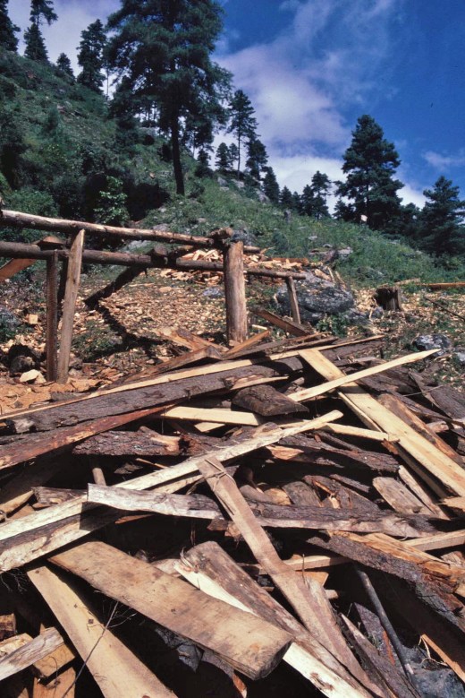
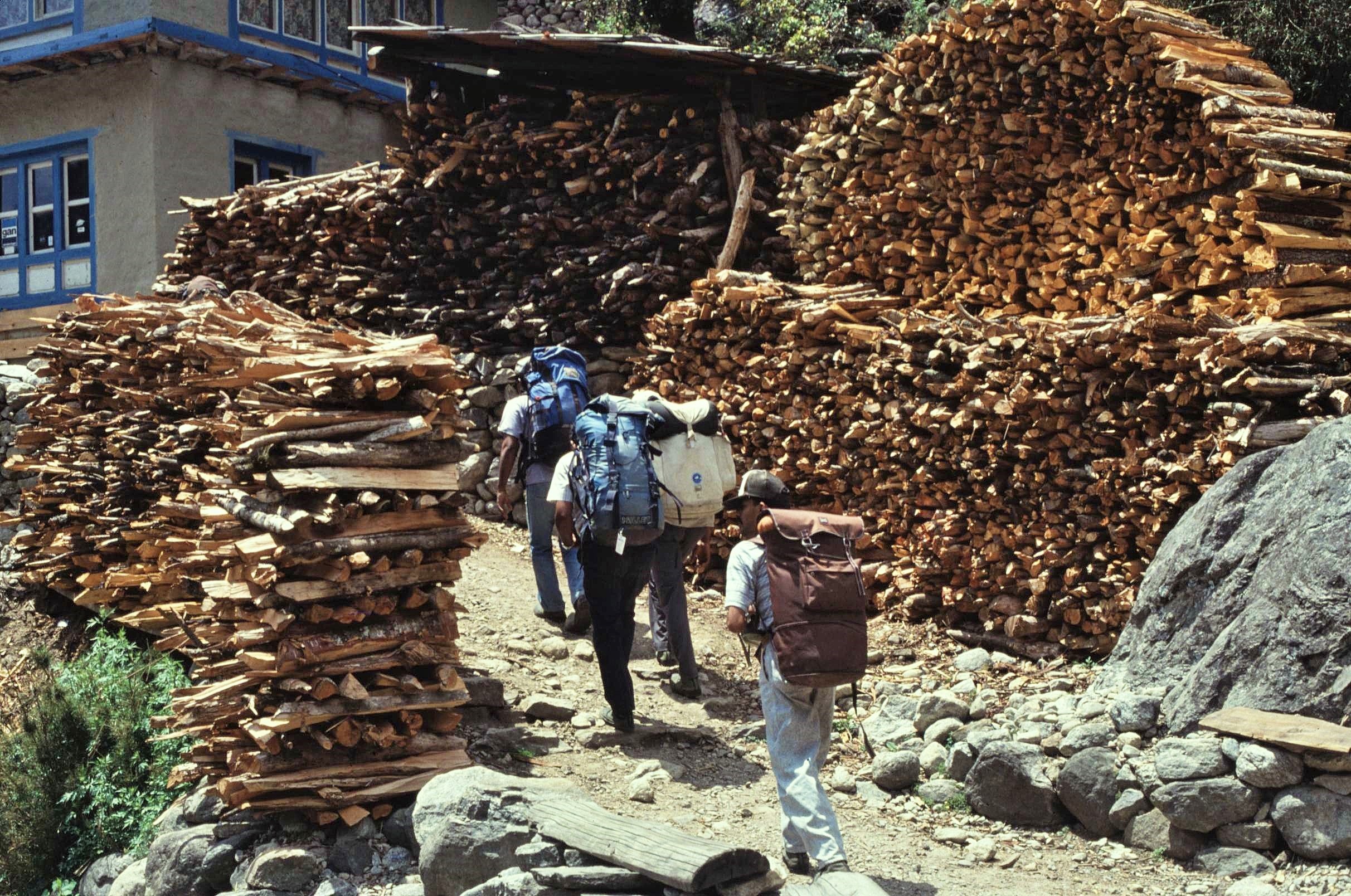
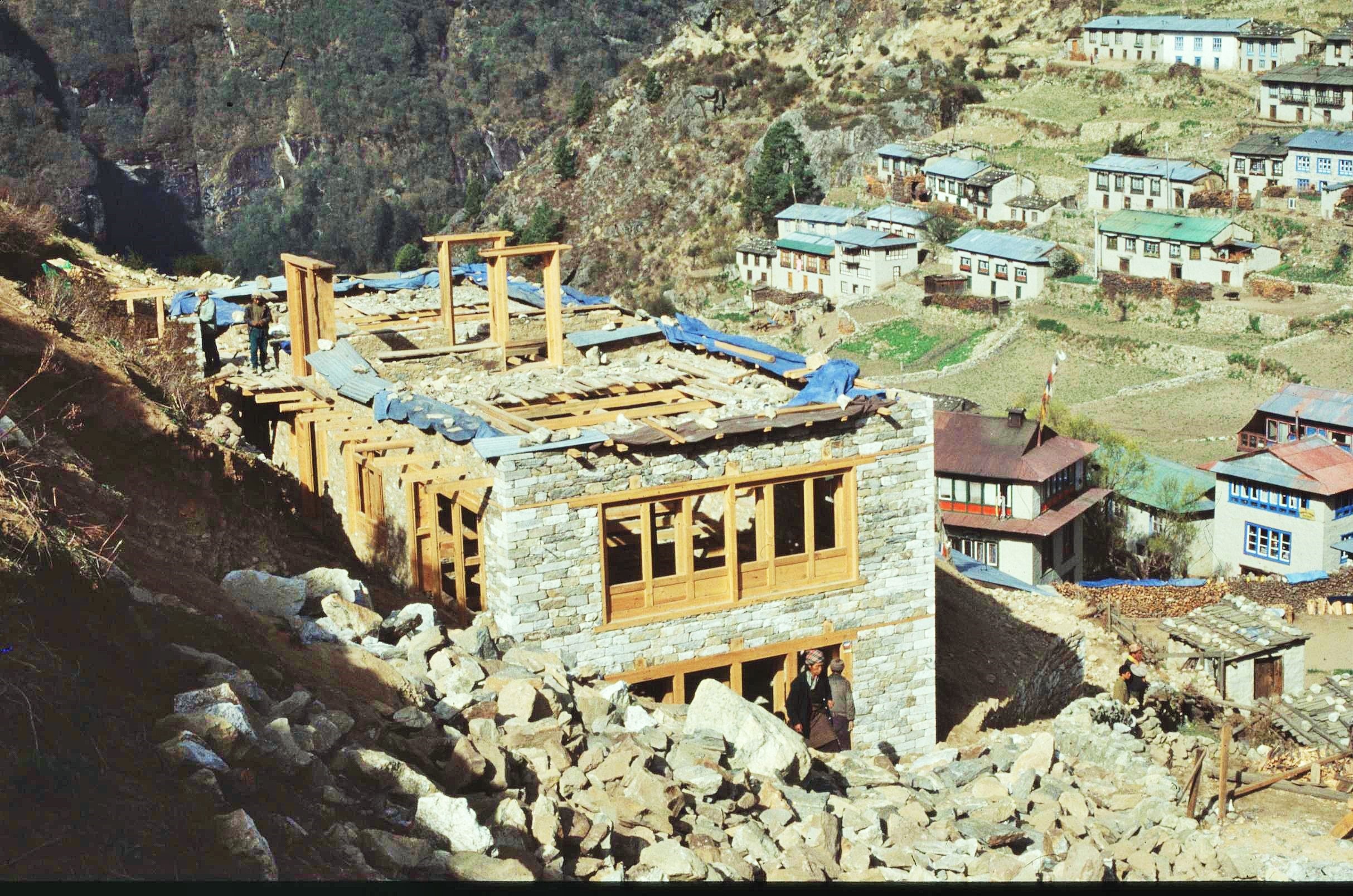
A particular issue in the approach to the Khumbu Region around Lukla has been the environmental impact of trekking and tourism. This has historically been responsible for a large amount of deforestation in the area, particularly just to the South of the Mt. Everest National Park boundary. Forests in this area were not accorded so much protection, however also acted as the main source of timber and firewood for the adjacent Sagamartha National Park. Consequently, when I was there, huge stacks of firewood were in evidence outside tourist lodges on the main trail towards Everest. Tourists demanded hot showers and complex European menus which further increased the demands placed upon the forests. Wood was also in considerable demand for construction of new tourist lodges in the area particularly in Namche and the Pharak area.


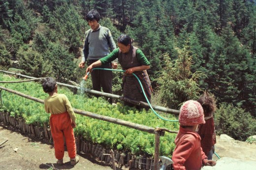
One of our tasks with the Forestry Program focused upon these issues and the challenges of attempting to reduce the impacts caused by tourism in this area. This involved the establishment new forest user groups which aimed to encourage higher levels of cooperation and participation by local people. Noticeably, the Sherpa women had a much greater say during these meetings than in the meetings held in the Middle Hills areas of Solu further South. The work also involved contacting the owners of tourist lodges in the area to investigate how they could reduce their overall reliance on fuel wood and to therefore help the forests to regenerate through more sustainable long term management practices. A project started by Sir Edmond Hillary had also been developing new tree nurseries in the area to deal with some of the more seriously degraded forests.

The Khumbu Region to the North of here is the gateway to Everest and is very much the heartland of the Sherpa people themselves. Namche Bazaar, nestling in it’s natural amphitheater is best known as being the Sherpa “capital” and boasts a thriving tourist industry with numerous hotels and lodges which seem to have gradually added more and more stories on top over the years. Many tourist groups, climbers and trekkers linger here for a day or 2 on their way to the Everest base camp for acclimatization purposes and so it can get quite busy at times, with an assortment of tourist ships reminiscent of Kathmandu’s Thamel District.


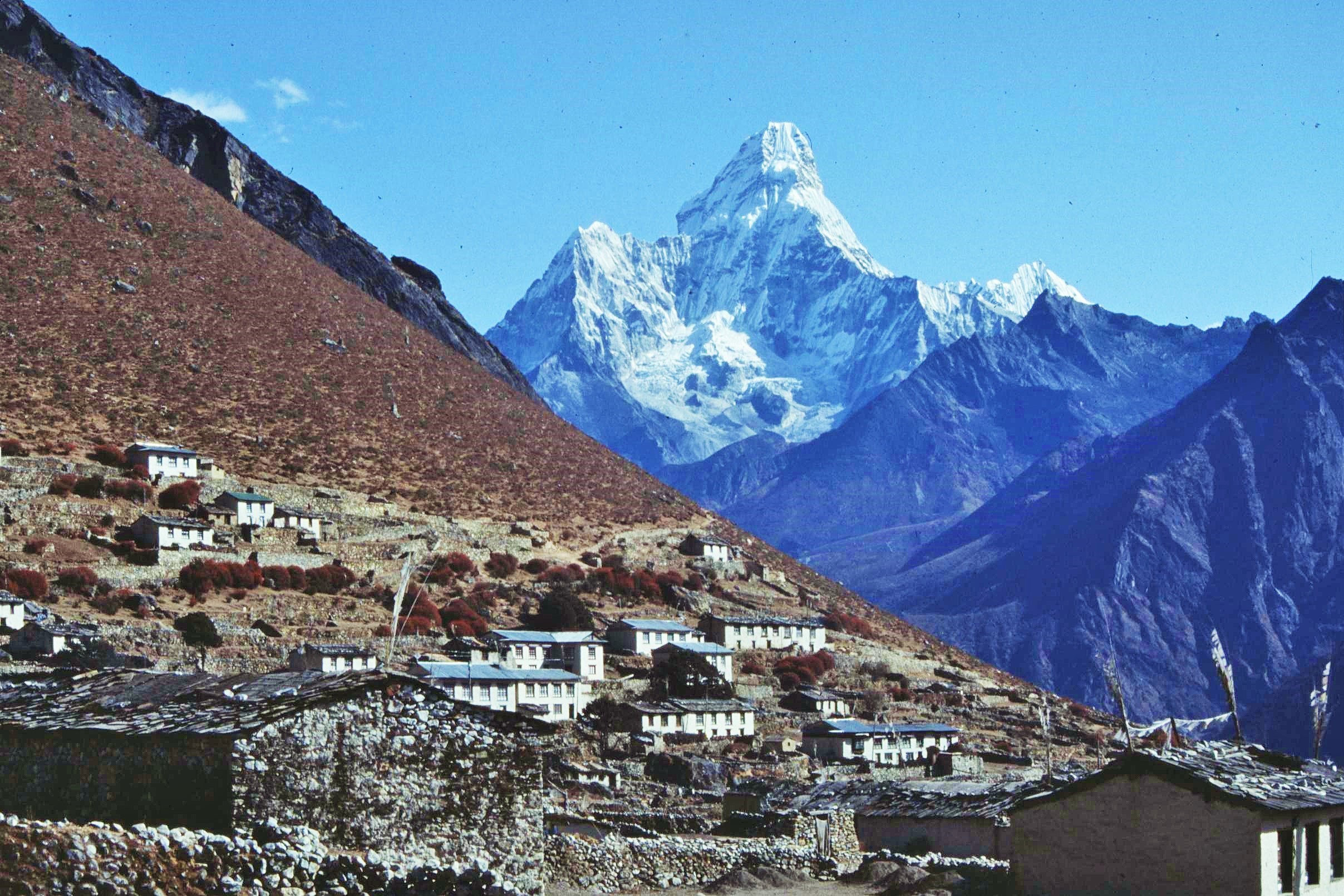
However, there are also quieter and more traditional Sherpa villages such as Khumjung and khunde, where slower rhythms and traditional Sherpa life can be observed with the spectacular backdrop of Ama Dablam, my favourite peak, towering gracefully over the valley. You will also see Sherpa women working in the fields, digging potatoes or harvesting buckwheat. Meanwhile, many of the Sherpa men will be involved in the dangerous work of serving high altitude mountaineering expeditions. This offers good financial returns but also carries a high price as many Sherpa families have learned to their cost, particularly in 2014 when 16 Sherpas were tragically killed in an accident in the Khumbu icefall.

When Edmond Hillary and Tenzing Norgay first scaled Mt Everest in 1953, the region had been effectively closed off from the rest of the world. The life of the Buddhist Sherpa inhabitants of the Khumbu had remained virtually unchanged for generations and mountain peaks, including Everest (or Chomolunga in Tibetan), were considered to be sacred places and the abode of the gods alone. There was certainly no question of the Sherpas wanting to conquer these high places for personal prestige. Following the ascent of Everest, however, all this started to change as the region opened up to climbing expeditions and then to trekkers who appeared in ever-increasing numbers.

The adventure tourism boom brought significant benefits to the Sherpa people who were able to earn wages of up to 5000 dollars a year (compared with the Nepal national average of only 700 dollars) in one of the world’s poorest countries. New schools, hospitals and airstrips were constructed in the Region, including the airport at Lukla. For the first time a new generation of Sherpa children were able to benefit from educational and employment opportunities far from their homeland. However, the stream of visitors also brought problems; these included deforestation, rubbish dumping, social inequalities and the decline of community cohesion and agricultural systems. The creation of the Sagamartha National park in 1976 set out to address some of these problems, but in so doing, inadvertently created additional pressures including the intensification of environmental impacts from deforestation outside the park boundary.

For me personally, one of the greatest highs (both physically and emotionally) must have been an evening ascent of the Gokyo Ri peak which, at 5500m, affords one of the best uninterrupted views of Everest. Gokyo also has the added attraction of being less frequented than the popular Kala Patthar peak, another trekking destinstion located close to Everest Base Camp (the circus and crowds thereof !).

After a long and unrelenting trek in, I climbed the Gokyo Ri one still evening (somewhat recklessly throwing caution to the wind with acclimatization). Upon reaching the summit of the peak, I sat completely alone for a couple of hours, clicking off snaps with my battered old manual SLR, accompanied only by my fleeting thoughts and the sound of the fluttering Buddhist prayer flags which adorn the summit. 

As the inversion clouds slowly drifted up the valley, cutting me off on the rocky island summit from the world below , I felt a wonderful sense of connection to world of rock and ice around me. As the last rays of the dying sun illuminated the lofty mountain flanks, Mt. Everest appeared serene, remote and unassailable.

Everest, was named originally to honour a British colonial surveyor, who never actually went near the mountain but observed it’s height from far away on the distant plains of India. However, instinctively it seems the Tibetan Buddhists possessed a more intuitive understanding of the significance of the peak;  Perhaps the Sherpa name “Chomolunga”, the Goddess Mother of the Universe, is a more fitting title which accords the peak the true worthiness and respect it should be due.


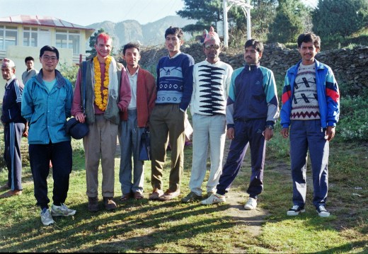
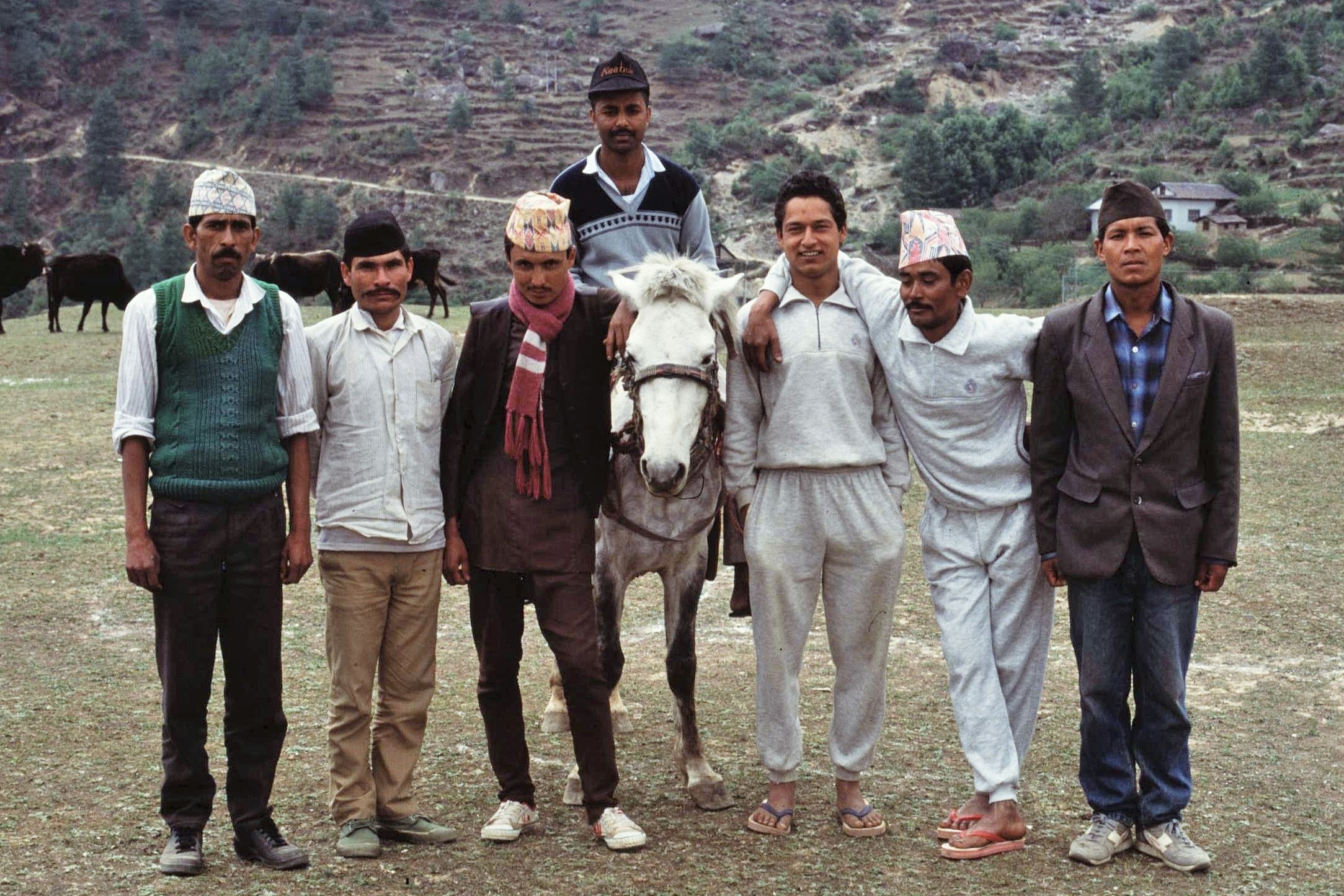
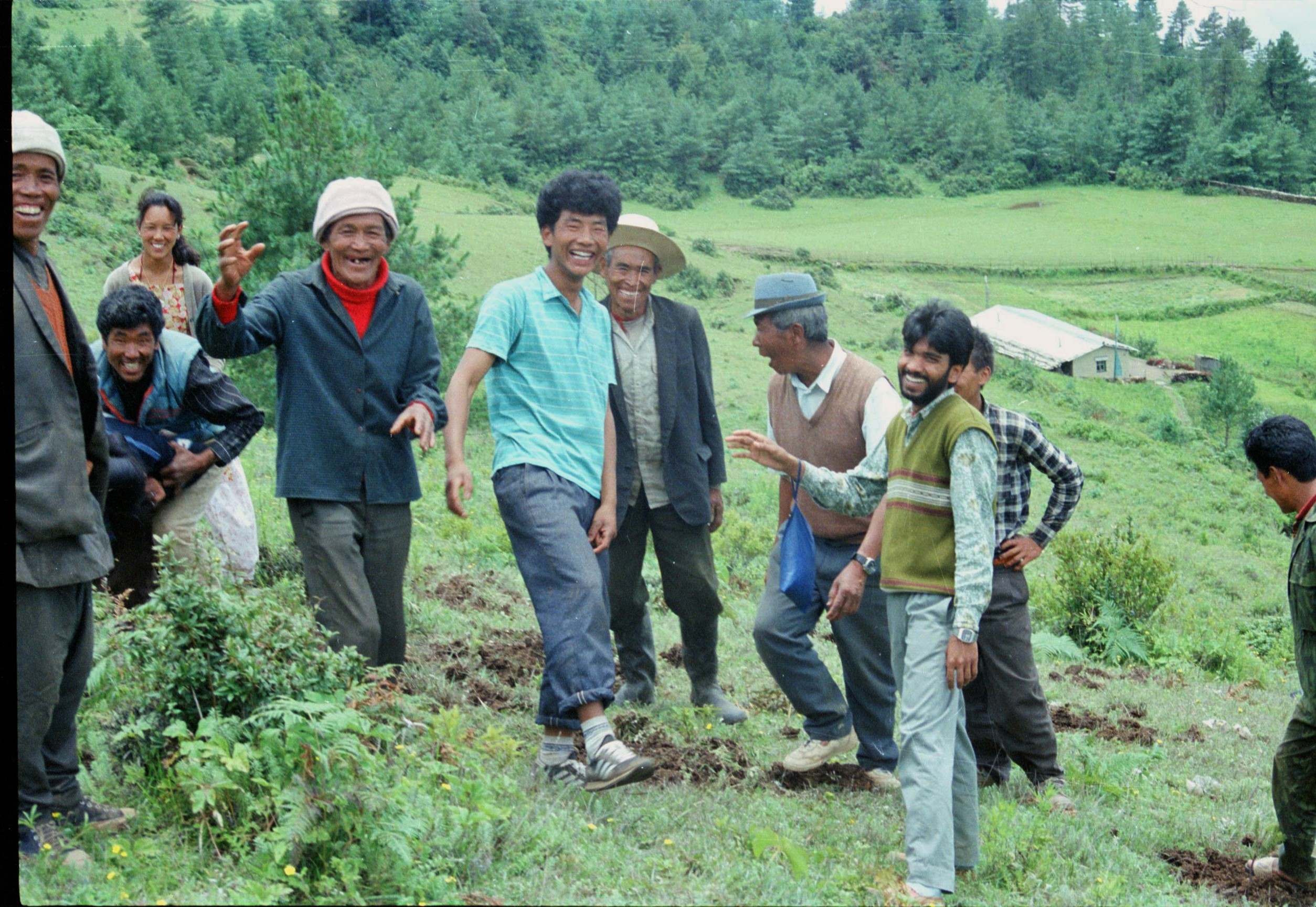
“Village stay”: Fond Farewells for the VSO Nepali language training class of ’91 Madanpokhara, Palpa District.

Image may contain: 3 people, people standing, people on stage and outdoor

Image may contain: 5 people, people standing, people sitting and outdoor


Posted in History & Culture, Mountain Treks, Trees & Greenspaces, Wild Places, World | Tagged , , , , , , , , , , , , , , , , , , , , , , | 11 Comments

Amongst Scotland’s Ancient Caledonian Pinewoods:

One of my favourite places to be in the World must be Scotland’s ancient Caledonian Pinewoods. Although now reduced to a few remnants, these distinctive forests used to cover more extensive tracts of the Scottish Highlands. In the words of pioneering forest researchers and professors, Steven and Carlisle, who first undertook surveys of these forests back in the 1950s,

“…to stand in them is to feel the past”.

DSC00921

Back in the 1990s, after completing my Masters in Natural Resources management, I was fortunate enough to spend one blissful summer as a Ranger/Naturalist working for the Scottish Wildlife Trust at the Pass of Ryvoan Pinewood in Glenmore Forest in the Scottish Highlands. My days were spent out and about in the Great Outdoors, recording wildlife populations, surveying vegetation and forest regeneration and showing visitors around the Reserve.

Ryvoan Walks26042020

For the visitors who attended my guided walks and talks, my job must have seemed like a dream job indeed; spending time in those ancient woods with the ever present backdrop of the Cairngorm Mountains and their snow bedecked peaks which beckoned tantalizingly on the horizon every day.  Of course it wasn’t all plain sailing – I remember days spent fending off swarms of biting flies or maddening plagues of midges as I struggled to measure and record the woodland trees and wildlife, amidst the dense undergrowth and on steep and precipitous slopes. Despite these minor inconveniences it must surely have beaten the average 9 – 5 office jobs of the visitors whom I had the pleasure of showing round the Reserve.

DSC00934

Many years later, I still  find it a joy to periodically get back to the Pass of Ryvoan and the stunning landscape of Glenmore, Strathspey and the Cairngorm Mountains; I love the sights, sounds and smells of the woodlands. The ancient Scots pine trees themselves, known as the “Granny Pines”,  are the veritable OAPs of the Forest, with some of them reaching up to 350 years old.  Like moody old forest trolls or goblins, many have unique, contorted and distinguished forms; each one possessing its own distinctive personality and spirit – far removed from the monochrome uniformity and boxy outlines of today’s industrial forestry plantations.

IMG_1074

One of the greatest pleasures in recent years has been showing my own kids, the Scottish Pinewoods and encouraging them to appreciate and explore the wonderful places that I was able enjoy when I was growing up in Scotland. Whether its scaling the old trees, listening to the bird sounds of the forest, investigating a wood ants nest and getting sprayed with formic acid or looking for insect eating plants like sundew and butterwort amongst the heather and sphagnum moss; such experiences are priceless and special for developing minds and help to engender a sense of responsibility and stewardship for nature and wilderness.

DSC00930IMG_0198IMG_2220

One of the real highlights of the Pass of Ryvoan is Lochan Uiane, or the Green Loch, which is a real gem; its turquoise green waters reflecting the colours of the surrounding woods and hills, particularly in autumn when birches and aspen are turning gorgeous yellow and amber. Local legends say that the Loch is this colour through the work the mischievous fairies who dwell nearby – apparently the  “wee folk” come down from the nearby “sìdhean” or fairy hill to wash their clothes after dark, thus staining the waters their wonderful hue. Science, however offers alternative explanations, which I’m sure can’t be true…

Although the Loch is much more visited these days than 30 years ago, it’s still a wonderful spot to chill on a fine day and enjoy nature. My favourite hiking route, the “high path”, leads back from Lochan Uiane along the higher slopes through the heart of the forest reserve. It’s along there that I spent happy hours recording vegetation profiles in the 1990s to help gain a better understanding of the woodlands, their natural regeneration and their conservation.

IMG_2252

IMG_1089Fortunately, the future of the forest is looking a bit rosier these days; with each successive visit I’m literally amazed with the way the young pines are spreading out across the landscape and starting to colonise the once barren ground on the higher slopes and the area between Ryvoan and the adjoining Abernethy Estate, an extensive reserve managed by the RSPB. This is the result of concerted attempts by conservation organisations to regenerate the Caledonian Pineforest through sensitive management, particularly through reducing deer numbers which have caused significant overgrazing of the young trees in recent years.

IMG_2080

There are now more ambitious plans afoot to regenerate considerable areas of the pinewoods around the Cairngorms, to establish more robust, functioning ecosystems over large areas and to reestablish the extent of natural treelines, reaching from the valleys up towards the mountain summits, themselves. The Cairngorms Connect project, for example, has the ambitious goal of  ecologically restoring 600km² of the Cairngorms over the next 200 years.

Whilst some of this appears simple and obvious, it also raises difficult questions and challenges about how much of the Highlands have been managed in the past and how far “rewilding” concepts can be taken, whilst taking into account the constraints and concerns of land managers and the wider public as a whole. Do we for example want to reintroduce large preditors such as wolves and bears again in the future ? How would that change our view about visiting the Cairngorms and how might it affect the overall ecology and functioning of natural systems ?

Despite all these difficult conundrums, I’m sure that pioneer foresters Steven and Carlisle would be happy to see the Caledonian Pinewoods once again valued and expanding: perhaps now we can not only “feel the past”  when we walk in these forests but can also see a future…

IMG_2051

IMG_1105

Posted in In Scotland, Trees & Greenspaces, Uncategorized, Wild Places | Tagged , , , , , , , , | 2 Comments

South Tyrol – “Slow tourism” without the crowds:

South Tyrol, or Südtirol, is certainly in the news at the moment, but sadly for all the wrong reasons, with Northern Italy particularly suffering the brunt of the corona virus infection.

However, last summer we spent a couple of magical weeks in this unique region, which straddles the mountainous border region between Austria and Italy.  And what a truly beautiful place it is – the soaring peaks of the Dolomites and other ranges, green pastoral valleys, historic villages and towns, vineyards and apple orchards galore and an inviting fusion of alpine and Italian flair. It’s really sad to think how many of these small tourism businesses will be suffering  in the coming weeks and months as a result of the present epidemic.

IMG_0257 (2)

Seemingly, nowhere I’ve been before illustrates the issues of localised over-tourism and concentration of tourists better than Südtirol: we found valleys such as the Grödnertal or Val Gardena which were completely choc-a-bloc with tourists, every carpark, full to overflowing, every cafe terrace bursting to capacity; we turned and ran…

Fortunately, in absolute contrast, just a few km away,  we stayed on a traditional mountain farm high above the Eisaktal at around 1,300m. It was an incredibly peaceful and beautiful location at the end of a steep, winding mountain road, a magnificent panorama unfolding across the valley from our balcony.  Straight out the door and you immediately enter a timeless and little frequented world of alpine meadows, pine forests and mountain trails – the busy and heavily touristed settlements of the main valley and the drone of the Brenner Autobahn seemingly a world away and out of earshot.

IMG_0300

We found our accommodation through a local enterprise called “Rotehahn”, or Redrooster, which specializes in providing authentic holiday accommodation on small family-run farms which produce distinctive local products from the Region. This was an ideal way to experience the area; the family providing the apartment were exceptionally friendly and were keen to show us the varied aspects of day to day life and challenges of running a mountain farm. The kids loved it too, with exclusive access to the cat barn where they could meet and greet the latest litter of kittens to arrive on the scene.

IMG_0098 (2)

We also found great walks and hikes amongst the ridges and valleys of Sarntaler Alps, far from the madding crowds and traffic congestion of the neighbouring Dolomites, which dominated the view to the East.  However, it was convenient as well just to pop down into the valley for a change of tempo and the odd excursion to historic towns and villages such as Brixen, Sterzing and Klausen and to enjoy some of the local Südtirol delicacies and wines. Although there is definitely a slight Italian feel in Südtirol, the everyday culture, dialect and traditions of the Region are generally more alpine in character than Italian.

The locals are also fiercely proud of their homeland and their mountain way of life; over the years there has been a steady undercurrent of opposition in response to the enforced “Italianisation” of the Region during the Mussolini era. During this period  local place names were replaced by newly invented Italian ones. As a consequence you’ll often find signs with the Italian names scored out and the original place name scrawled there instead.

DSC02635

IMG_0333 (2)
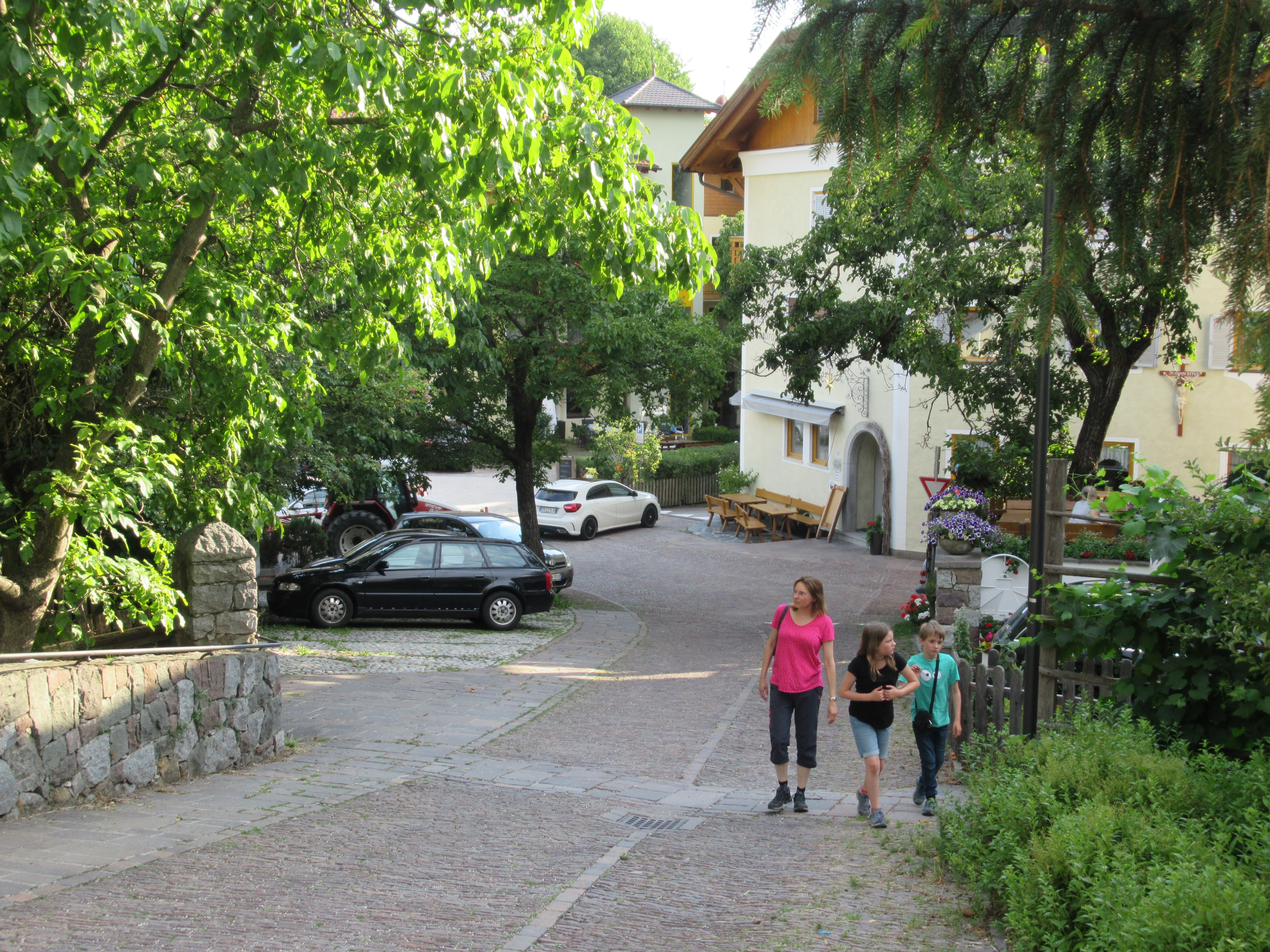
And so next time you think about taking a holiday to the Alps; rather than just supporting some faceless multi-national resort consortium, think about how your visit might benefit the local culture, traditional agriculture, landscape and economy. In this respect we found “Red Rooster” to be a great opportunity offering authentic experiences, off the beaten track and real insights into the local culture and traditions of the region.

IMG_0367

DSC02593

IMG_0293
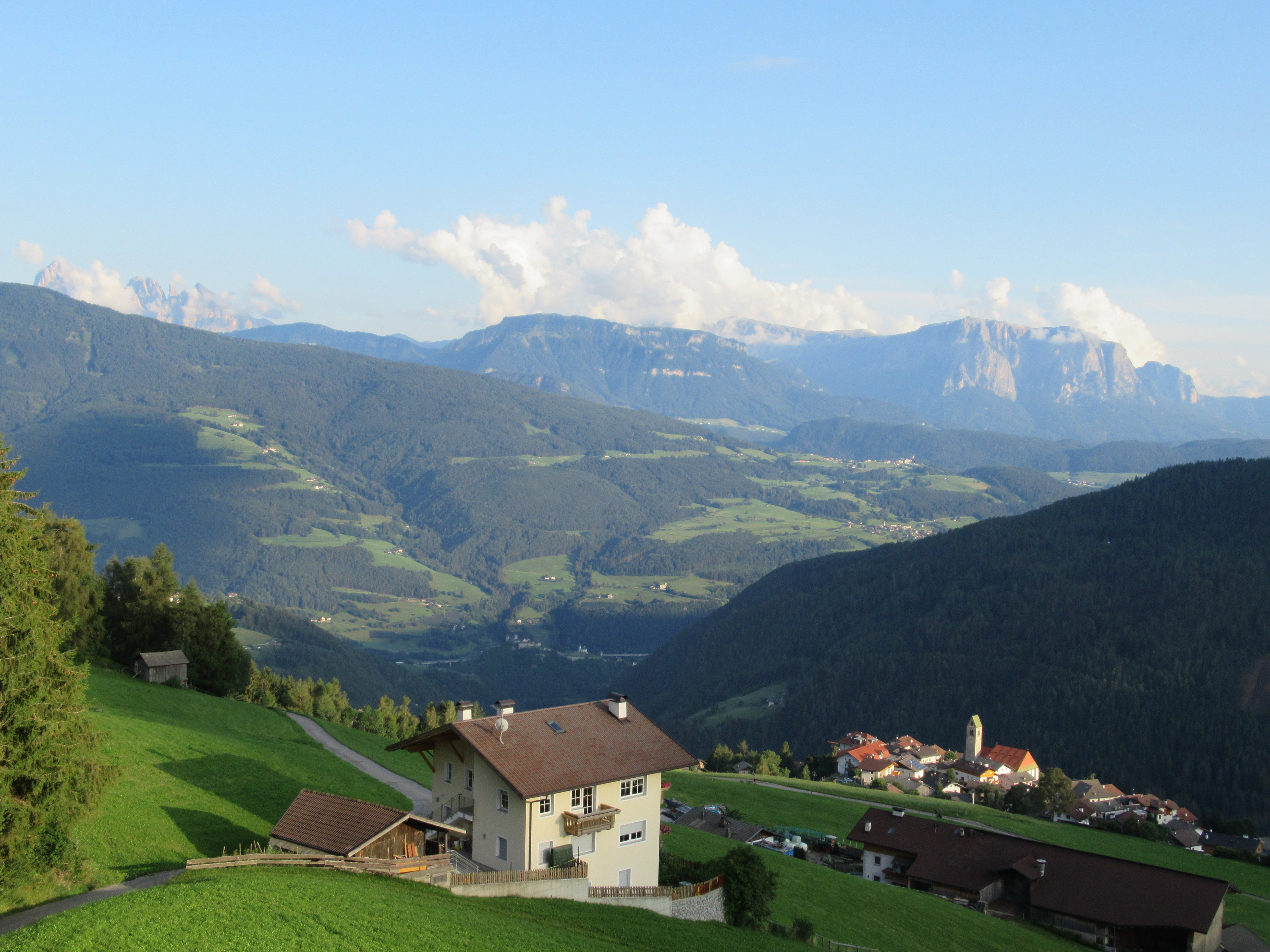
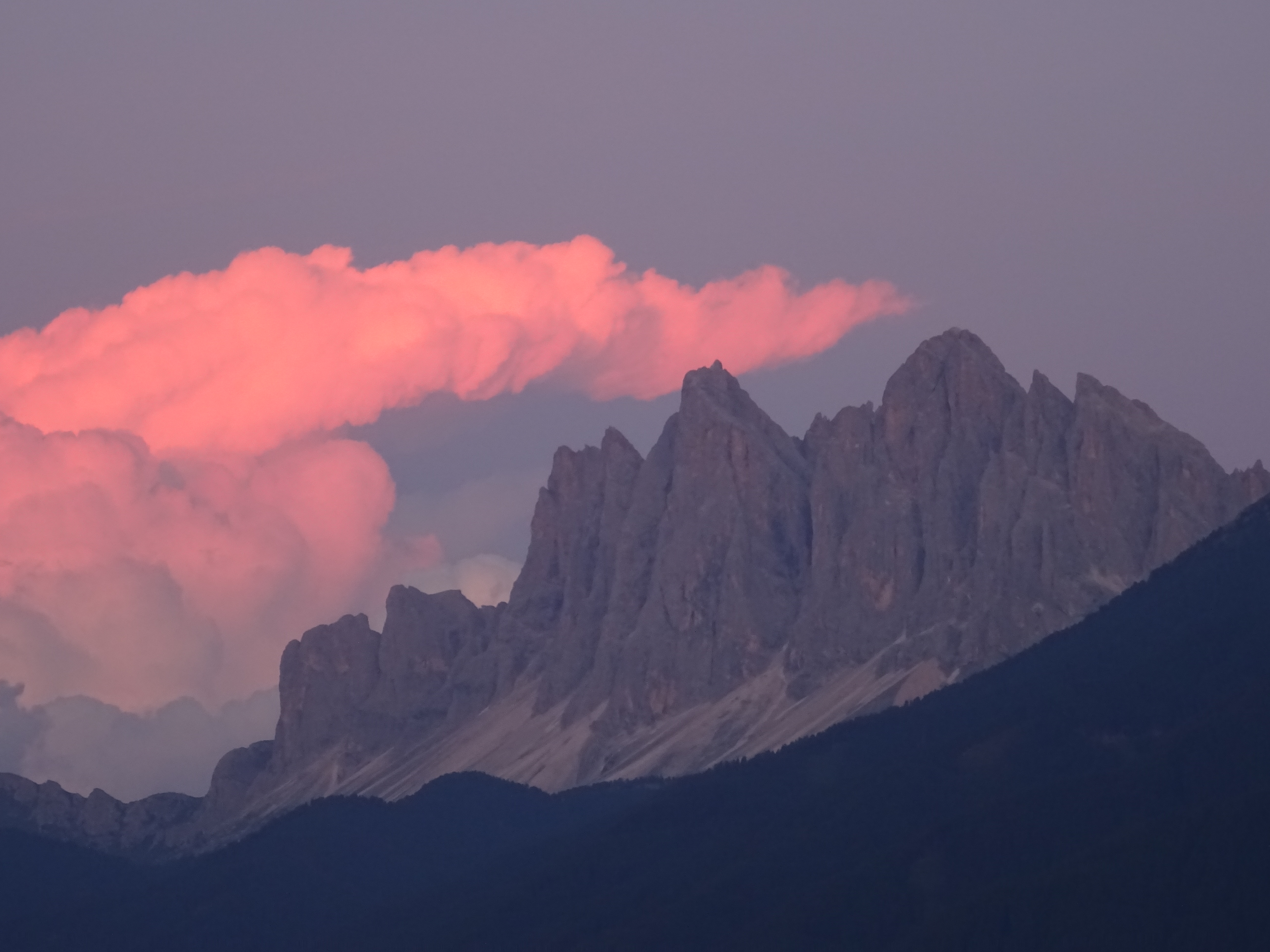
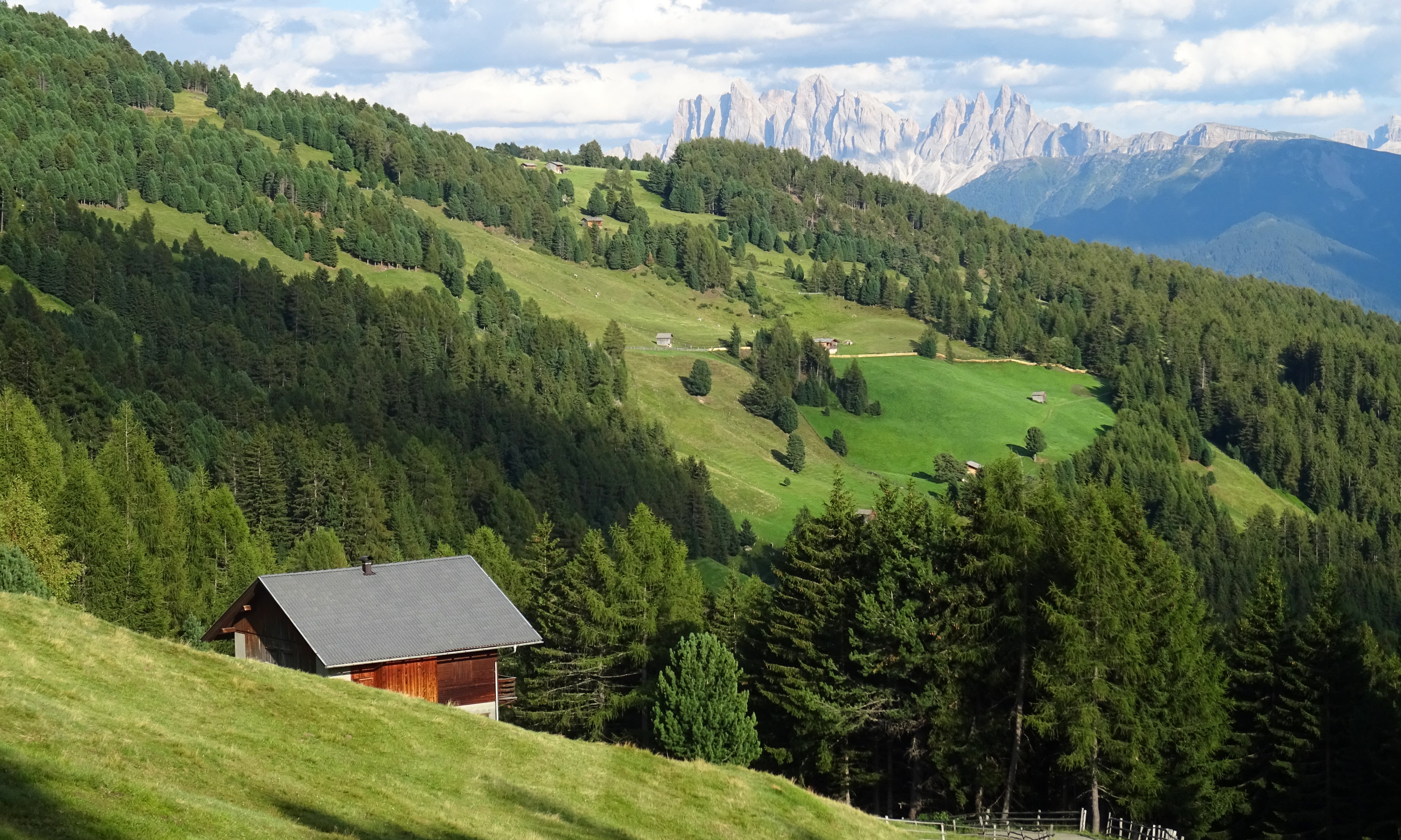
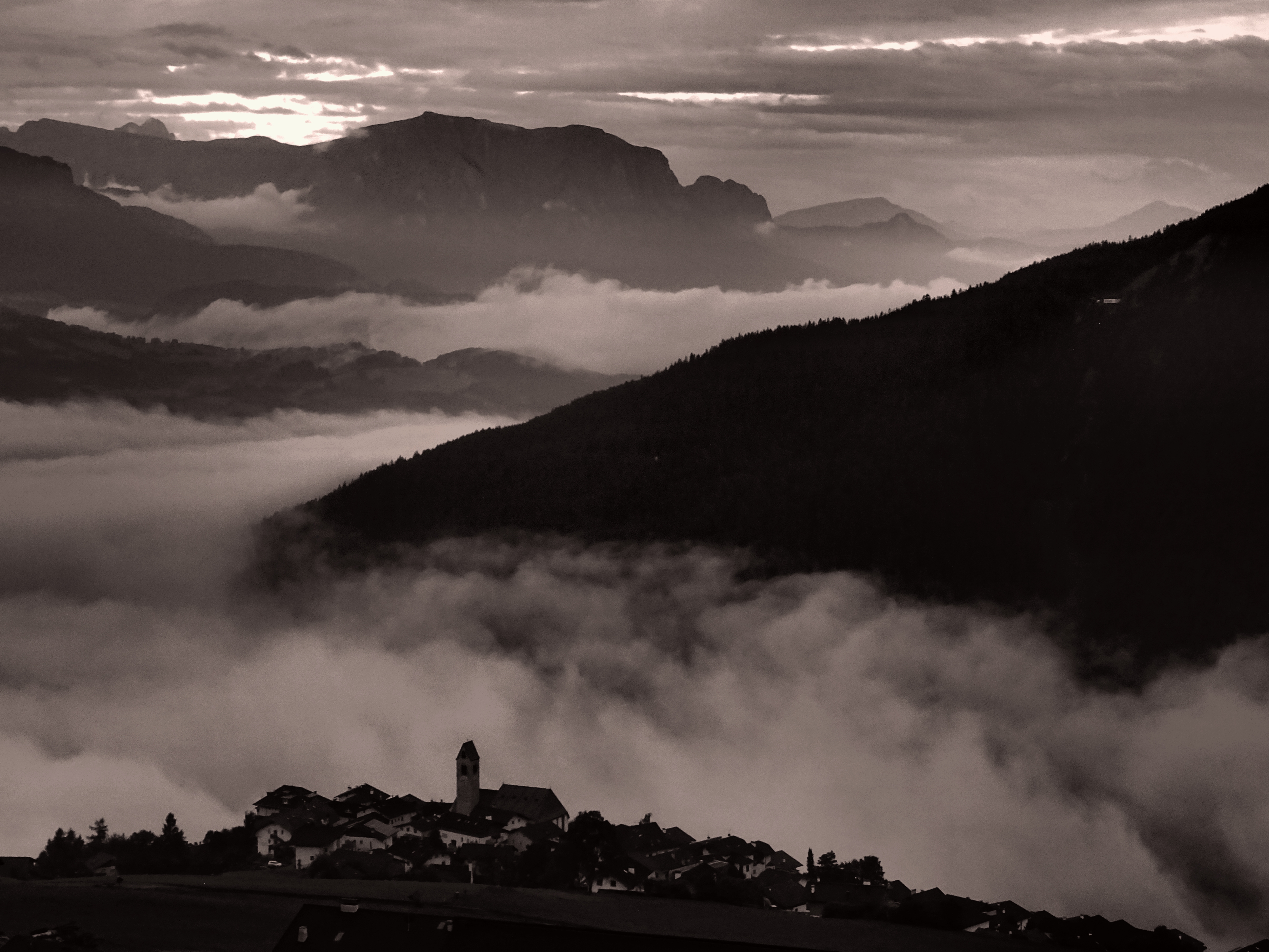
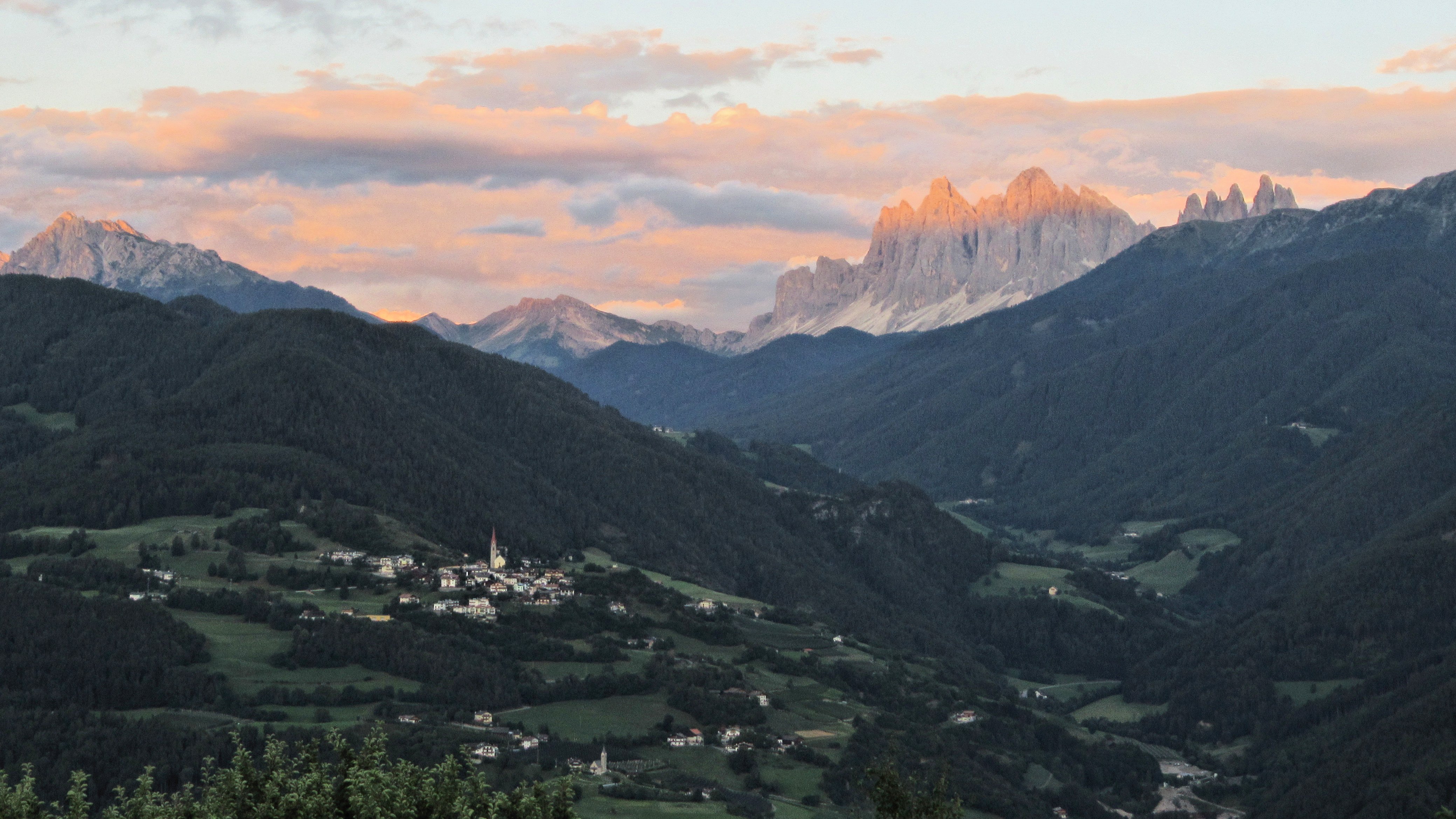
One of my favourite views was across the Eisaktal towards the Villnöstal and the ever enchanting peaks of the Geislergruppe mountain range, which loom dramatically above the picture postcard village of St Magdelena, the birthplace of Himalayan mountaineering legend Reinhold Messener.

We even found a perfect little pizza restaurant, perfectly framing this view and enjoyed a couple of memorable balmy evenings on the terrace; the last rays of the dying sun illuminating the peaks of the Geisler in a sublime rosy, alpine glow. We look forward to the return of such days and the chance to experience such beautiful places again soon…in the meantime our hearts go out to the people of Südtirol and all those adversely affected by the present crises in the Region and across the globe.

IMG_0100

IMG_0669

IMG_0678

IMG_0564

IMG_0612

IMG_0601DSC02625IMG_0435104x3pum_1_IMG_0443DSC02564

DSC02473

IMG_0717IMG_0349 (2)IMG_0731IMG_0289 (2)DSC02381Valley mist

DSC02325DSC02306

Posted in History & Culture, In Europe, Mountain Treks, Uncategorized, Wild Places | Tagged , , , , | Leave a comment

Canadian Rockies in Winter

Hello again ! It’s been a while since I posted anything on “Off the Beaten Track” and so I just thought I’d first give a quick update for anyone who has followed my stories here previously (before going on to talk about our winter trip to the Rockies). It’s certainly not for the lack of interesting things to say, that I’ve been fairly quiet of late, merely a lack of time to write about these experiences and to give them the full justice that they deserve.

Writing now, in March 2020, travel to faraway (or even to some nearby) places, really isn’t on the cards right now. Indeed, most of the world seems to be grinding to a halt due to the challenges posed by the Corona virus. That said and very much hoping that the present storms will pass, it’s nice to have had the luxury to visit some beautiful places during the last year, some of which are definitely out of bounds for visitors for the next wee while.

In our age of refugee crises, political storms, populist movements, global biodiversity loss and climate change impact – being able to travel is quite a luxury that we certainly shouldn’t take for granted. It might be for a while, that we also have to learn to take greater delight in these little corners nearer to where we live: the stream that winds around our town or through our city greenspace, the forest glade – where we might glimpse a deer, a woodpecker or a squirrel, a wildflower meadow or the village duck pond…  These are everyday experiences and places that we don’t have to travel half way around the world to appreciate (and perhaps the world itself, would actually be a better-off place, if we did decide to stay closer to home for a while !).

However, enough of moralising and pointless reflection. Before the present lockdowns began, we had the good fortune to spend Christmas around Calgary and the Canadian Rockies amongst family members. We took a few trips to the mountains, the prairies, downtown Calgary and beyond.  The highlight though, must have been spending Christmas skiing at the Fernie Mountain Resort in BC which is famed for it’s powder snow and laid back “ski-bum” culture. I’m so glad we had the opportunity to do all this and didn’t postpone our trip, otherwise it would have been quite a wait until the next opportunity came along !

Anyway, without further ado, here are some impressions of our Canadian trip, devoid of my usual accompanying ramblings for once…

Skiing at Fernie Mountain Resort, BC Rockies:

IMG_20191226_175112

The Journey back from Fernie via Radium Hot Springs and Kooteney National Park:

IMG_0020

IMG_0022

IMG_0025

IMG_0023

In Downtown Calgary:

Trip to the Royal Tyrrell Museum, Drumheller, in the Alberta “Badlands” – One of the World’s Best Paleontology Museums:

IMG_0071

IMG_0117IMG_0127

An excursion to Banff National Park and Sulphur Mountain:

IMG_0151IMG_0226

Cross country skiing at Bragg Creek near Calgary:

20191231_144811

Bow River Valley and the Calgary Zoo:

IMG_20200101_171123

Anyway catch up again soon – and please stay healthy !

Posted in Wild Places, World | Tagged , , , , , , , , , , , , , , | 1 Comment

Around the Tannheimer Tal & Pfronten

Gosh, it’s surely one of winter’s bleakest days – dark oppressive skies, rain in sheets, impending Brexit doom and no light at the end of the tunnel; meanwhile the Allgäu, where we recently spent a few happy snow days over Christmas, is now buried under metres of the white stuff, with avalanches threatening to sweep away alpine villages, people stranded and remote communities effectively cut off from the rest of the World. A good time then to stay close to the fireside with a hot toddy or a mug of glühwein and to reflect on some sunnier, warmer days spent in the mountains over the last year or two.

One place that keeps pulling us back, time and time again, is the valley of Tannheimer Tal, located on the border between Bavaria and Tyrol to the SW of Munich. Although the Tannheimer Tal is frequently referred to as one of the most beautiful high valleys in the Alps, it’s pretty much off the radar for most UK visitors, who mostly breeze past unknowingly on the way to more popular destinations such as Innsbruck or the Dolomites – some of the hoards being momentarily distracted to mingle with the crowds at nearby Neuschwanstein before heading quickly off again on their travels.

With a light covering of snow on the peaks and the lower pastures turning from vibrant summer green to the more subtle hues of autumn, it’s easy to see why claims about the valley’s beauty are quite justified.  There are some super hikes and the mountains are accessible for people of all abilities without being overly crowded, outwith the main holiday season. The scale of the landscape is perhaps also more on a par to that of the Scottish Highlands, rather than some of the better known parts of the Alps such as Mt. Blanc or the Bernese Oberland. Whilst it is still dramatic enough, it makes day hikes a civilised and practical option.

One great route taking in some accessible peaks is the “panorama” trail from Neunerköpfle, just above Tannheim village, to the Landsberger Hut.  We did this on a fantastic October day with clear skies and super visibility giving us great views across the Eastern Alps in all directions to peaks such as the Gaishorn, Hochvogel, the Zugspitz and the Karwendel . In particular the views from the Sultzspitze, were sublime and well worth the effort of making a small detour. The Neunerköpfle gondola provides easy access to the start of the route, thereby saving much of the initial uphill grind.

On the opposite side of the valley, the Gräner Höhenweg provides an equally worthwhile experience with a great high level traverse along the tops between the Fussener Jöchle and the Bad Kissinger Hut. As well as great panoramic views along the trail there are many alpine flowers along the route such as trumpet gentians, silver thistles as well as glimpses of elusive chamois (Gämse) and other fauna lurking in forested glades and alpine meadows.

img_2408

Continue reading

Posted in In Europe, Mountain Treks, Wild Places | Tagged , , , , , , , , , , , | Leave a comment

Far over the Misty Mountains Cold…

Sometimes you get some of the best experiences when you’re really not looking out for them; such as these photos which were taken out of the window on a scheduled flight over the Alps from Milan to Dusseldorf, late on a December afternoon last year.

IMG_0025.JPG

As the plane lifted out above the cloud inversion from Malpensa airport, a spectacular view was revealed, with range upon range of alpine peaks backlit by the rosy glow of the setting evening sun; the scene somewhat reminiscent of the cover of the hippy-dippy “Moonflower” album by Carlos Santana. Strangely enough though, not one of my fellow passengers so much as batted an eyelid or glanced out the window, choosing instead, to pull down their blinds as if somehow distracted by nature’s magnificent fireworks outside.

IMG_0018.JPG

We flew in a line that took us more or less over the Central Alps, directly over the Zermatt area on the Swiss Italian border. Mt Blanc in particular looked majestic with its plume of wave cloud caressing the summit as seen in the photo below (the big peak in the background – centre right). The large pyramidal peak in front of it is the Grand Combin, another 4000m peak, which (being a bit of a nerd) I later identified using Goggle Earth.

IMG_0031.JPG

Over the Christmas and New Year period it was great to actually get acquainted with the snowy peaks of the Alps again, but from a bit closer up this time.  The views below are taken from the Hochgrat mountain near Oberstaufen in the Allgäu Alps which is pretty much one of the first high ridges that you encounter when heading South from the lowlands of Bavaria. There are great vistas towards the central Allgäu, towards the Swiss Alps and the Bodensee (Lake Constance) lurking somewhere down there below the clouds.

img_0088

img_0086

And an unexpected bonus – there was snow to ski !! …or simply to enjoy the mountain scenery in this beautiful part of Bavaria for a few days – as well as encountering some of the mountains’ snowier local residents perched happily on a forested hillside…

img_0149

img_0206

IMG_0238.JPG

IMG_0241.JPG

IMG_0103.JPG

Now sadly back here in greyer lands – without the benefit of the white stuff. However in the Allgäu I heard that more and more snow is falling today; roads are blocked and many happy kids have had the benefit of a day off school. The snowy slopes and the great majestic peaks of the Alps beckon…

img_0254

Posted in In Europe, Mountain Treks, Wild Places | Tagged , | Leave a comment

The Final Mile


IMG_1619

Usually (if I get around to it at all), I write and share pictures about places, people and travels; however today, just for a change, I thought I would put a post about Runrig, a celtic rock band from Scotland that I’ve followed for many years. After 45 years on the road, the Band have finally decided to throw in the towel and retire gracefully – but not without first going out with a bang ! I was fortunate enough to get along to their “Final Mile” concert in the Lanxess Arena, Cologne and what a party it was too !! The band performed some of there best known tracks in front of a huge, enthusiastic crowd of nearly 20,000 in the vast arena.

IMG_1684.JPG

This was certainly a far cry from the first time I saw Runrig in the early 80s in the Pathfoot building at Stirling Uni in front of a bunch of 200 spotty students on a cold, damp winter evening. Quite an amazing achievement really considering that they never had a single international hit, lost their first lead singer to a career in politics at the height of their popularity (though he never actually did get elected) and that they chose to sing many of their songs in Scottish Gaelic – altogether not the greatest recipe for commercial success. Many fans in Scotland also completely wrote off the band after the departure of their first singer, Donnie Munro; being completely unaware that they had gone on to produce some of their best and most atmospheric material, whilst consolidating their international reputation with Canadian singer Bruce Guthro at the helm. Certainly, I think it’s fair to say that their later stuff (along with their very earliest) is altogether more “earthy” in character and certainly more folk-rock orientated than the more commercial pop sounds of the 1990s.

As Guthro observes, Runrig, however, have always confounded their critics, many of whom have, over the years, simply misunderstood and pigeon-holed the Band as being little more than a glorified ceilidh outfit: it was also perhaps a double edged sword that Runrig became best known for their rock anthem version of “Loch Lomand” – which further fuelled the view of the sceptics that the band was somehow a new take on the “White Heather Club”. After all, aren’t rock bands normally expected to emerge from gritty, urban hellholes and to centre their lives around the excesses of sex, drugs and a general culture of self annihilation ?

So, if you don’t know the band then please have a listen – the Scottish landscape, history, a sense of place, gaelic culture and well – just the trials of our everyday lives have formed the basis of their rich musical repertoire. This is combined with great musicianship, particularly from Malcolm Jones (the band’s very own reincarnation of Hendrix meets Mark Knopfler) and robust song writing from the brothers Callum and Rory MacDonald; however, it would be fair to say that all six members are excellent musicians and performers in their own right – the success of Runrig over the years being largely down to the close synergy between the band members.

IMG_1611

And so an emotional evening drew to a close – amid a barrage of searing electric guitar and drums and an aerial bombardment of dry ice and confetti raining down from the skies like a snowstorm for several minutes over an ecstatic crowd. So the boys from Skye (and Fife and Falkirk and Cape Breton Island, Nova Scotia and wherever else) “done good” in the end; for themselves, for music and for revitalising a whole language and cultural heritage – for following their own path in an increasingly conformist world.

IMG_1636

Many are somewhat overdramatically lamenting the passing of the Band with pretentious sounding comments like “they provided the soundtrack to my life” and such like – however, from my perspective they certainly have had an impact. So perhaps we’ll see you again “somewhere out there”; Rory, Callum, Iain, Brian, Malcolm and Bruce – though sadly it won’t be at the final concert below the Castle, in my home town of Stirling.

DSCN2361

Finally, whether you like or loath Runrig – the most important musical legacy of the band has been to inspire and embolden a whole new generation of Celtic musicians and performers to follow in their footsteps; combining elements of Scottish traditional music with modern instrumentation and influences from other musical genres: Julie Fowlis, Skippinish, The Peat Bog Faeries, Skerryvore, Manran, Tidelines, Salsa Celtica and Afro Celt Sound System, to name but a few (some of these being obviously more traditional than others).  This current generation of performers is actively reaching out to new and younger audiences; rest assured, the musical traditions of the Highlands and Islands are safe for the foreseeable future at least – albeit, perhaps not quite as your granny might have remembered…


Posted in History & Culture, In Europe, In Scotland, Music, Wild Places | Tagged , , , , , , , , , , , , , , , , | Leave a comment

Under Hebridean Skies

Ok, so it’s not that Germany lacks nature: there are broadleaved forests galore, meadows, lush river valleys and of course the wonders of the Alps, the Black Forest and the Bayerischer Wald. But somehow, in Germany, nature can sometimes seem just a little too structured, over-manicured and somewhat overpopulated with visitors. For real, wild nature, big empty skies, tangled coastlines, deserted beaches and true emersion in the raw elements, I sometimes just need to head North and West and back to the Hebrides – far away from the purveyors of hectic, routine and “ordnung” to a place where winds, ocean swells and tidal streams dictate timescales and schedules instead of just smartphones or school term times.

In May we spent a fantastic week on the Isle of Mull, based around the colourful coastal town of Tobermory. This picturesque little gem of a place was made famous to a whole generation of millennium toddlers as the setting for the kiddies cult TV series “Balamorie” – it was also responsible for providing the name for one of the esteemed 1970s “Wombles” characters.  With such credentials it’s hard not to fall instantly in love with Tobermory; it’s got a nice laid-back Hebridean feel about it, with cheerful multi-coloured houses clustered around a sheltered anchorage with working fishing boats tied up at the quay, shops selling all manner of nautical bric-a-brac for yachties, atmospheric pubs offering occasional live music, eclectic eateries and a burgeoning selection of wee craft shops selling paintings and pottery depicting the place.

Despite its apparent quaintness, however, within a few minutes from the town you can walk the famous “lighthouse path” along the unfolding, precipitous coastline through ancient woodlands bedecked with bluebells, primroses and wild garlic – suddenly to emerge into a different and more elemental world – a world of rock, sea and sky with sweeping views across the Sound of Mull to the distant Hills of Ardnamurchan and beyond; this is the quintessential  sense of “islandness” described and observed by many writers and wilderness enthusiasts such as Scottish nature writer Jim Crumley.

From the lighthouse you might well be rewarded with views of some of Mull’s famous and often, not so elusive, wildlife. Sea eagles, reintroduced to the Hebrides 30 years or so ago, nest on the lofty cliff tops and headlands around Ardmore Point whilst minky whales, basking sharks, bottlenose dolphins and harbour porpoises patrol the waters of the Sound.  Common and grey seals abound and otters can often be seen foraging close to the shore amongst the rocks and kelpbeds, searching for fish, crabs and other tasty morsels. All this abundance of wildlife has spurned a burgeoning ecotourism business on the Isle of Mull with wildlife watching trips being a favourite for many visitors; indeed there are now more wildlife watching boats than fishing boats moored in Tobermory harbour these days. We decided to take a boat trip from Tobermory with “Staffa Tours” out to the Treshnish Islands, a small volcanic chain of rocky outcrops scattered in a line across a peacock coloured sea of turquoise and aquamarine.

Lunga, the biggest of the Treshnish Islands is home to a large breeding colony of puffins. These cheerful, comical, little characters are one of our most endearing seabirds. They spend many months, or even years, at sea before returning to breed on small coastal islands such as Lunga which offer some protection from natural predators and access to rich fishing grounds. The puffins rear a single chick in an underground burrow. Needless to say ecotourism is now bringing more human visitors to their remote nesting grounds, however the puffins seem to positively welcome this development – the tourists scare away predatory seabirds such as skewers, which would otherwise wish to rob them of their hard earned catch of sand eels or even possibly take the young chicks from the nests.

The resourceful puffins therefore actively wait for the tourist boats to disgorge their human cargo before retuning to their nest sites; a clever ploy, which offers them a degree of protection from the predatory skewers or bonxies (as they are known in this part of the World). The puffins seem remarkably amiable and tolerant of humans. It’s therefore not so difficult to get super quality pictures of puffins as you can literally get within a couple of metres of them without causing alarm. My kids loved the chance to do a bit a close-up wildlife photography with some very convincing results to match anything produced by the BBC Blue Planet team (well maybe).

Close by the puffin nesting area is an impressive sea stack occupied by over 20,000 other breeding seabirds which include guillemots, razorbills and shags. The high-rise sea stack community is generally a much noisier and more hectic residence than the more gentile clifftop lawns of the puffins,  but the overall effect is stunning as the birds wheel around the stack, borne aloft on rising oceanic air currents. Lunga is also impressive for its surprisingly rich and lush flora with sea pinks (thrift), bluebells, sea campion and vibrant yellow kidney vetch abounding everywhere amongst a rich green sward of maritime grasses.

There is also a derelict settlement on Lunga where the remains of several ruined blackhouses can be seen at the North East corner of the island. These used to provide an isolated home to a community of around 20 people who scratched a basic living from their harsh surroundings through grazing cattle, crofting and fishing – enduring storms, salt spray and the wild seas through the long dark months of winter. It’s an evocative scene walking amongst the crumbling remains of the derelict buildings which face out to sea towards Mull and thinking about the simple Gaelic speaking people who once lived here. This is a scene echoed all across Mull, where extensive ruined townships bear testimony to the harsh realities and injustices of the Clearances during the 1800s. These were some of the most extreme in the Highlands, with landless poor including children, the frail and the terminally ill literally burned out of their cottages to be shipped off to the New World. Meanwhile a brutal and uncaring aristocracy obsessed with economic self-betterment washed their hands of blame, as the emigrant ships disappeared over the horizon.

Fortunately that tide has now firmly turned due to, amongst other things, the Scottish Land Reform process which is creating a new generation of community land owners across the Highlands and Islands of Scotland. Just before our visit to Mull, it was announced that the North West Mull Community Forestry Trust had been successful in its acquisition of the 2000ha Island of Ulva for social, environmental and economic regeneration purposes. Before the Clearances the island once boasted a population of 800, which in recent years has now dwindled to a mere handful. During my visit I had a chance to talk to the Community Trust about their plans for the environmental regeneration and repopulation of Ulva which I found very inspitational and reassuring. On the way back to Tobermory from Lunga, we also made landfall on Staffa with its superb columns of hexagonal basalt lava. These bear a close similarity to the Giants Causeway just across the sea in nearby County Antrim. (I wrote previously about a visit to Staffa and Iona also on this blog).

Back in Tobermory and new adventures awaited; after exploring some of NW Mull including beautiful Calgary Bay, which is responsible for the origins of its namesake in Canada, we wanted to get out to the famous lighthouse at the end of the Ardnamurchan peninsula. This marks the most Westerly point of mainland Britain, though many falsely assume that it’s actually Land’s End. It’s a short ferry trip from Tobermory to Kilchoan, a small, quiet village located near the end of the Peninsula. Although joined to the mainland, Ardnamurchan itself feels more like an island than Mull, it being otherwise physically isolated by mile upon mile of narrow, twisting single-track road. It’s a short but slow drive out to the lighthouse on the tortuous, winding road – at last the lighthouse is sighted and a huge panorama opens up across the Western seaboard. We opted to take a tour of the lighthouse itself; from the top distant the islands of the Hebrides appear to hover above the horizon due to an optical trick of the light; Barra, South Uist, Muck, Eigg, Rum and the Black Cuillins of Skye are all visible. The waters around the Point are also a great spot for whale and dolphin watching.

Whilst in Ardnamurchan, one place I had to get to was nearby Sanna Bay, famous for its beautiful white shell sand beaches and machair; a type of species-rich meadow found only in the Hebrides. I have a picture on my wall of Sanna Bay by Scottish landscape painter Jolomo; the image is alive with energy and colour; the foreground capturing a sunlit sea of aquamarine and turquoise and the latent motion of the outgoing tide. Meanwhile brooding storm clouds gather ominously over distant Rum in the backdrop – the ever changing interplay of light and shade of the Hebrides, reflected also in the personality of region’s people, their music and their culture (ranging from pure joy to the depths of despair in rapid succession).

I promised that one day I would take the kids there to see this magical place and just to show them that the colours shown in the Jolomo print were actually the genuine article and not merely a figment of the artist’s imagination. And undoubtedly they are real ! Intense colours alone, however, don’t do justice to the full wonder of this place with its vast, open seascapes, its cheerful chorus of skylarks and meadow pipits and the endless song of the surf eternally caressing the shell sand beach. To get to Sanna Bay you also have the added adventure of driving through the remnants of the Ardamurchan volcano, a stunning geological feature dating from the Tertiary period and one which is clearly visible from space. Along with the Mull, Rum and Skye volcanoes, lava erupting from this feature helped long ago to create the distinctive landforms and islands of the inner Hebrides.

So it was back again to Tobermory and all to soon, however, week on Mull was drawing to a close. It was time to make our way back to the mainland and then onwards to that even bigger “outside world”; the one the Gaels referred to less affectionately as “the Crowded River”, that great bustling tide of humanity stretching out across the Continent of Europe. Already though I’m thinking about other adventures and other islands to explore – I think that the Hebrides must hold a special place in my soul. Which island will it be next time: Coll (Katie Morag’s island) ? Tiree (for sail boarding and sunshine) ? Barra (for super beaches) ? Colonsay (for quiet unspoiled beauty and a unique bee population) or the Uists perhaps (for bogs, corncrakes and machair) ? The choice is endless; time marches ever onwards but there are still many places to discover and many more miles to go…

Posted in History & Culture, In Scotland, Wild Places | Tagged , , , , , , , , , , | Leave a comment

Land of lakes, rocky coasts & endless forests:

I’d never been to Scandinavia, until last summer that is, when we spent two wonderful weeks in a rustic, weather-boarded, retro-style, summerhouse set amidst lakes and forest, just a little to the East of Gothenburg.

IMG_0537

Although plenty of doomsayers warned us about the summer plagues of mosquitos which we would surely encounter (and which would, without a doubt, ruin our whole trip), I don’t think we saw a single one of the pesky blighters during the whole of our time there – Instead, just a charming landscape dotted with a myriad of lakes, endless forests and wild, rocky coastlines; all liberally scattered with an eclectic mix of neat, cheerily-painted wooden cabins and dispersed farm steadings. The Swedish holidays had finished and we had the place pretty much all to ourselves; some locals even expressed surprise at encountering holidaying visitors from warmer parts of Europe there at all.

IMG_0248

So if you like canoeing, or jumping into a lake each morning, quiet fishing villages and wild coastlines; or perhaps just simply watching an osprey pluck a fish from the mirror-like stillness of calm, evening water, then Sweden is the place for you.  And as for the mosquitos: why that’s just a tall story some bunch of locals made up to keep the place all for themselves – well maybe that’s true…

IMG_0261IMG_0304IMG_0340IMG_0351IMG_0454IMG_0569IMG_0596IMG_0626IMG_0635IMG_0653

IMG_0091


Posted in Canoe Trips, In Europe, Trees & Greenspaces, Wild Places | Tagged , , , , | Leave a comment