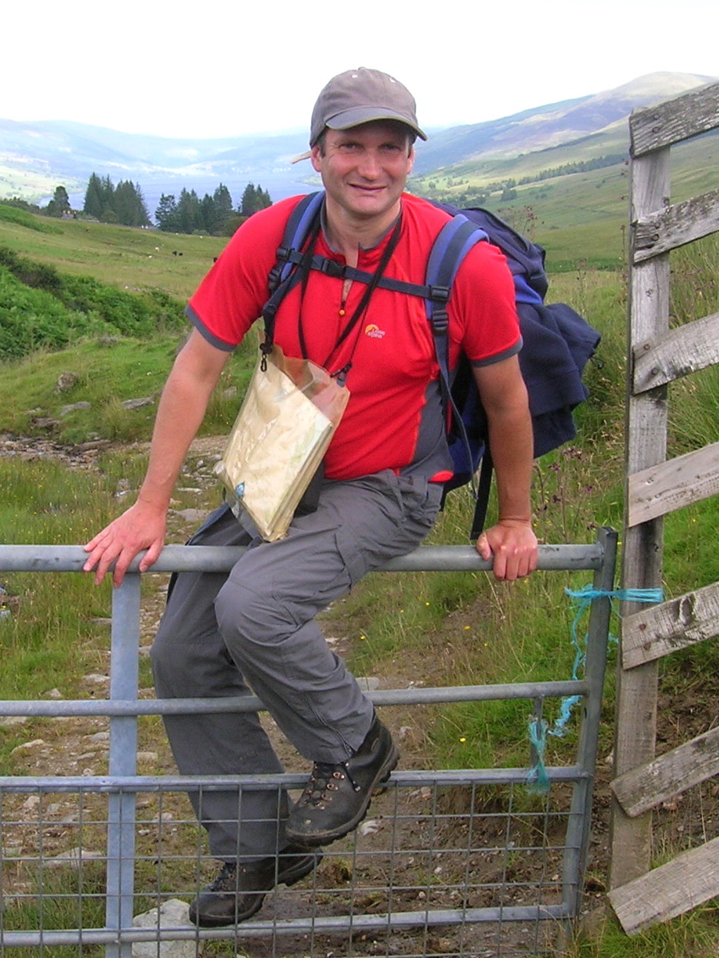
Around Salzburg and Berchtesgaden

I first visited Salzburg twenty years ago on an icy, monochrome January day. I was on a ski holiday in nearby Zell am See with an old school friend and we had opted for a day’s break from the pistes to go by train for look around the world-renowned baroque City.

CIMG0979

The famous Getreidegasse: the impressive signs date from a time when most people were illiterate

It seemed a strange choice at the time; the cold formality of Salzburg seemingly a world away from our cosy alpine resort with its cheery cellar bars, gluhwein and apres-ski scene. in Salzburg, by contrast, a biting wind blew down the  winding streets and across the open squares of the Altstadt. Save for a scattering of bakeries and shops on the Getreidegasse (the street of Mozart’s birthplace):, businesses were closed; the City seemingly silent and uninviting. We climbed the tortuous steps to the Hohnensalzburg Fortress, looming menacingly above the town and surveyed the bleak winter-locked landscape. The alpine charms of Zell am See were soon started to beckon us back.
CIMG1161

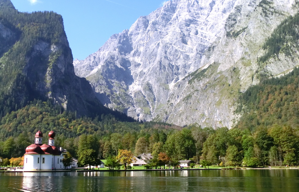
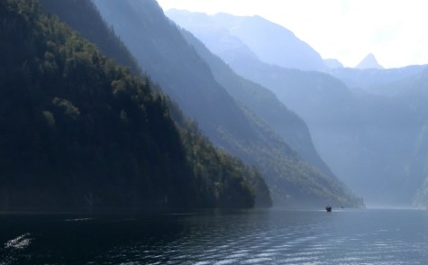
The spectacular Königsee: an alpine “fijord” in Berchtesgaden National Park

In recent years I’ve been lucky enough to visit Salzburg again on a number of occasions to attend environmental conferences and events. These recent experiences have proved much more positive than my first midwinter forray. Since then, I’ve discovered a colourful, vibrant and fascinating city set amidst a fabulous backdrop of alpine landscapes straddling the border between Austria and Bavaria.

There are dramatic peaks, spectacular glacial gorges, turquoise lakes and pastoral lowlands occupied by ancient towns.  Much of the surrounding alpine landscapes comprise protected areas including the renowned Berchtesgaden National Park which is internationally important for nature conservation as well as for outdoor sports.  The charming mountain resort of Berchtesgaden also has another dimension to its past however and is linked to some of the darkest episodes of the 20th Century.
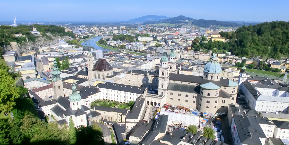
Overlooking the Altstadt from the Hohensalzburg

Overlooking the Altstadt from the Hohensalzburg

More than Mozart and the Sound of Music:

Mention Salzburg and a whole series of clichés spring to mind including  Mozart, the Salzburg Festival, Baroque architecture, alpine meadows and of course the “Sound of Music”. Despite its obvious popularity as a mecca for Julie Andrews fans, Salzburg is well worth a visit for a whole host of reasons.

Salzburg has a fascinating history; the City grew wealthy through the mining of salt in the surrounding mountains and became an important power base for an ambitious and ruthless dynasty of Archbishops who ruled much of the surrounding region throughout the Middle Ages. The Archbishops occupied the formidable fortress of Hohnensalzburg which dominates the Mönchsberg, or”Monks Mountain”, right in the heart of the city centre. Hohnensalzburg is a great place to start a tour of the City, not least for the amazing views of the surrounding countryside which provides a geographical context for the region.
CIMG1071

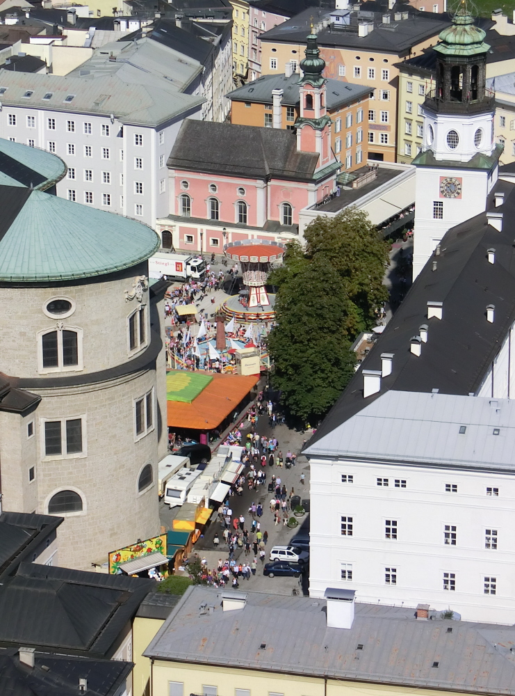
Festivities below in the Cathedral Square

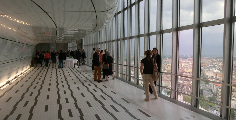
The view out over the Altstadt  (a UNESCO World Heritage Site) from the ramparts of the fortress is particularly striking with mighty baroque buildings including the Cathedral, the Residence Palaces and St Peter’s Abbey dominating the view.

Across the River Salzach, Salzburg’s other downtown peak, the Kapuzinerberg forms a backdrop for the more recent buildings, parks and boulevards of the Neustadt (New Town) to the North East. From the uppermost vantage point of Hohnensalzburg, the views South towards the Alps and the Mt. Untersberg (a mountain with a story which we’ll come back to later on) are also stunning.

CIMG1094

The spires of the Altstadt with with the backdrop of the Hohnensalzburg

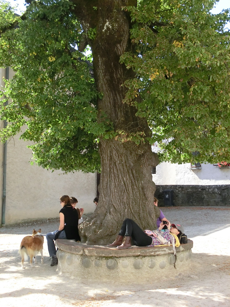
Inside the fortress, the impregnable defences and fearsome array of torture gear hints that the Archbishops of Salzburg were not people to be messed with and undoubtedly had ways of loosening their guests’ tongues. It’s all quite sobering and makes you grateful to be alive in the present era (despite all its woes) rather than the turbulent and barbaric days of the 13th Century when life was cheap and when those on the wrong side of “justice” often met a sticky end. In the upper courtyard of the fortress there is a remarkable old lime tree which is around 400 years old and which provides welcome shade for tourists on hot summer days.
CIMG1074

A shady spot: a welcome rest under a 400 year old lime tree

Despite all these down sides, the ruling elite of Salzburg left some remarkable legacies including many baroque buildings of the City and the remarkable “AlmKanal”, an impressive irrigation canal, which was first started around 800 AD and then extended to bring fresh water for the City’s residents (or at least to those with wealth and status).

The construction of the canal was an impressive engineering feat for its time and involved constructing a tunnel right under the Mönchsberg itself to bring fresh water right to the heart of the Altstadt.  As well as providing drinking water, the Almkanal also powered man many mills and small industries. The tunnel network under the Mönchsberg also reputedly provided a route of escape from the City during times of siege.

IMG_2004

Al fresco chess game in the Kapitelplatz

CIMG1090

Cycling and pedestrian heaven by the River Salzach

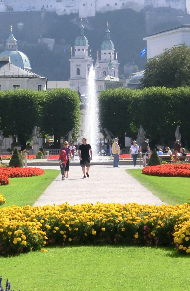
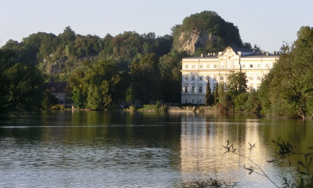
For closet “Sound of Music” fans though there are plenty of locations around the City to remind you of the one of the UK’s most predictably popular Christmas TV offerings. These include the colourful Mirabell Gardens designed by Fisher von Erlach on the Eastern side of the river and the stately Leopoldskron Palace which is located in a peaceful suburb located South of the City.

For real devotees though you’ll find no shortage of kitsch organised tours taking you around the main Sound of Music sights and packed with photo-hungry globetrotters eager to catch the best snaps to send home. Despite being tempted I decided it was a better policy to head out of town and experience some of the beautiful Salzkammergut region of lakes and mountains located a mere 40 minutes East of the City.
CIMG1100

The Mirabell Gardens: Top spot from the Sound of Music
CIMG0985

Leopoldskron Palace: Another “Von Trapp” venue

The Austrian Lake District; The Wolfgangsee, St Gilgen and the Zwölferhorn:

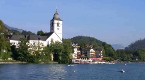
From the City Centre, I took a bus out to Stobl on the Wolfgangsee and decided to take a ferry back to St Gilgen, visiting St Wolfgang on route. Despite being quite busy, the Wolfgangsee, is a beautiful lake surrounded by spectacular peaks, which although not high by alpine standards are still very impressive in their own right. I decided to stop off at St Wolfgang itself, a compact resort hugging the Southern shore of the lake and under the flanks of the Schafberg mountain.

CIMG1025

The beautiful Wolfgangsee

CIMG1023

St Wolfgang: a rather picturesque tourist trap

St Wolfgang provided inspiration and the setting for the “White Horse Inn” operetta and has become quite a magnet for visitors. I must admit that I found the place to be somewhat of a tourist trap however; expensive souvenir shops jostled with crowded cafes for attention; all equally intent on emptying the contents of your wallet as quickly as possible. I sought sanctuary in the relative cool and calm of the Parish Church and checked out the famous Winged Alter carved by Micheal Pacher in 1481.  Undoubtably this is real medieval treasure and well worth a look.
CIMG1018

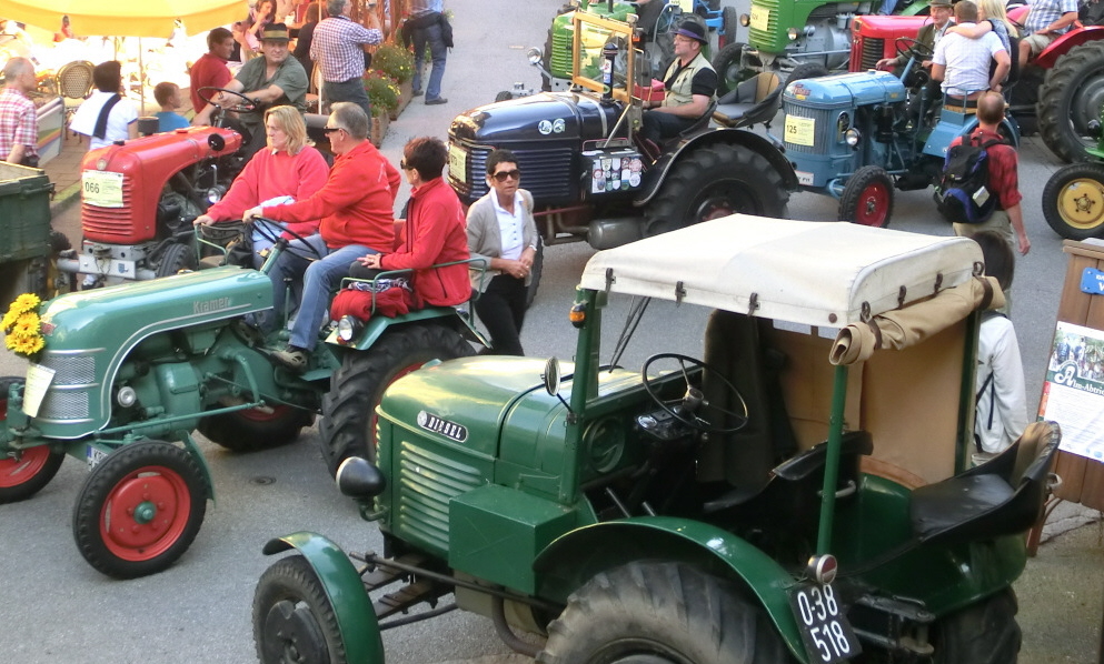
Nowhere to move for tractors: St Wolfgang

I left the church by a different door to find the narrow back streets completely choc-a -bloc with vintage tractors; a hundred or so spluttering but well-groomed machines belching out diesel fumes into the narrow thoroughfares and successfully holding back the tourist hoards at every available exit. On another day I might have found all this rather exciting, but on this occasion I decided that it was definitely time to leave.

So it wasn’t without too much sadness that I boarded the boat again and continued my journey down the lake, enjoying the fresh breeze, the space and the relative calm of the open water; St Wolfgang could keep its treasures for another day !

CIMG1028

Calming colours back on the lake

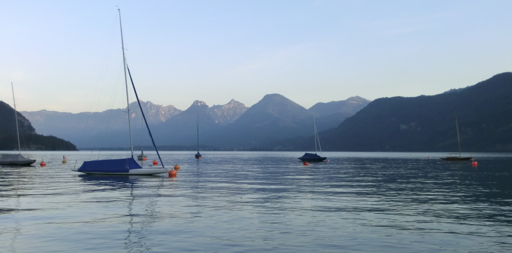
I found St Gilgin (at the Western end of the lake) to be an altogether more agreeable place and enjoyed the calm of the summer’s evening down by the shore watching becalmed boats and bird life. A craft fair was just winding down; however in comparison with the crowded alleys of St Wolfgang, this seemed spacious, cool and uncluttered and the venders relaxed and less pushy.

CIMG1033

Sounds of home: Austrian Celts in St Gilgin

There was also a band playing covers of Irish and Scottish songs which made me feel quite at home here. I had a chat the musicians during a break. Surprisingly, it turned out that all the members of this authentic sounding Celtic outfit  hailed from just down the road in Salzburg; I was quite convinced by them I must admit !
CIMG1047

Evening light on the lake

I enjoyed strolling through the deserted streets of St Gilgin as I waited for the last bus back to Salzburg. The bus was packed with bright, young people heading into town for a Friday night partying, the women looking good in tasteful and colourful dirndles. Ethnic costumes aside, this really reminded me of Friday night back home in rural Scotland; could I be in Banchory or Inverurie heading for a night out in Aberdeen ? (maybe not enough swearing, fighting or binge drinking for that though).

Following my voyage on the Wolfgangsee, I opted for another trip to St Gilgin with the aim of ascending the Zwölferhorn mountain, which is accessed by a vintage gondola system (and again providing another easy escape from the City of Salzburg).

IMG_1944

Zwölferhorn gondola

It’s a pleasant journey gliding above the alpine pastures and forests, the views becoming ever more expansive. From the top station, I hiked up to the summit and enjoyed a fabulous panorama over the Wolfgangsee and the peaks of the Salzkammergut region.  Today I was in luck and found the mountain trails remarkably uncrowded, save for a few trekkers and of course lots of cows.

IMG_1951

Zwölferhorn: panorama from the summit

The alpine meadows (or alms) of the region are truly spectacular; to the sound of tinkling bells, lazy, contented cows graze nonchalantly amongst a blaze of colourful wild flowers including spotted orchids, bell flowers, alpine asters and edelweiss. Near to the  Zwölferhorn itself, there are a couple of chilled-out mountain huts serving local specialities and a welcoming glass of beer or radler.

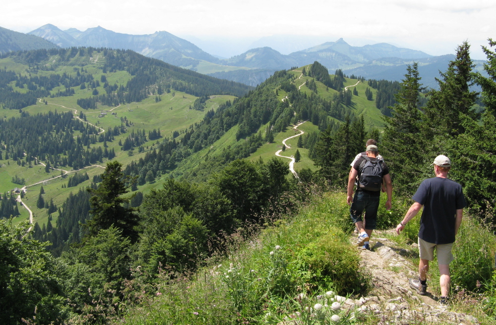
I opted to do a circular walk away from the main paths and through open patches of forest and meadows. Soon I was a world away from other walkers and was on my own amidst the alpine pastures with a spectacular backdrop of peaks to the South. After taking in a couple of minor summits, I decided to head down to a more remote hut, taking plenty of time en route to photograph insects and plants.
IMG_1949

Hitting the trail: heading South from the summit

IMG_1929

Summer meadow: orchids add colour

IMG_1943

Taking it easy: alm life in the slow lane
IMG_1990

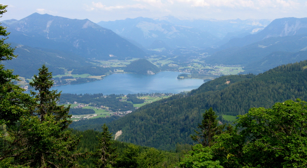
Fine vista: heading down towards the forest

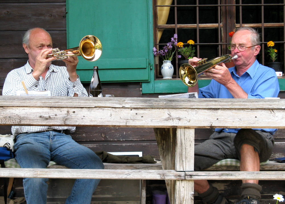
I approached another small alm hut, to be greeted by the haunting sound of trumpets which echoed around the secluded valley. Two old-timers sat on the balcony playing instruments, the atmospheric sounds blending perfectly and unobtrusively with the pastoral alpine landscape. There were no other visitors around and it seemed that the vintage duo met up every so often to play there purely for their own pleasure rather than for the specific purposes of entertaining anyone.

I enjoyed a leisurely beer and found some interesting information about alm life in the old days which; although at times tough, lonely and challenging, this lifestyle appeared not to be without its charm in comparison with our own frenetic 21st Century lifestyles.
IMG_1996

Trumpeters: old timers let rip

A sudden rumble of thunder focused my attention and I set off again quickly down through the forest, eager to get back to the valley before the storm broke over the peaks. It wasn’t to be though; the first heavy drops of rain splattered on my backpack and the heavens abruptly opened. I was soon soaked to the skin as the deluge began, the thunder rumbling ever nearer and flashes of lightning bouncing off the surrounding summits.

I started running down the endless track in a vain attempt to evade the storm. Fortunately I was in luck; the two trumpet players were making their way down the forest road in a battered old BMW and happily stopped to offer me a lift (which I certainly wouldn’t have refused). By this quirk of fortune I was soon back down in the valley and in the welcome shelter of the bus stop waiting for the next bus back to Salzburg.

The Königsee and Berchtesgaden National Park;

The mountain resort town of Berchtesgaden, located just over the Bavarian border 25km to the South East of Salzburg, is renowned both for its natural beauty as well as for more its darker associations with the Third Reich.

IMG_1919

Natural paradise: the alpine landscapes of Berchtesgaden

I was in Berchtesgaden to attend a 3 day event about the ECONNECT project, an ambitious European funded initiative which has attempted to restore ecological connections for animals and plants across the European Alps.  The Project has been striving to do this through establishing links between important alpine protected areas to achieve benefits for wildlife and biodiversity.

To take forward this vision, the project has considered natural elements including sustainable land use, in addition to economic and social aspects. The project has progressed through the development of  number of pilot areas which include  the Berchtesgaden National Park and the adjoining Weissbach Nature Park in Austria (both of which lie within the Berchtesgaden and Salzburg transboundary region).

IMG_1938

Peacock: nature made perfect

Although relatively small, at 210 square km, Berchtesgaden National Park is characterised by spectacular alpine habitats, spruce forests and meadows. The park is also home to many iconic alpine species including chamoix, ibex, golden eagles, alpine marmots and colourful plants such as blue gentians and alpine snowbells. The main attractions of the park however, are the fijord-like lakes of the Königsee and the smaller Obersee, which are encircled by the dramatic limestone massives of the Watzmann and Hoher Göll.

IMG_1924

Meadow flowers: splashes of colour

Despite the conference schedule being pretty tight, I was keen to pack in a boat trip along the Königsee to experience this dramatic natural landscape at first hand.  I braced myself for an early departure, giving the added advantage of cheating the crowds who annually throng to the Königsee  in vast numbers. To serve these visitors, a fleet of virtually silent electric boats ply the waters every day between Schönau and Salatalm at the Southern end, passing the famous onion-domed church at St Bartholoma (one of the most frequently photographed locations in Germany after Neuschwanstein) en route.

Taking the first boat of the morning had some advantages and I arrived to find the quay almost deserted, save for a handful of hardy early risers who were heading for the peaks. The down side was that the whole lake was enveloped in a thick, oppressive blanket of fog. During the entire journey up the lake there was nothing to be seen whatsoever, save for ominous dark shapes which periodically loomed threateningly out of the gloom. At one point the captain cut the engine completely and the boat glided eerily to halt, suspended in the omnipresent greyness between the swirling mists above and the deep, dark abyss of the lake below. The captain then, most unexpectedly, proceeded to stand on the side of the boat and pulled out a small hunting horn. One steady, melancholic blast and then a few anxious seconds wait; the perfect, clear echo bounced reassuringly back off the mountain side to greet us. The feat was repeated before the horn was put away as we embarked again on our voyage through this mysterious Avalonian world.

CIMG1107

Web of life: morning dew in the sunlight

It was not Excalibur however, which glinted from the lake, but the small lighthouse guarding the narrows at St Bartholoma; its pulsating strobe slicing through the morning fog to guide vessels safety in towards the pier. Shapes on the jetty started to coalesce and take on human form as the boat slowed on its approach. We tied up and a few rucksack burdened individuals disappeared down the gangplank before evaporating off into the mirk on some peak-bagging quest. I stayed on the boat as it again headed off toward the final destination at Salatalm. It wasn’t long before we arrived and the remaining occupants of the boat were finally dispatched.

CIMG1110

Morning mist: en route to the Obersee

Despite suffering from an embarrassing episode of “housemaids knee” (acquired from carrying our small children around rather too often), I was determined to walk to the nearby Obersee and defiantly limped off along the path in that general direction.  To a musical accompaniment of a babbling stream, ghostly silhouettes of birches and spruce trees formed through the cloud, the first hint of sunlight illuminating dew bedecked spiders webs.  I blundered on, increasingly focusing on the magical landscape unfolding around me in preference to inconvenient personal injuries; it’s really quite amazing how pain and irritation fade away when we change our focus away from ourselves to the world around us.

I was soon standing by the shores of the Obersee and found a large rock to perch on and rest my weary limbs. Rays of sunlight, resembling theatrical set-lighting, streamed through the mist as the banks of cloud slowly dissolved away to reveal a splendid backdrop of precipitous peaks.  A few wisps of steam, suspended in time like mischievous will-o-the-wisps, remained floating over the lake.  The sky cleared to a deep and perfect blue.  The gamble of the early start had paid off; I was in one of the most beautiful locations in the Alps on a bright and fabulous morning and whats more, I had the whole place virtually to myself.

CIMG1118

Morning has broken: mist disperses over the Obersee

CIMG1129

Sheltered bay at the Southern end of the Obersee

I continued on towards the end of the Obersee before the path became rather too steep and precipitous for my poor old “housemaid’s” knee (not one to tell the lads back home about !).  Reluctantly I turned around and headed back towards Salatalm and the boat back down the lake: besides I had a conference to go to and important things to learn all about the Alps ! The journey back down the Königsee was really quite serene. Mountain peaks reflected in the water under clear blue skies. Once again I had the boat almost to myself and I even got to the Conference on time (well almost…). Another wonderful snatched opportunity !

CIMG1149

Peace on the lake

CIMG1152

St Bartoloma: a much photographed spot

Dark shadows under the Jenner Peak:

The Jenner peak guarding the North Eastern flanks of the lake is a superb viewpoint and is accessible via an old-fashioned gondola. From the top of the lift it is only a short distance to the top of the small peak which affords a great panorama down the lake to St Bartholoma which is dwarfed by the towering bilk of the Watzmann massive.

Like the lake itself, the Jenner peak is another top visitor “honeypot” and can become exceptionally crowded at times, as camera bedecked tourists jostle for position to get the best snaps over the lake. Although Berchtesgaden is one of Germany’s most popular National parks, it remains possible to find more intimate encounters with nature by taking to the Park’s extensive trail network which leads off into a pristine world of alpine meadows and forests.

IMG_1911

The Königsee from above

Honey pot: tourist hoards flght for space at the Jenner peak

Honey pot: tourist hoards flght for space at the Jenner peak

Looking North from the Jenner peak you can clearly see the settlement of Obersalzburg, the location of Hilter’s renowned “Berghof”, with the infamous Eagles Nest or Kehlstein Haus standing remote and forbidding on the ridge crest behind. Hilter slowly turned the quiet mountain village of Obersalzburg into a heavily fortified military complex with buildings to house the elite of the Third Reich and a network of formidable underground bunkers. The view from Hilter’s Berghof window overlooked the imposing Untersberg mountain, which is also very prominent in the view from Salzburg itself.

IMG_1905

Hilter’s stronghold: the view towards Obersalzburg and the Eagle’s Nest (top right horizon)

There are some interesting connections with Aachen; legends stated that Charlemagne and his knights lie sleeping under the Untersberg ready to rise up and fight for the German people. It is likely that Hilter, with his twisted mindset, saw himself as the living embodiment of these myths and even described Charlemagne (regarded by many as a brutal imperialist) as being the most significant figure from History. Hilter apparently even wished to be buried under the mountain himself.

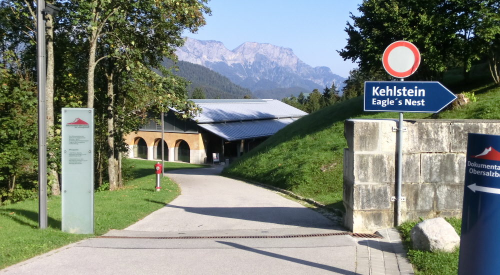
I visited Obersalzburg by bus and hoped to look around the “Documentation Centre” which records the occupation of Obersalzburg and links it to the wider atrocities of the Holocaust and WWII. Most of the buildings were destroyed by allied bombers towards the end of the war and the site is now mainly vacant, though in recent years an international hotel has been opened up to exploit Third Reich heritage tourism.
CIMG1188

Sombre reminder: Obersalzburg Documentation Centre

Despite past associations, the view from of the Untersberg Mountain from Obersalzburg is without doubt hypnotic and inspiring; what is hard to believe however is how the undeniable natural beauty and energy of this place could have been channelled into the hatred, xenophobia and systematic extermination of the Holocaust and the Third Reich’s “Final Solution”. The Documentation Centre makes some of these connections a little clearer.

Near to the Documentation Centre, buses depart taking visitors up the incredible switchback road around the mountainside to access the infamous “Eagles Nest” or Kehlstein Haus which remarkably survived WWII unscathed. The final 100m or so of ascent is by an elevator inside the mountain. The  Kehlstein Haus was presented to The Führer as a 50th Birthday present from the leadership of the Third Reich. Contrary to popular belief, Hilter in fact only visited ten times or so: in reality he was scared of heights and also felt extremely vulnerable to allied bombers and lightning strikes on the exposed ridge crest.

Bad spirits must still haunt the mountain and my expected bus back to the railway station at Berchtesgaden didn’t show up as expected, necessitating a forced dash on foot down the steeply angled road in order to make my train connection in Salzburg (my “housemaids knee” complaining ever more vocally on the steep and unrelenting descent). Fortunately I made it in time and was soon standing in front of Berchtesgaden railway station, ready to catch a bus to Salzburg.
CIMG1168

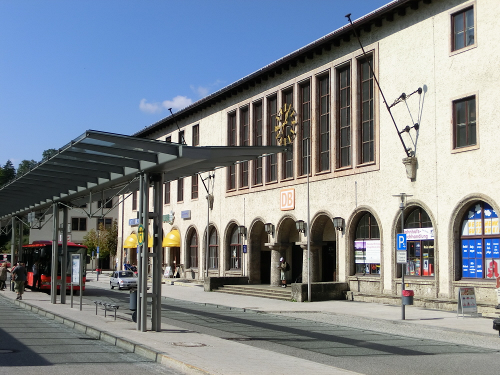
The Railway Station: a relic from National Socialism

The station is another classic piece of functional, if somewhat disturbing, National Socialist architecture; Hilter even had his private reception area where he awaited his motorcade to Obersalzburg (though I’m sure he wasn’t used to hanging around for too long).

Despite its negative historic associations, It’s hard not to like the old town of Berchtesgaden with its atmospheric old cellar bars, unrushed street life, fountains and substantial townhouses complete with external decorative frescos. These depict traditional Bavarian legends and folk stores; its easy however to imagine that some less politically correct elements may have been erased in the latter part of the 20th Century.

CIMG1181

Market cross: the painted facades of Berchtesgaden
CIMG1173

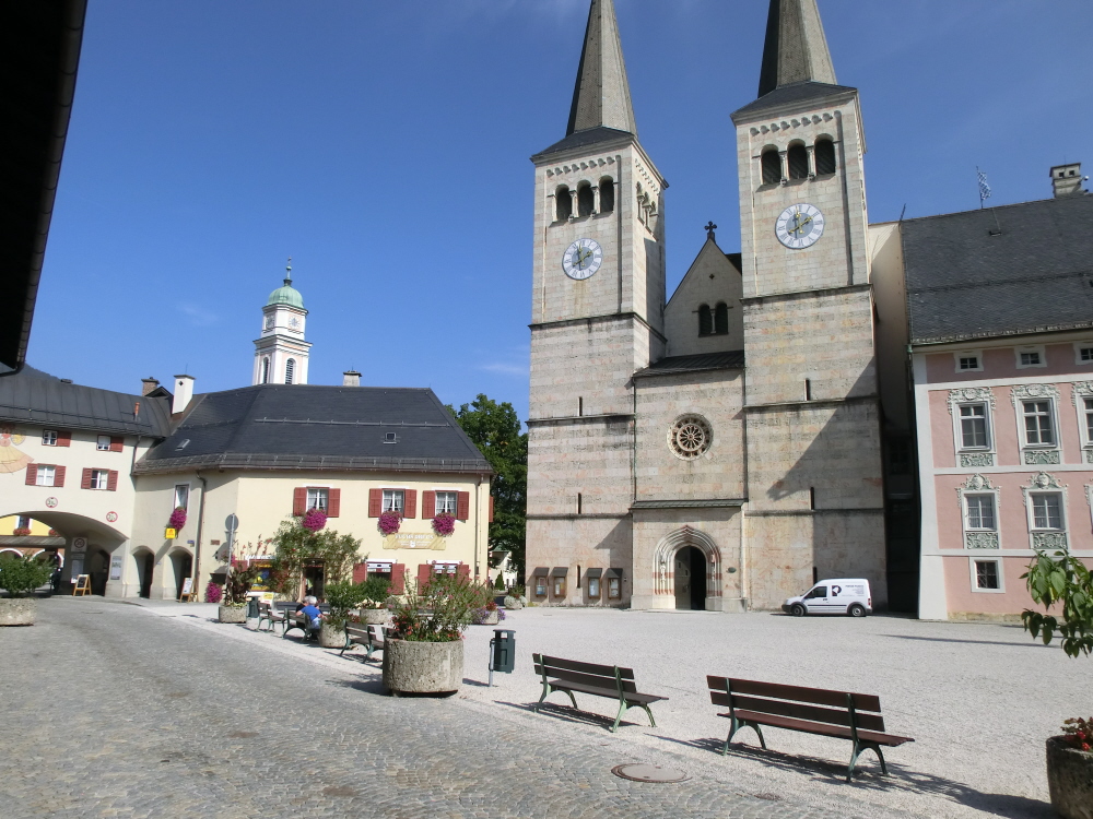
The Abbey Church of Berchtesgaden

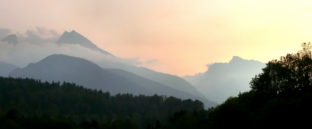
As I awaited the bus back to Salzburg, I mulled over the experiences of the previous days. Although inevitably some dark shadows still do hang over this part of the World, these are eclipsed by the striking natural beauty of the area; the intensity of colours, the tinkling of cowbells in alpine meadows and not to mention the fascinating old Baroque City of Salzburg. I turned one final time to gaze in awe at the spectacular Watzmann mountain before picking up my bag and boarding the bus.
CIMG1183

Sunset over the Watzmann

Posted in History & Culture, In Europe, Mountain Treks, Urbanism, Wild Places | Tagged , , , , , , , , , , , , , , , , , , , , , , , , | 1 Comment

Ghost Trains in the Urban Jungle

It could be a vision straight from a post apocalyptic sci-fi movie; a real-life “Planet of the Apes”. Trees and dense shrub vegetation encroach over former railway tracks, sidings and marshalling yards. Abandoned steam locomotives, rusting water towers and mysterious structures loom out of the undergrowth. All is silent and still, save for the occasional muffled sound of an ICE or S-Bahn train passing somewhere off in the distance.

CIMG5611

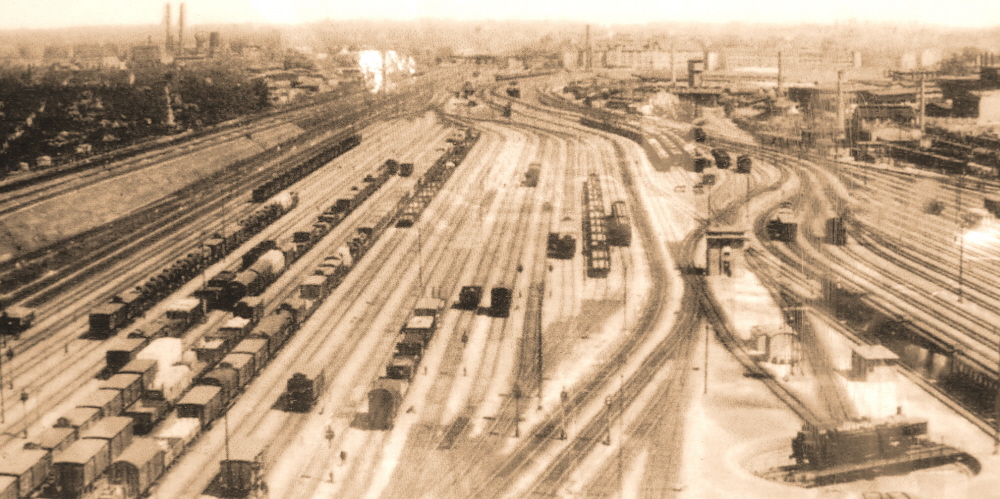
This is Südgeländ in Berlin, which I was lucky enough to visit as part of the recent Society for Urban Ecology (SURE) World Conference, held in the City . Südgeländ is an area trapped in time through an administrative quirk during the cold war division of the City between East and West. Following the handover of rail services to DDR administration in 1952, many cross city routes between East and West were abruptly closed down leading to large tracts of railway infrastructure being effectively mothballed. Areas were simply abandoned and left to go back to nature, with all the infrastructure simply left in place to rust and rot away.

CIMG5606

Südgeländ as it was before the division between East and West

Following the reunification of Germany in 1989, a decision was made to turn the Südgeländ into an area of public space for the benefit of the citizens of Berlin. The result is quite incredible; native species such as birch and beech joust for supremacy with introduced American Black Locust (false acacia) trees without intervention from ecologists or City Park Managers. The result is a fascinating illustration as to how forest communities and natural succession develops on disturbed sites. In some areas, unusual and unique species have colonised open grassland. These areas are maintained through grazing by (imported) sheep; one of the few concessions made to the otherwise non-interventionist approaches.

CIMG5607

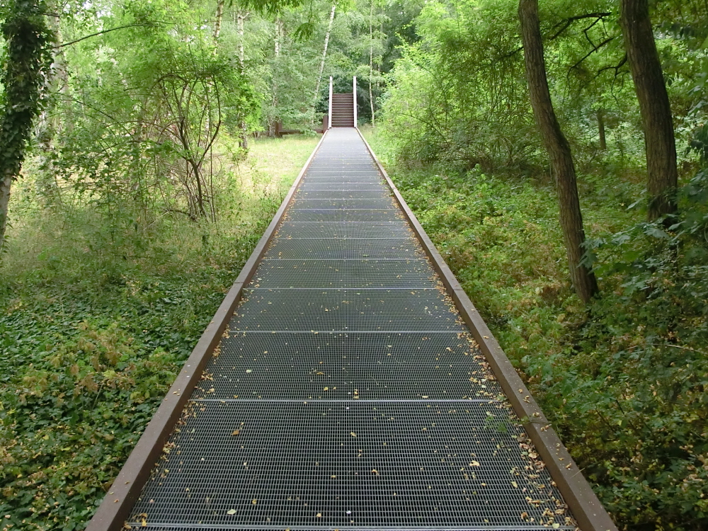
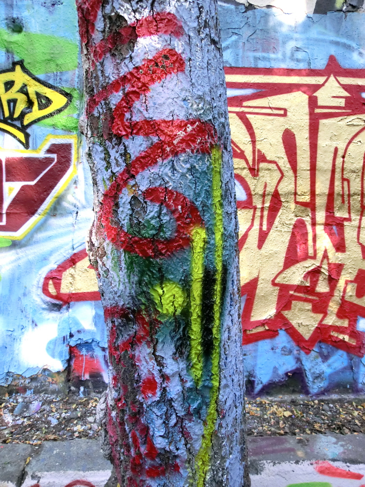
The organic chaos of Südgeländ is complimented by an assortment of surreal outdoor art structures, oddly reminiscent of a  Pink Floyd album cover. In other areas graffiti artists have run riot on former pieces of railway infrastructure, tunnels, embankments and bridges; even trees have not escaped the attentions of the aerosol spray brigade, resulting in some surreal effects.

CIMG5616

The approach at Südgeländ reflects a wider trend in Germany to simply leave former industrial infrastructure in tact to gently decay into nature. In other parts of the country such as the Ruhr and Saarland, former steel plants have been turned into massive outdoor art exhibitions or even into outdoor swimming baths, whilst the trees and natural vegetation slowly encroach to form the so-called “Industriewald”. Futuristic lighting installations help to accentuate the “Floyd” album effect.

CIMG5623

CIMG5626

CIMG5620

CIMG5638

CIMG5642

CIMG5652

CIMG5650

Elsewhere in Berlin the former Tempelhof Airport, has been opened up to form a large area of open space within the City. At weekends young families, picnickers, joggers and kite-flyers stroll happily and haphazardly across the empty runways against the backdrop of the austere terminal buildings (a product of the Third Reich); perhaps looking up only occasionally should the pilot of an Airbus or 737 forget that the airport has been decommissioned.

On a hot summers day, I enjoyed my visit to Südgeländ and found a green oasis hidden away from the heat and chaos of the City. However on a dark winter evening, I think I would definitely be glancing nervously over my shoulder, scanning the terrain for hostile zombies emerging from the post apocalyptic jungle…

For more information on global urban ecology issues see; http://www.society-urban-ecology.org/

Posted in Current Affairs, History & Culture, In Europe, Trees & Greenspaces, Urbanism | Tagged , , , , , , , , , , , , , , , , | Leave a comment

Brave New Worlds

A High-Rise Future ?

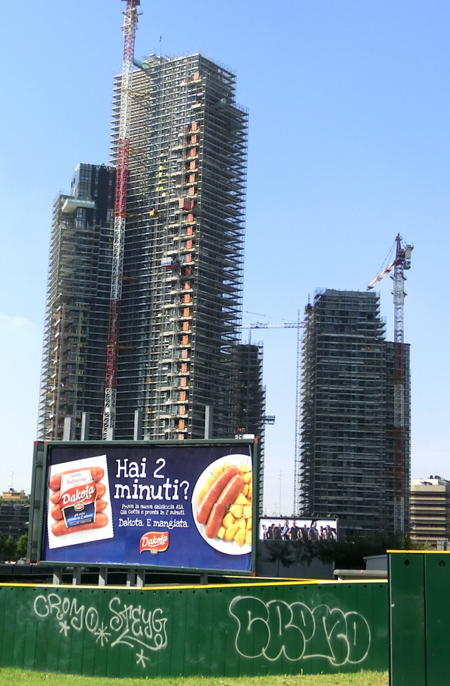
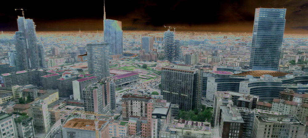
Our cities are changing and not just in Eastern China or the Gulf States; on a recent visit to Milan, I turned a corner in one of the City’s older districts to be confronted by a towering utopia of shining glass and steel in the making. The decaying grandeur of old apartments, period closes and shady piazzas, which once echoed to the sound of children’s laughter and evening chatter, is being swept away in an instant to construct tomorrow’s citadels of Big Business.

CIMG5060

Looking at this scene I couldn’t help thinking about the stone head monoliths of Easter Island where an earlier civilisation effectively wiped itself out through its own equally obsessive construction frenzy. These days however, it’s not the ancestors we are placating, but instead the corporate gods of wealth and power. Remarkably they even found space to put in a few trees; on the side of one of the skyscrapers and even before the upper floors were finally constructed. Can high-rise really mean a green sustainable future or is this merely a bit of “green washing” en route to “Mega City One” ?

CIMG5058

CIMG5076

CIMG5064

CIMG5065

CIMG5071

CIMG5066

CIMG5165

CIMG5088

CIMG5072

CIMG5074

CIMG5089

CIMG5094

Posted in In Europe, Trees & Greenspaces, Urbanism | Tagged , , , , , | Leave a comment

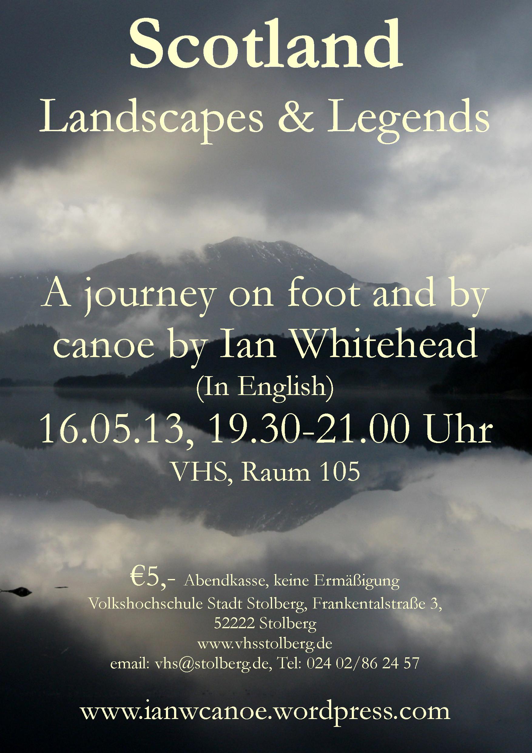
“Scotland: Landscapes and Legends”

Scotland Talk poster 2

For anyone in Aachen and surrounding area; I’ll be making a presentation at the Volkshochschule in Stolberg on the 16th May entitled “Scotland: Landscapes and Legends”. I’ll be talking about exploring Scotland’s wild landscapes on foot and by canoe (including many of the locations mentioned on this website) and explaining the background to the nature, history and culture of this fabulous country.

There will also be some good contemporary Scottish music to accompany the images, so come along and enjoy…

Posted in History & Culture, In Europe, In Scotland, Mountain Treks, Wild Places | Tagged , , , , , , , , | 2 Comments

Green Cities of Europe

European countries including Germany, Austria, the Netherlands and Belgium have become renowned in recent years for their progressive environmental planning policies which have helped to create some of the world’s most attractive and livable cities. It is therefore no accident that European cities including Vienna, Zurich, Munich, Dusseldorf, Frankfurt, Geneva and Bern frequently dominate the top 10 in the global quality of life surveys.

CIMG1088

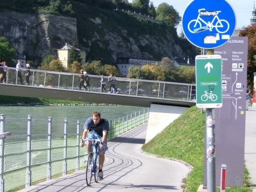
Green Network: Traffic free bike route along the riverside in Salzburg

These cities  offer vibrant and walkable city centres combined with networks of attractive parks and  greenspaces. In addition, European cities are also at frequently the forefront of transition towards a low carbon economy through modern, efficient public transport systems, energy efficient housing and innovative design.

The holistic and sustainable approach to urban planning puts green network thinking firmly at the forefront of planning policy and manages to successfully integrate a diverse range of environmental themes including sustainable transport, place-making, urban regeneration, locally sourced produce, urban trees and forestry, recreation and nature conservation. These themes are explored further with some successful examples of green city thinking from European cities;

CIMG0926

Karlsruhe Trams: One of the best public transport networks in Europe

Green Transport:

The integration of public transport is one of the key factors behind the success of many European cities. Nowhere does this best to my mind than the city of Karlsruhe in Baden Wurtenburg where an extensive network of “tram-trains” serves the City and the surrounding countryside. The scale of what has been achieved in Karlsruhe is quite breathtaking with over 10 lines, accounting for over 400km of track, serving the whole city-region and even extending deep into adjacent the Black Forest. The tram lines in the city often take the form of green grassy corridors which provide wider environmental functions and help to reduce the urban heat island effects.

In Edinburgh, where I worked previously, the creation of the City’s tram project has been the source of bitter controversy, contractual disputes and budget overspend since the start of construction a few years ago. The scaled down Edinburgh project involving the creation of one 13km line from the airport to St Andrews Square is costing the tax payer an estimated £776 million. I am amazed as to how a relatively small city like Karlsruhe can develop such a superb integrated transport network whilst the much higher profile Edinburgh project has struggled to get off the ground amidst a plethora of organisational failures, public opposition and political recriminations; to be fair to Edinburgh though, Karlsruhe has been gradually developing its network for the past 50 years or so.

CIMG1657

Going Underground: The future for trams in Karlsruhe City Centre

Still not satisfied with having a seemingly perfect transportation system, Karlsruhe is now going a step further and is busily digging up its main shopping street to bury the central axis of the tram system underground. Although this scheme is not without its own critics, the difference here on the Continent is the scale of ambition in terms of investing in new transport infrastructure. The result for Karlsruhe will be virtually traffic free streets in the town centre in future years, making the City an attractive place to live and invest in.

CIMG1655

Road Works; a familiar sight for the next several years in Karlsruhe

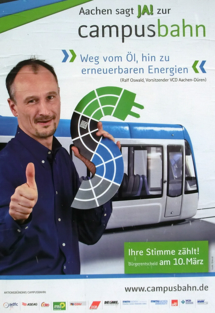
In Aachen,  the City where I currently live, there has been a heated tram debate going on for the last few years. Like many other cities, Aachen scrapped its tram network many years ago and has recently been formulating proposals to construct a new “Campusbahn”. This would aim to create a new line linking the City Centre with the University, residential districts and the prestigious new research campus currently being constructed around the University Teaching Hospital to the West of the City.

The scheme won the support of the majority of local political parties in Aachen and it was envisaged the project would attract a high level of external funding (based on achieving projected passenger targets). The indicative cost of the Campusbahn was €240 million of which the City of Aachen itself would have had to fund €130 million.  There were however concerns that the high cost of the project would put additional financial burdens on already overstretched City spending, as has been the case in Edinburgh. Unlike in Edinburgh however, the people of Aachen were asked to give their opinion at a referendum which was held on 10th of March.  The result of this was that 60% were opposed to the scheme and the project will therefore not now go ahead.

Campus2

Wishful Thinking: In reality Aachen said “Nein” to the Campusbahn on 10th March

There are however many variants on the tram theme which  can represent perhaps more cost-effective solutions. One of these is trolley buses which run on conventional streets whilst getting power from overhead cables. A system like this is found in the City of Salzburg with the clear advantage that noise and pollution within the City Centre is reduced without the requirement for costly and disruptive laying of special tracks. The resultant overhead cables can perhaps be somewhat intrusive but you quickly get used to these; similar issues would occur with a tram system anyway.

Whatever the specific transport solution, however (bus, tram or trolleybus), the key point is that transport solutions in European cities are generally integrated and usually gel seamlessly between rail, bus, bike, pedestrian and air systems. This is often not the case in the UK where networks are often uncoordinated or with gaps (try getting to Scottish Airports by rail for example !). In Germany, by contrast, the rail system has been more regarded as a key part of infrastructure and therefore essential for maintaining economic systems; it has consequently been accorded a much higher degree of state investment.

CIMG1103

An Alternative: Electric trolley buses in Salzburg with overhead power supply

So whilst the UK finally plans to have high-speed rail (HS2) running as far as Leeds and Manchester by 2033, Germany will have already had its ICE network in operation since 1991. There is also a considerable programme of investment in new tracks and station infrastructure including Berlin’s prestigious new showpiece Hauptbahnhof. It’s therefore little wonder then that the UK struggles to compete in Europe with its outdated Victorian rail infrastructure and slow pace of change.

Of course the Germans do like to complain about their rail network; the difference here however is that the train may go slightly later than planned rather than perhaps not at all (though to be fair I was left standing on a station platform in the snow here the other day when no driver appeared). Not everything goes to plan however in Germany; proposals to provide new through-routes for ICE trains under the “Stuttgart 21” project have become embroiled in bitter controversy with pitch battles and ongoing protests from residents and environmentalists about the financial and environmental impacts of the proposed rail routes near the City Centre.

IMG_0538

Prestige Project: Berlin’s palatial new Hauptbahnhof

On Your Bike…

In Britain the phrase “on your bike…” is most typically associated with Conservative politician Norman Tebbit who during the Thatcherite 80s urged a whole generation of unemployed Northerners to head South in search of better job prospects.  The Europeans however have taken the phase much more literally, with Continental cities taking huge strides toward getting people cycling through provision of a high quality infrastructure including networks of greenways.

IMG_0068

Many Roads: Plenty of choice of routes for cyclists from Aachen City Centre

Provision of safe off-road routes for bikes is one of the  greatest incentives to encourage people to cycle as part of their daily routine. The higher numbers of people using bikes in German and Dutch cities reflects this better infrastructure provision with noticeably more children cycling to school. This starts even from kindergarten age when many parents take their kids to nursery with a bike trailer or child seat whilst pre-school kids cycle along behind under their own steam.

CIMG1789

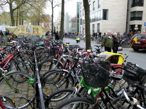
Bikes, Bikes and More Bikes: Two for every resident in Münster

Stop outside any railway station in this part of the world and you’ll literally find hundreds of bikes deposited there for the day by commuters. This is particularly true of the Netherlands where bikes carry no stigma and are very much part of everyday life with even town centre supermarkets selling spare tyres and pannier bags. At main railway stations there are also often good storage facilities for bikes as well as repair outlets where you can get your machine fixed up while you head off to the office. The existence of good infrastructure and safe facilities certainly makes cycling a more inviting option here.

Certain German Cities such as Münster particularly market themselves as being bike-friendly destinations. Wherever you look in Münster, you’ll find racks of bikes and there are even special streets which are only open to cyclists. The City famously has 500,000 bikes (2 bikes for every resident) and a 460km network of cycle routes which includes a car-free ring route around the City centre following the line of the old town walls. It is perhaps no accident that Münster boasts the lowest heart attack rate in Germany indicating significant health benefits. The network of cycle routes extends far out into the surrounding countryside which is famed for its traditional villages and moated strongholds.

IMG_1883

Hair Raising: What an electro bike can do for you

In recent years electro-bikes have seriously taken off in Europe and now account for a large proportion of sales. These battery-powered bikes can sprint along at an impressive 45km per hour and can cost you up to €5000. With an electro bike you only pedal when you want to making them a popular choice for the less fit or for elderly folks who find it more difficult to negotiate hills. Whilst I can see many benefits from electro bikes, I can’t help feeling that these do to some extent defeat the purpose of cycling, particularly in terms of health benefits; modern gearing systems don’t make biking such a chore these days anyway.

Congestion Free; networks for pedestrians and bikes in Salzburg

Congestion Free; networks for pedestrians and bikes in Salzburg

Green Corridors in the City:

Networks of interconnected greenspaces make European cities attractive places to live and provide multiple benefits both for nature and people within an urban setting. These include public open spaces, river and transport corridors, woodlands, conservation areas, play areas and quiet streets.

Many European cities owe their green infrastructure to fortunate geographical settings whereby settlements developed around natural features such as along river corridors as in the case of Berlin or Dusseldorf. In other cases, changing land use patterns, such as the removal of old city walls, left new corridors for recreational use, as happened in Münster or Maastricht.

CIMG1773

Green Orbital Route in Münster: Following the line of the old city walls

These linear routes often complemented networks of more formal public open spaces including city parks and “Kurgartens” which developed in large towns and spa resorts as a result of formal planning, the acquisition of old estate lands and through the philanthropy of wealthy industrialists. In the late 20th Century, the decline of traditional heavy industries also created new opportunities for the development of urban greenspaces, for example, in the Ruhr area or in the shrinking economies of Eastern Germany such as Leipzig.

In recent years the concept of green infrastructure, which integrates these components into one harmonious network, has been gaining ground and has now become widely regarded within planning circles as a key element of urbanism. Although at one time regarded as being mainly of ecological significance, these green networks are now valued for their ability to provide multifunctional benefits to urban populations. These benefits include including green transport, health, informal recreation, environmental education and ecosystem services such as climate regulation, air quality, wildlife habitats and CO2 absorption.

CIMG1805

Calm in the City: River corridor route linking greenspaces and urban areas in Münster

This is now being taken a step further whereby green infrastructure is now becoming a prerequisite for new planned development and city growth areas. This allows both nature and people to thrive and co-exist in new urban communities. Green infrastructure functions not just at a local level but at regional, national and indeed European scale. There are currently programmes right across Europe including in Scotland where considerable progress is being made through the development of the Central Scotland Green Network (CSGN).

IMG_0418

The Tiergarten: Berlin is one of Europe’s greenest cities with vast areas of parks and open spaces

IMG_0420

Art in the Park: Al fresco sculpture in Berlin

IMG_0484

Along the Spree: Riverside walk through the heart of the City

IMG_0467

Time for Reflection: Quiet moments in Germany’s capital

Urban Wildlife Sites: A place for nature as well as people ?

Urban Wildlife Sites: A place for nature as well as people ?

Walkable Historic City Centres:

Another feature which often characterises European cities and which distinguishes them from many North American counterparts is the compact nature of their centres which makes them eminently walkable. Following wartime destruction, many German cities have been faithfully restored to their former glory with attractively renovated buildings, market squares, street cafes and streetscapes which seamlessly blend old and new architecture.

CIMG1783

Street Life: Local colour and interaction

European cities also benefit from extensive pedestrianisation which keeps vehicles away from town centres allowing for the development of a bustling street scene complete with buskers, “living statues”, market stalls, fountains, street art and ample opportunities for people to interact. The City of Aachen where I live is a classic example of this, with the Altstadt providing a rambling series of enclosed squares and intimate spaces linked by winding alleyways lined with colourful cafes, specialist shops, bars and eateries. Nearby, in the genteel suburb of Burtscheid, people chat by fountains in traffic free streets, play chess on a giant outdoor chessboard or enjoy a leisurely beer or a coffee on a café terrace.

Contrast this with dull, formulaic layouts of cities dominated by the automobile (e.g. Houston, Atlanta or British New Towns) where vehicle turning circles and traffic circulation patterns have dominated design and have taken precedence over community life, local colour and human interaction. As a result, pedestrians have been banished to narrow strips of tarmac and play a constant game of Russian Roulette dodging in between cars. From my perspective, cities should be  lively and dynamic places which are designed for people rather than as a series of disconnected housing estates, soulless shopping malls and  drive-in warehouses only be accessed by vehicle. Such mechanistic planning kills interaction, creates social isolation and erodes community life.

CIMG0108

Domplatz: Historic corner of Aachen next to Charlemagne’s ancient cathedral

CIMG0284

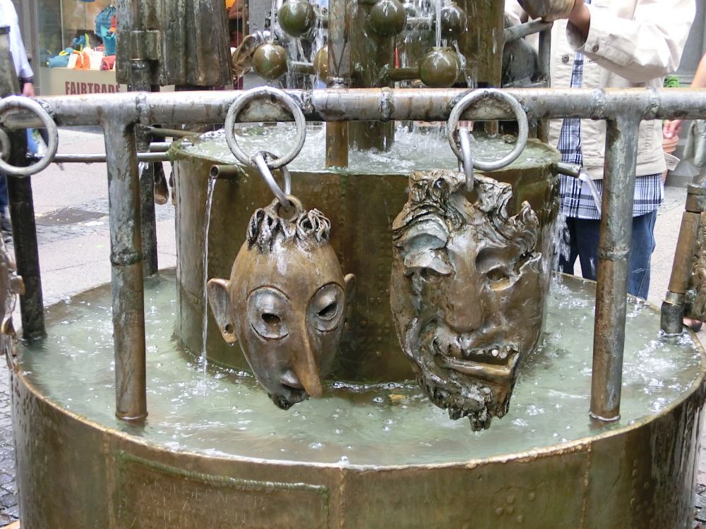
Street Art: The fountains of Aachen are a constant source of curiosity and interpret local folk tales

IMG_2101

Freiburg City Centre: A bustling pedestrian zone with open water channels running through the streets

Urban Change and Regeneration:

Urban change and regeneration have created great opportunities for creating new open spaces within Cities. Nowhere illustrates this process better than the City of Berlin. The Cold War resulted in the division of the City between East and West through the construction of the Berlin Wall.

The Wall, which was constructed in the early 1960s, left a huge scar through the heart of Berlin and claimed the lives of some 600 people who were killed trying to escape to the West. Following ever more vocal demonstrations, the Wall was finally opened up in 1989 and was eventually destroyed a year or so later following the collapse of the Communist regime.

IMG_0407

A Piece of History: A remaining section of the Berlin Wall

The demolition of the wall created huge opportunities for urban regeneration with much of the land being turned over to form new public open spaces and prestige projects including the Potsdammer Platz and the Sony Centre. Particularly poignant nearby is the Monument to the Murdered Jews of Europe. The Monument, designed by Peter Eisenman, is located significantly close to the site of Hitler’s Chancellery Building and was inaugurated in 2004 at a cost of 25 million Euros. The sombre memorial is intended to reflect the orderly and systematic way in which Jewish people were dispatched by the Third Reich, in a world devoid of humanity or reason.

Not far from here and close to Berlin’s  iconic Brandenburger Tör, is the City’s new Parliamentary Quarter located by the banks of the River Spree. This dynamic new area provides a good starting point for a walk along the Spree which is served by an excellent riverside walkway and cycle route. This greenway links riverside parks, greenspaces and nature conservation areas and takes people right through the heart of the City. Further along the route, towards the old Communist Party headquarters, you will also encounter lively new cultural quarters with riverside terraces offering bistros, bars and lively nightspots.

IMG_0428

Sombre Reminder: Monument to the Murdered Jews of Europe, Berlin

IMG_0486

Riverside Buzz: Regenerated riverside walkway along the Spree

Regenerated cultural quarters are not however unique to Berlin and you will find similar bohemian enclaves in many cities including Frankfurt, Dusseldorf and Cologne. Significantly, new public spaces in city centres should provide a vibrant setting in which people can meet, chat and interact informally rather than becoming overly sanitized expressions of civic pride with an accompanying list of onerous bylaws. Town centres should be open, dynamic places where people feel happy just to be themselves and where most of the entertainment is spontaneous and authentic.

DSCF1201

Spaces for People: Places where people can simply be themselves

DSCF1193

Recycled Art: Cutting edge bike sculpture

Locally Produced and Seasonal Produce:

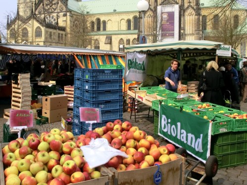
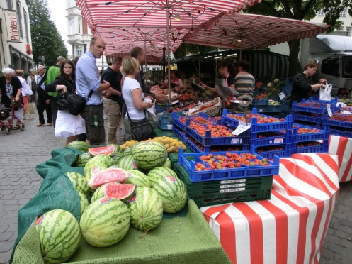
Without a doubt food on the Continent is healthier, fresher and more appetising than you’ll find in the UK. Whilst most Britains are heading down to Tesco to stock up on ready-meals to bung in the microwave, many of our Continental neighbours will be heading out to colourful markets to purchase fresh produce. It’s certainly the case that the ready-meals section in German supermarkets is very small, if  completely non-existent. This is probably one of the main reasons why Germans are generally heathier than people in the UK and have a greater life expectancy. There is also considerably more interest in organic produce here with most markets stocking a large percentage of local “bio” and seasonal produce. The markets also bring colour to town centres and a chance for people to meet, chat and relax whilst going about their shopping.

CIMG1785

Bioland: Organic produce for sale in Münster’s main market square

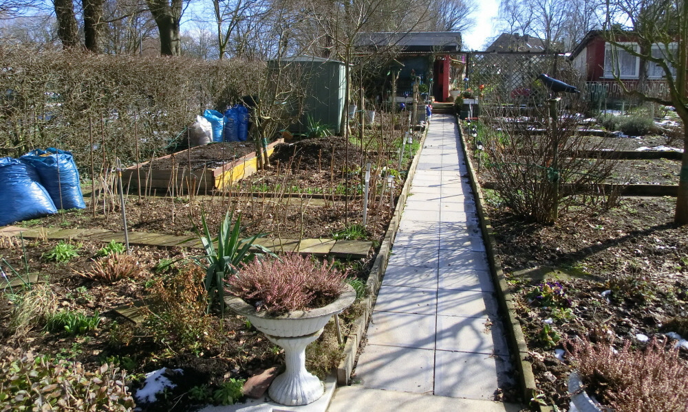
Germans also grow a lot of their own food for themselves with allotment gardens becoming ever more popular, particularly with young families. As you might imagine, German allotment gardens are somewhat of an institution with a whole series of elaborate rules and penalties for wrongdoers who do not keep their garden up to standard. Many allotment areas also feature small summer houses which provide the opportunity for urban dwellers to find their own little green oasis within the City. During the summer months people spend a good percentage of their time simply relaxing in their gardens and food growing is perhaps sometimes not always the no.1 priority.

Allotmant

A German Institution: Traditional allotment gardens in Aachen

In recent years there has been a growing interest in establishing community gardens on areas of derelict land in cities with particularly celebrated examples in Berlin. These community gardens function more as small cooperatives for food production; they attract a new dynamic breed of urban gardener who are more likely to be seriously interested in sustainable living rather than in keeping the management committee of the allotment club happy. This progressive trend is also reflected in Berlin’s school gardens which are increasingly becoming regarded as a model for sustainable urban agriculture in addition to educating a whole new generation about where their food comes from through active participation in community growing projects.

IMG_0215

Pumpkins fresh from the farm

CIMG0286

Fresh Fruit and Veg: Vibrant street market in Aachen

CIMG3872

Odd-shaped Vegetable Display: Aachen Marktplatz

Trees in and Around the City:

Continental cities place a high value on urban trees and woodlands. In my native Scotland, urban trees are frequently perceived negatively by residents and Councils and are often considered to be a source of potential property damage, public liability issues or a host of other nuisances ranging from autumn leaf fall through to the harbouring of undesirable pest populations. Consequently in Scotland, street trees are often poorly managed, become subject to vandalism and assume a relatively low profile in terms of incorporation within new developments. This is despite the fact that there is a clear link between urban property values and the existence of quality trees and greenspace.

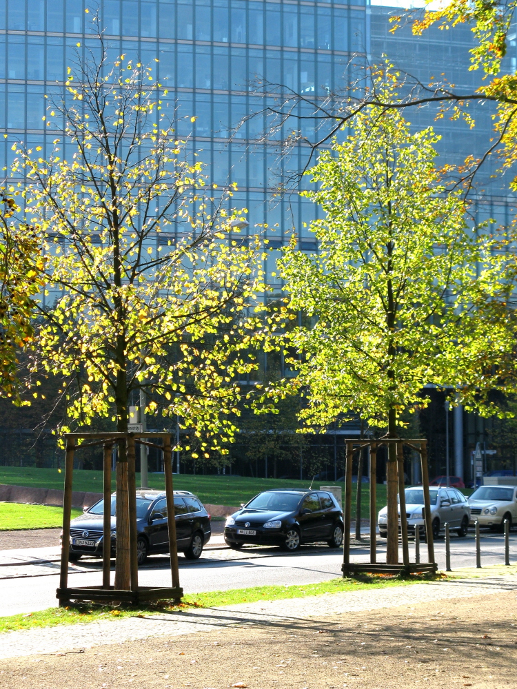
This is certainly not the case in Germany where most cities take a pride in their urban trees. This may be partly due to climatic factors, as higher summer temperatures create a demand for shade in urban centres. The City of Aachen for example, has some 20,000 street trees and a further 95,000 in parks and greenspaces. This is a pattern seen right across Germany in cities from Berlin to Frankfurt where attractive green streets are very much the established norm.

Species of street trees differ from the UK; although there are also significant numbers of pollution resistant plane trees here you will also find many exotics including Robinia and Turkish hazel. The management and maintenance standards are pretty high with extra precautions being taken to protect trees during new construction or laying of new underground cables. Interestingly here, the preservation of trees sometimes takes precidence over sight-lines at pedestrian crossings. There’s one such crossing just down the road from here, where a strategically placed Turkish Hazel completely blocks out the view of traffic for pedestrians crossing from an adjacent special needs home. This situation which would be unthinkable in the UK and I must admit I would be quite happy to take out this particular tree !

CIMG1794

Well Looked After: Urban Trees in Münster

IMG_0509

Street Tree Heaven: Typical scene from Berlin

IMG_0434

Autumn Colour in the City

IMG_0416

Latest Generation of Street Trees: Berlin

DSCN3977

Urban Greenery: Aachen

IMG_0531

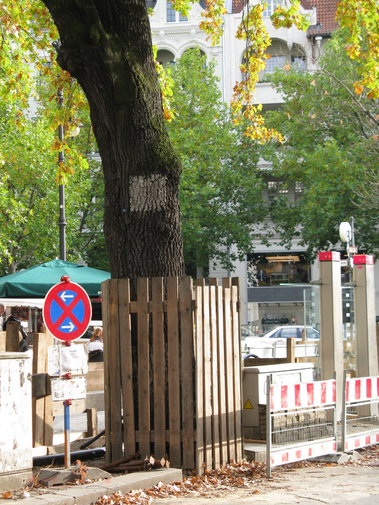
Protected: Berlin street trees during cable laying work

In addition to street trees, parks and greenspaces, many German cities boast extensive areas of urban woodland, known as “stadtwald” which fringe the city. Forests are very much embedded in the German psyche with urban fringe woods in particular being subject to heavy recreational use.

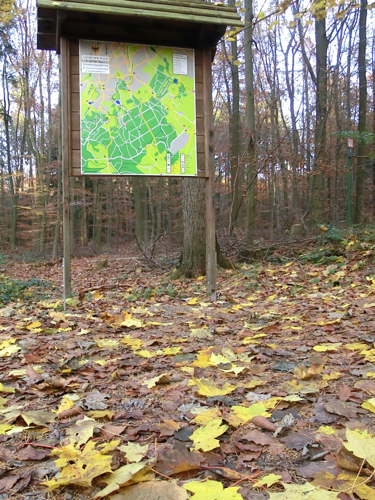
The Aachener Wald close to where we live is a much treasured resource for the people of Aachen with an extensive network of trails branching off in all directions. On a summer evening or weekend the woods buzz with activity including Nordic walking, rambling, jogging, mountain biking and horse riding. The Aachener Wald are also frequently used by school groups and kindergartens from an early age for “Waldtage” or “forest days” whereby groups get out and about into nature. Unlike in Scotland, urban woods are not perceived negatively in Germany as being dangerous or threatening places. Generally people feel safe and secure to use their local forests.

CIMG4220

Aachener “Stadtwald”

CIMG4294

Autumn Discovery in the Woods

One area however where Scotland definitely takes the lead is in the provision of ranger and environmental education services in urban centres. Just about every Scottish city boasts its own ranger service which provides outdoor education, organised events and conservation activities. This is one area which seems sadly lacking in Germany. As far as I can see there also does not seem to be such a developed concept of conservation volunteering here in Germany as in the UK where groups such as the BTCV have been going for decades.

Perhaps this is because Germans expect local authorities or private owners to undertake such work and therefore do not see a need to get involved. I can’t help feeling though that this is one area where the Germans are missing out when the social, health and environmental benefits of “green” volunteering are clear. Management of woodlands in Germany by local community groups also appears to be relatively unknown concept here (however if anyone knows of good examples I’d be interested to hear about these).

Regenerating Post Industrial Landscapes:

The Germans do however have a great track record when it comes to the regeneration and greening of former industrial areas. The Emscher Landschaft Park in the Ruhrgebiet is perhaps the best known example. The Ruhr is a fascinating place and for a brief period in history was the powerhouse of Europe before the decline of traditional heavy manufacturing industries. Unlike in the UK however, the Ruhr retained many pieces of its old industrial infrastructure including steel plants, foundries and pithead winding gear. These features were left in situ to become open air museums or otherwise were adapted to new functions including concert venues or futuristic art galleries. Meanwhile the surrounding degraded landscapes were often left to renaturalize resulting in the so-called “industriewald” a unique type of woodland found in parts of the Ruhr today where natural regeneration of woodland has occurred without human intervention.

ELFHNP images 216

Bing Tourism: Near Alsdorf

The combination of decaying industrial infrastructure and regenerating forests creates a surreal, almost postapocalyptic landscape reminiscent of abandoned cities close to the Chernobyl nuclear plant. This effect is further enhanced at night when theatrical and futuristic lighting of the old industrial complexes creates a dramatic, if somewhat haunting and unsettling scene; it seems that all that’s missing is the music of Jean Michelle Jarre.

On a much smaller scale to the Ruhr, regeneration of the old brown coalfields north of Aachen is taking place under a series of initiatives which include the “Grünmetropole”, a cross border initiative taking in former mining areas of adjoining parts of Belgium, the Netherlands and Germany. Through this project, colliery sites are being turned into museums, old coal bings are being re-landscaped as view points and new  recreation areas and nature conservation sites are being created.

As an example, near the old mining town of Alsdorf an innovative project has resulted in the development of a new country park with a series of dramatic walkways and platforms leading to the top of a re-natured bing providing views out across the evolving post industrial landscape. Nowadays renewable power generation projects in the form of wind turbines, are replacing mine workings as the dominant feature in the landscape. This project is part of a larger economic vision for the Euregio Region which aims to make this cross-border area, a dynamic and competitive location within the heart of Europe.

ELFHNP images 215

Serious Construction Work on the Alsdorf Bing

ELFHNP images 222

Brave New World: The view from the Bing

ELFHNP images 226

Grünmetropole: Bringing industrial heritage back to life in the Euregio

DSCN1868

Green Economy: Trees softening the impact of industrial development near Aachen

Sustainable Housing and Communities:

The drive toward a low-carbon economy is also having a major influence on urban design and construction in Germany. The Europeans have really been leading the game as far as developing eco-towns is concerned with some of the most established and successful models being found on the Continent.

One of the best known examples of Eco-city development is Freiburg in South West Germany and its well-known suburb of Vauban with its traffic-free living areas and eco-friendly apartments.  This colourful residential area makes use of every conceivable form of renewable energy including passive solar, photovoltaics, ground source heat pumps and biomass boilers. Energy efficiency standards are very high which is particularly pertinent given Germany’s decision to phase out nuclear energy entirely and move more toward renewables following the wake of the Fukushima disaster.

IMG_2105

Ecohousing and Gardens in Vauban, Freiburg

IMG_2106

Places to Play: Young families are well catered for in Vauban’s Eco-utopia

In addition to providing low energy housing, Vauban perceives itself to be an eco-utopia where owning a car is frowned upon (cars must be kept in peripheral car parks outside the residential zone) and where houses are surrounded by a series of attractive green spaces dominated by play areas, public parks, community allotments and meeting areas. Whilst Vauban is very much the stomping ground of the hardcore eco-purists, it does provide a model of sustainable development which has been copied and replicated in many other eco-town developments internationally. There are great ideas here, backed up by dedication and innovation. Would I actually like to live there myself ? On reflection perhaps not; whilst it might be an interesting experiment to try out, I think I’ve grown up in too much of an individualistic society to cope with being part of such a perfectionist community. An eco-house in the countryside with a bit of space around it; now that might suit me better..

IMG_2107

Green Fire Escape: Amazing what plants can do in an urban setting

Putting Together the Parts of the Jigsaw:

In terms of providing models for sustainability, there are certainly fantastic examples of urban planning coming out of Europe which are having a significant influence on rapidly developing global economies such as in Asia and Latin America. Despite this, Europe still has a long way to go; in Germany particularly (the country with one of the densest road networks in the World) there is a huge paradox between the German’s determination to invest in a green economy and their continued addiction to car culture where owning a gas-guzzling Mercedes or BMW is still regarded as being the number one symbol of success. Traditional German industry needs to catch up with this fact and to start truly promoting the benefits of a green economy through turning their obvious design innovation and quality standards to the production of new low-carbon products. This is certainly happening in the thriving German renewables sector but needs to become standard, mainstream practice.

Alternatively, perhaps we just have to  simply redefine what we mean by development and to start looking at so-called less developed countries like Bhutan where Gross National Happiness is being branded as the new alternative to GDP, an idea starting to catch on with governments around the world. In terms of sustainable development, the parts of the jigsaw are all there and can be drawn from diverse societies around the Globe, including in Europe; we just need to learn now how to put these pieces together more effectively into one coherient package and whilst we still have the time to do so…

Posted in Aachen & Euregio, In Europe, Trees & Greenspaces | Tagged , , , , , , , , , , , , , , , , , , , , , , , , , , , | Leave a comment

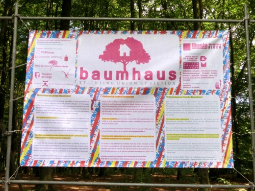
“Baumhaus”: Radical art down in the woods

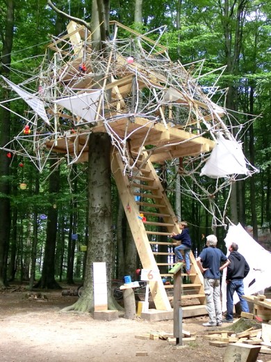
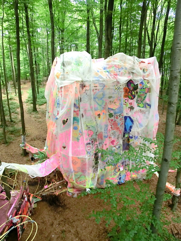
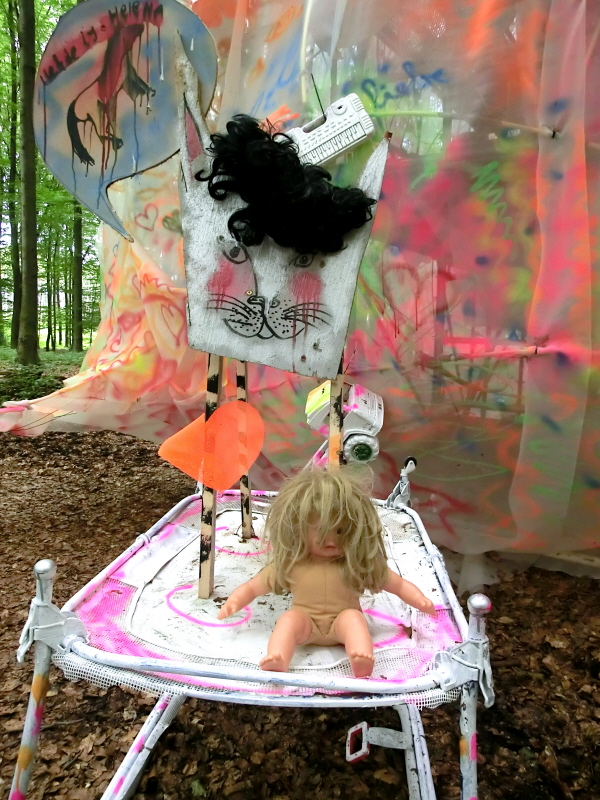
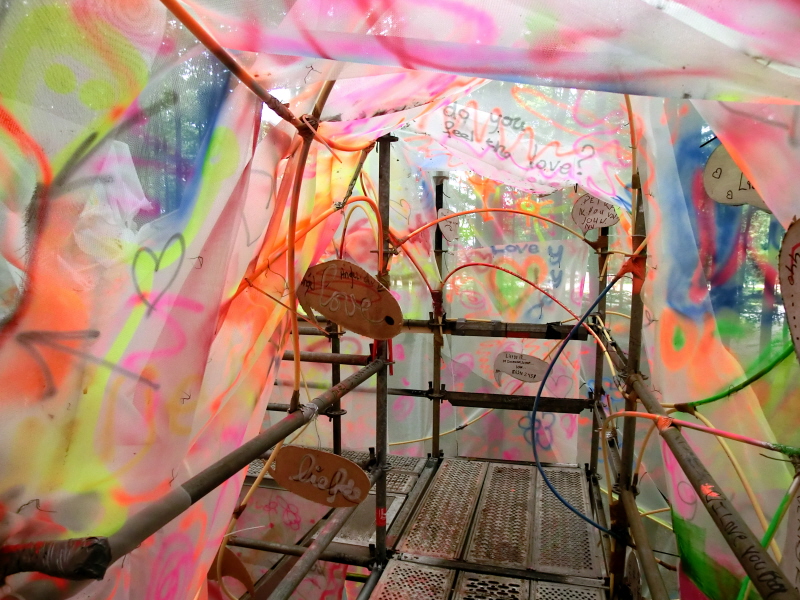
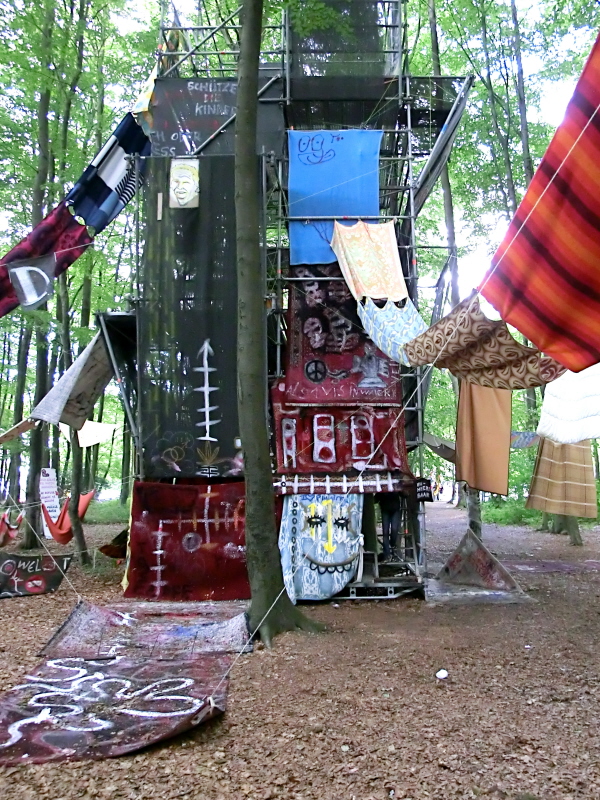
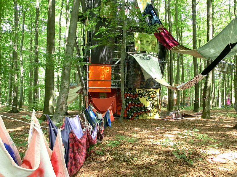
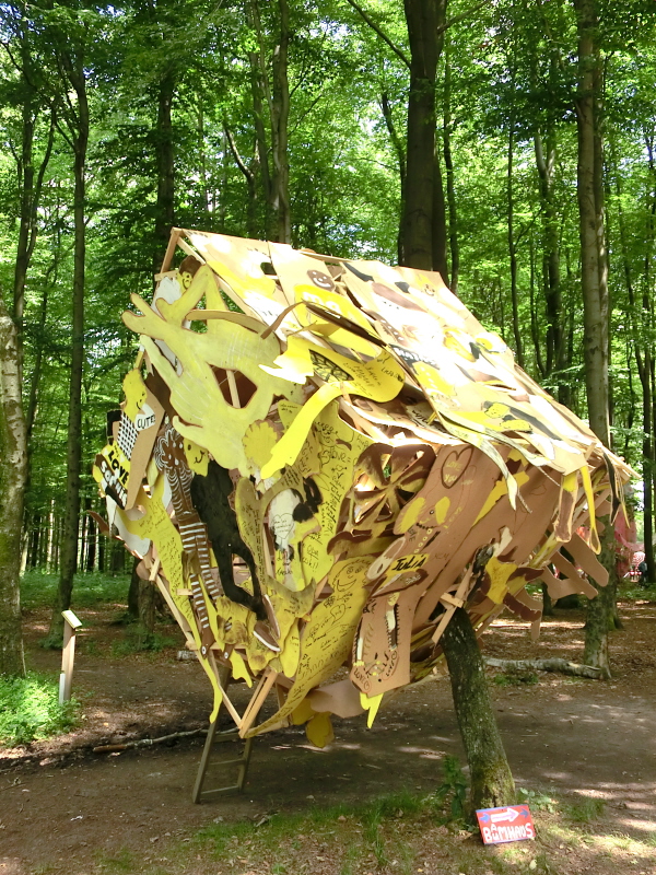
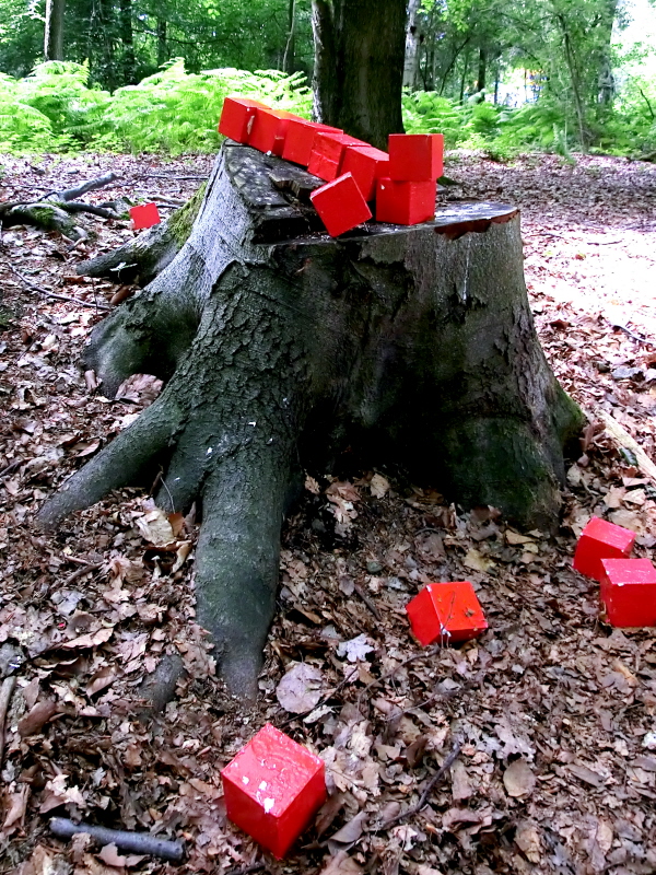
In a recent summer, something very strange could be seen down in the woods at the “Dreilander Punkt” outside Aachen at the meeting point of Belgium, the Netherlands and Germany. Weird shapes and constructions (featuring the most outrageous colour schemes imaginable), graffiti art and a host of other abstract eccentricities, could be seen looming out of the forest.

CIMG0218

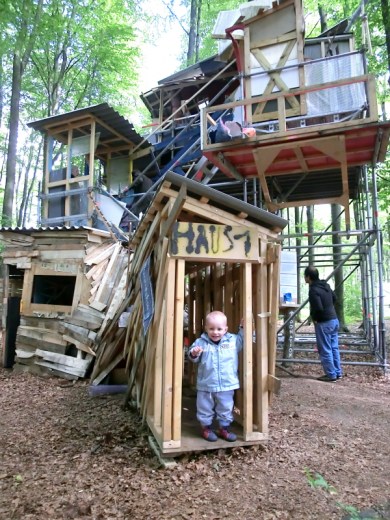
The “Baumhaus” or Tree House Project was created as a “living art” initiative involving participants from Belgium, the Netherlands and Germany. Over 270 people from the three countries worked together in the woods under the guidance of professional artists and architects to create a unique and perplexing piece of art. 

The organisers picked a theme, the “bare necessities of life”, which was considered to be relevent to all project participants regardless of race, colour or creed. Each tree house reflected a different topic within the main themes, these being:

• “The body”, representing physical needs)
• “The safe haven”, or security
• “The Gathering”, for social needs
• “The Anthem”, representing appreciation and recognition
• “Growth”, for development
• “The Discovery”, representing new requirements

CIMG0211

The six resulting  treehouses combined the disciplines of art, theater and design. Volunteers helped to work on the project at all stages, from initial conception, right through to the construction phases. In addition to building sculptures, they painted, photographed, filmed and produced creative writing and poetry around the various themes. 

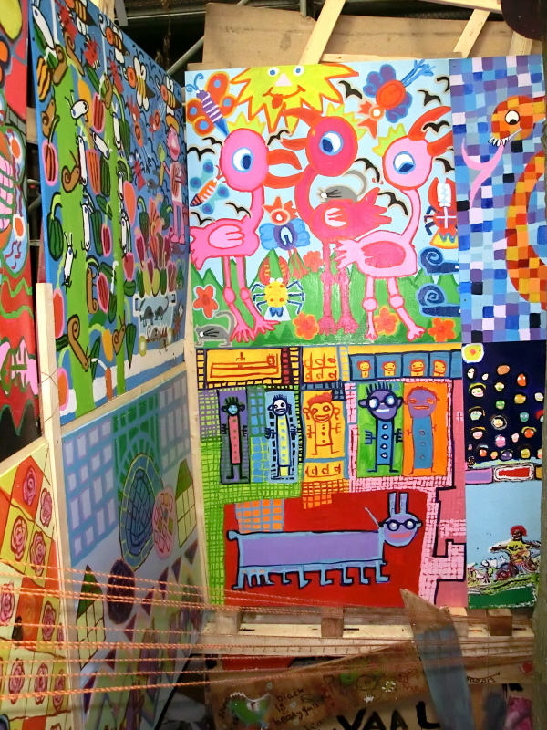
Before the project started, the artists and architects established a basic framework for each treehouse . Each participant was then encouraged to contribute material according to their own strengths. The Teams of international volunteers then worked together creatively to construct each different treehouse. Participants were diverse and included school children, students, corporate groups, elderly people and special needs groups. 

Those involved also contributed to the eclectic range of “recycled” materials that were collected and used for the Project; these included household  junk, textiles, bikes, toys, bird cages and polystyrene. To this rough and ready assortment of goods, were later also added; paintings, sculptures and artwork by participants which reflected the different themes of the treehouses.

CIMG0225

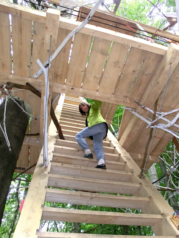
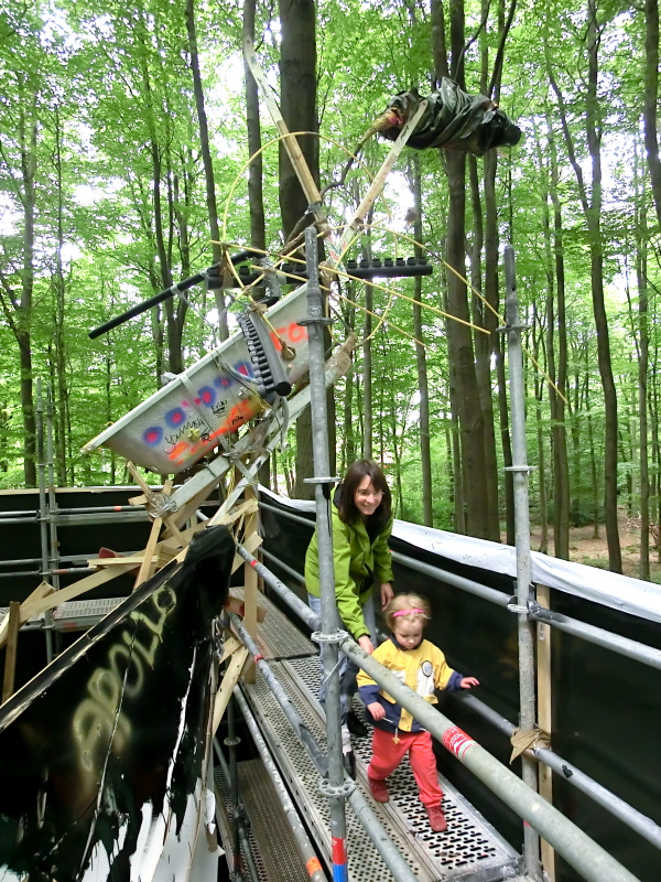
We found the “Baumhaus” exhibition a fascinating place to visit with all sorts of hidden nooks and crannies necessitating further exploration. The treehouses were open to the public though it was very much on the basis of “at your own risk”. Although most of the constructions appeared solid (a few definitely weren’t !), there were more than enough potential  hazards (e.g. rusty projecting nails and weak floorboards) to keep UK health and safety officials scurrying about for months … however our kids loved it and didn’t mind at all !  

CIMG0169

CIMG0187

CIMG0181

CIMG0180

CIMG0182

CIMG0184

CIMG0186

CIMG0183

CIMG0208

CIMG0210

CIMG0227

CIMG0233

CIMG0229

CIMG0231

http://www.unionbyfiction.nl/

Posted in Aachen & Euregio, In Europe, Trees & Greenspaces | Tagged , , , , , , , , , , | Leave a comment

Carnival in Aachen: Vanquishing the spirits of winter… ?

Joie de vivre, frivolity and “letting your hair down” are not characteristics most often associated with the Germans (with the possible exception of the well-known Munich Octoberfest) who are better known for their more sober traits including “attention to detail”, a sense of duty and the famed work ethic. However, anyone arriving in the Rhineland during the “Tolle Tag” (or crazy days) of the Carnival in February will be in for a serious dose of culture shock !

CARNIVAL3

Happy Smiles: Carnival is when the people of the Rhineland let go !

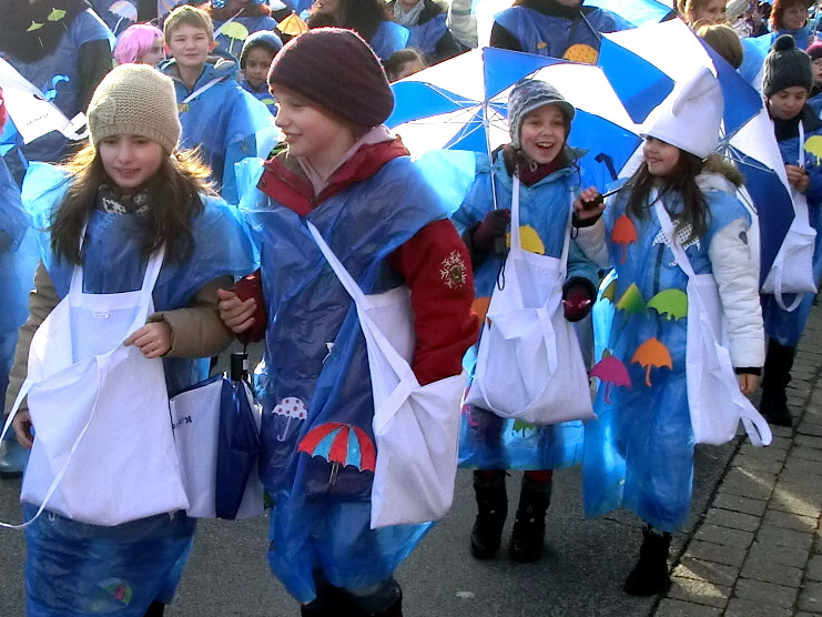
During these heady pre-lent days, it seems that the whole population dons silly costumes; banks and railway stations become impromptu party venues (with free drinks dished out) and seemingly everybody goes a bit mad. It’s not that Germans don’t like to have fun; it’s just that, unlike in  Britain (where humour creeps into business meetings, news broadcasts and interviews), the Germans often choose to pigeon-hole their enjoyment !

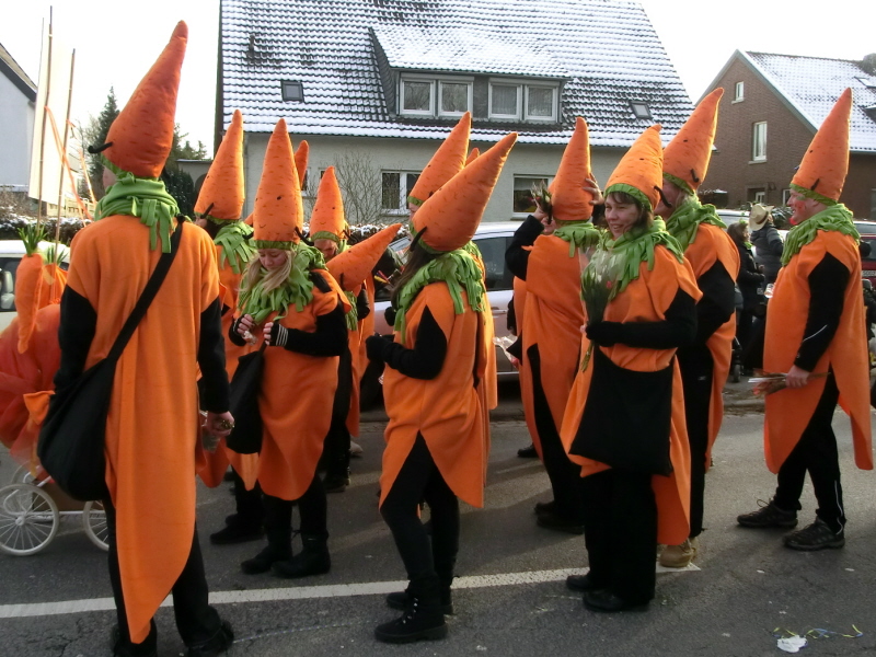
From a Scottish perspective, Carnival (or “Karneval” auf Deutsch) is a bit like Hogmanay in fancy dress.  Unsuspecting visitors, arriving in a major town such as Cologne or Aachen, will bump into (and trip up over) all manner of carnival detritus including drunken people dressed as pirates, cave men, carrots or even as giant tubes of tooth paste; it’s all quite surreal really !  In true German style, of course, there are those who take the Carnival more “seriously” with special societies complete with all manner of strange ritual, ceremonies and organisational hierarchies. Whilst the latter will leave the outsider feeling somewhat perplexed, the street carnival is fun and accessible to all.

CARNIVAL9

Watch Out: Carrot people are coming !

In Southern Germany Carnival is known as “Fasching” and originally had the purpose of vanquishing the spirits of winter. In towns like Freiburg, there is more of a “Brother’s Grimm” feel to proceedings with dancing witches and masked nature spirits more reminiscent of Tibetan tantric dances. In the Rhineland however, Carnival has a more contemporary feel and quite frankly anything goes.  The long weekend between “Fett Donnerstag” and “Rosenmontag” is the wildest of all with organised float processions in most towns.

CARNIVAL2

Russian Look: Eclectic costumes for Carnival

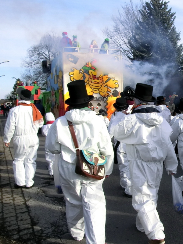
Although Aachen has large organised carnival processions, we decided to join a smaller event with friends in the smaller suburb of Brand. During these float processions all manner of weird and wonderful costumes are worn and sweeties and treats are thrown out of the floats to passing by-standers. The goodies are thrown with some force and you can end up getting quite a sore head if you’re not careful; I can’t ever imagine this ever happening in Britain these days (not unless all the spectators have first been issued with protective safety glasses and helmets by over-zealous health and safety officials !). It’s possible to scoop quite a cache of treats at these processions with many bringing a carrier bag along to mop up the bounty.

CARNIVAL5

Snow Patrol: the white mob pass by

CARNIVAL4

Carrot Crew: With orange noses at the ready

CARNIVAL8

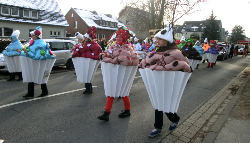
Cup Cake Ladies: Not to be messed with

CARNIVAL7

Anyone for More Cupcakes ?

CARNIVAL11

Hoovering up the Bounty

CARNIVAL10

No shortage of Goodies Lying in the Gutter

CARNIVAL1

The Frog and the Fairy Princess

CARNIVAL12

Enough Provisions to Last a Whole Year…

CARNIVAL14

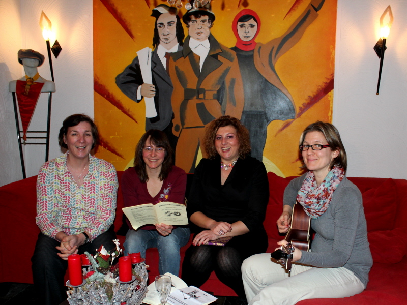
“Girl Power”: Ladies’ sing-along with revolutionary zeal at Theresa’s

A Stronger Spell Required:

Despite the Carnival frivolity, the spirits of winter have not yet been vanquished; indeed this week the snows have returned with a vengeance. Anyway, after all the grey days of January, it’s a great chance to get out and enjoy fun outside in the snow.  Me and my daughter Zoe, even designed our own special Scottish carnival snowman to greet visitors at the front door !

CARNIVAL15

Scotland Comes to the Carnival

IMG_4048

Snow Fun in the Eifel near Aachen

Posted in Aachen & Euregio, History & Culture, In Europe | Tagged , , , , , , | 1 Comment

Tummel and Tay: Exploring Scotland by Canadian Canoe

In an age dominated by road transport, most journeys these days involve jumping into the car.  This was not however always the case; for our ancestors rivers and lochs formed the main communication routes through the landscape. On the River Tay in Perthshire, for example, log boats have been discovered which date back more than 3000 years. The Carpow boat discovered near Abernethy on the lower Tay in 2000 is just one example of series of “dug out” boats which have been discovered by archeologists around Scotland. 

FA_04

Scotland’s Rivers: The Nation’s original highways

Fools Afloat: Learning the hard way:

I became interested in the potential for exploring Scotland’s rivers and lochs by boat  following a Canadian Canoeing expedition with my Brother, Ken, in the Bowron Lakes area of  BC, Western Canada  in 2001.  My first excursions in Scotland were with canoeing buddy, Steve, on the river Dee and Spey in Scotland’s North East. We literally jumped in at the deep end, bought a canoe between us (which we Christened “L’Escargot”) and headed off down the river.

Although I wouldn’t recommend this approach, we learned the hard way through negotiating rapids, river currents and submerged boulders. Despite many bumps, bruises and a few near-drowning incidents (not to mention dented boats and lost paddles) we survived our initial introduction and lived to tell the tale. It wasn’t long before we bought another boat which we named “Selkie”.

Our introduction to the world of open canoeing was exciting, fun and opened up a whole new area of challenge. It wasn’t long before we were undertaking expeditions of several days duration down rivers such the Spey. One of the great advantages of an open canoe being that you can stash a whole week’s camping gear (including comfy chairs) easily into the boat.

FA_05

Quiet Spot: An attractive spot for a break

Canoeing Around the River Tay Area:

One great area of Scotland for Canadian (or open canoes) is the catchment of the River Tay in Highland Perthshire. I moved to Perthshire in 2005 and began to explore the rivers and lochs of the area by canoe. The River Tay itself is the UK’s highest volume river and offers huge potential for open boating. It is navigable for it’s whole length from Loch Tay down to the tidal section below Perth with some bigger rapids (grade 2/3) being found at Grandtully and Stanley.

The lochs themselves also offer great paddling opportunities; particularly Loch Tay and Lochs Tummel and Faskally on the River Tummel catchment (a tributary which joins the  Tay South of Pitlochry). Although loch paddling can be a placid and reflective experience , it can also be a challenging one when wind speeds increase and the Scottish glens start to act as giant wind funnels. In a matter of minutes, Scottish lochs can be transformed from a mirror-like calm to a ranging tempest which can test the nerve and skills of any open boater.

DSCN3733

Winter Calm: Placid conditions on Loch Tay with the Lawers Range behind

“Pirates” on Scottish Waters:

Another “hazard” to consider on Scottish lochs and rivers is fishermen. In general most are courteous, as long as you respect their interests and minimise disturbance (many of them are paying considerable sums to fish Scottish salmon rivers) by passing with a wide margin or by waiting until they have finished casting. In general we found fly fishermen on the rivers to be pleasant enough (with a few exceptions).

On Scottish lochs however, groups of “rogue” coarse (both by name and by nature) fishermen can be an issue; they can often be found occupying lochside campgrounds with copious quantities of “liquid refreshment” stashed ready for a weekend binge.  With a canoe it’s usually easy enough to give this lot a wide berth (recommended !). Unfortunately many of these guys don’t take their rubbish home and can give campers a bad name.

These problems have reached epidemic proportions around some parts of Loch Lomand resulting in a wild camping ban. We toured some of the Loch Lomand’s islands and were amazed to find well established encampments complete with huge stashes of booze, generators and mobile sound systems; a case of Ibiza comes to the Highlands. Generally though, the further you are away from the cities of the Central Belt, the less problems of this kind you’ll encounter. Fortunately, most of Perthshire fortunately fits into the latter category with the greatest problems being found in the more accessible areas of Loch Lomand and the Trossachs National Park.

DSCN2008

Time for Reflection: Getting away from it all by canoe

Places to Go:

Some of the places I’ve particularly enjoyed exploring by canoe in Perthshire include Loch Tummel, Loch Tay and the River Tay itself. We were joined by quite a selection of people on these canoeing trips including the already familiar Iain and Steve (see Hebrides trip) as well as others listed at the end of this item;

Loch Tay:

Loch Tay is one of Scotland’s larger freshwater lochs and occupies a deep glacial trench between the villages of Kenmore and Aberfeldy. The Loch is surrounded by high mountains including the Ben Lawers Range which reaches up to almost 4000ft in height and which is also famous for it’s artic-alpine plants, relics from the last ice age.

DSCN3136a

Waterworld: Steve tackles Loch Tay

Loch Tay is also steeped in history and legend and is well known for it’s many crannogs. These are iron age lake dwellings which were constructed on wooden piles out over the water from the Neolithic period onwards. The crannogs were accessible only by causeways and provided relative safety and security for local tribes during periods of conflict. A reconstruction of a crannog and a fascinating interpretation centre can be found at Kenmore at the Western end of Loch Tay and is well worth a visit to learn about how people lived in ancient Scotland.

DSCN1057

Ancient Loch Dwelling: Restored Crannog at Kenmore

There are also fascinating abandoned “ferme touns” or early settlements located around the shores of Loch Tay, many of which were abandoned following the Highland Clearances. The settlement of Croft Feunaig above Chamaschurich (Bay of the Corracle) is a particularly atmospheric, haunting place and is evocative of a time when gaelic culture and a transhumance cattle economy flourished in the area.

Up in the hills, the remains of many sheilings (summer dwellings for graziers) can also be found. There are also many fascinating legends about the “Lady of Lawers” a Gaelic seer (or prophet) in the well establish Highland tradition of the “second sight”, The “Lady” prophesised many significant events which were later became true. The ruins of the abandoned village where she lived and grew up can also be found tucked away on the North shore of the Loch far below the main road.

DSCN3350

Lost in Time: The “ghost village” of Croft Feunaig

Whist Loch Tay is a beautiful Loch, it can also be a tricky one for canoeing when the wind picks up. The West end of the Loch by Killin is by far the most sheltered with waves building progressively the further East you go. Around Killin there are also some interesting small islands to explore close to the mouth of the River Dochart. Killin also has some interesting historic associations with local clans; the McNabs and the Campbells. Finlarig Castle, the traditional home of the Campbells of Glenorchy, can also be found hidden away in the woods close to the Lochshore.

DSCN3163

Island Retreat: By the mouth of the River Dochart, Killin

The Tummel: 

Loch Tummel is surely one of Scotland’s most picturesque lochs and is famed for it’s well known “Queens View”,  an idyllic outlook point much-loved by Queen Victoria.  The iconic view down the Loch towards Schiehallion (the Fairy Hill of the Caledonians) is superb and features widely in much Scottish tourist promotion literature. As well as reputedly having supernatural properties and being beloved of the “Little People”, Scheihallion (due to it’s near perfect symmetry) was also used in early experiments to determine the mass of the Earth.

Loch Tummel was artificially deepened as a result of hydropower development in the last century, creating a series of beautiful and attractive islands which are visible from the Queen’s View. Although the water level has been artificially raised, Loch Tummel still manages to preserve much of its natural beauty with no area ugly area of  exposed foreshore as is found around many other “man-made” reservoirs.

One of my favourite locations for paddling in Highland Perthshire is the Eastern end of the Loch which provides sheltered bays and a series of ever unfolding views as you progress Westward along the Loch. The islands make great places to visit and we spent quite a few happy nights camping out there (well away from the clutches of “coarse” (or coorse) fishermen. Below, Loch Tummel, the River flows down through the beautiful Linn of Tummel where it joins with the Garry before flowing into Loch Faskally by Pitlochry and then finally into the much larger River Tay.
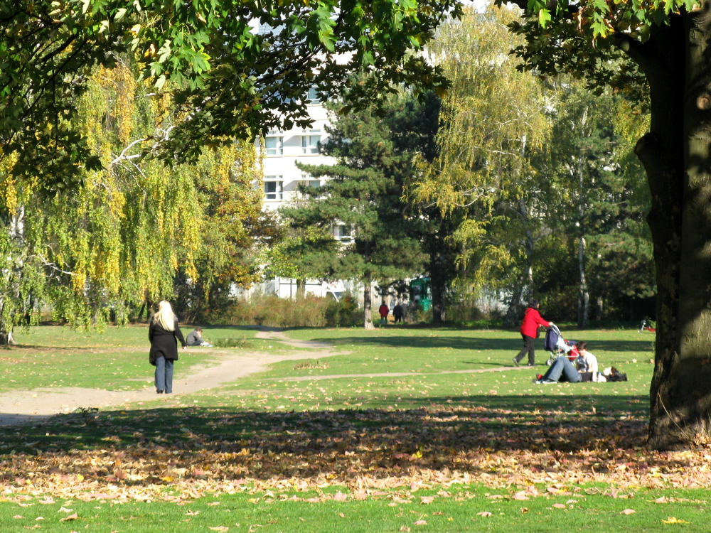
 

IMG_0618

Queen’s View: Down Loch Tummel to the islands and Schiehallion

Clearwater, tummel 031

Fun Afloat: On Loch Tummel

Clearwater, tummel 021

Island Hopping: Hilary crews “Selkie” on Loch Tummel

DSCN3538

Landfall: Me back on “terra firma”

Clearwater, tummel 012

Pirates Ahoy ! A strange encounter with a harmless lunatic on the water

Clearwater, tummel 033

Mystic Waters of Loch Tummel

IMG_0589

Big Tree Country in Autumn

DSCN2059

Perthshire Amber: Fantastic autumn colours

IMG_0560

By the Linn of Tummel

Down the River Tay to Dunkeld:
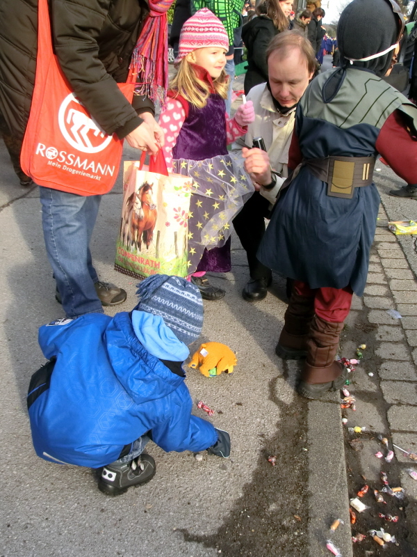
A great section of the Tay for open boating is between Kenmore, situated at the East end of Loch Tay, and Dunkeld. The river is fast-moving in the first part with grade 2 rapids around Chinese Bridge between Kenmore and Aberfeldy. Just above Aberfeldy is the confluence with the River Lyon (we also ran a section of the Lower Lyon in spate conditions with at least one dramatic “wipe out” i.e. when a boat fills with water and sinks).

Below Aberfeldy, are the famous Grade 3 rapids of Grandtully with their awkward angles and famous “Boat Breaker” rocks poised ominously just at the end of the rapids. Being cowards (and having already experienced rather too many “wipe outs”) we took the boats out the water and portaged them around to the next section.

From Grandtully down to Dunkeld, the Tay is a more placid beast as it passes through open farmland with beautiful views of the surrounding hills. Although there are no significant rapids on this section, there are strong currents and the prospect of a capsize in some of the deep, black pools with their “boiling” undercurrents seems rather uninviting; every year the Tay claims one or 2 lives and so a cautionary approach is best.

FA_07

John crews the boat

DSCN0499

Speeding Downstream: Steve and Iain

DSCN0496

Big Smiles: But the laughs are on us later on…

As you come near to the ancient village of Dunkeld, you pass through a spectacular “tree cathedral” of exotic Giant Sequoias and Douglas Firs situated in the grounds of the Dunkeld Hilton Hotel. Many of these majestic and exotic trees were introduced to Europe by intrepid Perthshire plant hunters such as David Douglas and Archibald Menzies. It’s mainly through the legacy of these pioneers and the devotion of the famed “Planting Dukes” of Atholl, that Highland Perthshire has acquired it’s new name as “Big Tree Country”.

The “take out” point at Dunkeld is next to the charming old Cathedral, one of the earliest seats of Celtic Christianity in Scotland. Dunkeld is also the home of Scottish singer-songwriter, Dougie Maclean, who has done much to romanticise and promote this part of Perthshire through his “Perthshire Amber” music festival held in and around Dunkeld every autumn.

True to form, Steve (well-known for his love of the water), managed to fall in just at the take-out point; a fitting tribute to a great river trip…   

DSCN3950

Take Out: The ancient village of Dunkeld

FA_03

There’s Always One ! …Steve after a wee swim

FA_02

Home and (not so) Dry: Ready for a pint !

Finally a word of thanks to all those who joined us on our “pioneering” canoe journeys especially to: Steve, Iain, Nathan, Ivor, Brian, John, Hilary, Pedro and James. We wouldn’t have gone far without you all !

For more information on Highland Perthshire and “Big Tree Country”:

http://www.perthshire.co.uk/index.asp

http://www.perthshirebigtreecountry.co.uk/


Posted in Canoe Trips, History & Culture, In Scotland, Wild Places | Tagged , , , , , , , , , , , , , , , , , , | 2 Comments

Greening Urban Scotland: the Lothians and Fife Green Network

One of the biggest and most interesting challenges that I’ve had in recent years has been the development of the Lothians and Fife Green Network Partnership (LFGNP). I was involved in the setting up of this project from its inception in 2008 (initially as the “Edinburgh and Lothians Forest Habitat Network”). 

Along with the rest of Scotland, Edinburgh and the Lothians has a relatively low proportion of woodland cover with a current level of only around 13% across the Region (by contrast some other European countries such as Austria and Slovenia have up to 80% forest cover). Our aim was to increase tree and woodland cover in the landscape for the benefit of both people and wildlife. Most important of all was to involve local people and communities in the work as well as planners and environmental professionals.

April 09 082

LFGNP: More Woods in the City

Two  years later in 2010, the Central Scotland Green Network (CSGN) was set up with a similar approach being applied right across the Central Belt of Scotland including the City Regions of Glasgow and Edinburgh. The CSGN area covers 19 local authorities (or an area equivalent to 10,000 square km), making it one of the biggest projects of its kind in Europe. We worked closely with the other CSGN partners to start to make the Green Network and urban forestry reality across East Central Scotland. Here is a little background to the Project and what were doing;

About LFGNP:

LFGNP was launched in 2008 by Scottish Environment Minister Michael Russell.  The Partnership aims to promote the economic, social and ecological benefits of green networks across the Lothians and to develop best practice on the ground. In August 2010 the Partnership was rebranded as Lothians and Fife Green Network Partnership (LFGNP) following the inclusion of Fife Council and Fife Coast and Countryside Trust as partners.

LFGN leaflet 1(V4)A1

LFGN leaflet 1(V4)A2

LFGN leaflet 1(V4)B

Strategic Outcomes:

The Partnership has five key strategic outcomes which link closely with Scottish Government Sustainable Economic Growth priorities:

  • To create an attractive environment
  • To provide biodiversity and green infrastructure benefits
  • To improve health and well-being benefits
  • To promote empowered communities
  • To assist education and lifelong learning through use of the outdoor classroom

In this respect the project is very much about bringing the benefits of trees and woodlands to local people as well as integrating forestry with planning and development.

A Forestry Strategy For Edinburgh and the Lothians:

LFGNP developed its coordinated vision through influencing and inputting into local and regional strategies such as Regional Development Plans (SESPlan), Local Plans and Public Open Space Strategies. Along with local authority partners, LFGNP coordinated and assisted the development of Regional Forestry Strategies for Edinburgh, the Lothians and  Fife.

The development of the Forest and Woodland Strategy for Edinburgh and the Lothians was one of the most significant goals of the project. This was taken forward firstly in the form of a Forestry Framework for the area which then later developed into an indicative strategy with maps showing areas suitable for the creation of new woodlands. The Strategy was finally launched in autumn 2012. The Forest and Woodland Strategy embraced the following key principles:

  • To Link  social, environmental and economic development.
  • To reference Scottish, UK and the EU green infrastructure policy.
  • To add value to what was already happening.
  • To deliver real benefits  and projects on the ground.

To download the Forest and Woodland Strategy:

http://elfhnp.org.uk/publications/elws_final_strategy_sept12.pdf

Best Practice Projects on the Ground:

In tandem with the Strategy, LFGNP developed a whole range of projects on the ground including woodland creation and management projects in the Pentland Hills, Rosslyn Glen and around Edinburgh City. Many of these projects were complex and involved working across multiple land ownerships to create the concept of joined up habitat networks and wildlife corridors. LFGNP also worked closely with the Edinburgh and Lothians Greenspace Trust to work in deprived communities across Edinburgh and give local people a sense of ownership of their woods.

April 09 017

Woodland Awareness for Local Kids

I left the partnership to move to Germany in 2011 but the work continues. For more information see:

http://www.lfgnp.org.uk/

http://www.centralscotlandgreennetwork.org/

For more details of my own professional experience in forestry and green networks please contact me on: ianwcanoe@aol.com

Trees 1

Green Cities: Community tree planting in urban Scotland

Posted in Current Affairs, In Scotland, Trees & Greenspaces | Tagged , , , , , , , , , , , , , | Leave a comment

Setting up an Adventure Tourism Business: a case of bad timing

Has it ever seemed like the day job is not quite enough ? For years I’d had a nagging feeling that there ought to be more to life than the 9-5 office job staring at computer screen. In some ways I was one of the lucky ones; I’d always had work in the field of environmental management and conservation which at least I felt was a worthwhile thing to be doing. However, as life had gone on, I’d become increasingly office-bound. It was time for something to change; I decided I would start an adventure tourism business !

DSCN2492

Scotland’s Wild Landscapes: A wealth of opportunity

Summit “Bagging” Culture:

Scotland’s mountains and wild landscapes are a fantastic natural resource and can provide a lifetime of opportunities for exploration. In recent years there has been a huge growth in the cult of “Munro Bagging” which involves ticking off all the summits over 3000ft (914m). When all the Munros are finished, there are the lesser summits of the “Corbetts” (summits over 2,500ft) and the “Marilyns” (whatever they are) to tick off; but, hey, that’s really getting into “anorak” territory which is not where I want to go.

With all this “bagging” going on, its sometimes remarkable how little the average Scottish hillwalker actually knows about the natural history, the landscape and the cultural heritage of the places that they are visiting; the mountains being simply reduced to the status of an outdoor gym with all sense of the “spirit of place” being lost somewhere in the race to tick off the next summit . This was never the case for some of Scotland’s most celebrated naturalists and mountain men such as W. H. Murray, Frank Fraser Darling and John Muir. I decided it was time to change things…

DSCN3398

“Granite Men”: Accomplished hillwalkers but not quite Reinhold Messner

I had years of hillwalking and outdoor experience behind me, including time spent living amongst some of the World’s great mountains. However I was no Rheinhold Messner; most of my recent mountain walking having been spent with Aberdeen’s “Granite City Hillwalkers”; a fine body of folk, but a group who generally prefered mountains that you can walk up, rather than climb up.

Getting Qualified:

So where to start ? I decided the best approach was to focus on the landscape, wildlife and history rather than focusing on technical challenges of getting to the summits. The idea was to bring the landscape alive to people who’d never really stopped to think about it too much. All great in principle but there were a few hurdles in the way;

The first of these challenges was to get a Mountain Leadership (ML)Qualification. The UK probably has one of the most regulated outdoor activity industries in the world following on from a spate of tragic accidents in the 70s and 80s where inexperienced leaders made poor judgements. Rightly so, getting an ML qualification is no mean feat in itself.

DSCN2298

On Ben y Vrackie with Beinn a’Ghlo Behind

Firstly you have to present a logbook detailing your experience. This meant trawling through years of past mountain walking activities and writing these up. You then have to attend at training course with a series of uninviting challenges which include; a 2 day backpacking expedition, wading through ice-cold mountain rivers and the dreaded “Night Nav” which involves escorting a group of fellow sado-masochists around the summits in the pitch black of night.

If you’re lucky, then a year or so later you can apply for the ML Assessment which  is the final straw in terms of Rambo-style macho adventures. In addition to physical and intellectual challenges, you are put under a high degree of emotional and psychological pressure as you are assessed over a series of tough challenges and a gruelling mountain expedition.

The aim is to give you the minimum of feedback and let you take responsibility for your own actions. Everyone takes turns to lead the group and navigate, though you can never switch off as the assessor can turn around at any minute and ask you to verify the location; there is strictly no conferring and the whole process can feel quite isolating. It’s all very tense when the results of the assessment are announced; “Ian Whitehead -You are the weakest link”; Fortunately this was not the case and I passed with flying colours.

Lawers range

Winter Hills: Scotland’s mountains are beautiful but challenging

With an ML finally in the bag there then followed a whole series of other challenges including public liability insurance, health and safety risk assessment, tax liability, business planning and promotion and marketing. Also central to the whole plan was to offer an interesting and diverse itinerary which provided insights into some of the best wild landscapes and cultural heritage of Highland Perthshire. 

The Real Work Begins:

I spent months undertaking research into every aspect of the Perthshire countryside including wildlife, plants, land use, landscape history, archeology, legends; the list seemed endless. I also recced a whole series of potential routes which seemed to offer the greatest diversity and interest and which also took in the best mountain landscapes (as well as cultural features such as abandoned settlements, sheilings, battle sites and ruined castles). Many of the routes were recced in the middle of winter which meant wading through knee-deep snow.

Despite the difficulties, I really enjoyed the research; it was pretty much what I did for a hobby anyway and I found the whole thing gave me a sense of purpose. On later trips I was joined by my partner, Martina, who would come over on weekend trips from Germany and then get roped into the process. It was also good to have a suitable “guinea pig” to test out some of the routes on and to get some idea of what was feasible. Sometimes I was out of popularity when it turned out, for example, that walking an old military road involved climbing over several barbed wire fences in rapid succession; now why wasn’t that on the map ?

DSCN3349

Landscape History: With Martina exploring abandoned villages above Loch Tay

Another major concern was the publicly machine; there needed to be leaflets, a website and suitable advertising throughout the area. I designed the leaflets myself on MS Publisher (which all printers hate) and a friend of a friend helped with getting the website designed and set up for a minimal cost. I then (somewhat optimistically) approached the “Tourist Board” to see if they would help me to promote the business concept. 

Being somewhat naive at that time, I didn’t realise that Visit Scotland (Scotland’s Tourism Agency) operated more on the lines of a commercial agency; basically the more money you pay them, the greater the profile you’ll get in terms of  advertising. The problem was that I had no money; it had all been spent on the other aspects of trying to get the project up and running. Reluctantly I accepted one of the lower budget promotion packages available and negotiated to use the Tourist Information Centres (TICs) as meeting points. 

DSCN3776

The Birks O’Aberfeldy: Romanticised by Robert Burns

“Keep Calm and Carry On”:

It was December 2007. Then a bolt of lightning out of the blue ! My partner was pregnant and the baby would be due next summer ! Delighted but shocked at the same time, I realised there was only a narrow window of opportunity to get the business concept up and running (as well as attending to my day job !). How on earth would this work out ?

And so for want of a better plan, I decided to soldier on with the idea and test out the concept, if only for six months. After that it would be likely to be all hands on deck. The walks were due to start at Easter; the publicity machine meant that people were supposed to book up to come along in advance through the Tourist Information Centres. Easter came and the weather was still cold with snow on the ground. There were no bookings but I decided to turn up at the right time and wait outside the Tourist Information Centre in Aberfeldy anyway.  No takers and so I went for coffee and a hearty breakfast instead.

DSCN3695

Land of Legends: Schiehallion, the “Fairy Hill of the Caledonians”

Over the following weeks, this was to become a reoccurring theme. Time after time, I stood  outside Tourist Information Centres on cold Sunday mornings, in the vain hope that somebody might turn up. The publicity machine simply wasn’t working. Quite often the staff in the TIC wouldn’t even know about the walks and the poster would end up covered by other promotional flyers advertising a host of activities ranging from holistic health retreats to model railway exhibitions.

Winds of Change:

As spring finally came and the days warmed up, I was joined on one or 2 of the trips by friends and familiar sympathetic faces, willing to act as further human guinea pigs. The feedback was unanimous; the product was good but the promotion was letting me down seriously.

DSCN3948

Friendly “Guinea Pigs” at Macbeth’s Birnam Oak

Towards the end of the six months, I completely gave up on the organised programme as it was clear things weren’t working. Then just as I’d abandoned all hope, a strange thing happened; people began to phone up wanting me to organise special “one-off” walks and events for  them. It was never a flood but a steady trickle was developing. At last something was happening… but time had run out ! 

The very last entry in my mountain leader log book was dated 21st June 2008 and read;

“Glen Tilt car park to Marble Lodge along main access route. Spent time looking at and identifying plants by the riverside. From Balaneasie struck due NE up the Faire Clach Ghlais Ridge. At about 500m managed to get a mobile phone signal and a text that my pregnant partner had been admitted to hospital in Germany. Headed back down and managed to get a 4×4 lift from a helpful estate worker.  An eventful wee trip !”

Three days later, I was in Germany for the birth of my daughter Zoe Elaine, who was born three weeks prematurely.  Life was never quite the same again…

Leaflet - WordPress 1A

Leaflet - WordPress 1B

Leaflet - WordPress2

DSCN3330

“Outdoor Look”: In the hills above Loch Tay

“Postscript:

For the next few years I lived between Edinburgh and Aachen before finally opting to move to Germany following the arrival of my son, 18 months later.  Since then, I’ve become a bit more of a “haus man” than an adventurer but hopefully that just a temporary state of affairs. 

Would the business idea have worked or was it  just a case of time and money down the drain ? Given enough effort, persistence and a bigger promotional budget, I’m sure it would have eventually been successful (I’m an optimist). With hindsight though, perhaps the organised itinerary was a mistake and it would have been more sensible just to offer the guiding service “on demand” initially. Also it’s not such a good idea to start a business when your partner, living in another country, gets pregnant ! In the words of John Lennon, “Life is something that happens to you when you’re busy making other plans…”

Posted in History & Culture, In Scotland, Mountain Treks, Wild Places | Tagged , , , , , , , , , , , , , , | 1 Comment