
This post covers part 1 of the “Sangay’89” Research Expedition – The expedition surveyed the natural ecosystems and biodiversity of Volcan Sangay National Park in Ecuador, from the high Andes to the rainforests of the upper Amazon Basin.
With a few exceptions, such as a couple of ill-fated hillwalking expeditions in the Scottish Highlands, it’s not often that I remember a trip more for what went wrong, than for what went right – when suffering, extreme conditions and physical discomfort were the overriding memories. However in 1989, I went to Ecuador on an ecological survey expedition to the high altitude páramo grasslands and cloud forests which straddle the transition zone between the high Andes to the upper reaches of the Amazon – although this was a fascinating region to explore, at times, the trip can only be described as a trip to hell and back !
Two years previously, I’d participated in the Operation Raleigh Indonesia Expedition to the Island of Seram, which focused upon comparative studies of altitudinal zonation of the World’s rainforests. This was a wonderful all-round learning experience, working with remarkable venturers and scientists on a remote tropical island in the Moluccas Region of Indonesia. I was therefore really excited to have the opportunity to join another expedition, this time organised by the University of Wales in Bangor, to Volcan Sangay National Park, which is located almost on the Equator,160km to the South of Quito, the Ecuadorian Capital.

My aim was to use the opportunity to undertake research for my Masters degree in Natural Resources Management at Bangor University, through focusing upon the ecology of forests at different altitudes and investigating management issues affecting the Natural Park. In comparison with Operation Raleigh, it was a very small team, comprising just seven postgraduate and undergraduate students, with a research emphasis upon grasslands, uplands, freshwater habitats and cloud forests.

One remarkable feature of Volcan Sangay National Park is the diversity encountered. In fact, the Park contains the whole range of life zones, from the snow capped peaks and glaciers of the high Andes at over 5000m, to steamy tropical jungles at just 900m above sea level. This remarkable transition occurs over just 30km as the crow flies, resulting in exceptionally high biodiversity. This has earned the Park a UNESCO World Heritage designation. These rich ecosystems are a home to a variety of mammals including the rare spectacled bear, the mountain tapir, jaguars and pumas. Fifty species of birds are found within the Park, including cock-of-the-rock and scarlet and blue macaws.
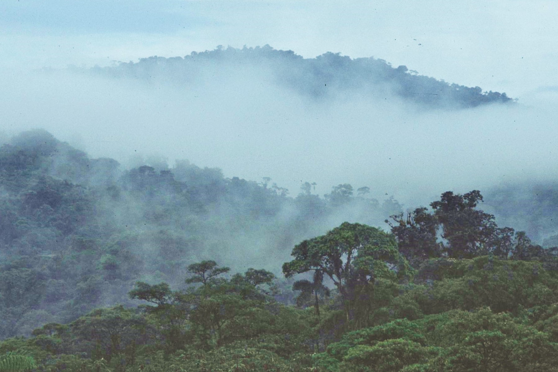
The Park is named after the volcanic peak, Volcan Sangay, one of the most active volcanoes in the world. Along with Sangay, a number of other peaks, including El Altar and Tungurahua, rise above the permanent snowline. Another characteristic feature of the park is the huge variation in rainfall. The western part of the Park lies within the Central Valley of the Ecuadorian Andes, the Valley of the Volcanoes. This is a rain shadow area, with only 600mm or so of annual precipitation. However, just a few km to the East, largely due to the condensation effect of moisture from the steamy Amazon jungles below, the precipitation can be an unbelievable 5000 mm per annum. To put this in perspective, the average precipitation in Glasgow, in rainy western Scotland, is a mere 1200mm by comparison, or just over one fifth of the amount of Sangay National Park.


It’s fair to say then that Volcan Sangay National Park is a pretty damp place indeed by any standards. Added to this, the precipitation falls mainly as snow over the higher ground (above 4000m or so), where freezing conditions are frequently encountered, despite the fact that the Park is located almost “slap-bang” on the Equator. Conditions are such then that the Park is certainly not the place for a casual Sunday hike; in reality it’s a very harsh place indeed given the constraints of climate and terrain !

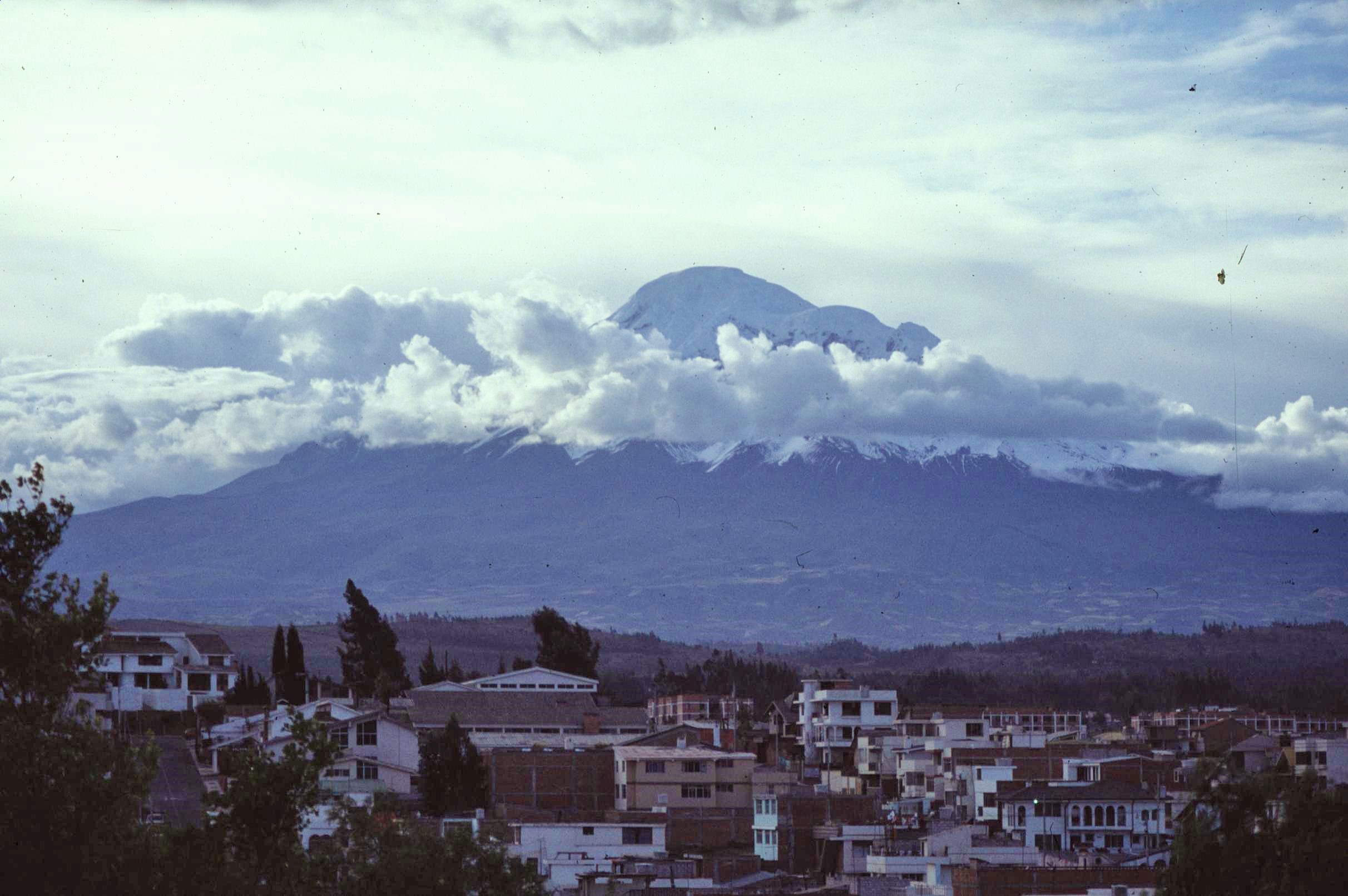
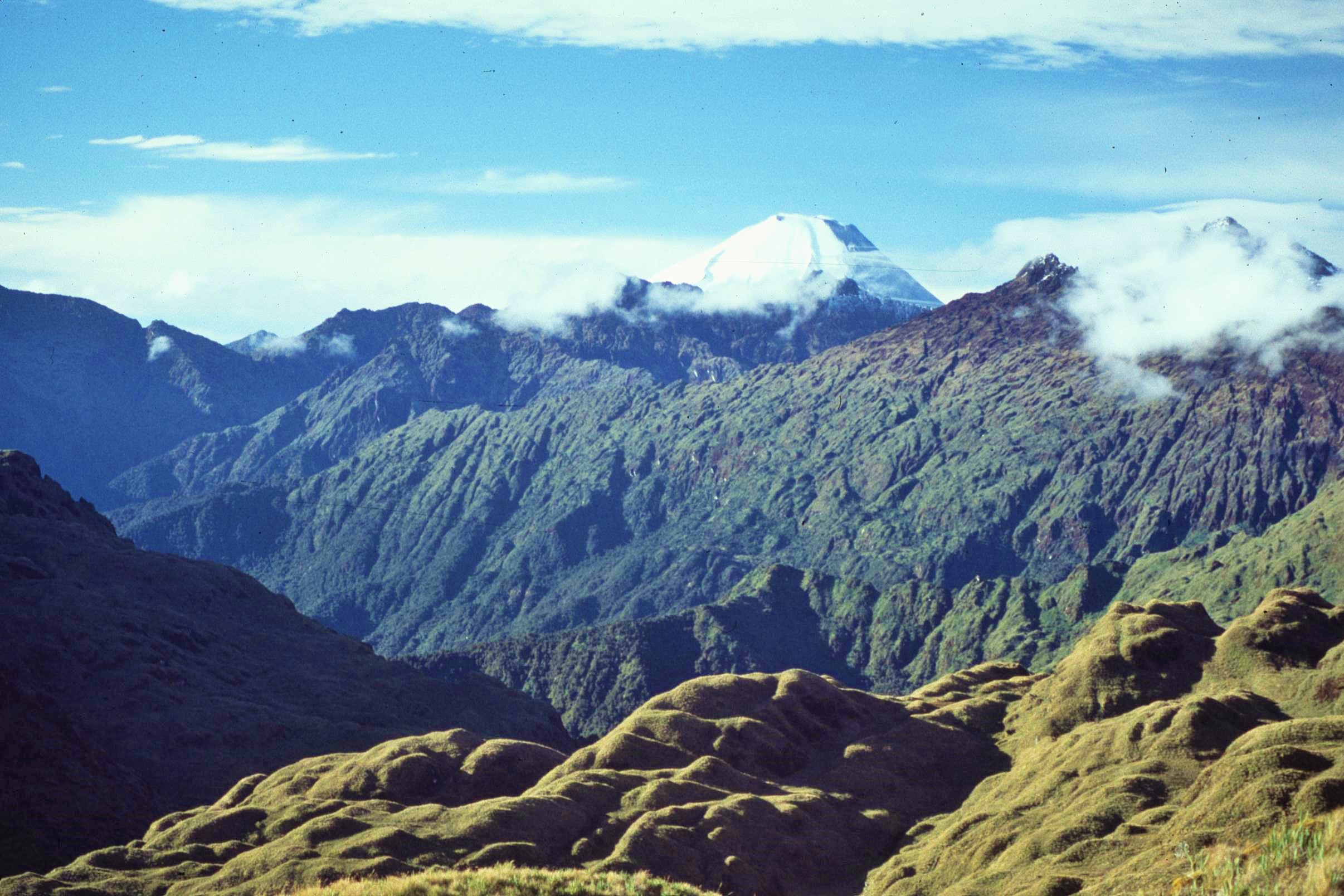
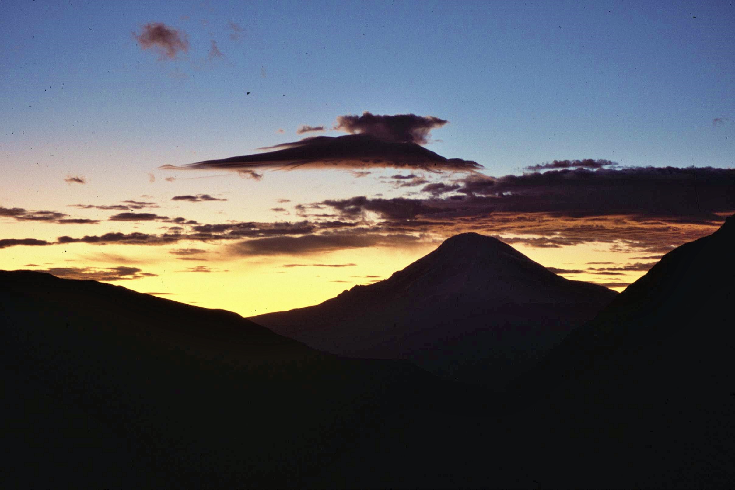
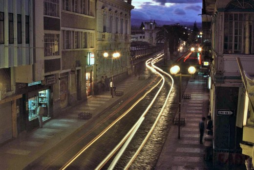
We started our expedition from a base in the medium sized town of Riobamba. The town is located at an altitude of around 2,700m in the Valley of the Volcanoes. From Riobamba, the view is dominated by the huge snow-capped mass of Chimbarazo, Ecuador’s highest mountain at 6263m, a currently inactive volcano. Chimborazo’s summit is also the farthest point on the Earth’s surface from the planet’s center as it is located on the equatorial bulge. It was made famous by early British explorer Edward Whymper (also one of the first people also to climb the Matterhorn) in his famous book, “Climbs Amongst the Great Andes of the Equator”. The opposite side of the Central Valley, adjoining the boundary of the Volcan Sangay National Park, is fringed by the iconic serrated outline of “El Altar” peak – another extinct volcano, the center of which collapsed following previous eruptions, leaving behind only a distinctive ridge, which once formed an edge of the volcanic crater.
Our initial plan was to head to the high altitude páramo grassland to the South of El Altar. With some assistance from the Sangay National Park staff, a park jeep would be used to ferry equipment and expedition members to the start point, thus allowing access to a high valley leading in an easterly direction. We would hike along this valley towards a mountain pass, which would permit a relatively easy approach on foot (and using porters) over the watershed separating the Central Valley of Ecuador from the Amazonian region. An expedition “base camp” would then be established on the other side, in a strategic location which would allow a number of different research projects to proceed simultaneously.

Local porters with mules were to be hired to carry expedition supplies (including camping gear, provisions and scientific equipment) across the pass to the proposed base camp site on the other side. This would be accessible to a range of sites including the páramo grasslands, glacial lakes and the upper parts of the cloud forest. From the study sites, we aimed to collect voucher plant specimens and lake water samples. A special drying kiln (using woodfuel obtained from the forest) would be used to dry the collected plant specimens, which would then be pressed, documented and packaged (using recycled computer paper) for transport back to the UK . Paper for pressing the plants wouldn’t be and issue as we had, optimistically, brought 30kg or so specifically for this purpose !

After finishing the work, expedition equipment would then be carried back out by ourselves (as the load would be much lighter without food) to the prearranged rendezvous with the park rangers vehicle. The food itself consisted largely of healthy, but bulky, fresh ingredients such as potatoes, carrots and other vegetables. It was decided that the volume would not be a problem though as the porters would be taking us directly to the base camp location and we wouldn’t need to move much in the way of heavy supplies.

It all sounded just too good to be true ! The route to get over the pass, apparently involved little ascent and would be an easy hike – although no topographic maps actually existed of the area to be able to confirm this or not; there would be a reliable team of experienced porters to get us to the base camp site. Furthermore, we would have a good sheltered location to work from where we could undertake a range of projects simultaneously. What could possibly go wrong ? Well… almost everything as it later transpired !

It didn’t take long for the cracks in the plan to show. I started to have my doubts as soon as we were introduced to our head porter and guide, a somewhat shifty looking individual who we came to know as the “Shadow”, during our brief period of acquaintance. He gave us an inspiring introduction…
“See this !”, he said, pointing to some random vegetation, “We don’t touch this ! We move like shadows, effortlessly over the land – like the wind through the grass; taking nothing and leaving nothing behind us – not one single trace of our passing…”


Whilst Chief Seattle himself (had he existed) might have been proud of this environmentally charged speech, the actions of the “Shadow’s” team didn’t quite concur with this. In fact, one of the “Shadow’s” men, in the meantime, was busily doing his best to set fire a perfectly innocent bush with some kerosene and a cigarette lighter, as a seemingly arbitrary whim; expressing whoops of delight at the small but meaningful blaze he’d just managed to kindle. Perhaps then the Shadow’s environmental claims, like many of his other statements, would be rather open to question.
After a rather tense departure we set off slowly up the valley. My sense of foreboding was indeed soon proved to be justified; in reality and in complete contrast to our plans, the trail barely existed. Conditions under foot were rough, slippery and difficult, eventually causing one of the mules to stumble with its full load and roll down a steep ravine where it lodged upside down in a tree. Fortunately the poor beast was ok and could be extracted, albeit following a complex and time consuming rescue exercise.

The route to the pass was certainly not flat at all, but climbed steadily for a good few hundred meters towards the summit of the col, above steep drops. It seemed that the information we had received on the feasibility of the route was incorrect, to say the least. To make matters worse, the porters staged periodic strikes, demanding higher pay for their work. Following a few tough periods of negotiation by Paul, the expedition leader, the journey continued onwards in fits and starts with repeated standoffs with the porters. Progress was slow and painstaking indeed. Things finally came to a head, just short of the summit at around 4000m, when after one final strike, and yet another tense and failed negotiation, the porters finally walked out on us.
Oh, the best laid plans of mice and men…

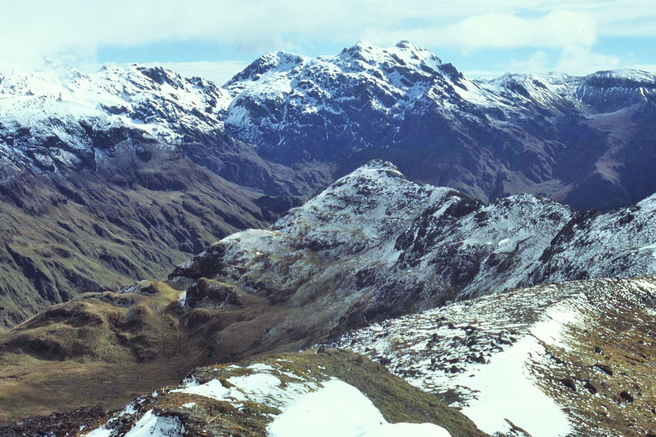
And so, following the dramatic and untimely exit of our porters; that’s where we found ourselves – abandoned at the top of a desolate pass, in the middle of the Andes, with several sacks of potatoes, 30kg of computer paper and a huge heap of miscellaneous expedition detritus at our disposal. There was no way that our small team of 7 could possibly move all this equipment, either very far or very quickly. The location at the top of the col, made Rannoch Moor in my native Scotland seem positively inviting by comparison. Just about 100m above us was a permanent snowline of the forbidding and unassailable looking El Altar. In short we were definitely up shit creek without a paddle (or a porter) in sight !
We desperately needed a plan and sat around to thrash one out. Going back didn’t seem much of an option and would have been decidedly counterproductive given that we’d come this far already. Our one concession to anything resembling a map, was an aerial photo of the terrain, which must have been taken on one of the couple of clear days per year in that neck of the woods. It showed a couple of small glacial lakes in a hollow not too far from the top of the col, down on the other side. We decided that the best plan would be to recce the nearest of the lakes and find out whether it might be possible to establish a camp there; preferably before dark which was fast approaching.

Leaving a big pile of gear at the top of the pass, we went down to check out potential sites. The lake shore, whilst not altogether sheltered, certainly offered a little more protection from the elements that at the top of the col. The ground was pretty sodden, however we found a little area on a rise which was somewhat less boggy than the surrounding terrain and was just about “doable” as a camping area. The lake had a slightly mysterious, Arthurian quality about it in the fading evening light, which seemed oddly appealing. However, no hand bearing Excalibur, or any Inca equivalent, appeared from the murky waters.
So with sterling effort that evening, we did what we could to make the most of a not-so-ideal situation. The tents were pitched, more gear was brought down from the top of the pass and a hot meal was cooked using freeze dried camping food on a small Trangia stove (the fuel for the big stove still being still in “transit” at the top of the pass). Eventually, tired and reasonably happy we crashed out for the evening, secure in our tents. The rest of the gear could wait until the next morning…
That morning we awoke to find a minor “blizzard”, a layer of heavy, wet snow blanketing the tents and the surrounding landscape (much of which was oppressively shrouded in low cloud). After emerging from our tents, unenthusiastically, half the group headed off to ferry some more luggage from the top of the pass; including our large cooking stove, some sacks of potatoes and fuel for the stove. Meantime the rest of us did the best we could to make the place shipshape and prepare a basic breakfast, in less than pleasant conditions. It wasn’t long before the portage team returned from the top of the pass laden down with gear. Long faces in the distance indicated yet more potential woes – this proved a correct analysis.

All our fuel had gone ! It had seemingly vanished into space overnight ! We considered the possibilities – most likely, it been stolen by someone who’d been watching our movements the previous evening. Whilst it might be easy to draw snap conclusions about who that could be (particularly given the tense standoff with the porters and the “walkout” the previous evening), the fact is we had nothing concrete to go on. More importantly, we had no fuel whatsoever and pointing the finger of blame for our predicament at this time didn’t seem particularly useful. At least we were still here, we hadn’t been murdered in our sleep. Maybe it could be worse…
However, positive thinking aside, we were in a tricky situation: seven people, in an exposed location and with only one small and inefficient Trangia stove to cook with and a heap of slow cooking, bulky provisions to rely upon for the next couple of weeks. In addition there was very little shelter and access to many of our proposed study sites looked problematic due to the tricky terrain and conditions under foot. Nevertheless we decided to remain positive and to progress with whatever work we could undertake in the circumstances.

The next couple of weeks certainly proved to be challenging. Despite the awkward situation we put a brave face on things and started to get under way with our research work as far as was possible. Firstly, work was started on the collection and analysis freshwater samples from the lake using a small inflatable boat, brought there specifically to collect samples from different depths across the lake. This involved looking at aquatic life, micro organisms and the chemical composition and PH of the lake water. It was relatively easy to undertake this research given our location next to the lake, however it didn’t really provide a huge amount for labour for most of the team to involve themselves in.

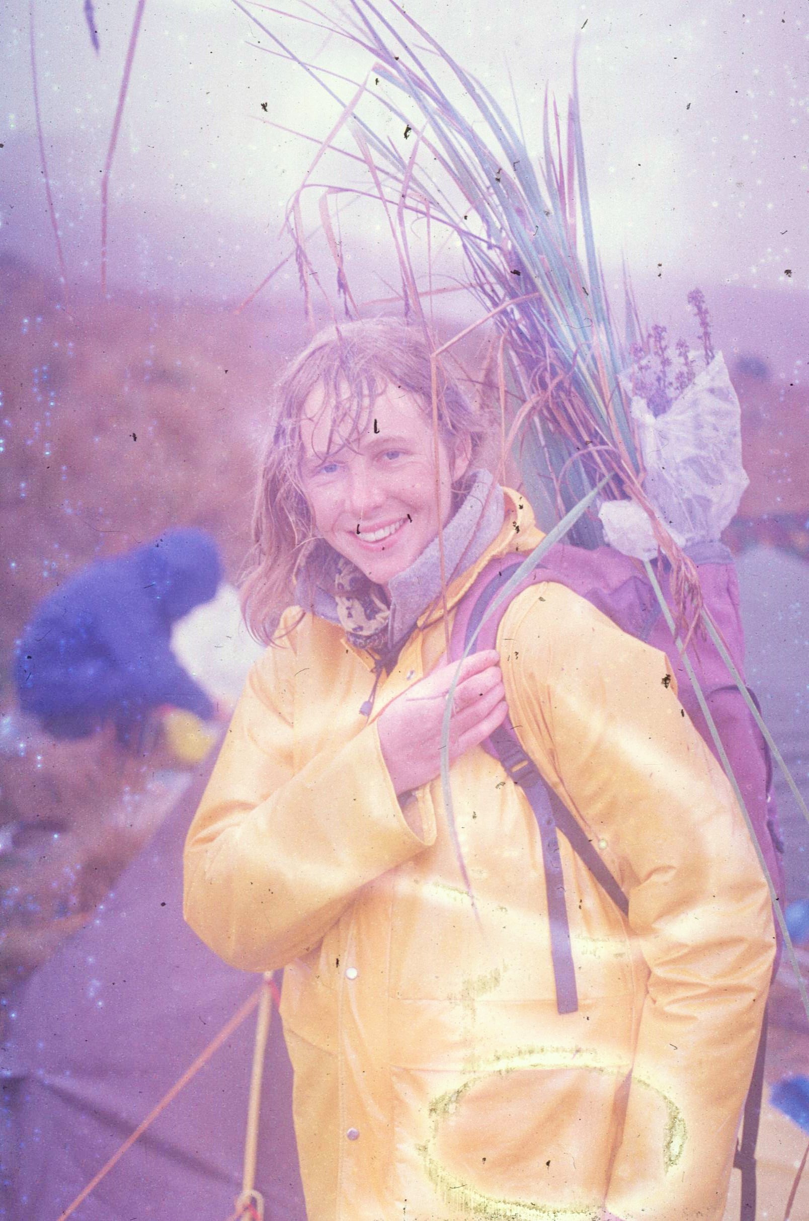
In addition, the plants and ecological habitats of the of the páramo grasslands were surveyed. Samples of characteristic plants were gathered including mosses, lichens, liverworts and various grasses which would later be packaged up, dried and brought back for identification at the Botanical Gardens in Kew, thus also creating a small income stream to help finance the project. In addition to these small and unobtrusive plants, there are some highly distinctive and characteristic species found in the páramos of Ecuador. These included giant puyas, strange erect, triffid like plants surrounded by a rosette of prickly leaves around the base.

During the course of our stay by the lake, we made several attempts to get down to the headwaters of one of the main river valleys where we would be able to undertake surveys of the upper cloud forest and where, potentially, we might find a more sheltered and attractive campsite. Every attempt however ended in failure, causing us to turn back frequently due to tricky terrain, steep ravines, cliffs and wet slippery conditions underfoot, all which all rendered further forward progress impossible without too higher degree of risk in this remote location far from help. The lack of any proper topographic map also made navigation next to impossible in the thick. Indeed, on one occasion (even with a compass) we found ourselves just going round and round in a circle, such was the level of disorientation in the featureless, misty terrain.


From my perspective, I felt somewhat underemployed and took to sulking morosely in my sodden tent, behind an ever growing pile of empty tuna tins. It seemed frustrating that I wasn’t able to start work of my masters project, it being simply impossible to access the forests on the slopes beneath us. Rather strangely, one day for a bit of a distraction, if nothing else, we even tested a telescopic high pruning device – designed for collecting samples of fruit or flowers from high up in the tree canopy. This seemed altogether slightly surreal and ironic on the desolate paramo far from the nearest trees. On another equally strange occasion, a group of about 15 smiling youths, dressed in casual city clothing suddenly appeared out of nowhere, asking directions for somewhere beautiful and “chilled” to go for a “nice picnic” – they wandered off, vanishing again into the mist towards a ravine as mysteriously as they had appeared – or was that just perhaps a hallucination (fortunately nobody was singing “Brown Girl in the Ring” by Boney M at this point…).
Worst of all though by far were the the tricky cooking arrangements. These made it difficult to prepare any proper meals, as cooking potatoes and other vegetables on a tiny Trangia stove was just about impossible and completely inefficient (even more so given the high altitude) when precariously balancing a heavy and oversized pot full of vegetables on its edge. I remember one particularly bad evening when, after battling to cook the reluctant ingredients for about 3 hours, the nominated cook knocked the whole pot and all its contents over onto the grass, rendering them pretty much inedible. Although nothing was said, it’s fair to say that looks could kill !! That evening, we ate cold tuna alone in our tents from what I remember; such was the tension and the remains of the meal being unsalvageable.

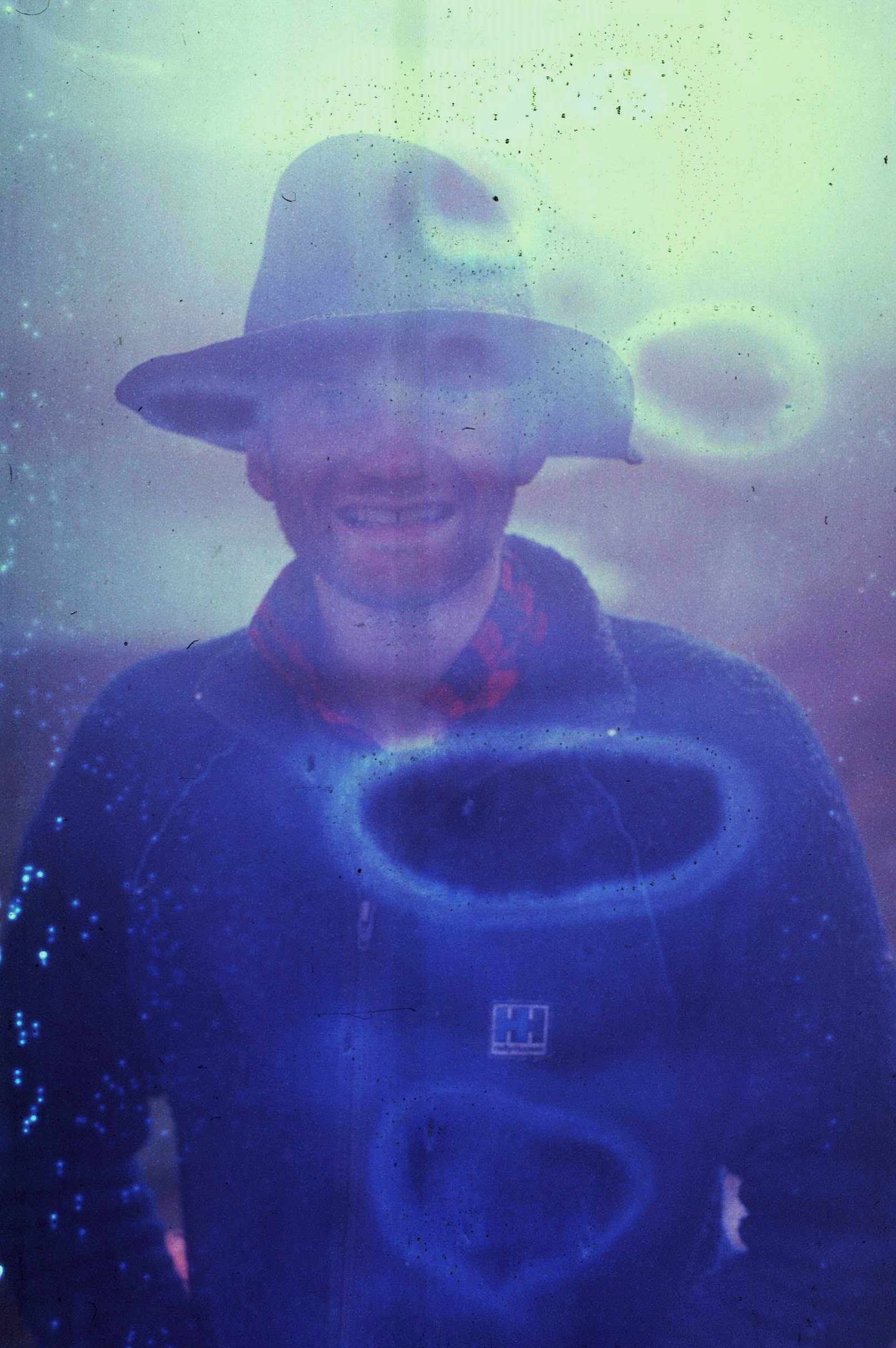
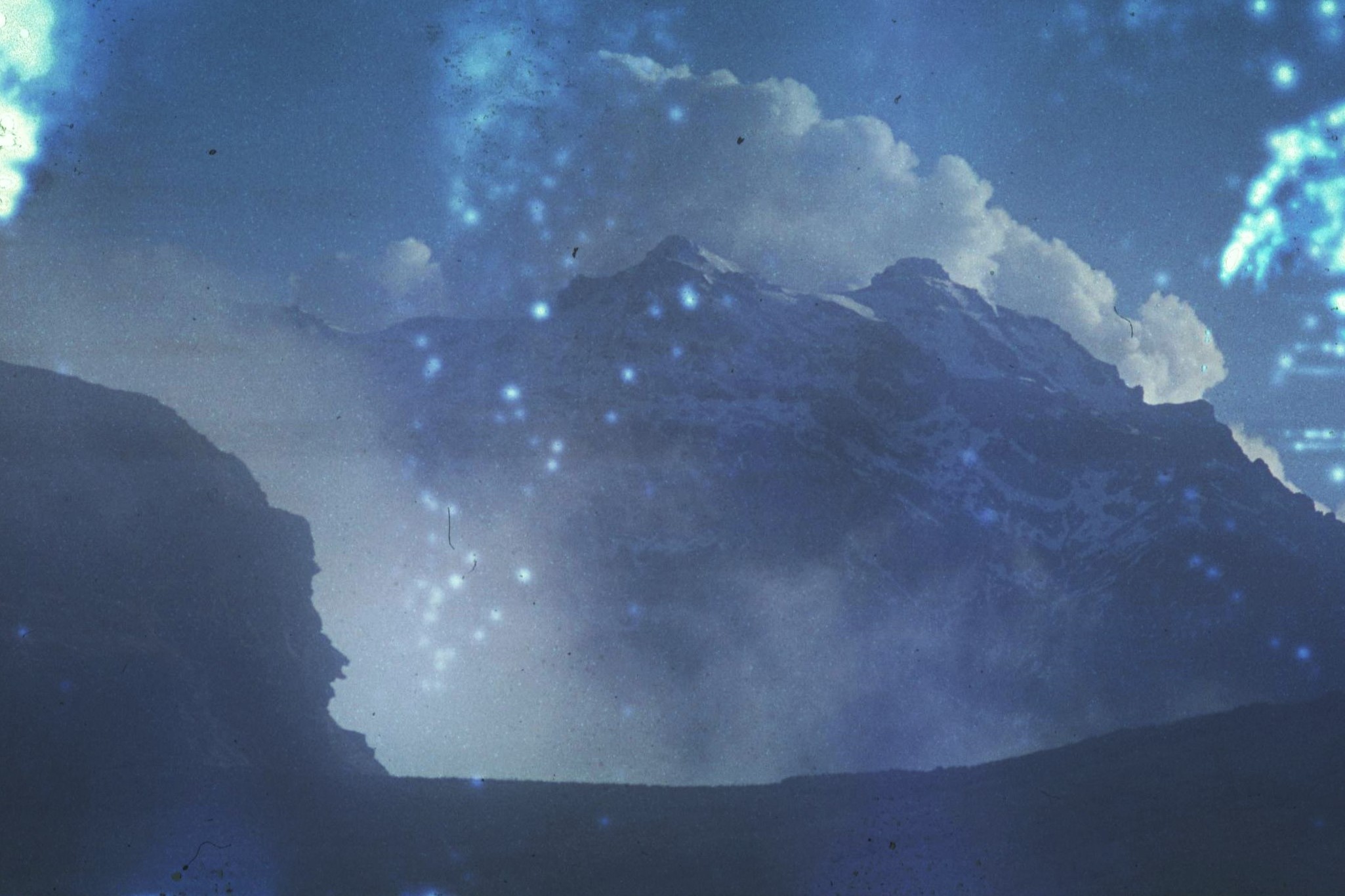
Work also proceeded slowly. The situation was compounded when my camera also fell into a bog and was completely submerged. I was mortified; however, lucky enough I had a bombproof manual Olympus SLR with me. Amazingly, my trusty old friend survived the ordeal and still managed to produce photos despite its underwater adventures (it still works more than 30 years or so later). Immediately following the submersion, my long suffering camera managed to capture some marvelous and surreal “art-house” style compositions which somehow caught the atmosphere of the situation far better than “normal” photos might ever have done.


The climate certainly didn’t play out in our favour. Everyone was constantly soaked to the skin and there was simply nowhere to dry clothes or equipment in our small and damp tents. Problems of damp were compounded by the fact that some of the team had down sleeping bags which immediately lost all there thermal insulation value when saturated. The rainy and misty conditions during the day were accompanied by night time temperatures which dropped below zero, when the sky would miraculously clear and it would stop raining until first light when the deluge would once again continue. Fair to say, this was completely soul destroying.

Although dramatic starry skies and views of the snowy bulk of El Altar in the moonlight were impressive, the climatic conditions were a disaster in terms of keeping, already chilly, team members at a reasonable temperature. In the end, a few of the team had to share sleeping bags just to avoid the worst excesses of hyperthermia – a real threat in this situation. Meanwhile our campsite was reduced to something resembling a muddy World War 1 battlefield scene with random pieces of equipment strewn around everywhere across the bog – nobody having the motivation, or the willpower to do very much about it, given the oppressive cold, windy and damp conditions. There were times nobody wanted to come out their tents at all – really things were getting pretty dire by this stage.

After a week or so of existing in such unpleasant conditions; having survived spilled pots, constant damp and freezing nights, we were finally blessed with some clear and sunny weather. With theatrical unpredictability, the clouds suddenly rolled back to reveal the dramatic “Middle Earth” landscape of snowy peaks, rocky crags and impenetrable ravines. Most striking of all, the enormous pyramidal bulk of Volcan Sangay, hovered ominously above the horizon, as if somehow suspended upon a thin layer of cloud, in the manner of a ghost castle from a maritime mirage.
This was a harsh and an uncompromising landscape and certainly not anything resembling a cosy Lake District scene, where a National Trust tea shop (or even better, a pub) might be lurking conveniently just around the corner. Indeed Volcan Sangay itself seemed the very essence of Mt. Doom, and about as appealing. Though for one of the most active volcanoes in the world, we observed no signs of eruptions – perhaps resulting from the fact we couldn’t see very much of anything for most of the time.


Having endured 2 weeks in “Camp Hellhole”, the team finally agreed it was time to make a tactical withdrawal, to altogether friendlier terrain and climate. The freshwater team and those looking for mosses and grasses on the páramos, also decided that they had also had enough and had collected enough data and specimens to justify the Calvinistic suffering of the preceding days. I must admit to feeling rather happy about this decision and looked forward to getting the hell out of there asap.
The plan was then to go back across the col, ferrying gear and equipment over the pass in stages and then to establish a camp down on the other side of the watershed, where conditions were more favourable. This would also allow access to some fragments of high altitude forest which were characteristic of the Central Andes. So, instead of the threatening bulk of Volcan Sangay to the east framing our view, it would now be the lofty heights of Chimborazo to the west, silhouetted by the light of the dying evening sun. This view seemed altogether more appealing.


Immediately we crossed the col to the other side, conditions improved dramatically and the sky was clear instead of the constant cloud and mist that we had experienced over the last couple of weeks. There was now no more rainfall to speak of – it was a different world altogether, all the stranger for the fact that it was only just a few km away as the crow flies. Getting the gear over the ridge was a different story though. This mammoth task requiring endless exhausting shuttles to get everything over, with one team taking everything to the top on the eastern side and another group shuttling it down on the Western slopes. There were tents, survey equipment, bulky food, personal baggage and yes, of course, the computer paper… (hmm yes, the computer paper…). Eventually after a day of hard portaging, we’d managed to get the bulk of the gear over onto the friendlier side of the mountain and to get our new campsite established.

The contrast couldn’t have been greater, we had a nice dry camping spot and were even able to get a campfire going which we could use for cooking. This seemed like luxury indeed compared with past days. Even better, I was able to start work on my first forest plot survey with much appreciated assistance from other team members. The valley was characterized by a special type of high altitude woodland called Polylepis, a family of shrubby plants which only grows at such high altitudes in the Andes. The composition of the woods is unusual, with a tortured and twisted form of also single species stands. After familiarizing the team with the essential measuring equipment, we got to work – it felt good to be getting on with something positive for once and progress increased rapidly following a sharp learning curve.
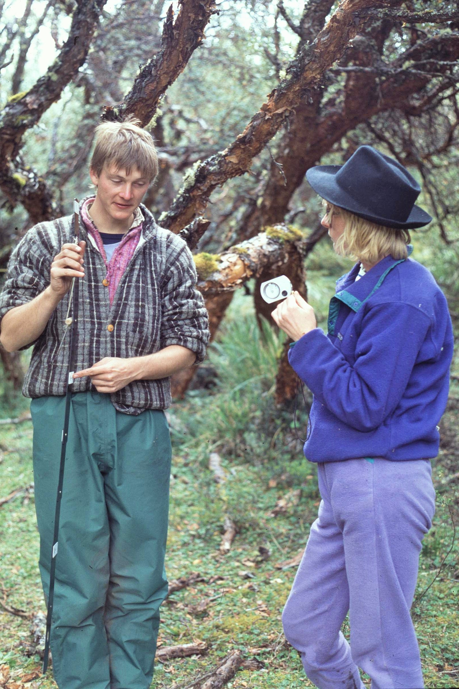
There was though a small hiccup here too. We had brought along1000 aluminum tree labels for our survey work, to enable the tress to be marked and then identified at a later date. These were all organised in a numbered sequence on a wire, for simplicity of access. Tree number 1 went just fine, followed by the next 50 or so, until some overzealous team member (to remain nameless) dropped all 1000 onto the ground in a beautifully chaotic and random heap – perhaps like the incident of the spilled potato pot all over again. This time though, there was no get out clause, the culprit having the unenviable task of sorting out all 1000 labels into the right order again – a challenging task indeed, guaranteed to test even the most patient.


And so, following a day or 2 of intensive recording of the research plot, our work in the area was finally finished. It was time to collect up our gear again (in stages of course), hike out and make for our prearranged rendezvous with the National Park staff, who were fortunately waiting for us as planned. As we bumped and jostled back down the unsurfaced mountain roads to Riobamba in the park ranger’s vehicle, it was a good chance to reflect upon our experience. It had certainly been a long 2 weeks or so; at times bounding on sadomasochism and pushing the margins of what might be reasonably tolerated in the name of scientific research. Perhaps we emerged stronger from the experience though and certainly just a little bit wiser when it comes to expedition planning – particularly when it comes to not taking the information of others at face value.
It’s fair to say though that when we got back to the hotel at Riobamba, a proper bed and a good night’s kip had never seemed so appreciated. Normal food and drink in the town’s various eateries and emporiums also had never, ever tasted so good ! We enjoyed some well- earned days of R and R, taking in some local cultural highlights, like when the police brass band try to outperform the army band in the Town Square (ear protection essential).

The fact remained though that the expedition was certainly not over – we had only surveyed one of the forest sites at around 3,800 and still had several more to do at different altitudes down to the tropical forests of the Amazon Basin. Nobody was going home just yet or even simply going AWOL – though I must admit the inviting thought of the latter did occur to me at this point ! A couple of things were certain though;
i) What was to follow certainly couldn’t possibly be worse than the previous couple of weeks and;
ii) I will NEVER, EVER go back to that lake again as long as I live !!
Follow the next chapter of the story – coming soon: “Hell & High Water: Ecuadorian Andes to Amazon – Part 2”
