
This post covers part 2 the “Sangay’89” Research Expedition – The expedition surveyed the natural ecosystems and biodiversity of Volcan Sangay National Park in Ecuador, from the High Andes to the rainforests of the upper Amazon Basin.
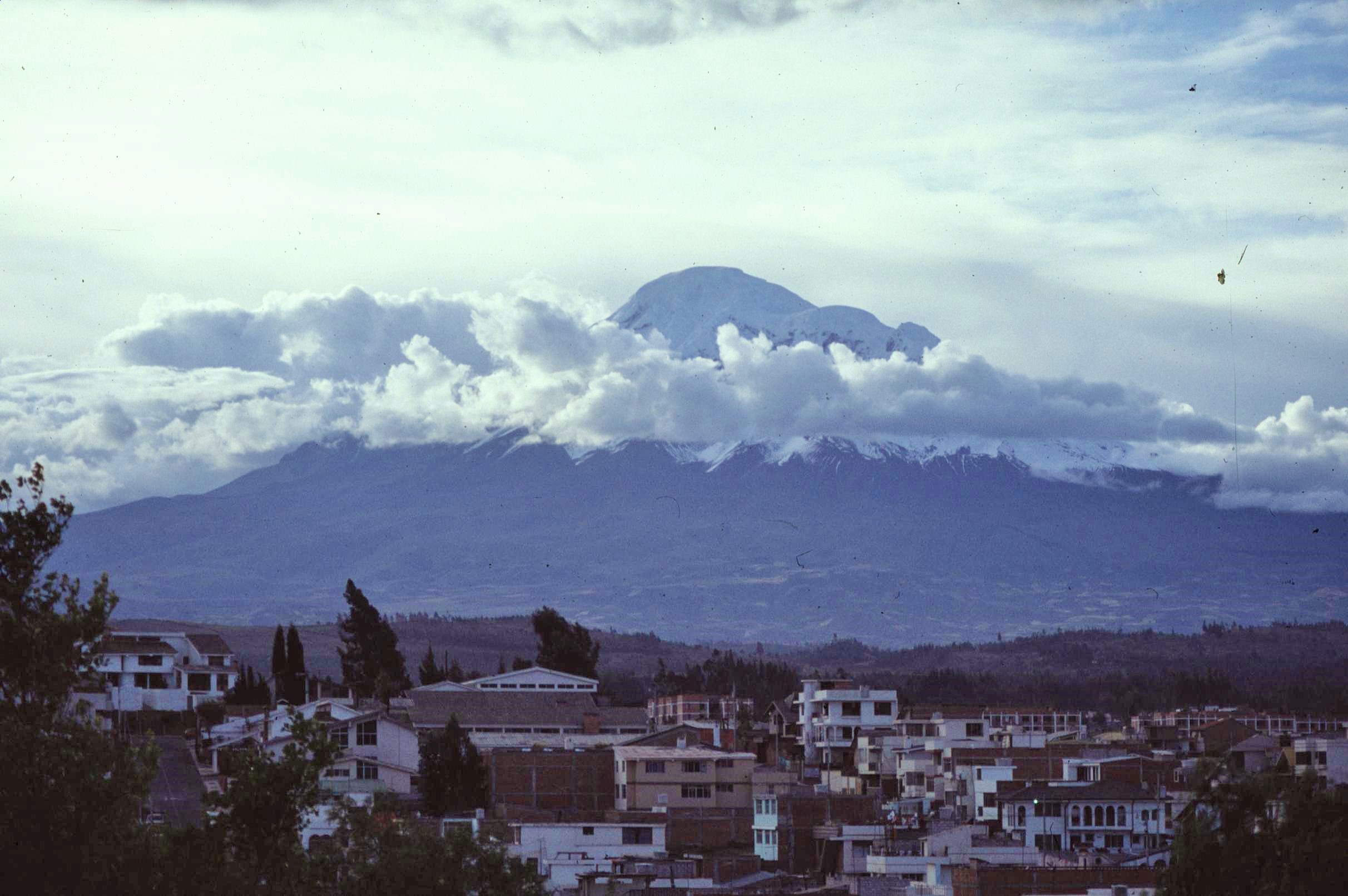
In Part 1 of this story, I covered the background to the University of Wales expedition to Ecuador in summer of 1989 and the first challenging couple of weeks in the Eastern Cordillera of the Andes. These were spent in the high altitude páramo grasslands, at around 4000m in altitude, in the shadow of the the soaring, snow-capped, volcanic peak of El Altar.
As explained previously, things didn’t go quite as smoothly as planned though during the first part of the expedition. After experiencing some really challenging conditions, withstanding the elements and one or two other unpleasant surprises (including most of our fuel being stolen), we returned to the City of Riobamba, battered and bruised, to lick our wounds and catch up with some much needed rest and relaxation. This is where I once again pick up the story again:


The first part of the expedition had certainly been tough, without a doubt. However, although things had been pretty dire at times, in an exposed and boggy campsite, we’d managed to collect a lot of data and vegetation specimens from the high altitude páramo grasslands and also from one or 2 freshwater lakes in the vicinity. On the way back to Riobamba we’d also surveyed one high altitude area of native forest known as “polylepis” woodland. The awkward fact remained though that there was a lot of work to be done, if we were to fulfill our aim of surveying forest study plots all the way down to the upper Amazon Basin – over 3000m lower in altitude but only 40km or so away as the crow flies.
The Sangay National Park Rangers suggested that we might find it possible to get to the montane forests on the Amazonian side of the Andes range by following the valley of the Rio Palora, an remote easterly flowing river valley. We had previously tried in vane to descend to the headwaters of this river, from our previous campsite, but had found our way continually blocked by impenetrable terrain comprising of cliffs, steep ravines and dangerous slippery ground. It had proved an impossible challenge.
The park rangers however claimed that access was possible to the Rio Palora via another valley called the Aloa Valley. They informed us that from there it would be possible to cross a saddle and descent via a “proper” trail to a location called “El Placer” which was considerably lower in altitude at 2,700m and would give us access to a diversity of different forest habitats. Being gluttons for punishment and not wanting to go home empty handed, we decided to give it a go – even though the “once bitten, normally twice shy” rule applied also to us as to everyone else.


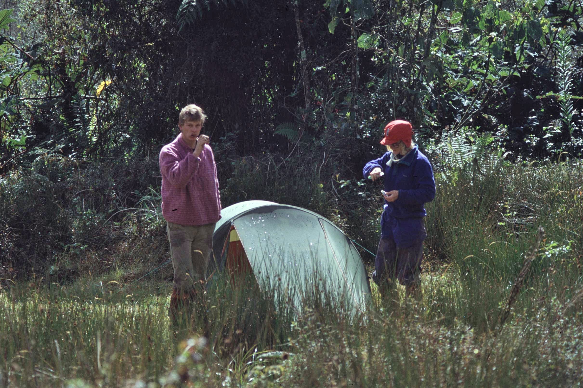
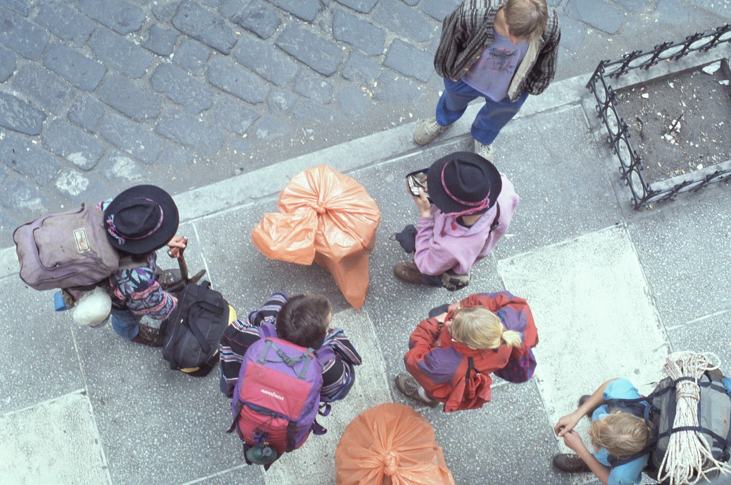
We still had a few days in Riobamba though to recover from the last excursion and to make preparations for the next one. This time we wouldn’t be caught out: we’d travel much lighter, carrying everything we needed in our backpacks and without the benefit of awkward porters and their temperamental mules to deal with – both of which might go on strike without warning. Our food would also be more appropriate and include much more in the way of dried and lighter-to-transport ingredients. And as for the 30kg of computer paper for pressing plant specimens – well that could definitely stay behind this time…
However, before we left Riobamba, we were able to use up a good quantity of the computer paper supply in the hotel lobby, for pressing and drying the plant specimens that we’d collected from the páramos, which mainly consisted of unimpressive looking mosses and liverworts – many of which, it transpired later, were previously unrecorded by scientists. It did strike me as rather odd though to set up a plant pressing production line on a hotel landing. I couldn’t really imagine doing that in a “Travel Lodge” in Britain – but then in Ecuador, it seems that anything goes (and it did somehow blend in with the rather “lived in”, fading grandeur of the hotel surroundings).
 So a few days later, fully refreshed and ready for action, the park rangers took us along a tortuous winding mountain road in their 4 x 4 jeep, first south and then towards the east and into the Aloa Valley. It was a rather damp and drizzly spot where they dumped us, bidding us a hearty farewell and bon voyage. However, despite the drizzle and the ubiquitous cloud, undeterred, we packed up our gear and readied ourselves for the hike in to the Rio Palora Valley. It was certainly easier to get moving without complex negotiations with porters this time.

Our route took us along the valley which runs initially in a northerly direction. Near the end of the valley, the path veers off to the left and then climbs progressively, at an easy incline, to an obvious saddle – the location of a mysterious lake known as Leguna Negra. The lake has a misty and rather eerie atmosphere about it and has many legends associated with it. Locals say that its dark waters conceal sinister secrets and that care must be taken in it’s vicinity, lest the water spirits try to rob you – it all sounded rather like the Scottish tales of kelpies – majestic water horses that carried victims to their doom through drowning them.
Other legends say that the Inca inhabitants of the region, threw their gold and treasure into the lake to avoid it falling into hands of the Spanish Conquistadors. Whatever the truth, I have to confess I didn’t really like the lake very much and found its dark waters and billowing mists rather oppressive, eerie and unwelcoming.

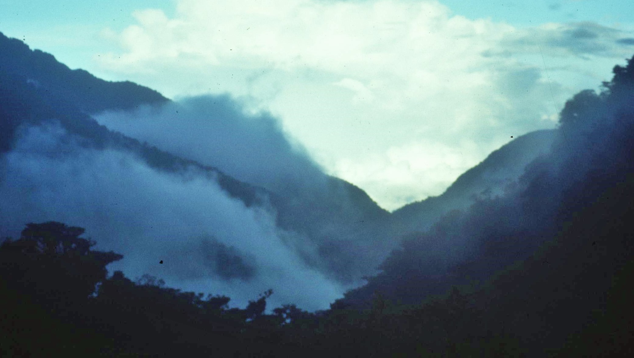
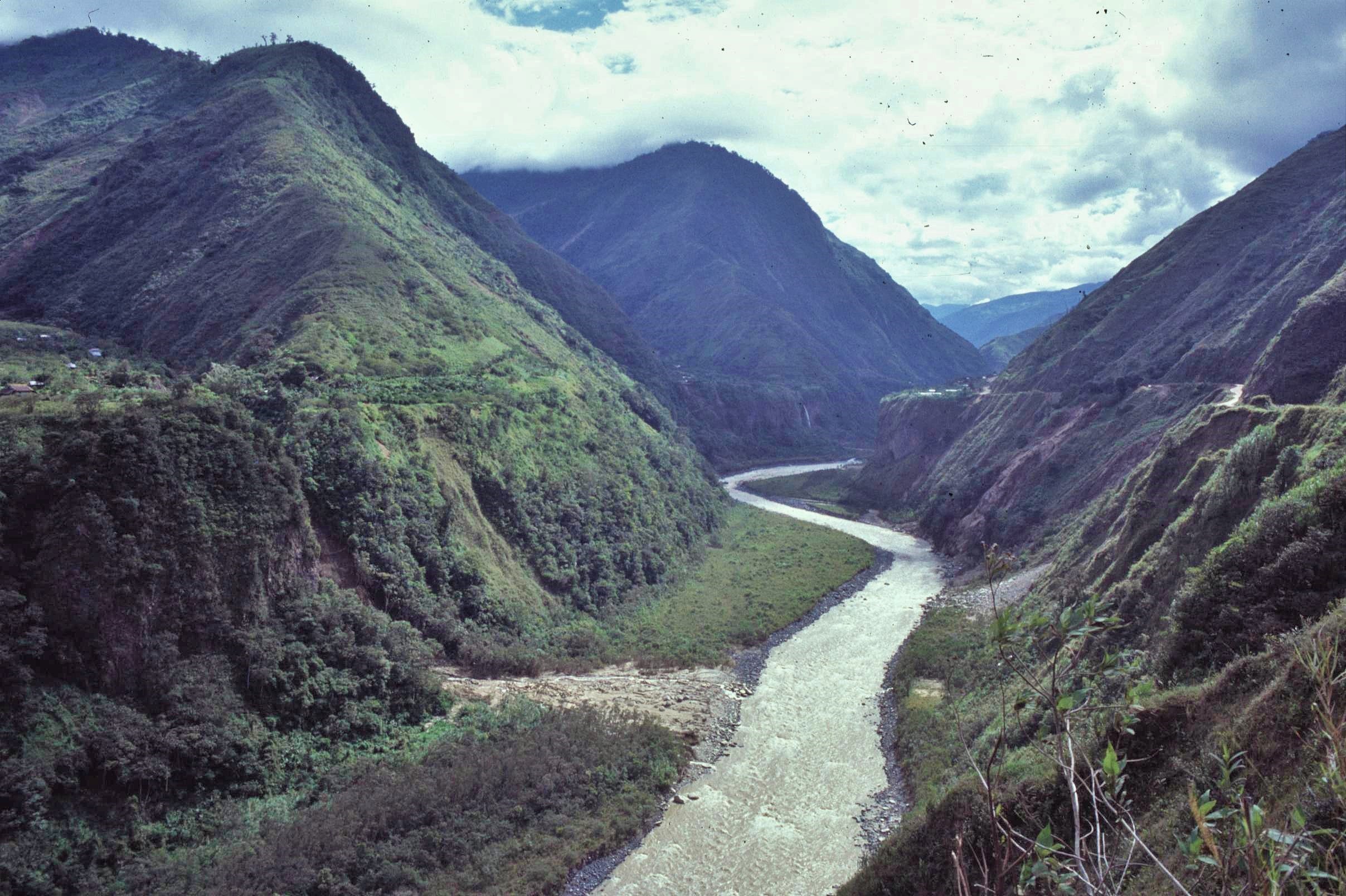
Passing by the lake unscathed, however, we reached the edge of the saddle and peered over the other side. Albeit for a fleeting moment, the mists parted and we caught a new vista open up below us to the mysterious east; this time down towards the headwaters of the Rio Palora, a minor tributary of other still greater rivers which eventually flow into the mighty Amazon and beyond to the Atlantic Ocean – some 3000 miles away on the other side of the South American Continent.
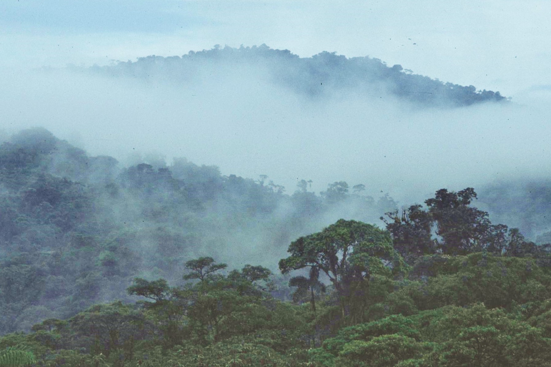
The rangers were better informed this time; there was a clear path down the steep valley for us to follow, which would take us into the cloud forest below. Whilst the valley looked more lonely and forbidding than attractive, there was indeed a route and no other option other than to follow it. We headed off down the steep slope, in the direction of Amazonia and whatever might befall us next.
It was a long, tortuous descent down the valley of around 1300 metres to reach the Rio Palora valley. It wasn’t long before the first shrubby growth, marking the edge of the cloud forest, came into view. Slowly the shrubs became stunted bushes and then finally trees as we progressed down the hill. The temperature also became noticeably warmer and the chilling effect of the wind lessoned as we lost altitude. At times the path became quite overgrown suggesting that this route wasn’t used quite so often.

After what seemed like an endless descent, we eventually reached a small grassy clearing at a place called El Placer in the river valley itself, at an altitude of 2,700m. This would be our camp site for the next few days. Compared with the campsite in the páramo, this seemed like the ultimate in luxury. The site was sheltered from the wind and it was located below the oppressive layer of semi-permanent cloud which had dogged our pervious location. In fact, it was almost even a bit of a sun trap and the weather was noticeably brighter here. Best of all however was that there was a basic shelter for cooking and generally for “chilling out” without the need to constantly stay in a small and claustrophobic tent – it was open at the sides and with a corrugated iron roof to keep off the rain; luxury indeed !
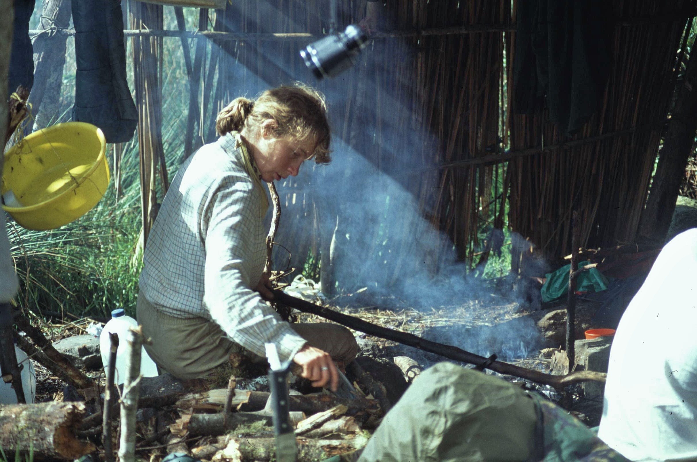

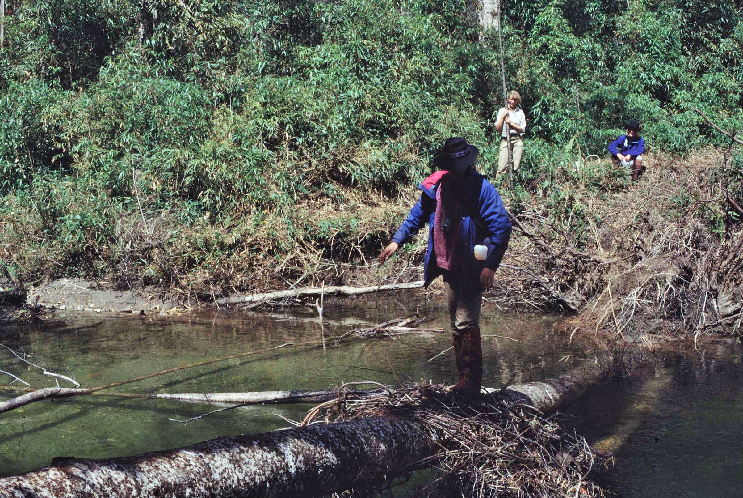
The “basecamp” at El Placer gave us convenient access to a number of varied survey sites, spread over an altitudinal range of a few hundred metres. The forest here was quite varied, with some mixed montane forest on the slopes and some single species alder stands on the lower, boggier ground. We soon set to work to identify, mark out and survey some sites. These were certainly challenging from a logistical and practical point of view. One of the plots could only be accessed by walking along a partly submerged log to cross the river, which was always an interesting activity. It reminded me of Robin Hood and Little John but nobody actually got a soaking.
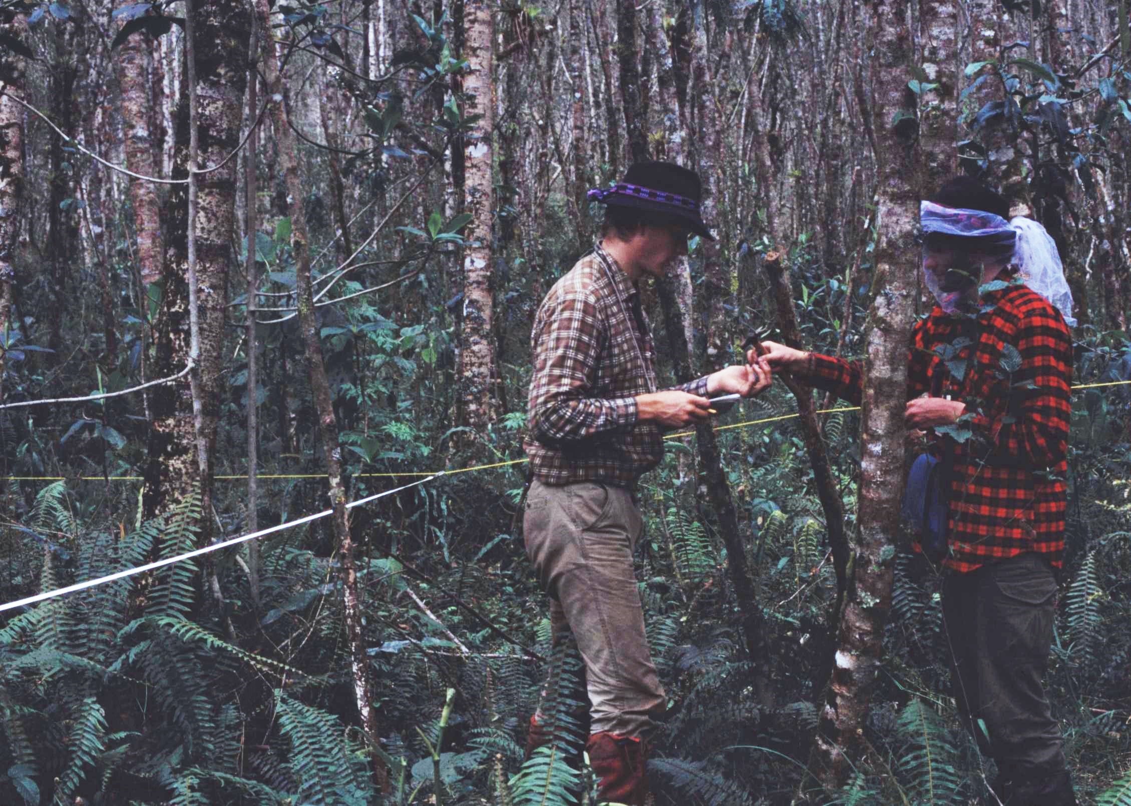
The work involved, first marking out the 60m x 30m plots with chord and then recording the tree girths, heights and the spread of the canopy in each instance. This was accompanied by details of species present (where possible), the total number of tree species found, the ground vegetation and the soil conditions present.
Survey work also had it’s own share of occupational hazards; in one of the plots we were constantly under attack from very large and aggressive horseflies which had a painful bite. Dealing with this menace, required an improvised veil tied around hat brims, to keep the irritating protagonists at bay. Another of the plots by contrast was situated over particularly rough and rocky ground, where at any given moment, you could find yourself suddenly disappearing into deep subterranean hollows, where the mossy ground was prone to giving way beneath your feet..

There was plenty of interest to see in the area from an ecological perspective. Along with the trees, there were other interesting plants to look at, particularly bromeliads. These are colourful parasitic plants that grow on the trunks and branches of other trees. The bromeliads are in fact like small pitchers and often contain miniature water worlds in their midst, sometimes with a host of other wildlife present, such as insect larvae and small tree frogs

The tree frogs themselves were most active at night, when they produced a harmonious chorus of bright chirping and “binging” sounds; overall a bit like the effect of a gentle breeze blowing through the suspended crystal elements of a chandelier. Curious to know more about the perpetrators of the frog symphony, we decided to go on a night time safari with head torches to try and collect a few of the noisy creatures.
Blinking in the torchlight, it proved fairly easy to track down and round up a good few frogs from following the direction of their night time chirps. The following morning we set up a “film set” comprising of a tree branch to take a few pictures of some of the frogs that we’d collected. It has to be said, that most of the frogs, though certainly vocal enough, were in reality quite tiny; being little bigger than the size of a finger nail. Following their fleeting moment of fame in our outdoor studio, the frogs were then released back into the wild to continue their froggy existence.


The mood and general morale of the whole team at El Placer was generally a much happier one that the previous campsite and certainly made all the more so, by the fact we could move around in dryer and more comfortable conditions. From El Placer, we had hoped that we might be able to head further down to Rio Polora valley to access the subtropical rainforest at lower altitudes, however a couple of recces revealed that the valley below here really was impassible and without any kind of trail that might provide any suitable access route. We therefore had to content ourselves, for now, that 2,700m was the lowest altitude we could attain on this leg of the journey.
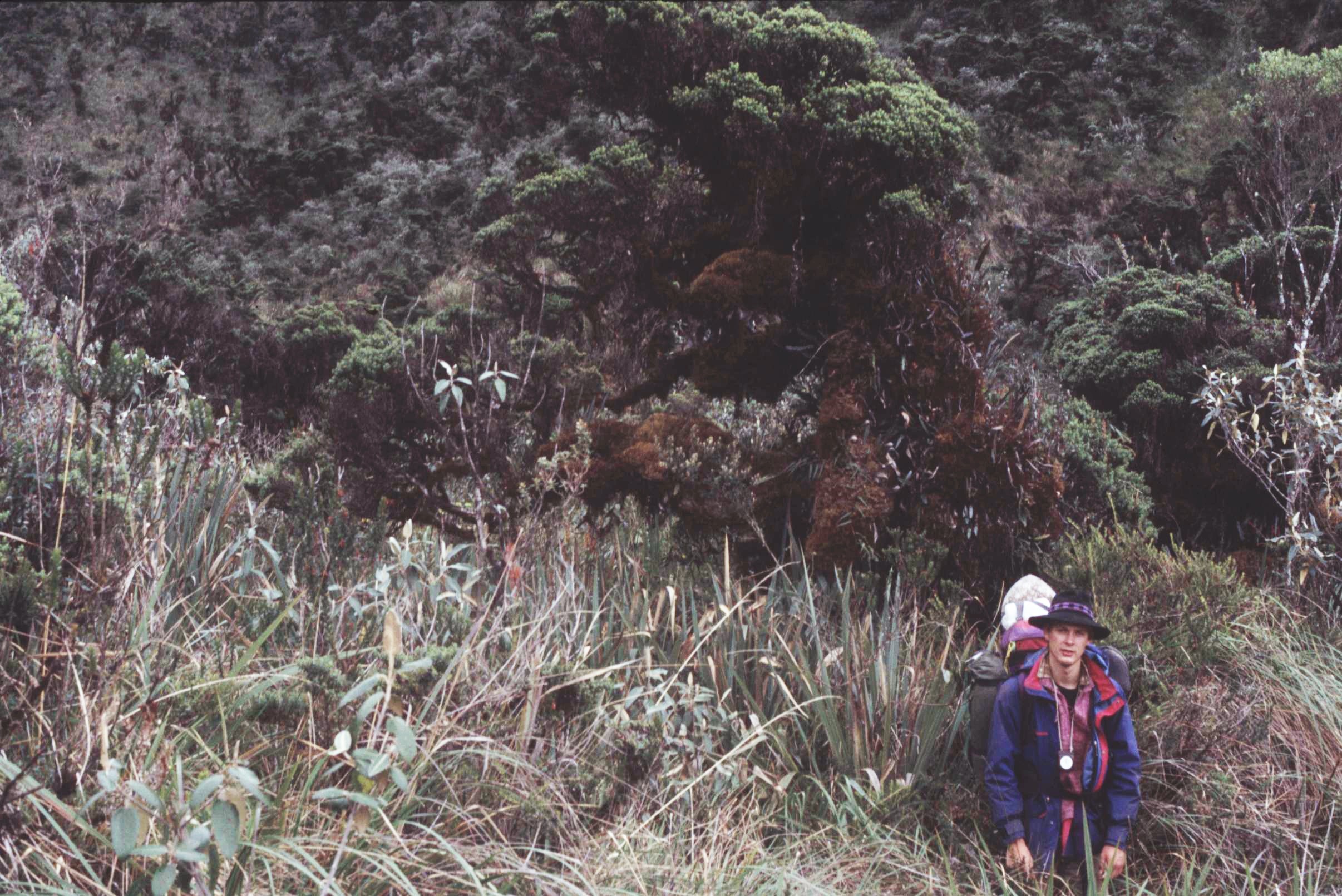
Having finished our forest survey work at El Placer, we decided to move back up the hill to undertake work on a couple of plots at intermediate altitude nearer to the tree line, in the so called “elphin” woodland. Although this didn’t offer quite the same high standard of accommodation as lower down in the valley, it was fine for a couple of nights and allowed us to gain access to new areas of the cloud forest. As ever there was the constant business of collecting plant specimens which would later be pressed and stored safely for transit back to the UK some weeks later.


After another couple more days and having then finished our work on the Eastern slopes, we made our way back over the top of the pass. We past the brooding and mysterious Leguna Negra and once again entered the Aloa Valley on the other side, where we wanted to identify and record, yet another, forest survey plot. We had no prearranged pickup from the National Park staff this time and so our plan was to hike down the valley to the village of Aloa and from there catch public transport, of some variety, back to the “Big City” of Riobamba.
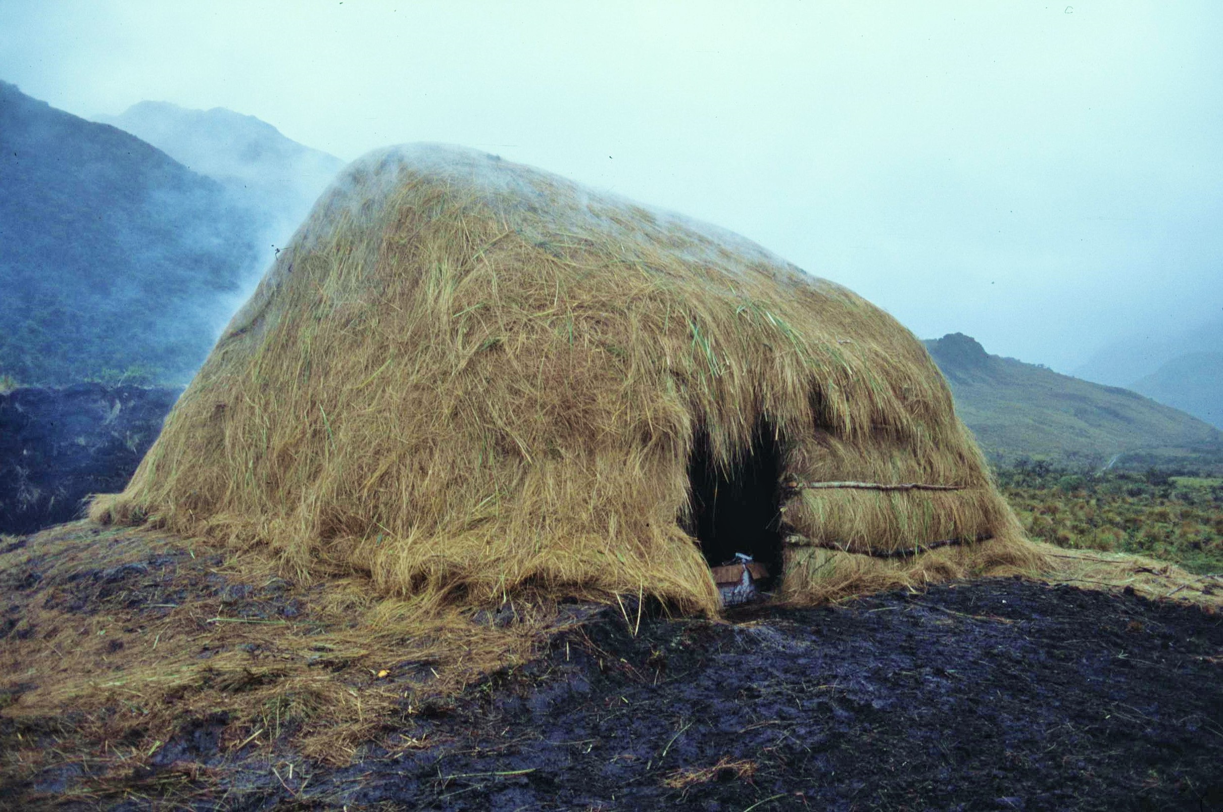
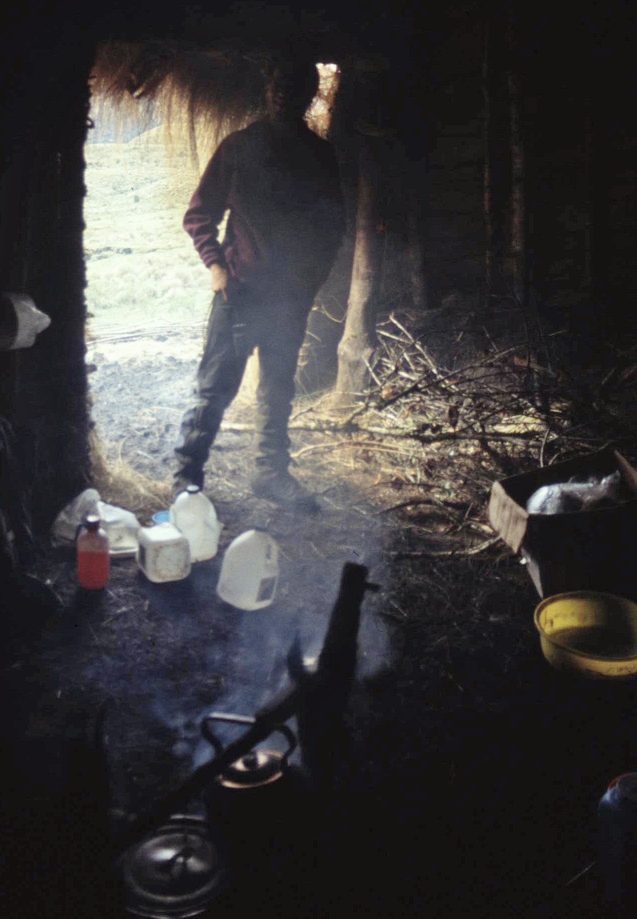
That night, instead of camping, we found a rustic herder’s hut to stay in, somewhat reminiscent of a west highland black house, with a roof made of straw and an open fireplace in the middle of the floor, from which smoke filtered up through the roofing itself. This was certainly very organic accommodation indeed, with turf and brushwood walls (if just a little bit smoky at times). Still, it kept out the elements and was certainly more comfortable than being in the damp confines of a small tent. In the Aloa Valley there was generally much more evidence of human activity all around, including some cattle pens and signs of burning of the pasture by agriculturalists.
Following a couple of nights in the herders hut, we finished our survey work in the area and it was then time to head back to Riobamba for another few nights of rest and recuperation before planning the final phase of our work. After packing everything up, we hiked down the Valley to the small village of Aloa. As we nearer habitation, the landscape showed more signs of human influence, with a patchwork of tiny and attractive fields in an assortment of mottled hues carved into the hillside.
From the village of Aloa, we hoped to find some transport back to Riobamba. However, on arrival, the locals assured us that no vehicles were going that way in the near future and that we might effectively be waiting for a while. After sitting around disconsolately for an hour or so, however, an old truck pulled into sight and a small crowd of people, mainly woman with goats and chickens started to congregate around the vehicle in expectation. Paul spoke to the driver who informed us that indeed he was going to Riobamba and could take us all along for a small fee, with the other passengers. He did however warn us that there would also be a “small bit of cattle” accompanying us on the journey. This seemed like the best chance of getting back to Riobamba that day though and so we decided the “small cattle” would be a minor inconvenience, which would be worth suffering for a good night’s sleep in a hotel.

And so in we got into the back of the cattle truck with the local ladies, some kids and an assortment of goats and chickens. The back door was sealed shut and we headed off down the bumpy gravel road – so far, so good ! After 5 minutes of so, however, the truck pulled to the side and the back door was opened yet again; there in front of us and staring us right in the face was the “small bit of cattle” as described. The extremely large bull was led into the truck with its owner and the door was closed behind us, effectively sealing us in – this could prove an interesting trip !

It did ! Once again everything was quite calm initially until the bull decided to lick the face of one of the goats. A peasant woman who owned the goat then, very cleverly, decided to chastise the bull by whacking it one the in the face – unfortunately though, the bull wasn’t very pleased about this ! So here we were, stuck in the back of a sealed truck, on a winding mountain road, with an assortment of other animals, people and a very irate bull.
The bull started stomping its hooves angrily and head butting the side of the truck, rocking the whole vehicle from side to side on the narrow road, with it’s precipitous drops – it was terrifying and we were all trapped. Eventually it took a gang of several men to push the bull against the back wall of the driver’s cab and to keep it there for the duration of the whole journey by leaning with their backs tensioned against the roaring and squirming beast. Never have I been so glad to get out of a vehicle when we emerged relatively unscathed from our ordeal in Riobamba a couple of hours later.

So back in Riobamba and all still in one piece thankfully ! We had a couple of days to work out our next plan in between more bouts of eating, sleeping, drinking and pressing collected plant specimens. Although we had now surveyed 6 forest plots successfully (a considerable achievement given previous progress), the lowland rainforest of the National Park had so far eluded us, because of the rough terrain and the difficulty of access. The Plan was then to take a bus around the edge of the Park to the eastern boundary and then to proceed back into the Park along the Rio Palora River from that side.
It turned out that the Sangay National Park Rangers had a large dugout canoe with a powerful outboard motor and that they would be willing to take us up the river to a suitable site where we could successful survey the lowland forest of the Park. This sounded like a practical and exciting proposal and a way of at last accessing the so far elusive rainforests of the Amazonian side. And so a few days later we packed up our gear and boarded a bus for the next leg of the trip, which would hopefully see our fieldwork completed in Sangay National Park.
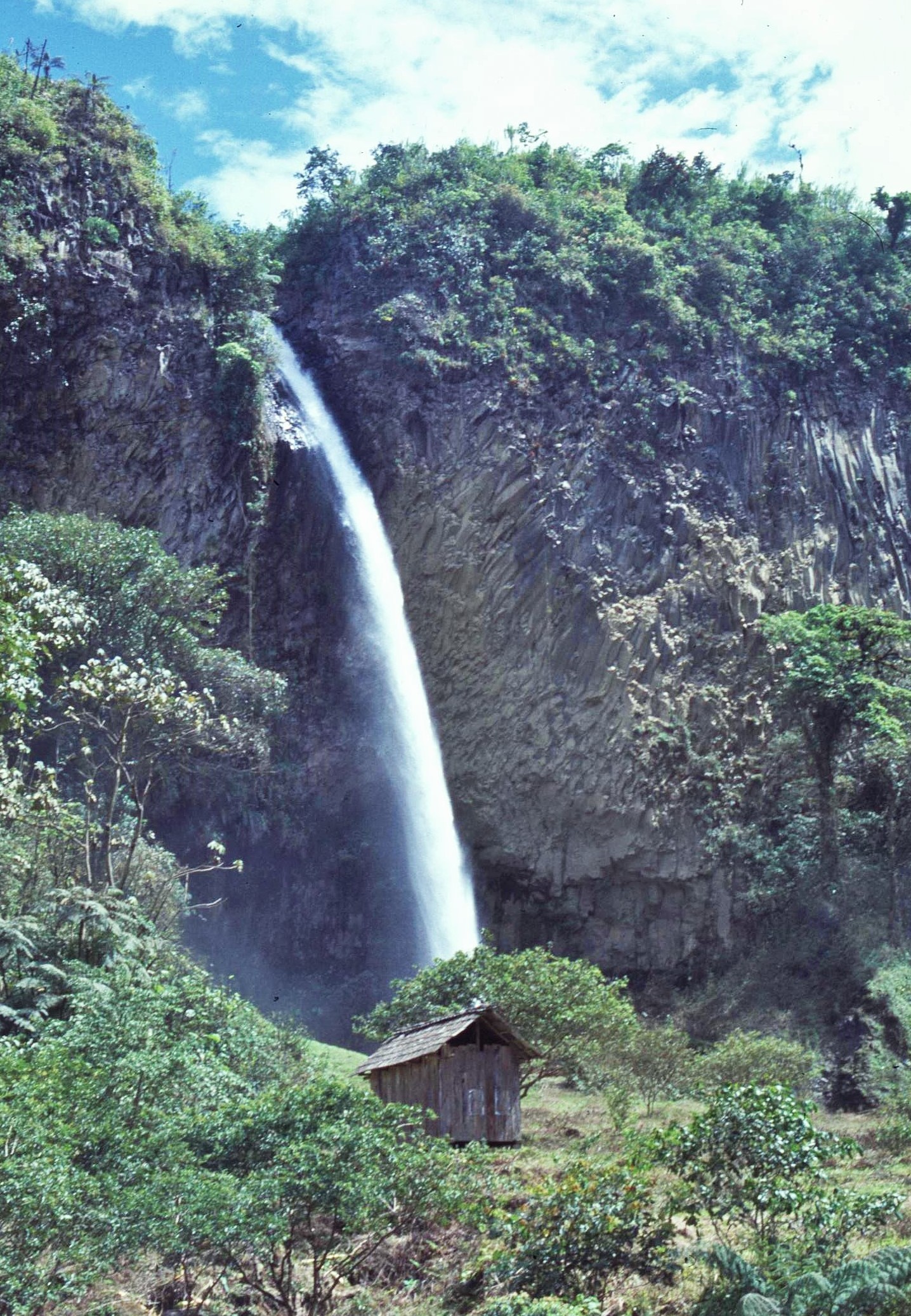
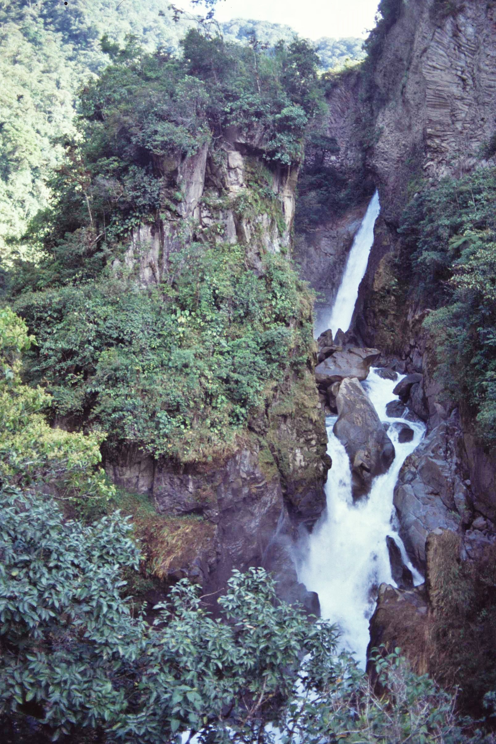
The journey down the northern boundary of the Park was quite spectacular and followed the gorge of the Rio Pastaza, a large and high volume river, tumbling down from the Central Andes. An interesting and beautiful place to visit en route was the spa resort of Baños de Agua Santa, located directly under the volcanic peak Tungarahua. Baños is famed for its hot springs and many beautiful waterfalls. We spent a bit of time enjoying the lovely and lush surroundings there.
To the South of Baños, we encountered significant evidence of deforestation on the steep hillsides along the side of the highway, with many small sawmills cutting timber unsustainably to supply the fruit packaging industry. The consequences of this damaging activity were all around, with many landslides on the steep slopes and resultant soil erosion turning the silt-laden tributary rivers a dark, muddy brown colour.


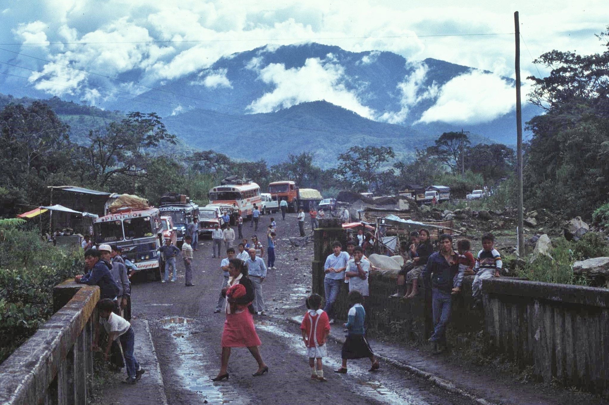
After some delays, caused by the landslides themselves blocking the road, we eventually arrived at the burgeoning City of Puyo – one of Ecuador’s expanding frontier towns in the Amazonian region. From there we took another bus heading south, roughly parallel with the Sangay National Park boundary.
Bus travel in this part of the world is certainly interesting – most of the time we had the chance to sit up on the roof rack with the luggage. This was great for taking in the view, although at times you had to watch out for overhanding tree branches, or even rocky overhangs on mountain roads, which could cause you quite an injury, or quite likely, death. Reassuringly the mountain roadsides are often lined with a succession of white crosses, where vehicles have gone over the edge and into the abyss in years gone by.

Much of the rainforest immediately to the east of the park boundary had previously been cleared for agricultural development and the region was already being extensively colonised. However, the road infrastructure to the East of the Park was not well developed, with the buses fording the rivers when the water was low in the dry season. Otherwise all the payload (people included) would have to be taken across rickety wooden suspension bridges, (the bridges not being strong enough for the buses themselves to cross). On another occasion, we did have to get out and had to cross a major river using an areal ropeway suspended just over the water – I must admit though that was quite good fun, even though it didn’t make for the quickest journey time.


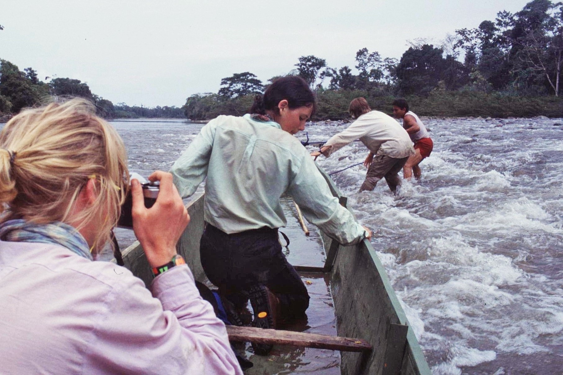
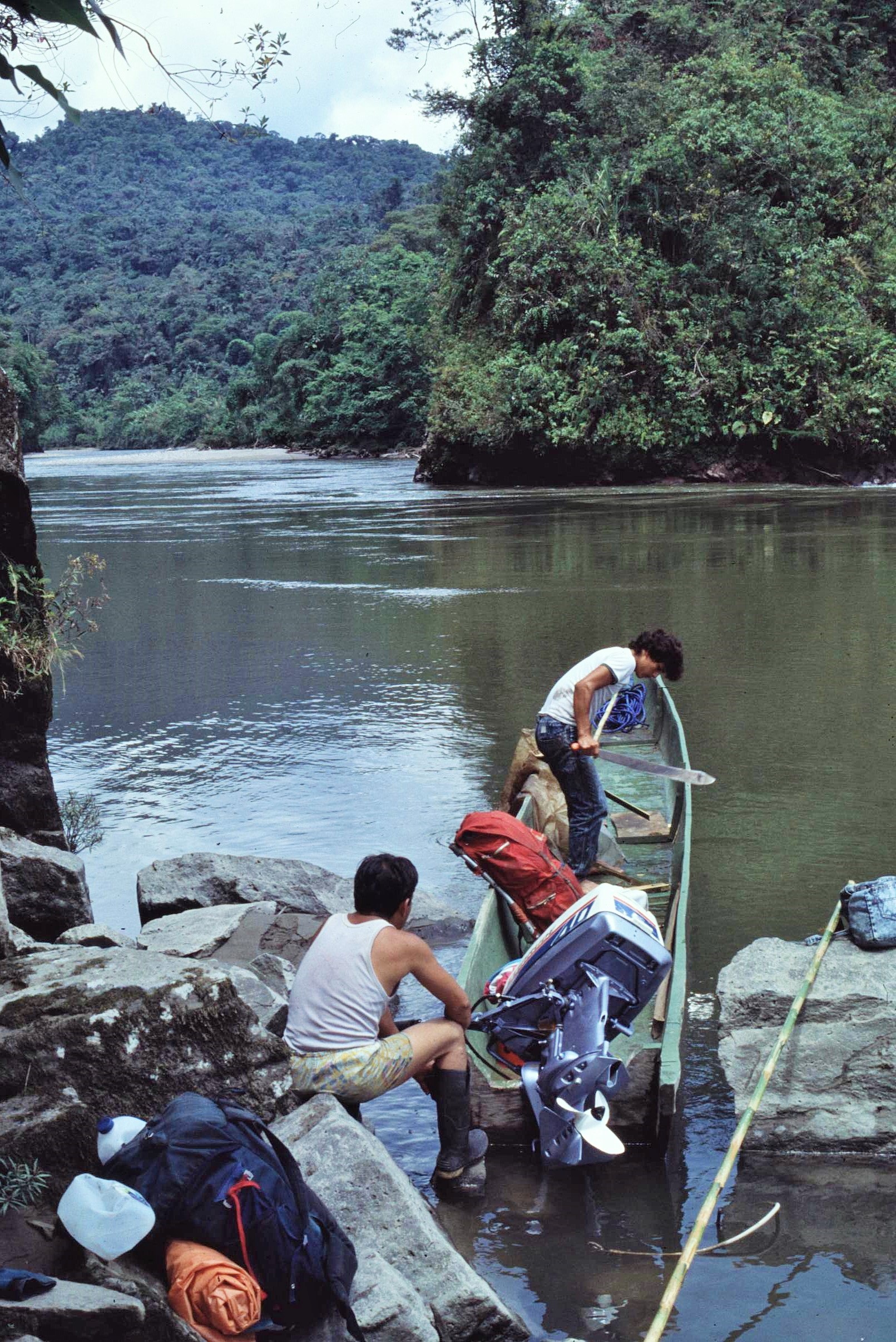
Our plan was to head back up the Rio Palora from its confluence with a larger river. Two of the park rangers had access to a large motorized dugout canoe and were willing to take us up the river, for a day or so, to a suitable location where we would be able to undertake our survey work. The trip however involved a bit of shuttling to and fro to get all up us and our gear up-river to the suggested location.
The trip was certainly not all plain sailing and there were rapids along the way, which involved taking gear out of the canoe and having to push the heavy craft up through the white water. This was exciting, but also exhausting and dangerous as the craft was extremely heavy and could easily crush a trapped foot in the strong current. It has to be said though that the rangers were expert boatmen and made the best of a difficult job, with us all joining in the hard graft of pushing the boat through the rapid sections.

One night was spent in an intermediary camp by the riverside. However we certainly leant our lesson that night, when due to heavy rains in the mountains, there was a flash flood ! This required us to hastily move our camp in the middle of the night as the dried up river bed quickly filled up to become swiftly flowing torrent and a channel of the main river. The next morning, unscathed and largely dry we continued further up the river until a suitable location for our survey work was identified. This would be our real “jungle” experience of the trip, with the tree canopy reaching up to 40m above our heads with cathedral like splendour.
Our survey camp in the lowland rainforest could not have been in greater contrast to that on the páramos, up near the snowline, in the early stage of the expedition. For a start, it was about 30 degrees or so warmer and hard to believe that this might be a mere 30km of so away from where we first started our research. Despite this, it wasn’t hugely more comfortable in the rainforest camp, as we were effectively sleeping on the forest floor, under just the covering of a tarpaulin to avoid drips cascading from the tree canopy high above.

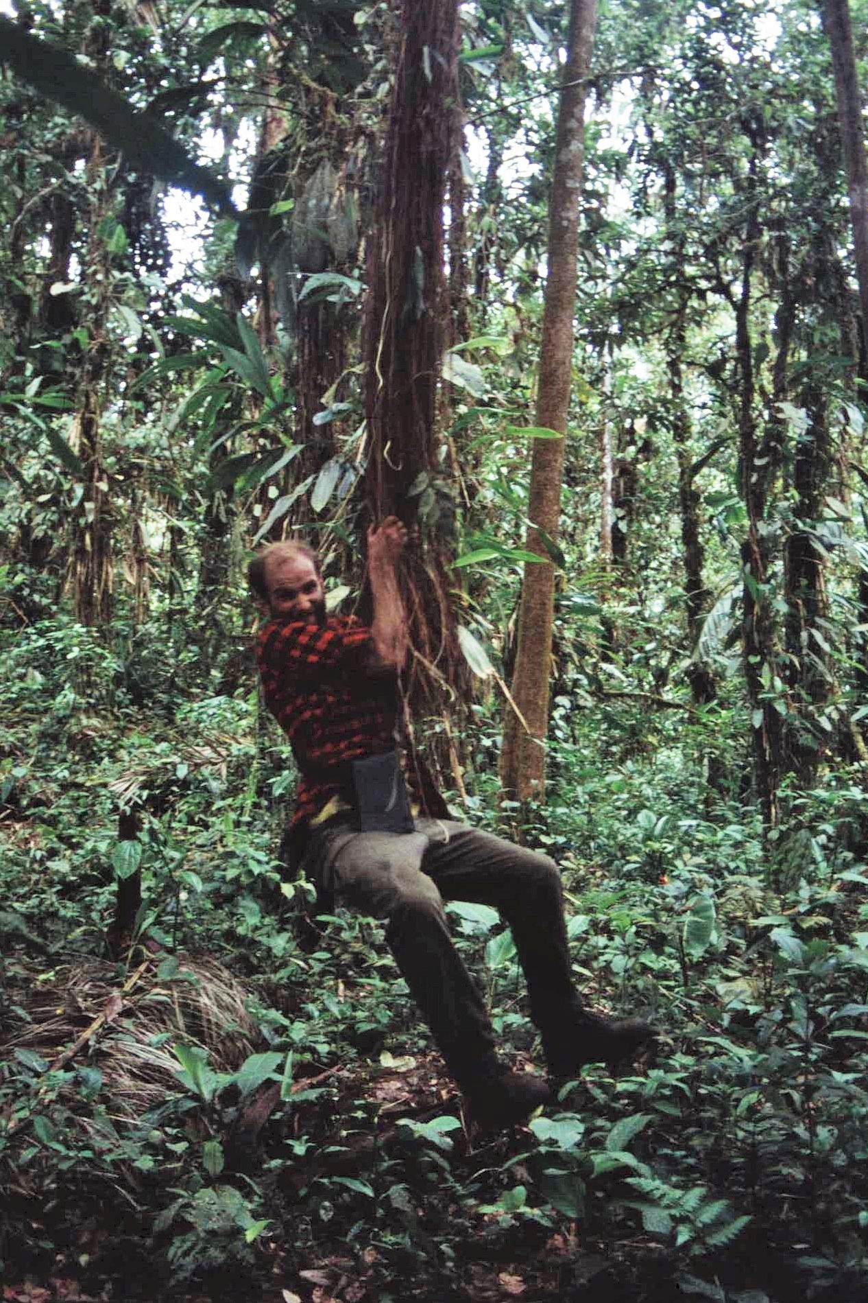
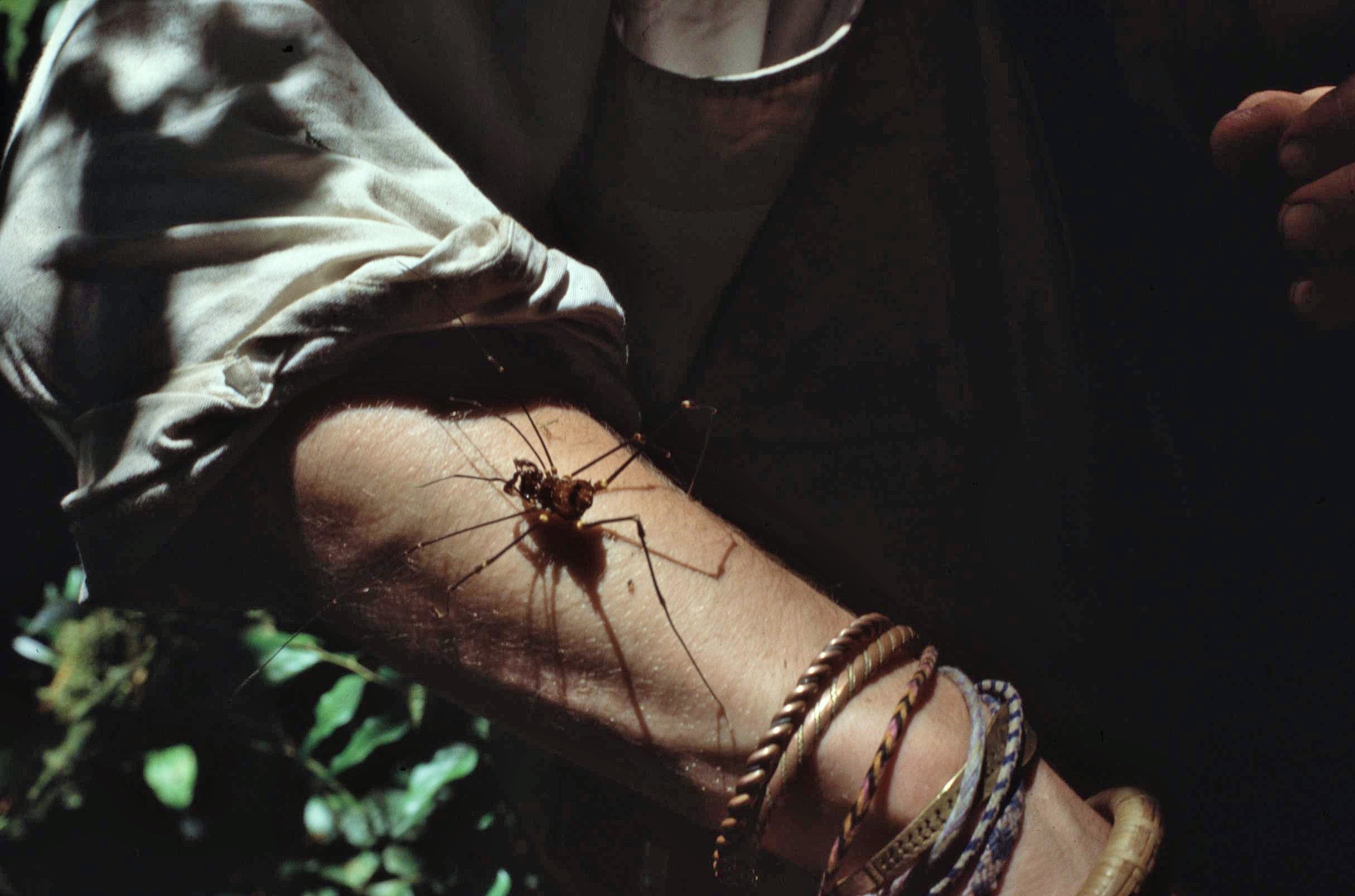
Although we had mosquito nets to offer some basic protection from “bugs and beasties”, there were certainly no shortage of creepy crawlies about, particularly in the night time. Our somewhat basic and makeshift camp certainly gave us little protection from these. Interesting bugs encountered included some rather large and threatening looking spiders. One expedition member in particular was quite happy to let these crawl about all over his arms – however, I must admit to being a little more cautious and squeamish about these things. In the meantime I just practiced being “Tarzan” by swinging from suspended lianas, becoming quite an expert at this.
However it wasn’t all work and no play – we had our forest survey plot work to undertake here – the last of seven plots which would give us a relatively good overview of the changes in forest structure resulting from altitudinal change in the Park (although admittedly there were gaps in the middle of the Park area where access was literally impossible). The survey work in the lowland plot went relatively smoothly and we were able to undertake the process fairly quickly by this time through experience already gained on other sites. This left us some additional time to explore the lowland rainforest of the area.
Not far from the location of our research plot, we surprisingly encountered an example of illegal forest clearance within the protected national park area – a reminder of the serious threats of colonization and deforestation which exist in such protected areas. Interestingly, however, the cleared area seemed to be for the establishment of a “forest garden” – somewhat similar in appearance to those I had seen cleared in the rainforest, by shifting cultivators, on the Indonesian Island of Seram.

We didn’t find those responsible for the clearance activity; perhaps they would have wished to maintain a low profile to avoid the attentions of the park authorities. Arguably however its impact upon the forest ecosystem would have been light and sustainable at this low level – the real threat comes form larger scale colonization as witnessed through gold mining and mass resettlement for subsistence agriculture in large areas of the Brazilian Amazon. Usually, small scale indigenous style agricultural practices have posed little threat to the rainforest, however it could become a problem if left unchecked.

So after a couple of nights in the lowland rainforest it was time for us to leave and to head back down river. Our reliable boatmen once again returned at the allotted time and ran us down the river with our gear. Going downstream also wasn’t without it’s challenges due to the intermittent patches of white water (Grade 3 perhaps). The risk of capsizing the boat and getting it submerged was high – full of water, the heavy dugout canoe would have proved impossible to move. We therefore had to unload and reload our cargo at intermittent intervals to avoid the worst of the rapids and the possibility of a capsize. Soon though, we had reached calmer waters and were drifting back to our starting point.

We had achieved our goal and returned with a portfolio of scientific data documenting the Park´s complex ecosystems from an altitude of 4000m to just 900m. We had collected diverse plant samples which would be transported back to the UK for identification and analysis.
In total the forest surveys had involved some 35 person days of work (not including access to the field) and the recording of nearly 5000 separate measurements involving the girth of the trees, the extent of the canopy, the height and base of the crown and information on the diversity of species present.
In undertaking this work, I was extremely grateful for the assistance of my fellow expedition members, without whose help, the study would not have been possible. There was however, still much work to be done in terms of processing the data and sorting out our botanical collection; all of this would occur in good time. I would also have to write up and complete my MSc Thesis (which was duly done and submitted the following year).

")

However, for the present, our travels in Ecuador were not quite over – indeed, there was still some exploring of the country to be done (though more as tourists this time and not as scientific researchers). We boarded transport back to Riobamba, happy in the knowledge that, despite considerable set backs and difficulties we had achieved our key objectives in Sangay National Park. For now though we could be confident in knowledge that we had survived “hell and high water” and come out the other end with our heads held high and still smiling; if only just at times…


So i searched for an image of Sangay- and up came your site, 32 years after our trip to Ecuador Ian. I recognise my head and arm in some of those shots and I’m confident i took the shot of you swinging on the vine. It was a tough trip, great memories. Loved your shots of Langtang too , I did a survey there in 93. Regards, Mike Bassett
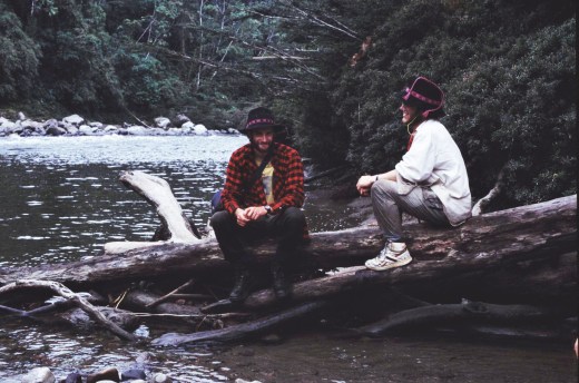
Hi Mike, I just put up that story relatively recently after finally getting a slide scanner – it’s great to hear from you after all these years. Otherwise I’ve completely lost touch with the people from that particular trip; it certainly was a tough one indeed – Indonesia and Nepal seemed like luxury by comparison, but I think that was mainly down to weather conditions ! I was going to put in a picture in with both of us sitting by the river – must have forgotten (actually just noticed that it is there after all). Otherwise I’ll write a separate piece on our train trip down to the coast some time – remember that place we stayed in some rundown hotel ? That was an interesting night for sure ! How’s life treating you anyway these days…? are you involved in teaching ? – that’s really great if you can pass on your enthusiasm for adventures on to the next generation. I’m fine – just become a Doc (only took me about 30 years or so longer than others to do).
Yup, been teaching in.Cardiff and South Wales for 25 years now. Never planned to, but finished in Bangor, worked for a year to raise money.and then cycled in Africa for a year, then a master’s that took me to Nepal for 3 months, then teaching. I remember that night in that hotel. I remember misunderstanding the owner and peeing in the middle of his yard. Then running off early in case he gave us his daughter! And gun point for a runrig cassette and Walkman whilst on a boat. Funny, I remember some.of those photos, and have some.almost identical ones stored away. Kids always get my stories, fills time and I showed your photos today to a group that are leaving. Joe is in Brazil, a professor I think now, certainly a doc of botany, working in Rio. He has been there for 25 years I think. The rest, no idea! Seems.like yesterday. The first site was a low point. I remember Joe and I had to live off cold food when we headed to the other lake for a few days, and we punctur d his dinghy with the hook we used to sample plants! Your current project looks cool! Very in right now too. Great to know life going well for you.
Don’t remember the “heist” Mike; that sort of thing must just have been par for the course in those days I guess ! A great adventure though all in all.
Maybe of interest: https://www.plymouth.ac.uk/research/ecology-and-evolution-research-group/assessing-the-ecology-of-the-andes