Seeking the Good Life: In the Karwendel Alps

It used to be that virtually all my “holidays” involved being on a mission of some kind or other; whether it was exploring a new part of the world by bike, going on a mountain trek or on a badly planned kayaking adventure in hostile weather conditions. Having itchy feet is not something easily cured. 

IMG_3554

However  these days I’m feeling my age somewhat and experiencing something relatively new; the dreaded and unchartered waters of the family holiday !  With small kids, finding a base that suits everyone’s needs becomes the determining factor when planning a break. This is not always as easy as it sounds.

The Karwendel Region, however, straddling the border between Bavaria and Tyrol really does seem to offer everything that we could ask for; whether its mountain walks, al-fresco swimming, playparks or city tours. We spent 2 great weeks there, last summer and will be heading back again that way soon. Here are a few of the memorable places we found, many of them by accident…

Base Camp: Krün

We based ourselves in the laid back alpine resort of Krün which is located approximately 20km East of Garmisch Patenkirchen in the broad green valley of the River Isar. Krün is a charming place with traditional flower bedecked chalets, a baroque church (my son who is a fan of such things) and a great network of trails for cycling and walking branching off  in all directions towards neighbouring peaks and lakes. 

For kiddies there is also a fabulous new play park down by the river with a watery theme which will keep children absorbed for hours. Best of all for me were the striking views of the Karwendel Alps , especially as the evening sun casts its last rays on the peaks.

CIMG2517(R)

CIMG3047(R)

CIMG3045(R)

CIMG2476(R)

CIMG2729(R)

Herzogstand and the Walchensee

Just South of Krün is the Walchensee, one of Bavaria’s largest and most beautiful lakes. The water is a fantastic turquoise colour and the lake is popular for all manner of watersports, particularly sail-boarding with strong and reliable wind conditions. We also went for a swim in the Walchensee but found the water a bit on the chilly side. However, there are numerous other smaller lakes for swimming round about where the water temperature is much warmer.

Towering above the Walchensee is the mountain of Herzogstand (1731m) a favourite mountain of the eccentric Bavarian King Ludwig II. You can take a cable car part way up  and from then on up it’s a slow plod for another hour or so to the top to the pavilion on the summit which was originally constructed by Ludwig II.

The views from the top are fabulous, especially as you’re right on the edge of the Alps and can look across the flat plains towards Munich on one hand or across the dramatic limestone peaks of the Karwendel and Wetterstein Ranges to the South (including the Zugspitz, Germany’s highest mountain at 2962m). Remarkably my daughter made it to the summit on her own accord; something that she is still very proud of.  There is a fantastic, airy, ridge walk to the neighbouring peak of Heimgarten. This is an adventure for another day without kids.

IMG_3525(R)

IMG_3494(R)

CIMG2800(R)

Along the Isar to Eng Alm

The crystal clear river Isar flows NE from Krün and the neighboring village of Wallgau before passing  through a steep forested valley reminiscent of the Canadian Rockies (without the grizzlies). This beautiful section of the river down as far as the Sylvensteinsee apparently makes for a great canoe trip (I’ll have to try it some time) though the flow of the river is normally greatly reduced due to hydro abstraction further upstream. 

At Vorderiß the Rißtal joins the main valley and it’s possible to turn South and follow the long “no through” road along the Rißbach towards the hamlet of Eng which is famous for its extensive areas of alpine meadows  and unique sycamore woodlands. You soon pass into the Austrian province of Tyrol and shortly after that enter the Alpineparc Karwendal; a protected wilderness area of  920 square km featuring some of the best mountain scenery in the Northern Limestone Alps including extensive areas of alpine meadows. The Park is home to Ibex, chamoix, golden eagles, marmots and a whole host of other spectacular fauna and flora.

CIMG2551(R)

Eng Alm is an alpine hamlet straight out of a Heidi story with its collection of old traditional houses and barns. It is still worked as a traditional alpine meadow and is a great place to watch farmers at work tending “the coos” for production of distinctive local cheeses and dairy products. Kids will love it; we found our two were fascinated just to watch the cows coming in for milking; a rare sight for those brought up in the days of factory farming and supermarkets. Despite the fascination of watching cows, Zoe and Kai always manage to find a play area, even in the most unlikely of locations (ho,hum).

CIMG2568(R)

CIMG2600(R)

CIMG2607(R)

IMG_3430(R)

CIMG2615(R)

CIMG2594(R)

Flower Power Bavarian Style

Heading back down the Rißtal we found a particularly cool place to eat out and sample some traditional Bavarian food. I liked the unusual style of the place; an eclectic blend of Bavarian Kitsch, 60s “Flower Power”, Easter Island ancestor worship and Appalachian hillbilly; a rare combination indeed !

We were the only guests; fortunately the natives were friendly (an old Austrian couple) and it was great to sit out amongst the flowers on the terrace surrounded by stunning mountain views.  Definitely a good place to go back too sometime and fortunately not a banjo in sight (for those who’ve ever seen the film “Deliverance”).

CIMG2663(R)

CIMG2660(R)

CIMG2652(R)

CIMG2647(R)

In the Buchelwiesen

South of Krün there is a remarkable landscape left behind by glacial moraines called the “Buckelwiesen”.  These rolling drumlins are now converted to soft pastures and are a brilliant green that could be straight out of a “Dulux” paint commercial. They are also very species-rich and support lots of interesting flowers as well as being a rare surviving example of an important cultural landscape based on meadow management. Apparently the Nazis had big plans to grub up the buckelwiesen and to create a planned super-settlement; fortunately (like many of their other heinous plans) this one never got off the ground.

You can walk or cycle along the ridge crest through the buckelwiesen from Krün for several km enjoying great mountain views of the Karwendal. In addition it’s possible to visit various “farm tourism” outlets including the Gaos-Alm, a fascinating goat ranch featuring yet another cool and unique al-fresco eatery. Once again Zoe and Kai made a beeline for the play park and discovered a trampoline with a view…

CIMG2975(R)

CIMG2985(R)

CIMG2944(R)

IMG_1964(R)

IMG_3510(R)

IMG_1927(R)

CIMG2662(R)

Around Mittenwald

The historic village of Mittenwald is the main centre in the area and is located in a deep valley flanked on either side by the steep slopes of the Karwendel and Wetterstein ranges. The town is famous for its long tradition of violin making and impressive, painted building facades. Goethe described the pretty town as being a “living picture book” and this certainly remains true to this day. The town is a pleasant and relaxed place with laid-back cafes and bars down the main street in which to unwind.

Mittenwald was also historically an important location on the Transalpine Route and became a significant centre for the trade and exchange of goods. The town has hosted the historic Balanzo Market since the middle ages whereby craft products from Italy were brought to new markets to the North of the Alps. The Balanzo market is still held in the town every 4 years but is somewhat more touristy these days than it used to be. 

CIMG2999(R)

From Mittenwald you can take the Karwendalbahn cable car up to near the summit of the Westliche Kawendalspitze (2384m). The views from the top are fantastic and it’s an easy walk from there up to the start of the Mittenwalder Klettersteig. The Klettersteig itself is an airy (though well protected) traverse over several mountain summits which are all over 2300m in height. It’s a classic route and the  views in every direction are sensational. You definitely need a head for heights for this one though !

CIMG2906(R)

CIMG2927(R)

CIMG2929(R)

Just South of Mittenwald is the dramatic Leutsacher Geisterklamm where in recent years an exciting 800 metal walkway (including a series of suspended “panorama” bridges) has been created along the side of the steep gorge. The route is well protected and is therefore fine for taking kids along (vertigo aside), as well as offering  great views down over the gorge to the river far beneath. The trail is themed around a mountain spirit which was reputed to dwell in the gorge. Despite this, it’s not too kitsch at all and (even better) doesn’t cost anything to visit. 

CIMG2673(R)

CIMG2683(R)

CIMG2677(R)

The Kranzberg, located West of Mittenwald, is another good place to explore and is accessed by an old, rustic chairlift. It is a great location to go walking or to simply idle about enjoying mountain cafes amongst the woods and meadows. At the top of the chairlift is the well-known “barefoot walk” which allows you to take off your shoes and to get muddy by negotiating a route of a kilometre or so over various obstacles, textured surfaces and constructions. Once you’ve got your boots back on, you can also walk from the Kranzberg down through the forests to the Lautersee; a great spot for swimming (but also very popular and a little bit too crowded for our tastes).

CIMG2917(R) CIMG2528(R)

Within a Stones throw

You don’t have to go far from Krün in any direction though to find great things to do. We found the Barmsee, just a couple of kilometres away from the village made an ideal place for swimming. There is no road access there, which fortunately helps to keep the place a bit quieter and there are excellent trails for walking and cycling around the lake.

On the other side of Krün, a bridge over the river Isar (opposite the village) takes you straight onto an extensive network of alpine trails which provide access into the high mountain country east of the village; including the Soiernspitze Range which encircles two beautiful high lakes.

There are numerous other trails which take  you up through the alpine meadows and onto the rocky peaks. I’s a long, hard graft to get up to the treeline but well worth it in the end. For those seeking easier access to high places its possible to catch the “Alm Bus”, a minibus service providing access to Krüner and Wallgau Alm to the West of Krün.

CIMG2865(R)

CIMG3025(R) CIMG3037(R)

And a City Break thrown in

Innsbruck, the capital of the Tyrol is located on the Southern boundary of the Karwendel range and for a change of scenery and pace makes for another good day trip. Located at the confluence of the Inn and Sill rivers, the City has a long tradition stretching back to Roman times. Innsbruck is known as a major tourism and winter sports destination and its possible to catch a cable car from the suburbs and be up in the mountains within 45 minutes or so.

You can get a train there direct from Mittenwald, the historic line wending its way through Seefeld and other smaller mountain villages before descending steeply down to the Inn Valley. In no time at all your into a “big city” environment with museums, galleries and cafes (not to mention lots of tourists !).

CIMG2835(R)

CIMG2860(R)

IMG_3548(R)

Something for Everyone

Whilst the Karwendel Alps might not be one of the “ultimate” alpine adventure destinations (like Zermatt, Grindelwald or Chamonix), for my mind its all the better for that. We found there is more than enough there to do there and sufficient challenge to keep all the family occupied for a couple of weeks or more amidst a backdrop of spectacular alpine scenery.

The Karwendel benefits from being relatively laid-back, uncrowded and has managed to preserve much of it’s strong sense of regional identity whilst also offering all the facilities you could need. Compared with many parts of the alps, the area has also not suffered too from a construction boom of intrusive concrete developments such as shopping malls, theme parks and transport infrastructure, the emphasis instead being on local design and quality construction. In short this is Bavaria at its best and we’ll certainly be heading back this way again.

For more information see:

http://www.alpenwelt-karwendel.de/en

http://www.karwendel.org/

Posted in Family, In Europe, Mountain Treks, Wild Places | Tagged , , , , , , , , , , | 1 Comment

Three Men in 3 Boats: a Hebridean tale of Cowardice and Mediocrity

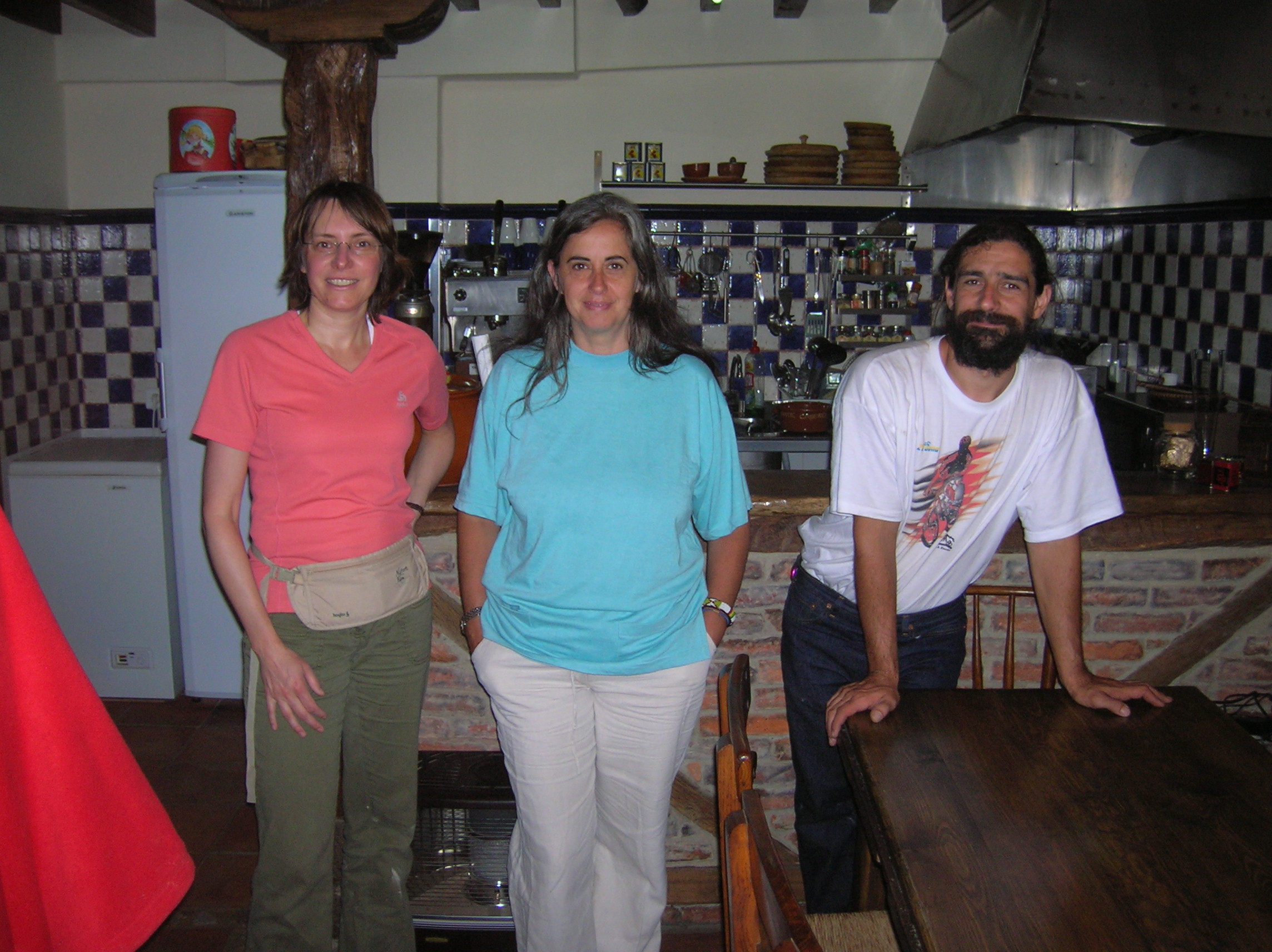
It’s hard getting used to being landlocked here in continental Europe. Any piece of water, whether it’s a reservoir, stagnant pond or small stream now starts to take on a special spiritual significance, if like me, you are used to living close to the magnificent lochs and coastlines of Scotland. All part of the price paid for living here I guess, amidst “cafe society”, at the heart of Europe.

Copy of DSCN1561

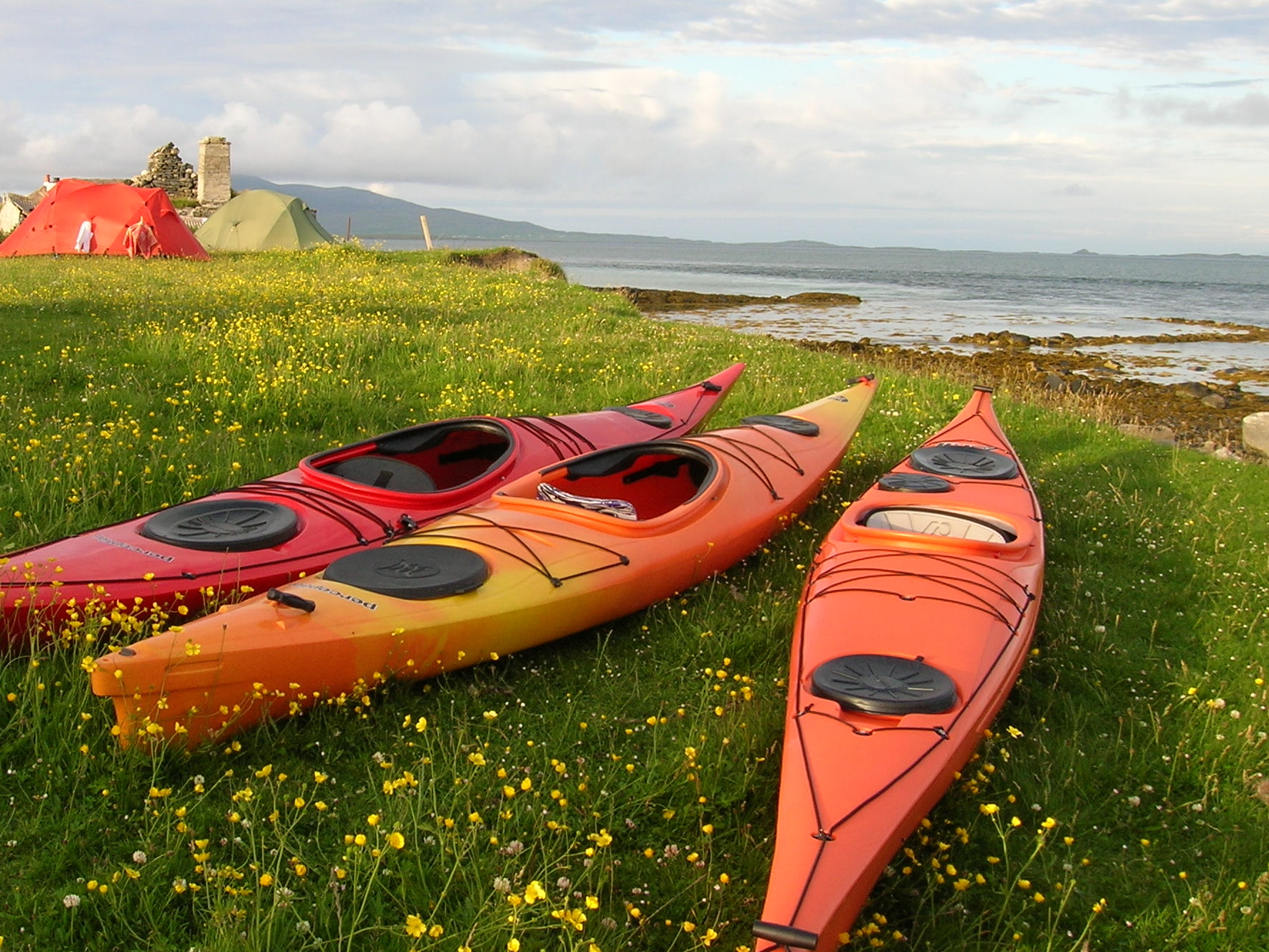
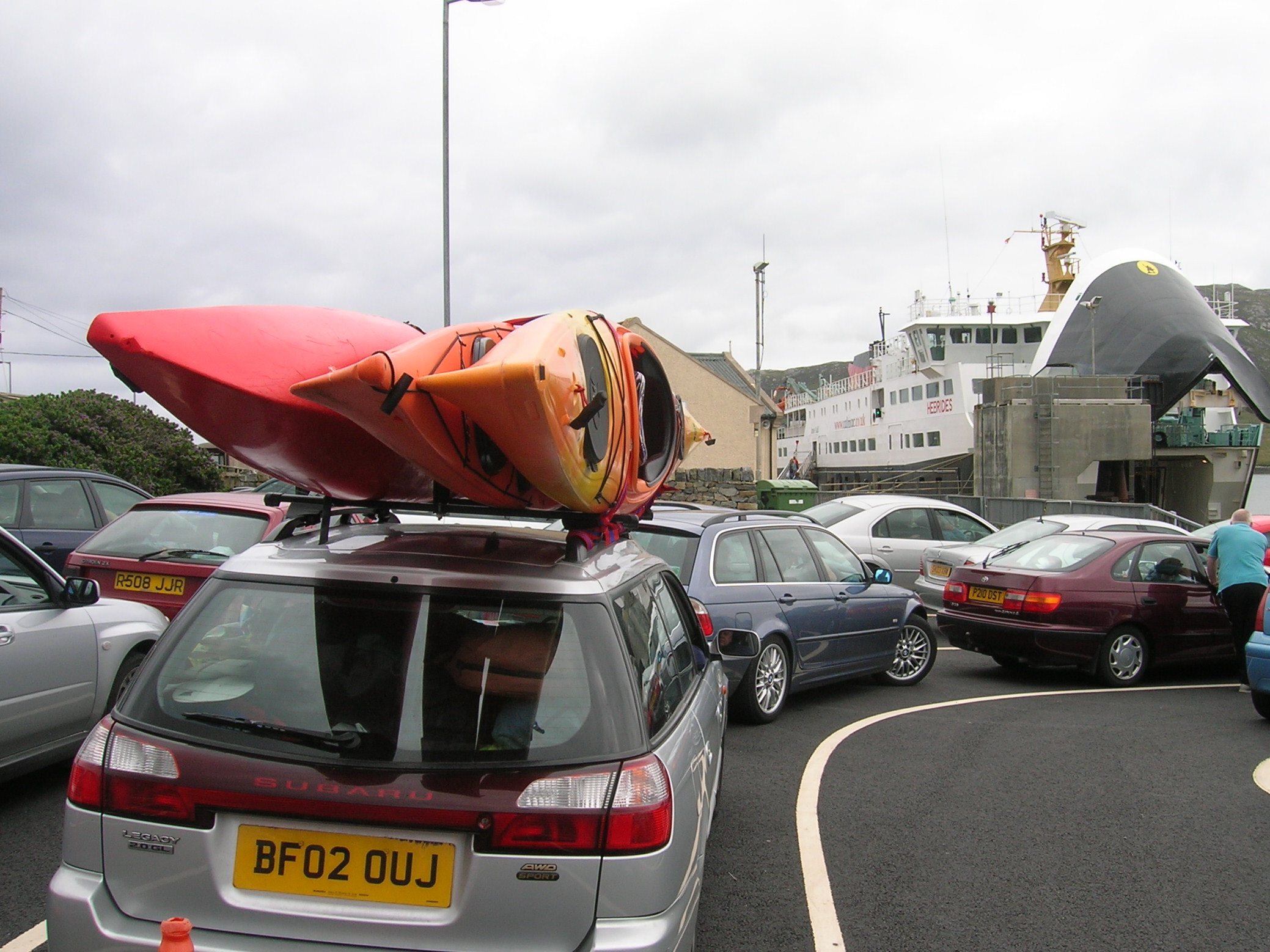
The Three boats: Awaiting paddlers

If Scotland excels at something then “being wet” must surely rank at the top of the list (with midges coming in as a close number 2). If you’re looking for sunbathing opportunities this is not so good; however for canoeing and kayaking, the possibilities offered by Scotland’s wild lochs and coasts are endless. This is the story of a small expedition to the Hebrides made by our (not so) intrepid team before I departed the shores of Scotland to live on the Continent.

A Cunning Plan

Before I introduce the team, it’s important to note that we were not elite ocean paddlers intent in paddling unsupported across the Atlantic; rather we fell more into the category of bumbling amateurs who had picked up some basic canoeing and kayaking experience “the hard way” through falling into many of  Scotland’s rivers, freshwater lochs and coastal waters. So our small group consisted of two Ians (or strictly speaking one “Ian” and an “Iain”) and a Steve. 

Used to paddling calmer inshore waters, it was with extreme bravado and foolhardiness that we decided to head out West to tackle bigger waves, stronger currents and the Atlantic swells of Scotland’s Outer Hebrides; the last outcrop of land passed by generations of Scottish emigrants on route to America.  But had we bitten off more than we could chew ?

DSCN1552

A Motley Crew: The three men – Ian (left), Iain (middle), Steve (right)

The idea came about after I’d been reading my copy of “Scottish Sea Kayaking” and looking longingly at  images of bronzed paddlers enjoying idyllic, sun-drenched days exploring the Sound of Harris, all with a backdrop of beautiful shell-sand beaches and colourful coastal machair. This was a challenge which we were surely up for.

I discussed these plans with my old canoe buddy, Steve (a somewhat  unconventional, though inspirational, school teacher, in the “Dead Poet’s Society” mould), in the pub one night over an obligitory couple of pints. Taking Dutch courage, Steve agreed that this was indeed a great plan (he also once said the same about cycling overland to Vladivostok after a pint or 2; something still not yet achieved to this day!) and that we should make preparations forthwith. We quickly managed to press-gang a third member, the unsuspecting Iain,  into the team. He fitted the bill perfectly with his apparent nautical knowledge gained as a merchant navy seaman (though we weren’t actually aware at the time that he didn’t possess a kayak). The scene was set for brave and daring deeds; so we thought.

DSCN1557

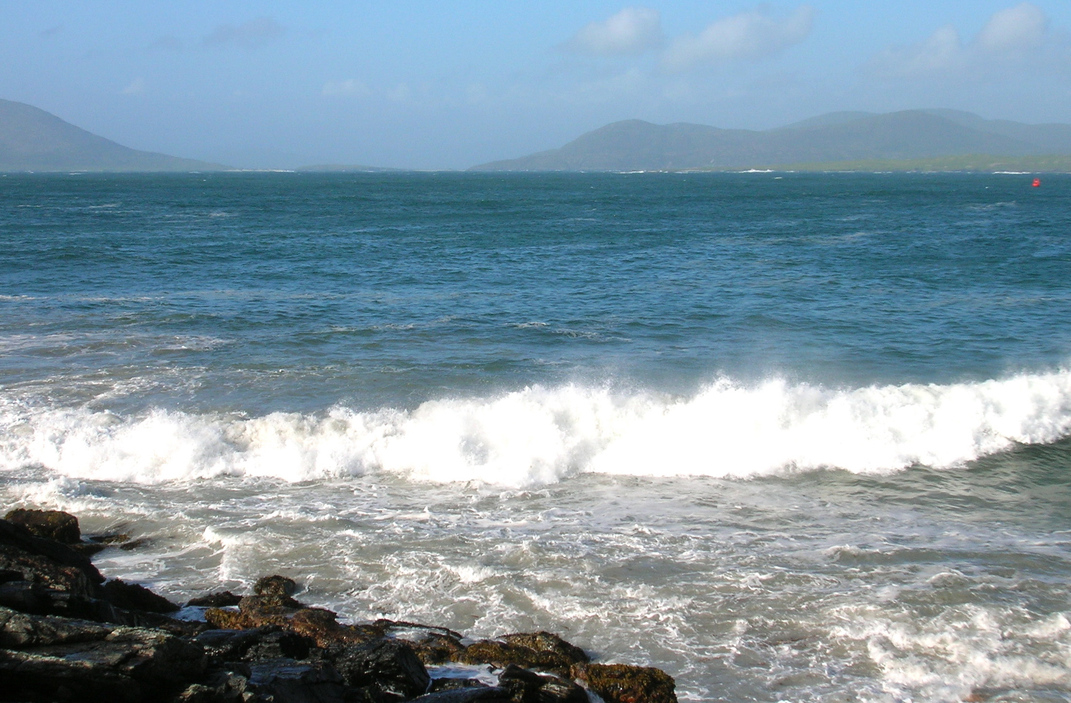
Atlantic Strand: Ultra marine on the North West Coast of Uist

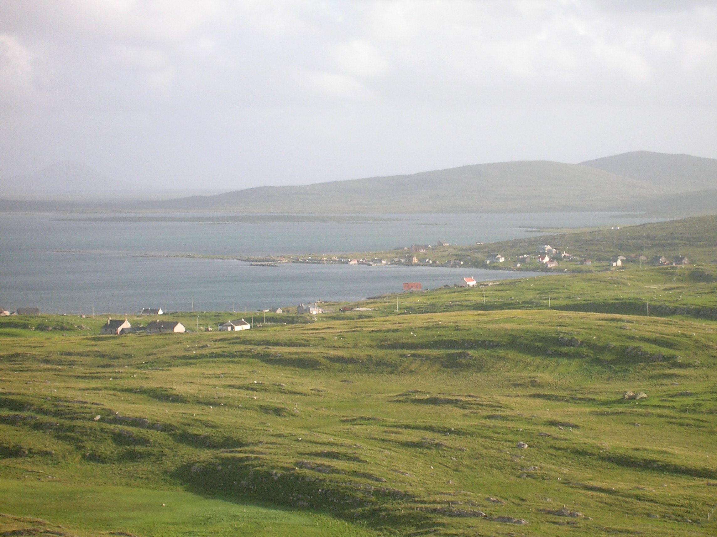
Our Plan was to head for the Isle of Bernerey which is accessed by a causeway from the much larger island of North Uist.  And so on a summer’s evening in early July we rendezvoused at Uig on Skye ready to take the morning ferry to Lochmaddy. A night out in Uig, the capital of Northern Skye, allowed us to discuss our game plan and set us up for the trip (as well as raising some interesting questions regarding group dynamics).

Next morning, after ditching a car in Uig, we strapped all three kayaks onto the roof of one vehicle and made our way to the ferry queue. Soon we were on board, steaming across the Minch and enjoying a hearty bacon butty breakfast courtesy of CalMac (the ferry operator which serves just about all of the Western Highlands). After the relatively smooth crossing, it seemed like no time at all before the ferry was tying up to the quayside at Lochmaddy, the “major” port on North Uist and home to a few hundred hardy souls.

DSCN1655

Burial Ground, Beinn Schleibhe: Religion is still a key part of life in the Uists

First Impressions

You can tell the minute you step off the boat at lochmaddy that you have arrived on a staunchly protestant island as you are greeted by threatening posters denouncing the evils of the “demon drink”. The Uists are indeed a stronghold of the “Wee Free” or Free Church of Scotland, a very pure form of Protestantism  which demands strict obedience and avoidance of ornamentation and ostentation in any of its forms. 

The Hebrides are still one of the few parts of Scotland where the Sabbath is strictly observed and its only relatively recently that Sunday ferry sailings have started up (despite strong opposition from many locals). Woe betide anyone who might consider hanging out their washing on the Sabbath day; a strong local taboo in the Uists and one not to be broken.  Not all of the Hebrides are protestant; some Islands such as South Uist and Barra are predominantly Catholic and are perhaps slightly less strict regarding observance of the Lord’s Day.

The Machair and the Sea

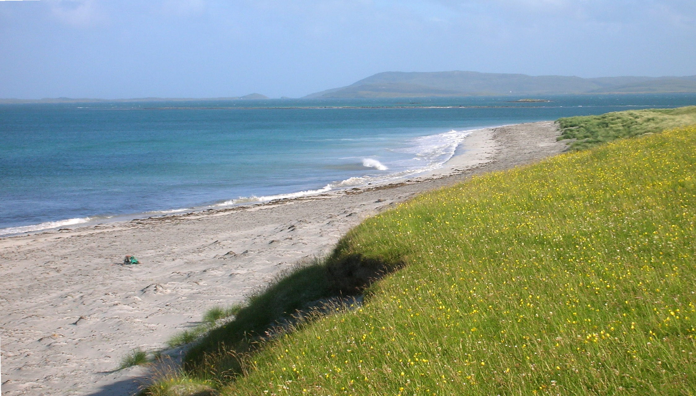
Quickly leaving Lochmaddy (and swiftly moving on from religion), we made our way over to the Western side of North Uist and checked out the beach at Tràigh Hòrnais, a perfect arc of white shell-sand fringing a broad bay with a view out the small island of Boreray. 

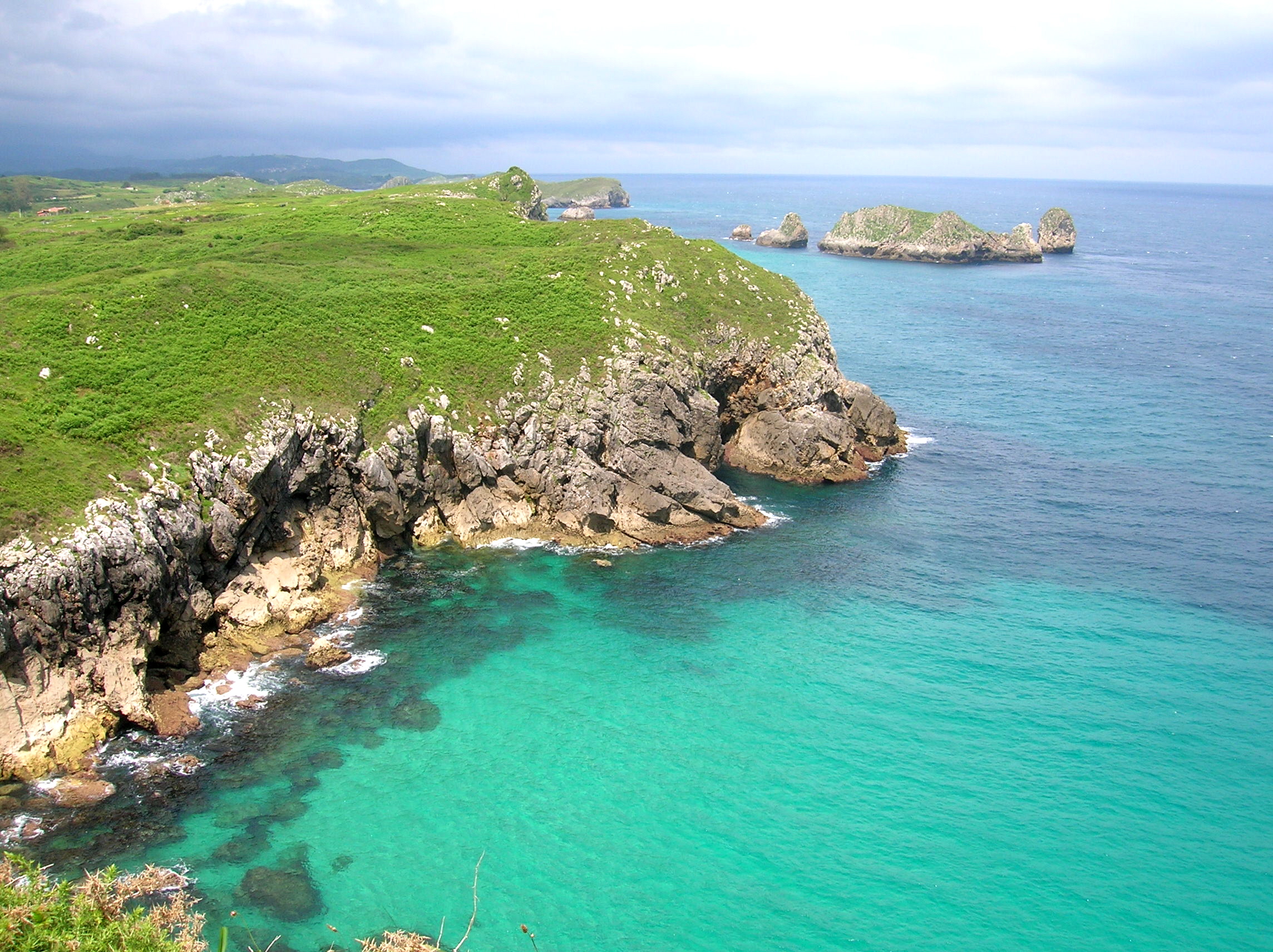
Beaches on the West coast of the Hebrides are unrivaled for their beauty and pristine clear waters; with intense aquamarines, turquoise and indigo colours. In addition, the Scottish islands are refreshingly uncrowded, thanks largely to perceptions of the dreich Scottish climate which keeps hapless hoards of  holidaymakers at bay. Those prepared to run the gauntlet of rain and midges will be rewarded with some of the most unspoilt and spectacular coastal scenery in Europe. The weather in this part of the world is notoriously fickle, but, when the sun does shine, the sea truly sparkles and the light is intense.

DSCN1620

Where Machair Meets the Sea

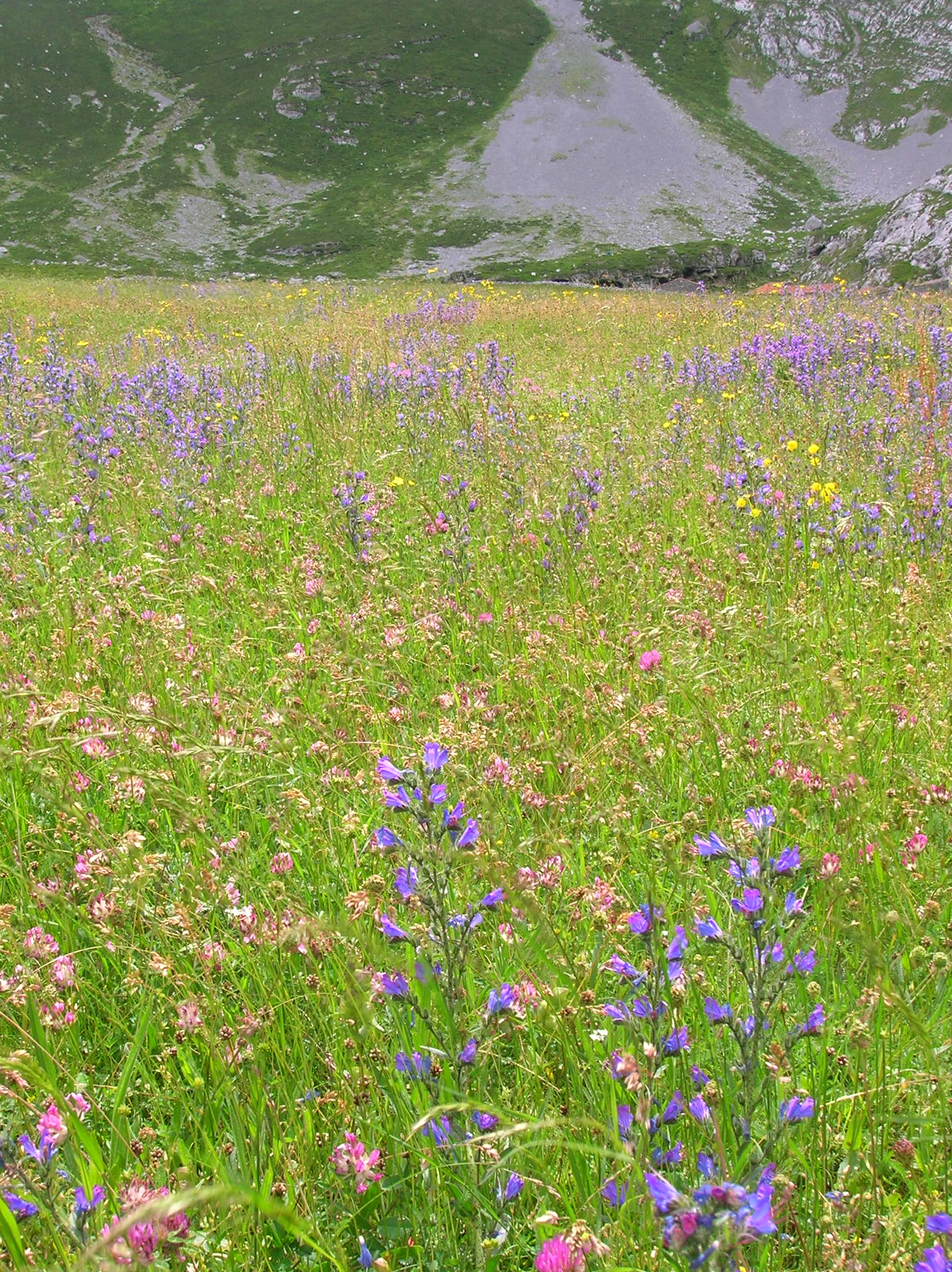
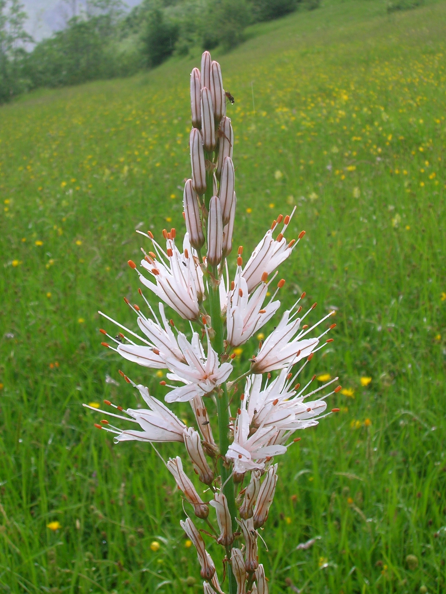
Bordering the beach at Tràigh Hòrnais is an extensive area of machair, a low-lying sandy pasture, unique to the Hebrides. Machair occurs where alkaline shell-sand blows over areas of peatland creating fertile, species-rich meadows. In early summer these can be a blaze of colour with wildflowers such as birds-foot-trefoil, yellow rattle, lady’s bedstraw, buttercups, daisies and clovers.

Machair has been cultivated over the centuries and usually offered the best agricultural land available. Traditional management systems such as hay-cropping are still considered to be some of the most wildlife-friendly farming practices found in the British Isles today.  Farmers are encouraged to retain traditional practices through targeted agri-environment incentives.

Crofting  has favoured wildlife species endangered elsewhere and helped these to thrive. These include the corncrake which can be heard throughout the islands with its very loud and distinctive grating krek krek call. As we walked around the Robach Machair we heard frequent corncrake calls amongst the longer grass but were unable to track down any of those responsible for this breach of the peace. Machair also provides a home to many species of wading birds including dunlins, twites, redshanks and golden plovers. 

DSCN1576

An Earthly Utopia ?

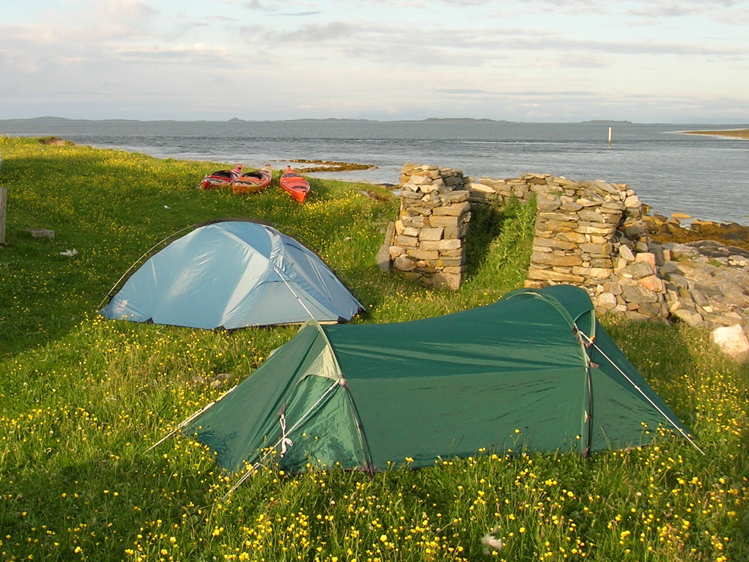
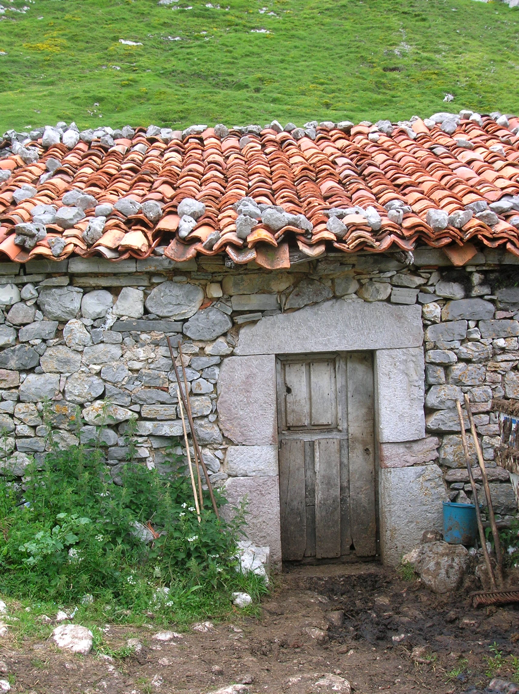
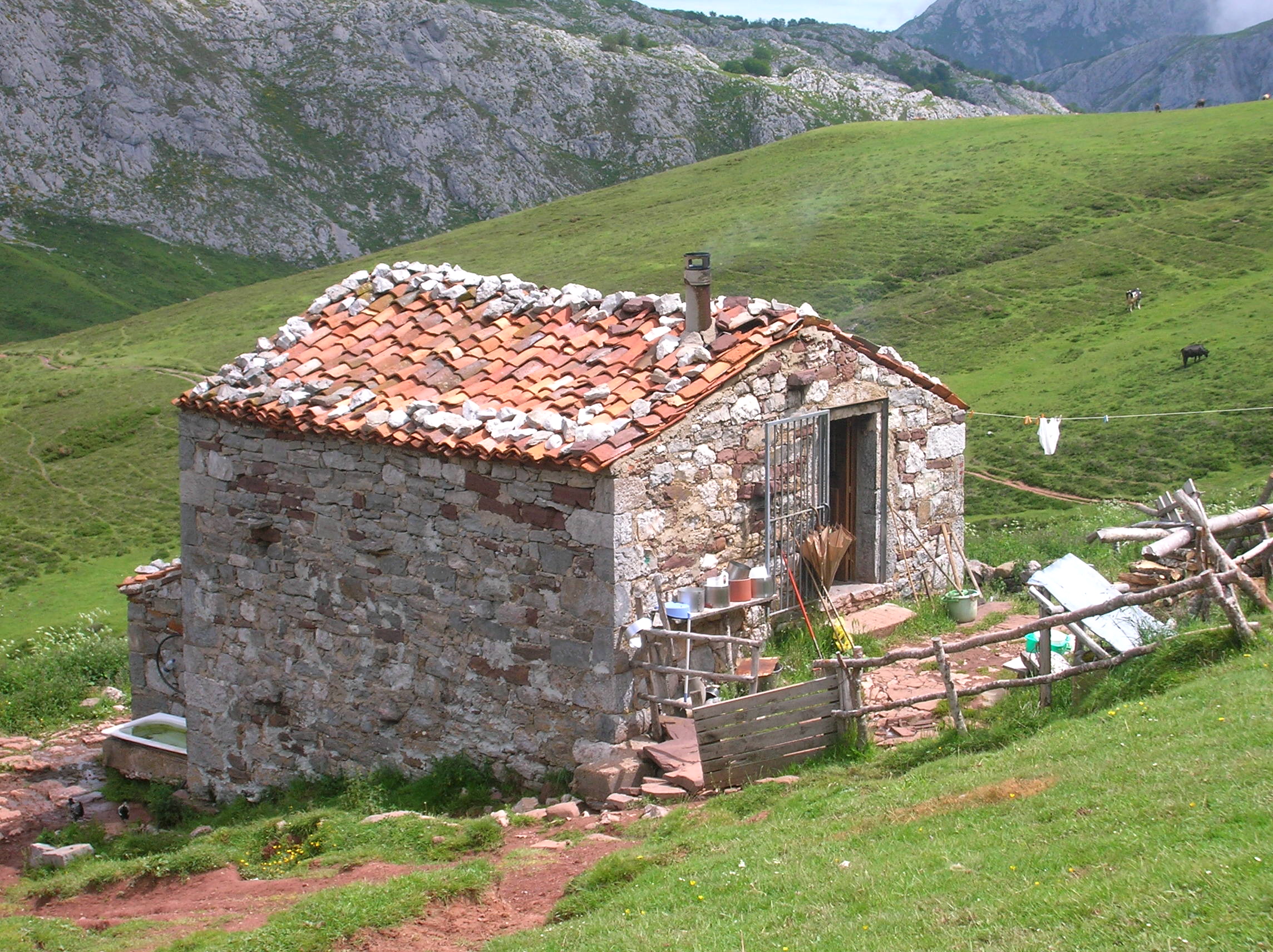
Back to the main plot: we made for our proposed campsite on the East side of Bernerey. The idea was to camp on a grassy area down by the sea close to the small youth hostel. This combined opportunity for privacy with a chance to use the facilities of the hostel for cooking, showering and sheltering from the elements. The hostel is a charming, traditional  Hebridean blackhouse with a thatched roof . The blackhouse, of a type once common in the islands, has been lovingly restored by the  Gatliff Trust  and is managed in partnership with the Scottish Youth Hostels Association.

It couldn’t have been a more idyllic evening as we pitched our tents by the sea, enjoying the fantastic, sweeping panoramas out across the Sound of Harris to distant peaks with ocean and rocks dominating the view. We ate a hearty meal, washed down with a couple of beers and looked forward to the prospect of a great day’s kayaking ahead. Despite the fact conditions were now perfect for an evening paddle, we resisted the temptation in order to savour the moment and to adjust to the more leisurely pace of island life. As the old West Highland saying goes, “Why do today what can be done tomorrow”. 

Copy of DSCN1562

Sea View: Idyllic campsite on the first evening

It didn’t take long to find out, however, why this laid back approach wasn’t the way forward. In the Uists it’s a case of “four seasons in an hour” and before we noticed it, the light breeze had started to strengthen and shift direction as ominous clouds began to blow in from the West. We turned on the radio to catch a weather forecast. Not good it seemed; a frontal system coming in from the West with likelihood of gales gusting to Force 9 !

Battening Down the Hatches

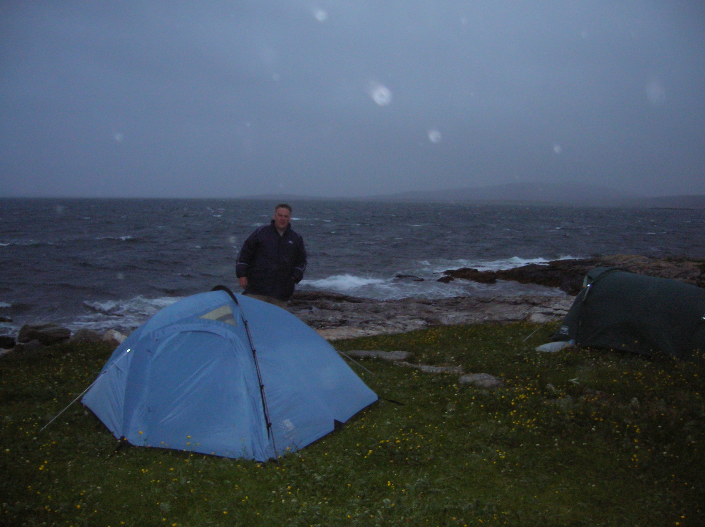
The forecast proved to be well founded for once. Pretty much true to form, our earthly island paradise was transformed, within the space of a few hours, into a ranging tempest as the sky darkened to an ominous gun-metal grey and foaming breakers started to crash onto the shore within spitting distance of the tents. We decided to check out the hostel which we found to be over-brimming with jovial university geologists on a field excursion. After joining in the camaraderie for a while, we then decided to turn in for the night,  retreating inside tents and preparing to batten down the hatches for, what promised to be, a restless night.

From the relative security of my tent, I listened to the wind gusting ever stronger as the fabric stretched and the poles creaked menacingly. The gusts became progressively louder and threatening; almost deafening like a jet plane taking off, as the flysheet flapped violently in a manner reminiscent of Scott’s ill-fated journey back from the South Pole.  Salt spray, whipped up from the foaming sea, washed over the tent. I struggled to console my self by reading a book by the light of my head torch. All plans for getting “a good nights kip” were now put on hold; surviving the storm was now all that counted.

DSCN1578

Sea Winds out on the Wild: Not quite so idyllic

With each successive gust, the tent bulged violently as I turned restlessly, the roof of the tent just a couple of inches above my face through the sheer force of the wind. It felt like the whole structure was about to lift off, taking me with it.

I texted the long-suffering Martina (whom I had only just recently met on a walking tour in the Pyrenees) with news of our dramatic predicament. Resolutely, like any good war correspondent, I continued to provide updates at regular intervals throughout the night ; a series of garbled and increasingly desperate texts along the lines of, “Help – the tents are lifting off !” or “Oh my God, we’ve had it this time !” or “Arrgghh, we’re goners for sure now”. Needless to say, this was all somewhat at odds with the blissful picture I’d painted just a few hours earlier of an earthly island paradise bathed in sunshine.

The next morning the deafening roar of the wind and pounding surf had subsided to a more comforting level. Now there was a new deeper and more ominous sound and something that sent a shiver down my spine to the very core of my being.  This was a primeval noise, akin to that of a slumbering monster, a savage boar or some foul necromancer straight from a Brothers Grimm tale. Gingerly, I peeped out the tent expecting to come face to face with the Beast itself.  Instead I stared out across a featureless, soaked, monochrome landscape towards the other tents which had also taken a heavy battering through the night.  The monster was alive and located !

I laughed at my foolishness; the unearthly sound emanated from the direction of Steve’s tent. I’d quite forgotten just how bad his snoring could be !  Both relieved and yet appalled, I crawled back into the security of my tent and covered my head with a  pillow in an attempt to squeeze in another forty winks. Anyway it didn’t look too promising for sea kayaking that morning.

DSCN1582

The “Beast” Emerges From its Lair

Weathering the Storm

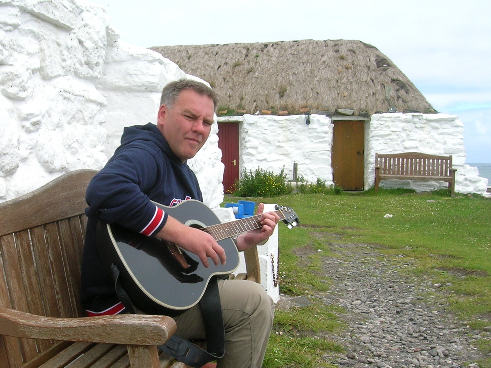
All day the storm winds continued to batter our small encampment as we sought refuge in the sanctuary of the hostel. Thankful the building been vacated for the day by the university geologists who were off, busily rooting about in pursuit of interesting and unusual rocks. We adjusted to the pace of island life; we chatted, read books and strummed tunes on the guitar. It was a chilled-out sort of day really, though not quite what we’d intended or come to the Hebrides for.

Occasionally, in moments of short-lived optimism, we’d poke our heads out the door looking for signs of imagined brightness in the sky (a favourite if somewhat fruitless pastime in Scotland). However the wind continued to gust and the waves continued to pound the shoreline with unrelenting vigour. All thoughts of kayaking activity were abandoned; we had cold feet !

That evening,  the geologists returned and the mood picked up, a good “craic” filling the building and raising our spirits.  All too soon however, it was time to turn-in again though. Reluctantly we retreated from the comforting warmth of the (overflowing) hostel and headed out again into the blackness of an island night, the blustering wind buffeting us and the driving rain stinging our faces. A second night of living hell followed, the tent flysheet flapping ever louder as the roof bulged downwards again, scraping my face. I updated Martina again about our battle with the elements (why should anyone else be allowed to sleep !) and rolled about restlessly into the “wee small hours” until at last sleep overcame me.

DSCN1575

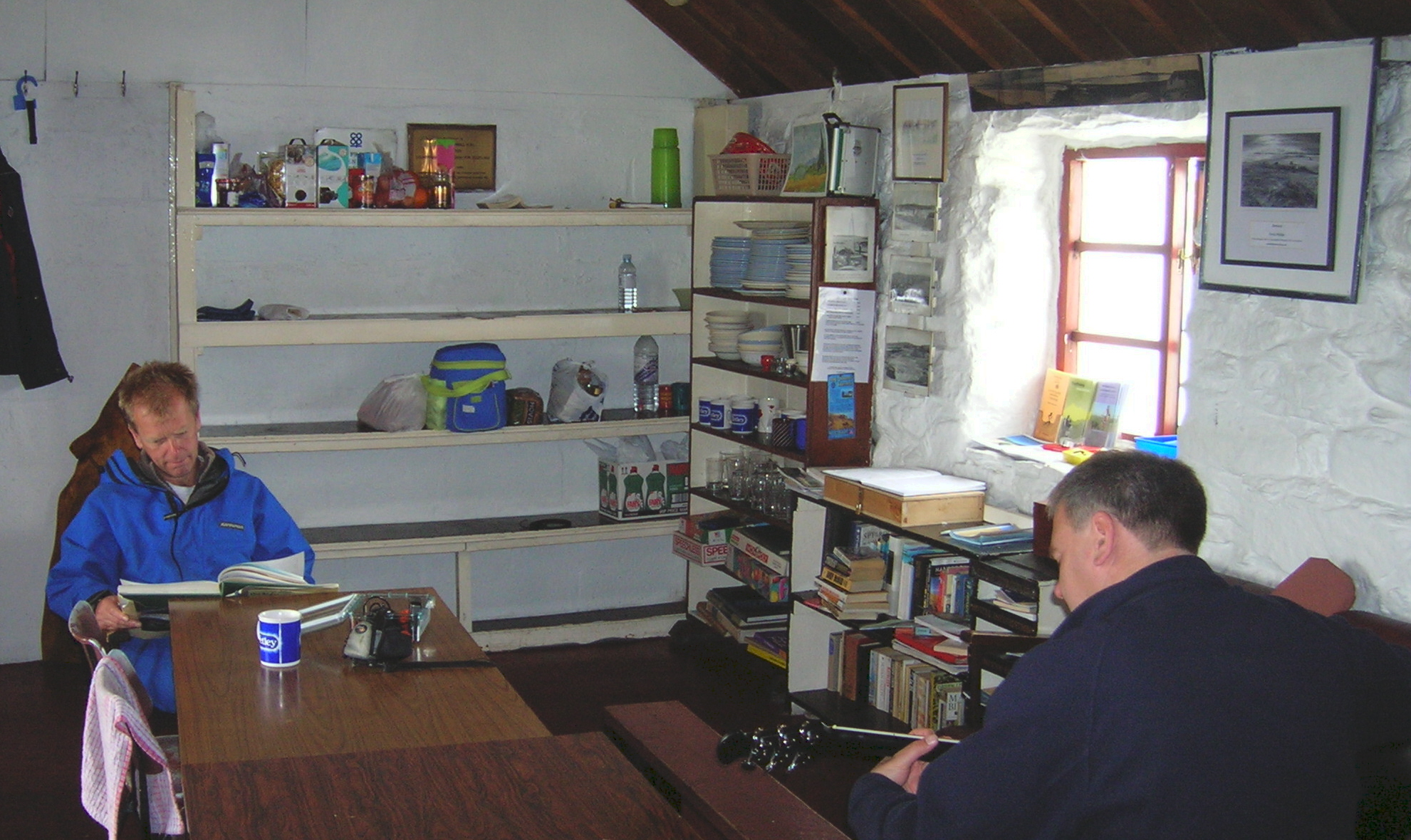
Sailors Rest: In the calm of the Blackhouse

Bleary eyed and still half awake the next morning, I peeped out of the entrance to see the that wind had dropped somewhat and sky appeared lighter. The ominous, deep resonance of snoring once more drifted across the Hebridean landscape, breaking the morning stillness. Occasional spluttering from the direction of Steve’s tent  indicated that the “Beast” might indeed shortly be stirring again from its slumber. Iain appeared now, blinking hesitantly at the door of his tent. He  looked pale, drained and sleep deficient as he shook his head despairingly toward the direction of the “Beast’s” lair. Clearly, he had not enjoyed a good night’s sleep what with flapping tents and the omnipotent night-time snorting.

Eventually everyone emerged. Whilst Steve appeared none the worse for wear, Iain looked drained and sickly following the night-time snoring assault. Unfortunately for him, he had pitched his tent much closer to the seismic epicentre then I had. 

Breakfast and a council of war followed. It was agreed that we would get out in the kayaks that day no matter what. For once, it was only driseling instead of raining properly which, from our experience to date, might be described as good weather in these parts.

Thunderbirds are Go !

Discretion, so they say, is the better part of valour and taking this to heart we decided that the exposed open waters and strong currents of the Sound of Harris were not for us in these fickle weather conditions (especially as Iain had never been out in his boat before; he’d picked it up from a hire outlet on the road North). We decided instead to head for the more sheltered waters around Loch Dheor and Loch Siginis in the upper part of Loch Nam Madadh. In this area, a veritable myriad of tidal channels between tiny islands and  promontories offers a considerable degree of protection even from the worst of weathers.

Ian

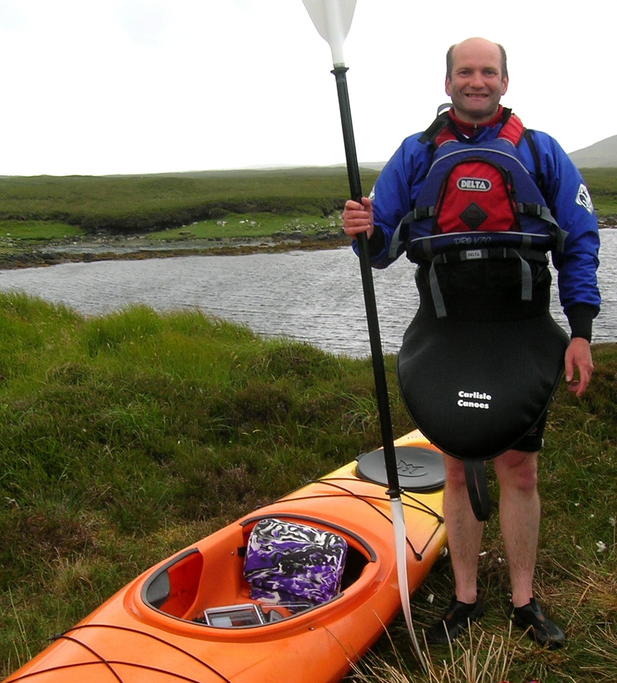
Sharp Dressed Man: Me ready for action

Even as we got changed, the wind whipped the foam out of the water and mischievously tried to  prise the paddles from our hands and send them flying off across to the Mainland.  Eventually though, after a wobbly start, we were water-borne. With a strong tail wind behind we were soon flying across the water ourselves and heading on a collision course with small islets. The contrast between the sheltered water, protected from the wind by the shore and the water exposed to the wind was extreme to say the least. One minute you would be becalmed and midges would emerge to bite you; the next you would be skiting, quite out of control, across the water at what seemed like 40 mph.

DSCN1591

Sheltered Inlet: In the maze of tidal channels around Loch Blathaisbhal

It felt great to be out though and to be battling against the elements in raw nature, or “blowing away the cobwebs” as we say in Scotland. The tidal channels were fascinating to explore with some interesting wildlife. Common seals, hauled out on the tidal islands, eyed us up suspiciously before grumpily retreating into the water with a snort and blast of salt spray from their hairy nostrils. They would then circle round, their heads and bemused faces bobbing out of the water as curiosity finally won over from fear about  the uninvited strangers entering their salty domain.

Otters also abound around the coast of the Uists. I was lucky enough to catch a fleeting glimpse of one before it disappeared in amongst the seaweed. Generally, a kayak is a great platform from which to view wildlife. Critters are far less concerned about canoeists than they are about people who walk around on two legs; the latter having a history in Scotland of  being rather more threatening to wildlife. On another part of the West Coast, I watched an otter from the sanctuary of my canoe (which was literally just a few feet away) for about  20 minutes as it blissfully gobbled down a  fish meal, seemingly oblivious to my presence.

DSCN1594

Taking a Break at Low Tide

We sought shelter of calmer waters in the lee of the wind and enjoyed a tasty snack before biting midges became too much of a nuisance and we were on the move again. When we had arrived the tide was just on the turn and their wasn’t much movement.  However it wasn’t long before there was quite a significant flow as the pools began to empty and were transformed, from areas of still (although windswept) water, to a series of small rapids and waterfalls. These proved to be exciting and sporting challenges which we enjoyed and which made up somewhat for the lack of opportunity to go out on more open seas. We played around in the pools and system of channels for another couple of hours or so before making landfall and dragging the boats back to the car. We headed back to base camp.

Iain

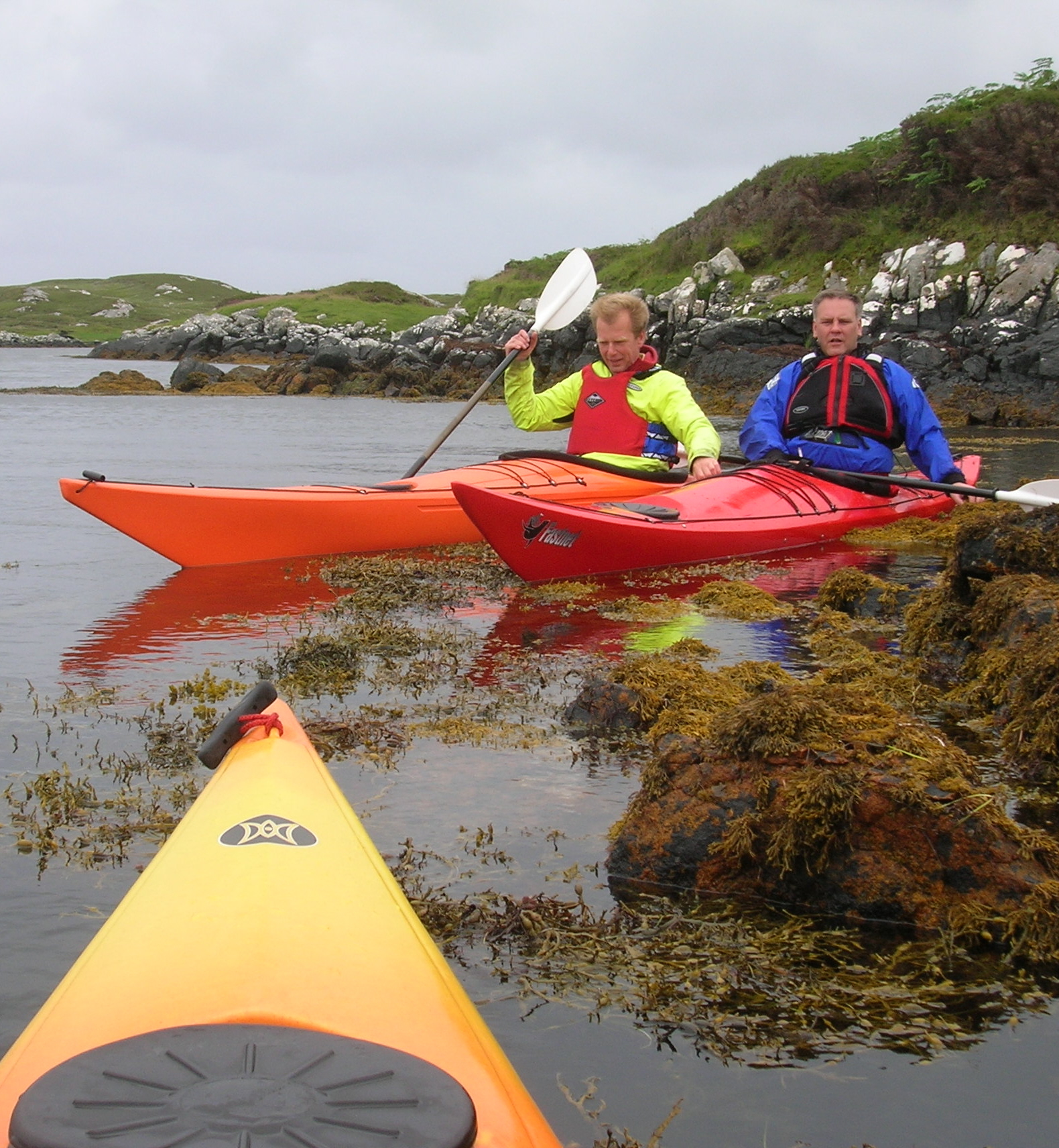
Iain gets a feel for his new boat in a moment of calm

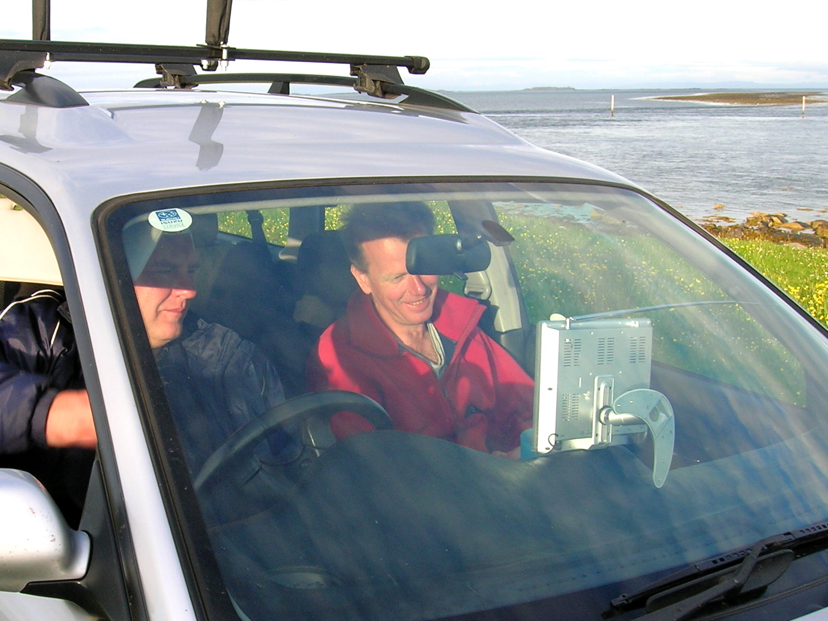
Tired and happy from these exertions we were happy to put up our feet and too our surprise the wind finally began to drop and the sun came out. The island world was transformed from grey monotone back to a landscape of colour and light. Iain and Steve were keen to watch some important football match or other and mysteriously  produced the required  technical gadgetry to make this possible. They were soon settled down in the car to watch the match, an occassional chorus of boos and cheers emanating from the vehicle. Although it being one of Scotland’s major religions, I have no personal interest in “fitba” whatsoever. I consequently determined to explore the island on foot to take advantage of the, no doubt, all-too-fleeting change in the weather.  

Copy of DSCN1560

“Fitba !”: No escape even on Bernerey

Island Castaway

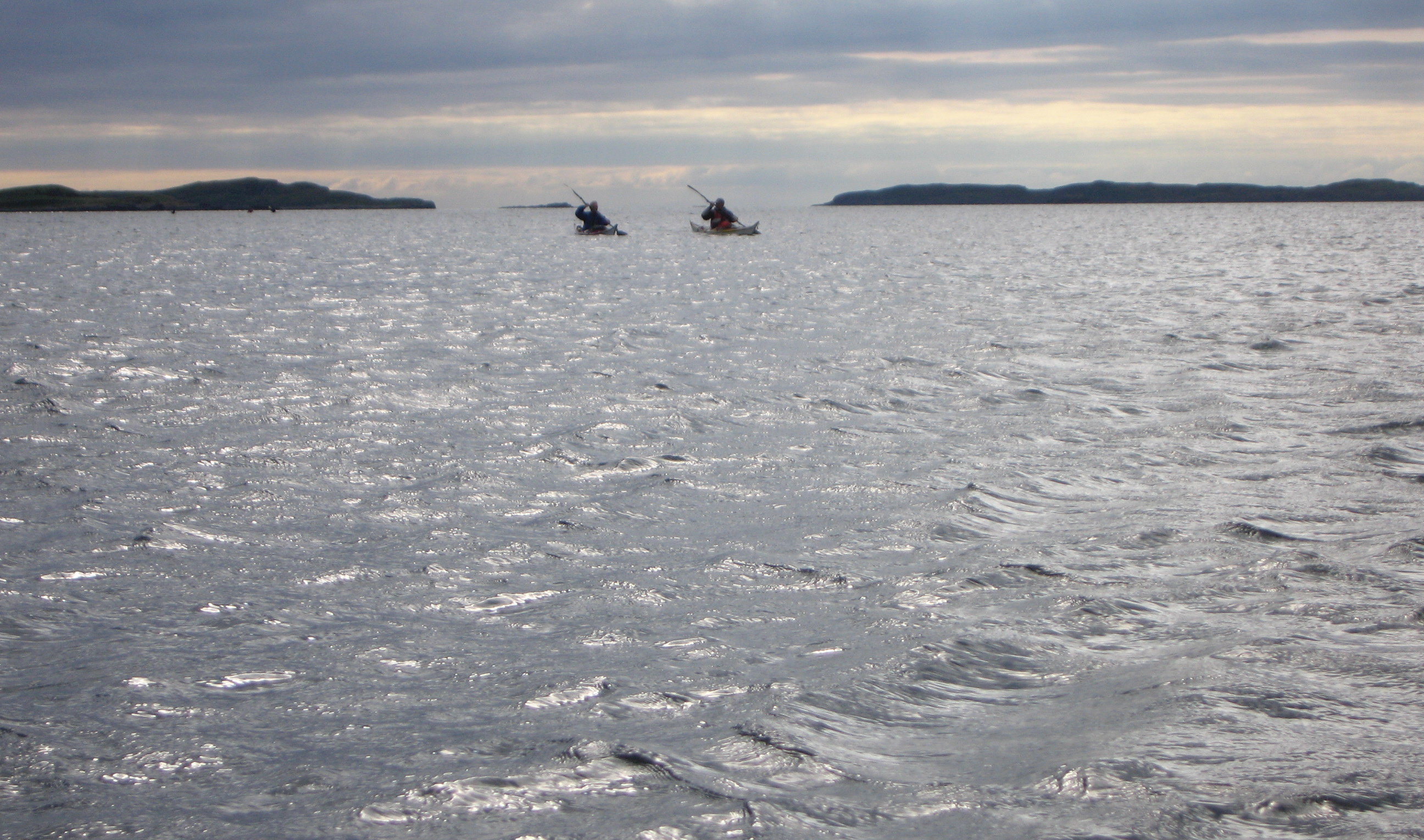
I headed off around the coast like a latter-day Robinson Crusoe enjoying the intense light and the sunshine. The air was full of the sweet chorus of skylarks and meadow pipits; the whole place was alive. A gentle surf washed the long sweep of shoreline just around the corner from the hostel, a collection of six sea kayaks adding  further colour to the scene. Had these guys been out in the storm I wondered. The was no sign of the occupants and so I continued my walk around the North side of the Island with wonderful expansive views opening up towards Harris.

DSCN1614

Beached Kayaks: With the peaks of Harris visible across the Sound

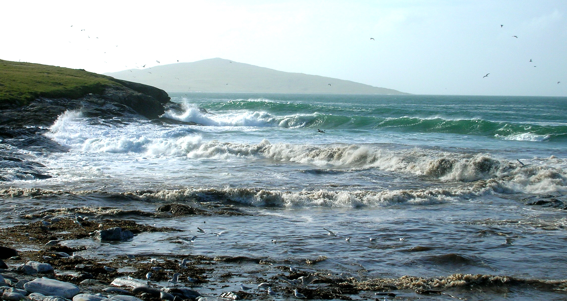
I followed the coast around the flanks Beinn Schleibhe passing through some vivid green patches of wet meadow dotted with yellow flag iris and ragged robin. I soon found myself on the exposed North West side of Bernerey; a rocky shoreline battered by the full force of the big Atlantic breakers we’d been dreaming about. I stopped for a while in this wild and windswept place to take in the magnificent views across to the Island of Pabbay and the mountain peaks of  North Harris. The steady pounding of the ocean waves, accompanied by the lonesome cries of terns and black-headed gulls cast a hypnotic spell. I found it hard to drag myself away from this enchanted place when it was finally time to move on.

DSCN1628

The Mighty Atlantic: Big breakers on the Bernerey’s West Coast

West Coast

The Raw Power of Nature

DSCN1636

Damp Flush: Wet meadow on the West Coast of Bernerey

A long Tradition

I set off again and headed up to the summit of Beinn Schleibhe which affords a tremendous panorama of the whole island, despite the fact it’s barely 100m high.  From this strategic vantage point, Bernerey appears to be a much more settled and far less remote place with a scatter of whitewashed cottages and mail order bungalows clustered around the Eastern seaboard. On the way down the hill back to the hostel, I passed by the old burial ground of Beinn Schleibhe, an atmospheric place and testament to the islanders who have come and gone through the centuries to leave their mark on Bernerey. The Hebrides are still one of the key strongholds of the Gaelic culture in Scotland with the landscape being shaped by generations of crofters and farmers.

The islands have always proved a challenging place from which to make a living and this has often not been helped in the past by inequitable patterns of landownership. The 18th Century Highland Clearances which followed the break up of the clan system had a huge impact in the Hebrides and provide the explanation for many of the extraordinary settlement patterns found on the islands to this day. 

On neighbouring South Harris for example, many people were evicted from better quality land that they had farmed for generations to make way for sheep farming. Whilst a large proportion of islanders emigrated to the New World, those that remained were forced to eke out a meagre and perilous existence on the Island’s barren East Coast. 

DSCN1645

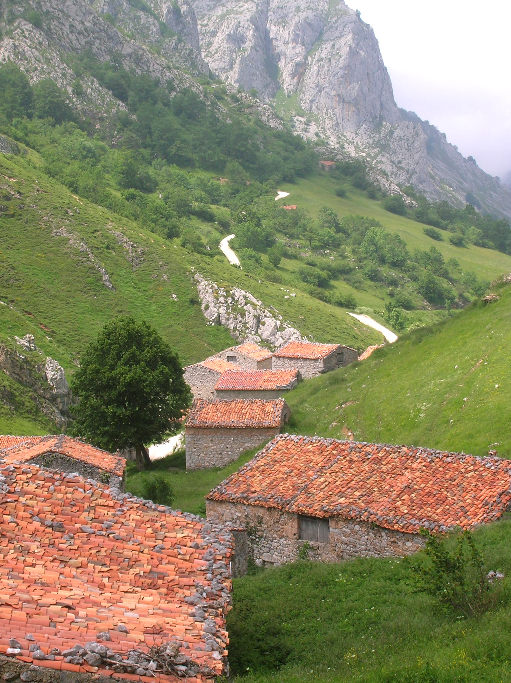
Crofting Country: Dispersed townships are characteristic of the Outer Hebrides

To scratch a living from such unpromising and  impoverished soils required considerable stamina. The people built up so-called “lazy beds” comprising alternate layers of peat and seaweed piled up over the barren gneiss bedrock and thus enabling them to grow a few basic crops such as oats and potatoes. There followed many years of struggle, poverty and campaigning before island crofters were able to win any rights of secure tenancy. The process of change continues down to the present day with recent legislation which now gives whole communities the “right to buy” their land if they can access the necessary resources.

DSCN1649

Sea Dreaming: Next stop America

A Tense Battle of Wits:

Back down at the hostel the “fitba” was finally finished (result unknown) and food (of sorts) was being prepared. It appeared that the geologists had vacated the hostel leaving the place empty and now up for grabs. I seized my opportunity and quickly moved my gear, lock stock and barrel, out of the tent, determining that for one night at least, I would get a decent sleep well away from wild winds and snoring monsters. Not only would I have a comfy bed to look forward to; but a whole room and the whole blackhouse all to myself; luxury indeed !

Iain, eyed me up jealously as if hinting at some undisclosed game plan. I asked him curiously if he was also planning on relocating to the hostel as common sense might dictate;  little did I suspect that there was a tense battle of wits being played out between the sharp-witted Iain and the Gruffalo-like Steve.

DSCN1657

Room with a View: The rustic hostel at Port Ludaig

As Iain later explained (with a hint of sadness in his eyes), nothing could have appealed more to him at that moment in time than the prospect of a decent night’s sleep away from howling winds and night-time noises. Being a pragmatist however, Iain readily understood the sheep mentality of the snoring Steve. In short, if he moved inside, Steve would be bound to quickly follow; then there would be no prospect of peace for sure. Iain also understood that Steve, having been brought up in the West of Scotland, needed to prove his machismo. Unfortunately this meant for Iain that Steve would be unlikely to relocate on his own accord and wouldn’t be the first of the two to go inside.

So it was the lesser of the two evils that Iain valiantly opted for; better to remain buffeted by the wind and storm outside in a flimsy tent (and separated by a distance of several feet) rather than face the uneasy prospect of being trapped indoors and at close quarters, with the snorer. Whatever the case, it all suited me just fine . I enjoyed a blissful night away from the wind, rain and snoring !

DSCN1678

Wild Rover: Scotland’s answer to Shane Macgowan

All Abandon Ship…

I awoke rejuvenated after an excellent night’s sleep. The others crawled into the hostel somewhat later; a motley crew looking tired, unshaven and dishevelled. We gobbled down some unappetizing breakfast and stared forlornly out the windows across the windswept grey, cold sea.  The wind gusted strongly, shaking the door on its hinges, howling through cracks in the woodwork and rattling the windows.

We discussed our predicament. It was unanimous ! ..We would leave Bernerey and head for more sheltered waters on the mainland where the chances of finding suitable conditions for kayaking might be somewhat better.

We packed up out gear and collapsed the tents before spending the rest of the morning chilling out. This involved taking turns to entertain (and irritate) each other with the guitar in front of the hostel.  I found the location, looking out to sea, most inspirational and conducive to composing little ditties which I still have in my head to this day.

Later we waved goodbye the blackhouse and set off, albeit a little sadly, to join the ferry queue at Lochmaddy. We were soon heading off over the sea to Skye and pastures new.

DSCN1679

Over the Sea to Skye: Awaiting the Ferry at Lochmaddy

Through Pastures Greener:

In comparison with the wind battered Uists, Skye appeared like a veritable Garden of Eden with patches of broad-leaved woodland and green fields providing a welcoming contrast to the upland moors and mountainous landscapes. Our plan was to quickly drive across Skye before heading over the Bridge, which now connects the Island with the Mainland and then to drive down the fijord-like Loch Duich to Sheil Bridge where we would spend the night.

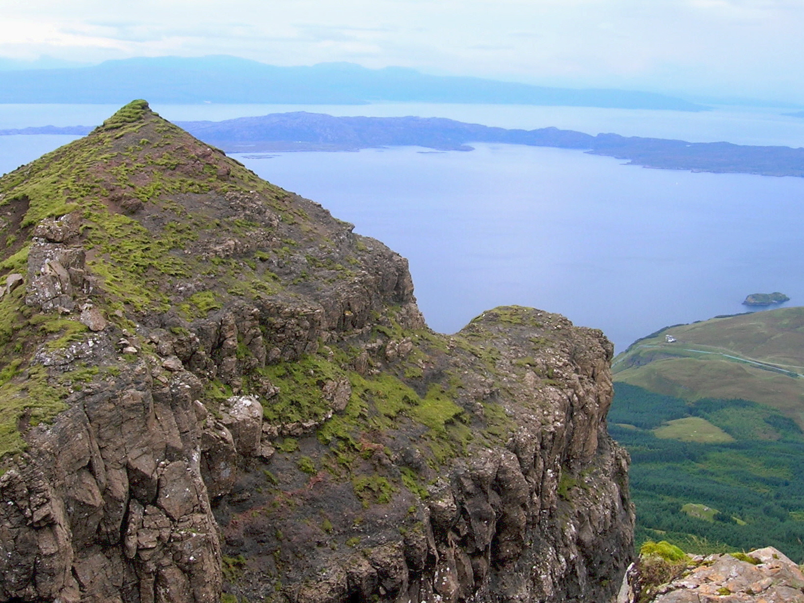
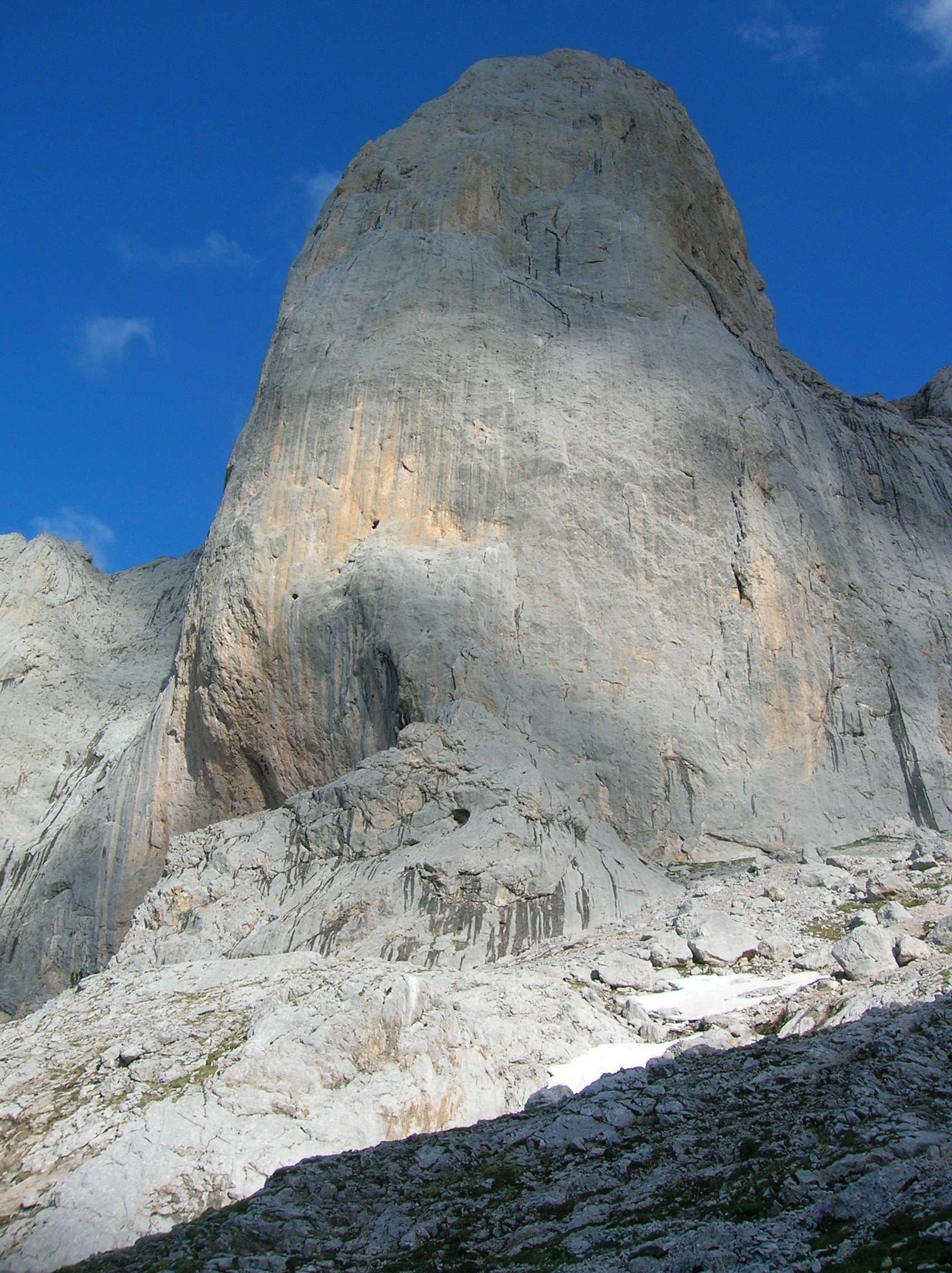
Skye is the largest of the Inner Hebrides (at 639 square miles) and boasts an incredible diversity of scenery and landscapes including most famously the Cuillin Ridge comprising of volcanic basalt and gabbro rocks. The Cuillin Ridge is one of the best known and most dramatic mountain ranges in the British Isles. The terrain is rough and testing and the weather conditions often poor. Despite this the Cuillins are a magnet for climbers and mountain walkers from all over the country.

DSCN1183

Rocks and the Water: Sunset over the Cuillin Ridge

DSCN1939

On the Ridge: View towards Blaven (928m) from Bruach na Frithe (958m)

I was first drawn to these hills when I was still at school and spent quite a few happy breaks in the Cuillins learning basic rock climbing and ridge scrambling before I worked out that I didn’t really have such of a head for heights after all (fortunately I hadn’t fallen off before that). Despite this, getting up onto the Cuillin Ridge is well worth it and there are magnificent views out over the Western seaboard of Scotland to the distant Outer Hebrides, Rhum, Eigg and the Torridon Hills . When the weather closes in here though, (as it frequently does) a compass will be of little practical use as the rocks are magnetic. In addition to the better known Black Cuillins, the nearby Red Cuillins, whilst being less precipitous are still spectacular in their own right.

DSCN1948

Red Cuillin: Marsco (736m) in evening sunlight

The mountain scenery in the North of Skye is different again in character but equally dramatic and worthy of  exploration. The Storr (located to the North of Portree) is famous for it’s “Old Man”, a soaring  and seemingly unassailable rock pinnacle  under the summit of the main peak (719m). From here it’s possible to walk the entire length of the Trottenish High level route to the equally spectacular Quirang. This dramatic ridge crest route provides sweeping coastal views in all directions and along with the Cuillin Ridge is a classic Scottish ridge walk.

DSCN1960

Over the Sound of Raasay: Looking East from the Storr towards the Mainland

On the Road Again

The Highlands are renowned for their winding single track roads which confuse and beguile many foreign visitors, some of whom are unused to the concept of pulling over to allow oncoming vehicles to get past. It’s not unknown to find an agitated BMW or Mercedes driver steadfastly refusing to budge or back into a passing place located just a few metres behind; meanwhile a long-suffering local person is somehow expected to reverse for 500m up a steep hill and around a blind corner.  This is a situation where common sense and courtesy need to prevail over any written rules.

In general though, single track roads are on the wane as main routes through Skye and the Highlands are increasingly upgraded with slick dual lanes, neatly cambered corners and an assortment of day-glow cats-eyes. Quite often though it’s cows and sheep that delight in slowing up the traffic on Highland roads. Whilst cows just like to simply stand there and create a roadblock, sheep have mastered the annoying habit of running in front of cars for mile after weary mile, despite numerous opportunities to get out the way.

IMG_3816

“Get oot ma road…”:Going nowhere very quickly on a single track road

The greatest hazard comes on Highland roads at night though when the lack of traffic encourages people to really “put the foot down”.  There is a real risk of a collision with a red deer. Sometimes the only indication you’ll get that they’re there at all is the reflection of your headlights in their eyes; then you realise that there are hundreds of them right next to the roadside and it may already be too late. I know of several people who’ve collided with red deer on Highland roads at night, often with disastrous results.

The “Other” Part of Skye

The Sleat Peninsular in Southern Skye is a green and pleasant land and is known as the “Garden of Skye”. This area seems remarkably sheltered in comparison with the more mountainous areas further North and is a land of whitewashed crofts, patchwork fields and sheltered bays. There are also great views across to the Cuillins from the West side of Sleat, including from the crofting township of Tarskavaig which is accessible by another of the winding single track roads that I’ve just described.

DSCN1236

“The Garden of Skye”: Crofts at Tarskavaig on the Sleat Peninsular with the familiar Cuillin Ridge behind

Sleat  is also home to the Sabhal Mòr Ostaig, a modern purpose-built campus which has been created to ensure teaching of Gaelic culture and language to new generations of people from the Highlands and Islands. In general, Gaelic culture and music is thriving as never before. 

As a young man I remember being captivated by the music of the Skye band “Runrig” who at that time were unique amongst rock bands for singing many of their songs in gaelic. Runrig indeed did much to pave the way for popularising gaelic music and culture and were amongst the first in a long line of later artists including as Capercaillie and more recently, Julie Fowlis with her beautiful and haunting gaelic melodies.

As a spin-off from the popularisation of Gaelic, there is a growing interest amongst younger people to learn to play and perform traditional music. There are also numerous “Fèis” events held throughout the year across the West Highlands where you can spend a weekend learning to play and perform traditional music amidst convivial company. I’ve been to a few of these and would certainly recommend getting along. The “craic” is good as they say…

DSCN1221

Sabhal Mòr Ostaig: ensuring the future of Gaelic culture and language

DSCN1224

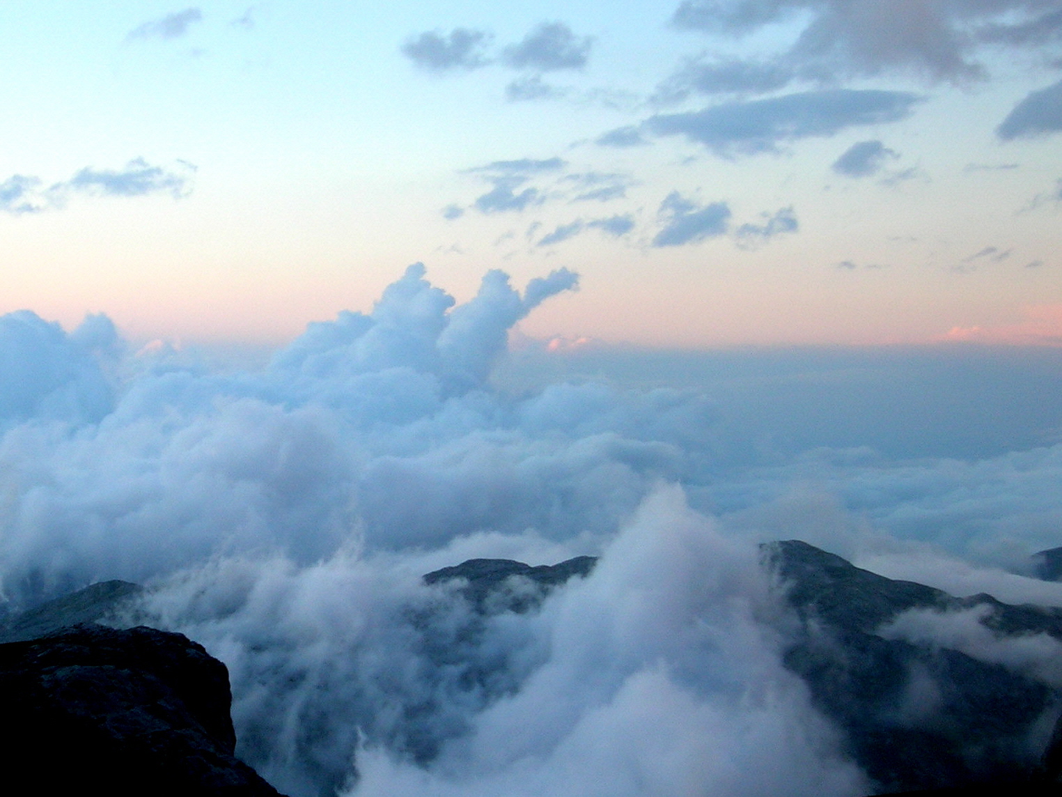
Ambient Cloudscape: Looking West towards the mainland from Skye

The last Leg

And so we passed over the Skye Bridge on the last leg of our trip and made our way down the fijord-like Loch Duich past the world famous Eilen Donan Castle (the one that has been in too many movies to count).

We checked in at Ratagan Youth Hostel, another characterful building located down by the shoreline. To our horror we realised we would all have to share the same dormitory room here. This time however, nobody had the energy or interest to put up tents again. Most surprisingly Steve, proving  that he really he was a gentleman after all, produced shiny new sets of earplugs for everyone; pointing out that he’d brought them along incase any other members of the team were bad snorers ! …enough said. 

And so the next morning we awoke to find sunlight streaming in through the windows of the hostel. The earplugs had done their job perfectly and we’d all managed to get some sleep at long last.  Outside, not a single breath of wind ruffled the mirror-like surface of Loch Duich.

Hardly bothering to have breakfast, we threw on our clothes and pushed our boats out onto the still water.  At last the gods were smiling upon us and we enjoyed a perfect morning paddling before packing up and heading off down the road. Perhaps at the end of the day, this was all we had really been seeking  from the start; were we just fair weather paddlers or, at worst, cowards seeking out the mediocre ? The big waves, strong currents and howling gales of the Outer Hebrides would have to wait for some other day.

DSCN1682

Such a Perfect Day: Brilliant morning sunshine at Ratagan, Loch Duich

DSCN1688

Becalmed on Loch Duich

DSCN1690

What it’s all about !

DSCN1705

Steve and Iain with the Five Sisters of Kintail ridge (background)

Postscript: Sea in the Blood

With hindsight our trip had not been a particularly successful one, as far as our objective of clocking up kayak miles was concerned.  However, that’s just the way it is on Scotland’s West Coast; you have to adapt to wind and weather and (to a considerable degree) learn to go with the flow. This may mean disappointments and changes of plan.

To reap the riches of Scotland’s unspoilt coastline you need patience, flexibility and most of all a high degree of humility; the sea is not to be messed with, as those who’ve felt its enormous power will know. Most importantly (and at risk of sounding like my mother), if you do want to kayak on coastal waters, it’s best to start out by going along to a club to learn some of the basics including how to deal with capsize and rescue situations.

The Scottish coastline is tremendously beautiful, diverse and unlimited in the scope it offers for exploration and experiencing a sense of freedom. Here in Continental Europe, the sea is not quite so close and the kayaking opportunities (that I used to take for granted in Scotland) are now much more limited. However, I think the sea must be in my blood; I don’t think that I’ve become a total landlubber, not just yet anyway. The kayak is safely stowed away here awaiting its next voyage…

 …and an old sea dog never forgets his tricks !

Sea dog

Sea Dog: Me on the sea

West coast kayaks

No Limits: So many places to explore by kayak on Scotland’s West Coast (FSKC Photos)

IMG_3778

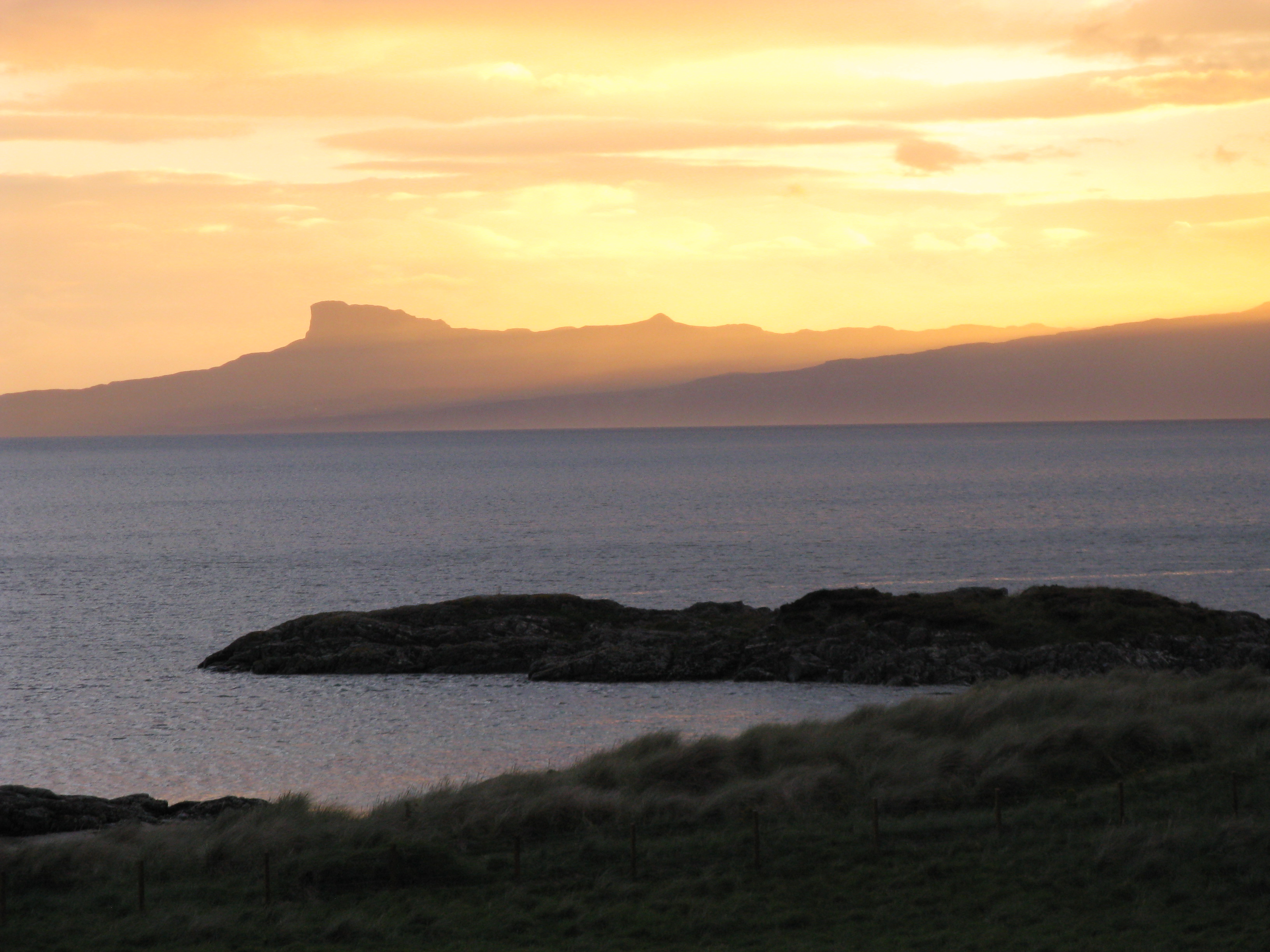
Island Sunset: Looking out to Eigg from Traigh beach, Morar

Posted in Canoe Trips, In Scotland, Wild Places | Tagged , , , , , , , , , , , , , , , , , , , , , , , , , , | 2 Comments

Picos de Europa: On foot through Spain’s Costa Verde

It’s mid January and at last we’re snowbound here in Aachen after seemingly weeks of damp, mild winter weather. During these dark, winter days thoughts start turning to sunnier months spent exploring Europe’s wilder places.

I’m always amazed by the sheer diversity of landscapes on this supposedly crowded and well charted continent. One of the real gems we’ve discovered is the Picos de Europa in Northern Spain, a part of the Cordillera Cantábrica mountain chain which runs along the Costa Verde from the Portuguese border to the Pyrenees. 

DSCN2912

Spain’s Green Costa Verde: the Wales of the Iberian Peninsula

I first saw these shimmering peaks, which rise dramatically from the sea, from a plane window en route to Portugal. I didn’t need much convincing that the Picos must be a spectacular part of Spain to visit. A few years ago  (in the days before children arrived) we were lucky enough to get the chance to spend a couple of weeks wandering through the Picos to the Costa Verde. This is a record of our journey…


Santander and the Costa Verde

Our journey started in Santander on the Costa Verde. This Northern coast of Spain is remarkably green and runs contrary to every stereotype that people might have of the country. Described as the “Wales of the Iberian Peninsular”, the coastline of Cantabria and Asturias is a green and unhurried land with a relatively cool climate, strongly influenced by moist winds off the Atlantic. As with the British Isles this means a high likelihood of encountering rain. However this shouldn’t put you off; the landscape is stunning and as we found you might just get lucky and avoid the downpours ! 

DSCN2635

The sun drenched valley of Liébana with the peaks of Ándara (Mazio Oriental) in the background

In the valley of Liébana

We took a bus from Santander to the town of Potes. This small bustling town is located deep in the valley of Liébana on the South Eastern side of the Picos. Potes is located in the rain shadow of the mountains and consequently is blessed with a sunnier, warmer climate than encountered on the coastline. These sheltered valleys are characterised with an almost mediterranean  type flora with evergreen forests including some remarkable cork forests which traditionally have harvested to supply bark for the wine industry and production of other cork products.

DSCN2668

Day-glow colours: bloody cranesbill in the meadows around Potes

There are also some colourful, dry meadows with spectacular displays of colourful flowers such as vipers bugloss and bloody cranesbill. Traditionally these meadows have supported a long tradition of cattle rearing and consequently have been managed by local farmers to become some of the most diverse and richest ecosystems in Europe (more than 1400 species of plants have been recorded in the Picos).

DSCN2676

Village scene: distinctive red pantile roofs of the Potes area

The villages of Liébana are delightful to explore with their characteristic welcoming terracotta tile roofs.  Village life is slow and tough but there is something interesting to discover in every hamlet. These days many people are leaving the land and traditional village life to seek enhanced economic opportunities in urban areas. Consequently, as in other rural communities around Europe, many houses are now being converted to second homes with a steady stream of incomers queuing  up to buy properties as holiday apartments. Whilst its sad to see the decline of traditional rural lifestyles, I hope at least the character and traditional buildings of these small villages can be retained through an influx of outside investment. These traditional houses are real treasures worth preserving.

DSCN2657

The Pig Whisperer: Martina getting acquainted with the locals

Our plan was to do a circular walking tour of several days taking in the Central and Eastern ranges of the Picos before visiting the Western range for a few days and the spectacular Garganta del Cares gorge which dramatically spits the ranges in two.  The idea was to travel light and take just the basics with accommodation in local inns, mountain huts and auberges.  We choose to go in June as the Picos is relatively uncrowded at that time of year and there is therefore no need to book accommodation ahead. Another benefit of visiting the Picos in early summer is that this is the best time to appreciate the areas amazing biodiversity including the spectacular displays of wild flowers in the alpine meadows.

DSCN2694

Torre Alcacero (2247m) and Pico de La Padierna (2319m) from El Butron

To Fuenta De  and the Urrieles

We hitched a lift up the Deva Valley to Fuenta De located at just over 1000m above sea level. From Fuenta De a short cable car ride takes you up 800m in just a few minutes and into the heart of the Urrieles (Central Range) of the Picos. From the top station at El Cable we were rewarded with spectacular views of neighbouring peaks including  Torre Alcacero (2247m) and Pico de La Padierna (2319m). The view across the Deva Valley to the Cordillera Cantabrica was also spectacular with low cloud clinging to the summits. We set off in the direction of Puertos de Aliva through a landscape of close-cropped meadows interspersed with familiar alpine plants including the intense blue of  gentians.

Cloudscape

View across the Deva Valley to the Cantabrian mountains

DSCN2697

Making tracks towards Puertos de Aliva

DSCN2700

Long and Winding Road: the trail through the screes

This is cow country with cattle being integral to the production of celebrated local cheeses and dairy products. traditionally the meadows would have been grazed by relatively small casina cattle from Asturias or the wide horned tudances from Cantabria. Both these breeds were hardy and suited to life in the mountain meadows, however nowadays these are often being replaced by new breeds offering higher productivity.

DSCN2707

Cow Country: The Puertos de Aliva has been grazed by generations of cattle herders

In the Valle del Duje

Along the Valle del Duje, several hamlets of summer sheilings used by the graziers are encountered en route to Sotres with the most attractive being located around Vegas del Torro and Invernales del Texu. Traditionally, as in the Alps (and previously in the Southern Highlands of Scotland) cattle are managed through a system of transhumance and are taken in early summer from winter accommodation up to the high pastures to graze. 

This whole system is responsible for the incredible cultural landscapes found in the Picos as well as much of the biodiversity of the high meadows. Increasingly however younger people are reluctant to practice the relatively tough and lonely lifestyle associated with transhumance leading to an abandonment of pastures and the increasing tendency to rear cattle indoors. 

DSCN2715

Cattle graziers summer sheilings

We walked down the valley flanked by dramatic peaks and rock towers reaching to the heavens on either side.  Further down the Vallee de Duje, the meadows are a veritable blaze of colour.  Plants growing there include many familiar plants found in Britain including vipers bugloss, kidney vetch, stichwort, birds foot trefoil and greater yellow rattle. In addition there are many species of orchids, a few of which are unique to the area.

DSCN2721

Blaze of colour: meadows of the Vallee de Duje make a stunning spectacle

DSCN2718

Variety of life: summer flowers including vipers bugloss, kidney vetch, stichwort and birds foot trefoil

In addition to traditional management of hay meadows, the amazing biodiversity of the Picos is also influenced by the area’s geology with the central ranges largely consisting of limestone with Devonian slates and shales found on the periphery.  The limestone was deposited in warm, shallow seas during the Lower Carboniferous period before being raised up through cataclysmic geological activity to form lofty mountain ranges.

Later glaciation and frost shattering sculpted the rocks during successive ice ages to form the dramatic peaks, cirques and aretes characteristic of the Picos today. Underground the erosion and chemical weathering of the limestone created extensive cave systems, some of which later collapsed to become deep gorges.

DSCN2728

Sheilings at Invernales del Texu

DSCN2732

Looking back along the Valle del Duje towards Puertos de Aliva

Onwards and upwards

The next morning, refreshed and rearing to go after a night in the mountain village of Sotres, we made our way through damp morning air up the winding trail towards the Vega Urrielu. As the trail zig-zagged steeply up the hillside the views started to open out.

DSCN2734

Invernales del Texu with Picu Boru behind

We passed through beautiful wet meadows with impressive displays of white asphodels, orchids and yellow rattle. Finally as we reached a broad saddle near to Mida La Terenosa, the clouds started to part and we got our first views of the Urrieles peaks including the dramatic rock tower of  the Naranjo de Bulnes, often described as the “Matterhorn” of the Cordillera Cantábrica.

DSCN2723

Close up: delicate hues of squinancywort, a characteristic plant of limestone grassland

DSCN2737

White asphodel in a wet meadow

The landscape changes abruptly as you enter into the Alpine zone of the Picos as the vegetation recedes and limestone bedrock starts to dominate. The high mountain areas are home to numerous chamois which nimbly navigate the precipitous ledges and rocky screes with comparative ease. Golden eagles and griffin vultures wheel above mountain peaks and passes, borne aloft on the rising air currents.

DSCN2740

First view toward Urrielu from Mida La Terenosa

DSCN2746

Summer dwelling near to Refugio de la Terenosa

The path became increasingly steep and narrow as we headed on upwards towards Picu Urriellu and our destination of the Refugio J.D. Ubeda. We passed by the small summer hamlet of la Terenosa where a weatherbeaten lady with a somewhat  melancholic menagerie of animals, offered some basic refreshments in a style oddly reminiscent of a Nepali “tea house”.  After a brief stopover we continued onward.

Soon we were enveloped  in a thick mist with the path climbing steeply and with precipitous drops opening up below. We climbed interminable zigzags up the slope, Martina growing ever skeptical about the prospect of finding  attractive accommodation in such a seemingly hostile environment. An increasing silence indicated a growing level of disapproval as I adopted my patronising “Mr Motivator” role, struggling to convince her of the validity of our plans. At last the Refugio loomed reassuringly out of the cloud as doubts were put aside and inviting smells of  food ushered us inside.

DSCN2775

Clouds hang in the valley below Veg Urriellu near to the Refugio J.D. Ubeda

Urriellu and the Naranjo de Bulnes

Suitably refreshed with Asturian stew and a fresh change of clothes, we emerged two hours later from the refugio to find ourselves blinking in bright sunshine. The ominous waves of cloud had rolled back to to reveal a spectacular panorama all around us, rock towers and lofty peaks piercing the skyline. 

Eager to explore, I scrambled up the flanks of a peak to a spot a few hundred metres above the refugio where I was rewarded with dramatic views of the Urrieles massif.  The cloud had now receded to a much lower level with an open view to the North. This low-level cloud, known to locals as the “encainda”,  is a characteristic feature of the Picos and is caused by warm, moist air blowing inland  from the Atlantic and condensing as it cools.

Above the clouds

Above a cloud ocean: looking North towards the Cantabrian Coast

Most spectacular of all was the view of the Naranjo de Bulnes (2519m). This imposing rock tower is known as the “Matterhorn” of the Picos and poses a formidable challenge for rock climbers. The peak was first climbed by Spanish climbers Pedro Pidal and Gregorio Pérez in 1904. Although not the highest peak in the Picos de Europa (that accolade falls to Torre Cerredo at 2648m), it is certainly the most iconic and best known. Further peaks rim the enclosed valley to the South and it’s possible to cross the Horcados Rojosa, a high col above the Huo Los Boches, to the Cabana Veronica,  a tiny mountain hut reminiscent of a crashed Apollo command module.

DSCN2774

Jewel in the Crown: Naranjo de Bulnes, Picu Urriellu (2519m)

DSCN2763

Wild Country: peaks above Huo Sin Tierre towards the Horcados Rojosa

Rescue Mission

After a cramped night in the Refugio we planned further exploration of the high country up towards the Horcados Rojosa col. The day dawned bright and sunny with near perfect conditions. We were just about to leave the refugio when our plans were scuppered by a seemingly confused and frightened Russian gentleman who approached us.  He  appeared to be suffering from heart palpitations and altitude sickness, having climbed up all the way up from sea level the previous day.

Reluctantly we changed plans and offered to escort the gentleman back down the hill to lower altitudes.  Fortunately he seemed steady enough on his feet and we set off downwards, making  rapid progress as we moved into easier terrain. Our friend, now feeling much better, was most grateful for the escort and thanked us profusely as we parted company by Cuetu Cuaceya. We stopped for a while to explore the meadows and after an idle lunch break we headed onwards towards the mountain village of Sotres, the unofficial “capital” of the Picos. 

DSCN2795

Rescue Mission: escorting the Russian gentlemen down to safety

DSCN2801

View down the Hou Lluengu towards Bulnes

DSCN2811

Back down in the meadows around Cuetu Cuaceya

Through the Andara range to Beges:

We enjoyed a couple of nights in a small pension in Sotres. The first evening was very quiet and we had the place pretty much to ourselves. The next day was Friday and we were amazed that evening by the steady stream of weekend visitors who flooded into the village. Our small pension was soon bustling with clientelle who rapidly appeared to be enthusiastically downing the entire contents of the bar in record time.

As mentioned, the Picos region, suffers from a steady out-migration, particularly of younger folk looking for economic opportunities. However, unlike in other European countries, many local people continue to maintain dwellings in their place of origin and return home at weekends to catch up with village life. This has the effect of transforming what appear to be deserted ghost towns into bustling weekend honey pots. The contrast could not be greater.

DSCN2826

The picturesque village of Sotres (1045m): the “capital” of the Picos

We left Sotres and headed through the Andara range towards the hamlet of Beges with a view to climbing the two peaks of Sagrado Corazon (2214m) and Samelar (2227m).  After climbing steeply upwards from Sotres we reached an undulating, stony plateau with extensive views in all directions. A welcome breeze brought relief from mid morning heat as cloud started to blow in from the coast to the North, enveloping the lowlands and leaving the lower peaks as freestanding and isolated islands.

We made good progress and were soon at the tiny Casetòn de Andara Refugio, tucked away under a rock outcrop amidst a desolate landscape of abandoned mining operations. Continuing steeply upwards past the Refugio, we reached the Col de San Carlos and then following another final hard push we stood proudly on the summit of Sagrado Corazòn (2214m), the land dropping steeply away in all directions. To the South we could see our starting point of Potes down in the sunny, lush valley of Liébana which contrasted starkly with the barren mountain peaks and the banks of cloud to the North.

DSCN2839

View south West from the summit of Sagrado Corazòn (2214m),

DSCN2840

Alpine flowers near the Col de San Carlos

DSCN2841

Spring gentians in the Andara range

After taking in the view we made our way back down to the Col in the direction of Samelar (2227m).  From the peaks we retraced our steps back to Casetòn de Andara and continued our journey onward toward Beges. The route followed a largely straight track which contured gently along the side of the mountain, just level with the edge of the cloud sea beneath us. One minute we were rewarded with dramatic “Lord of the Rings” type views of peaks looming out of the mist whilst the next minute we would be immersed in the merky sea of fog, struggling to see a more than just a few feet in front of our noses.

DSCN2853

Another Lord of the Rings moment en route to Beges: Looking Northward towards Tresviso

On the way we got fleeting views towards the mountain village of Tresviso with its infamous zig zag path which provides tortuous access from the Desfiladero de la Hermida gorge some 800m below. This path is now very popular with walkers and was apparently still used daily by the local postie into recent times. 

Our own route to Beges followed a similar course as it plunged downwards into the cloud through a series of convoluted hairpin bends. I cleverly suggested a short cut to miss out some of the hairpins by cutting directly down the slope; although seemingly a good idea, this proved to be a highly unpopular decision. We were soon sliding down through knee-deep scrub, between precipitous crags and hidden sinkholes (which presumably provided access into unseen limestone caverns below). Fortunately we both survived the ordeal and soon the mists parted to reveal the inviting village of Beges beneath us; it had been a long day.

DSCN2870

The hamlet of Beges: a green oasis tucked away in a hidden valley

Beges

We checked in at the characterful auberge in the village where we found we were the only guests. We were made very welcome there by the young couple who had recently restored the building and opened it as a hostel. The pair had come to Beges seeking the good life, with the bearded husband combining life as an auberge host and part time farmer with playing bass guitar in a rock band in coastal resorts.  Pride of place in the auberge was the beautifully restored vintage coffee machine which could as well grace any city cafe in Paris or Milan. It was very inspiring to see the couple bringing new life,  fresh ideas and creativity into a small and isolated mountain community. 

DSCN2873

Rustic Residence: the delightful auberge in Beges

DSCN2875

At the Auberge: friendly hosts and great coffee

The next morning dawned bright and sunny again as memories of the previous days mist and steep descents were forgotten. Our hosts offered to show us their recently reopened cheese cave which was tucked away into the side of a nearby mountain. Chees from the Picos is well-known and revered varieties include the famous blue cabrales cheese made from a mixture of cow, goat and sheep’s milk. The Picón cheese made in Beges follows a similar formula and is traditionally made by straining the curd through horse hair.  The salted cheeses are then sent to be matured in limestone caves for a year or so where they acquire their characteristic blue veining.

Our hosts were keen to keep these local traditions alive and had invested considerable resources in opening up an old cave again for cheese production. The way into the cave was quite a squeeze and after some initial effort, we were rewarded with remarkable views of stalagmites and stalactites (the “tites” come down). Most remarkable of all were some rather well matured cheeses with had been left behind by the previous incumbent of the cave; some 25 years previously. Being a little conservative in our eating habits we decided not to sample these !

DSCN2861

Well Matured: 25 year old cheese festering in the cave near Beges

DSCN2869

Green Valley: the landscape close to Beges with the hamlet of La Quintana

 Over the Collado de Pelea

Leaving Beges we headed through beautiful and more gentle green countryside passed the hamlet of La Quintana and toward the Collado de Pelea. Following another stiff climb to the top of the Col, we were rewarded with excellent views down to the Rio Deva Vallee and the pastoral landscapes surrounding Potes. Wild horses grazed peacefully  in the meadows and we found a great viewpoint to enjoy a leisurely lunch overlooking the Cantabrian mountains.

DSCN2878

Traditional barns around Puerto de Pelea looking towards the Sierra de Beges

DSCN2881

At the top of the Collado de Pelea looking towards the Rio Deva Vallee

This last day of our circular trek, was one of the hardest on the knees with continued ascents and descents through the wooded countryside (though fortunately mainly downhill). Around Pendusa, we passed by some remarkable groves of ancient sweet chestnut trees which have been pollarded by generations of local farmers to provide a source of poles and small timber. In Britain these would have graced any collection of veteran trees.

We passed through a number of small villages, mostly quiet and deserted with little sign of life. It would be sad if these communities die out and merely become holiday retreats for urbanites. The rich, local traditions and intimate connections that people have with their landscape will be lost at the expense of the Picos’ diversity as a whole .

DSCN2891

Ancient Trees: sweet chestnut pollard in the woods near Penduso

One long final descent and we were into the medieval streets of Potes, our knees now protesting with every step.  Rounding a corner we saw our accommodation and a welcoming small street cafe beckoning; time for a break and a chance to rest weary legs !

The Macizo Occidental

Somewhat recovered from the exertions of our trek through the Central Picos, we were also keen to visit the Macizo Occidental or Western range. This part of the Picos has a damper and more humid climate than further East and has large in tact areas of natural beech forest.

We travelled around the periphery of the park to the village of Soto de Sajambre where we based ourselves for a couple of nights in another small pension. The next day made an excursion up toward the peak of Pena de Dobres, passing through the extensive montane meadows around Vegavaño and along a rough path through extensive beech woods to the Col below the peak.

DSCN2942

Further West: Upland beech forest and pastures around Vegavaño above Soto de Sajambre

These remoter areas of the Picos are home to diverse mammals including remnant populations of the Cantabrian brown bear, Iberian wolves, wild boar and red deer.  In total there are some 60 mammal species in the Picos, many of which developed in comparitive isolation when this part of Europe was cut off from surrounding populations by the ice sheets of the Pleistocene. 

Brown Bears particularly remain under threat, having been persecuted relentlessly by illegal hunting and through infrastructure development. The development of a new ski resort at the San Glorio pass has been particularly controversial with years of bitter fighting between state-backed developers and conservationists. Despite this, construction goes ahead with considerable destruction of the bear’s habitats for hotels, lifts and carparking.

DSCN2967

Exploring the montane beech forests above Vegavaño

We were not fortunate enough to see any of the larger mammals of the Picos with the exception of chamois. Despite this the beech forests are fascinating to explore with beautiful damp glades with white asphodel and  myriad of attractive insect species including colourful fritillaries, skippers, coppers and blue butterflies. The woods are also full of bird life including tree pipits, nuthatches, flycatchers, treecreepers and more exotically capercaillies (which unlike their Scottish counterparts live in deciduous woods). 

We made our way back to Soto de Sajambre stopping off at the Refugio Vegavaño en route for a welcome cup of coffee in front of a warm wood fire. The Refugio’s warden has developed an interesting side line making child-size papier-mache gnomes which can be found liberally scattered in hotels and catering establishments throughout the region. Along with the chance to sample the twenty five year old Picón cheese, we decided to miss out on the chance to give a gnome a home on this occasion.

DSCN3001

Fritillary: over 140 different species of butterfly are found in the Picos

 The Garganta Del Cares

Another “must see” location in the Western Picos is the Garganta Del Cares gorge which splits the Central ranges from the Urrielos.  The so-called “Divine Gorge” is some 2000m deep in places and runs for 12km between Cain in the North and Puento Poncebos in the South.

The gorge has been cut over millenia through the erosive action of the Rio Cares river. In the 1940s, an airy walkway was constructed through the gorge to service a hydroelectric canal. This route has now become one of the most popular walks through the Picos and visitors can now explore the Garganta Del Cares through a series of narrow terraces, tunnels and dramatic bridges high above the tumbling waters of the Cares.

In July and August it can become very busy here but we were fortunate enough to find things somewhat quieter.  We walked through the gorge taking time to admire the dramatic mountain scenery and to watch enormous griffin vultures circling high in the sky overhead. We then retraced our steps back along the route and it was interesting to see how the scenery unfolded from a different perspective.

At the end of the gorge, close to Cain, is a restored wolf trap of a type used in previous centuries to round up, what were then, considered  (and in some instances still are) to be dangerous threats to life and limb. It seems that the myth of the “Big, Bad Wolf” still lives on in many parts of Europe today leading to ongoing persecution by landowners and hunters.

DSCN3012

Crossing point: in the Garganta Del Cares

 To the Coast of Asturias

Returning again to Cain, we somewhat reluctantly decided it was time to leave the mountains behind and to make our way down to the Asturian coast for a few days of relaxation.  We headed by road through the Desfiladero de Beyos (which marks the Western boundary of the Picos) to the town of Gangues d’Onis and then onwards through the coastal mountain ranges to the fishing town of Llanes. En route we were lucky enough to get some superb views looking out to sea from ridge-top vantage points.

DSCN3057

Where Mountains Meet the Sea: the distant Asturian coastline comes into view (top left)

Llanes is a perfect mix of historic fishing town and small tourist resort. The old, walled town boasts an attractive and bustling harbour with some lively bars and eateries located in the brightly painted buildings which line the waterfront. There are also some splendid small beaches located in rocky coves not too far from the town centre. Later in summer Llanes gets busy as hoards of Madrileños make their seasonal migration to the coast in search of beaches, and more importantly, cool breezes away from the stifling heat of the city. Fortunately we found Llanes to be a quiet, laid back and uncongested town during the month of June, making it just the right place for us to unwind.   

DSCN2901

On the Beach: sheltered cove at Llanes

The whole coastline of Asturias is, as yet, relatively undeveloped and consequently escapes the invasion of foreign visitors found in the Costas on the Mediterranean Coast of Spain. This is probably by virtue of the fact that the sea temperature is in comparison relatively cool and in addition the weather is much more unpredictable than further South. However, I think the climate gives the Costa Verde a special appeal; it’s incredibly green and in places, still relatively wild and untouched in character.

This is starting to change however, as new roads are built along the coast and apartment blocks start to spring up in ever-increasing abundance, mainly to serve the needs (and investment interests) of the Madrileños. It is my hope that this surge in construction does not destroy the integrity of the Costa Verde.  The worst impacts of development need to be mitigated through a strong planning system or we risk turning the Costa Verde into yet another series of characterless concrete resorts ruled by big business as has tragically happened in many parts of the Mediterranean and Adriatic. Once again I believe that sustainable “green” tourism based on local diversity should be the way forward.

DSCN2896

Fisher Town: colourful fishing boats and houses in the coastal village of Llanes

We headed to Ribadesella, the next town located westward along the coast and found this to be a charming old seaside resort with a compact old town set against an impressive backdrop of mountains. We enjoyed walking around the streets of the Old Town and window shopping in some of the diverse array of specialist shops selling local cheeses, wine, crafts, fruit and vegetables.

Close to the town you can also visit the Tito Bustillo caves where 15,000 – 20,000 years ago, prehistoric men adorned the cave walls deep underground with hunting scenes.  There are special measures taken to preserve correct temperature and humidity underground to preserve the quality of the images. The caves also boast spectacular stalactites and stalagmites and are well worth a visit. Even older relics dating back to the Jurassic period can be found along the coast in Ribadesella, where its possible to see fossilised dinosaur footprints, shells and tree trunks. 

DSCN2927

Local Specialities: cheese shop in Ribadesella

There are numerous further interesting small towns and villages right along the Asturian coast including the impressive fishing village of Lastres, with its cluster of terracotta roofs perched haphazardly on a steep hillside overlooking a small and sheltered harbour.  To mark the end of our tour we checked into a charming small hotel at La Isla overlooking a beautiful sandy cove.  The hotel was run by a formidible old sea-captain with a great, white beard who, for much of the  day, stared wistfully out to the ocean whilst his poor, stressed wife scurried  around hectically serving the needs of visiting guests.

DSCN3071

Home by the Sea: Fishermen’s houses in Lastres

We took a walk along the nearby beach at Vega, one of Northern Spain’s best surf locations, and enjoyed watching the boarding fraternity battling with big the Atlantic rollers. Vega is a chilled out sor of place and very much the hang-out of the folks who forgot to ditch their Volkswagon camper vans back in the 1980s. As well as being a generally “cool” place to hang out, Vega is a great venue for fossil hunting. We found many fossilised shells and other interesting but indistinguisable objects, although we failed to turn up any more dinosaur footprints. 

DSCN3110

Fossil Hunting: looking for dinosaur footprints at Vega beach

As the evening light faded and the informal surfer’s bars started to buzz with chatter and tales of boarding bravado, we sat late on the beach enjoying the fresh, salt wind and the roar of the breakers pounding the shore. This was surely the way life was meant to be lived rather than the daily battle through commuter traffic that most of us learn to put up with as part of our routine.

DSCN3122

Evening Light: Atlantic waves at Vega

The next night was midsummer night and traditionally the time when fire festivals, a custom dating back to pagan times, occur all along the Asturian coastline. We joined the local bonfire in the village of La Isla and felt at home amongst the hospitable local people; the event seeming very reminiscent of a Guy Fawkes bonfire party back home but without the fireworks. Just up the coast, a much rowdier event was taking place with revellers enjoying non-stop party music and dancing through to the wee small hours.  Whilst it sounded tempting to be with the crowds, I think we were happy to enjoy the low-key, intimacy of the more authentic local gathering.

The next day it was time to head back to Santander and then onwards to jobs, flats, daily routines and the global finacial systems which sustain us. At that time me and Martina were living apart, split by geography in different countries and so it was quite a transition from our carefree travelling lifestyle “back home” to the “daily grind”.

DSCN3124

Midsummer Night: traditional fire festivals are held throughout Asturias on 24th of June and have their origins in pagan tradition.

Winter daydreaming

Back here in Aachen, the snow now lies thick on the ground muffling the sound of traffic on the ring road not far away; a tolling church bells helps to break the stillness.  

Looking back on this trip through Northern Spain a few years ago and it’s hard now to imagine being quite so free and easy with our two small children in tow. Although we’re more rooted now, that’s rather more by default than by design. Like everything else, that will change again over time, as we start to push the boundaries forward and involve the children in more adventurous trips and activities.

Time to plan another small adventure; now it’s more likely to involve spending time in adventure playgrounds and watching cows grazing in meadows than on scaling summits; however the lure of the mountains is great and who knows there might even be the chance to surreptitiously bag a quick peak.  The Alps beckon…

DSCN3125

Journey’s End: chilling out at La Isla

Posted in In Europe, Mountain Treks, Spain, Wild Places | Tagged , , , , , , , , , , , , , , , , , | 3 Comments

Black Forest Mist

Aachen is buffeted by many of the same Atlantic pressure systems that also give the British Isles its renowned damp climate. These weather fronts run up against the foothills of the Eifel plateau (an easterly extension of the Ardennes) and deposit their precipitation over the City of Aachen. Compared with Scottish weather however, it’s really pretty tame (though you’ll find Aacheners like to spend plenty of time complaining about it) !

 warm mist landscape

Further East, it’s a different story. Just a little further to the South East and you’re into an area of drier and more typically Continental climate. The Rhine Valley between Karlsruhe and the Swiss City of  Basel typifies this with often settled conditions and high pressure dominating; the City of Freiburg, for example, is one of the sunniest places in Germany with an almost Mediterranean feel about it and offering endless al fresco dining opportunities.

On either side of the Rhine Valley rise ranges of hills; the Black Forest on the Eastern (German) side mirroring the Vosges Mountains on the French side  around Strasbourg. Both these regions are known for their cultural landscapes with wine villages on the lower slopes and forests and meadows higher up nearer the ridge crests.  In winter its common to get valley cloud (or temperature inversion) conditions with the cold air and  fog sitting over the lowlands and the ridge tops standing clear in the sunshine. This same phenomena can be found in many parts of the world including over the Forth Valley in my native Scotland (so-called “haar” conditions which are well-known to Edinburgh folk).

 IMG_0981 

IMG_0982

 We spent a few days in the small village of Sasbachwalden, just on the edge of the Northern Black Forest. Sasbachwalden is a picture postcard village, sitting in a small glen with some beautiful old houses and agricultural buildings which are typical of the region. I loved the way that the mist clung around the slopes just over the village, creating interesting shapes and patterns as the suns rays struggled to burn through the low cloud. 

IMG_0948

Although Sasbachwalden is situated at only 172m above sea level on the  Badischer Wine Route , its possible to rapidly ascend over 1000m directly behind the village to reach the Black Forest Scenic Route ( or Schwarzwaldhochstraße) which runs close to the ridge summits. The Schwarzwaldhochstraße affords terrific views across the Rhine to the Vosges Mountains and as far South as the Alps. In winter there are numerous small ski areas which can be accessed from the route and which serve local communities. 

IMG_1025

Up on the ridge we got some amazing views of trees looming mysteriously through the mist and the sinking suns rays casting dramatic beams of light across wooded slopes.  We climbed to one of the summits. From high above we were able to look down over a sea of cloud; detached and remote from the world below amongst the mountain meadows and spruce forests. 

IMG_1063

IMG_1060


cloudscape

Posted in In Europe, Mountain Treks, Wild Places | Tagged , , , , , , , , , , , , , , | Leave a comment

Assynt: Winter light in Scotland’s far North West

Journey  to Scotland’s “Middle Earth”

Whilst Germany is fascinating to explore for its culture, heritage and history, it’s very hard to beat the Scottish Highlands for experiencing pure, raw nature and a sense of connection with landscape and “spirit of place”. The Assynt region of North West Scotland is one of my very favourite locations to escape to; seen at this time of year, with a low winter sun, there are some truly breathtaking light effects.

DSCN0619

This region of wild, unspoilt coastlines, white-sand beaches, cliffs and dramatic mountains is unique in all of Britain with its Torridonian sandstone mountains overlaying a bed of ancient Lewisian Gneiss rock. Like everywhere in the Highlands, the ecology of Assynt is far from pristine (having  been altered by man for generations). Despite this, wild nature, rock and water are the dominant elements and its as close to wild landscape as you’ll find anywhere in Scotland.

DSCN0624

DSCN0724

These are some images taken during a winter excursion to the area which included an ascent of Cul Beag. I used one of these photos as the cover for an album of songs which I produced; I tried to convey in one song “Assynt” my sense of connection with this place through a series of simple impressions reflecting the changing seasons and moods of the landscape; from peaceful summer days under a blue sky to wild winter storms when savage winds scour the landscape and throw up driftwood far inland (from a German perspective, perhaps these are evocative of the moods caught by landscape painter Caspar David Fredrich). 

DSCN0746

DSCN0671

A great way to appreciate Assynt is by canoe or sea kayak and I have made several summertime trips exploring the rocky coastline and headlands as well as down some of the long freshwater lochs to camp right under the foot of Suilven (my favourite mountain). One of the delights is to kayak out to small coastal islets where you discover curious seals who will always interested to encounter visitors. Legends abound of the “selkies”; half men, half seal creatures, who in celtic mythology, sometimes decide to leave the sea to live amongst ordinary fisherfolk. 

I know one place where you can canoe out across a shallow lagoon of perfect white shell sand and watch the seals playing all around you; go further out beyond the reef and you start to feel the Altantic swell gently lifting the boat, just enough to make you aware of the ocean’s enormous power and to sense your own fragility; for this there’s no admission fee, no interpretation signs and nobody telling you what to do !  Surely something priceless in these days of over organised mass tourism. Enough said; hopefully these pictures give you an idea…

DSCN0306

DSCN0324


Assynt

Assynt, your heart its beating,

Sacred Citadels of Stone,

Salt winds singing over rocks cascading,

Your waters tumbling down,

Assynt, there’s a fire that’s burning,

In whirlpool oceans of cloud,

Summits soaring, your spirits casting,

Silence that echoes so deep.


White woods etched crimson gold,

Autumn fire cascade,

The blood red tears of your dying sun,

Heaven tainted afterglow,

Azure surf, searing ultra marine,

Foaming stacks, rocky hold,

Shining waters, daggers slicing,

The mirrors pinning earth to sky


Tangled islands, whitewashed stone,

Bleached strand, turquoise glaze,

Ochre fields, the bracken gloaming,

Dewdrop tainted crystal dawn,

The howling winds and the crashing seas,

A driftwood boat lost on the storm,

The seabirds cry, mocking shadows

Of winter’s hearth’s flicking night


DSCN0665

Posted in Canoe Trips, In Scotland, Mountain Treks, Music, Wild Places | Tagged , , , , , , , , , , , , , | 2 Comments

Castles, Vineyards and Ancient Villages

In the shadow of Burg Thurant:

The austere twin towered fortress of Burg Thurant stands impressively on a hill top overlooking the winding streets, ancient houses, inns and vineyards of Alken, a medieval wine village situated on the lower Mosel.

Burg Thurant: a powerful stronghold overlooking the Mosel village of Alken

This dramatic scene symbolises everything about the Mosel Valley, its complex and turbulent history in stark contrast to the beautiful and varied landscapes of the river valley which loops its way, in a series of majestic meanders, from the Luxemburg border near Trier down to the confluence with the Rhine at Koblenz.

Since its construction in 1198 by Count William Heinrich, Burg Thurant has borne witness to many conflicts and skirmishes. For much of its history, the castle was partitioned down the middle and under the control of the squabbling powerful Archbishops of Cologne and Trier; the two towers functioning as separate keeps. Inside the castle typifies everything one would expect of a medieval fortress complete with dungeons, torture equipment and rickety, old ladders up precarious towers.

Over the last  year we’ve had the chance to spend several weekends exploring the Mosel Valley and have, on a couple of occasions, stayed overnight in the village of Löf, directly overlooking Burg Thurant. Illuminated at night by floodlights, the castle has an eerie and brooding presence; appearing, as if somehow, to float in space above the surrounding landscape.  Hypnotically, the image draws you in and hints at darker episodes in the castle’s history. 

Needless to say, given the choice, I wouldn’t wish to spend a night alone in the Castle’s guest apartments !

Visitors Welcome: Burg Thurant’s imposing portcullis entrance

Exploring the river

The Mosel (or Moselle in French) begins its journey high in the Vosges Mountains of North Eastern France before winding its way for 515km through France, Luxembourg and Germany to its confluence with the Rhine at Koblenz. In Germany, the river cuts its way through a deep gorge between the uplands of the Eifel (to the North) and the Hunsrück (to the South). At Trier, the Mosel is joined by the river Saar, a major tributary.

The Mosel is famous for its vineyards and quality wines. Much of the landscape is dominated by viticulture with vines growing on even the steepest of slopes, and often, in unfeasible locations. Although relatively far north for wine production, the steep valley slopes help to maximise exposure to the sun; small changes in soils, aspect and slope angle can significantly affect the taste and quality of the wine.

Woods and vineyards: slopes of the lower and middle Mosel comprise a varied mosaic

Travelling along the river valley is a delight with considerable variation being encountered along the 195km stretch between Koblenz and Trier. The steepest sections of gorge are found on the middle and lower sections between Bernkastel Kues and  Winningen. These sections are characterised by the classic Mosel landscapes which were favoured by romantic painters and writers such as Turner and Byron. The mosaic of vineyards, forest, hilltop castles and ancient villages is quite enchanting with new vistas opening up around every loop of the river. 

Higher up the Mosel towards Trier,  the valley sides are not quite so steep and vineyards tend to become the dominant element in a more open and undulating landscape. Viewpoints from high above the river reveal extensive and sweeping views across the extensive uplands to the North and the South. 

Upstream: landscapes are more open and the vineyards form the dominant landuse

The Mosel valley is served by excellent transport facilities and consequently, there are many possible ways to explore the river. One of the best ways is to take one of the many passenger boats which ply their way up and down the valley. Possible options, range from a fully catered cruise lasting a few days, through to short “hops” between villages lasting only an hour or so. From our perspective we’ve found the best option is to exploring the river in shorter, more manageable chunks and to jump on and off boats at regular intervals to explore interesting riverside towns and villages. 

Navigation: Although maintaining a seemingly natural character, the river has been heavily engineered for boats.

Since 1964, the river has effectively been tamed for shipping  through the construction of a series of imposing weirs and locks. During this process, old bridges were removed and sections of the Mosel were deepened and widened to give the river its present course. Although this engineered appearance can detract from the overall integrity of the river, it’s impact has, to some extent, been localised to areas around the locks. Consequently much of the Mosel still maintains a relatively natural feel and can be enjoyed for its high landscape quality.  

Kayaking the Mosel: canoes and kayaks are a great way to see the river but watch out for barges !

The taming of the river has greatly reduced its flow rate, however it is still a pleasure to explore by kayak. I’ve already made a couple of kayak excursions down sections of the river and have very much enjoyed these. Hazards to watch out for mainly come in the form of other river traffic. Barges frequently ply the river, however these tend to slow-moving and don’t throw up in the way of major wake. Usually, the barges are easy enough to avoid by keeping over to one side or other.

Power boats and jet skis can be more of a menace. These tend to be concentrated more on the lower reaches of the Mosel (around a few marinas and large campsites) and can be rather noisy, intrusive and at times a downright nuisance. For kayaking, it’s therefore better to seek out the quieter sections of the river (generally further upstream) where powerboats will be less of a problem.

The lower Mosel is also a major transport corridor and noise from vehicles, (particularly motorbikes) can detract considerably from the surroundings. By contrast, the upper reaches of the river  are more peaceful and with less direct road access to the river. kayaking in these areas is therefore a more enjoyable and mellow experience (more like I am used to in Scotland).  Also, avoiding bank holidays or busy periods can be a good idea for those seeking out less crowded water.

The Mosel Cycleway: just the right pace to enjoy the Valley

The Mosel “Radweg” or cycleway is also another very popular way of exploring the river valley. Cyclists are very well catered for with excellent off-road sections passing alongside beautiful sections of river and fascination small, riverside towns and villages. In general the route is well surfaced and cyclists can take advantage of local public transport to allow day trips with a return to the start point.  Transport is well-integrated and cyclists can take their bikes on local buses (which often have a special bike trailer), trains and boats. Many people also take several days to cycle the complete length of the Radweg (a distance of 311km from Metz in France to Koblenz), taking the opportunity to enjoy staying in the many small hostelries, wine lodges and guest houses encountered en route.

Catching the Mosel “Weinbahn” at Traban-Trabach

The Koblenz to Trier railway provides another excellent means of accessing the valley and exploring villages and towns. The line was originally completed in 1879 as part of the “Cannons” Railway between Berlin and Metz. The railway follows the main valley between Koblenz and Bullay before then veering off inland towards Wittlich. An interesting and laid back branch line known as the “Mosel Weinbahn” runs between Bullay to Traban-Trabach. Apparently this was once famed for the  boisterous nature of its passengers who used the route as part of their introduction and discovery of Mosel vineyards. Wartime plans to extend this line further up the river were never completed.

Main centres

The majority of visitors coming to the Mosel tend to visit just a few main centres which are listed in the guidebooks and largely ignore the Mosel’s real treasures which are the less frequented, smaller riverside villages. The Three main centres between the Roman City of Trier (and birthplace of Karl Marx) and Koblenz are Bernkastel Kues, Traban-Trabach and Cochem.

Of the three main centres, Bernkastel Kues is my favourite. The highlight of the town is surely the busy Marktplatz with its amazing collection of half-timbered houses surrounding a perfect, neat, little town square with its central fountain. The pretty little town seems very reminiscent of the British children’s TV series “Trumpton” (for those old enough to remember it !).

The Mosel viewed from Bernkastel-Kues bridge

There are some amazing, wonky old houses in the centre of the town including the famed “Spitzhäuschen”, a topheavy little building leaning jauntily at an unfeasible angle. The Marktplatz, although bustling, is not oppressively busy and is a great venue to chill out with an ice cream and listen to some of the eclectic street entertainment on offer which ranges from Andean panpipes through to Bavarian “Oompah” music. The most famous BernKastel wines include the Bernkastel “Doctor” whose steeply sloping vineyards swoop downhill virtually into the town centre.

Half timbered: the old buildings around Bernkastel’s Marktplatz are quite stunning

Many small restaurants and wine tasting establishments are located away from the main square down smaller back streets and are a pleasure to explore. These are generally better priced and less frequented than in the town centre. In general Bernkastel quietens down in the evenings when day trippers and coach parties have dispersed leaving the town largely free for exploration.

More unique traditional buildings in Bernkastel Kues

Traban-Trabach by comparison is a more genteel place which became particularly wealthy through the Wine Trade, being at the turn of the 20th Century the second largest wine exporter in Europe after Bordeaux. In 1904 the 2 separate riverside communities were united into one through the construction of a bridge designed by famous Berlin architect Bruno Möhring. This had a huge knock-on effect for the town with many of the wealthy wine merchants then commissioning Möhring to design opulent villas for themselves.

These riverside villas are now the defining feature of the town and remind me somewhat of the work of Glasgow architect Charles Rennie MacIntosh, famous for his Art Nouveau style. In later years Traban Trabach developed into “the place to be” for well-healed wine tourists. The town still has a pleasant, spacious and uncrowded (though somewhat “blue-rinse”) feel about it today with fine riverside views and walks.

 The third main centre on the Mosel (and by far the busiest) is Cocham. The town is beautifully situated on a bend of the river, overlooked by the imposing Riechsburg (a dramatic mock-medieval castle constructed in 1877 on the remains of an older fortress). Like the other main centres, Cocham is fascinating to explore with an interesting Marktplatz and streets of half-timbered houses running off in all directions.

Cochem Marktplatz: cappachino heaven

Cochem does suffer significantly though from the solid weight of visitor numbers and associated trappings of mass tourism. The town is the major stop off point for many coach tours and boat trips on the Mosel meaning that, for much of the year, the town is swamped by visitors who competitively squeeze into the  multitude of boutiques, craft shops and souvenir outlets which characterise the centre. Once again a visit to the back streets or “out of hours” tourism can be more rewarding experience.

We planned to take a train from Cochem railway station back to where we were staying in Löf; the experience proving to be somewhat reminiscent of a Friday night out in Glasgow and the Munich Oktoberfest fused together. Unfortunately, we missed our train and sought sanctuary the station Bistro which overbrimmed with an eclectic mix of drunken German ramblers, lederhosen-clad Bavarian folk singers and one angry,unkempt man who shouted non-stop abuse down his mobile to some long-suffering partner. It seemed about time to leave…

Historic Villages

The smaller villages along the Mosel are the real gems of the river valley. My advice is just to pick a few villages at random and then to head off exploring without too much in the way of prior research; you’ll be surprised just how many unique and  unusual things there are to be discover around each new winding street corner. To be flippant about it, anything not in a major guidebook will be worthy of a look as you’ll go without preconceptions. Well promoted tourist centres (with associated congested streets, overflowing car parks and inflated prices) on the other hand can sometimes be a bit of a let-down.

The smaller Mosel villages often have a colourful local history with ornately constructed traditional houses, churches and public buildings which are often overlooked by coach parties eager to get to the gift shops of the next major tourist honey pot. The village of Enkirch for example perfectly illustrates unique village traditions and has a history going back some 2500 years to Celtic and Roman times.

Enkirch: the jewel in the crown of veracular buildings

Enkirch was first mentioned in 733 AD under the Celtic name of “Anchiriachum”. Archeological discoveries found there include the grave of a Celtic princess. Since Roman times, wine making has been well established in Enkirch and has formed the mainstay of the local economy. The prosperity generated through wine growing allowed the construction of many fine half-timbered houses from the late middle ages onwards. Today the village is considered to be one of the finest examples of traditional half-timbered construction in the Rhineland style.

“Drilles und Spilles”: not such a good place to hang out

A unique feature in Enkirch is the ominous “Drilles and Spilles”, an unusual rotating cage which was constructed in the Middle ages to humiliate and punish wrong doers (in the same spirit as the stocks or the Scottish “jougs”) . Those sentenced to spend time there were apparently subject to the ridicule of towns-folk who would rotate the cage at regular intervals much to the aggravation of the interne. Later the cage was used during colourful local festivals for the “auction of maidens” (though apparently this was conducted in “good humour” by all those involved). Looking at the oppressive cage today though, its easy to speculate that it could have been the scene of some of the darker episodes of Enkirch’s long history.

Spring woods above St Aldegund

St Aldegund, further down the River is another fascinating settlement with Roman and Celtic origins. Archeological discoveries there include the foundations of a large Roman Villa and a tomb dating from the time of Constantine the Great (306-337AD). Vineyard workers encountered the large stone slab with early Christian symbols in 1953. Underneath the heavy slab, an intact woman’s grave was revealed with rare and valuable offerings which  included a deep blue glass bowl in the shape of a ship.

Unusual Addiction: young Kai awaits his first fix of church interiors

The old church is also worth a look and was built as a sanctuary by local farmers for the Apostle Bartholomew, the cattle saint. The church, located on a hillside overlooking the village, is a masterpiece of 12th century Romanesque style and has a simple rustic charm not found in later buildings.

A visit there is made more interesting by the fact that you have to go and seek out a key from a local householder to gain access. My son, Kai, found the whole experience very exciting and since then (and somewhat unusually for a 2-year-old) has become a dedicated fan of old church interiors. The vineyards above the path to the church are on an unfeasibly steep slope and can only be accessed by an ingenious hydraulic lift system.

Village fountains: another magnet for inquisitive children

The attractions of the smaller Mosel villages are too numerous to mention here and really need to be discovered in your own time and through your own unique experiences. Other  interesting features which you might encounter include village wells and fountains, town walls, wine presses and wood carvings.  One thing is for sure, like the wines, the Mosel is not a place to be rushed; only by sauntering along the Valley at a leisurely pace  will you get the chance to capture anything of its spirit.

Crossing point: ferry across the river at Pünderich

Wine Culture

Quality German wines are one of the country’s best kept secrets and some of the best of these are found in the Mosel region.  When I was younger, cheap bottles of German “plonk” were the standard stuff of low-budget student parties. In Britain, average knowledge of German wines typically extended as far as “Liebfraumilch” and “Blue Nun” which were widely deemed to be representative of German wine as a whole.  These sweet wines were typically made from the Müller-Thurgau grapes and were designed for the mass market. Anyone who has lived in Germany for a while, however, will know that Germany also offers great quality wines and at prices that won’t have the bank manager pounding on the door.

Riesling grapes: the gold of the Mosel Region

The wines of the Middle Mosel are particularly well-regarded with the greatest concentration of vineyards occurring between Schweich and Pünderich. The best known wine villages in this area include Trittenheim, Piesport, Brauneberg, Bernkastel, Wehlen and Zeltingen.  Best known among the Mosel wines is the Riesling with its characteristic light, aromatic, fruit flavours and high acidity content. Mosel Rieslings are refreshing, zesty and demand further attention; one glass will never be enough !

Catching the rays: vineyards above the village of Piesport

The quality of the best vineyards is determined by a range of local climatic factors and soil conditions. Vineyards therefore alternate between the left and right banks of the river depending on slope aspect and consequent exposure to sunlight.  The river itself helps to reflect sunlight onto the vineyards, thus facilitating the ripening process of the grapes. Soils are also crucial and typically in the Mosel these consist of well-drained, Devonian slates which retain heat and minimise moisture retention.

Sampling the wares: local wines on display

Wine growing was first established by the Romans in the Mosel region and has become an integral part of the area’s cultural traditions and heritage. In every village and town you will find beautifully decorated small wine outlets (often with magnificent floral displays) offering you the chance to sample the local wares; the greatest problem being  knowing where to start since the choice is so great. My advice is to pick a few at random and see how you get on.

Wine tourism: more interesting for grown ups.

Many Mosel villages host annual wine festivals which are colourful and relaxed affairs where visitors can let their hair down and enjoy local food and wines in convivial surroundings. During these fests, village streets are closed to traffic and a whole series of impromptu stalls are set up. These offer diverse opportunities to sample wines, local speciality foods and craft products; often with entertainment laid on by musicians and street entertainers. We went to one such “fest” in  Pünderich which we greatly enjoyed. The important thing is not to be in a hurry, but just to take things as you find them (you might also need to think in advance about how to get home as the temptation to stay on a bit longer will be great !).

Despite being seemingly relaxed affairs, the wine festivals should not be regarded as frivolous and are a matter of great pride for the local communities involved. Each community elects their own wine Princess (“Königin”) who acts in the role of wine “ambassador” for that particular village throughout the coming year. Having a wine princess in the family is seen as being a great accolade for the families involved. Inevitably there will be a plaque on the wall commemorating the event in future years.

Monreal – a real life Hobbit town

Moving away from the river onto the adjoining plateaux, different landscapes are encountered which are no less endearing in their own right.  Hidden away in a dell amidst the rolling hills of the Vulcan Eifel massif is the enchanting  historic village of Monreal; a real medieval gem which is well worth exploring.

Monreal: no sign of Bilbo Baggins !

This picture-postcard location is remarkably uncrowded and would provide the perfect setting for Mr Bilbo Baggins and  his fellow hobbits with its random assortment of quirky black (or red) and white houses clustered around the banks of the gently flowing River Eltz. This is a perfect place to spend a lazy summer afternoon simply watching the world go by, playing poohsticks from one of the ancient bridges or through exploring the many narrow, ambling village lanes.

The Village prospered through the development of a flourishing weaving industry, the proceeds of which, allowed many fine buildings to be constructed including the  impressive Gothic church and the ornate bridge over the River Eltz with its stone, lion gargoyles. The houses of the weavers, though small by todays standards, were well constructed with large windows to let in plenty of light. Many of these old houses are now used as holiday homes with many local families now living in newer houses further down the valley.

Old streets of Monreal are a delight to explore

The twin castles of  Loewenburg and Pilippsburg are perched dramatically on adjacent hillsides overlooking the town. A walk up to the top is well worth while and its even possible to climb right to the top of the Loewenburg Castle to enjoy the very best views. From the top you can fully appreciate Monreal’s beautiful, sheltered and location within the green, wooded valley of the Eltz.

Viewpoint: looking down on Monreal from the Loewenburg

Down the Eltz – a  fairy tale castle

It’s possible to follow a path some 20km or so down the peaceful valley of the river to Burg Eltz, one of the Mosel Region’s greatest historic treasures. The route to Burg Eltz also passes by Burg Pyrmont, another spectacular fortress dating from the 12th Century.

Burg Eltz: straight from a Brother’s Grimm tale

Burg Eltz itself could be straight out of a Brothers Grimm fairy tale and surpasses everything one might imagine of a medieval castle. The castle is located deep within the densely wooded valley on a rocky knoll and is cut off on three sides by the meandering River Eltz. As such, it’s quite hard to get to since there is no direct road access. This means that visitors either have to walk down a steep hillside or otherwise take advantage of a minibus shuttle service. This somewhat limits the number of visitors in a place which could otherwise easily be overrun by tourists.

Close up: Burg Eltz is no less impressive

The castle was built between the 13th and 16th centuries and provided accommodation for three separate lines of the same family; it was in effect three castles in one.  The families didn’t always see eye to eye and the Great Hall offered the only communal meeting point where issues of mutual concern could be discussed. Inside, Burg Eltz has a real lived-in feel with twisting spiral stair cases, secret chambers and some amazing painted walls and ceilings. Remarkably, Burg Eltz was never destroyed and survived a two-year siege in the 14th Century and the French invasion of the area  in 1689.

Downstream towards the Rhine

South of Burg Eltz, the River Eltz joins the Mosel at the village of Moselkern. From there it’s only a few kilometres downstream to the City of Koblenz where the Mosel joins the much larger River Rhine. 

Near the wine village of Winnigen (shortly before Koblenz), the River flows under the huge road bridge which carries the busy A61 Autobahn high over the Valley. This spectacular bridge, one of the highest in Europe, towers impressively above the river, dwarfing  the vineyards, farms and villages of the valley below.

CIMG4398

Rapid Transit: new transport infrastructure is bringing changes to the Mosel

Plans to construct a second road bridge higher up the valley near Bernkastel Kues have recently been the source of considerable controversy  and have left local communities strongly divided.  The proposed “Hochmosel” bridge (already under construction) will be nearly 2km long and will soar over the Mosel villages of Ürzig and Zeltingen-Rachtig. It will form part of the new A50 autobahn route which will provide a strategic connection between Belgium, Holland and Frankfurt (as well as providing connections to Frankfurt Hahn Airport). Plans for this project were first muted during the Cold War (for strategic military reasons) before being put into a state of limbo for nearly 30 years until recently re-emerging again.

As well as questioning the overall need for the route (Germany already has one of the world’s densest highway networks), critics say that the project will cause considerable ecological damage. They argue that the Bridge will impact significantly on some of the area’s best regarded vineyards as well as on the tranquility and environmental quality of the Middle Mosel region as a whole through additional visual intrusion, traffic noise and pollution.

From my personal perspective I think it is important that the Mosel region is not overdeveloped. I believe this runs the risk of destroying the very elements which make the Region unique and fascinating to explore; these being beautiful unspoilt landscapes, tranquil scenery, fine wines and fascinating historic villages. In short the Mosel Region (like its wine) is something to be savoured and explored at a slow pace; not something to be rushed through at 130km en route to Hahn Airport. As I see it, “slow” tourism, local produce and cultural heritage promotion have got to be the way forward for the Mosel; ignore these elements at your peril !

Journey’s end – The Deutsches Eck

The Mosel finally joins the Rhine in the genteel and pleasant city of Koblenz at a point known as the Deutsches Eck, in the shadow of the huge statue of Kaiser Wilhelm I mounted proudly on horseback and blessed by Angels. The statue was severely damaged during WWII but now has been restored to full pride of place.

Despite the busier river traffic of the Rhine, the Eck is a good place to chill out, watch the world go by and reflect upon the journey down the Mosel. One thing is for sure; there remain many more hidden treasures still awaiting discovery. We will be back to explore more Mosel castles, vineyards and riverside villages (and of course to sample more of the wines !).

Posted in Canoe Trips, History & Culture, In Europe | Tagged , , , , , , , , , , , , , , , , , , , , | Leave a comment

Winter market

Warming  scenes from the “Weihnachtsmarkt”  in the medieval old town of  Stolberg near Aachen. Gluhwein and crepes with African music !

All of a sudden Christmas seems nearer…

Posted in Aachen & Euregio, History & Culture, In Europe | Tagged , , , , , , | Leave a comment

Enchanted Forest

We stay next to the Aachener Wald, a large area of mixed woodland located a few just a few minutes walk away from where we live. At this time of year the low angle autumn sunlight shining through the beech leaves gives the forest an almost magical feel.

We should never overlook the beauty just on our doorstep…

Posted in Aachen & Euregio, In Europe, Trees & Greenspaces, Wild Places | Tagged , , , , , | Leave a comment

St Martins Fest – heralding the start of winter

One of the joys of living here in Aachen are the many and varied festivals which occur here throughout the year. One of my personal favourites is the St Martins festival which is held every year around the 11th of November.

In Germany, Belgium and the Netherlands, children make brightly coloured lanterns and parade through the streets singing songs commemorating the life of St Martin. The Saint was originally a Roman soldier who gave up military life to become a humble monk and who was known for his many acts of compassion.

We joined a St Martins parade through the Frankenburger Viertal area of Aachen. It was exciting and atmospheric walking through darkened streets, the multitude of coloured lanterns glowing a veritable spectrum of colours. Lantern designs are incredibly varied with traditional themes depicting the sun, moon and stars and modern influences ranging from Disney cartoon characters through to pop stars and inevitably Hello-Kitty.

Atmospheric evening: the procession passes through the streets of Aachen

The procession was led by a figure mounted on horseback playing the role of St Martin. Eventually everyone converged at a central point where the most famous legend about St Martin was to be re-enacted. In this legend, St Martin came across a beggar who was dying of cold in a snowstorm. Feeling pity for the poor fellow he took of his cloak and cut it into two pieces with his sword to share, thus saving the beggar’s life.  These re-enactments are predictably quite short; despite this they do go to all the trouble of getting a real horse for St Martin to sit on.

The Climax: St Martin prepares to slice his cloak into two pieces

The St Martins festival appears to have originated in France and spread through parts of Germany in the 1500s and then later on to Scandinavia and countries bordering the Baltic. Although the festival celebrates the life of a Christian saint, it is likely that it may have  had pre-christian origins.  The festival marks the beginning of winter in the agricultural calendar and was traditionally a time when  feasts would have been held and when new farm labourers would have been hired. It was also the start of the forty days of advent (and penance !) leading up to Christmas.

The Young Ones: children and young families form the bulk of participants

Following the re-enactment of the St Martins legend, a huge bonfire was lit and  revellers enjoyed a choice of mulled wine, hot chocolate and treats for children. Most popular was a piece of glazed fruit bread in the shape of a man (somewhat like a gingerbread man) with a pipe known as a “weckman”. At this point all the children started to run around excitedly, colliding into each other in the darkness and getting just a bit too out of hand. This was obviously great fun for kids but somewhat stressful for adults; the greatest problem being relocating them amongst the throngs of people, the bonfire smoke and the dark.

From my perspective, this is a great event for children and (to those of us from the British Isles) somehow resembles a non-spooky version of Halloween. Much to the joy of my son Kai, the local fire brigade were also in attendance, complete with an antique fire tender that kids could pretend to drive; needless to say children were soon swarming all over it. However, despite this, the Aachen firemen coped pretty well and kept their cool.

Time to go home, thus heralding the usual chorus of moaning and complaints from the 2 youngest members of our family (who had to be dragged, cajoled and carried up the road). Despite that, St Martins Fest proved to be a most atmospheric, warming and memorable evening. 

Seasons warmth: bonfire to herald the start of winter

Posted in Aachen & Euregio, History & Culture, In Europe | Tagged , , , , , | Leave a comment

Going Home – A view of Scotland from Europe

I’ve been living in Aachen for over a year and in early November I decided it was time to head home, to reconnect (albeit briefly) with past roots and all things Scottish. Most interestingly I wanted to see how Scotland appeared to me from the outside, as someone now established on European soil.

The purpose of my visit was to catch up with friends and family back home but also served the function of reacquainting myself with Scotland and to see what had changed over the last year or so since I headed for Europe.

Above the clouds: a chance to reflect

Flying:

I both love and loathe flying;  I loathe it for its obvious impact on the Planet and for the fact that all personal freedom is taken away as you are unceremoniously paraded through a succession of security checks, shopping opportunities and soulless waiting areas.

However, the chance to view the world from above and to look down on familiar places and landmarks, changes perspective. In our everyday lives (and especially with 2 young children) we  appear constantly to be in overdrive and lurching from one minor crises to the next.  From 30,000 ft the world looks very different; banks of cloud swirl and coalesce casting hypnotic patterns, like waves on the ocean. The patchwork landscapes of people recede and the natural forms of the land re-assert themselves.  The curvature of the earth is revealed as you start to sense that only a few miles of atmosphere separates us from the rest of the Universe. A window on the intuitive mind is opened. Naturally, this is powerful medicine and so I like to get a window seat when I’m flying !

Back on solid ground:

Back to earth with a bump (courtesy of Ryanair) as we skidded down on the tarmac at Edinburgh Airport. I was greeted by the once all too familiar landmarks of the Pentland Hills, the Fife uplands and the shale bings of West Lothian, remnants of our once proud industrial past.

Stirling: Land of Bruce and Wallace

I grew up not far from here, near Stirling, in a landscape made famous by such Warriors and Kings as Robert the Bruce and William Wallace. The geographical location of Stirling  was centre stage in the history of Scotland and played a key role in the Scottish Wars of Independence.

One of the first places on my list of sites to revisit was Stirling castle. Stirling provided one of the few crossing points of the Forth Valley which was, for much of the historical period, impassable and characterised by treacherous bogs and marshes. In this respect Stirling Castle commanded one of the key locations in Scotland and effectively controlled the exchange of goods and people between the Highlands and the Lowlands. The Castle has thus been described as a huge broach which pinned together the early kingdom of Scotland. 

Stirling Castle: centre stage in Scottish history

Although of key defensive significance for over 3000 years, the Castle came into its greatest prominence during the Middle Ages when it became, from the 12th Century onwards, one of the most popular locations for Scottish Kings and Queens. The Castle featured strongly in much of Scotland’s most bloody and turbulent campaigns including the Battle of Stirling Bridge in 1297 and the Battle of Bannockburn in 1314.

However, it wasn’t until the 16th Century that the Castle reached its heyday when it became the chosen residence of the Stewart Court. During this period James V redeveloped the site as an extravagant Royal Palace for his French wife, Mary of Guise, with the aim it should rival anything in Europe.  The Castle soon became the nursery of future Stewart monarchs including the ill-fated Mary Queen of Scots and James VI who went on to become James Ist of England. 

The Royal Apartments later fell into disuse and served for many years as military barracks. I remember making visits there as a child; the Castle at that time being little more than a windswept and derelict shell with the buildings sadly gutted following decommissioning by the army. All that has happily changed now and following an ambitious restoration project by Historic Scotland, the Royal Palace has once again been returned to its former glory as it would have appeared at the time of the Stewart Monarchs.  The effect is truly magnificent and is the result of years of painstaking research to reproduce authentic versions of interior furnishings, artwork and tapestries from the period. It is guaranteed that over the years this will become a prime heritage attraction for Scotland as well as being of key historical significance.

Royal Palace: the Renaissance apartments of the Stuart Kings and Queens are now beautifully restored

In contrast a walk down through the winding streets of Stirling’s Old Town did not prove to be such a positive experience. Like many Scottish towns, Stirling has suffered in recent years from planning policies which favour out-of-town shopping developments, indoor malls and an ever-increasing proliferation of retail parks. Inevitably these are located on greenfield sites around the edge of town which are largely inaccessible to those without cars.

Sign of the times: many traditional Scottish town centres appear increasingly bleak

The result is to create bland American style development around Scottish towns with traditional high street shop units now sitting empty and derelict (or converted to charity shops). Street life in Scotland has as a consequence been greatly diminished or has moved indoors to clean but sterile mall environments characterised by a depressingly predictable assemblage of chain stores. 

 This contrasts markedly with European cities such as Aachen where different planning policies and more conservative shopping habits favour lively and colourful street markets and the retention of a plethora of independent stores.  Much of urban Scotland on the other hand appears drab, less colourful and less attractive than other European countries. The Scottish climate, economic recession and the emergence of internet shopping have also all taken their toll on Scottish High Streets but I think we should also not underestimate the impact of planning policies.

Shopping Mall Culture: much of street life in Scotland has moved indoors

Where it all began:

Six miles NW of Stirling is the small Cathedral “City” of Dunblane and it was here that I spent most of my formative years. When I grew up, life in the “Dunny” was happily uneventful like most other small towns and we felt privileged to live close to the “wild” landscapes of the Scottish Highlands whilst also being accessible by train to Scotland’s 2 major cities. Predictably, as we got older most people drifted away for education, life experience, jobs or just to see the “Big Wide World”; the “Dunny” became a pleasant memory.

The historic heart of Dunblane has a beautiful and timeless air with the earliest parts of the Cathedral dating back to  the 11th Century.  The Cathedral is surrounded by a cluster of pebble dashed houses and overlooks the attractive valley of the Allan Water.  As children, we used to spend many happy hours playing by the river and exploring the nearby dells and burns. Although we didn’t realise it at the time, we enjoyed a level of freedom that many children today don’t experience.

Dunblane Cathedral: a place of peace

In 1996 the tragic events that unfolded at Dunblane Primary School shocked the world. Those of us who’d grown up in Dunblane and attended the school could not believe that such evil could be unleashed  in “our” town; for many years after, it felt like our past had been stolen away from us through one scandalous act of violence (though this was nothing compared to the anguish of those families who were personally involved). Since then the road to recovery has been a long and painful one for the community.  Throughout this troubled period Dunblane Cathedral remained a place of peace and hope for local people.

Fortunately the news is more positive these days and Dunblane is now becoming known as the home of international tennis superstar Andy Murray; there is even a special gold painted post box to commemorate his 2012 Olympic victory and this is rapidly becoming a point of pilgrimage for Murray fans. Despite international success, Andy Murray hasn’t forgotten his roots and recently made a tour of Dunblane to a rapturous reception.

Perthshire Amber: 

One of my favourite parts of Scotland is Highland Perthshire, a dramatic region of mountains, lochs and forests rich in myth and legend and made famous by writers and romantics including William Wordsworth and Sir Walter Scott. At this time of year the Perthshire landscape is particularly stunning and is a veritable blaze of autumn colour.

Autumn Gold: stunning colours of Highland Perthshire

This part of Perthshire is now known as “Big Tree Country” largely down to the work of the so-called “Planting” Dukes of Atholl who established over 27 million trees on bare slopes during the 18th and 19th Centuries. This included many exotic confers brought home by intrepid local plant hunters including David Douglas and Archibald Menzies. Some of these introduced trees such as Douglas Fir now reach a height of over 150ft. Other amazing and remarkable trees in the area include the Birnam Oak (a remnant of Birnam Wood from Shakespeare’s Macbeth) and the Fortingall Yew which is believed to be as old as 5000 years (the precise age is not known) making it potentially the oldest living thing in Europe.

In addition to the amazing natural spectacle, 2 annual events now bring large numbers of visitors to this part of Perthshire during the autumn season. The first of these is the “Enchanted Forest”; an atmospheric light show in a natural woodland setting which brings the woods to life through dramatic use of lighting, eerie soundscapes and stunning pyrotechnics. This is a magical event and one well worth braving a cold autumn evening to see.

Abstraction of Light: Dougie Maclean’s atmospheric concert in Dunkeld Cathedral

The other highlight of this time of year is Dougie Maclean’s “Perthshire Amber” Festival. Dougie Maclean is a native Perthshire singer songwriter and is renowned for his beautiful (though often melancholic) ballads about the Scottish landscape and people. The Perthshire Amber festival goes on for several days and makes use of some remarkable and atmospheric venues including the restored crannog (an iron age lake dwelling) on Loch Tay and Castle Menzies near Aberfeldy. We were fortunate enough to attend an evening concert in the beautiful setting of Dunkeld Cathedral, one of the earliest establish sites of Celtic Christianity in Scotland. Simple but atmospheric lighting inside the old Cathedral provided a timeless backdrop for an inspiring and warming evening of Maclean’s haunting music.

Woods of Caledon: birches illuminated by low angle sunlight

In Scotland’s Capital:

Edinburgh is one of my favourite places in the world and the City where I still feel most at home. The natural geography of the “Athens of the North” provides a spectacular setting for the City which is spread out across seven hills including the extinct volcano of Arthur’s Seat, Salisbury Crag and the Castle Rock. From all of these viewpoints it is possible to enjoy dramatic panoramas across the City, the surrounding countryside and out across the Firth of Forth to Fife and the North Sea.

Centre Stage is undoubtedly Edinburgh Castle which occupies an ancient and impregnable volcanic crag at the heart of the City Centre. This is a textbook “crag and tail” with the medieval Old Town located on a ridge of higher ground which was protected from the powerful action of ice-age glaciers by the more resistant Castle Rock. The “Royal Mile”, the old High Street of Edinburgh, runs along the crest of the morainic ridge down through the Canongate to the Palace of Holyrood  and the site of the new Scottish Parliament.

Green oasis: Princes Street Gardens with the old town behind

Eventually the Old Town on its ridgetop became too crowded, insanitary and chaotic leading to the development of the Georgian New Town on the North side of Princes Street between 1760 and the 1830s (at its time this was the largest planned piece of urban development in the World). At around the same time a lake known as the Nor Loch separating the Old and New Towns was drained and this hollow now forms the green oasis of Princes Street Gardens and the location for Edinburgh’s Waverley Station. The resulting Cityscape with the Old Town on the higher ground and the New Town spread out below gives Edinburgh a special visual appeal.  

Scott Monument: with the stunning backdrop of the Castle Rock

One of the places I really wanted to see in Edinburgh was the National Museum of Scotland. During my student years at Edinburgh University, I spent many happy hours between lectures wandering around this fantastic Museum (which had the advantage of being free to visit !). At that time the Museum was just beginning to modernise and still had studious looking rows of glass display cases revealing objects collected from around the world; pull back an unasuming cover and you would find yourself suddenly confronted with a veritable treasure trove consisting of huge beetles, stick insects from the tropics, pottery from the Ming Dynasty and a host of other surprises.

Over the last couple of years, the Museum has been completely refurbished to provide a state-of-the-art, world-class facility. Gone are the old dust covers and rows of stagnant display cases; now everything is fully interactive, computer enhanced and accessible to all.  The finished result is a huge asset to the City of Edinburgh and could keep even the most attention deficit deficient child happily occupied for weeks on end. Central to the Museum is the superb main hall, a triumph of Victoria engineering and design. I took advantage of the opportunity to walk around the museum to also meet up with an old friend and it was interesting to hear some of his personal views on the state of the Scottish economy and political makeup of the country.

National Museum of Scotland: superbly refurbished

In general, most of the economic news we hear from the UK at present is fairly bleak (along with that from many other European countries). However, it is good to see that in Edinburgh at least (and despite difficult economic times) some things are still moving forward. Most welcome of all is to finally see progress is being made on the City’s beleaguered tram project which has been the source of bitter controversy since it’s inception a few years ago. The project has experienced huge delays, financial problems and ongoing disputes between client and contractors.

As a result the Trams have become deeply unpopular with much of Edinburgh’s population and the project has as a result come close to being mothballed on several occasions.  Although the final result will be much scaled down from the original plans, it is my personal hope that the Trams will eventually win the hearts and minds of the (sometimes somewhat change resistant) people of Edinburgh; in much the same way that the Scottish Parliament building is now (albeit grudgingly) accepted despite similar problems with over-expenditure and bad project management.

Big Plans:

Another huge project which is underway is a new Forth Road Bridge which is being constructed alongside the famous 19thC Railway Bridge and the 20thC Road Bridge. The Existing Road Bridge links the Capital with Fife and the North of Scotland and now handles some 70,000 vehicle movements per day; way in excess of the original forecast capacity. However, in recent years, corrosion of the bridge cables has been detected, facilitating a heated debate about the requirements for a new Forth Crossing. Attempts have been made to dry out the cables to reduce the corrosion though it is uncertain as to how successful this is.

Many environmentalists see the new bridge as unnecessary and it is envisaged that an additional crossing will greatly increase general vehicle movements along with associated pollution and congestion. However, the present SNP Government argues that this is a vital project for Scotland’s infrastructure and overall strategic economic development; the concern being that Scotland’s transport infrastructure will effectively grind to a halt as HGVs are restricted from using the existing Road Bridge in future years due to cable corrosion.

I must admit to being quite surprised by the speed at which this project is progressing compared with some other Scottish “flagship” schemes including the Aberdeen City Bypass and the Edinburgh Trams, both of which have experienced significant delays for technical, legal and environmental reasons. Already, approach roads, junctions and foundations for the Bridge are being put into place.

Crossing point: work is already underway on the new Forth Crossing

Building a Green Economy:

The Forth Crossing is one major project listed in Scotland’s National Planning Framework as a key infrastructure development. Another of the projects listed in the Framework (and the one which I was personally involved in) is the Central Scotland Green Network (CSGN). The CSGN is an ambitious project which aims to improve the overall environmental quality of Scotland’s Central Belt through significant enhancements to greenspaces, path networks, enhanced woodland creation and ecological connectivity.

Much of Scotland’s Central Belt still bears the social and economic scars of former industrialisation and mining with poor quality housing, high unemployment and severely degraded landscapes scattered in pockets across the Region. The CSGN aims to reverse this decline through working together in tandem with local authorities, government agencies and NGOs. Similar large-scale environmental regeneration projects have occurred in Germany (e.g. Emscher Landschaft Park in the Ruhr) however in the case of the CSGN, a much larger area of land is involved (over 10,oookm2) and critically, financial resources available are significantly less.

The vision for the CSGN is an extraordinarily ambitious one and is only made possible only by existing organisations working closely together in partnership. I was based with The Edinburgh and Lothians Greenspace Trust (a local environmental NGO) with the aim of leading co-ordination and delivery of the CSGN across East Central Scotland. The Greenspace Trust works as a mentor and facilitator with community groups and local people to improve greenspaces around the Capital and to get local people practically involved in projects to improve their own environment.

Green Future: big challenges lie ahead for the Central Scotland Green Network

I visited my old office and colleagues at the Greenspace Trust and found that things were in a pretty heathy state there despite the overall economic problems Scotland is experiencing at present. One of our particular tasks in the Lothians was to increase the amount of woodland cover from the present low figure of 13% up to a target of 25% in future years. Whilst this aspiration is some way off, it is encouraging to see projects that we initiated at last starting to bear fruit.

The NGO (or 3rd) sector is without doubt one of Scotland’s great success stories in  and I do not see the equivalent in Germany where organisational structures are more clearly defined and where there is a much greater divide between the public and private sectors. In Scotland the 3rd sector works wonders at levering in external funding resources and helps to bridge the gap between local government and business interests. Local NGOs are also perceived as being more accountable, have a freer hand and tend to be regarded more positively by local people than public bodies. Increasingly NGOs are restructuring on social enterprises lines and are bringing in new innovative ways of working.

In addition to the Central Belt, Scotland’s rural landscapes are also undergoing a huge transformation at present with the Scottish Government’s rush to develop renewable energy sources, particular from wind and wave energy. A huge programme of wind farm construction is currently underway with a target of delivering 50% of gross electricity consumption from renewables by 2020 (this has now been revised up to 100%).

Renewable Energy: changes afoot in the Scottish uplands

In terms of reducing carbon dioxide emissions, this programme is admirable. However, with wind farms rapidly springing up here, there and everywhere there are huge concerns being voiced by conservationists and wild land groups. These concerns particularly relate to the visual impact of hundreds of turbines and associated transmission lines upon (as yet)  relatively uncluttered Scottish landscapes in addition to the potential impact on individual bird species such as raptors. It is my hope that a balance can be reached between protecting the integrity of our most important landscapes whilst ensuring a reliable supply of “green” energy which reduces CO2 and climate change impacts; this can only be achieved through sensitive planning and siting of developments. 

Music and philosophy:

One of the things I really love about Scotland is the chance to play music with friends. I’d planned to meet up with a couple of ex-colleagues and musician friends for a jamming session in Dunfermline (the burial-place of Robert the Bruce)and was really looking forward to this.

In Scotland informal music sessions are a part of everyday life and anyone with a modest degree of talent can join in a pub session without needing to feel too embarrassed about it.  This contrasts with Germany where music and the arts have a slightly more elitist flavour and (so far from my experience) are not quite so accessible to non-specialist musicians. This may well be something to do with the German desire for perfectionism and the fact that most things in Germany are usually organised pretty well in advance (spontaneity not being one of the Germany’s leading characteristics !).

Celtic music by contrast is extremely healthy, vibrant and dynamic at the present time with old Scots and gaelic standards frequently fusing with blues, country, reggae, improvised jazz and other world musical influences. I have to admit that the availability of easily accessible “session” culture is something I really miss in Germany; there are many evenings when I simply pine for a few beers with the chance to play along with other musicians (and without anybody getting too serious about it). 

Needless to say we had a great evening in Dunfermline; a steady flow of liquid refreshment helping to get the fingers working and the vocal chords warmed up. We also had two great “moothie” players in attendance, the eclectic combination resulting in a diverse mix of tunes ranging from Johnny Cash through to slow Gaelic airs.

Scotland’s heartbeat: musical evening amongst distinguished company

Inevitably when you get a group of Scots musicians together in a room (with enough liquid refreshment to lubricate the conversation) the  mood will turn melancholic at some stage as people get into the darker themes of Scottish history and culture. This reflects the subject matter of many popular Scottish songs which (like Portuguese Fado music) follows the topics of emigration, economic hardship and the generally tough lot experienced by previous generations.

Many of these historical factors still have a huge impact on the Scottish landscape today. In particular Scotland suffered in the past (and still does) through inequitable landownership whereby a small elite ended up owning of vast tracts of the country.  During the worst part of the Highland Clearances whole communities were forced off their ancestral lands to make way for sheep farming and sporting estates. Many ended up emigrating to territories opening up in Canada and the New World or moving to the growing cities of the industrial revolution. The ghosts of abandoned “ferme touns” still haunt many parts of the Highlands today and it’s easy to imagine the suffering of poor people evicted from their houses in the harsh Scottish climate.

I recently read Andy Whiteman’s interesting book on this topic entitled “The Poor had no Lawyers”. Whiteman’s book investigates in detail how the present landownership patterns became established, who owns the land today and how they acquired it. The story is a complex and somewhat depressing one but as the title suggests the odds were very much stacked against the native tennent farmers and crofters. Fortunately, in recent years things have begun to improve with “Community Right to buy” legislation being adopted by the Scottish Parliament. Since the passing of this legislation quite significant areas of rural estate have been bought over and are now being managed sustainably by local community trusts; long may this trend continue. 

Empty Glens: uncomfortable questions still cloud Scotland’s land ownership

The big questions for the future:

By far the biggest topic of discussion in Scotland at the present time (apart from the demise of Rangers FC) is the Scottish Independence Referendum. This was one of the key election pledges of the SNP Government and has now been scheduled for the autumn of 2014. The Scottish people will be asked the simple question “Do you agree that Scotland should be an Independent Country ?” and will be asked to give a simple “yes” or “no” answer.

This will be a key test for Scotland’s self-confidence as a nation. There is no doubt that devolution and the Scottish Parliament have been a good thing for Scotland and there are few who could now envisage turning the clock back. On the whole people in Scotland are more self-confident and prouder of their heritage than ever before with a burgeoning interest in Scottish music, cultural traditions, history and the arts.

Despite this, many question the economic realities of Scotland becoming an independent nation particularly in the light of the global economic recession and the fact that key Scottish financial institutions such as RBS had to be bailed out through massive injections of funding  from the UK Government.  Another uncertainty is whether Scotland would automatically qualify for full membership of the EU (as was assumed to be the case) or whether the newly independent Scotland would have to re-apply for admission. It is certain though that if the originally proposed second question were included on the ballot paper ( i.e. should the Scottish parliament assume greater powers) then the answer would most be an emphatic “Yes” from the Scottish people. However full independence might be a step too far for many, particularly in the present troubled times. The jury is out.

Holyrood Parliament: will it govern a newly independent Scotland ?

The “Brave” effect – past and present:

On the last day of my visit to Scotland, I took a trip to the Trossachs; a beautiful area of lochs and hills which has often been described as Scotland in miniature. The area was made famous by romantic writers including notably Sir Walter Scott who used the Trossachs for the setting of his “Lady of Lake” and “Rob Roy” novels. This spawned a whole generation of literary tourists including such notables as Thomas Carlyle, Queen Victoria, Hans Christian Anderson, Alexander Smith and Jules Verne.

Like Highland Perthshire, the Trossachs are rich in tales and legend; stories of the supernatural, witchcraft and about romantic “heroes” like Rob Roy (a Highland version of Robin Hood). Particularly of interest is the tale of the Reverend Robert Kirk, an Aberfoyle church minister who strayed from the path of the 17thC Establishment to write about the hidden world of the faeries in his book “the Secret Commonwealth of Elves, Fauns and Fairies”. Not long after writing the book, Kirk’s body was found in mysterious circumstances on Aberfoyle’s Doon Hill clad only in a nightgown.

Scotland’s powerful landscapes: continue to inspire

The new myths of today are different but no less powerful. Whilst visiting the Trossachs I was interested to see how VisitScotland (the national tourism agency) are promoting the Disney Pixar film animation “Brave” to potentially inspire a whole new generation of young tourists to visit Scotland. I picked up a leaflet entitled “Scotland, where legends come to life” which explored how elements featuring in the “Brave” movie such as castles, wild landscapes, clans, highland games and nature can all be seen in real life (in Scotland naturally !). I also followed a link to the Visit Scotland “Brave” website and I must admit to being very impressed as to how the featured “Library of Scotland” could bring the landscape to life and inspire young imaginations.

This follows on from a whole series of films about the Scottish landscape and culture including  Bill Forsyth’s film “Local Hero” and most famously the Hollywood movie Braveheart.  Braveheart, out of all the movies, has helped to bring visitors in droves to Scotland (and particularly to Stirling) through its larger-than-life depiction of William Wallace, Scottish rebel leader, freedom fighter and national hero.  Along with earlier romantic literature, Braveheart has indeed captured the imagination and helped to spawn new myth. Whilst we all know that the plot is largely fictitious (i.e. William Wallace never actually wore a kilt or looked like Mel Gibson) we all somehow like to buy into it because it feeds off our quintessential sense of what it is to be Scottish.

From the top of the Dukes Pass in the heart of the Trossachs I watched the last rays of the drying autumn sun illuminate the hills of the Southern Highlands. Without a doubt there is something unique in the Scottish landscape that touches you deeply and spiritually in a way like nowhere else. Perhaps it is the omnipotent sense of the past in Scotland; the long evolution and mixing of Celtic, Pictish, Viking and Britons (not to mention more recent imigrants) that provides the country with its unique sense of mystery and timelessness. Perhaps it’s also Scotland’s brooding wild landscapes with the primeval skeleton of ancient bedrock exposed to the surface for all to see.

One thing is for certain; there might countries which are wealthier, better organised, more efficient or which have better weather (not a difficult thing to achieve). Despite this, Scotland still possesses a special magic which is hard to pin down; it will always be the place where I feel most at home.

So I choose to buy the into myths and will forever enjoy being be a part of them…

Low light: November sunset over the Southern Highlands

Posted in Current Affairs, History & Culture, In Scotland, Music, Trees & Greenspaces, Wild Places | Tagged , , , , , , , , , , , , | 1 Comment