Let’s face it, the chance to go downhill skiing is a luxury indeed these days. In our age of climate change it’s also becoming increasingly difficult to seek out reliably snowy slopes, especially in some of the lower lying mountain ranges of Europe. I learned to ski many years ago in the relatively inhospitable conditions of the Cairngorm Mountains in Scotland; a place where people “ski despite the weather” rather than for any particularly inviting attributes that might exist ! Scottish skiers are traditionally a hardy breed; no cosy alpine huts, Apfel Strudel or Glühwein to be found on Scottish slopes - more a case of bringing along a flask of tea or a soggy cheese sandwich to gulp down on a windswept parking lot.
In reality, I can remember numerous days in the Coire Cas or at Glenshee, immersed within a featureless white void of low cloud; ice crystals, whipped up by incessant winds, relentlessly sandblasting any exposed areas of skin. Nevertheless, there were also occasional beautiful days with picture-postcard blue skies, sun drenched pistes and wall to wall snow cover (sometimes lasting 3 to 4 months from December right through to April or even May). Such rare days, at best, compared favourably with skiing conditions to be found anywhere on the planet. And then there was the swinging, hipster 70s-style resort of Aviemore to boot !
Me enjoying full snow cover: Cairngorm late 1970s
Sadly, these times seem rather a thing of the past nowadays, with a series of mild winters meaning that preserving any amount of snow cover on Scottish pistes these days requires Herculean efforts (though there are still some occasional “good” seasons). My periodic checks for recent webcam footage from Scotland increasingly reveal depressing scenes of overworked “piste-bashers” (or even just guys with spades) forlornly redistributing heaps of melting snow, in vain attempts to maintain fragile cover on otherwise barren hillsides. Indeed, what might once have been described as “terrible” snow coverage in the 1970s is now being trumpeted as a being a “fabulous” opportunity for Scottish skiing fans ! It seems that many frustrated folks have abandoned the pistes altogether and headed off to the Alps, or bought touring skis as a way of seeking out more extensive terrain amidst remote Scottish summits.
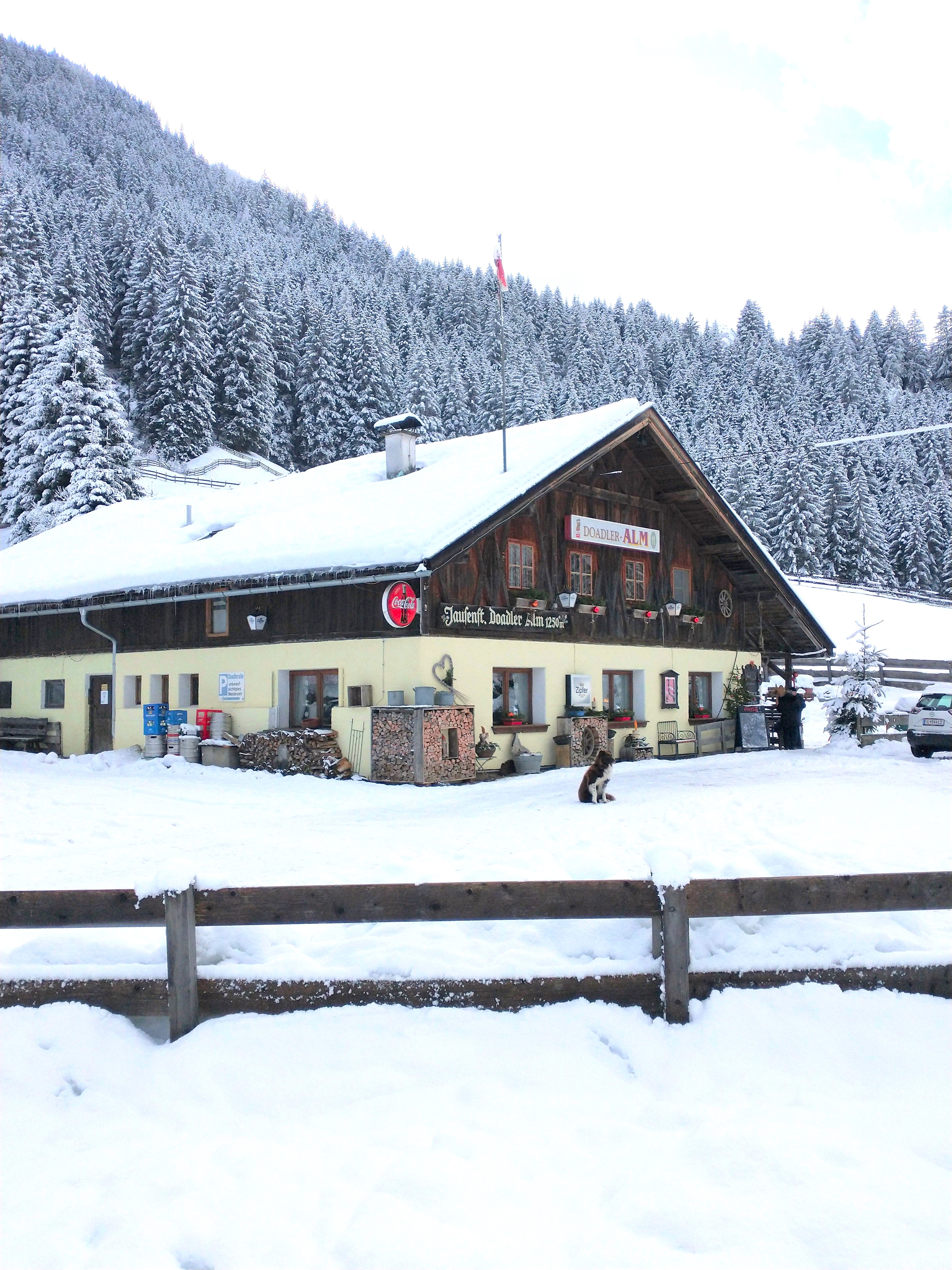
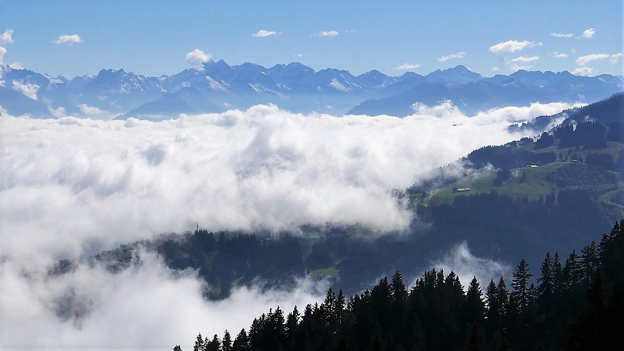
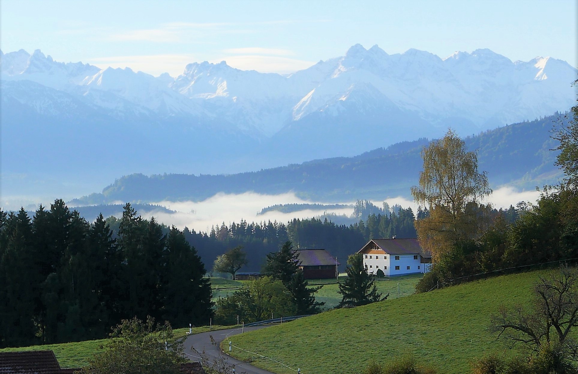
However, these issues certainly aren’t unique to Scotland. On the Continent, the same problem also affects lower lying ski areas along the foothills of the Alps, such as in Bavaria. Here, snow cover is proving increasingly unreliable in locations under 1500m or so, even despite a heavy investment in artificial snow making equipment, which requires low temperatures to be effective. Last year, over Christmas, we headed for the Allgäu region of Bavaria to be greeted by mostly green, springlike conditions, with just a few meagre patches of melting snow (a couple of weeks previously the picture had seemed much more promising). My kids found just one snowy piste of about 200m to practice on in the area. Even that seemed like a lucky break at the time; that little, tired patch of snow certainly earned its keep that year ! (strangely enough, Scotland was one of the few places with any snow around that time, unless your headed for the higher alps and their associated traffic chaos, as everyone headed up the same treacherous winding mountain passes simultaneously).
Snow a rare commodity: Allgäu, Bavaria, Christmas 2022
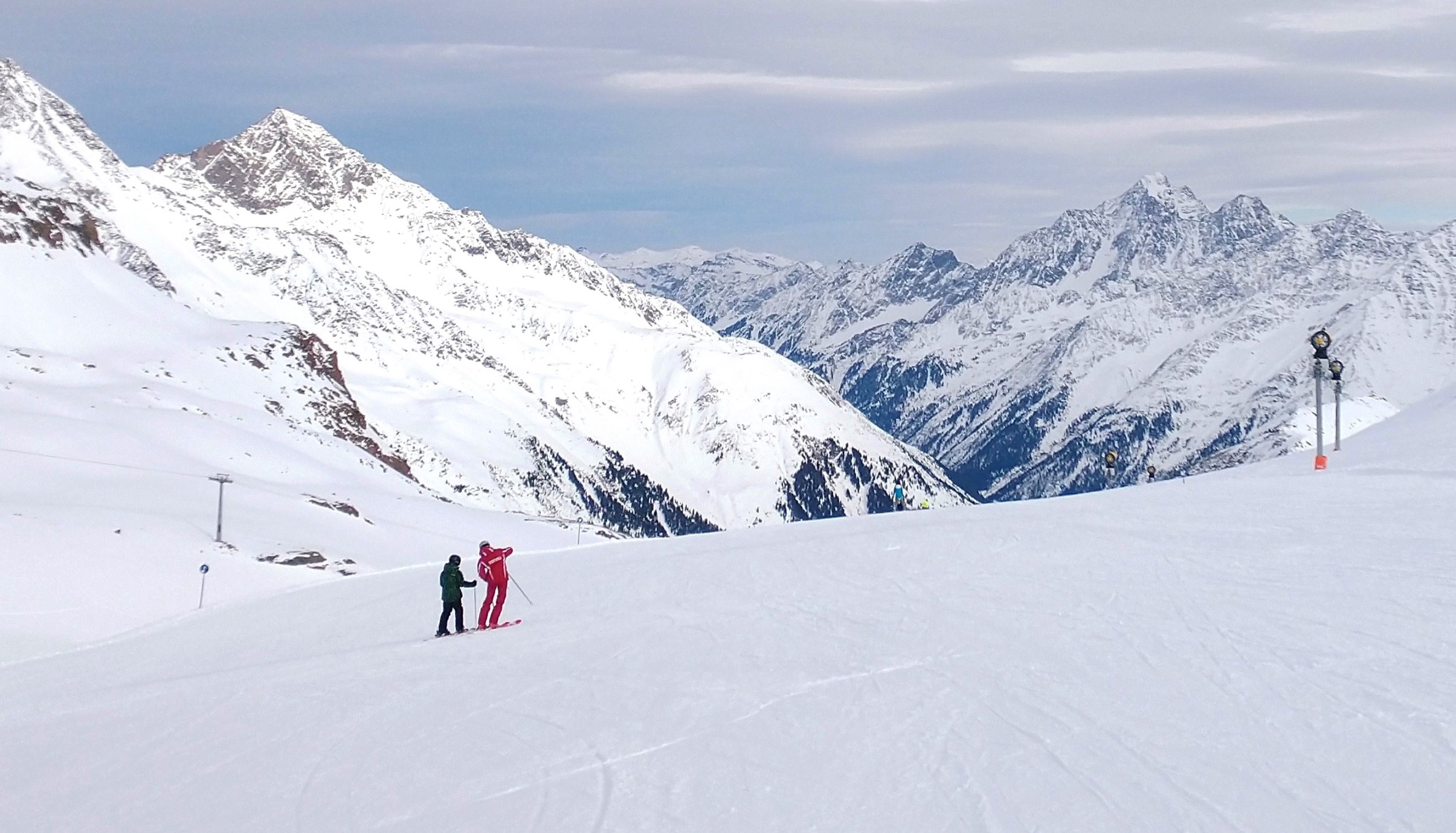
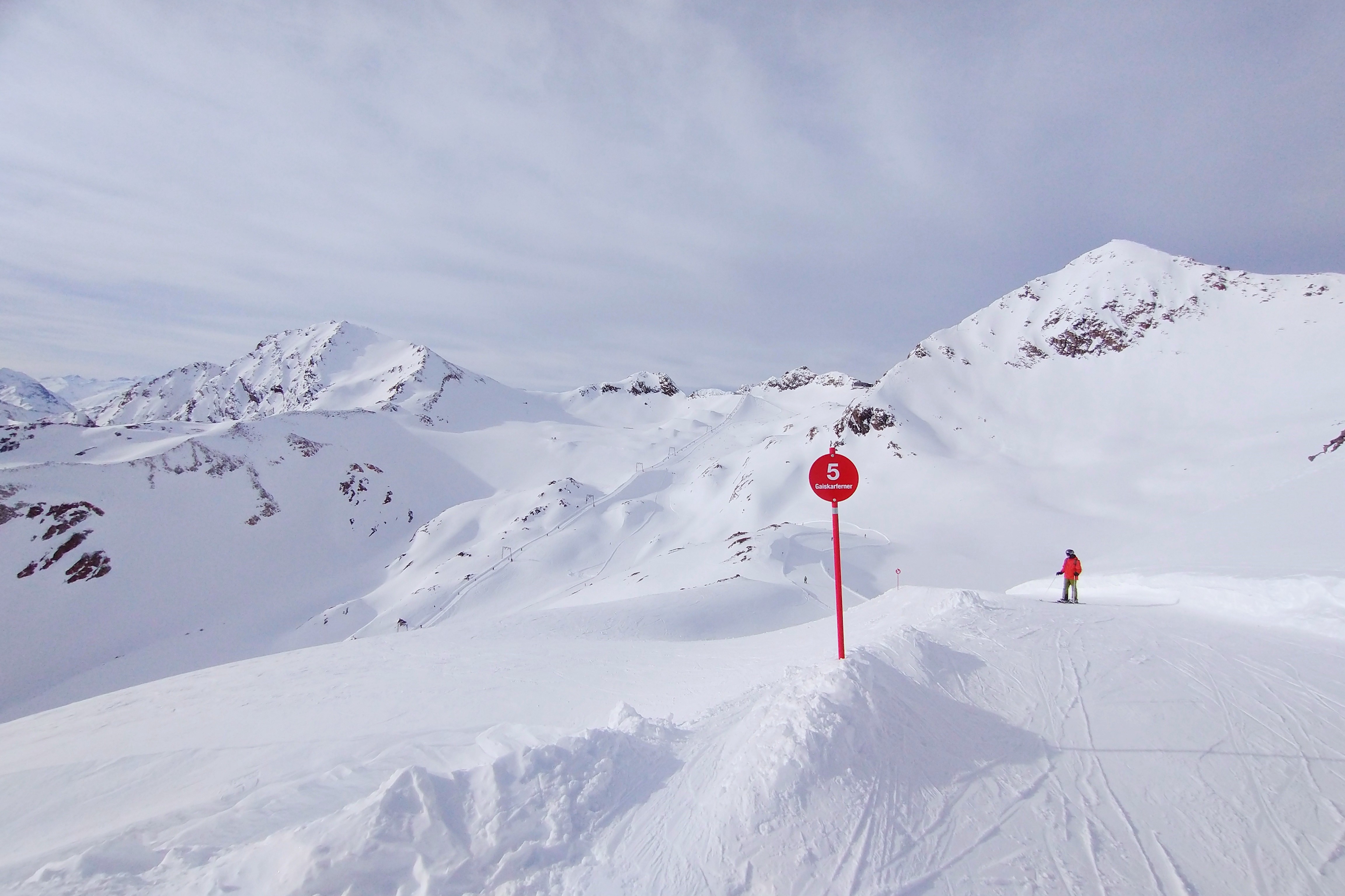
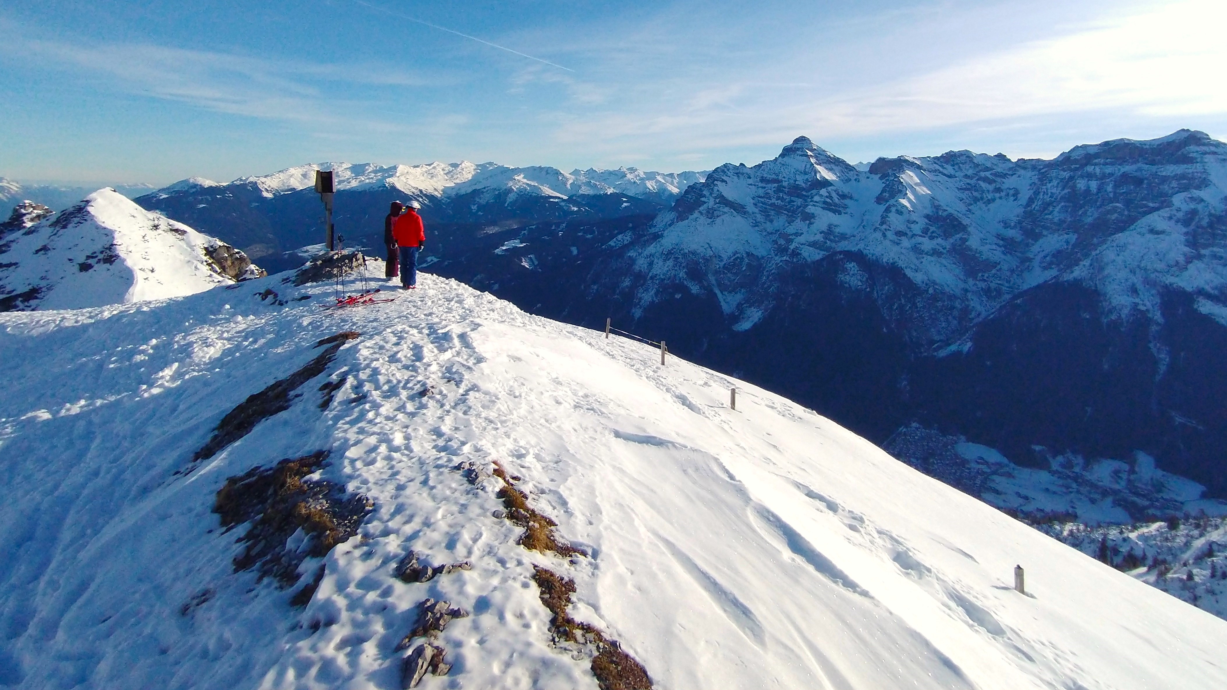
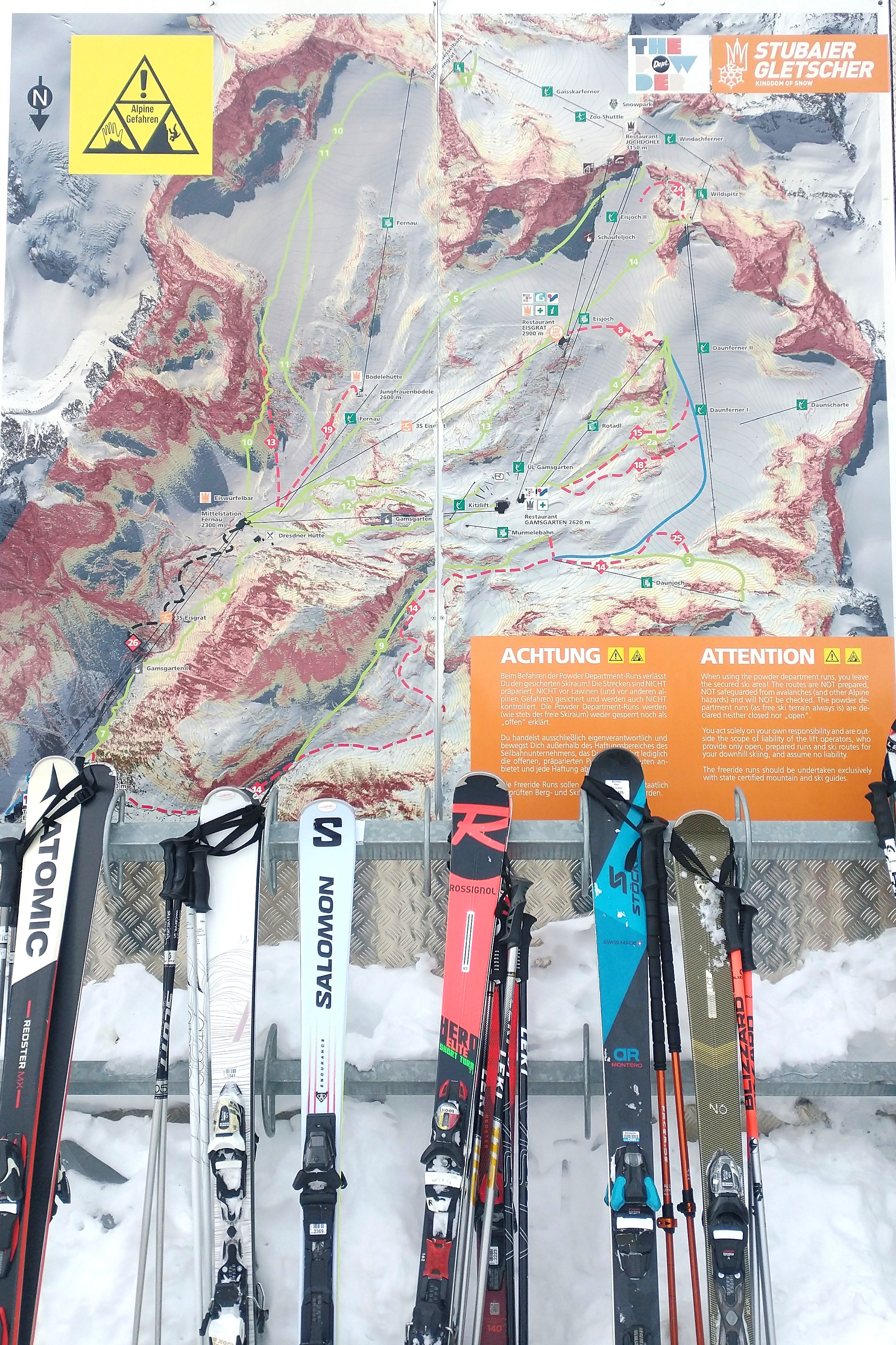
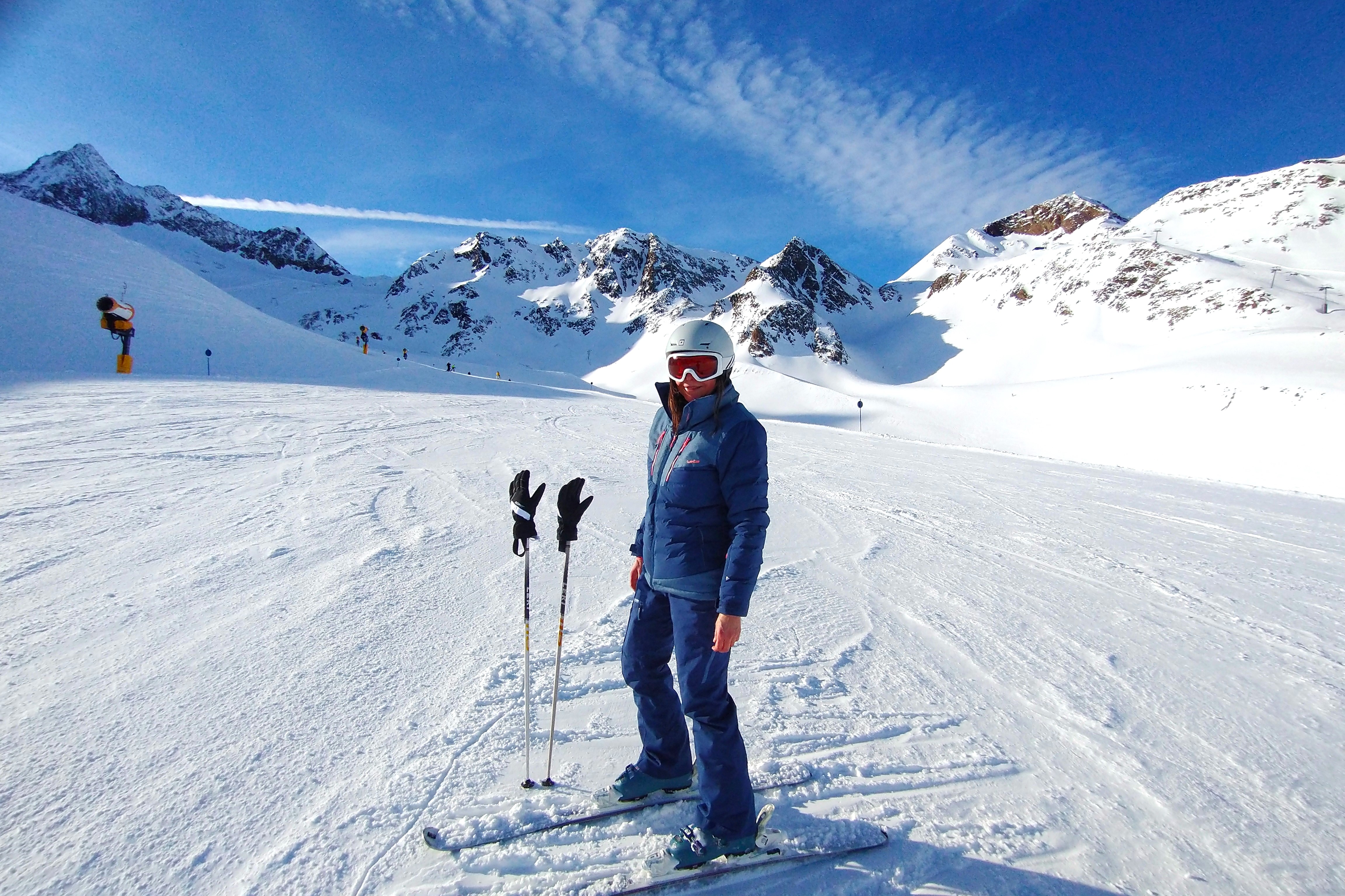
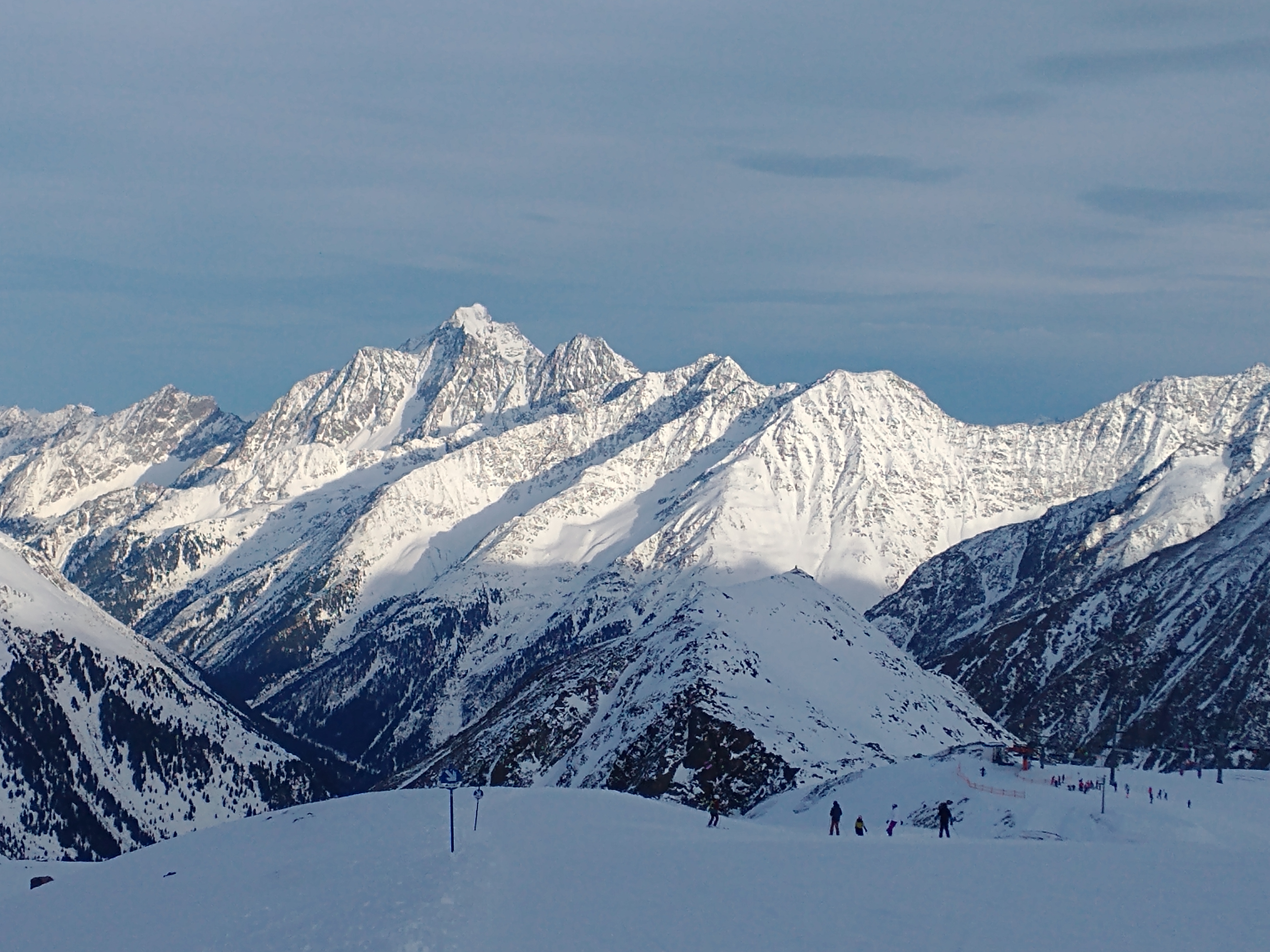
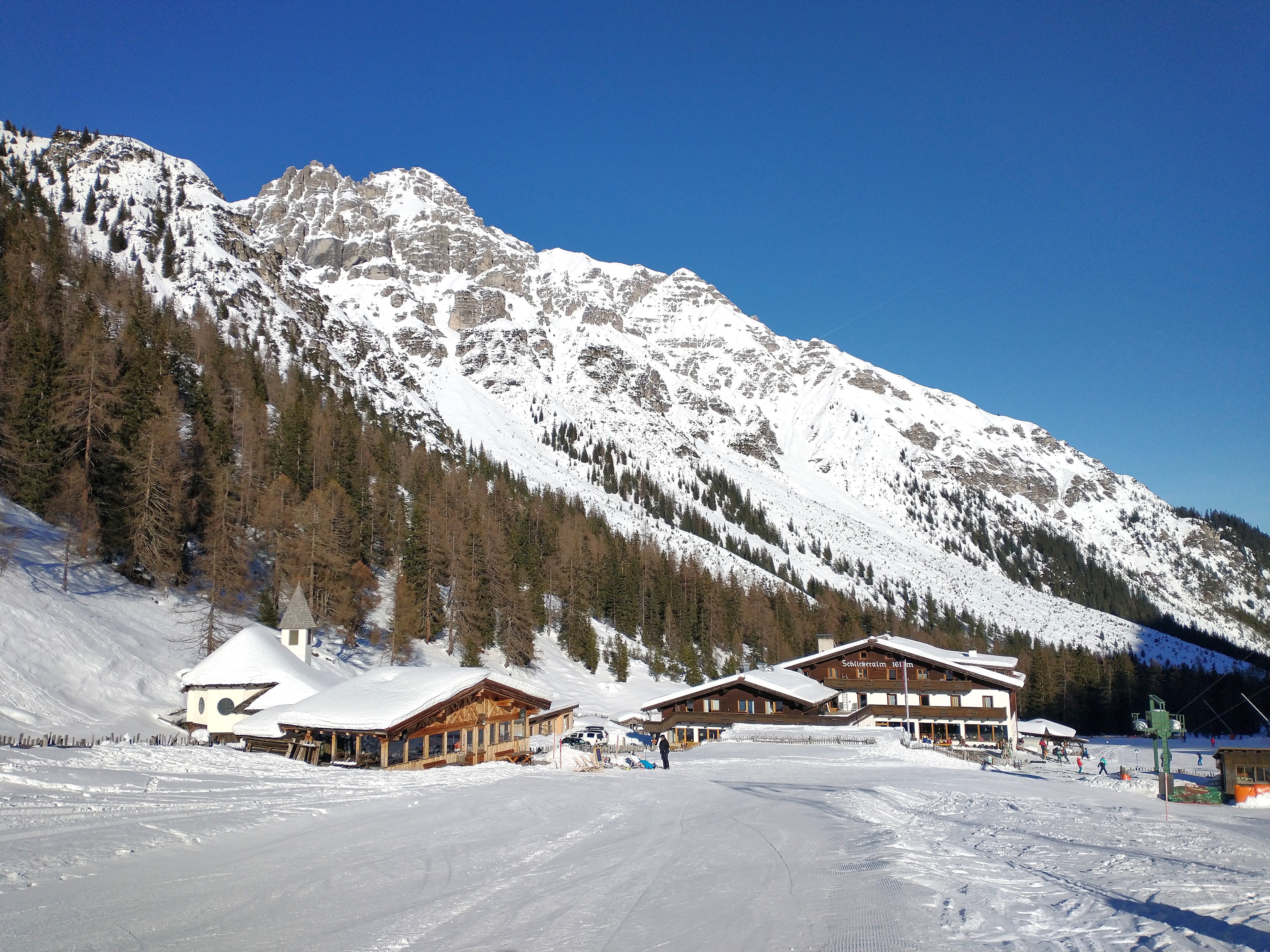
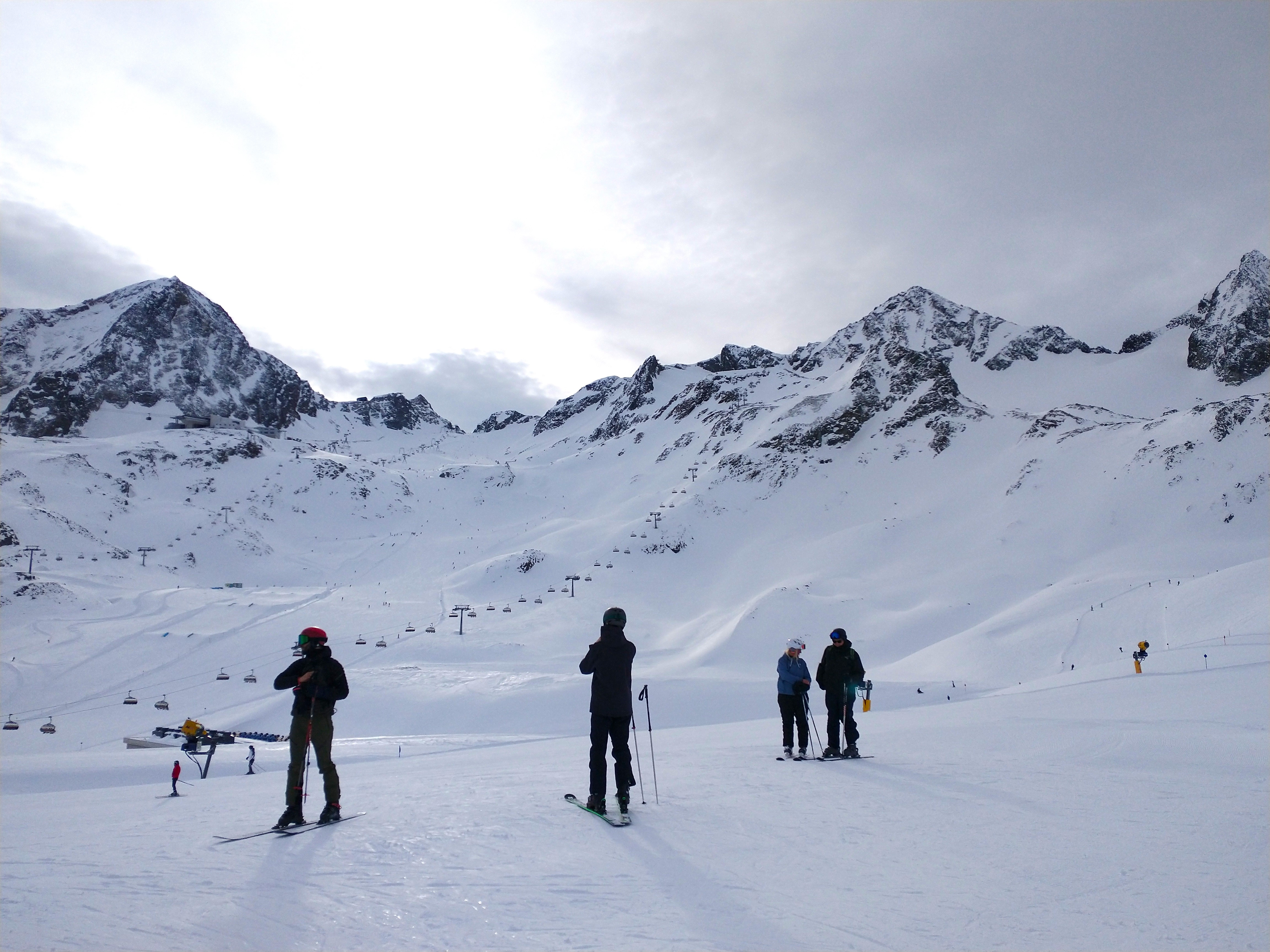
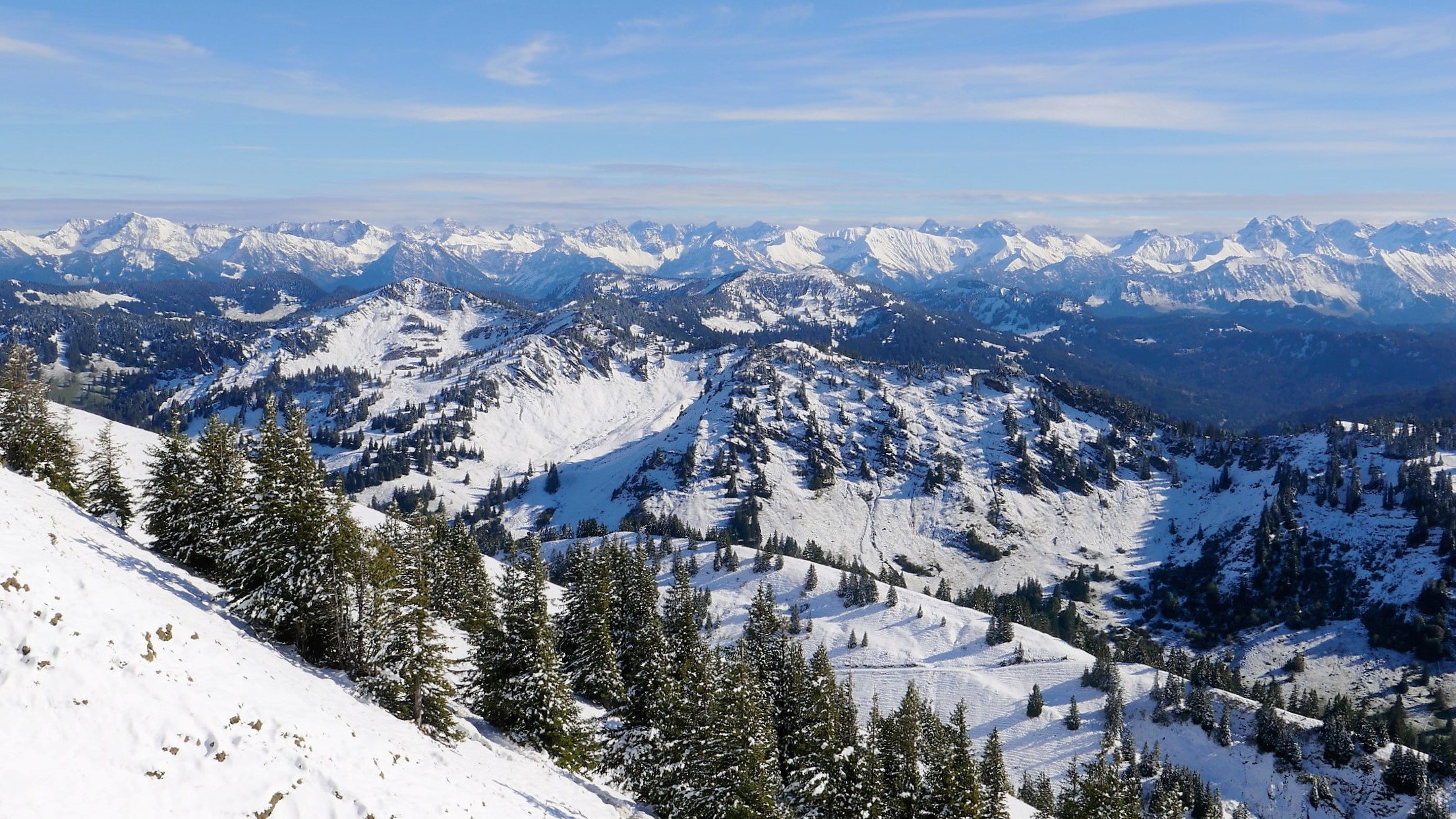
For me, though, snow coverage was beginning to seem all rather academic anyway. Following a knee injury, I’d begun to think that my skiing days might be well and truly over. However, never one to concede defeat, the chance to get back on the slopes again proved to be one just too inviting to resist. And so, during the most recent festive season, we headed for the Stubaital near Innsbruck for a week, where my son was keen to try out his new snowboard and check out the slopes. This time, we took no chances and deliberately sought out higher terrain, beyond the first northern ranges of the Alps. The Stubai Glacier ski area seemed like a safe bet. It offers a vertical range from 1500m up to 3000m, reaching to the very the crest of the Alps, by the Italian border. In addition, the nearby Schlick 2000 ski area also offers further attractive opportunities at slightly lower attitudes, located further down the valley towards Innsbruck. It has a a cosy, traditional alpine feel about it and is set amidst a dramatic backdrop of rocky alpine peaks and spruce forests (rather like a small chunk of the Dolomites that’s been broken off and shifted 80km north).
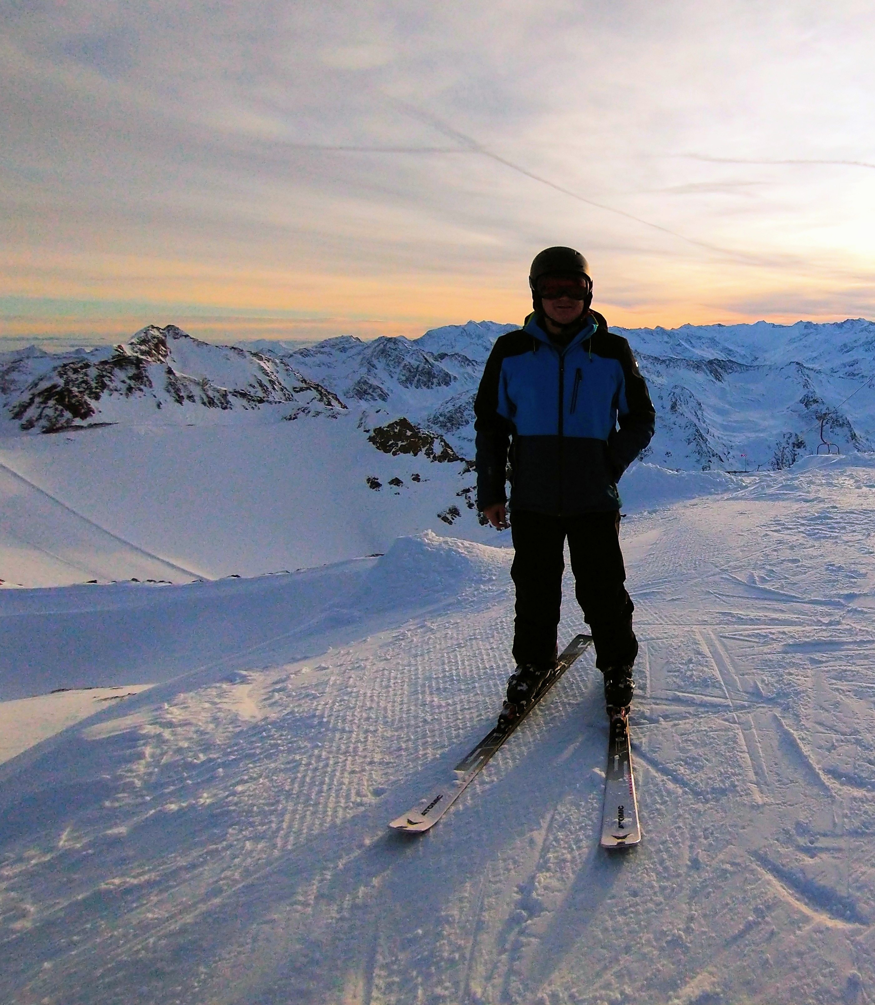
Happily, this time we hit the snow jackpot ! The conditions were just wonderful with great mountain panoramas, relatively uncrowded slopes and settled weather conditions for the duration of our trip. Skiing with a not-too-perfect knee was a bit of an unknown quantity, but fortunately everything functioned exactly as it should. Surely that was one winter high just too precious to miss.
So, here’s a few images from the trip:
Unfortunately, one thing is for sure; the alpine ski industry faces a challenging future as a result of evermore uncertain snow conditions. Many lower attitude resorts will have to think very creatively about the activities and experiences they offer in order to continue attract visitors. In addition they must also consider the thorny topic of their own carbon footprint (transport to get there being one of the key themes), if they are to survive and prosper in an evermore unpredictable climate.
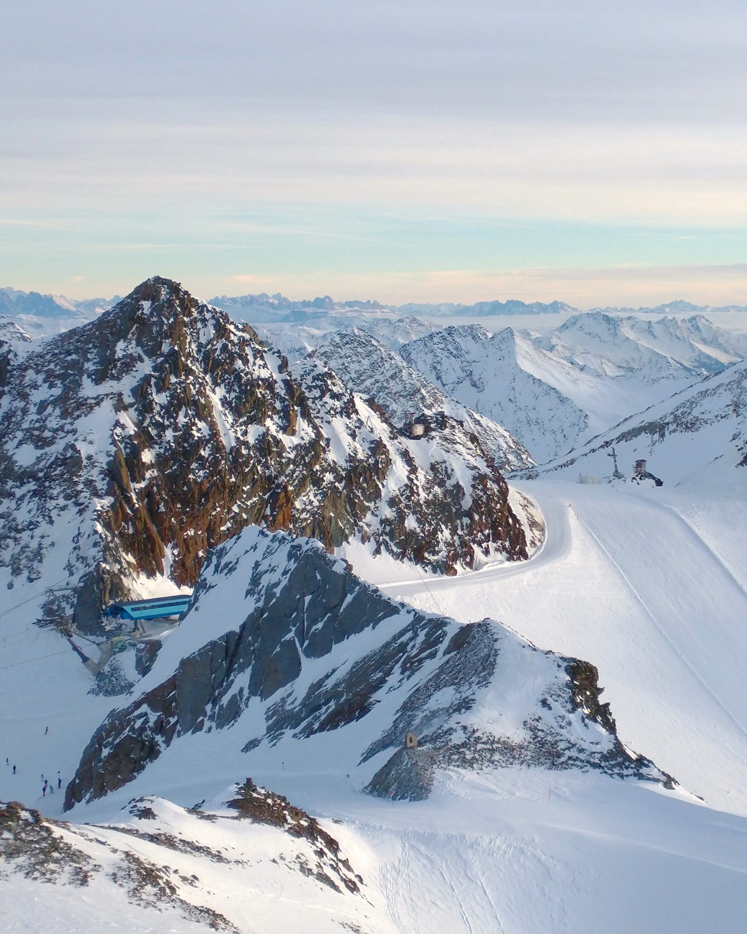
Sadly, the high glaciers of the Alps are not immune to the problems of global warming, with glaciers receding at ever-increasing rates (indeed, it is predicted that half of the current 4000 or so alpine glaciers will be gone by 2050). Loss of ice mass, through melting, directly affects the Stubai Glacier itself – the melting of the glacier itself is all-too-evident when riding up on the ski lifts. In locations where the surface has been protected from melting (using a variety of reflective sheeting and thermal insulation techniques), the remaining depth of ice can be clearly observed to be several metres higher than in the surrounding unprotected areas. It seems that, nowhere, is climate change more evident.
For now though, we enjoyed the precious chance to be part of the winter wonderland; I wondered:
– How can such opportunities last into the foreseeable future ? Will future generations still be able to enjoy winter sports in the Alps ? If so, what needs to change to achieve that (other than relying more and more on artificial snow) ?
– Can ski resorts themselves really adapt to become more sustainable, and if so how ? Many are already starting to look ahead with constructive ideas and innovative new approaches (including energy and water use, public transportation, “slow”/niche tourism, summer alternatives etc.)
– To what extent are we also part of the problem ? How can we change our habits to become more responsible as individuals and “consumers” ? e.g. how do we travel to get to the mountains (actually the greatest impact of all) ? How do we support a sustainable local and green economy rather than merely throwing money into the hands of external “big business” interests.
There are no quick-fix solutions however; but many complex challenges ahead.
Protected ice to support the lift pylon – the surrounding mass has gone.Top of the Stubai Alps: Christmas 2023
Anyone who works in the environmental sector will tell you that there’s no such thing as a “proper” holiday; indeed, sitting on the beach for 2 weeks sounds to me like the very epitome of sensory deprivation. By contrast, the idea of a road trip around British Columbia (BC) with my family this summer sounded like a veritable voyage of discovery. So, it was with enthusiasm (and a degree of trepidation) that we boarded a flight from Frankfurt bound for Vancouver with the aim of exploring parts of the Pacific NW in a campervan. Without a doubt, BC’s diverse forests would certainly influence a large part in our travel itinerary; both in positive and negative ways, as it turned out. There was much to learn on our journey.
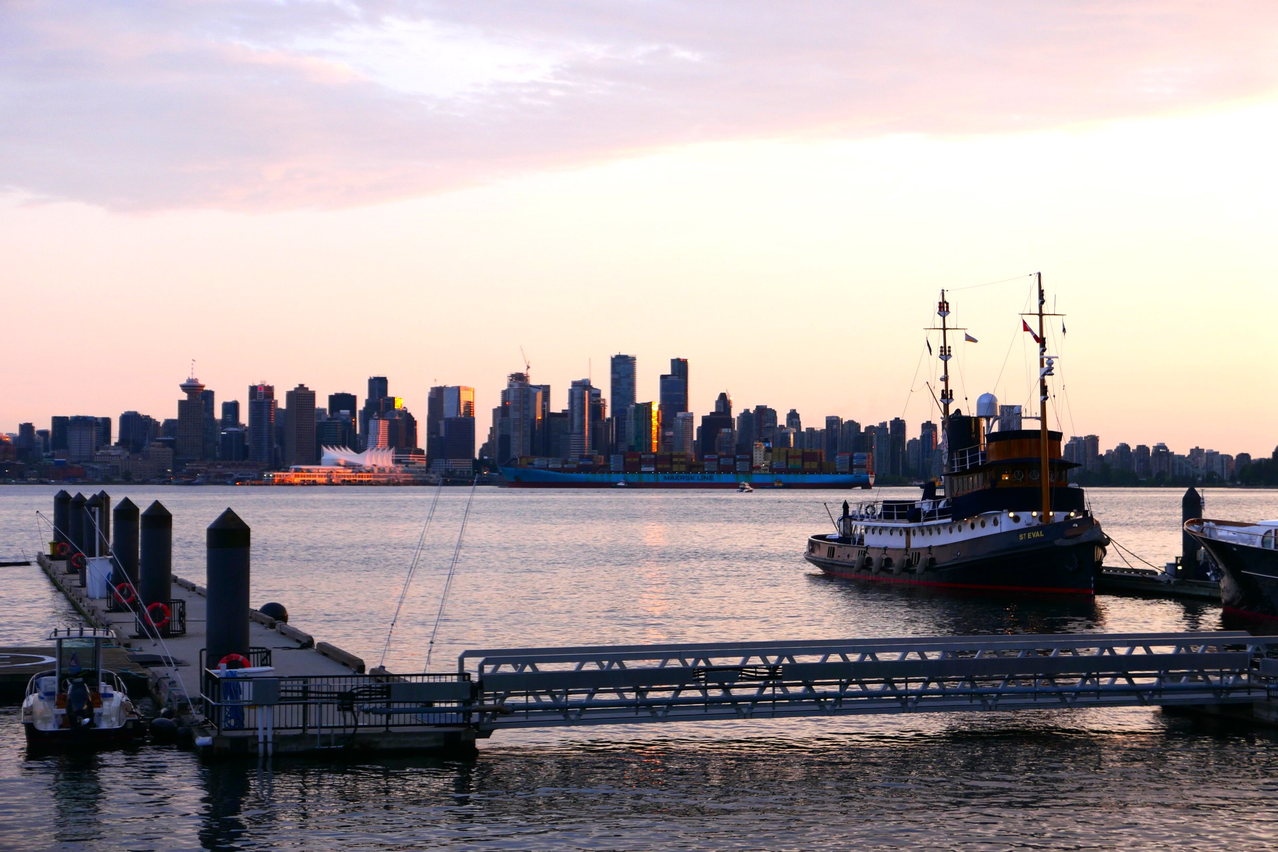
Exploring Vancouverand Stanley Park
Our first port of call was Vancouver itself, giving us the opportunity to check out some of the City’s amazing sights; including its famous parks and greenspaces. The “Jewel in the Crown” of Vancouver’s outdoor spaces is surely the world class Stanley Park, which occupies a sublime location on a forested peninsula, surrounded by water and mountains on most sides and located just minutes from the City’s vibrant Downtown.
The iconic park contains significant remnants of coastal temperate rainforests characteristic of the Pacific NW bioregion. These include ancient western red cedar trees, big-leafed maples and towering, cathedral-like Douglas firs, which reach to over 50 metres in height. The forest has bounced back over the years, following a series of disturbances, including a great fire of 1886 and selective logging which took place between 1860 – 1890, before the area was designated as a park. Most recently, following a devastating windstorm in 2006, some 15,000 new trees and shrubs were planted to restore the park’s forest ecosystems.
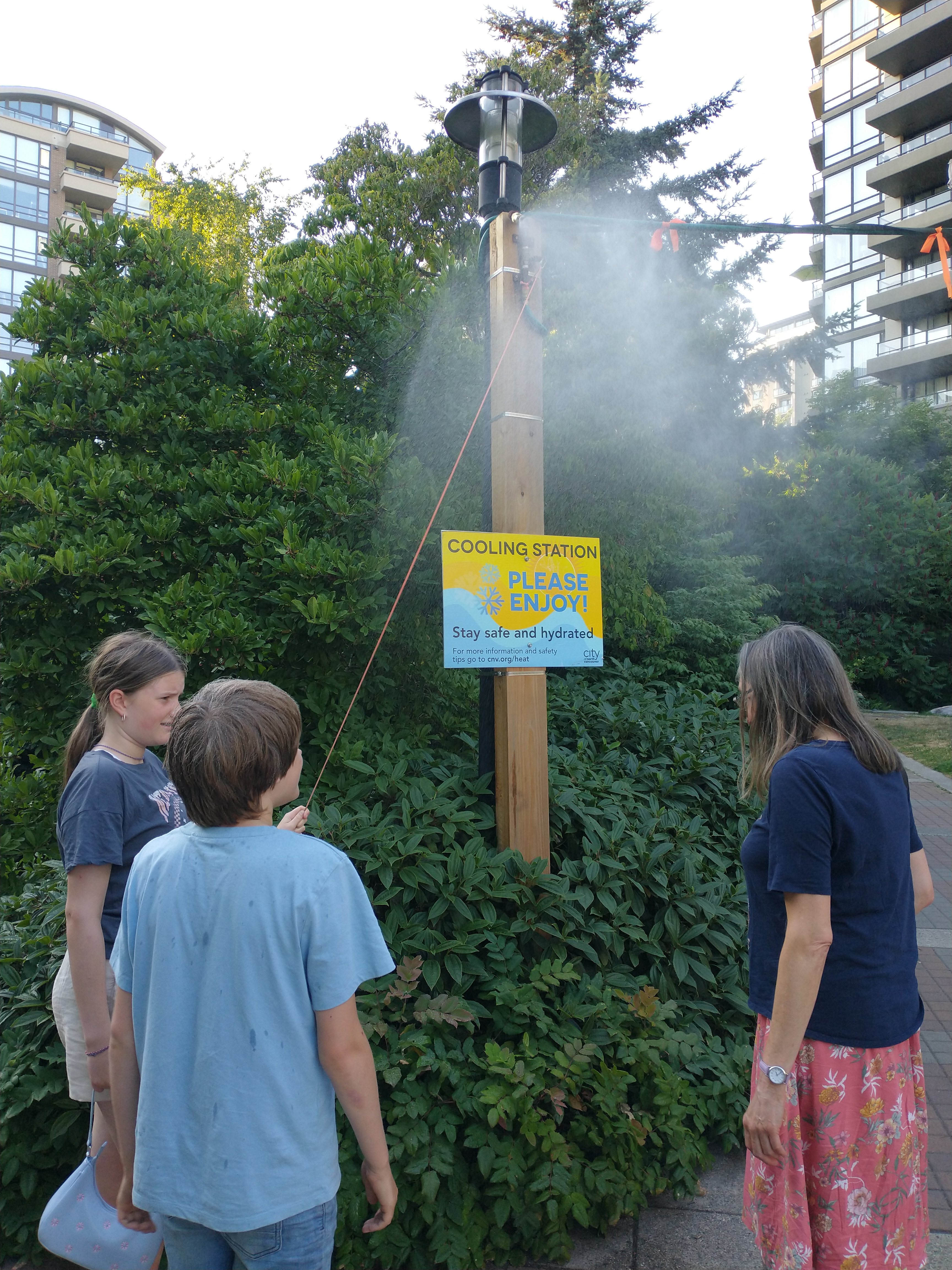
The big issue now though facing Vancouver’s forests is the problem of drought, which has severely affected the entire region, particularly the interior of BC. Many parts of BC are currently on the highest levels of drought alert – 4/5 on a scale of 1-5 – following a succession of dry springs and summers in recent years. In addition to the obvious implications of moisture deficit on the City’s beleaguered tree stocks, urban greening strategies are focusing on the issue of reducing urban heat island impacts, including consideration of how the presence of an extensive tree canopy, can help to lower temperatures in residential neighbourhoods.
This has implications for social and environmental justice; despite best intentions, healthy canopy cover is most often associated with upmarket neighbourhoods, where properties can easily change hands for several million dollars. It’s fair to say that Vancouver’s popularity, sky-high rents and the legacy of Covid have exacerbated social inequalities in recent years, with homelessness becoming disturbingly evident in many parts of the Downtown. In the search for quick fixes to heatwaves, the City of Vancouver have been experimenting with creating “cooling stations” which are accessible to all (including socially disadvantaged groups), with water sprays to provide welcome relief from the most extreme summer heatwave conditions – something that my kids really enjoyed experiencing.
An Ecotopia on the Pacific Coast
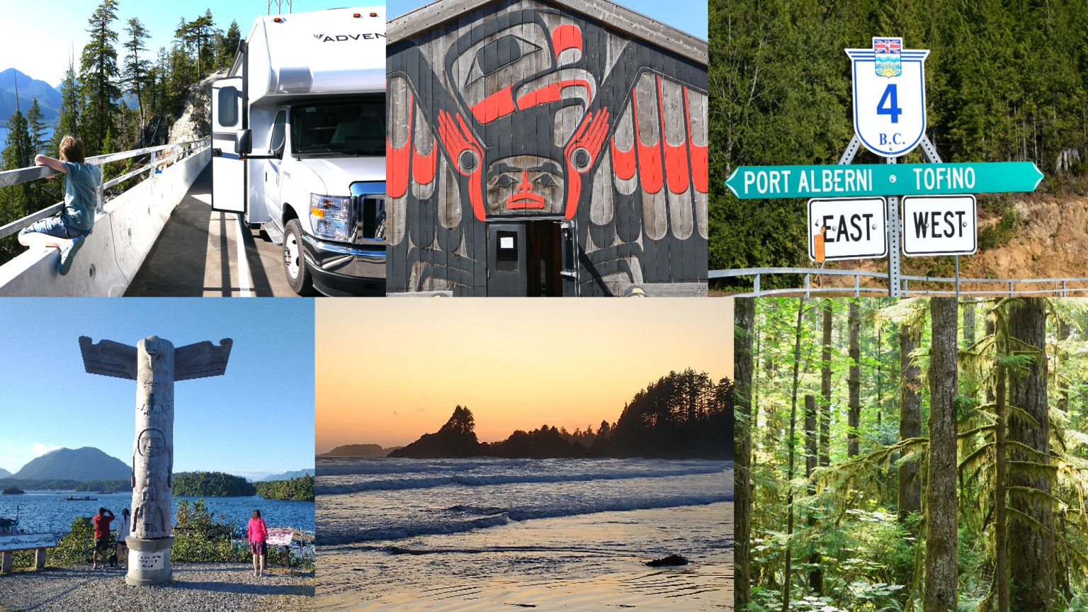
After the “Van” big city experience, it was time to head for nearby Vancouver Island and a very different type of “van” escapade; this time, a rented RV (campervan), where we were keen to explore some of the Island’s wonderful coastal scenery and temperate rainforest ecosystems. Further indication of drought related problems was all too soon in evidence though, when we turned onto the Island’s scenic Highway 4, heading for the small coastal resort of Tofino.
Just before reaching the famous and magnificent “Cathedral Grove” of Douglas Firs near Port Alberni on Highway 4, the road winds beneath precipitous slopes, between a lake shore and a steep mountainside. A smouldering wildfire on the upper slopes had partially blocked the highway, with heavy engineering operations underway to prevent debris from sliding down onto the road from the destabilised slopes above. This was no light undertaking; indeed, the Highway had been completely closed for a couple of weeks, putting a huge strain on the local economy, with few alternative transit options existing, other than tortuous unsurfaced logging routes. Fortunately, just in time for our trip, the road had partially reopened, albeit with a long and slow traffic management/convoy system in operation.
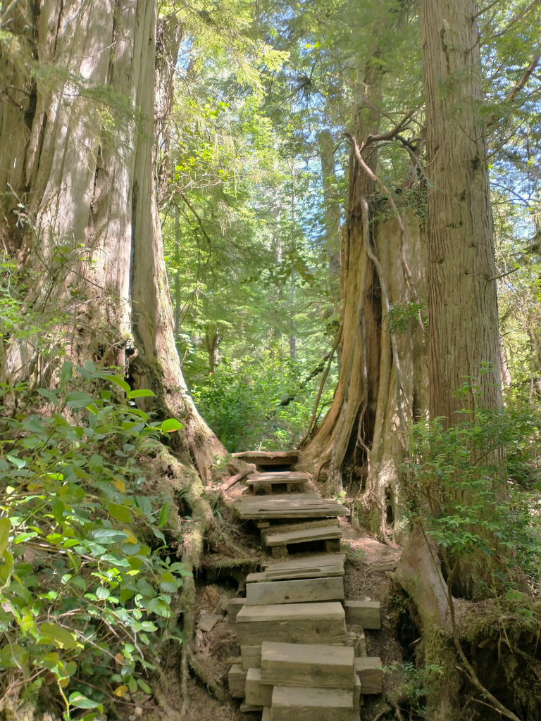
So, we eventually reached Tofino on the Pacific Coast. In recent years, Tofino has acquired the reputation as an “ecotopia” resort with its endless miles of sublime beaches, temperate rainforests and the bountiful marine life of the Clayoquot Sound. Here, it’s possible to undertake just about every form of adventure and ecotourism activity; from surfing to sea kayaking, to winter storm watching, to whale and bear watching. The Sound boasts some of the most intact coastal rainforest ecosystems in Canada, with magnificent Douglas firs, Western hemlocks, Sitka spruce and Western red cedar stands – some of which are over 1000 years old. We took advantage of excursions offered by a couple of local adventure tourism operators, including a sea kayak trip to visit the legendry Tree Trail of Meares Island and a wildlife watching tour offering opportunities to see orcas, humpback whales, sea otters and black bears. Such small ecotourism businesses now form the mainstay of the Tofino economy.
The “War in the Woods” and a new economic model
The region’s spectacular natural assets have not always been perceived as being of such value however; before the advent of the ecotourism boom, Tofino was very much an old-fashioned logging and fishing town. Back in the 1980s there were even plans by big logging firms to clear-fell the trees of the Clayoquot Sound, their worth being perceived merely in terms of sawn timber commodity value. The resultant protests from indigenous First Nations groups and environmental activists achieved legendary status as the “War in the Woods”. The campaign had an impact far beyond the shores of Clayoquot Sound and was actually the largest ever act of civil disobedience in Canadian history, with several hundred people being arrested in clashes with law enforcement officers.
Following years of intense conflict, the entire Sound was eventually designated as a UNESCO Biosphere Reserve in 2000, further emphasising its ecological significance. However, to this day, the agreement is still contested and is not legally binding in preventing companies from logging the area in the future. Later, in 2014, local First Nations residents created the “Meares Island Tribal Park”, effectively proclaiming Indigenous sovereignty over a large area of the Sound. In advocating for the expansion of Tribal Parks on formerly held indigenous land, First Nations Canadians seek to return to more traditional systems of natural resources stewardship. Overall, the position of First Nations groups, is politically a sensitive one in Canada at the present time, with Tribal Parks increasingly likely to play an important role in the future. The inspiring approach taken in Tofino has shown how a local economy can be transformed, from one based purely on unsustainable resource extraction, into a model favouring longer term sustainability, environmental stewardship, ecotourism and the preservation of cultural heritage.
Into the interior of BC: forests’ health in danger
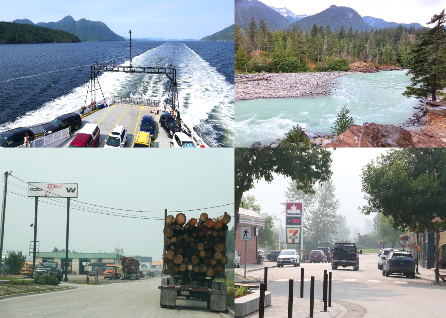
After leaving the Pacific Coast, the next leg of our tour took us into the interior of BC, towards the great ranges of the Rockies, including the world-famous National Parks of Glacier, Jasper and Banff. Our route took us through a staggering variety of biogeographical zones, from the forest clad slopes of the Coast Ranges to the parched dry grasslands and semi desert region around Kamloops.
The further you travel into the interior, the more apparent it becomes that not everything is right with BC’s forests. Our journey took us through desolate uplands, featuring oppressive monocultures of lodgepole pine; seemingly, devastated by successive waves of wildfires and bark beetle infestations. The extent of burnt areas was really quite mind-blowing and the resultant landscapes singularly bleak to witness. Worryingly, the bark beetle problem also seems to be increasing in areas of formerly pristine montane habitats such as along Rodgers Pass in Glacier National Park, where thousands of trees have been affected by spruce bark and mountain pine beetles; milder winters in recent years have contributed to the explosion in the beetle population. At Rodgers Pass, I spoke to a somewhat world-weary Parks Canada ranger there who appeared to feel powerless and depressed about the situation – obviously having answered too many questions from curious visitors on why the Park’s forests weren’t looking so healthy these days.
Rockies? What Rockies?
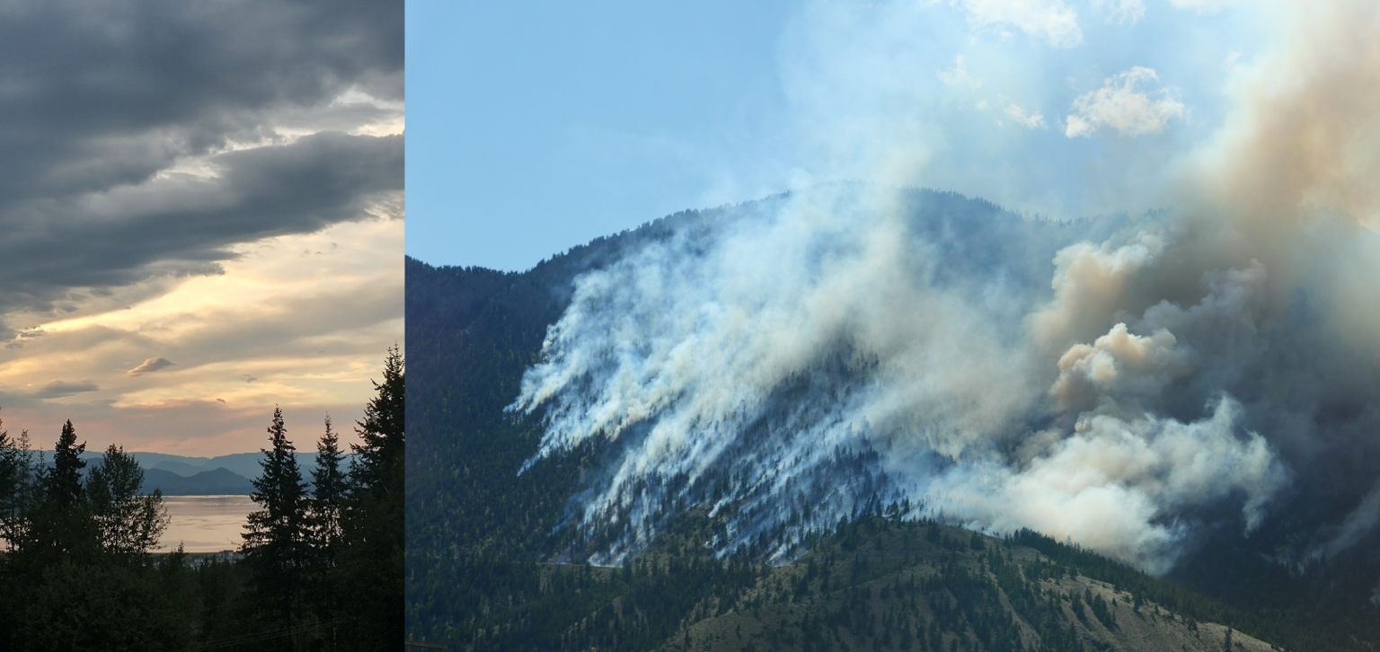
It was after leaving Rodgers Pass, however, on the route towards Golden, that the real impact of Western Canada’s drought and intense heatwaves became depressingly apparent. All too soon, sublime panoramas of distant peaks and glaciers became a thing of the past as the acrid smell of woodsmoke filled the air; intense colours fading to monochrome as visibility decreased dramatically. We were now experiencing the new norm of BC’s fire season; it appeared that much of the smoke was actually drifting in from huge wildfires far away in Northern BC, burning hundreds of km away.
Along with enormous fires in Eastern Canada this year, BC’s fire season has already been by far the worst on record. Even by mid-July, a staggering 14,000 square km had burned across the province (equivalent to an area of 45% of Vancouver Island) which already overtakes 2018 as being the worst fire season on record. In addition to the obvious environmental and economic impacts of this, the effects on human health through smoke inhalation are significant, particularly to those with existing heart and raspatory conditions. There is also a considerable threat to human life and property; indeed, three firefighters had already tragically lost their lives this year in the struggle to contain out-of-control blazes across the province.
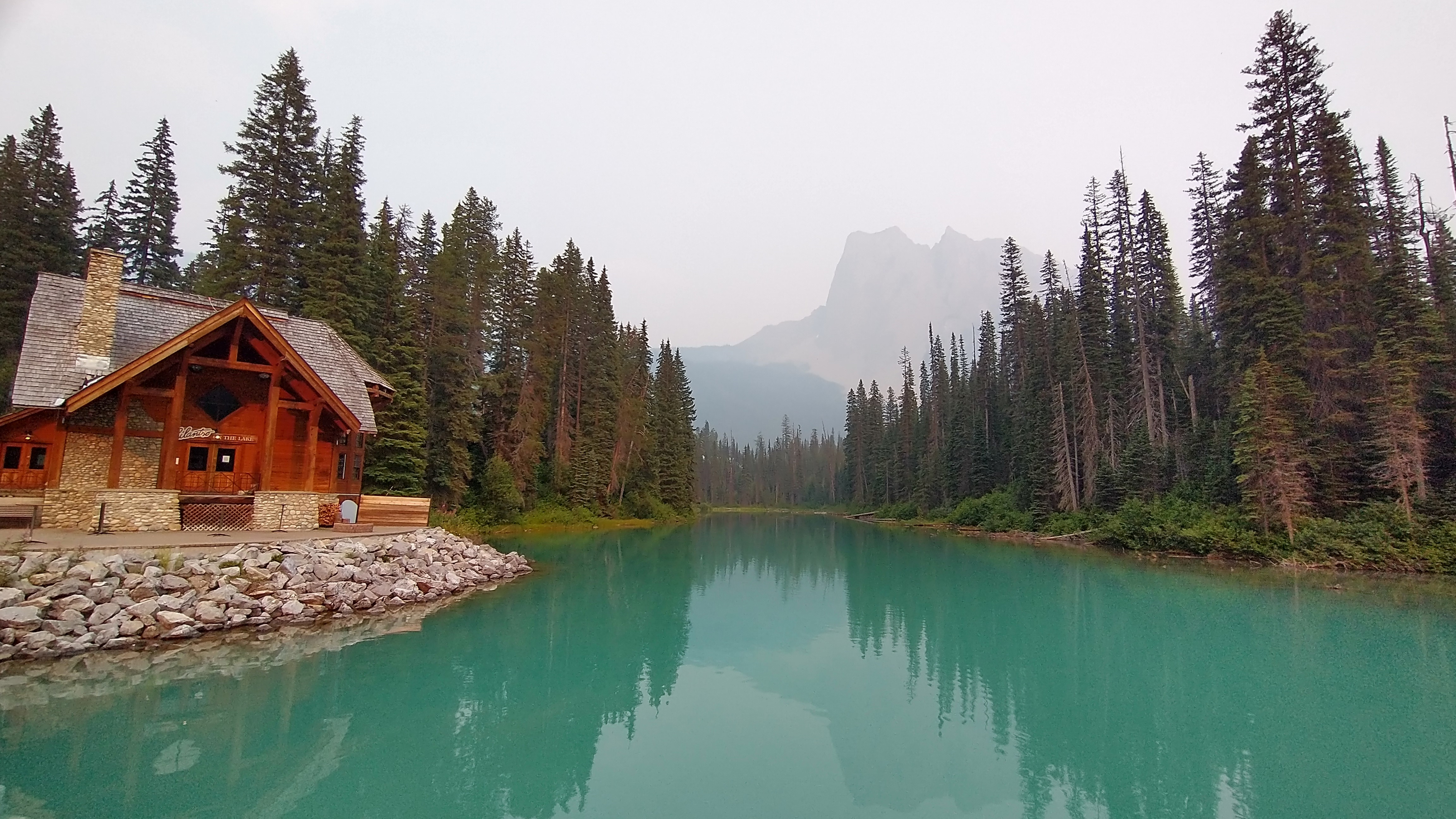
The smoky skies continued to dog our excursion to the Rockies, often combined with dust from seemingly endless road construction projects, aimed at upgrading the TransCanada Highway from 2 to 4 lanes. We booked into lodge accommodation at the iconic Emerald Lake Resort, surrounded by the grand peaks of the Rockies, for a couple of nights, but were unable to really enjoy the normally sublime setting of Yoho National Park. The all-pervasive smoke muted colours and reduced visibility, putting rather a damper on the whole experience.
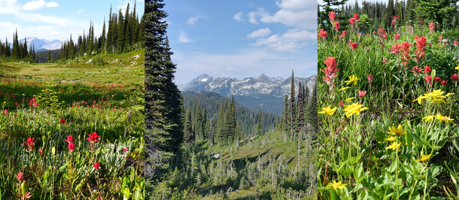
The same was also true in massively over-touristed Lake Louise, though it did get slightly better when we headed up the renowned Icefields Parkway, as far as dreamy Bow Lake, where starry-eyed couples posed for surreal wedding photos admidst the smoky backdrop of the lake and surrounding peaks. Although we know fire plays an important role in natural forest regeneration, I had to admit that my holiday mood felt a little subdued in the knowledge that somewhere, not so far away, forests were being reduced to ashes; particularly given the abnormal intensity of this year’s fire season.With little improvement in prospect, we revised our plans to head further up the Icefields Parkway to Jasper and cut our losses, heading back west towards Revelstoke and eventually finding blissfully clearer skies. Visiting the renowned “Meadows in the Sky”, a biodiversity hotspot in Mt. Revelstoke National Park, really was like moving from the darkness into the light; as panoramic views of peaks were once more revealed, and the vibrant hues of mountain skies and wildflowers again reached their full intensity.
Dry as a bone in the Shuswap
We spent much of the last week or so of our BC trip in the town of Salmon Arm in the Shuswap Lakes Region of BC where my brother has lived, on and off, for the last couple of decades. Salmon Arm is an attractive and pleasant place to live, close to mountains, lakes and forests – but also boasting productive agricultural land, fruit farms and wineries to boot. If there is a promised land to be found, then Salmon Arm must surely be somewhere well on the road to it.
However, even here, in the laidback Shuswap Region, there was a sense of foreboding about the ever-present risk of wildfires and the threat to life and property that this presents. There are constant reminders; helicopter teams buzz the surrounding hills after every dry lightning storm to check out possible sources of ignition for the next big blaze – many buildings such as my brother’s house are particularly vulnerable, being located close to the forest edge. A constant daily threat of evacuation hangs over residents, who must be prepared and ready to pack up at a moment’s notice should worst come to worst.
Peoples’ minds in the region will also be focused upon the sad case of Lytton, a small community in BC’s Fraser Valley which had the unfortunate accolade of recording Canada’s highest ever temperature of 49.6 degrees C, on June 29th, 2021. The following day, a devastating wildfire swept through the entire town, reducing it to ashes in minutes and causing the deaths of 2 people.
During our stay, we also had the chance to visit the Border town of Osoyoos, where my niece has been working on biodiversity conservation projects. Even as I write this, parts of the town have also been evacuated in response to an aggressive wildfire, spreading North from across the US Border. The threat is constant and very real.
Journey’s End:
So sadly, it was soon time to pack up and head for home. We were recommended to take the scenic Highway 99 back to Vancouver, which turned out to be an excellent low-traffic alternative, to the tedious slog and barren scenery around Merritt. Needless to say, this first involved the need to check traffic and smoke reports to look for potential hazards on route. Generally, though the journey back was quite breathtaking with awesome vistas of lakes, mountains and rugged canyons; though we did pass one major blaze across the Fraser gorge near the town of Lillooet. The final section from Whistler to Vancouver on the “Sea to Sky Highway” was a bit of a slow grind though, due to a vehicle collision and a resulting 3-hour traffic hold-up. On a more positive note, however, a black bear casually sauntered across the road in front of us, just outside the resort of Whistler; another one for the tick list.
And so back to Europe and the long flight over Canada’s far North, Hudson’s Bay, Baffin Island, the Greenland Icecap, Iceland, the Faroe Islands and the Hebrides. Generally, our trip was a great experience, providing a myriad of impressions and memories; both good and bad. However, the scale of the challenges facing Canada’s forests through increasing temperatures, droughts and wildfire hazards cannot be overestimated.
If you want to read more about our more recent wintertime adventures in BC (including our visit to Vancouver, Silver Star, Revelstoke and the Shuswap) then checkout this story: https://ianwjourney.com/2026/01/19/christmas-in-canada/
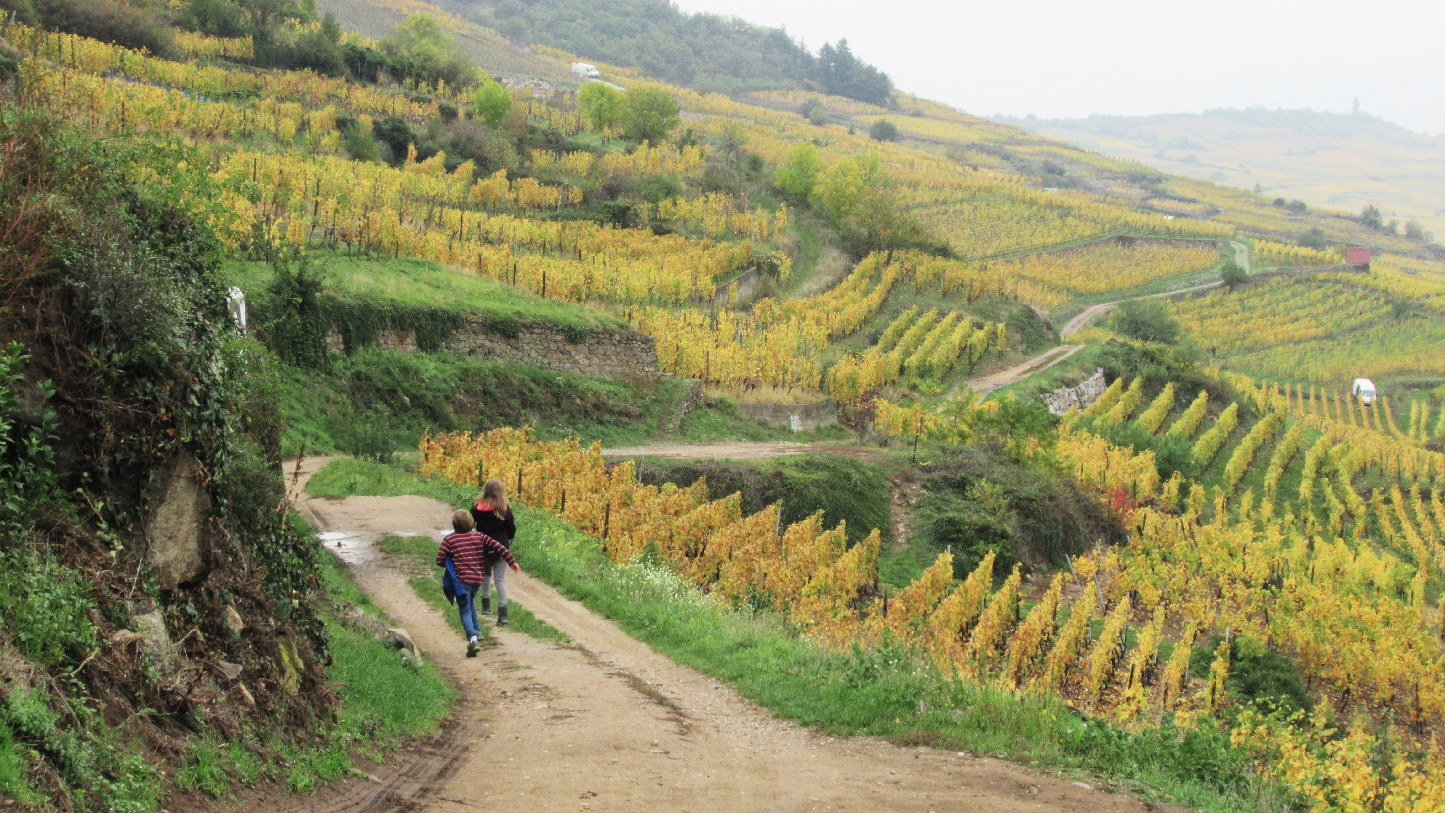
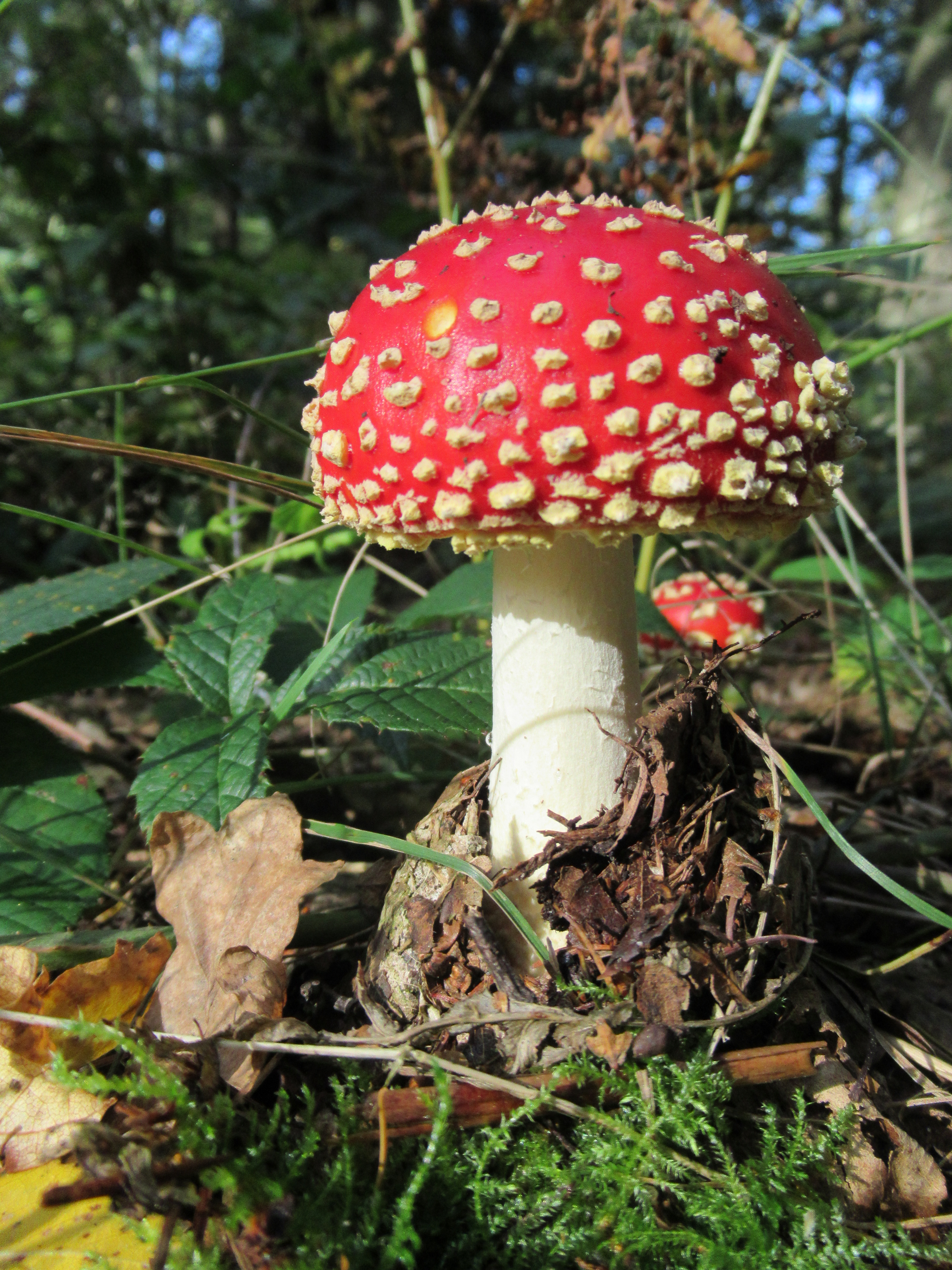
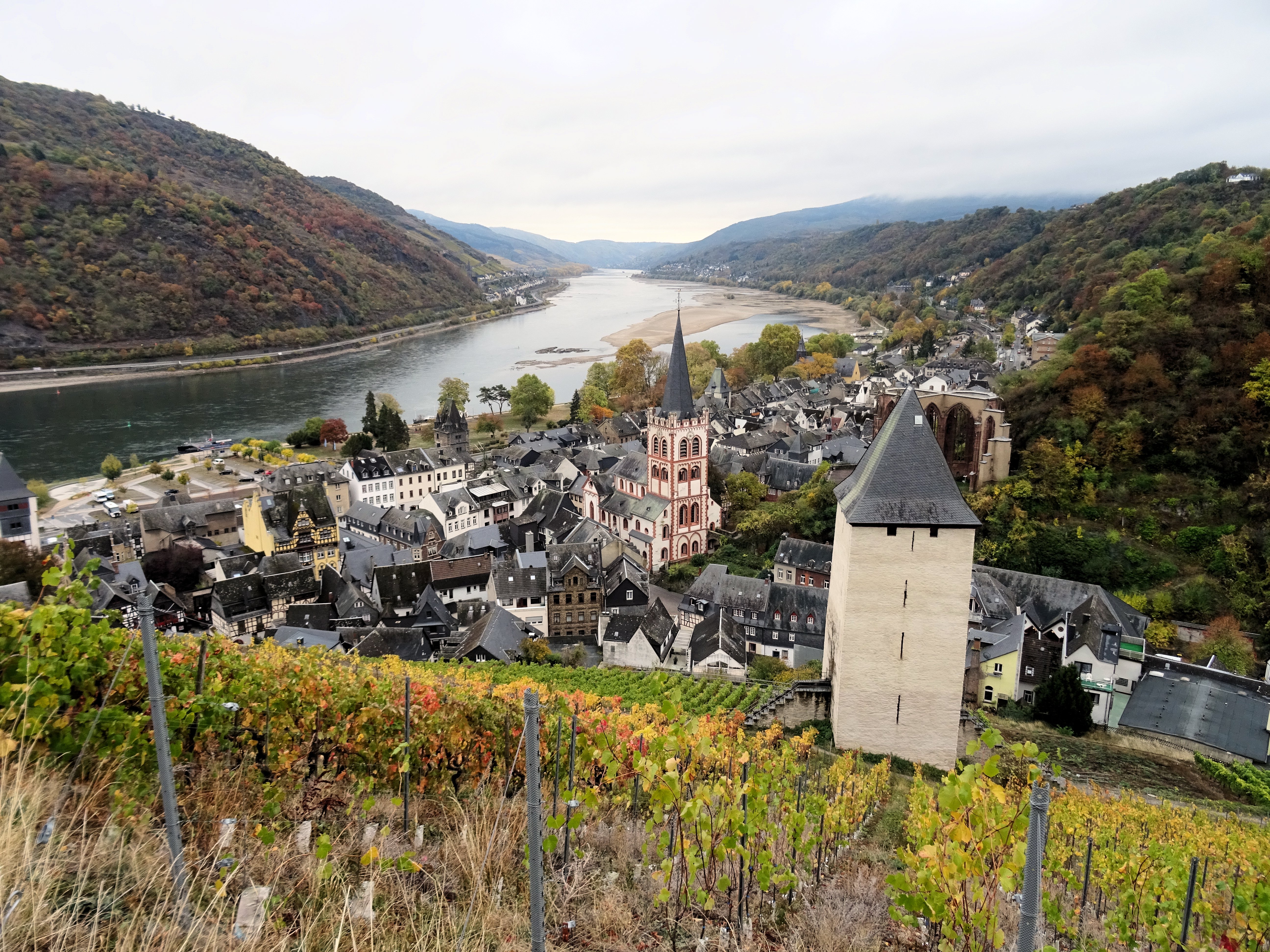
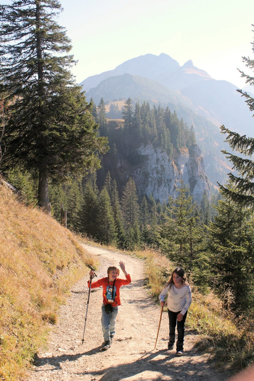
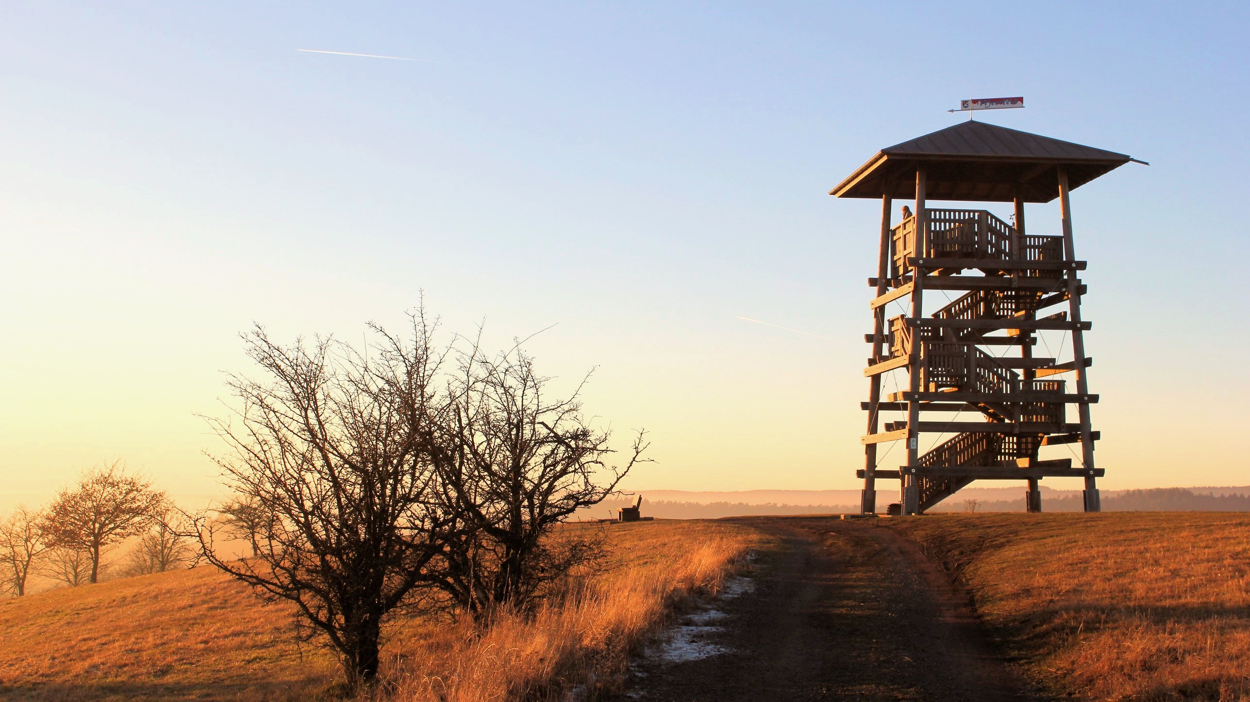
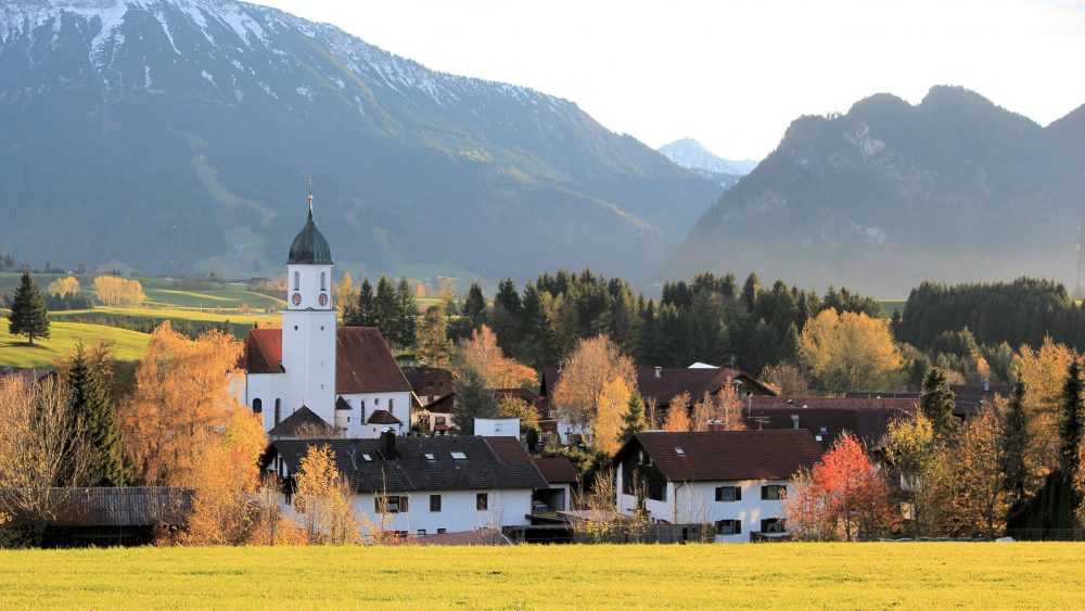
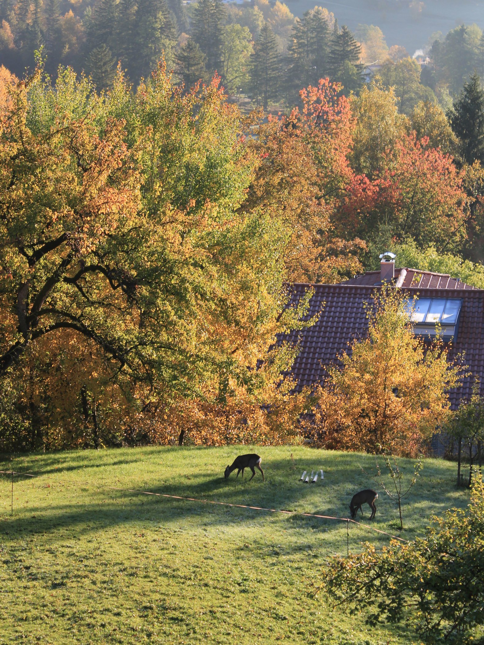
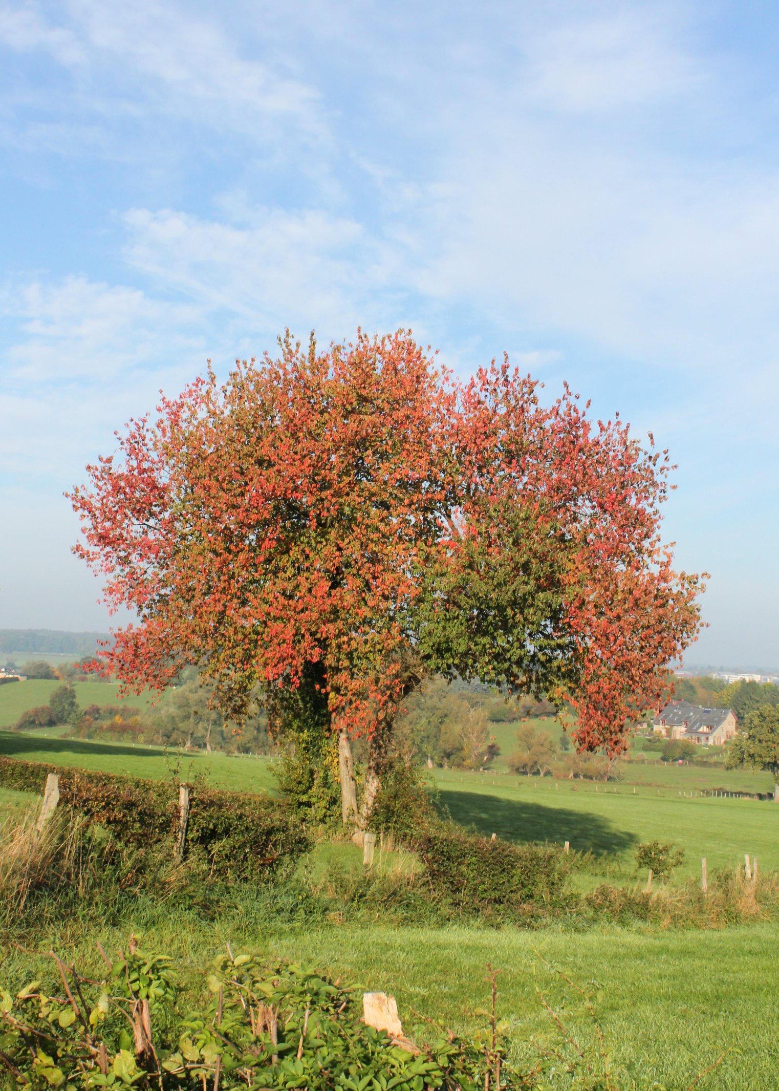
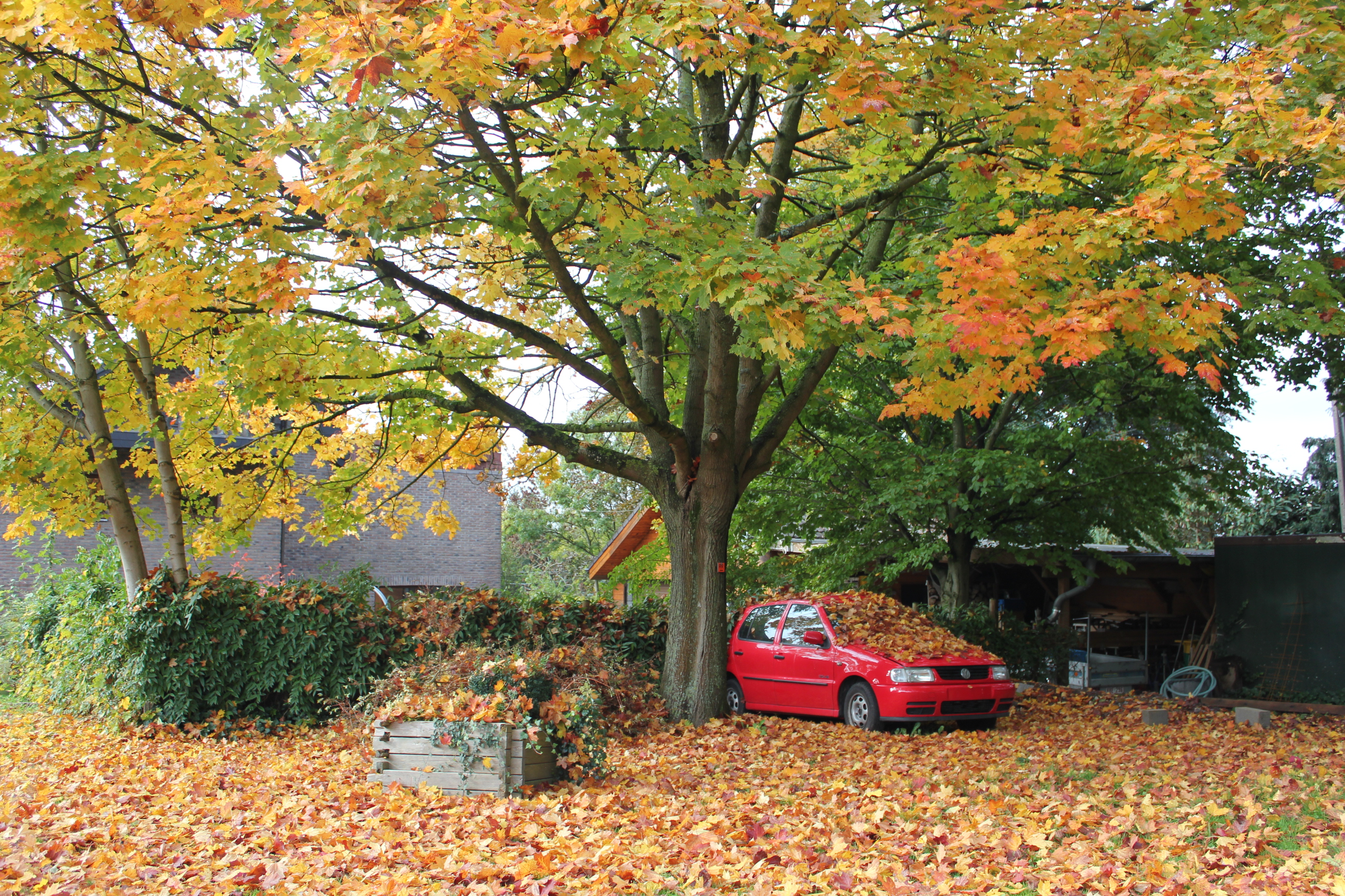
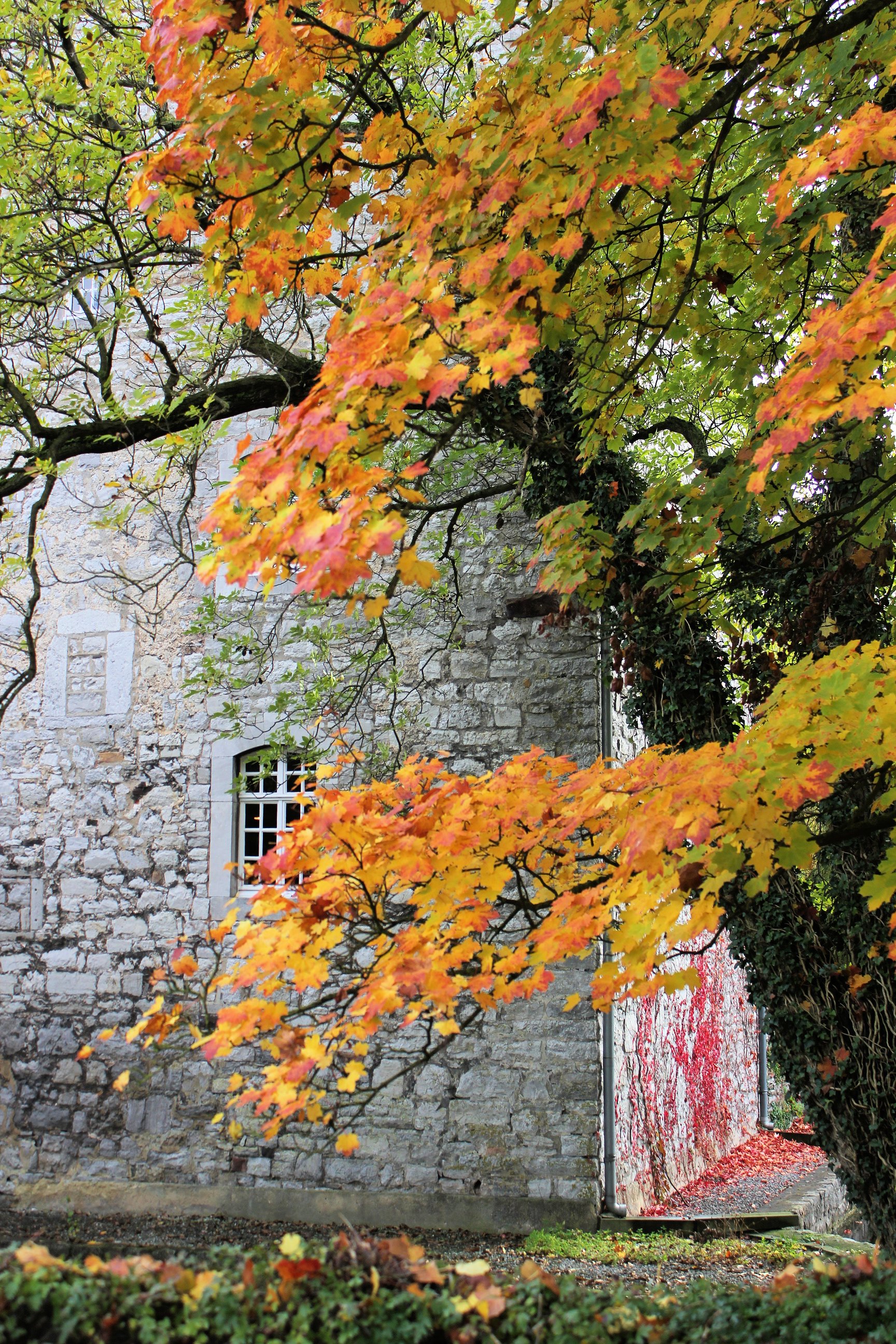
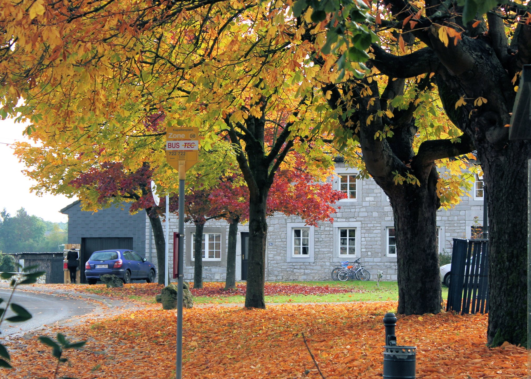
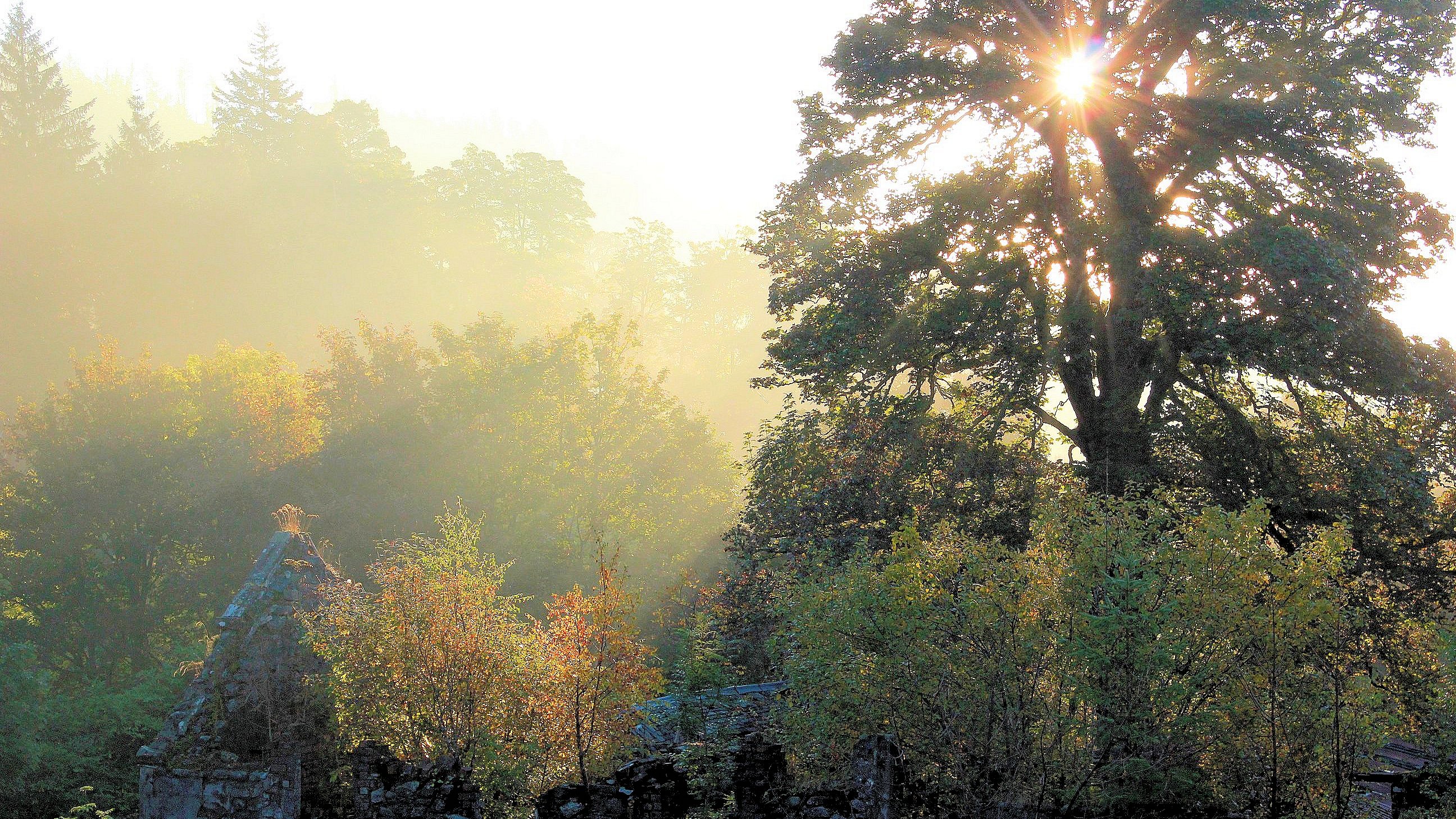
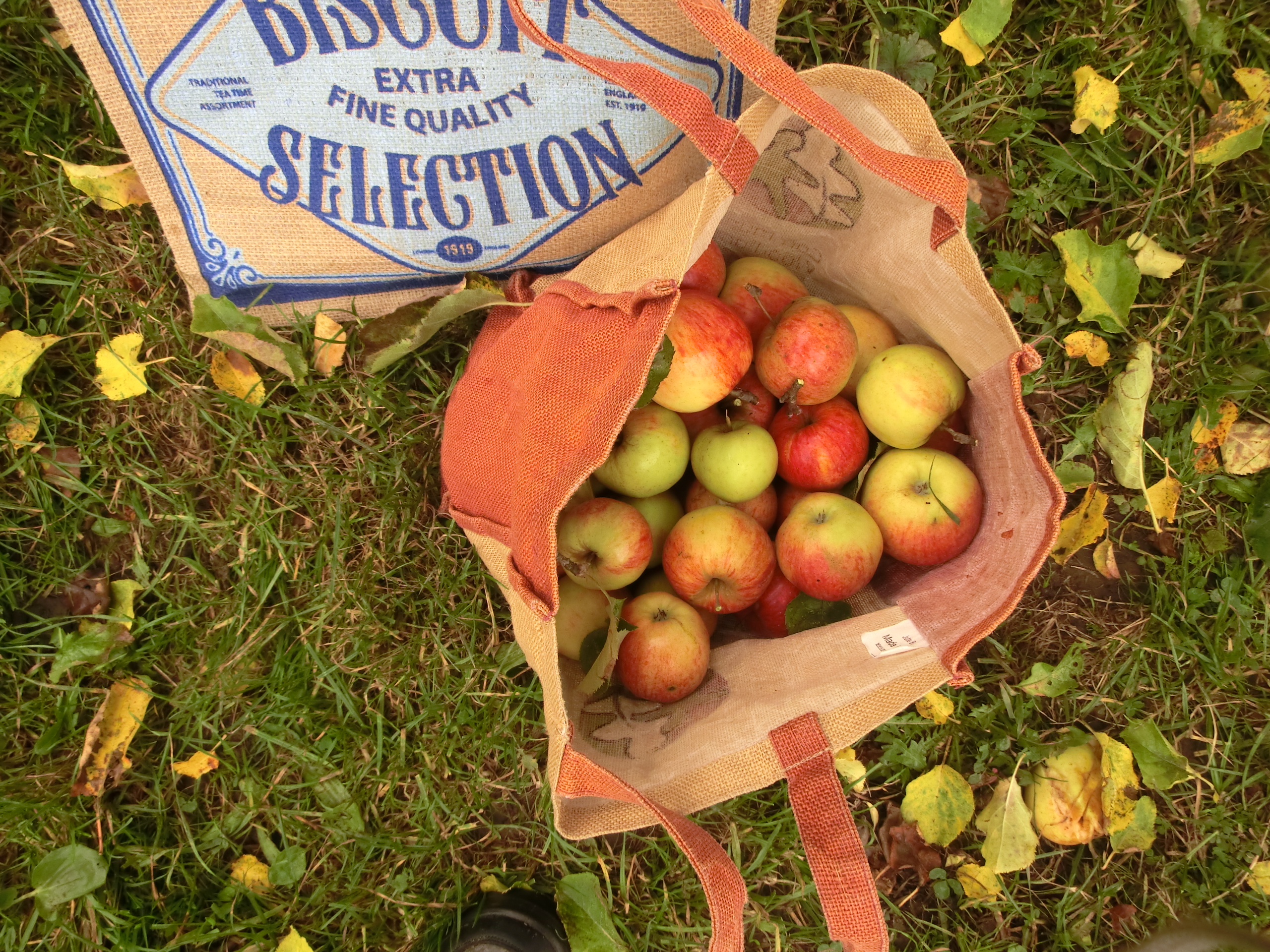
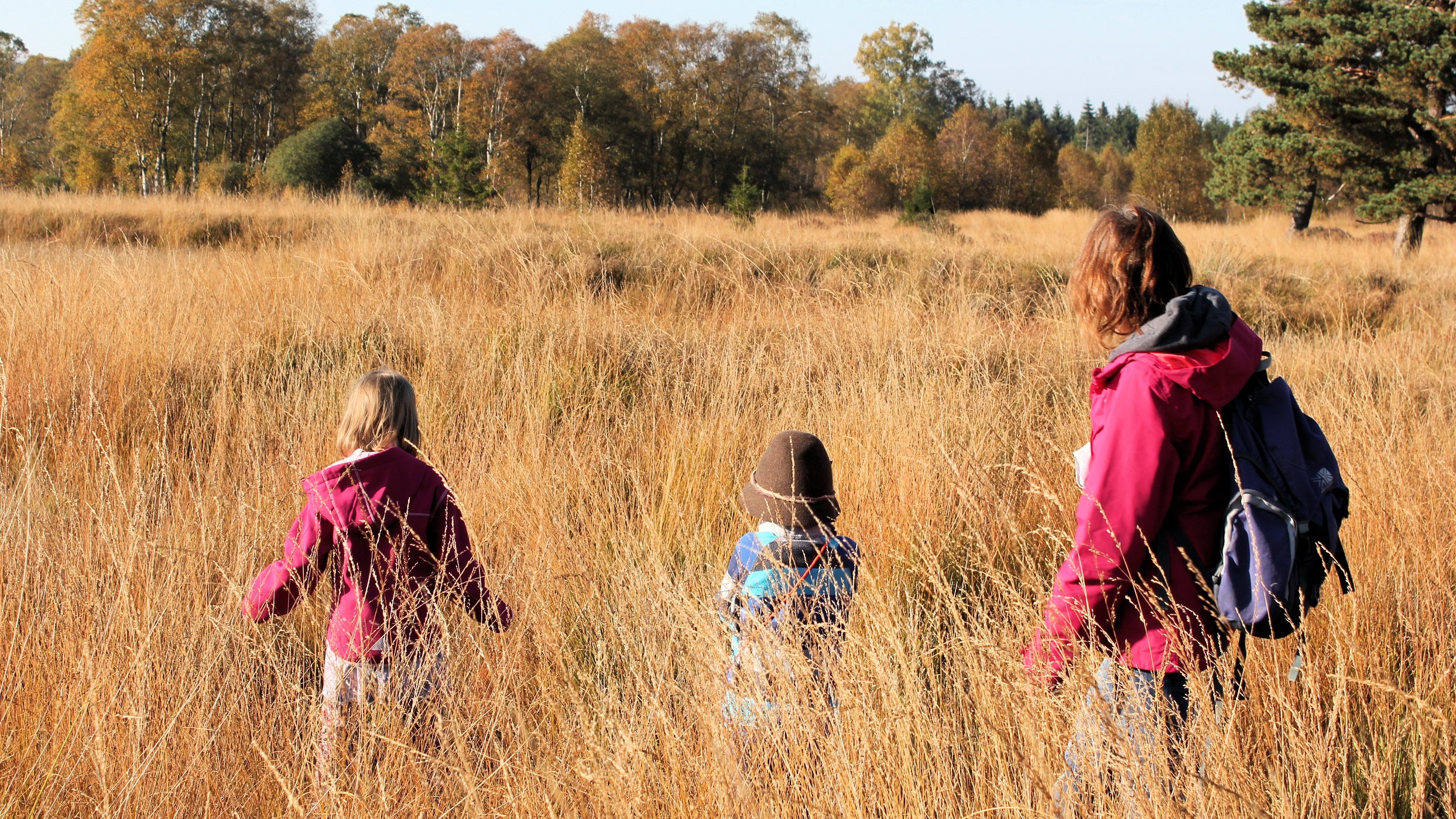
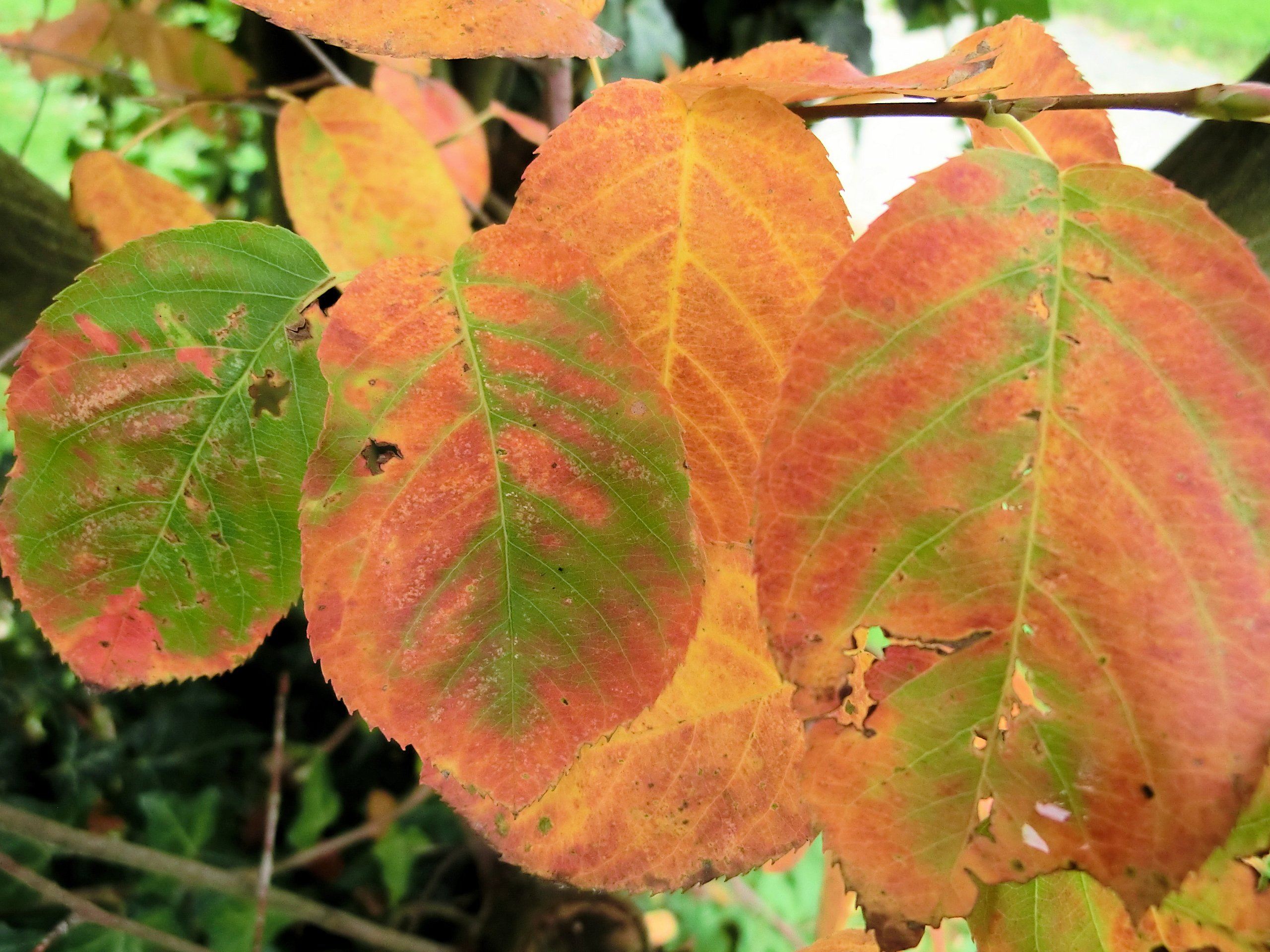
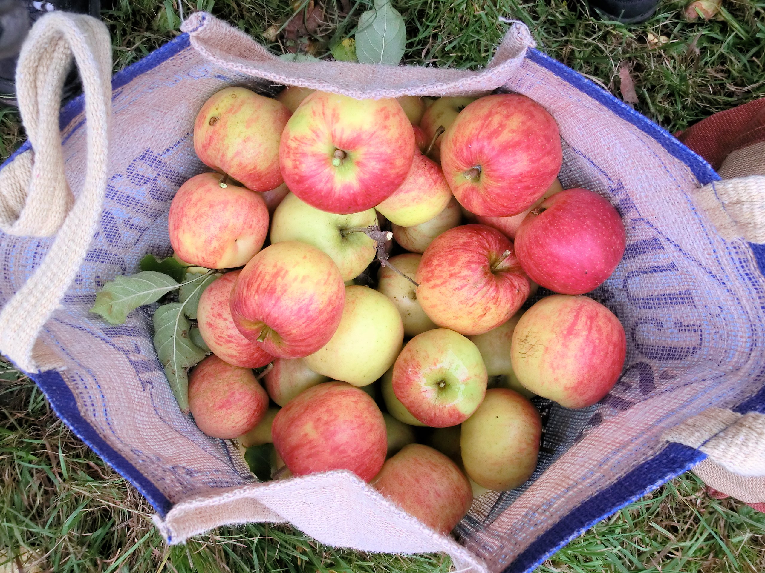
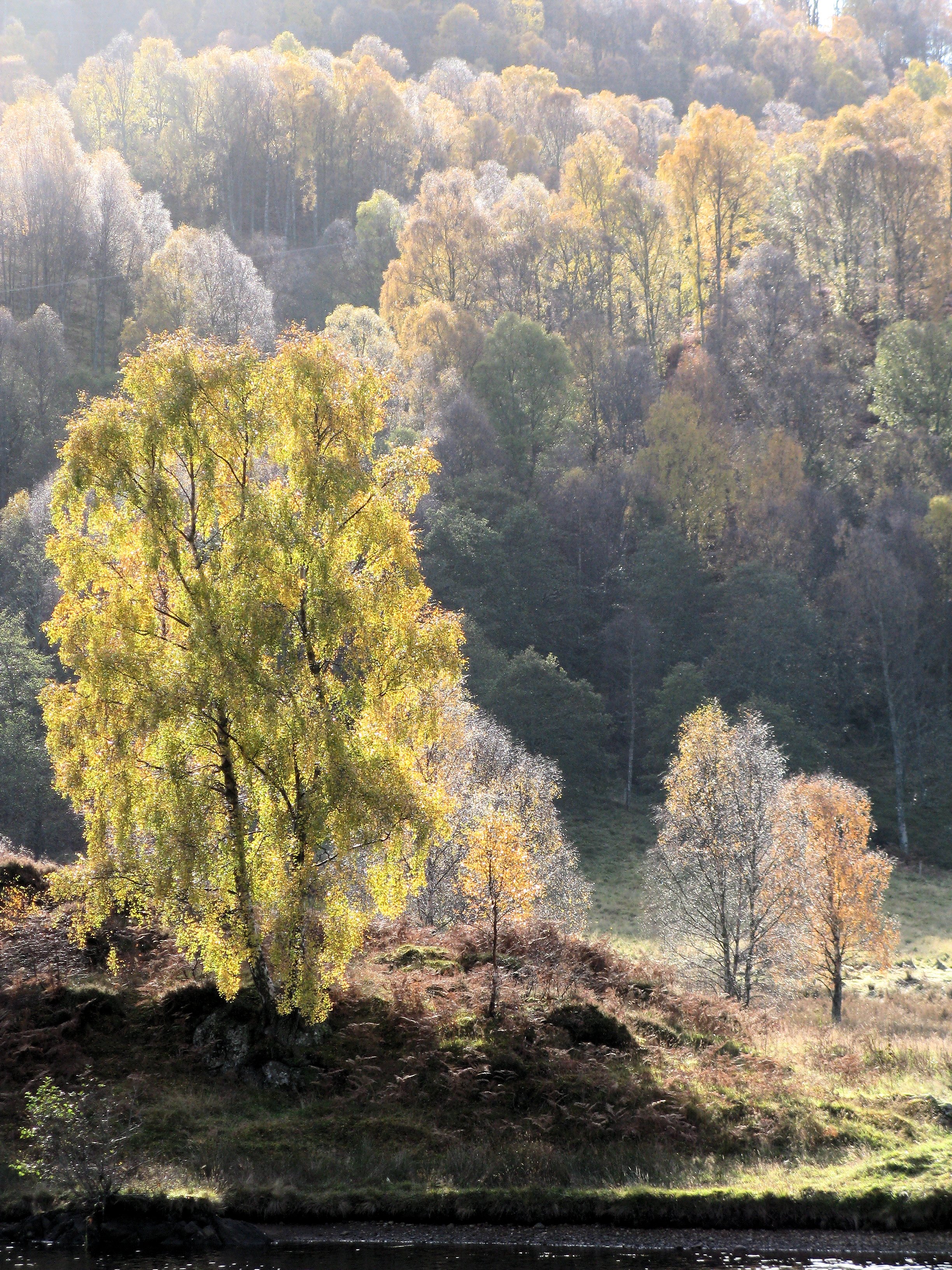
At the end of the summer, it never ceases to amaze me how, every year, so many folks look to the approaching winter with a sense of foreboding, quite forgetting that the most beautiful season of the year has yet to pass. In between the showers and the squalls, the autumn is simply the best time to be out and about amongst the woods, fields, villages, lanes and hills that comprise our patchwork landscapes.
So, here’s a gallery of photos from some previous years, just to whet your appetite for all things autumnal. Better still, get out into nature and take a look for yourself; you won’t be disappointed ! Sure, the dark days and long nights of winter will come; but, reassuringly, each season offers up its own unique treasure-trove of wonders – like that golden glass of Speyside single malt by the fireside on a dreich winter’s night 🙂
People keep telling me that Norway is overpriced, overcrowded and over-touristed – in fact, images of visitors fighting for their own tiny piece of Instagram space atop the airy and iconic Pulpit Rock by Stavanger, jostle for attention on seemingly near-identical Nordic blog pages. Furthermore, everyone invariably shouts out “too pricey” when you even so much as mention the homeland of the Vikings as a would-be holiday location, principally citing the price of a pint as being ample evidence in itself – of course, the most important criteria in any civilised society ;-).
However, I find it’s always best to form your own impressions about places and to experience them at first hand before pronouncing judgement. Usually, social media commentators tell only partial truths – of course, there are always “hot spots” and conversely, there are undoubtedly quieter places too; if you’re one of the privileged few who can read a map these days and don’t feel obliged to blindly follow the Instagram sheep (and their so-called “influencer” shepherds), it’s more than likely that you’ll also find some fabulous, uncrowded places without too much trouble, in a vast land with a population of only 4 million.
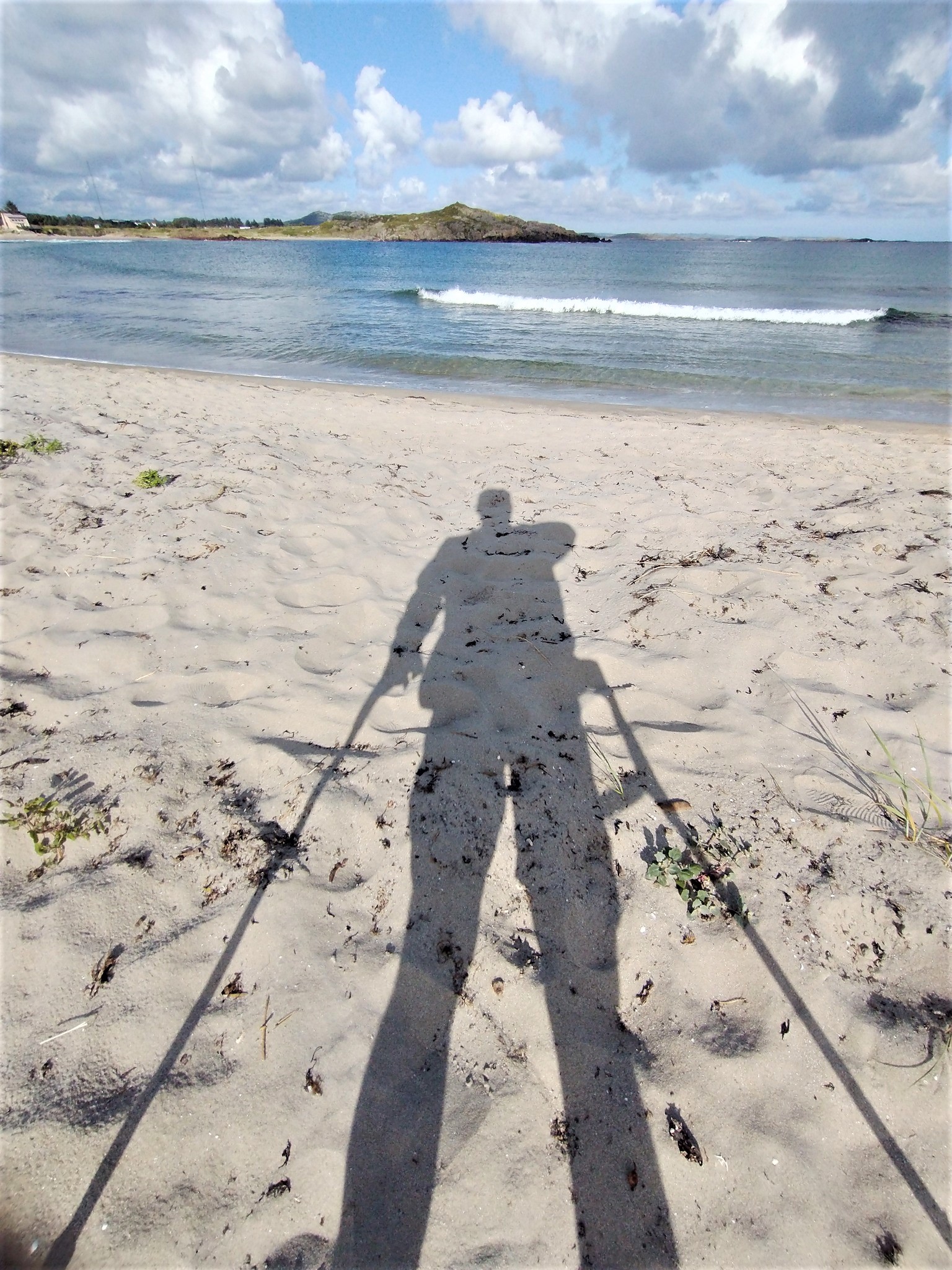
For the last couple of years we’d been trying to take a holiday in Scandinavia, but were beaten back due to endless cancellations and Corona restrictions. Then 2022 looked altogether more promising, until a serious hiking accident over Easter sent me unexpectedly off to the Surgeon’s table in Garmisch-Partenkirchen and threatened to once again put a damper upon any further travel plans for the rest of the year. However, we persevered and in July found ourselves on a beautiful part of the Norwegian Coast (albeit, me with obligatory crutches in a supporting role).
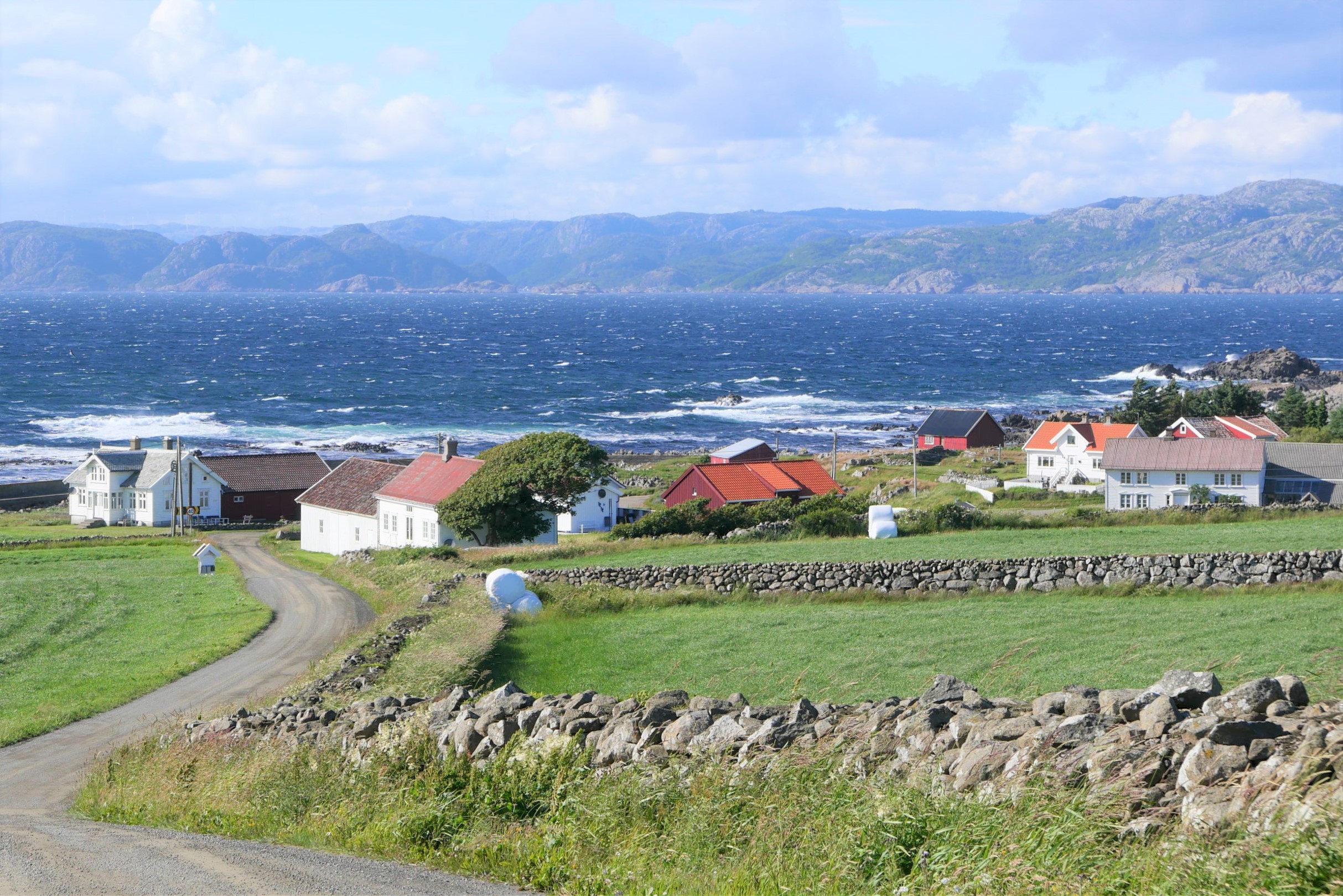
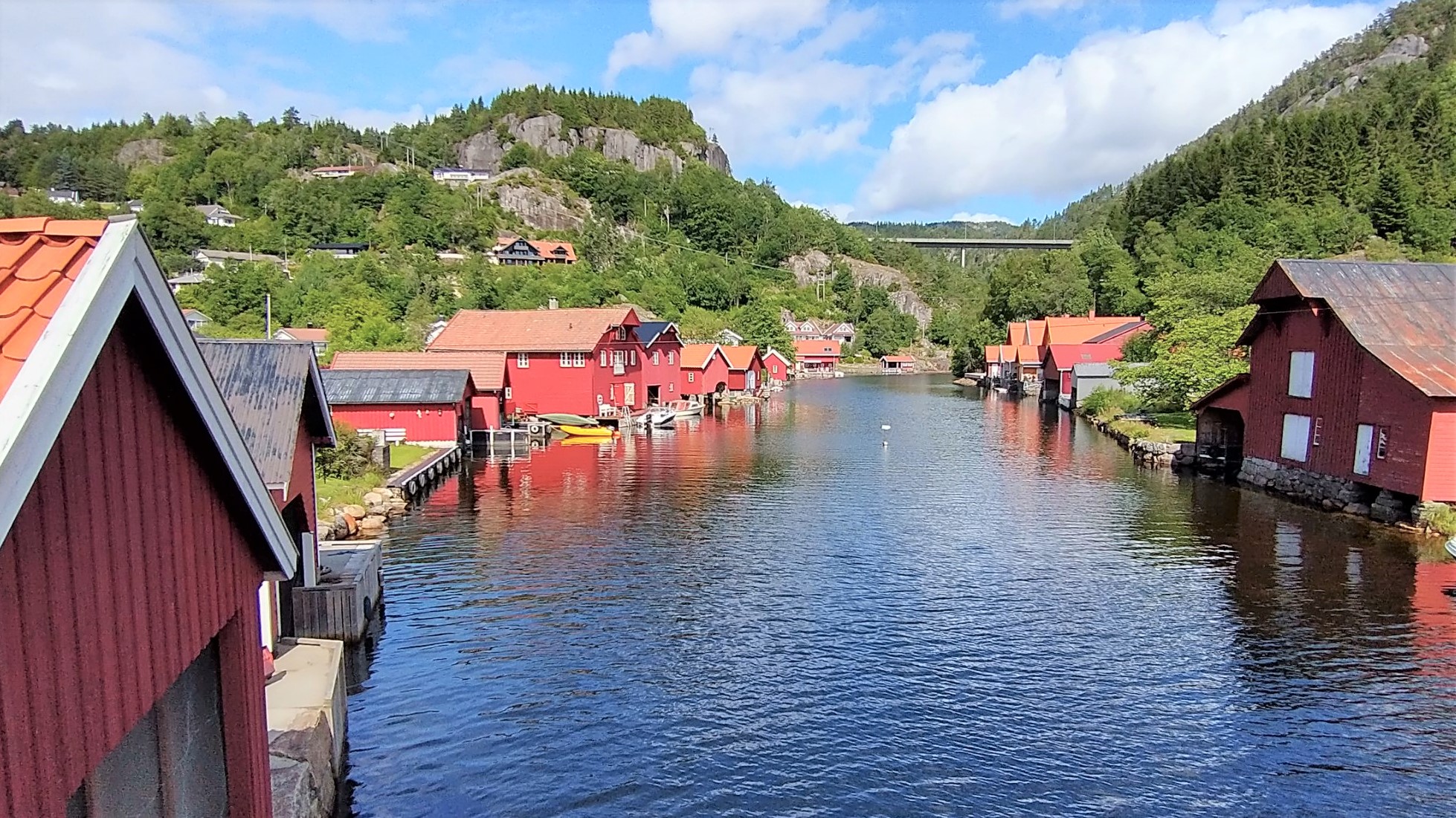
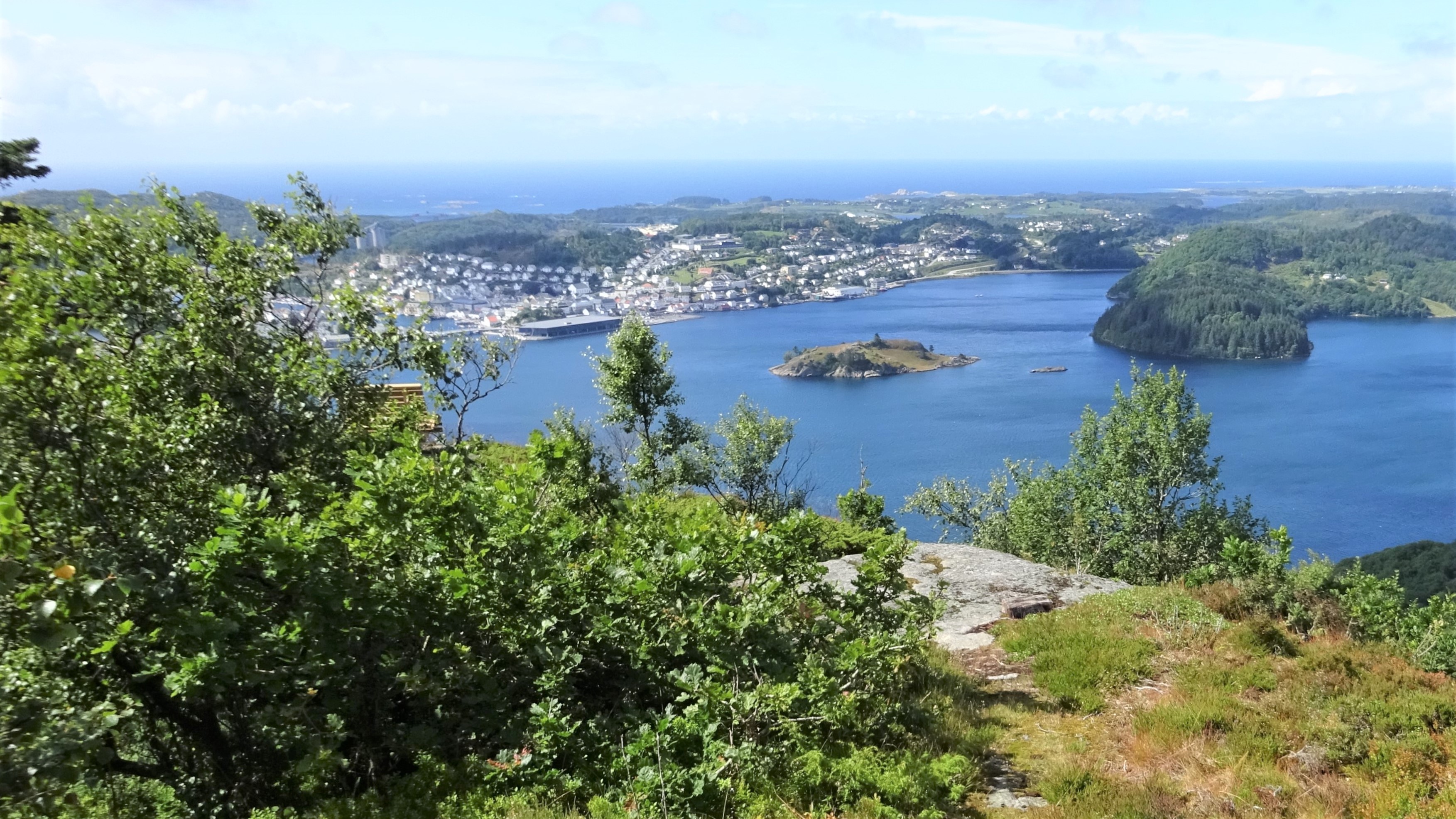
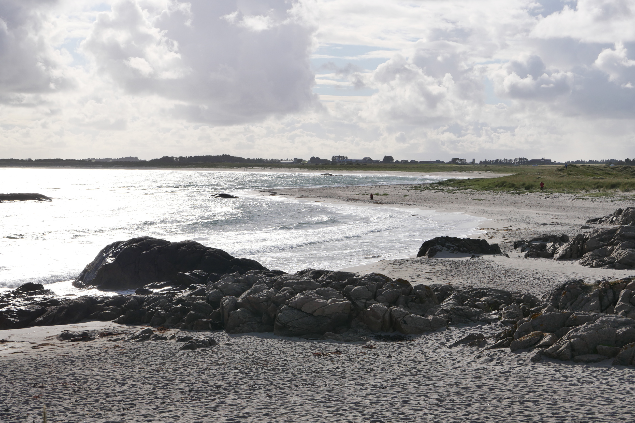
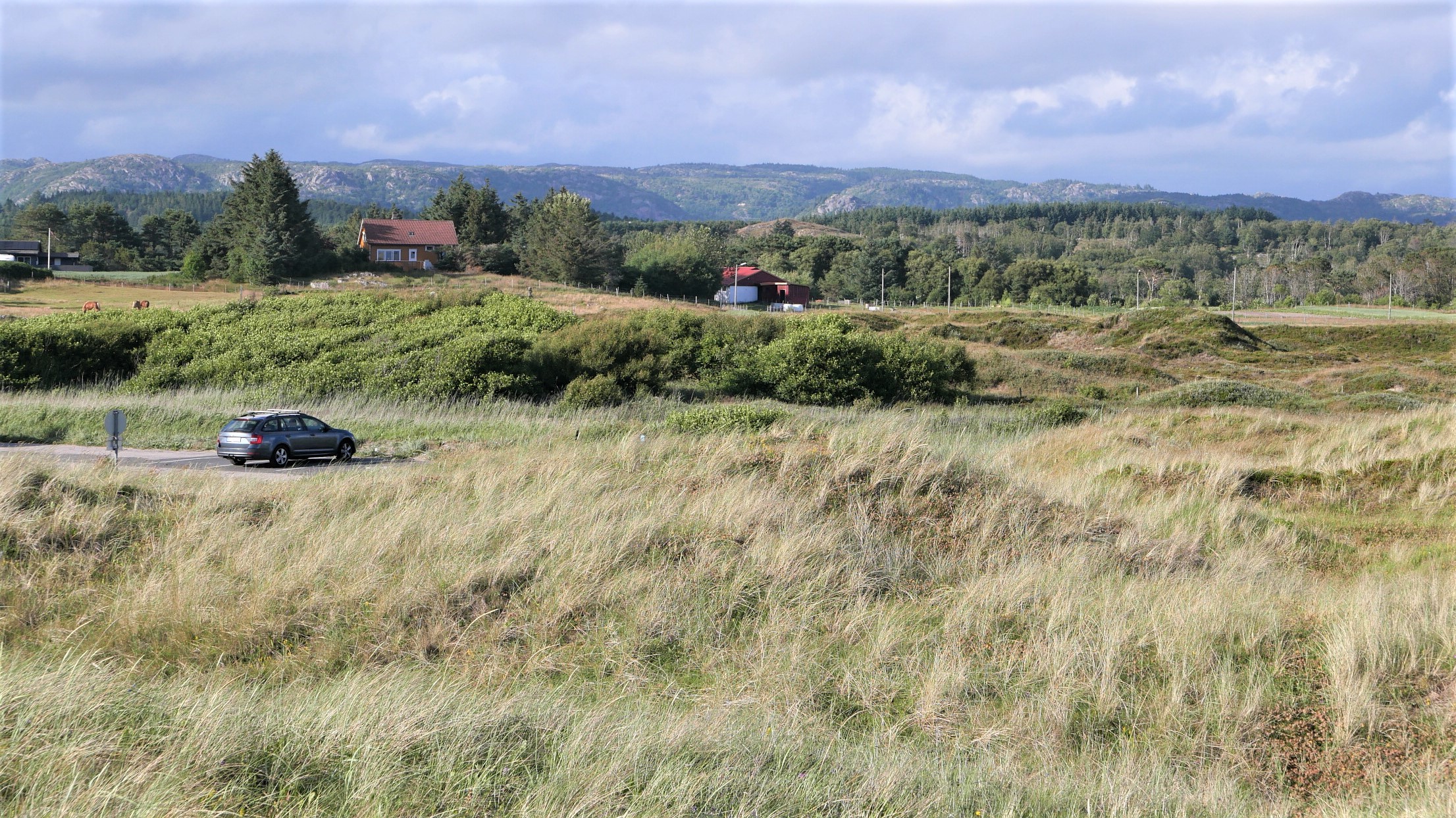
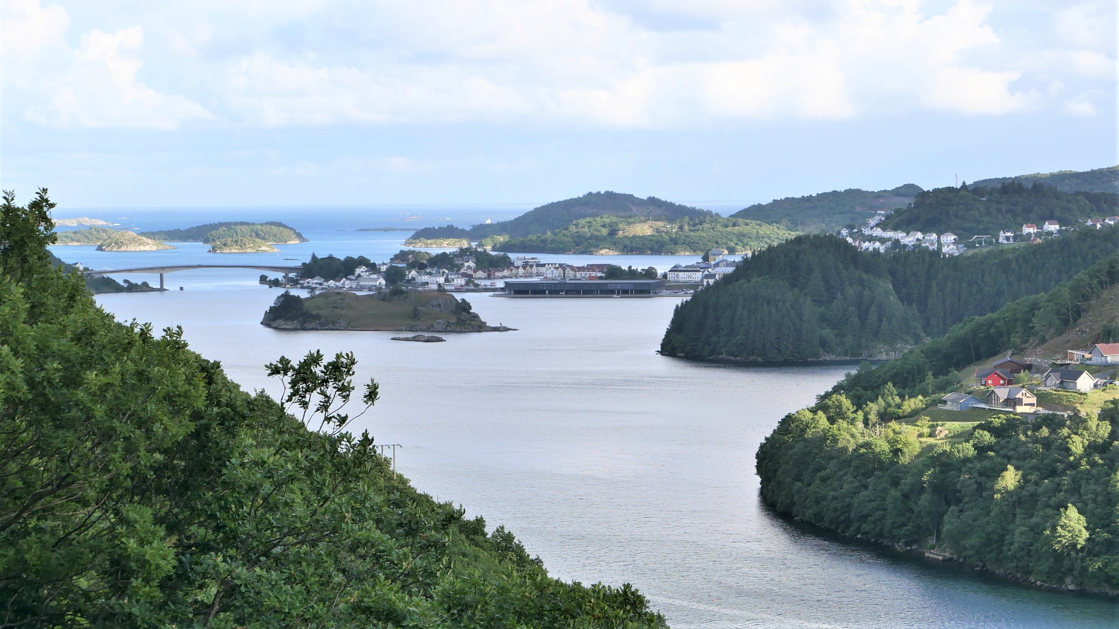
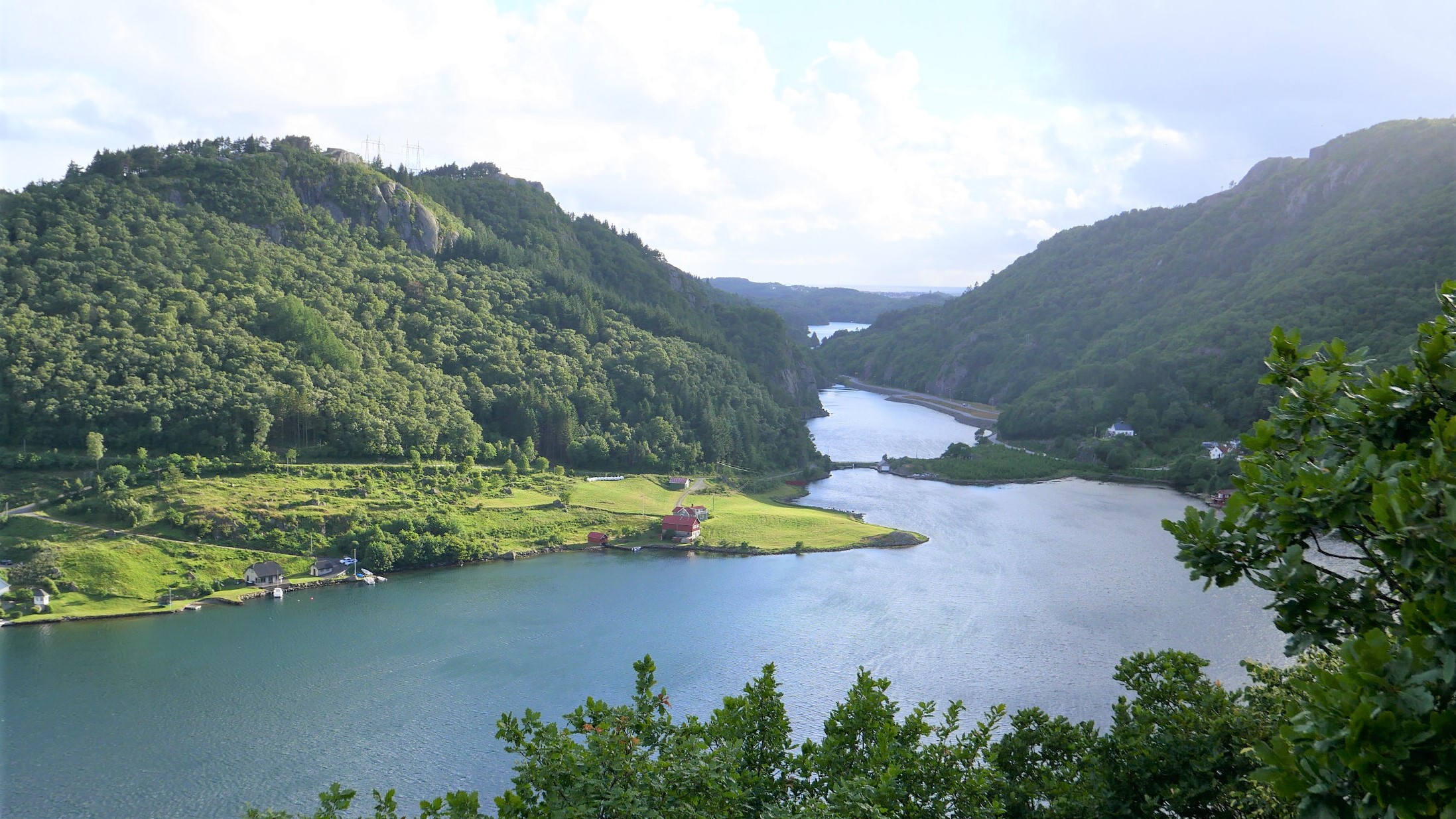
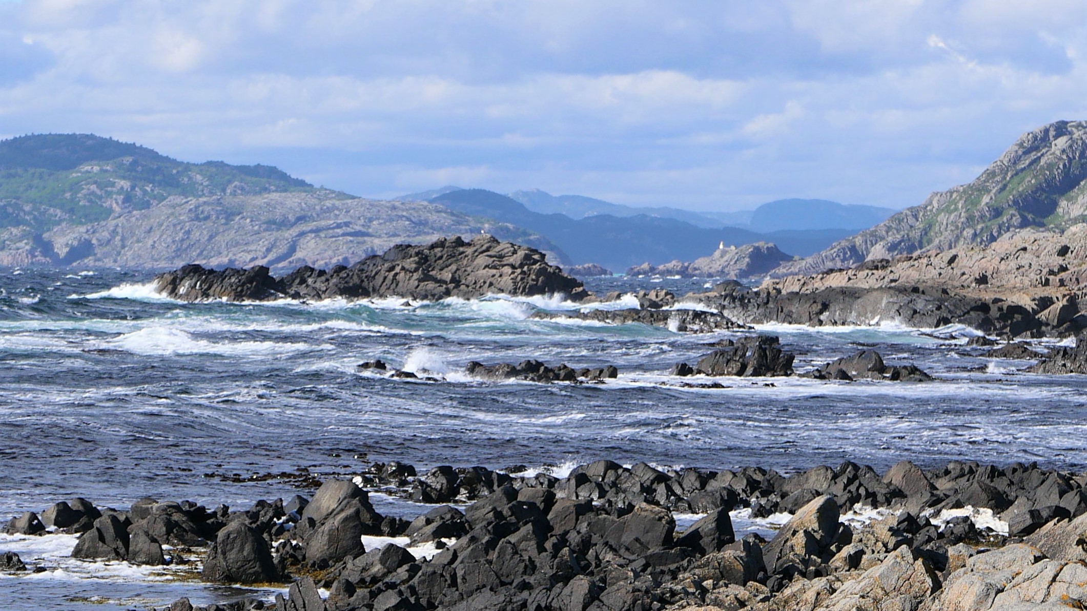
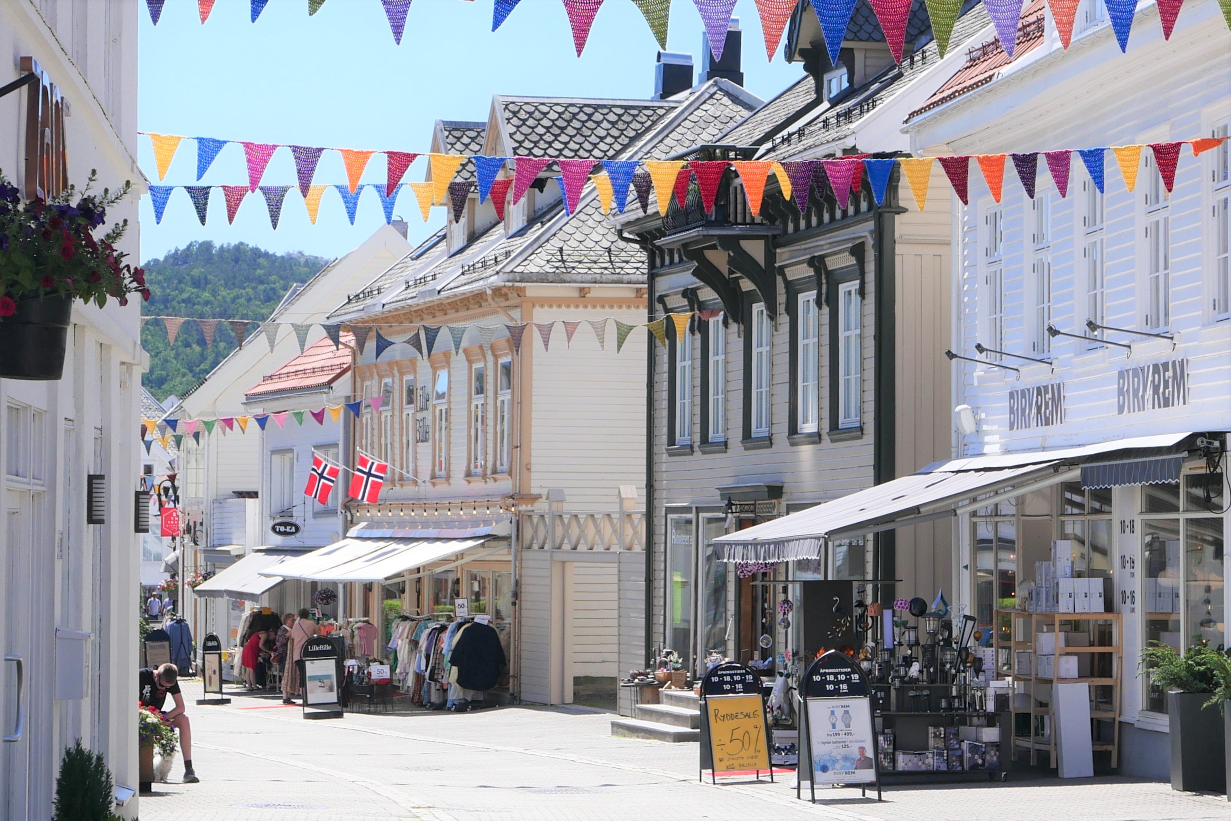
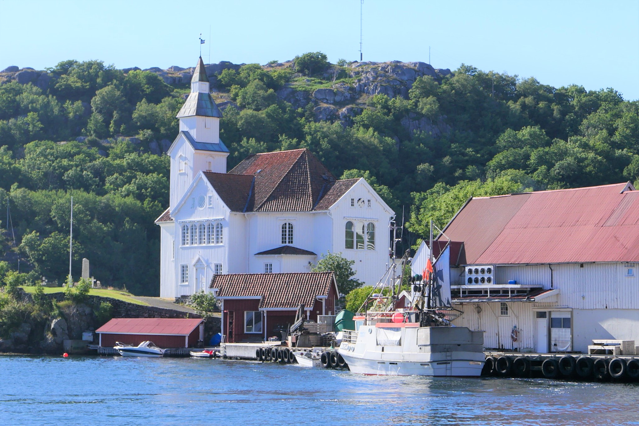
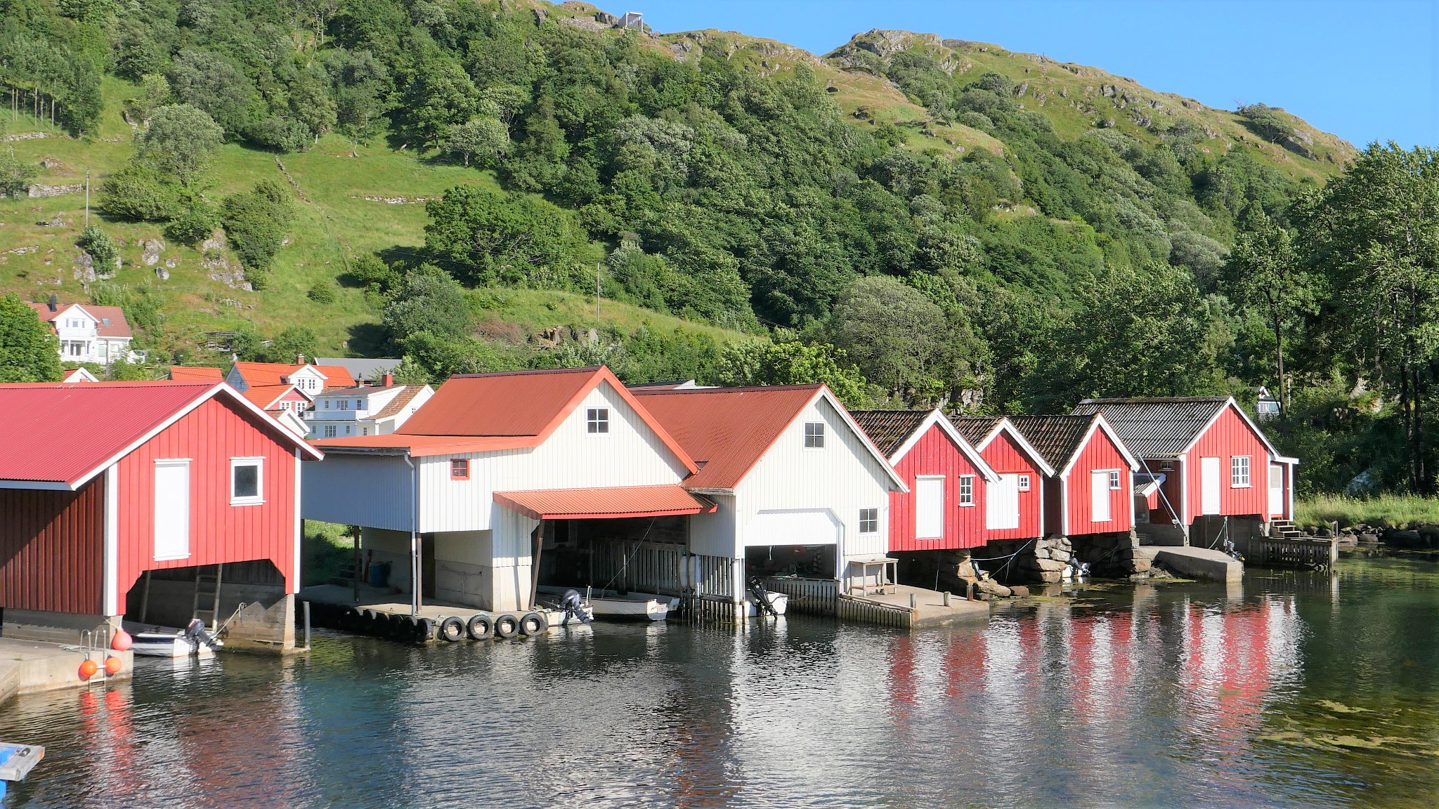
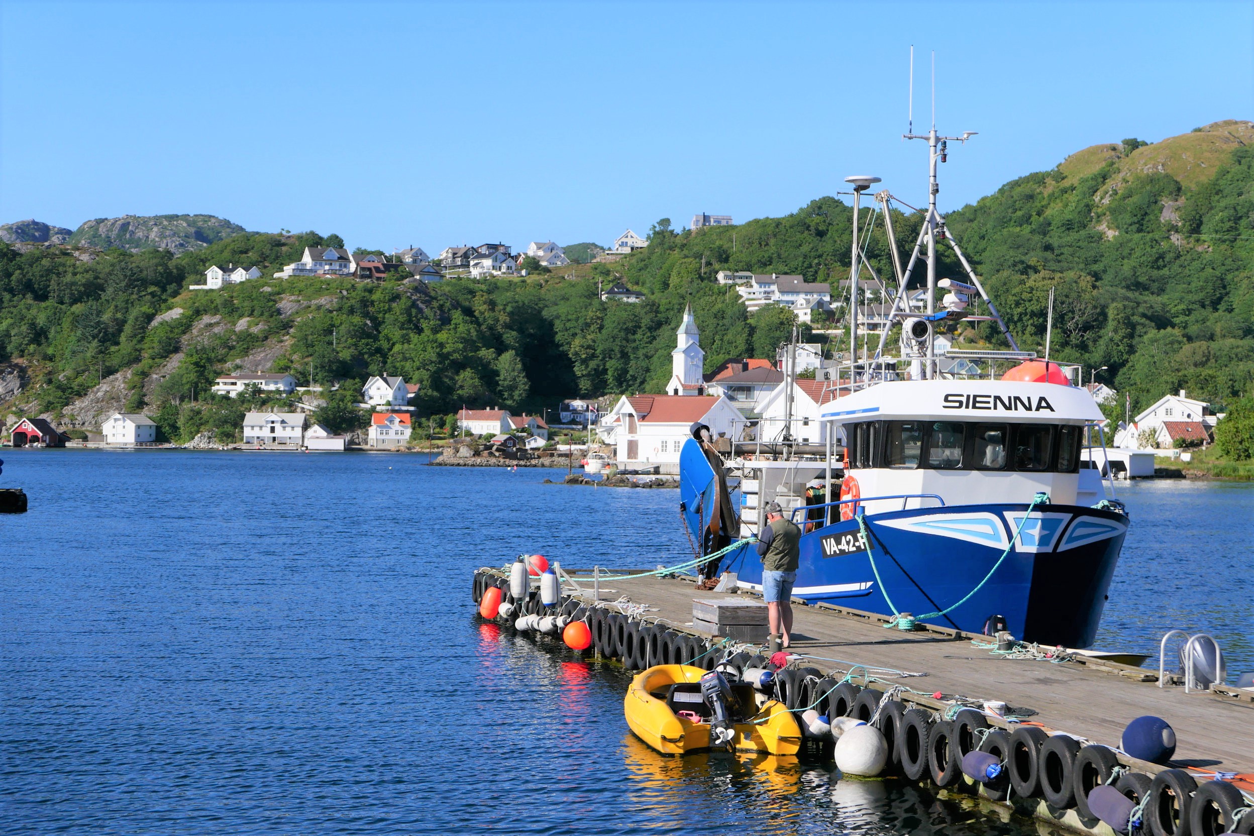
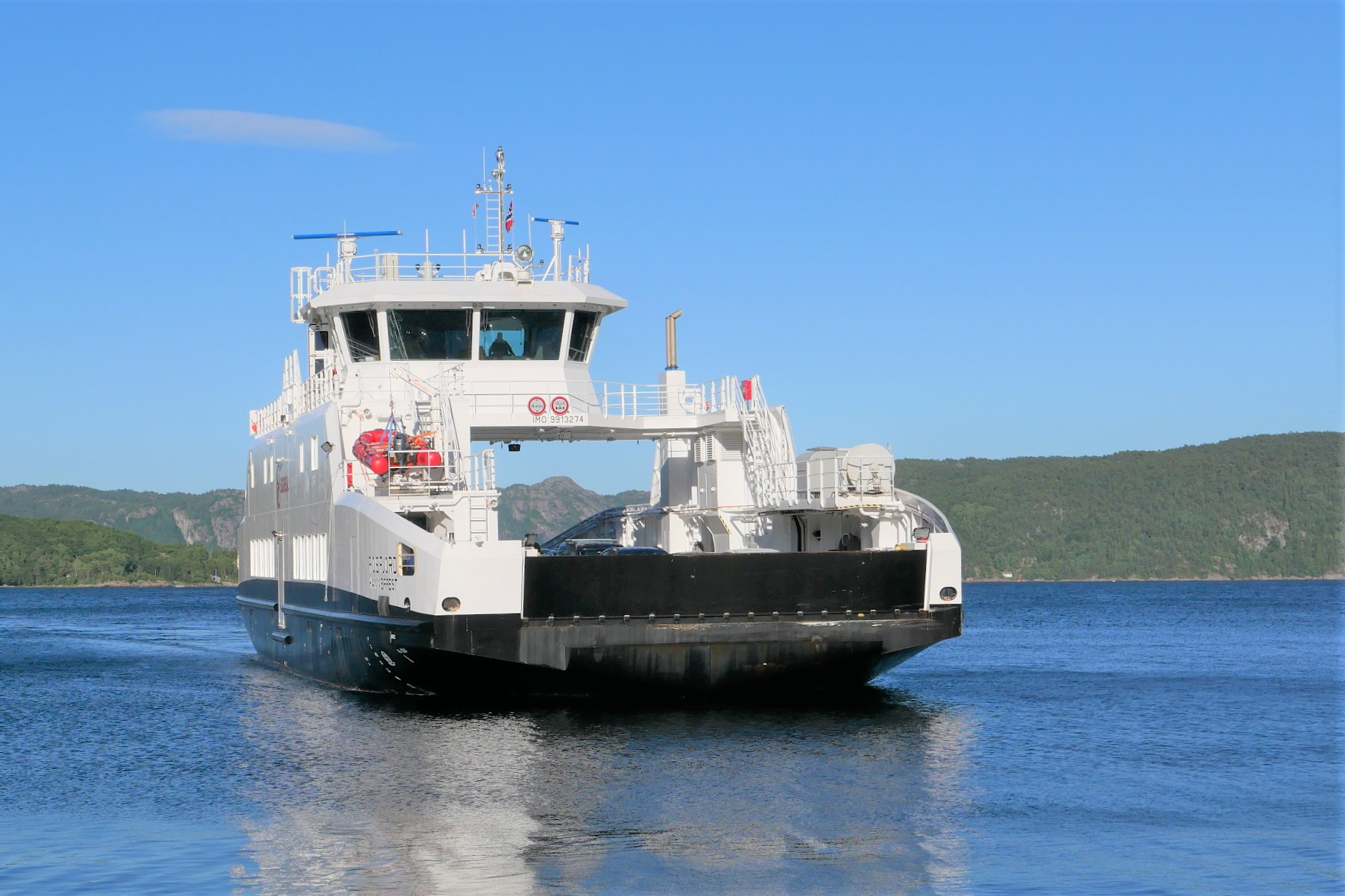
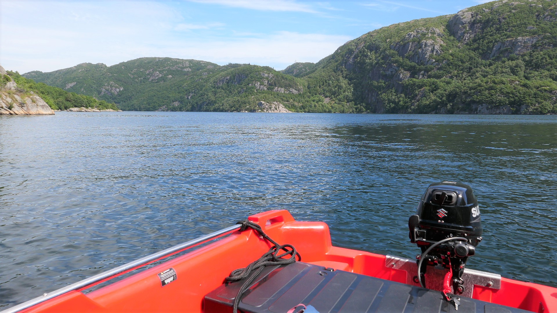
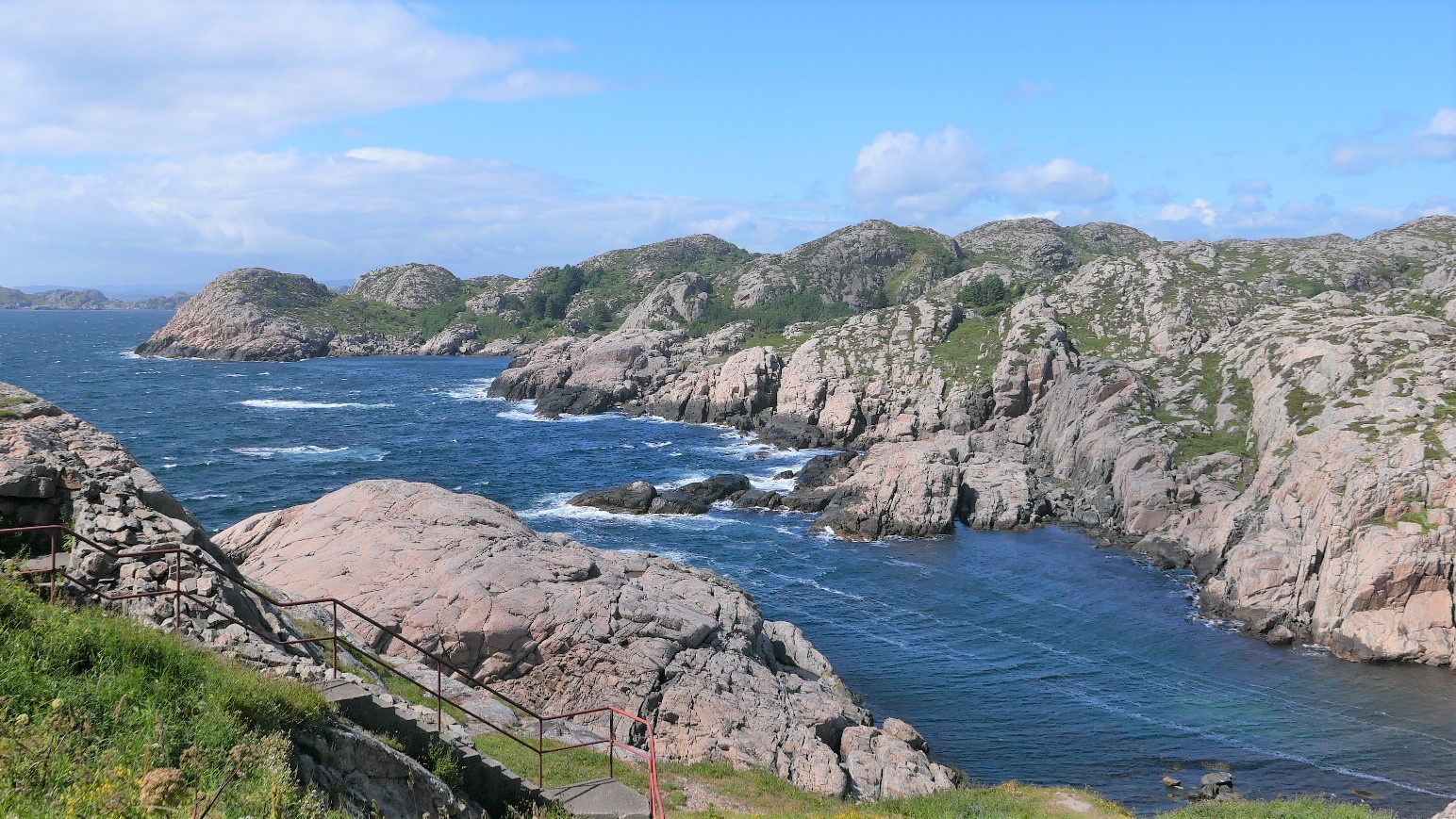
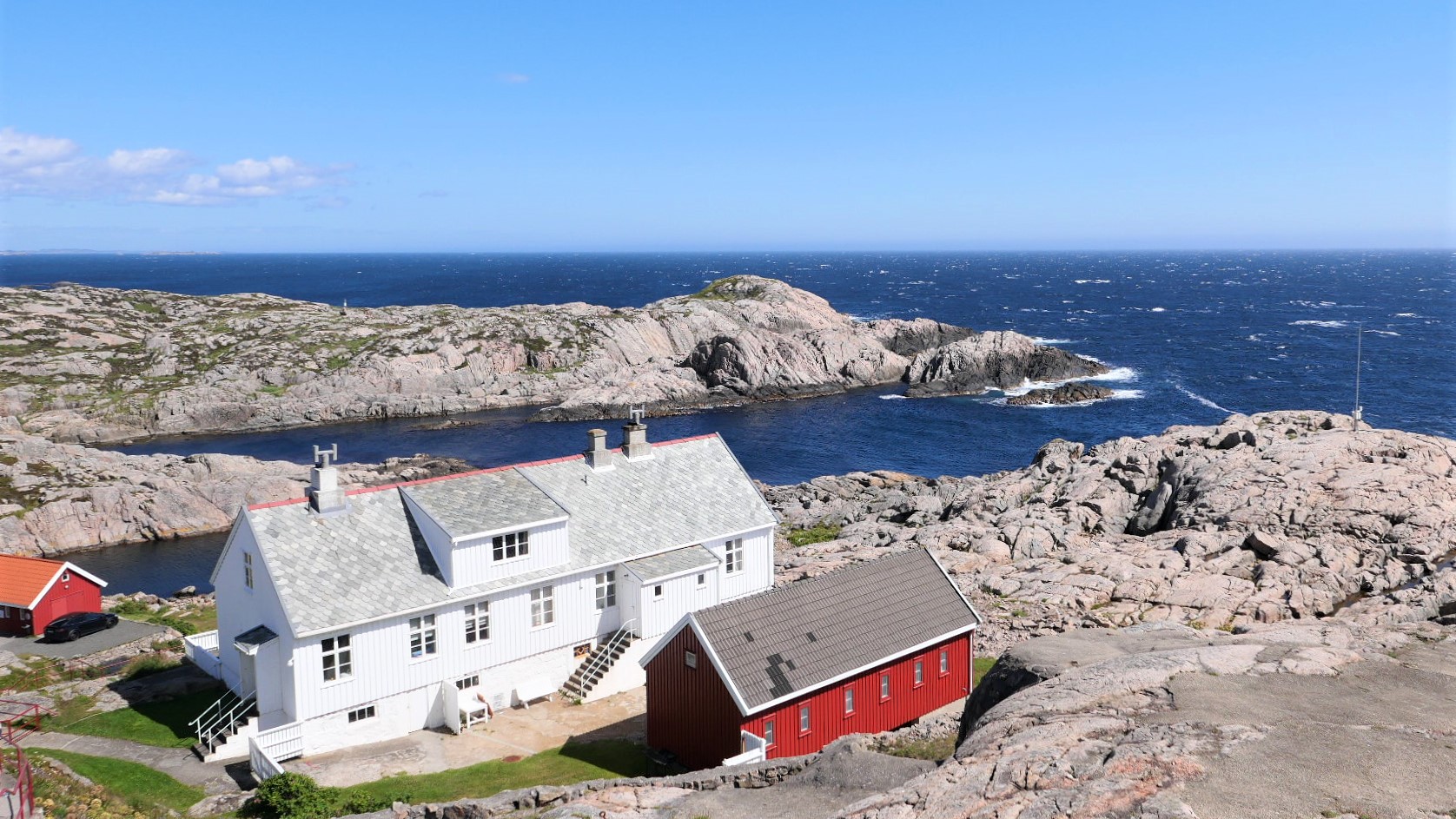
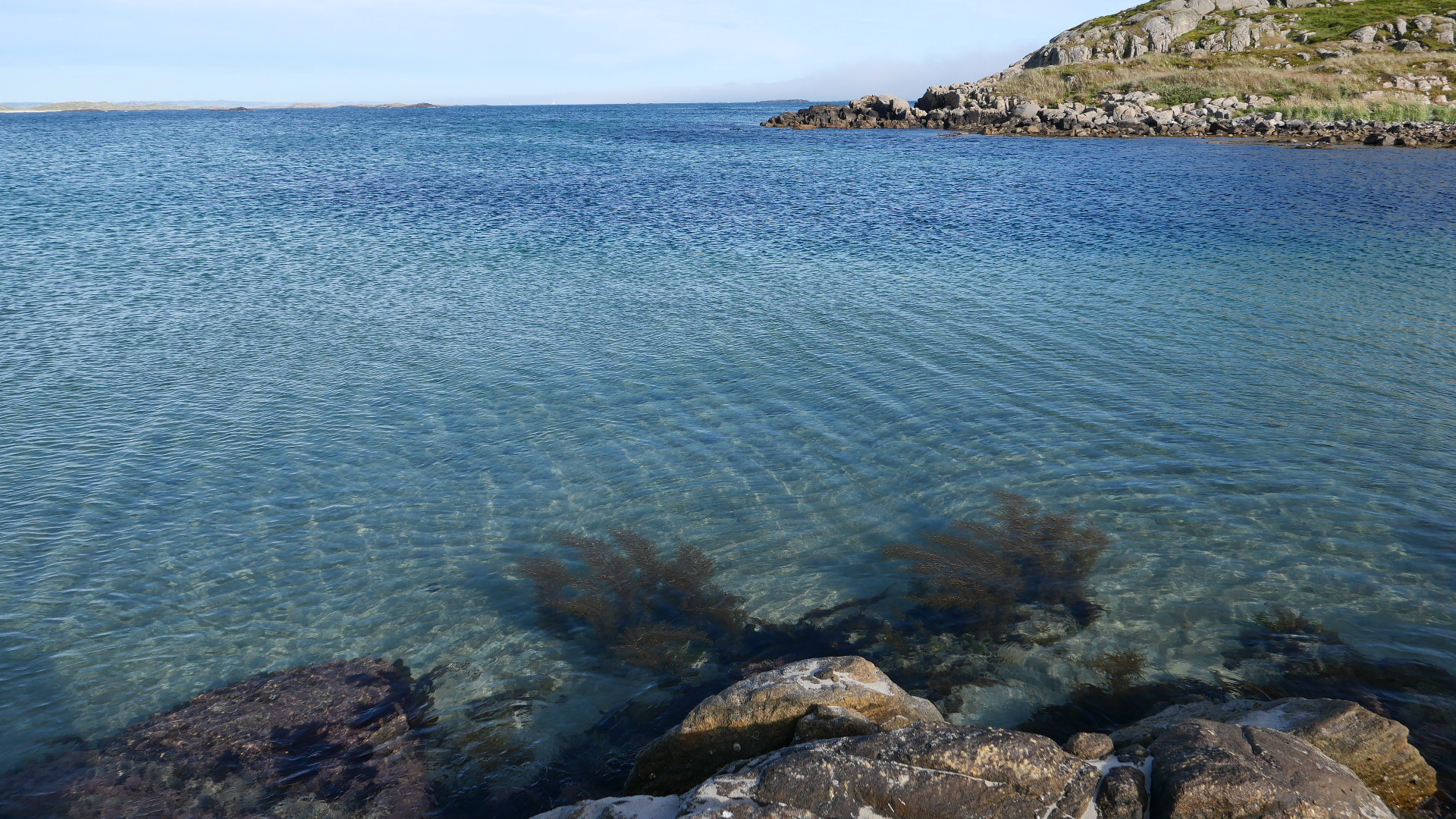
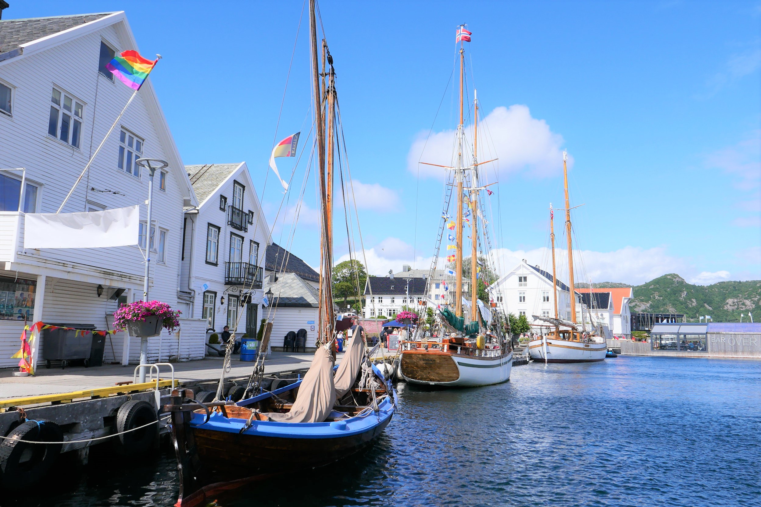
Anyway I’m so glad we did. We stayed near the picturesque harbour town of Farsund in SW Norway, which seems to be largely off the camper van circuit. There are endless uncrowded beaches, boasting extensive dune systems (of the mercifully, “unTrumpified” variety), big sky panoramas around the adjoining lower lying lands of Lista and extensive networks of fjords, which penetrate far inland (though not on the same scale as those further North). Here. you can find ancient cultural landscapes, packed with historic field systems, old farmsteads, bronze age cairns and rock carvings of ships made by ancestors of the Vikings, as well as some surprising artefacts and forts from WW2. Much of the coast is strictly protected as wildlife habitat, which keeps away the “resortification” you might find in other destinations, though you’ll find some quaint old fishing villages with small harbours, which seem literally hewn out of the rock as refuges from the wild wind and waves.
OK, if you want cheap meals out and toasting yourself on the beach in 40 degree heat, then probably Norway wouldn’t be you destination of choice (but who wants the latter anyhow ?). I have to admit, it was pretty windy most of the holiday and barely got above 18 degrees the whole time. Eating out also wasn’t a good option unless you like throwing money away for no good reason; though strangely enough, we found that Norwegian ice cream comes in mega-portions for a relatively modest price.
Overall, there were many things about Norway which surprised me; the unhurried courtesy of the drivers, for instance, and the fact that there are so many electric cars on the road. The complete lack of any fish and chip venders was also not quite what we’d expected when looking for cheap family dining options (presumably everyone catches and cooks their own fish in Norway !). However, lovers of wild places, winds and seascapes will not be too disappointed about this. I would certainly have no hesitation to recommend a wee trip across the water some time to meet our Nordic relatives… (just bring your own beer and a few other essential supplies, that’s all !)
In reality, many places around the planet never quite match up to the expectations and preconceptions that we have for these places. Glossy tourist brochures and websites, churn out endless images of unspoiled nature, friendly locals, incredible food and culture – however, often the truth is very different and we can encounter the worse excesses of mass tourism, social inequality and places spoiled by pollution and litter. Sometimes, we can find both extremes close by one another.
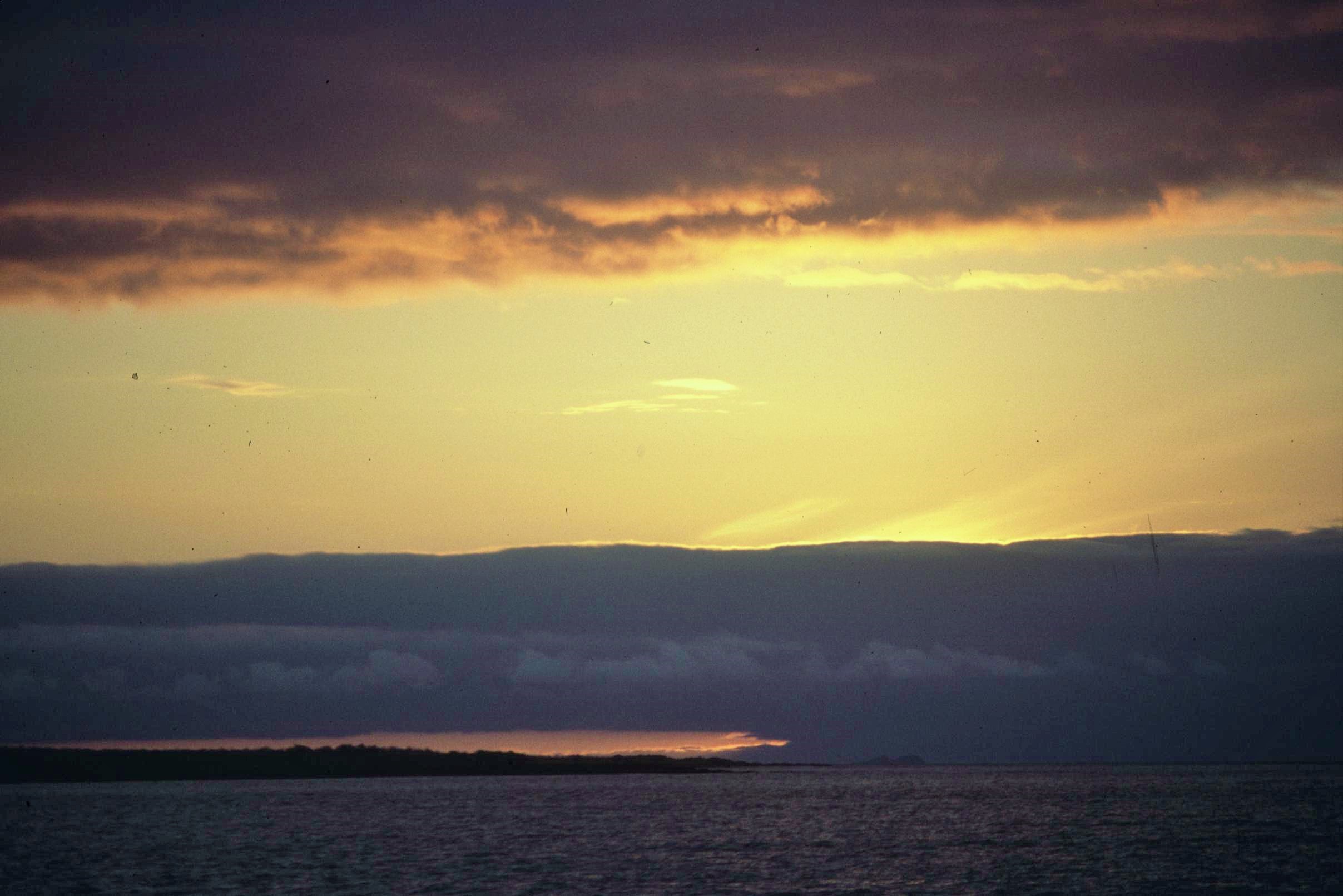
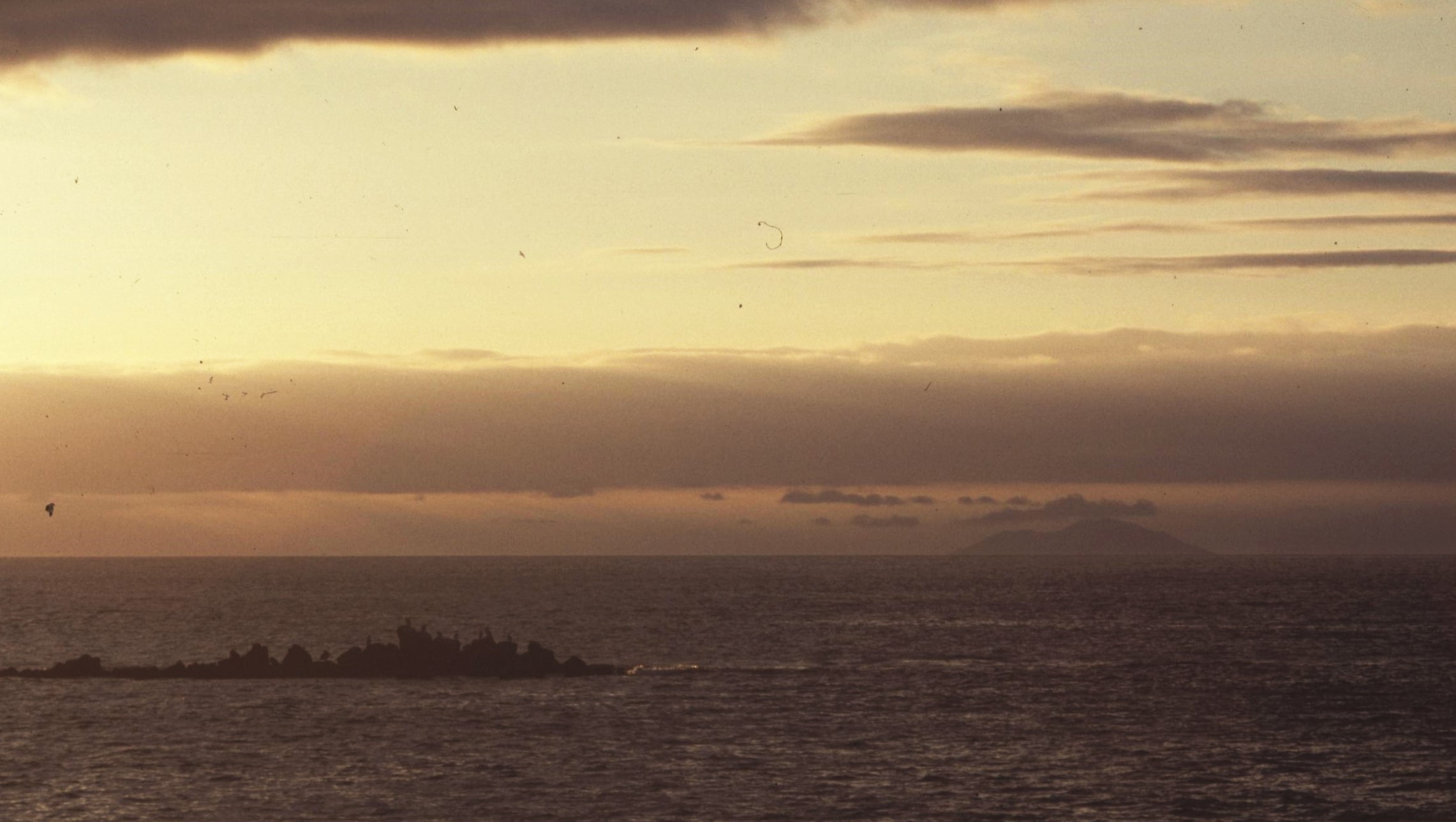
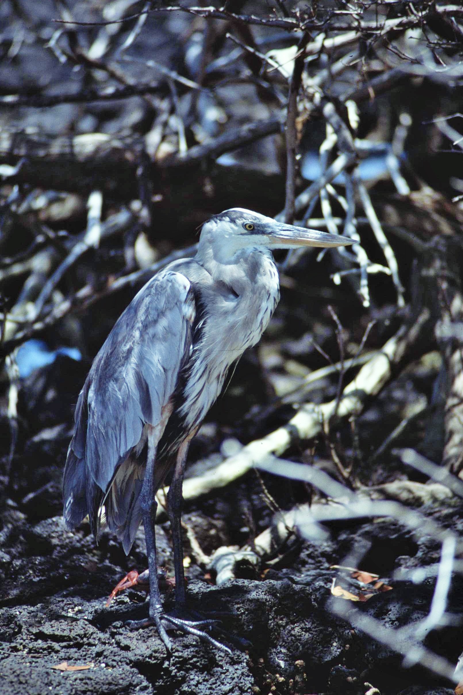
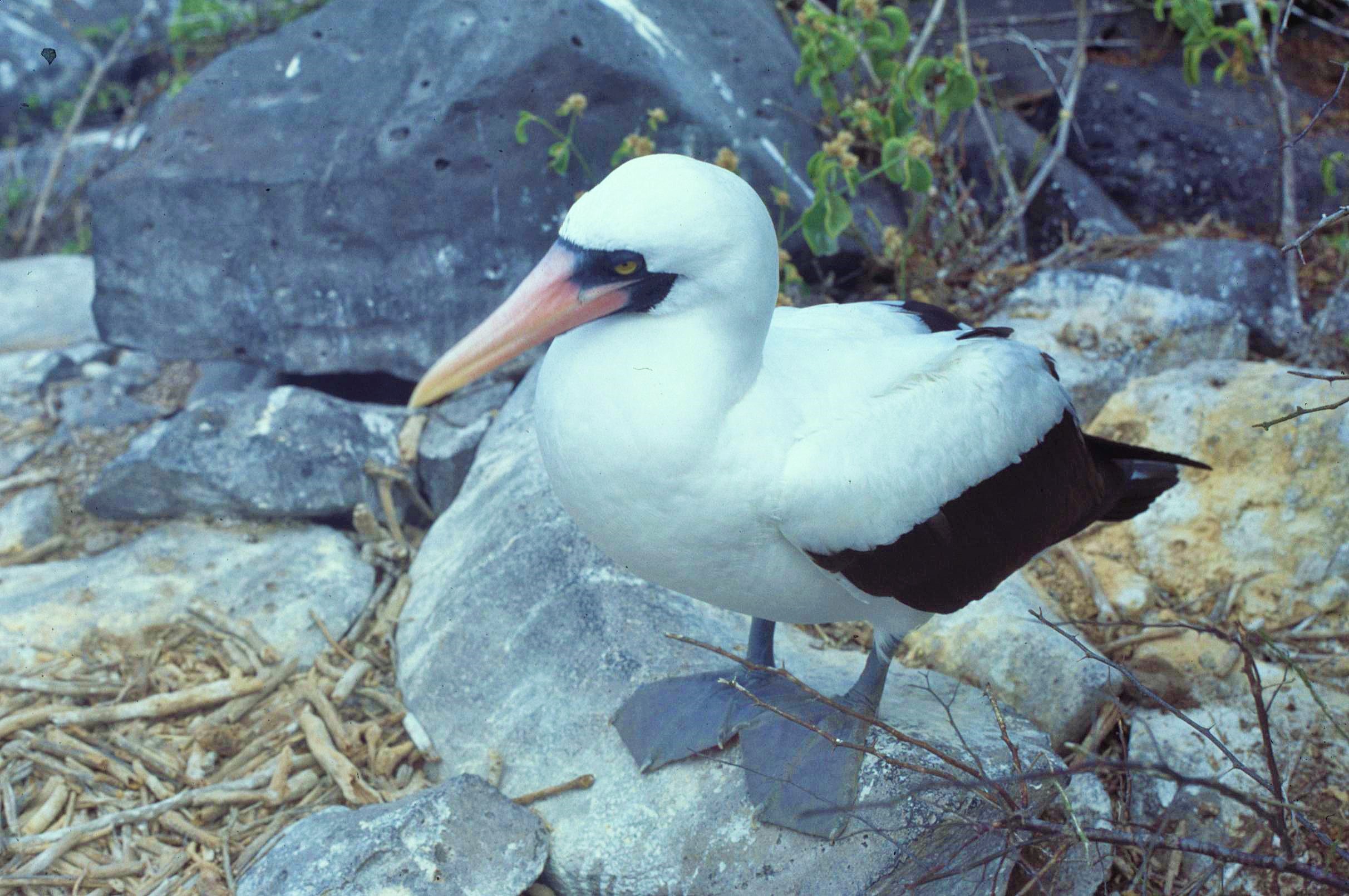
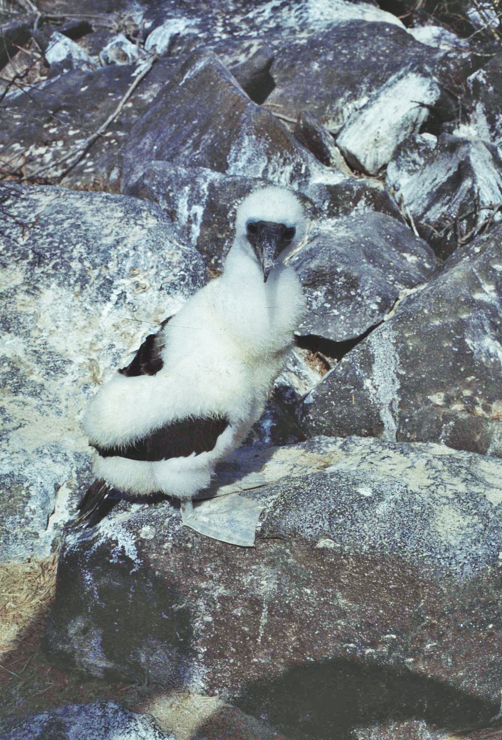
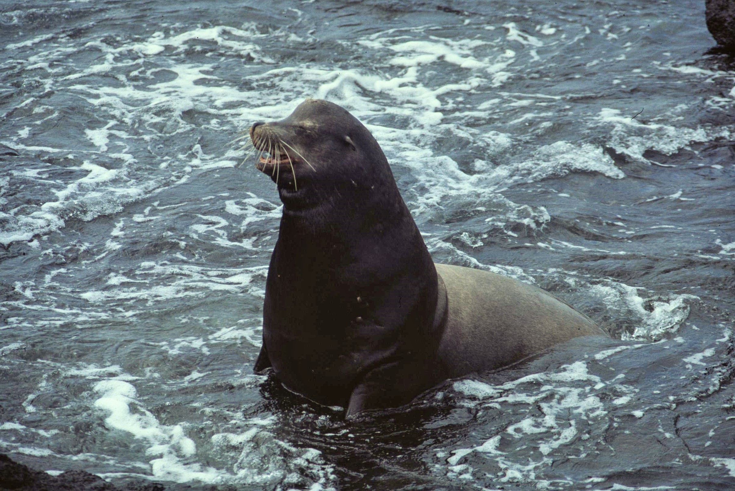
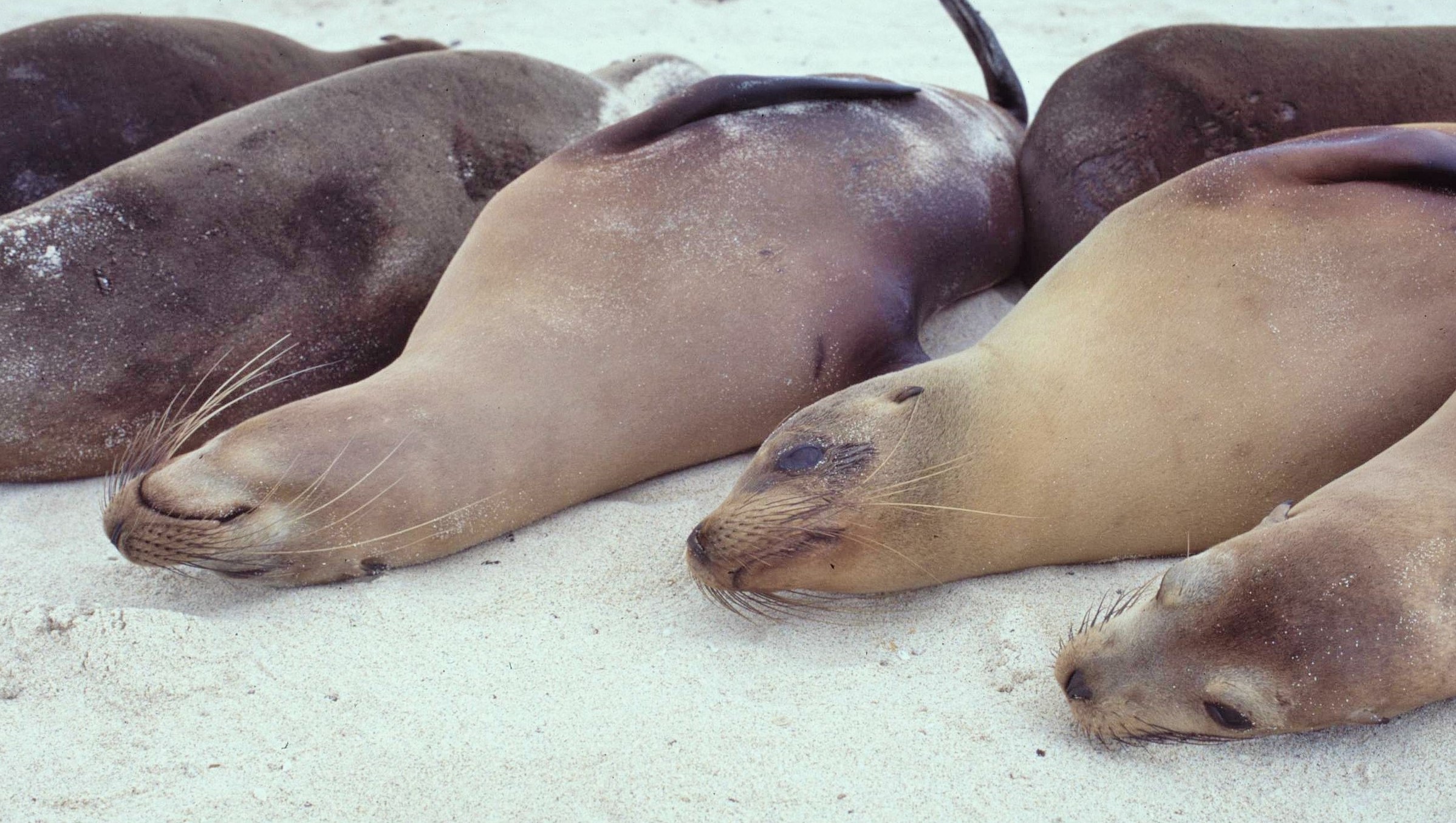
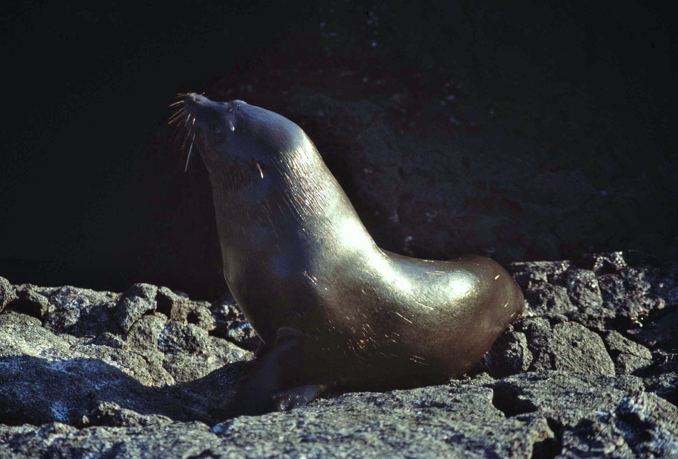
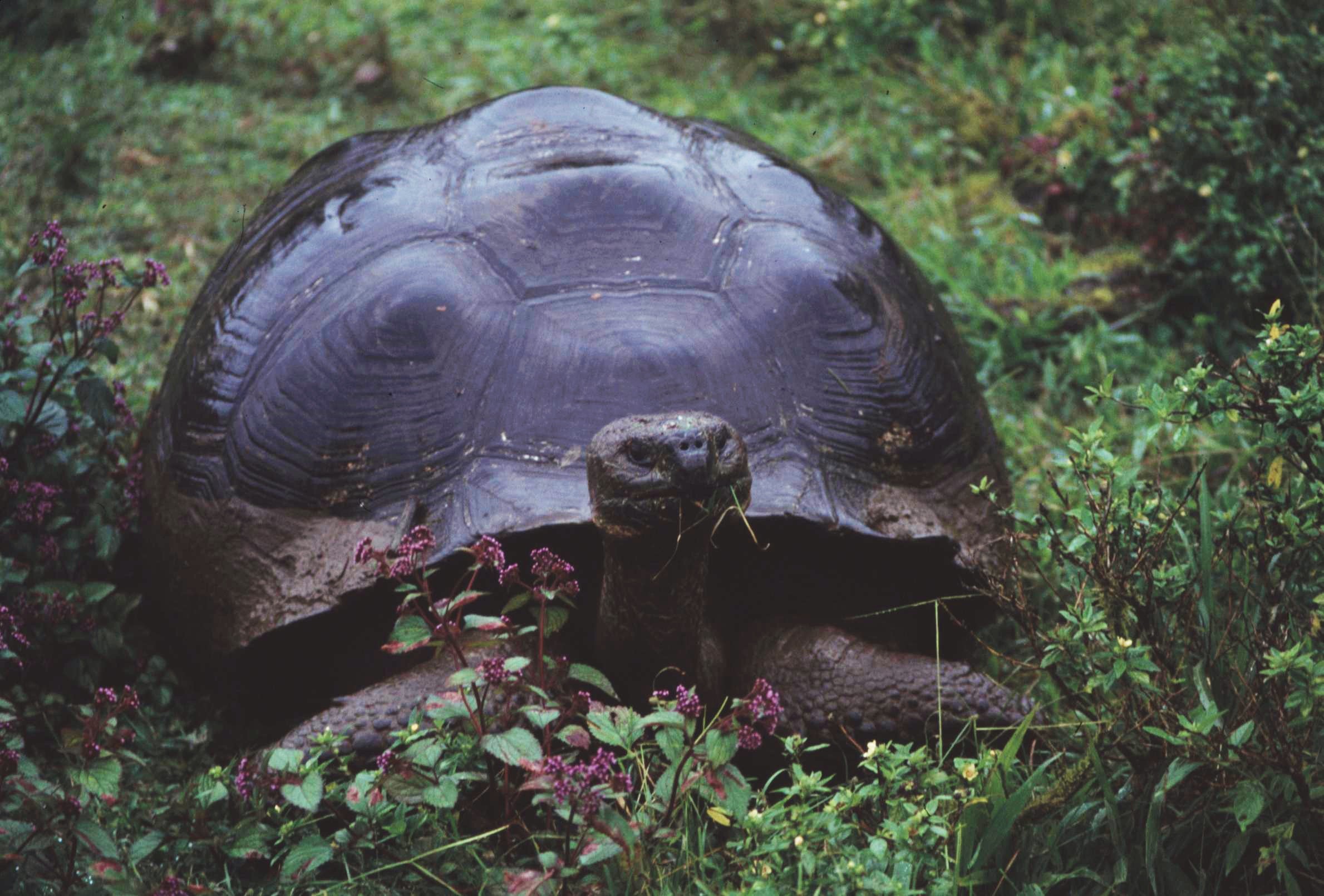
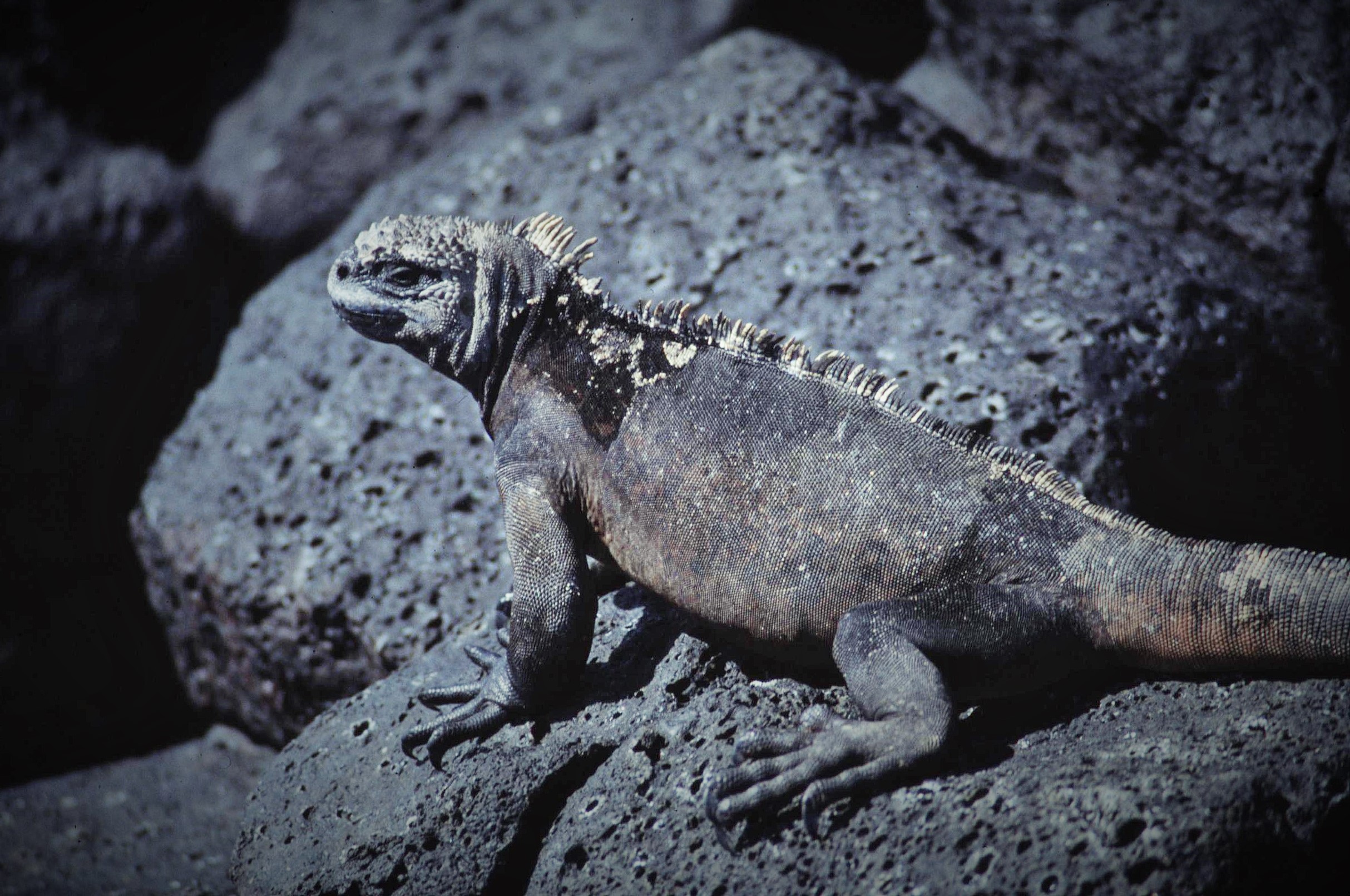
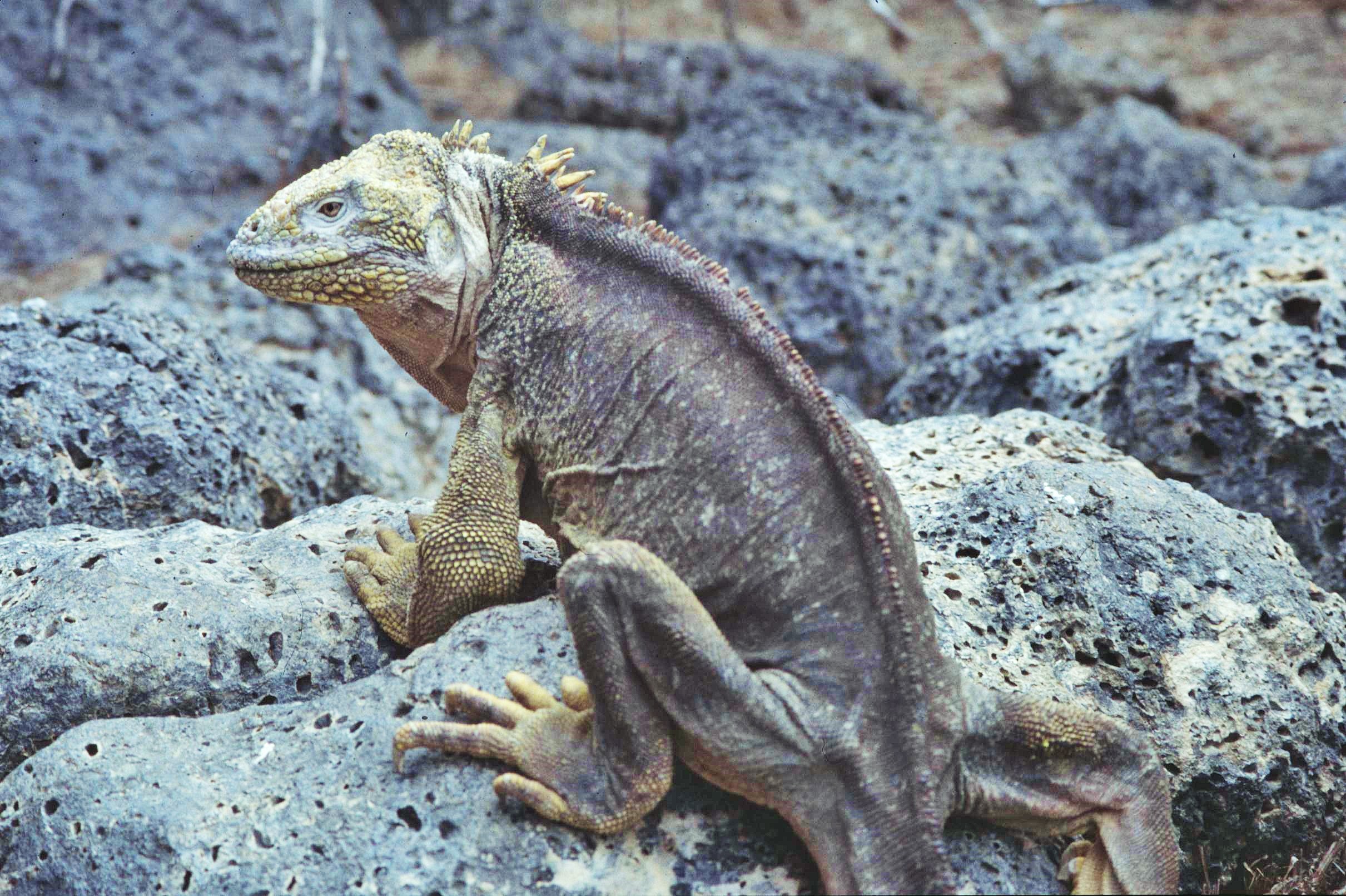
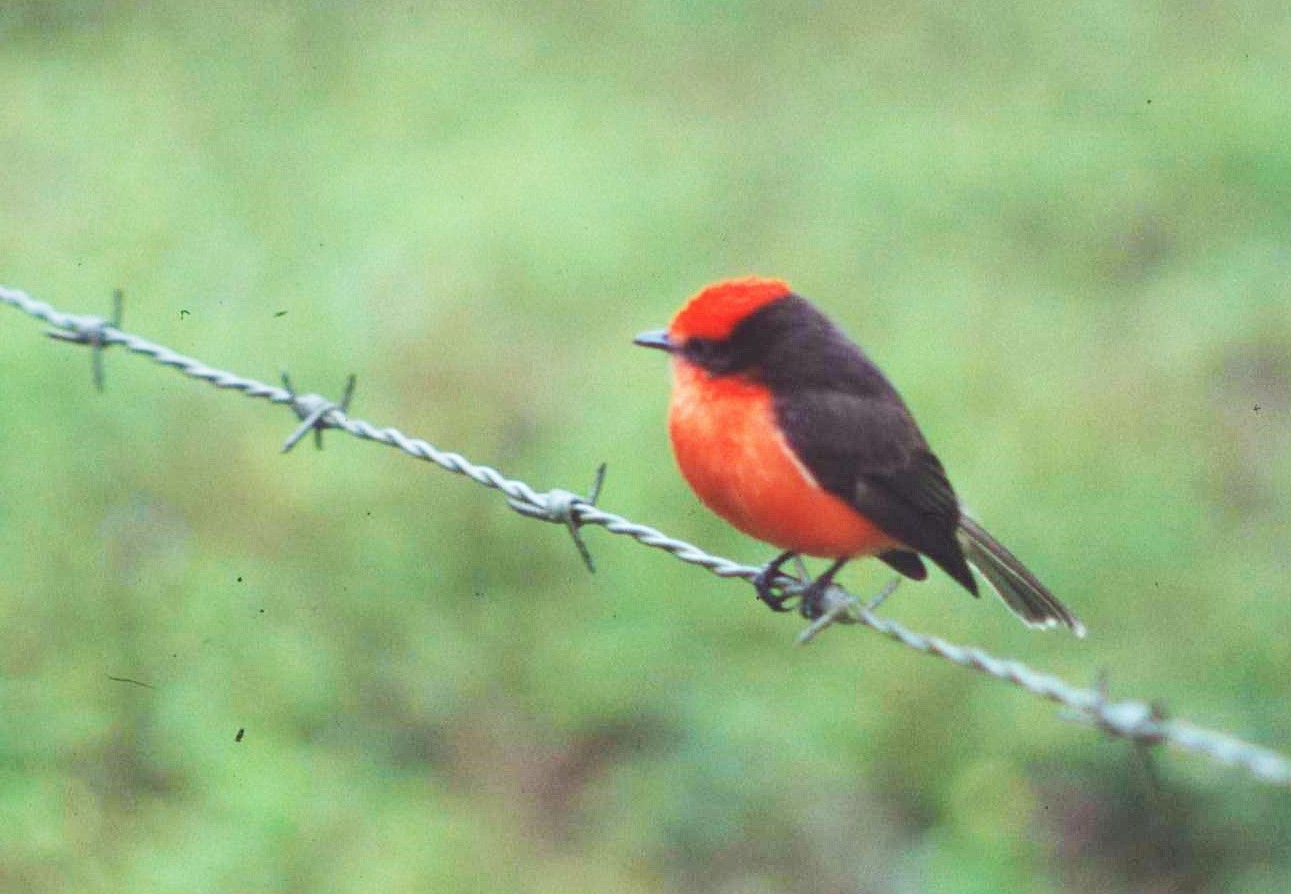
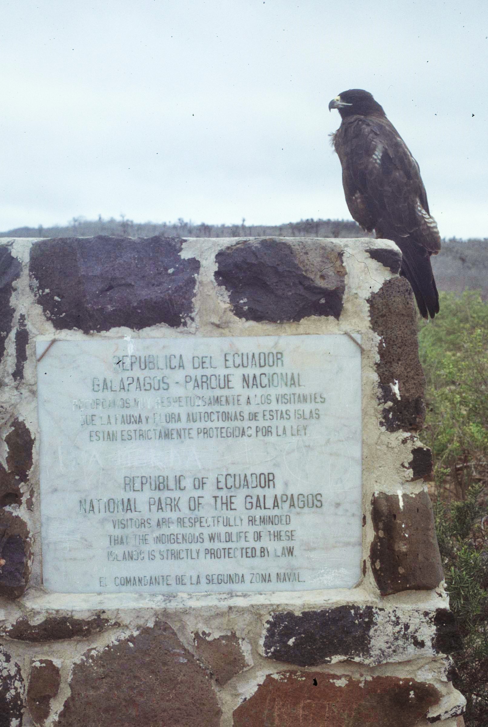
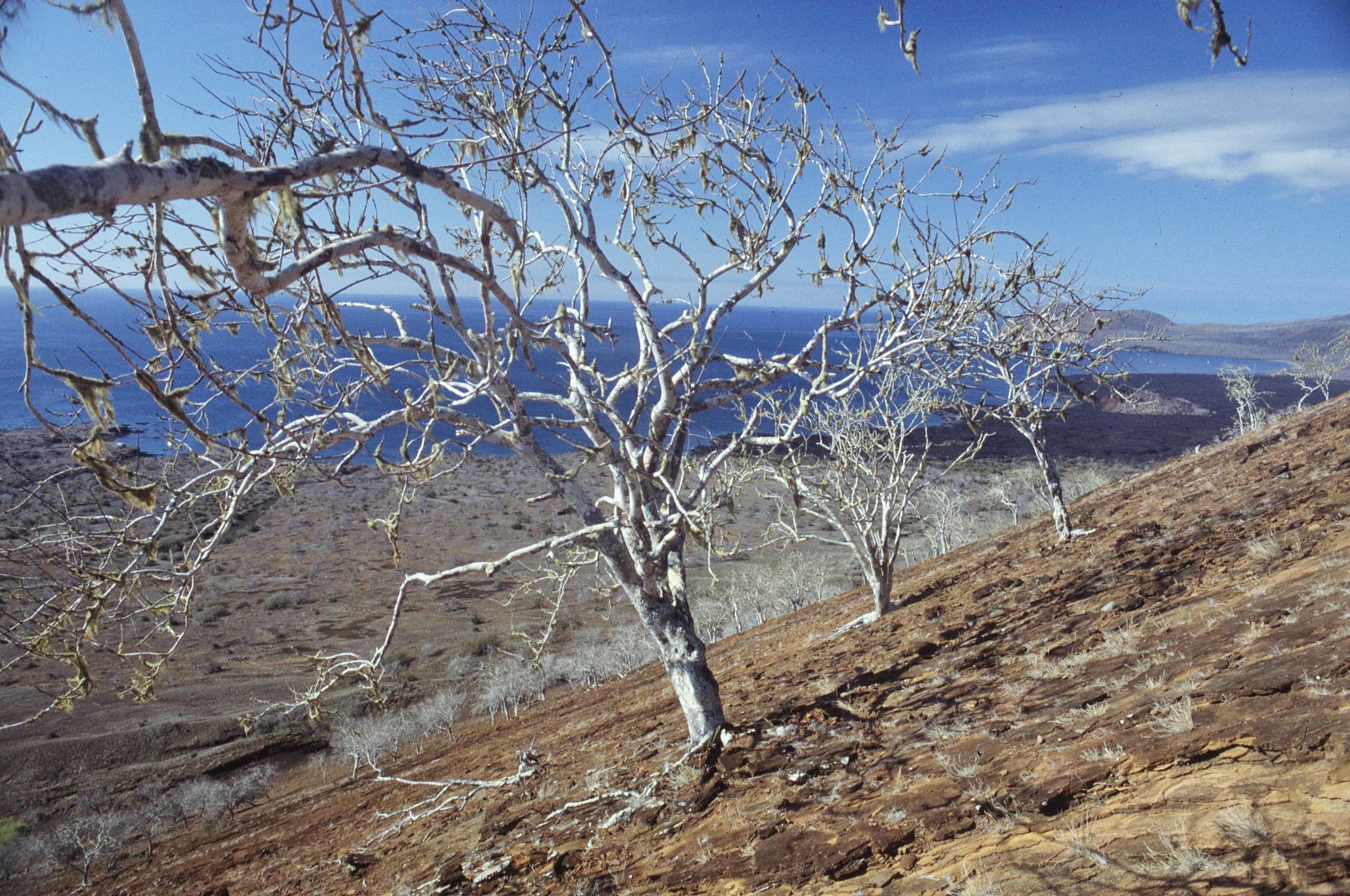
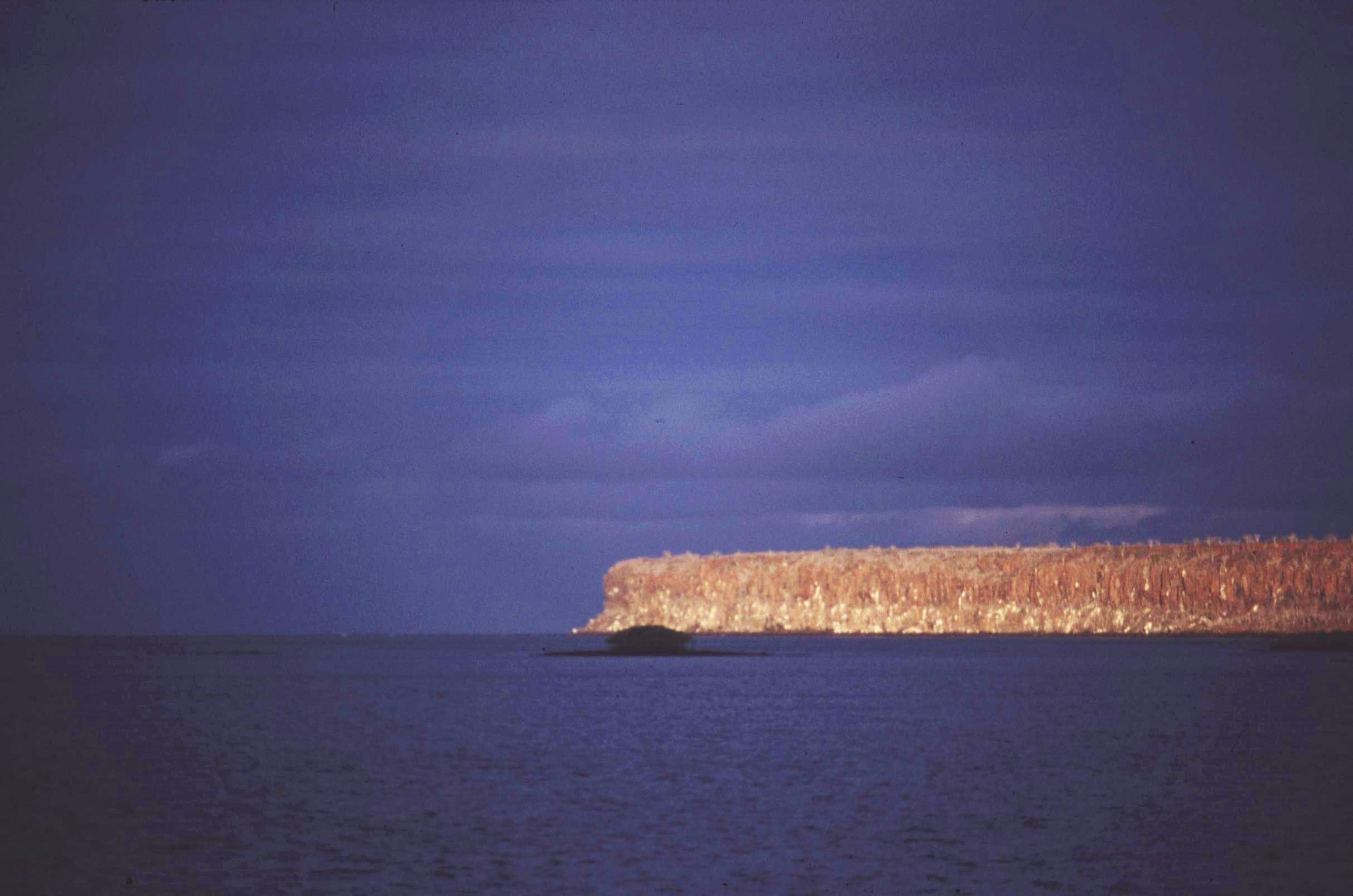
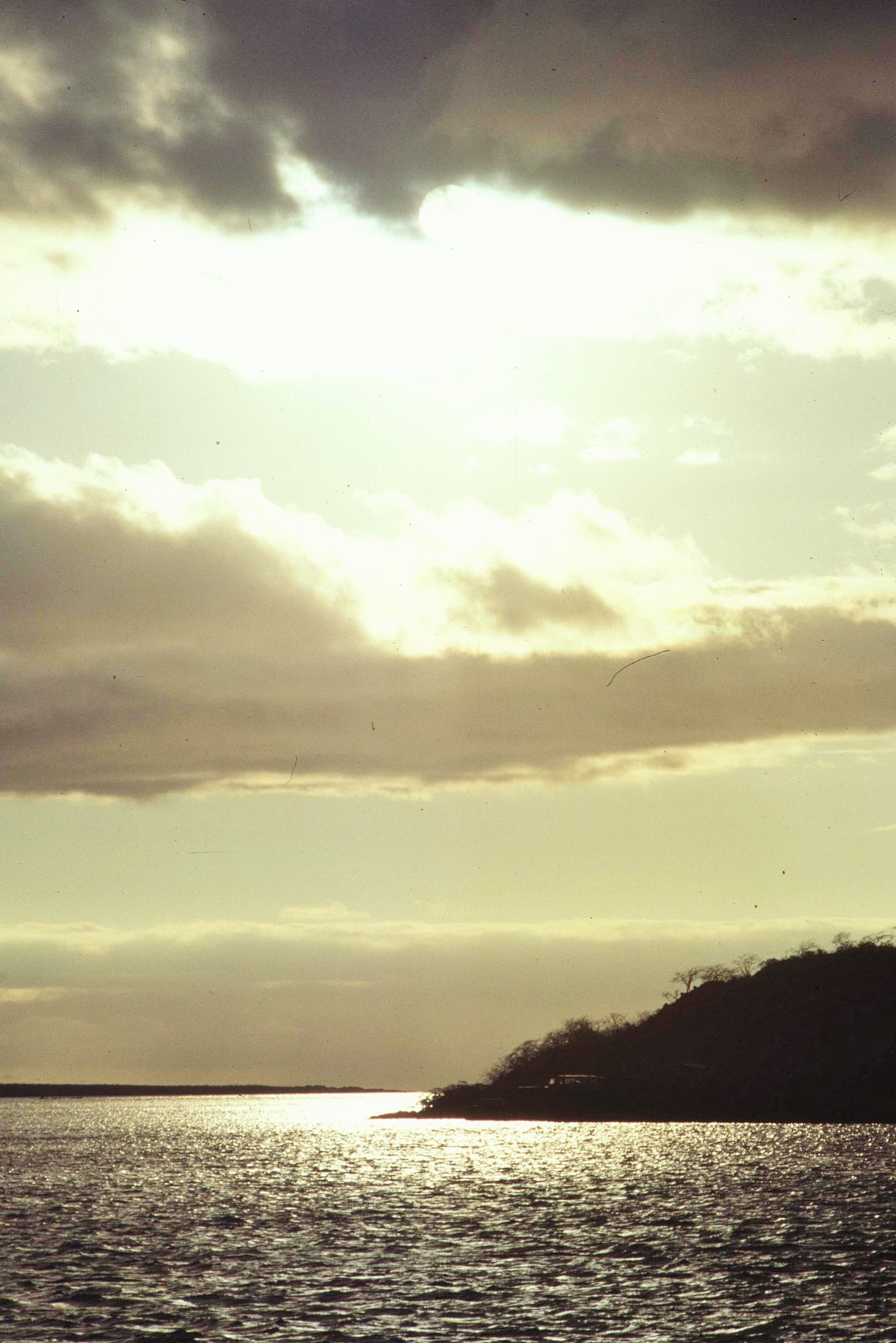
One place that won’t disapoint though is the Galapagos Islands, lying almost 1000km out in the Pacific from mainland Ecuador and boasting spectacular biodiversity that inspired Darwin’s theory of Evolution by Natural Selection. Back around 1990, I visited the Islands as the final part of a University of Wales Expedition to study Ecuador’s amazing ecology and biodiversity. Without a doubt, anyone who is even remotely interested in natural history will find the Galapagos fascinating, with so much local variety existing between the different islands.
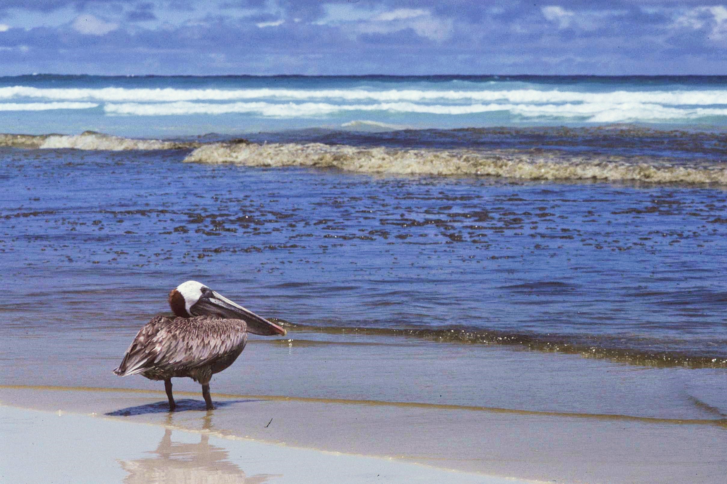
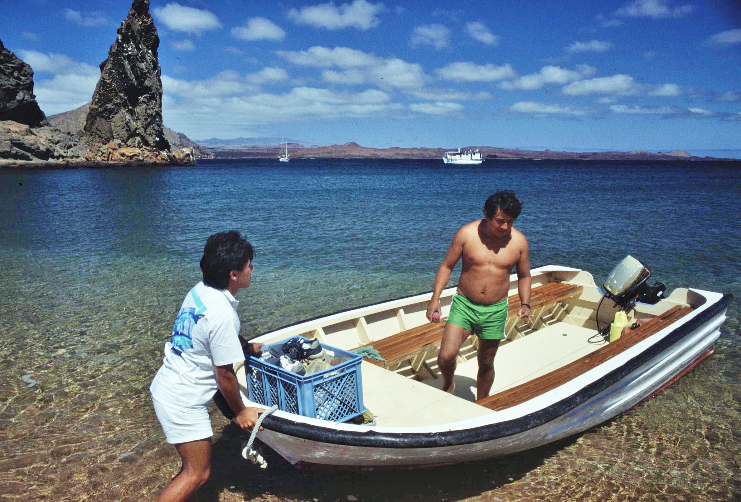
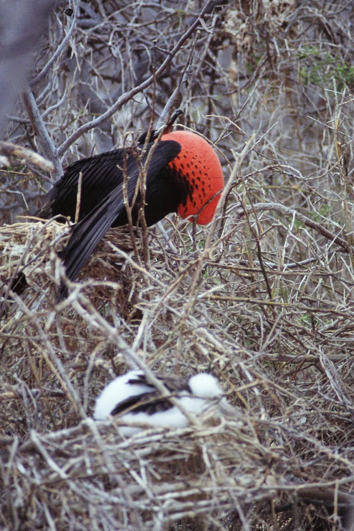
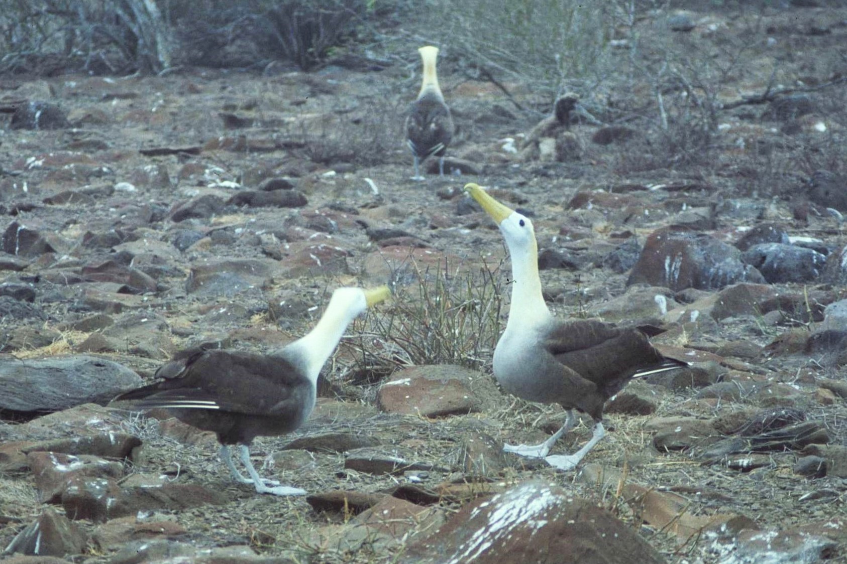
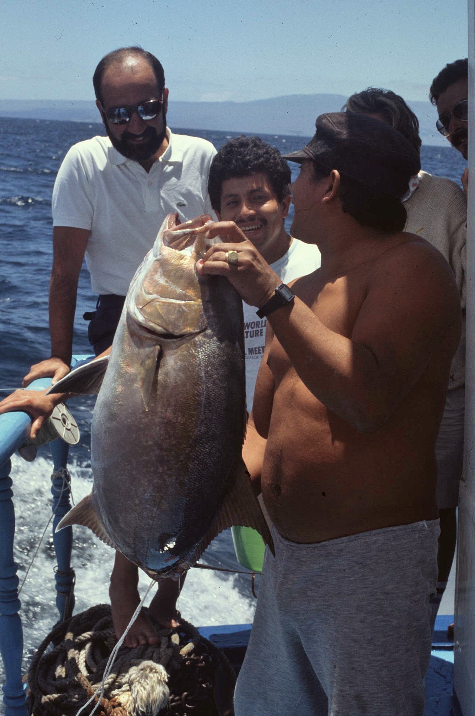
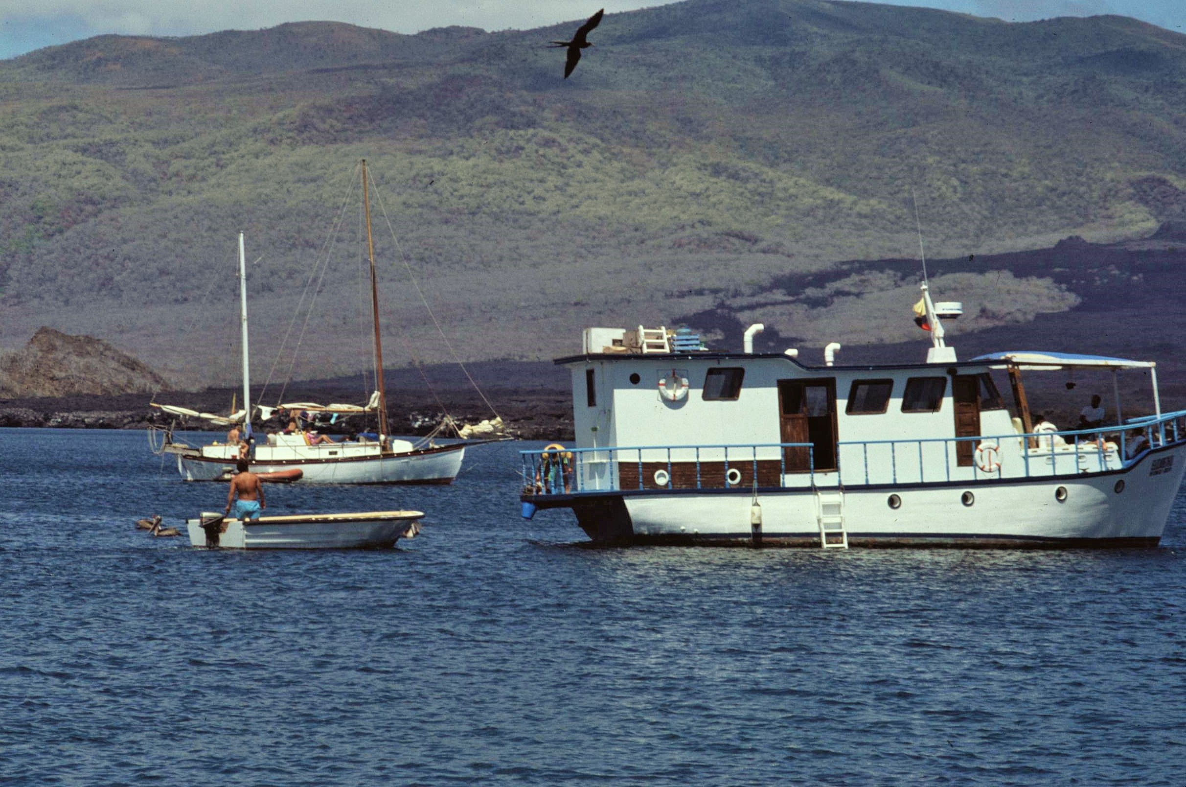
The only way to get around is by boat, with a local National Park guide, as legally required for all visitors – I spent a week on board a smaller tourist boat with a mixed international group of tourists and visited several islands. The wildlife is amazing and you’ll certainly encounter pretty much everything you can find in the guidebook; you can swim with sealions, watch dolphins jumping in the bow wave, sit next to marine iguanas or giant tortoises, encounter unique seabirds such as waved albatrosses, blue-footed boobies or frigate birds – the list is endless.
Moreover, given the absence of previous human inhabitants on the islands, the wildlife dosen’t readily want to run away and is incredibly tolerent of visitors. For photographers, this can be quite a revelation and even rather unsettling. It was this lack of fear amongst the local wildlife populations that allowed sailors, from days of yore, to exploit the situation through stocking up their ships with some of the island’s more vulnerable species, including giant tortoises which were stacked alive into the holds of waiting ships. The sailors also introduced many problem species such as goats and dogs that competed with native wildlife populations.
So, even the wonderful Galapagos is not without its problems and threats; commercial pressure in recent years from bigger tour companies has resulted in increasing levels of overtourism which has started to exceed the ecological limits of the fragile islands. The human population has also mushroomed, as mainland Ecuadorians move to the Islands to cash in on the economic tourist boom, through working in service industries. This has often put the local people increasingly into conflict with conservation objectives, with associated issues of pollution, over-exploitation of natural resources (including over fishing), erosion and spread of non-native species of flora and fauna. These threaten the delicate balance of nature.
Of course, bigger boats means bigger bucks for tour operators, but also puts increased pressure upon fragile natural environments and ecosystems. It’s a lesson we see repeated aroud the world. The Galapagos Islands population have to be careful not to “kill the goose that lays the golden eggs” – especially in an environment of such high international significance from a biological perspective.
Anyway, just a brief introduction for now. I hope you enjoy a few pictures of the islands (without further description), of their amazing geology and wildlife and also some images highlighting the threats facing this fragile paradise….
Sometimes I’ll start writing a post or a story and then get completely distracted with other stuff, with the good intention of revisiting it sometime later – could just be a case of writers block or a lack of inspiration at the time. Anyway, here is a very good case in point; I think I started writing this a couple of years back about a journey, made some years ago, from Quito in Ecuador’s Valley of the Volcanoes to the Pacific Coast near the border with Colombia. So, I might as well start where I left off, otherwise It’ll be a another couple of years in the making for sure.
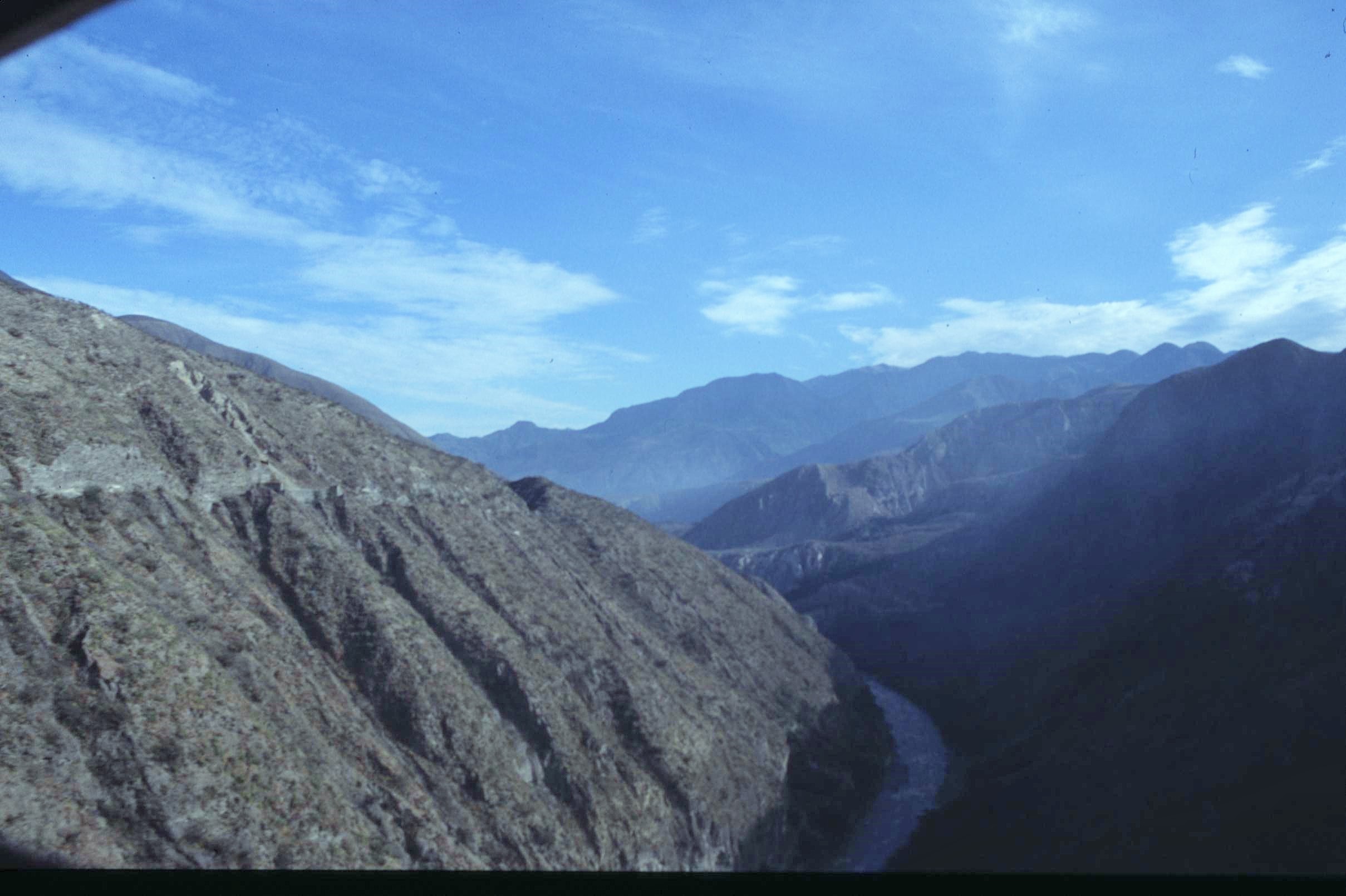
I’m sure things have changed quite a lot in Ecuador these days, but at the time it was certainly quite an adventure to visit and travel there (it most likely it still is, though my next door neighbour, who’s from Ecuador, tells me the roads are a bit better these days). Sadly, the most exciting part of the journey which we made by train from Ibarra in the “Avenue of the Volcanoes” to the coastal town of San Lorenzo near the Colombian border, simply isn’t possible these days, after much of the tortuous rail route has been closed down. This was the due to the high costs of maintaining the line, the extreme difficulties of maintenance and the creation of new alternative road corridors linking the coast to the Interior.
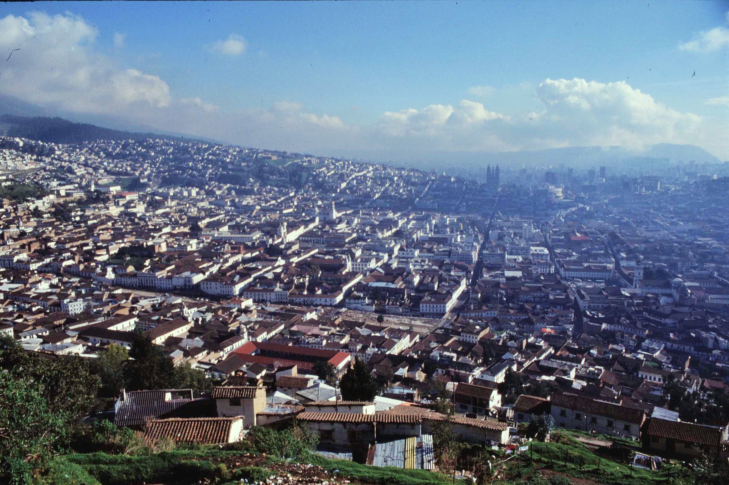
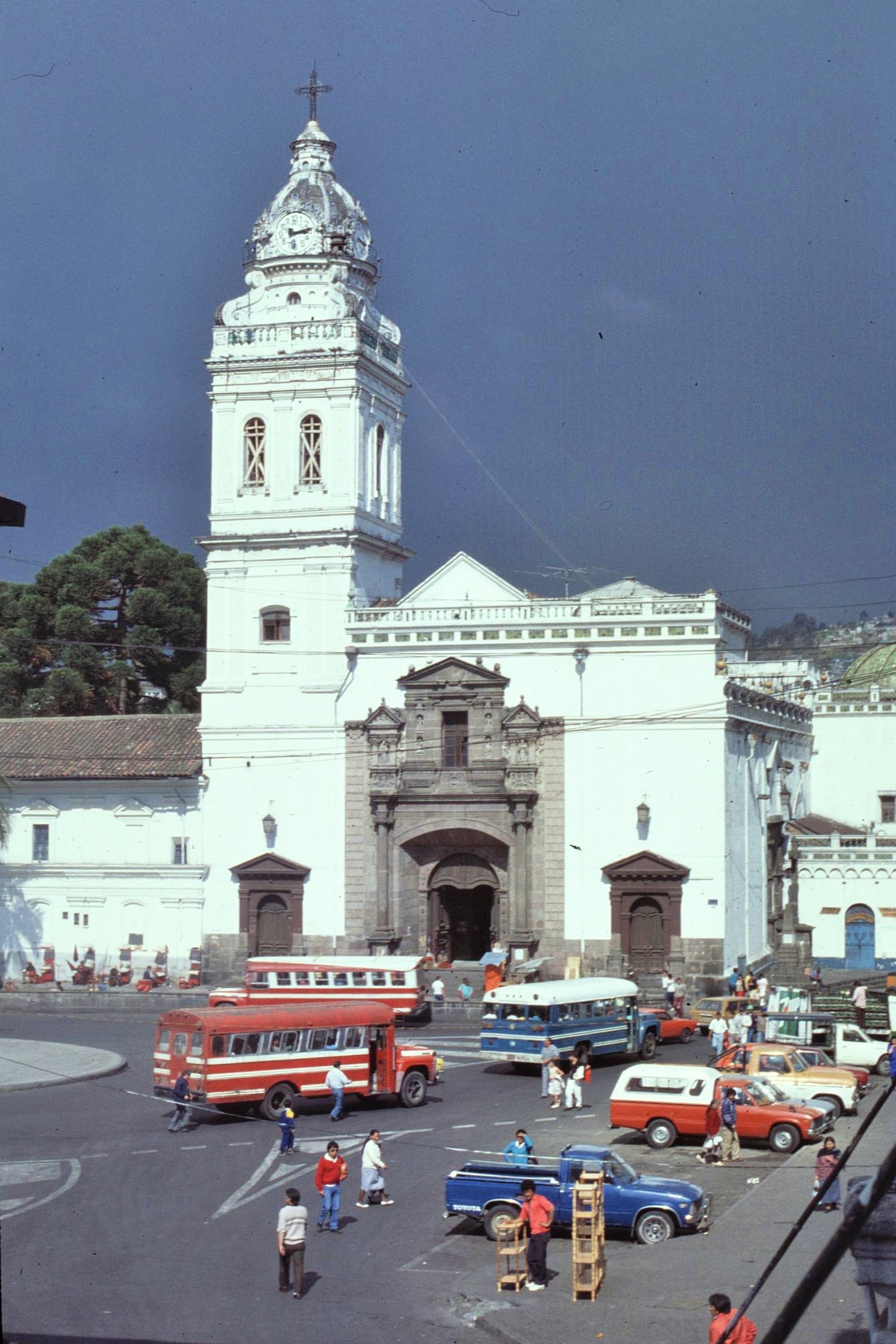
Our journey started in Quito (and was part of a longer stay in Ecuador as part of a University of Wales biological research expedition). The Old City of Quito is a fascinating, if chaotic, place set at a bracing altitude in the Central Valley of the Andes and with a characterful architectural legacy from Spanish colonial times. However, like many Latin American Cities, Quito is a place of stark contrasts, the congested streets of the old town give way to the slick skyscrapers, plate glass facades and planned boulivards of the wealthy, downtown business district, which literally oozes with revenue from Amazonian oil speculation and exploration.
However, it’s in the congested narrow streets and piazzas of the Old Town that you can find the real heart of Quito. This city never sleeps; if you stay in the cramped old town, expect to be kept awake most of the night by all manner of revellers, hawkers, drunkards and impromptu street brawlers. The latter are periodically and randomly dispersed by police with battons, when they have the inclination to do so. Such colour and spontaneous chaos is really what makes Quito unique. Just expect the unexpected – and cling onto your wallet as you negotiate the maze of old streets.
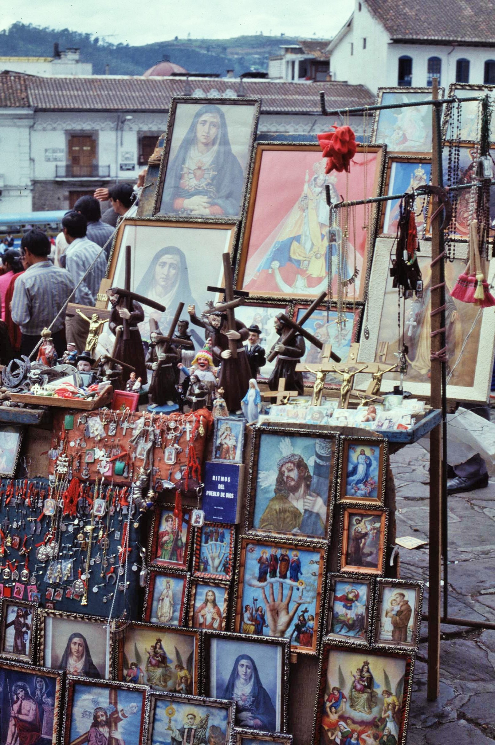
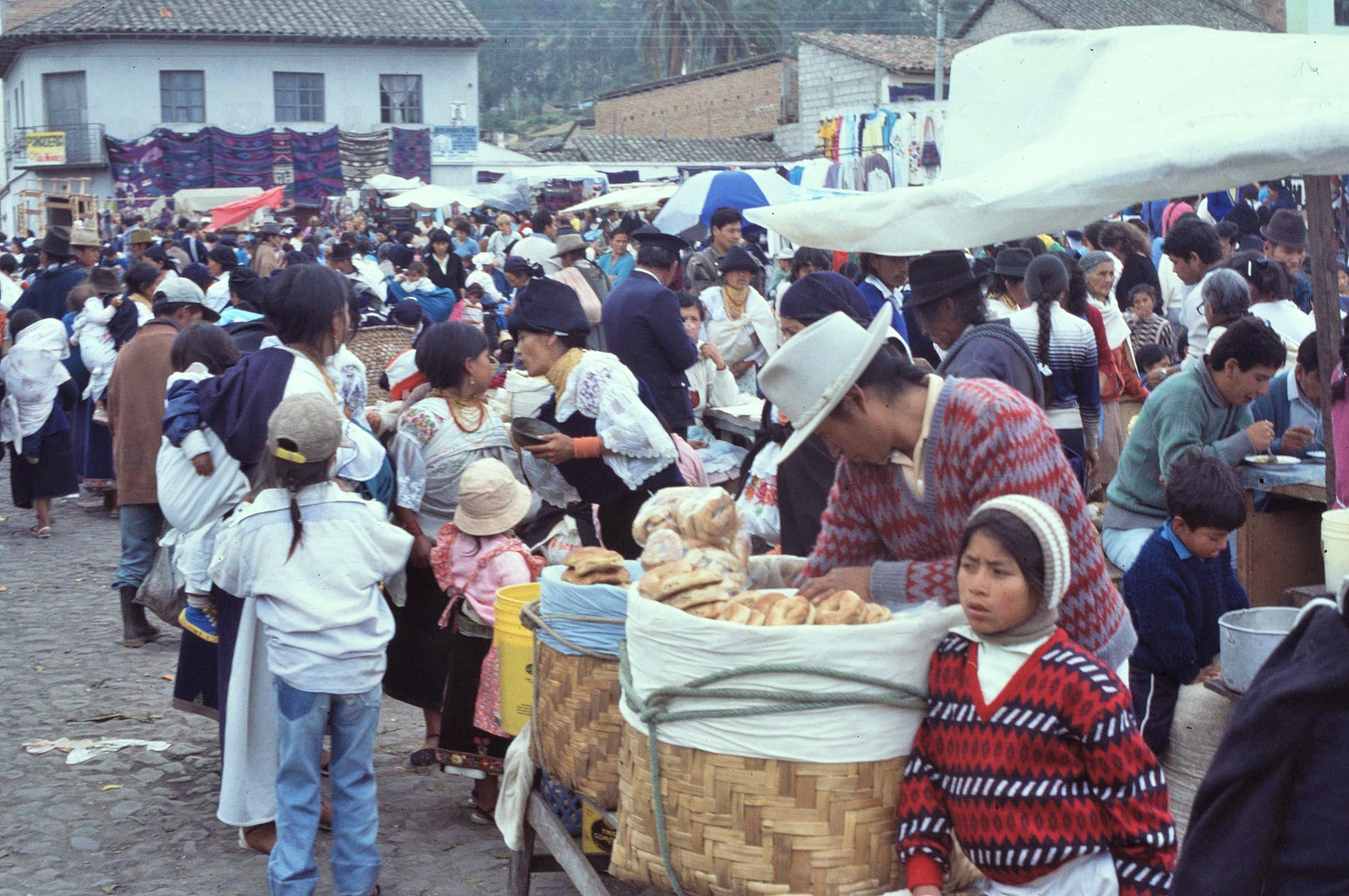
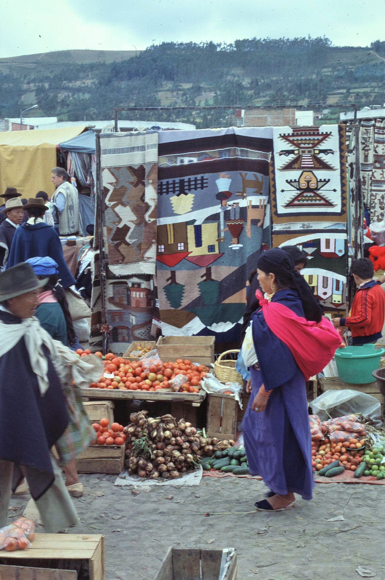
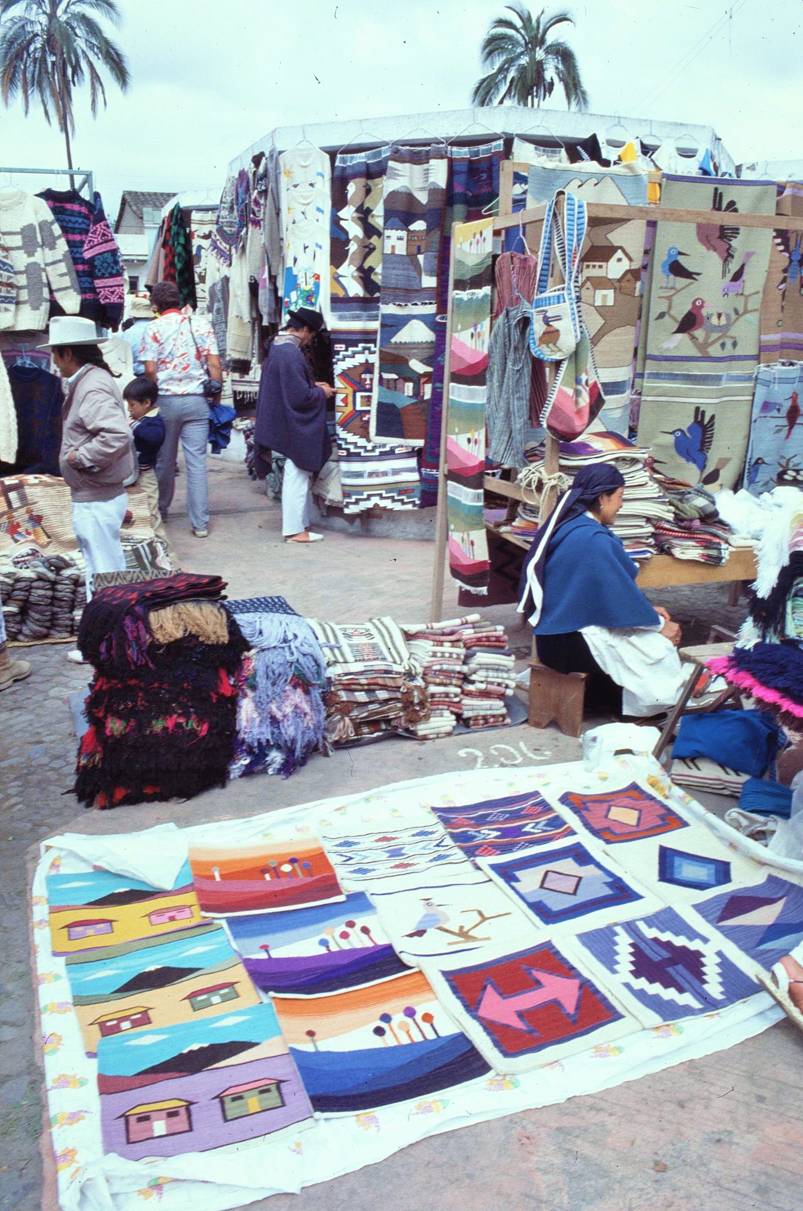
From Quito, we headed North along the Avenue of the Volcanoes to the well known City of Otavalo, which is situated at around 2,500m on the central spine of the Andes. This hosts a famous weekly handicraft and textile market, which is well frequented by tourists keen to buy their souvenirs from their visit to the Andes.
The market was our intended objective too. Whilst that was fascinating, the accomodation there was less so impressive. Due to high visitor numbers, we ended up sharing some crowded floor space in a small hotel room with a ragged assortment of European and North American traveller types. This was almost tolerable, until the drunken son of the hotel owner returned in the middle of the night to find is own room occupied by about 15 unwelcome foreigners. Anyway, it turned out he wasn’t too happy about this and decided to try and smash in the locked door with a view to killing all the occupants inside – at least that’s what he, fairly clearly, told us he wanted to do. It took a few other burly residents and some smooth talking to pacify the guy in the end, as we peeped gingerly out the door, waiting for the storm to subside (with a series of periodic aftershocks). Anyway, we lived to fight another day.
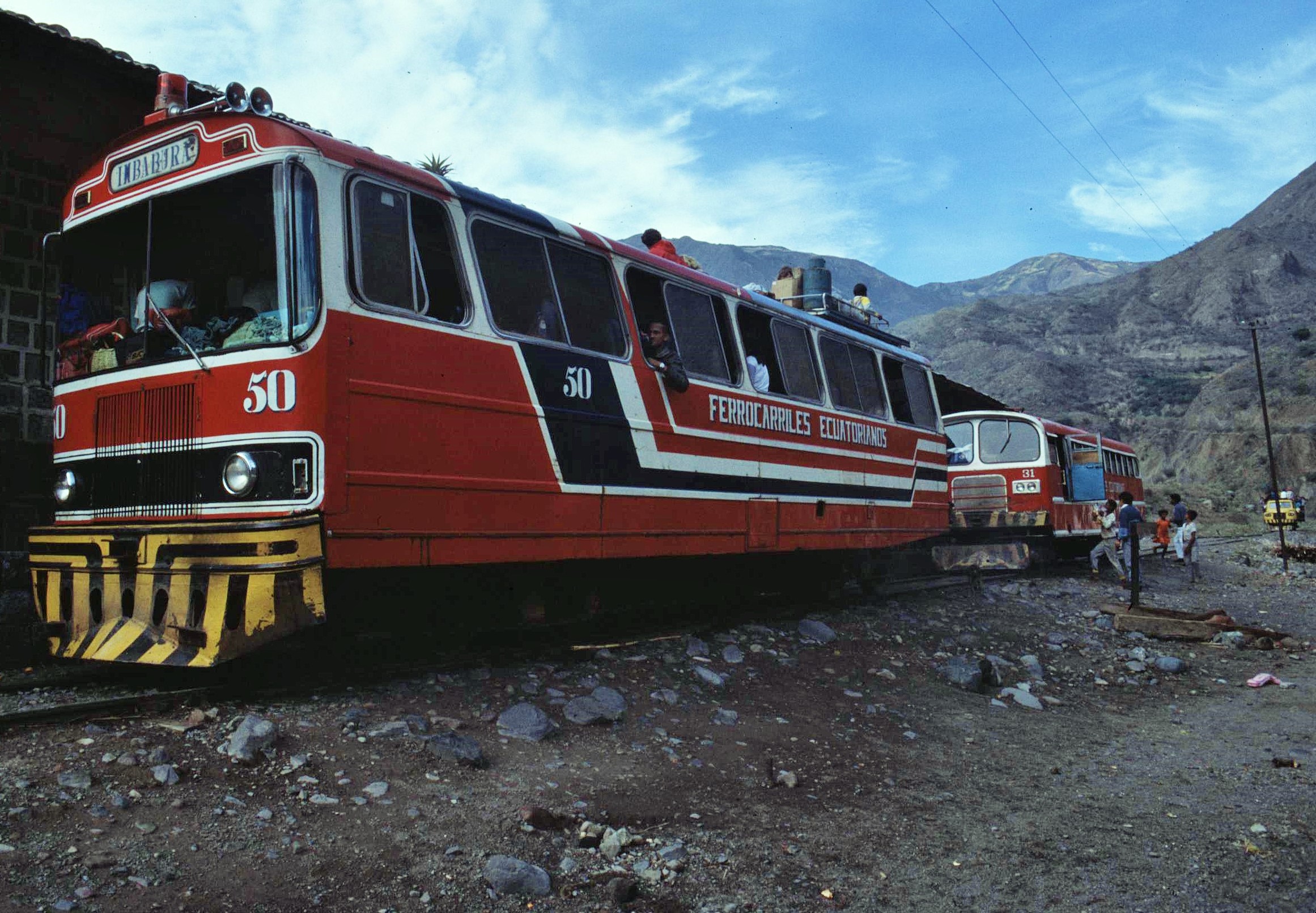
However, this late night drama, gave us a taste of what was to come with our planned journey – following an epic train from Ibarra in the “Avenue of the Volcanoes” to the coastal town of San Lorenzo, many miles to the West.
The fun started when we “queued” up to buy a train ticket in the first instance. Well actually there was no queue really, just a crazy fisticuffs brawl to physically get to the ticket counter, where the strongest were ultimately the victors. After half an hour of pushing and shoving, however, me and my travel buddy, Mike, emerged victorious with tickets in hand. It was actually quite an advantage in such cicumstances that many local Ecadorians were really quite small folk, giving us Europeans a physical advantage, though maybe I’ve shrunk myself a bit since then.
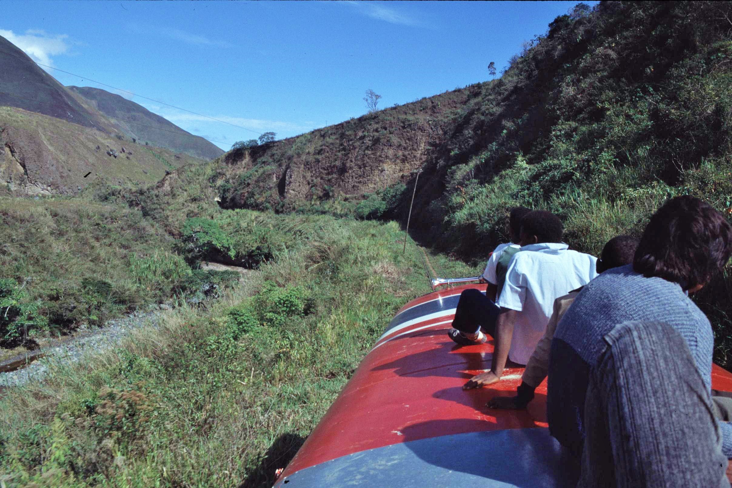
The train itself, was, well, nothing like a conventional train in reality; more like a convoy of 2 buses and an old pickup truck which had been mounted onto narrow gauge railway wheels. Of course there wasn’t really much room inside, and anyway just like a Nepali bus journey, it was packed with an assortment of livestock including, goats, pigs and chickens and their respective owners. So in the interests of personal space and getting a decent view, we opted to sit on the roof, which was interesting indeed, as there wasn’t really anything much to hang onto up there and spaces was rather limited.
The descent from the high valleys of the Andes to the tropical lowlands was spectacular and exciting to say the least. However, sitting up on top there you certainly had to remember to duck everytime you came to one of the frequent tunnels, there being just about enough head room to pass under safely, as long as you kept your wits about you. The drops to the side were also impressive and certainly tended to focus one’s mind about the need to keep clinging on tightly to avoid sliding off into oblivion. This was rail travel Indiana Jones style without a doubt – I decided, after that, I would never complain about conditions on British or Continental rail journeys again.
However, that was just the tip of the iceberg. Later in the journey, the old loco wasn’t sounding quite so healthy and spluttered menacingly before grinding unceremoniously to a halt. So we had to jump off and push the train uphill on a number of occassions, when the starter motor had failed to deliver the desired goods. Pushing a fully laden train (albeit a bus really) up a hill is not something really to be recommended, though it certainly did the trick to get us on our way again. It was rather worrying when it starting sliding backwards downhill again though.
We also had quite a few interminable waits in one-horse, former plantation towns, which were certainly well off the beaten track. This was not entirely relaxing however, especially in one place where a dispute started between various groups of locals. People then started firing rifles randomly up into the air and shouting loudly at each other in angry voices about who knows what ? I must admit I was quite glad to leave that particular place, even though the local bananas were quite tasty really.
After another long section through more plantation areas and degraded tropical forests, we eventually arrived in the sweaty lowland coastal town of San Lorenzo. It had been a long and tiring day. San Lorenzo felt rather a tense and cheerless place, due to political tensions with drug trafficing and cartels operating over the nearby Colombian border. There seemed to be alot of police and army personel around.
We decided not to hang around and the next day and set off, taking a number of informal small ferry boats which transported us on a long and tortuous route through the coastal managrove swamps to the roadhead at the next town, some miles distant. The atmosphere in these places was rather unnerving and unfriendly; at one point someone pulled a gun on me, just to get pocession of a cheap walkman and a cassette tape, which I was all too happy to hand over. 🙂 In another town, a policeman grabbed a fellow travellers camera, as he got off the boat, and ripped out the film, right in front of him; ignoring me who was, strangely enough, taking a picture of this at the time.
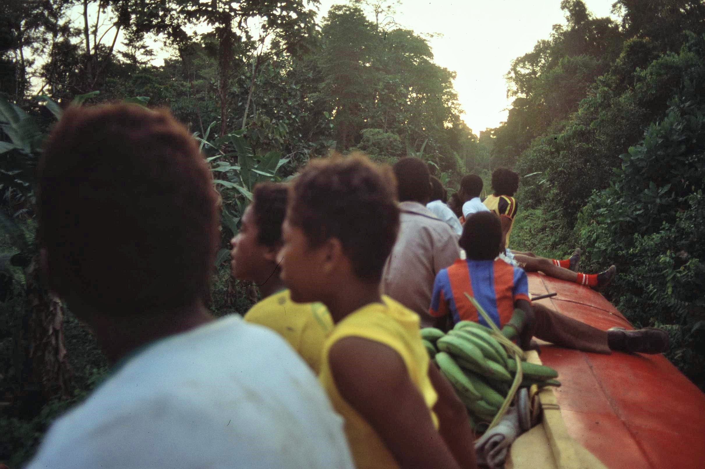
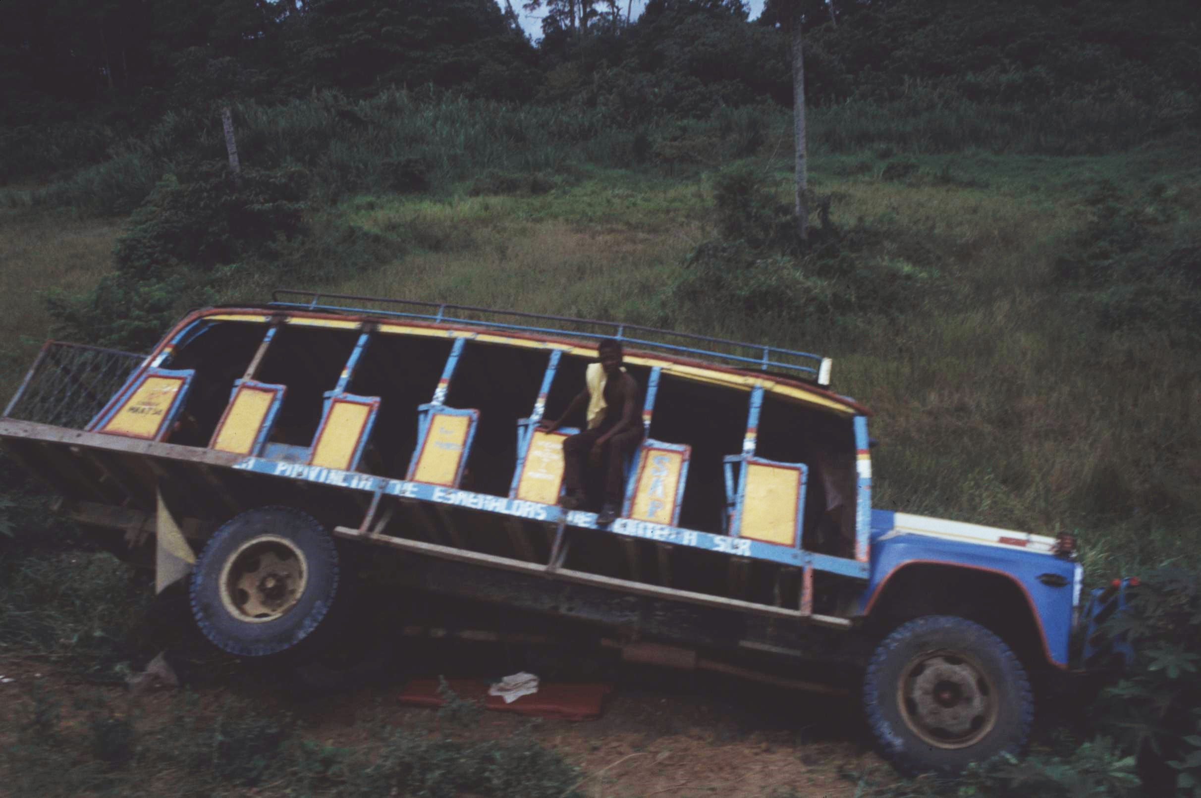
The next bit of the trip along the coast was by local buses, again sitting on the roof. It’s fair to say that any Ecuadorian bus journey invariably involved being blasted with Salsa or (rather rougher) Cumbia music, usually at excessive volume, through tinny, broken speakers, rendering any conversation pretty much impossible. These open sided old wrecks, however, were of a much more primative character than the Ecuadorian norm and happily didn’t even boast a decent sound system to speak of. We passed through numerous small, grubby and characterless, one-horse roadside places; the kids cheerily yelling out “Hey Gringo !” and waving wildly to us to attract our attention, as if we were celebrities like Butch and Sundance (we did have similar cowboy hats), whilst the other inhabitants looked all just rather bored about life in general. We encountered wrecked buses which had fallen off the side of the road. These locations are often, later, marked with a white cross, to remind future passengers of the potential fate awaiting them if their driver isn’t paying attention (usually on tortuous mountain roads with a bull in the back).
On one occassion (in the Ecuadorian bus equivilent of “Snakes on a Plane”), a live and giant orange spider crab, caught by a local fisherman – and ineffectively packaged in some, spikey green leaves for transportation – escaped and started running wildly around the roof of the bus, just next to where we were sitting amongst a haphazard collection of baggage. It snapped menacingly at random into the air with its formidable claws. Fortunately, before anyone needed to dive off the roof of the moving bus to save themselves, one quick-witted passenger managed to quickly grab the ugly brute (which in reality was the innocent victim). Then, in a finely correographed piece of theatre, he agilely slung it into a conveniently located briefcase, which belonged to another unsuspecting traveller; who was happily ensconsed downstairs (completely oblious to the action going on above).
At the next stop, the owner of the briefcase, (a well dressed doctor or local businessman, from the look of things) got off the bus and unwittingly grabbed his bag down off the roofrack (with full assistance, of course, from the crab catching “hero”), before happily trotting off down a side path – case (and spider crab!) in hand. He must have had the shock of his life – or did he die of a heart attack ? We’ll never know the truth !
Further along the coast, in another rundown and uninspiring town, we decided to stay the night as a bit of adventure and to experience the “Real Ecuador”. The owner of the hotel there seemed friendly enough and soon introduced us to his bashful teenage daughter, whom he was adament either me or Mike should marry, casually suggesting; “Just make sure you take her with you when you go !”. Ok, whilst she wasn’t unattractive, this didn’t really tie in with our travel plans and so we gave the host (and his bemused daughter) our polite appologies on this occassion. However, every time the door to our room was opened, the daughter concerned would be hovering about, right outside the room and would then follow us to the bathroom, around the garden, or even on trips out around the town. The next morning we planned for a short, sharp exit; making an impromtu and unnanounced getaway in the wee small hours before sunrise and creeping out so as not to disturb the locals, or incurr the wrath of the hotelier.
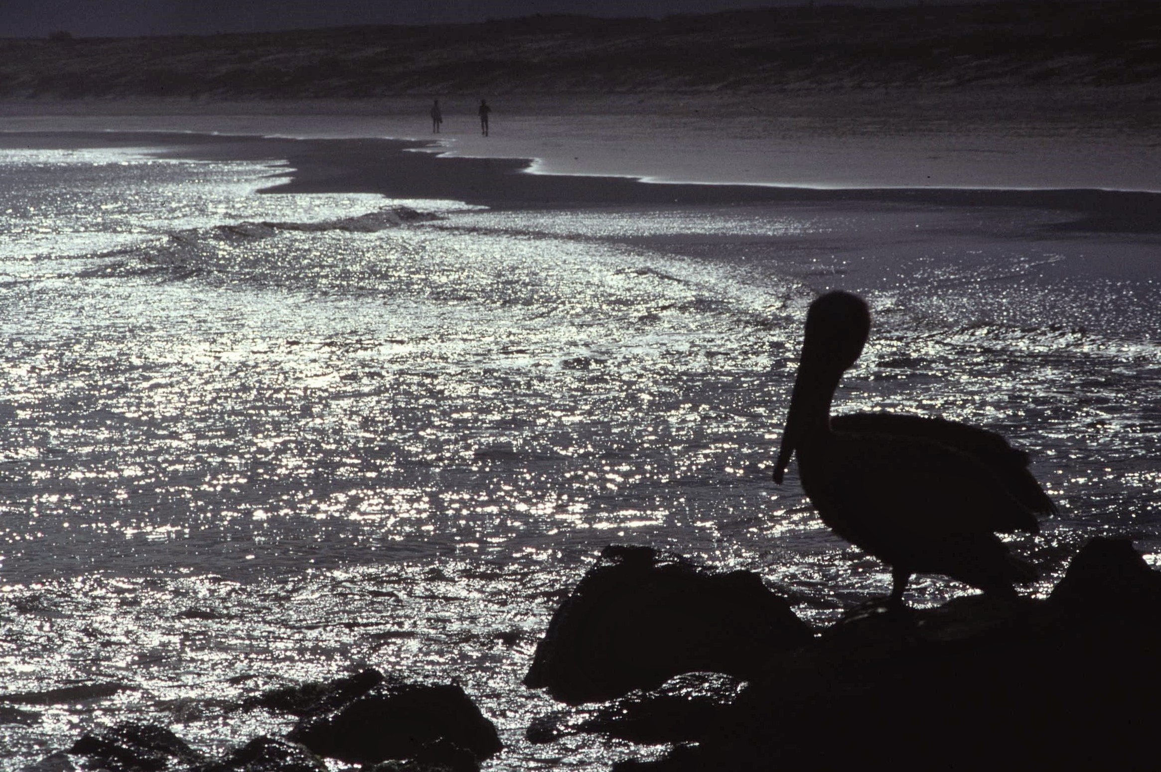
After a couple of other stops, including a resort of sorts with a rather uninviting black sand beach (and serving up some rather lethal, local-speciality bright green beverage of unknown provinance) we made our way to the coastal town of Bahia- which altogether seemed a little bit more genteel and welcoming compared with the trials of the previous days. There we then split paths; Mike headed off on his way to take in some other coastal destinations, while I decided to chill out for a couple of days around Bahia by myself. We would be catching up again in Quito before flying home with the rest of the team – so plenty of chance swap travel stories later on.
There was still much to do and see in Ecuador, including the vibrant and hectic city of Guayaquil and of course the wonderful and unique Galapagos Islands, a few hundred miles off the coast to the West. For now though, I was happy enough just to hang out in a less chaotic environment and watch the evening activities of the local fishermen, to hear a gentle breeze rustling through the palm trees and to watch the majestic orb the evening sun sinking low over the great Pacific Ocean. What could be better than that surely ?
Our lives take us through so many different phases, twists and unknown turns; well certainly mine has. Sometimes it’s interesting to look back and see what crazy things we were preoccupied with in years gone by; given perspective, we might even see some of our past projects in an entirely new light (or maybe come to the safe conclusion we were possibly just a bit deluded at the time).
So, around the year 2000, I suddenly had a hankering to become a wandering guitar man of sorts – a kind of Scottish version of Neil Young or Bob Dylan. Whilst others might just have dismissed this as obvious evidence of a midlife crises, me being me, took the concept a good bit further than it probably ever should have been taken (which most likely wasn’t very far). So, I wrote a bunch of songs about “real life” journeys and then, rather naively, walked into a recording studio in the Aberdeenshire countryside, determined to make my entry into the rock n’ roll hall of fame.
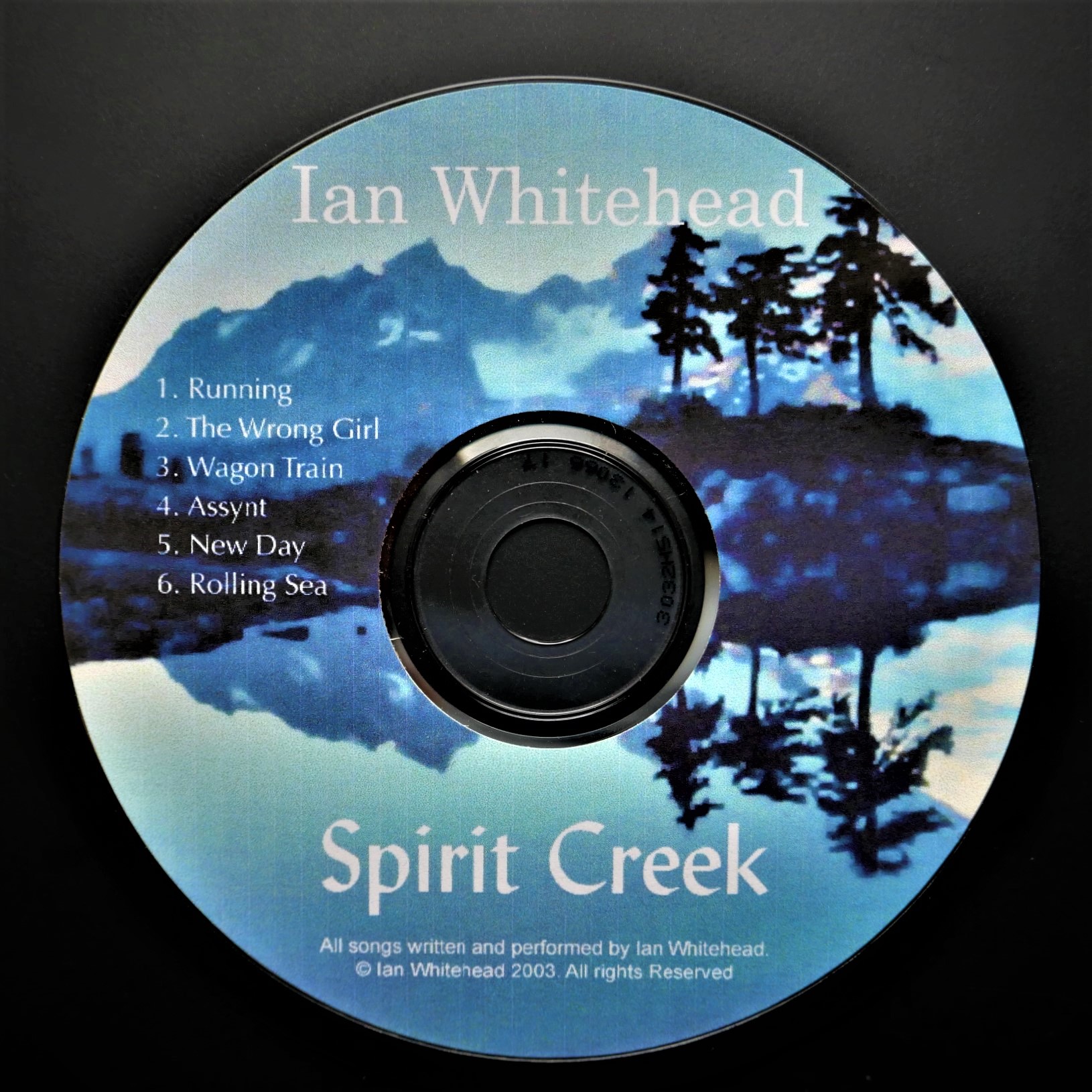
Assynt, the rocks and the rolling sea
The resultant collection was called “Spirit Creek”, and was inspired by journeys to far flung places (physical and metaphorical) and some of the more colourful characters from my own life, with some rather ethereal and ragged Celtic overtones thrown in for good measure. Of course, the expected worldwide fame never resulted and probably was never actually wanted in the first place really, if truth be known, These days I still trip over copies of the CDs which clutter up the house in abundance, much to the annoyance of my partner.
A few years later (around 2008), I recorded a few more tracks, this time in a much more raw and less polished format in a wee studio by the banks of the River Tay in the “Fair City” of Perth located in the heart of Scotland – this second collection of songs went under the name of “Heartbeat”. In truth, it probably was really straight from the heart (we ironic and self deprecating Scots aren’t normally quite so used to expressing ourselves so openly, unless of course we’re either Robert Burns, or alcohol is involved, preferably in industrial quauntities) and it was quite cathartic to write – song writing is certainly a great way of offloading the accumulated emotional baggage of the years and has much to recommend it in that respect as a kind of self therapy.
Anyway, it would be a crime surely not to share these historical masterpieces and some rather dodgy vocals with you all out there. I’m certainly not a natural singer by any stretch of the imagination. However, I’m rather happier with some of the guitar work, despite the fact I do tend to automatically home in on the minor mis-tunings, timing errors and occasional bum notes; though admittedly not all of these were my own creation. In the end though, it was all down to good creative synergy with the other people wo helped me out, teamwork and a good few blazing arguments, not all of which I won sadly.
So for now I’ll promise to stick to the day job, if you let me know what you think…
Spirit Creek:
The Wrong GirlAssyntRolling SeaWagon TrainRunningNew Day
Heartbeat:
World Gone CrazyHeartbeatAnother DayRebirthWalls of JerichoFootstepsThe Flame Within
Zen and the Art of Songwriting:
It’s always interesting to understand the humble roots from which a creative project kicks off – that initial spark, which usually occurs when a wee tune or a few words randomly pops into your head – and how a little technology and some slick studio production, can help to create a fire from these small sparks, usually with some hard slog and a whole load of aggro en route. These days, simply any aspiring numpty can be made to sound like Sting, Bryan Adams or Madonna thanks to the wonders of digital processing technology.
However, the more interesting and profound question, is where do these “sparks” actually come from in the first place ? For me, it’s not generally in the supermarket checkout queue or when my mind is cluttered up with a long list of daily tasks, routines and distractions (which is pretty much most of the time these days); more often than not, it’s when I’m immersed in nature’s rhythms and cycles; whether that’s sitting on the rocks by the sea, walking the hills, or through enjoying a spot of informal forest bathing.
In a Scottish context, Gaelic songwriters such as Julie Fowlis have been particularly influenced and inspired by their surroundings and percieve themselves and their music as being intimately connected with the landscape, both present and past. Rory and Callum MacDonald, of Runrig fame, articulated the concept perfectly in their song “When I Walk Among the Hills”, albeit under the guise of “The Band From Rockall”. In addition to landscape and cultural heritage influences, life changing events (like falling in love, the birth of a child or a death), can also be a major catalyst for creativity, without a doubt – they haul us unexpectedly out of our comfort zone and make us think about the overall trajectory of our lives.
Personally, I think there’s a certain intuitive energy that comes from connecting with the natural world and landscapes though – this can bring everything sharply into focus, like flicking the trip switch and suddenly plugging into the mains voltage supply (instead of our usual, feeble AA battery energy source). However, it’s also subtle, easy to miss, or to ignore completely, as we rush around blindly in our frenetic daily routines and minor quests.
To tune into the “music” we need to find time and space to let the dust settle and the haze dissipate; “Reaching out, tuning in to your soul” as I described it in the song “Running” – the first one I ever recorded. The “Flame Within” – the first composition I wrote, after my guitar teacher assigned me the task of writing a song for “homework” – was pretty much based around the same concept of connection with the natural world. I remember Simon, my teacher (a diehard “blues man” and rock maestro, if ever there was one), telling me it sounded a little bit “twee”, before qualifying that with, “…but then fuck what anybody else thinks !” – a useful piece of advice that has stayed with me down through the years; I can live with “twee” as long as it also has soul and integrity.
Moving decidedly into the metaphysical and the philosophical realms, it seems the ascetic Celtic monks of the Skellig Islands, the Australian Aborigines, the wandering holy men of the Himalayas (the ones that weren’t liars and cheats that is) or Zen minded conservationists like John Muir and Henry David Thoreau understood such concepts better than you or I. For them, the intangible notion of “spirit of place” has been an important theme. That might be found in the collective consciousness of a nation itself (the “Heartbeat”), on a stormy Atlantic coastline (“Assynt”), in a bombed out hellhole in Syria, Iraq or Ukraine (“Walls of Jericho”), by a Himalayan sacred lake or pass, in the Sierra Nevada or Yellowstone (“The Flame Within”), along an old gold rush trail in the Caribou Mountains of BC (“Wagon Train”), or in a Sicilian ghost village.
It could be simply manifest through those inexplicable goosebumps we experience when visiting a tumbled-down steading from the Highland Clearance era; maybe we imagine catching fleeting whispers from the past, carried on salt-laden winds across the ages. Indigenous shamans, poets and writers have been better at tuning into and expressing such powerful voices from the cultural landscapes they inhabit; as a homegrown example, just think of Gaelic poet, Sorley Maclean and his powerful poem, “Hallaig”, in which he repopulates and rebuilds a whole deserted community from the Hebridean Island of Raasay, in his mind’s eye – as if the ghostly inhabitants themselves are springing from the very soil, the trees, undergrowth and stones of the place, where they’ve merely been resting for a while. This was later brought to life later by the late Scottish contemporary composer and innovator, Martyn Bennett.
It’s fair to say that we also inhabit a world of constant turmoil, albeit it one based upon infinite distractions and instant gratification through overconsumption, that we think will make us happier somehow. In effect, these things achieve little, except to isolate ourselves from the real connections and sources of power, including from the little stream (the “Spirit Creek”) that transforms itself into the big river and flows ever onwards towards the deep “Rolling Sea”. Like nature itself, music can also be a raft to help us navigate the rapids we encounter on that, sometimes turbulent and unpredictable, journey downstream.
For someone from a scientific background, these topics also might sound pretty esoteric and abstract, but I think we all function on different levels and we should accept that not everything we can relate to on an everyday inituitive level should necessarily be the subject of a detailed empirical analysis. But, coming sharply back down to earth with a bump (and away from such a load of pretentious old “hippy shit”), at least I can enjoy the smug satisfaction that I can actually play my own instrument and write my own songs – and that’s certainly far more than many of today’s manufactured, one-minute-wonder, talent show participants can do (though admittedly some might sing more sweetly or have better looks).
Bah Humbug ! Maybe that sounds like I’m a wee bit jealous really… I’m most certainly not; authenticity is everything after all 😉
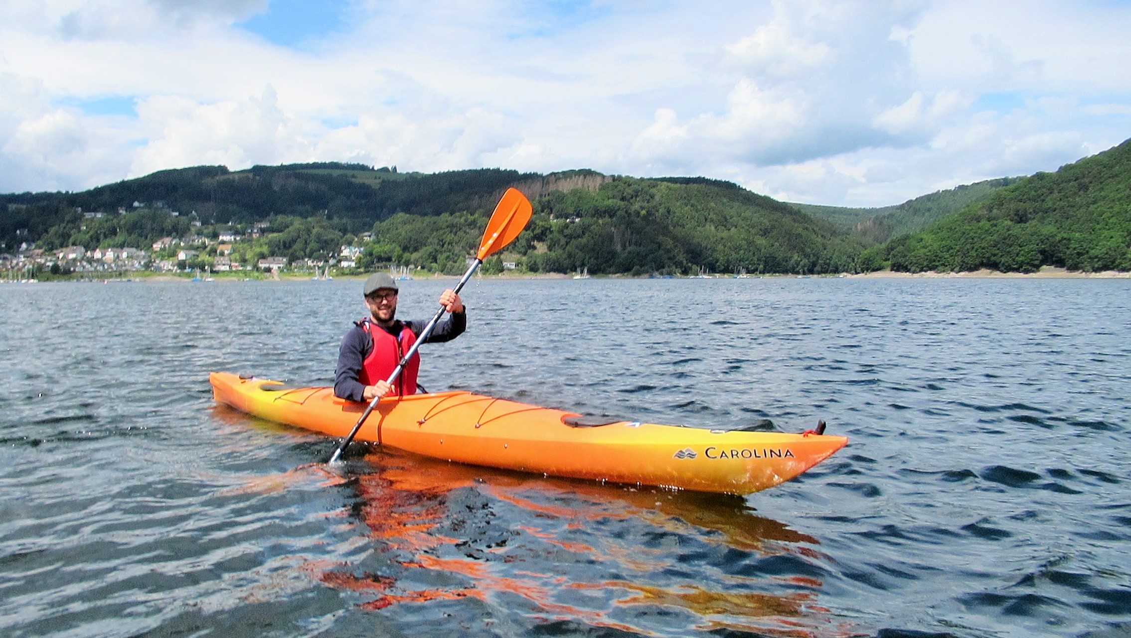
It’s that time of the year when I crave to get back out onto the water again – however, this year it’s different unfortunately. Whilst normally I’d be cheerily loading up kayaks onto the roof bars on a weekend, I’m now frustratingly confined to shore due to a knee injury. Indeed, this is despite persistent calls from my son, which it has to be said, is quite a piece of role reversal. For someone who loves being on the water, this can certainly be dispiriting, though I’m confident it’s just a matter of time before normal service is resumed; let’s certainly hope that’s the case.
In Scotland, where I first started sailing and then canoeing, we were pretty spoiled from a water sports perspective, given the sheer availability of water everywhere in the Scottish landscape – whether it be lochs, rivers or sheltered coastal locations. Ok, so Scottish water might certainly not be the warmest; I remember deliberately capsizing in Loch Tay as part of an open canoe rescue course one freezing February day, when the water was a balmy 2 degrees C – never again ! (at least not without a wetsuit that is).
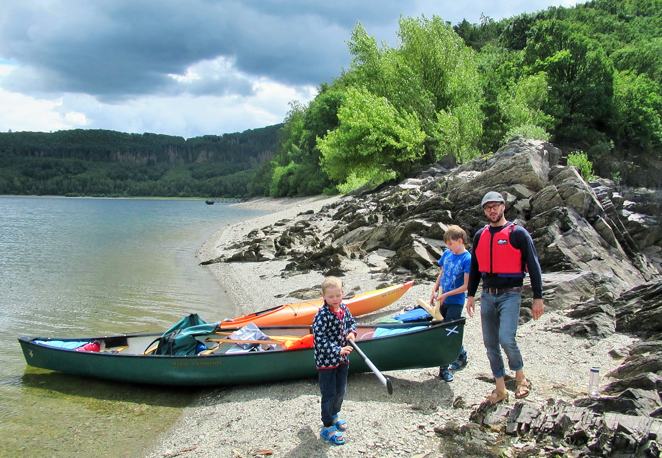
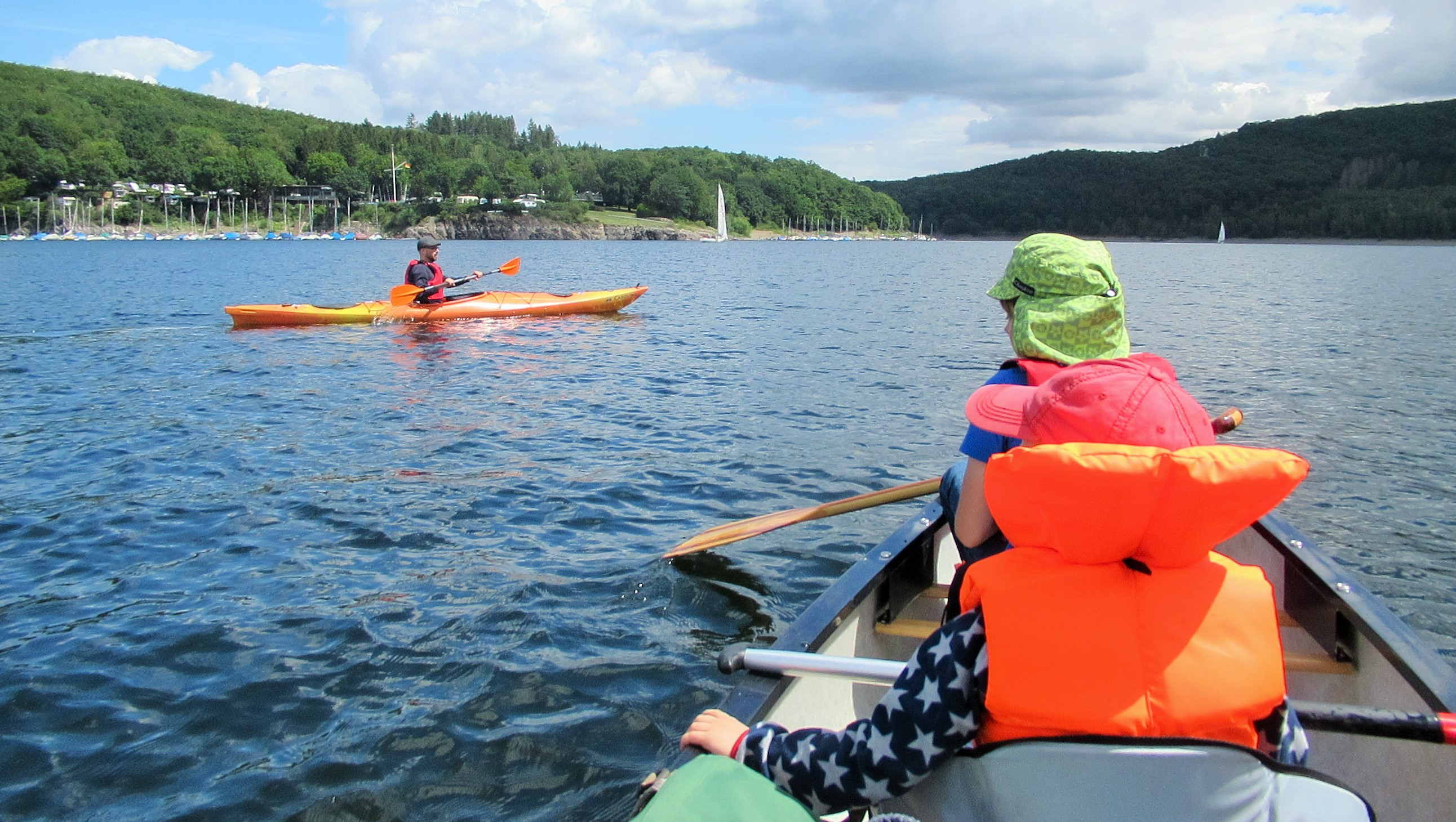
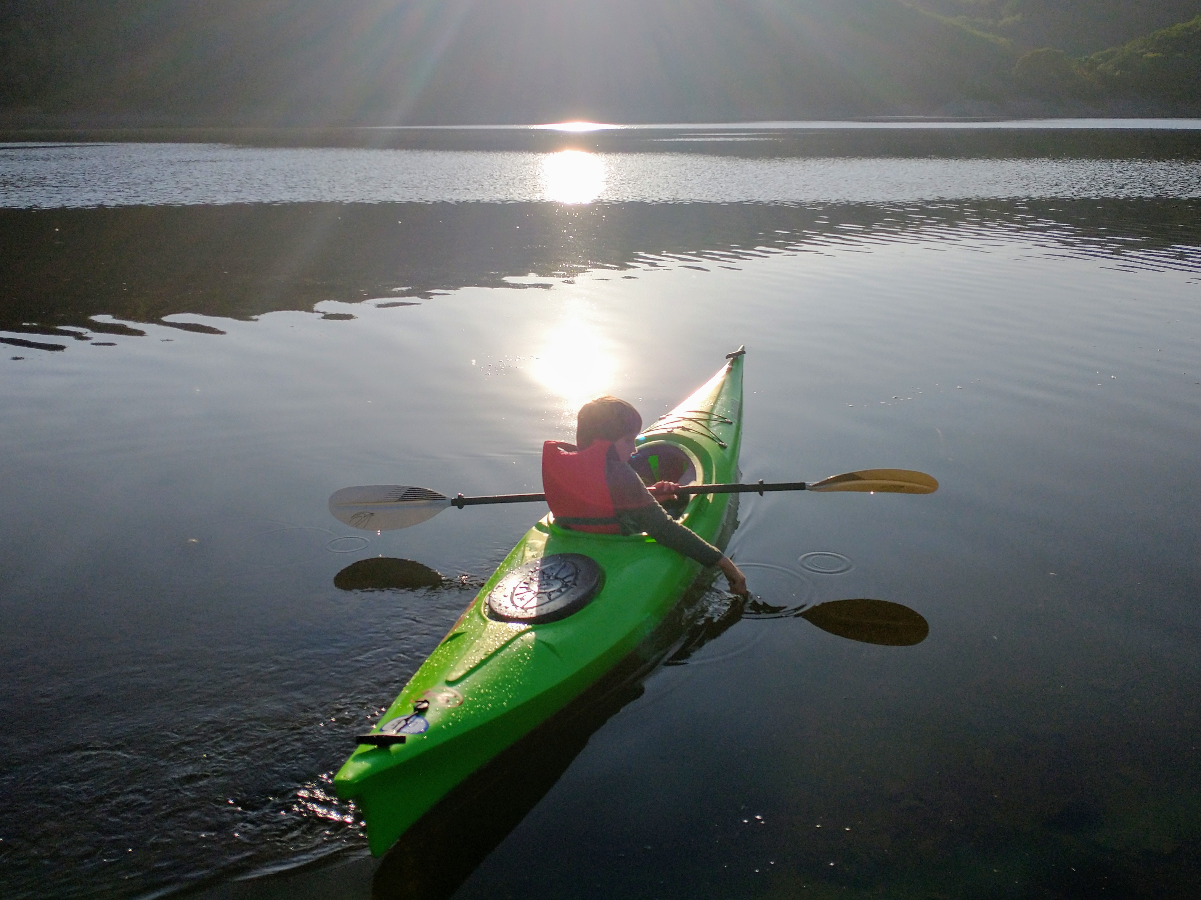
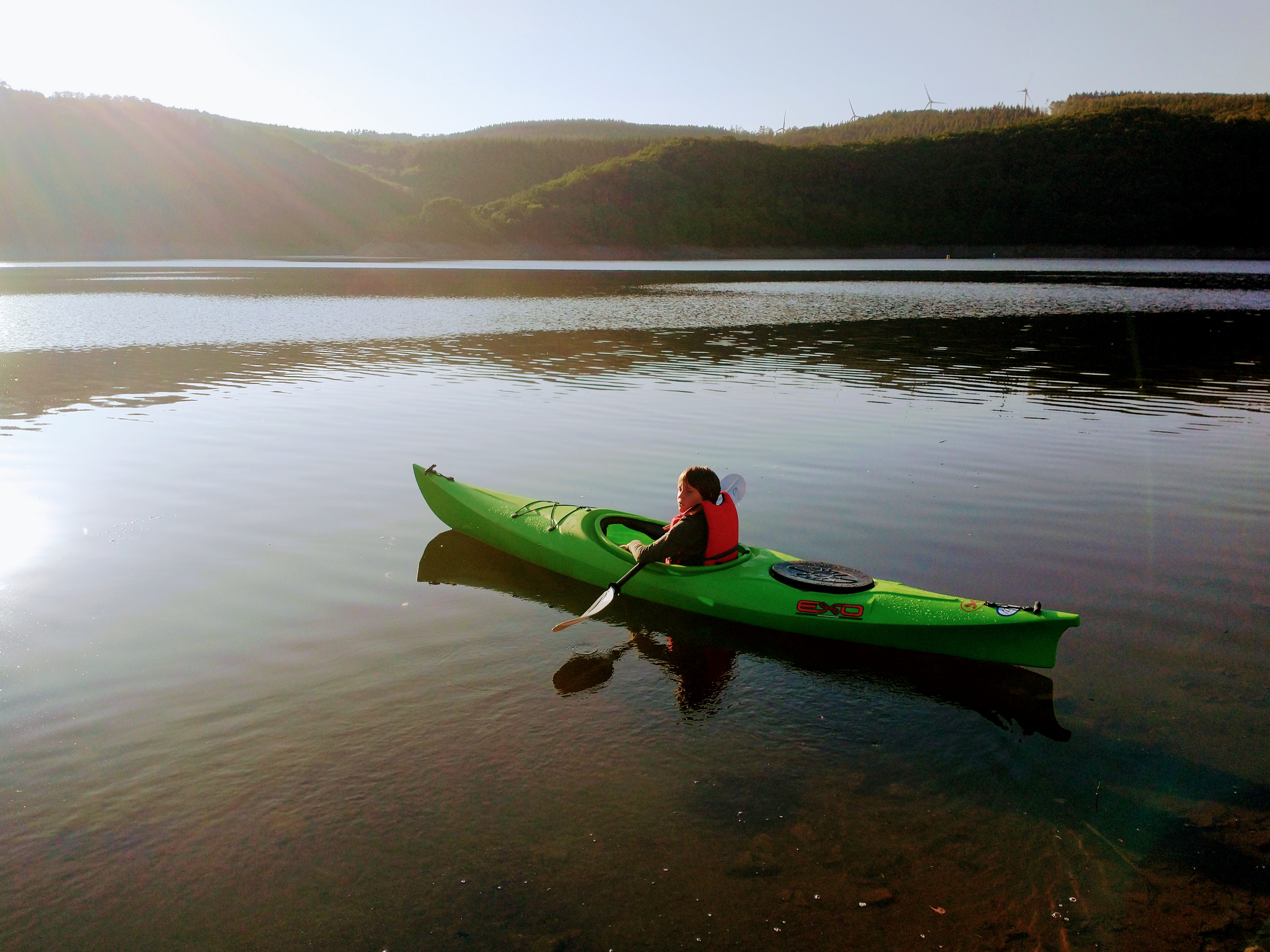
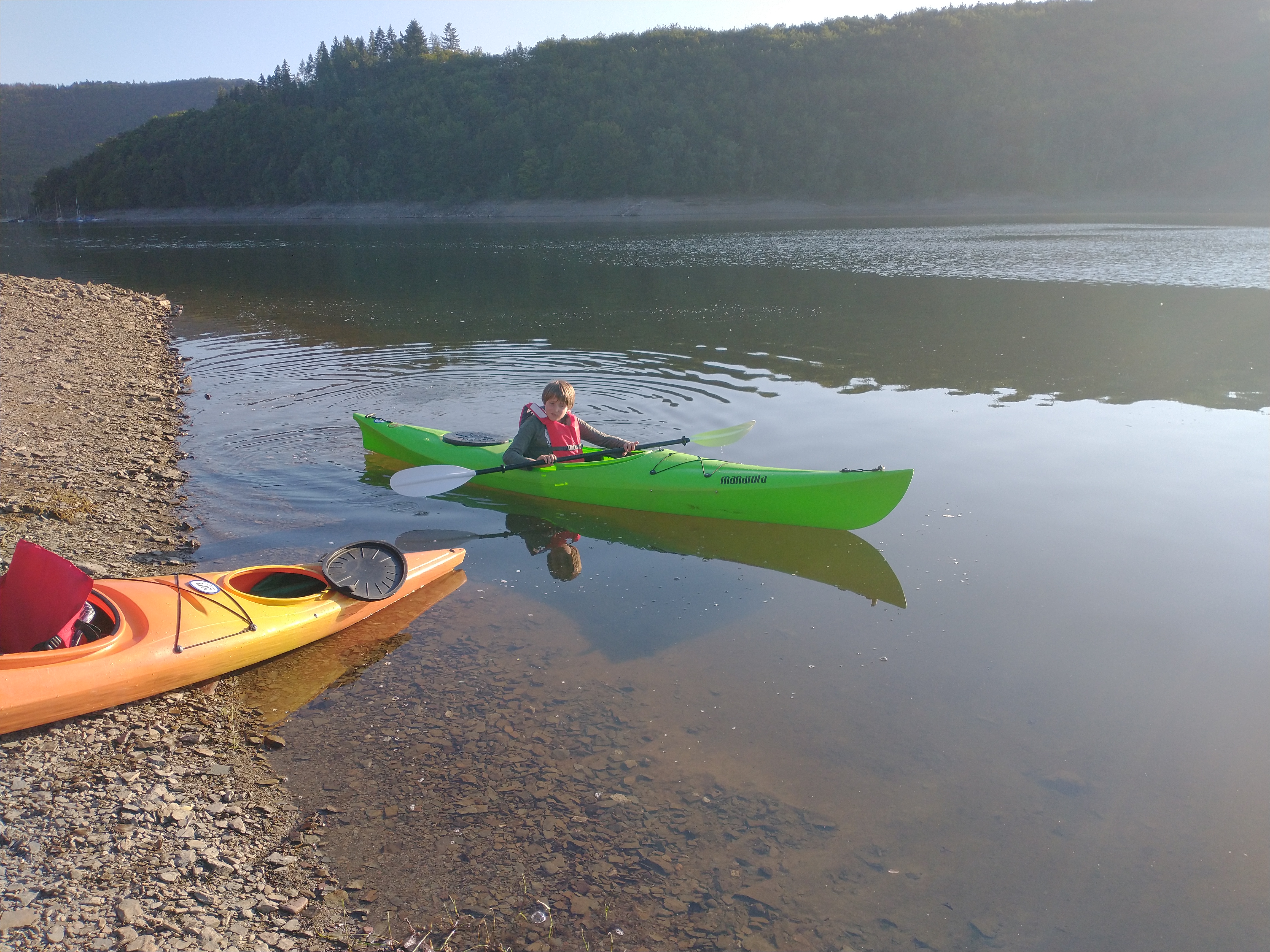
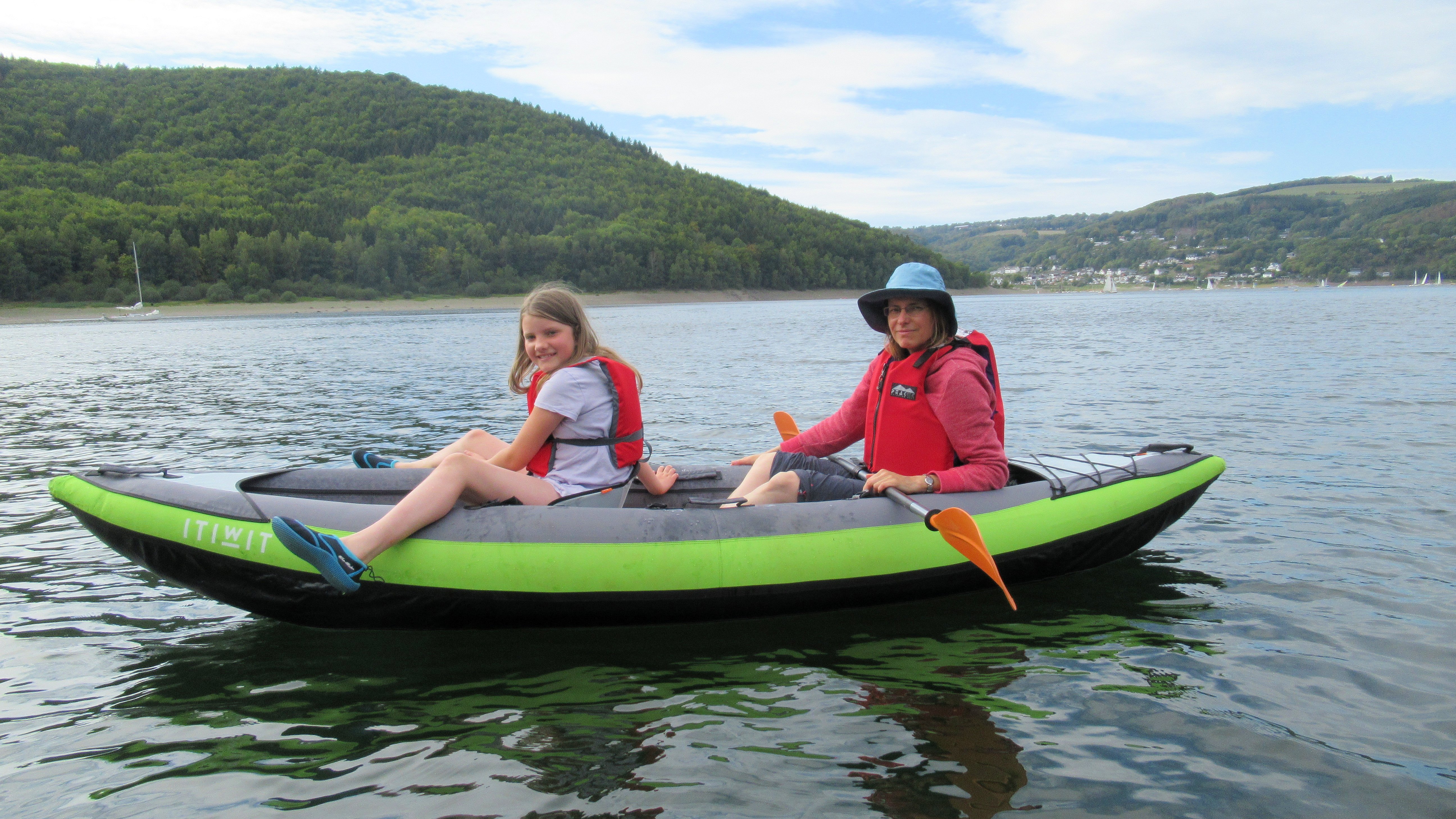
Although there aren’t too many paddling possibilities around Aachen, the saving grace in this region is the Rursee; one of a series of large reservoirs constructed during the 1930s along the valley of the River Rur been Monschau and Heimbach, for supplying water and hydropower to adjacent urban districts to the north. The Rursee lies within the hilly and forested Eifel region and partly within the Eifel National Park area itself. In fact it’s only a 40 minute drive up the road to get there, making it a very doable and pleasant excursion for an afternoon or evening.
Over the last few years, I’ve often dragged (sometimes reluctant) family members and an assortment of paddling buddies and our kids’ pals up there for chilled-out (and occasionally more challenging) sessions on the water. Here’s a selection of images, including our friends Lamar and Pehr, who’ve quite certainly gotten into the spirit of these watery adventures, whether in open canoe, kayak or inflatable boats
Last year, I bought my son Kai his very own kayak – after spinning around in circles for quite a while (and getting extremely frustrated), he’s now taken to it like a duck to water. We’ve found evening trips by far the best time to visit the Rursee – by that hour, the day trippers have largely packed up and gone home for the day, the pleasure cruisers and overzealous rescue boats have finished their shifts (though we do like playing in the waves they create) and there’s generally a more peaceful vibe about the place. In fact you can often get the whole lake to yourself, save for a few sailing boats which drift peacefully by.
So, let’s hope that we can get out on the water and enjoy that evening calm again soon. We just can’t wait…
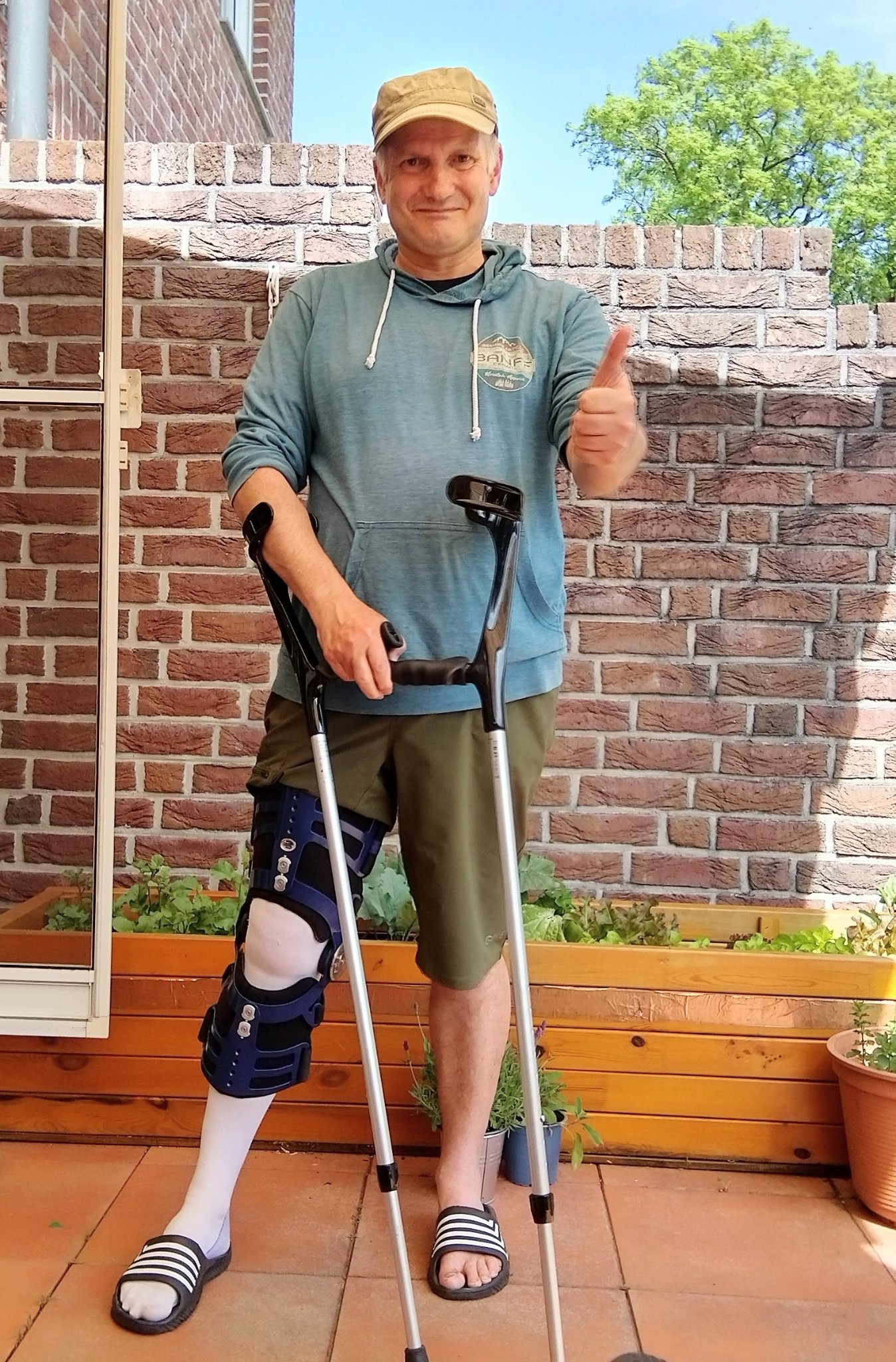
When you go out for a straightforward hike with your family, you don’t expect to have to be carried out on a stretcher by the local mountain rescue team, bundled into a waiting ambulance, undergo emergency surgery and then spend the rest of your holiday recovering in a hospital bed – Let’s face it – that’s not why we take holidays ! Unfortunately, however, that’s what happened to me over Easter this year.
Hobbling around the house on crutches and with my knee braced up, makes me reflect on how lucky I’ve been over the years to generally have avoided such calamities, especially in some remoter locations, where help is far away or possibly even unavailable. It also makes me aware of how luck can run out when we least expect it, when things are routine and easy. Life is precious and fragile – so just when we are taking everything for granted, we can so easily experience that unexpected “ouch” which literally brings us down to earth with a bump.
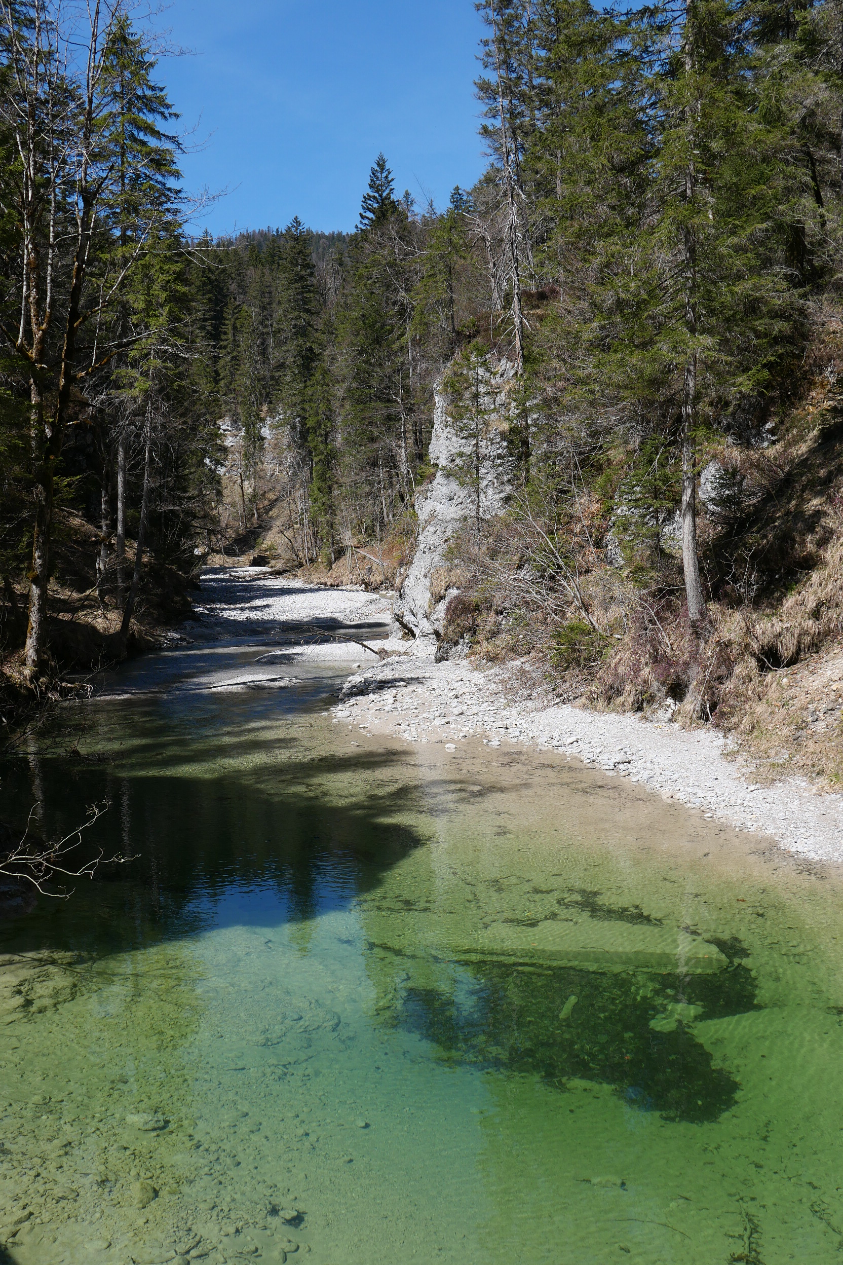
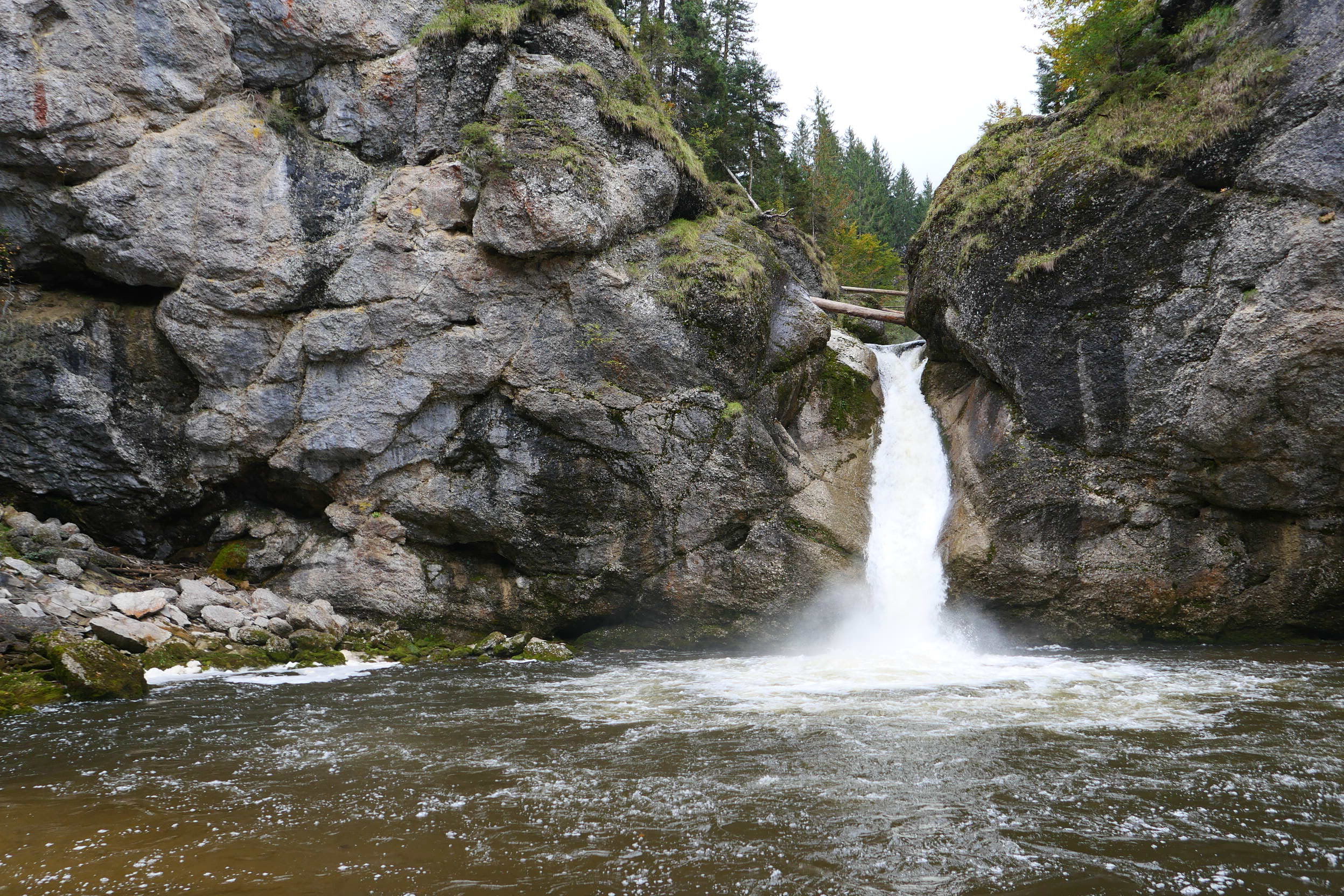
However this is no epic tale of survival against the odds – just a straightforward, rather silly case of misjudgement and lack of attention. That particular day in April had started well enough. The plan was for a simple and unambitious hike on an interesting, but straightforward path along the Finzbachklamm, an impressive gorge, tucked away in the hills near the village of Krün in the Karwendel region of Bavaria. Heading off into the woods, we followed a rough path along the bottom of the narrowing ravine, taking time to linger by some lovely and inviting aquamarine pools, where the river Finzbach flowed between rocky headlands. After that, the path wound more steeply upwards, zig-zagging up the steep side of the gorge and providing ever more impressive views of the valley, the surrounding forests and mountains. The trail then continued along the rim of the gorge, past some airy viewpoints, for another km or so before joining a larger forest track.
All this natural wonder is indeed the perfect inspiration for photos and that was my simple thought when I decided to step a bit nearer towards the edge, just to get a couple of nice snaps from an obvious lookout point; by that time my family were somewhat well out in front and I quickly weighed up the pros and cons of lingering to take in the view. That turned out to be a bad decision…
Focusing more upon the view than the easy terrain over which I was walking, proved my undoing. There were some projecting tree roots, a rough step down and a change of incline which didn’t really register. Without any warning I found myself suddenly hurtling to the ground (fortunately not over the drop which was a few metres further on). At that moment, there was a very loud and very ominous crack from my leg and I found myself literally lying in a heap on the ground; my leg pushed back and hurting like hell – a horrible cramping pain.
After the initial shock, I tried to move my leg, however it clearly wasn’t wanting to go anywhere and the pain was stabbing and unpleasant to say the least. I thought about dislocation of the knee as a possible scenario and wondered if I could push it back using the other leg, having heard urban myths about rugby players doing similar things and then getting on with the game. So in some ways this was helpful – the useless leg flopped out in front of me and the pain subsided immediately. However, unfortunately, it didn’t simply click back into place as a result of my makeshift DIY!
So Survival plan A, perhaps made some sense if being somewhat optimistic; Survival plan B, which involved trying to somehow stand and walk along the path, proved even more optimistic. Miraculously I made about 10m or so before collapsing in an unruly heap and great pain by a big pine tree and having to repeat the procedure of pushing my leg forward to ease the pain, which again provided some relief.
So it was clear I was going nowhere. Plan C was to accept unpleasant facts and to wait for help from my family, who were somewhere off in the distance in front. Surely they would notice that I wasn’t following sooner or later. After what seemed like an age, I heard the welcome sound of their distant voices up the trail; however despite my repeated calls, they then seemed to get no closer – my calls going unheard.
Eventually, just when I was giving up hope, my daughter came sauntering around the corner to check out the situation. I explained that I couldn’t walk any more and needed help to move. True to form, I received a quizzical look from Zoe and questions I hadn’t expected about why I’d decided to have a rest on the ground and put my feet up, whilst others were waiting ahead up the trail. I gave up trying to explain my predicament and bawled “Just get Mummy…!!!”.
Fortunately, this proved more successful, and a bemused “Mummy” soon appeared after she’d received the news from my daughter that I’d decided to have an Impromptu nap by the side of the trail for unknown reasons. However, this had sounded somewhat too out of character to be convincing in any way. So “Mummy” got on the phone and dialled the emergency services once we’d looked at the map to determine the location and best access – fortunately it was only 50m or so of rough path to the Jeep Track. After another half an hour or so, we heard the welcome sound of the the Krün Mountain Rescue Team vehicle approaching, to pick up the pieces and bring me back to “civilisation” (after first dragging out their own vehicle out of the mud, after it got bogged down trying to turn around).
The rescue guys were clearly pros though and carefully loaded me into a stretcher, making sure not to bend the leg. After being wheeled over the section of rough path on their patent 4X4 stretcher (which featured a bike wheel underneath for all terrain use), I was loaded unceremoniously into the rescue vehicle and then bumped and jostled down the forest track. I was then transferred to an awaiting ambulance in Krün (where a few onlookers took the chance for a gawp at the victim), which took me to the Accident and Emergency unit in Garmisch. Although it was all a bit hazy, I have to say the emergency teams were great and provided wonderful support and encouragement. At Garmisch, I was wheeled along long corridors to be assessed by various specialists in low-lit and labyrinthine underground chambers, then x-rayed and ultra-sounded to determine what happed. Eventually a white robed doctor gave me the verdict – I’d completely ripped my patella tendon (that was the loud cracking noise !). This required urgent surgery to stitch the tendon back together.
So I had my operation the next day (no time wasted here in Germany, though that’s not always the case), which was successful and then spent the rest of the holiday recuperating in the hospital ward, billeted with a young German soldier who’d had a skiing accident and a Romanian chef with an unfeasible work-related foot injury. Both the inmates and the staff were fine and decent company, not that I was feeling so sociable. In fact we were treated well by everyone, though I have to admit an extended hospital stay was not quite my idea of a holiday by any means – worst of all was the daily stomach injection against thrombosis. It’s still part of the recovery plan 😦
At least the view was great though – overlooking the Zugspitze, Germany’s highest mountain and the ski jumps of the infamous 1936 Winter Olympics, which was opened by a propaganda hungry Adolf Hitler to showcase the alleged might of the Third Reich. Some decades later, it was here that Eddie the Eagle was to train for his epic performances in Calgary. It has to be said that I was lucky to enjoy such a fine view from a hospital bed and a work colleague even, encouragingly, sent me an article about how nice views of nature aid recovery of hospitalised patients.
Obviously, there was some truth in this. After several days I was deemed fit for release and my family duly appeared to collect me for the long drive home – they’d had to extend the holiday especially and book accommodation for an extra few nights; the kids obviously being devastated about missing school.
So now I’m recuperating at home – it’s a slow road to full recovery and I hobble around the house with crutches and a knee brace, moaning about mysterious aches and pains; expecting sympathy, but not really getting much. After all, it was my fault for being such an idiot in the first place surely (just to avoid household chores or something). Occasional trips out to visit doctors and physios livens up the routine somewhat.
All in all, I do feel very grateful though that, I have been looked after by so many kind people and to live in a “civilised” country which can provide such an infrastructure and care – We do take a lot for granted. Who knows when life can change in ways which are quite unexpected and less pleasant than our normal cosy routines – SHIT HAPPENS I guess, but at least I’m here to fight another day ! Strangely enough though, mountain hikes are not on the wish list right at this moment.
And I did enjoy the Easter holiday for a couple of days at least. Here’s a few photos of those first few blissful days.
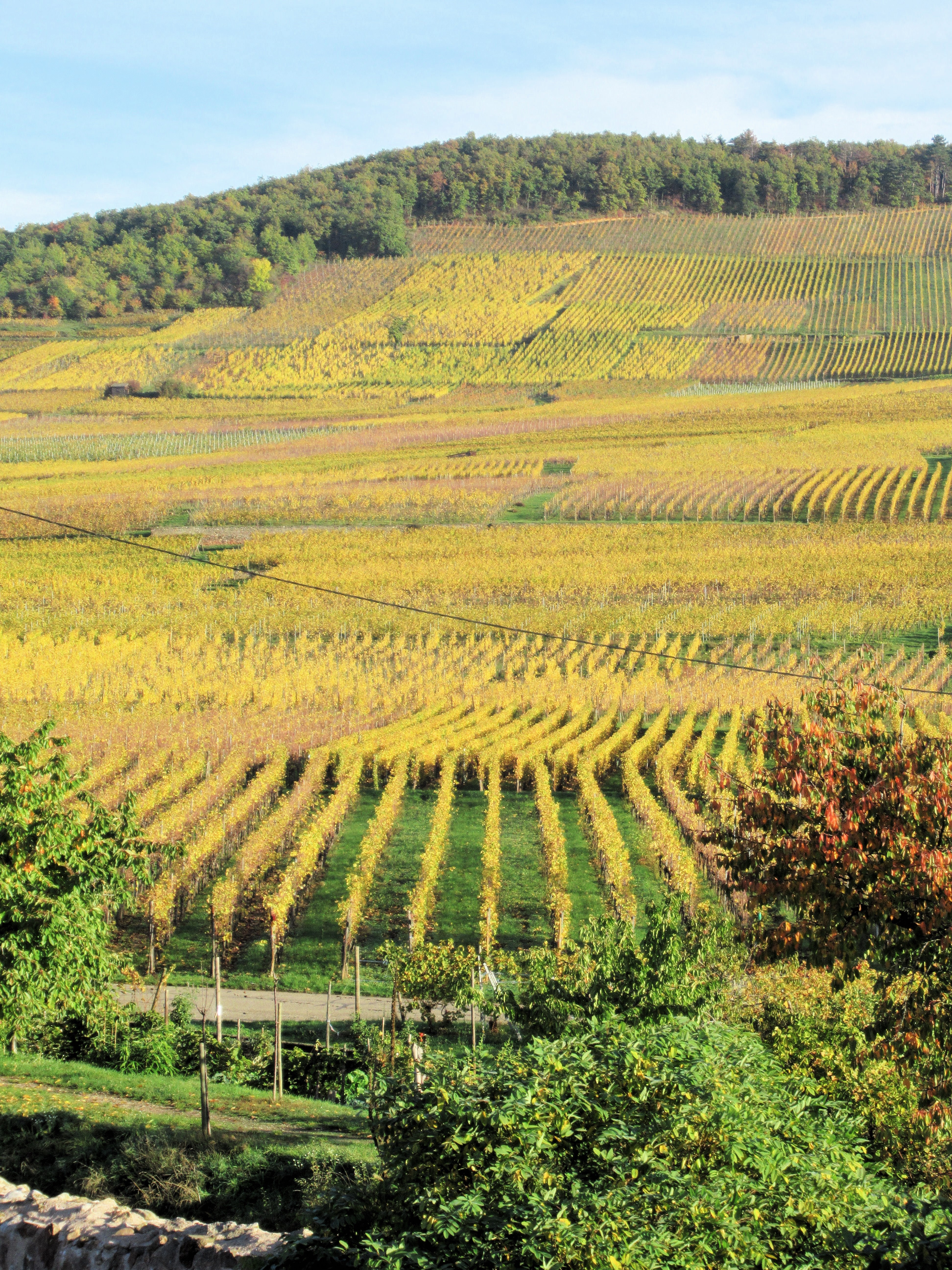
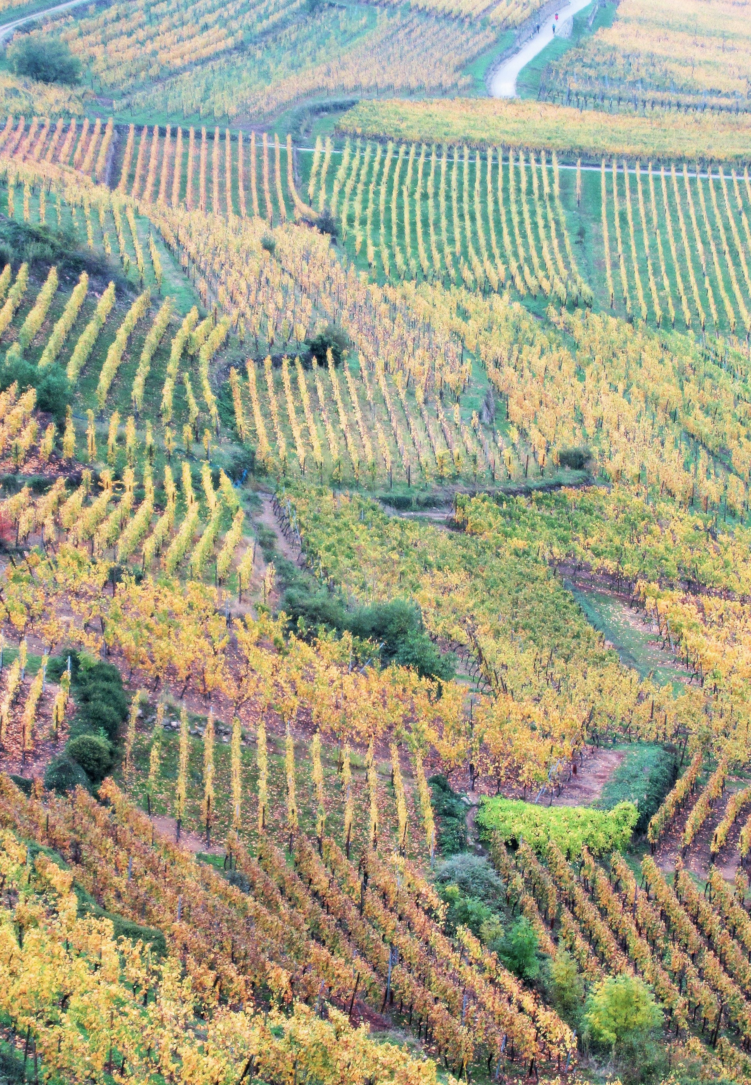
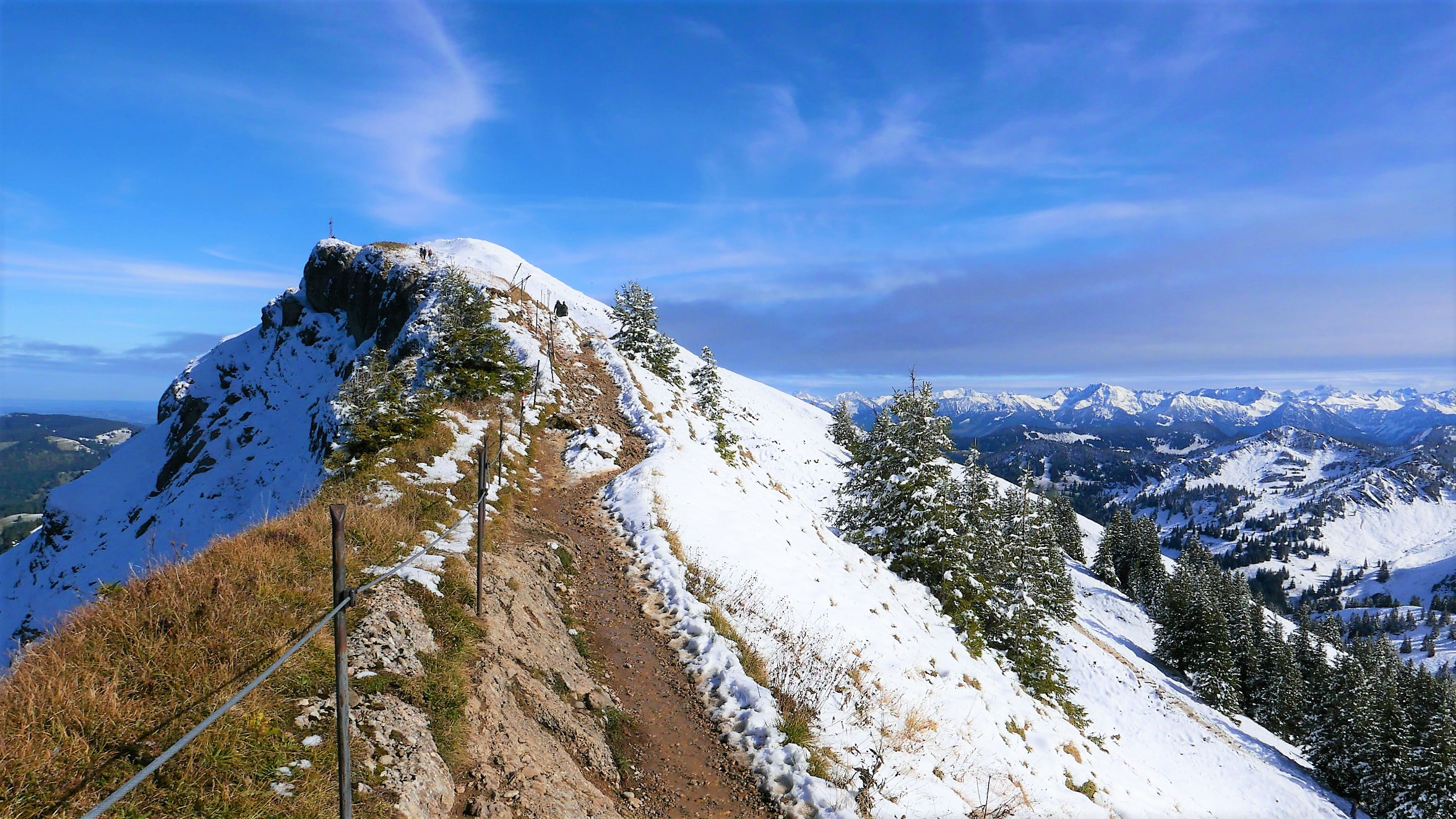
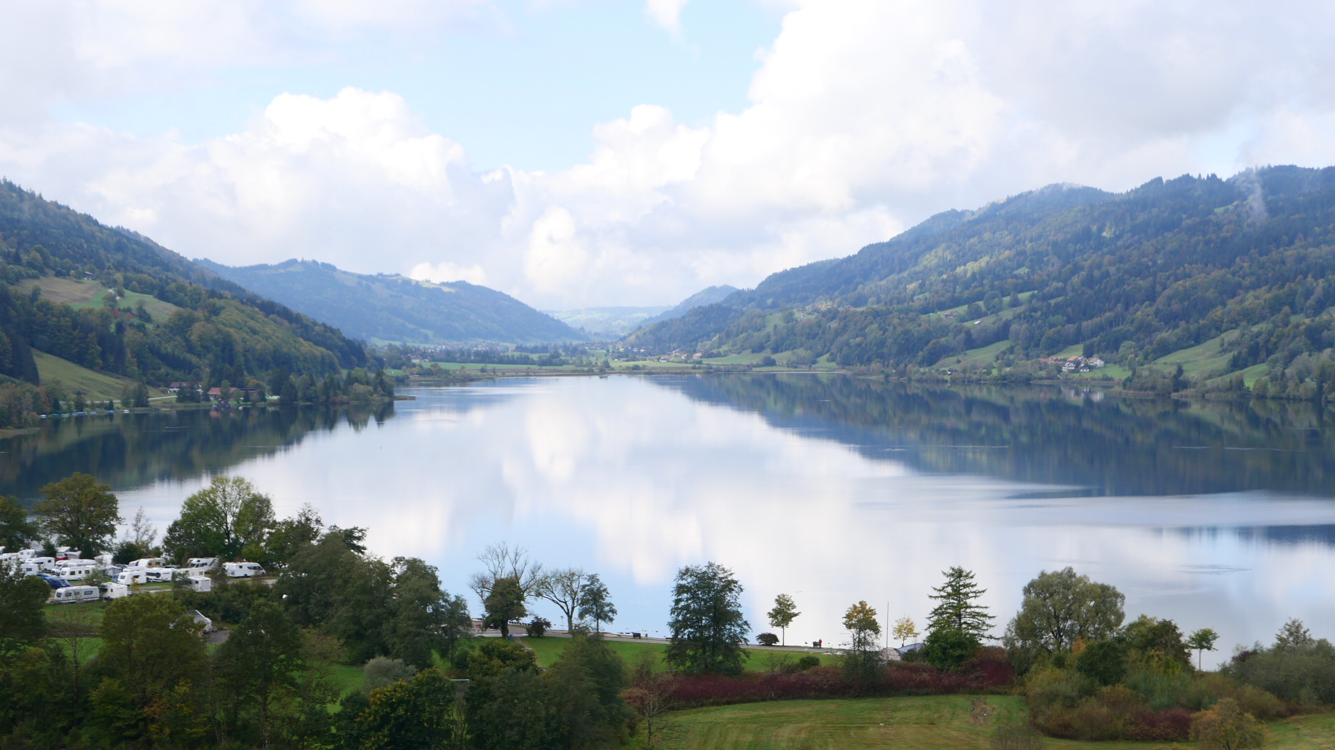
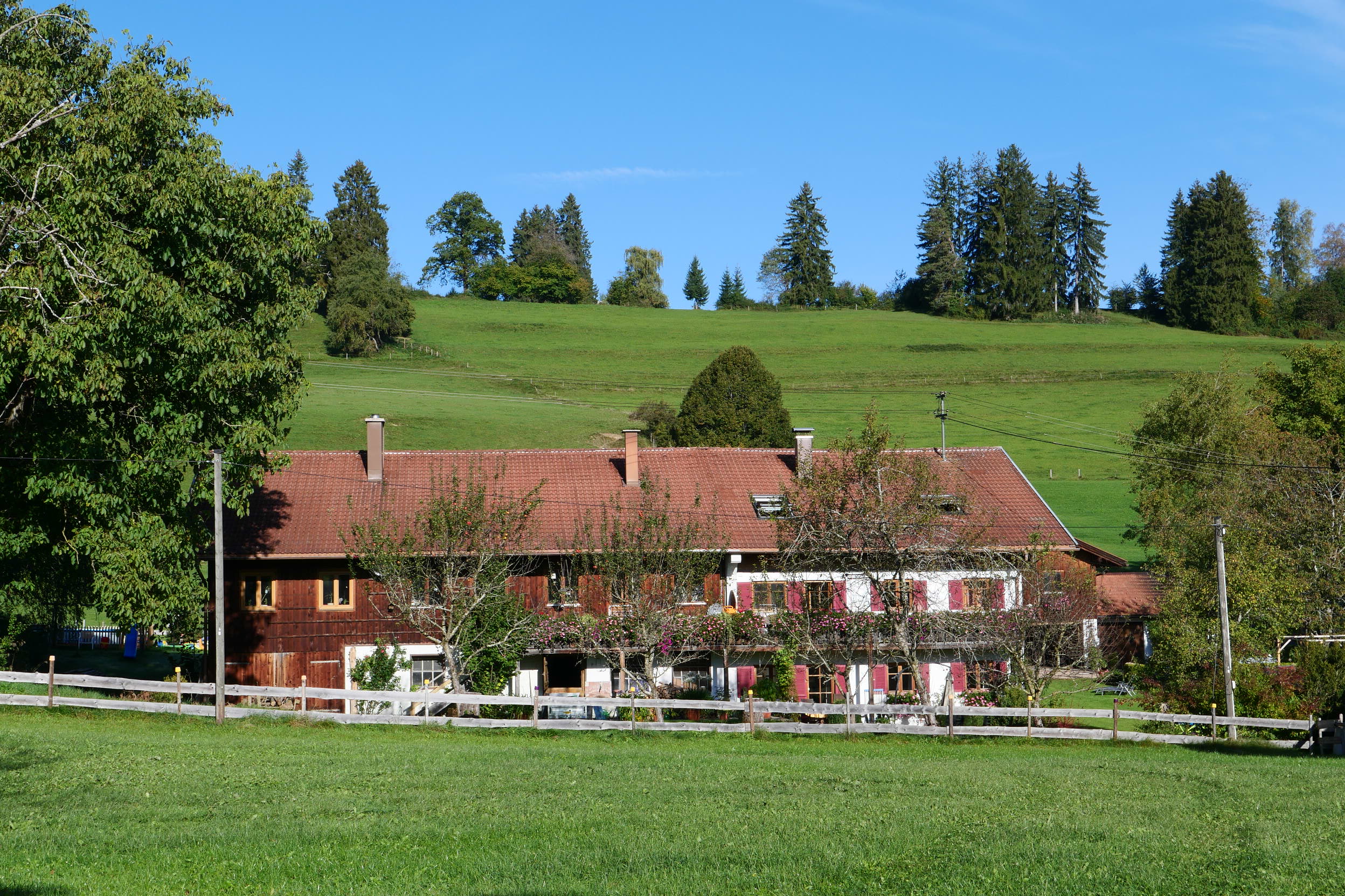
The chances are that you’ve never heard of the Nagelfluhkette – at least I’d be somewhat surprised if you have ! The unusual name refers to a compact mountain range at the northern edge of the Allgäu Alps in South Eastern Bavaria. These mountains reach their highest point at the peak of “Hochgrat”, 1,834m above sea level – located at the western end of the highest ridge and overlooking the pretty spa resort of Oberstaufen. The Nagelfluhkette as a whole, comprise of a series of parallel ridges which run to the south west of the Illertal, the main valley of the Allgäu Region, where the settlements of Sonthofen and Immenstadt lie.
So how exactly did the Nagelfluhkette get it’s curious sounding name ? Well, in Scotland, where I come from, we have the rather more fun (and appetising) sounding “pudding stone”; a soft conglomerate rock made from many smaller, rounded stones which have been compacted together under huge geological pressure. Indeed, this type of stone is quite common along the edge of the Highland Boundary Fault in Central Scotland, particularly around the Aberfoyle and the Trossachs area. In short, “Nagelfluh”, equates to “pudding stone”; the German name deriving from the rounded pebbles which are visible in the rock and which are said to resemble the heads of nails which have been hammered into the stone.
Coming back to Bavaria; the whole of the Nagelfluhkette area is now designated as a Nature Park and it was the first cross-border Nature Park created between Germany and Austria. The primary objective is the protection, care and development of nature and landscape. Nature parks generally aim to integrate nature conservation objectives with the promotion of local tourism and sustainable development. In that respect they differ from National Parks in Central Europe, which normally give a greater overall priority to strict nature conservation.
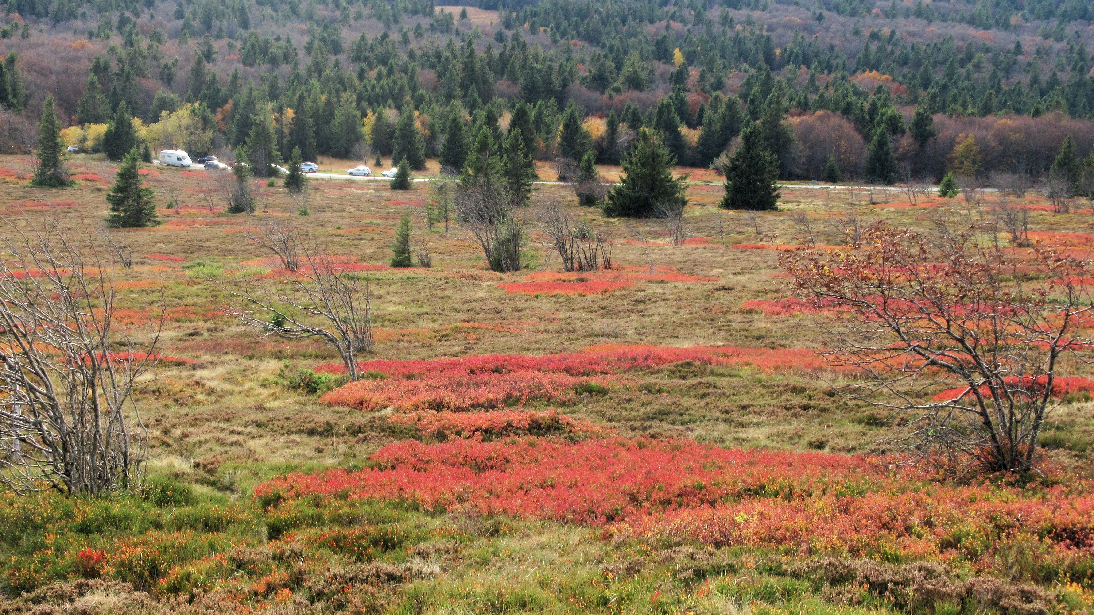
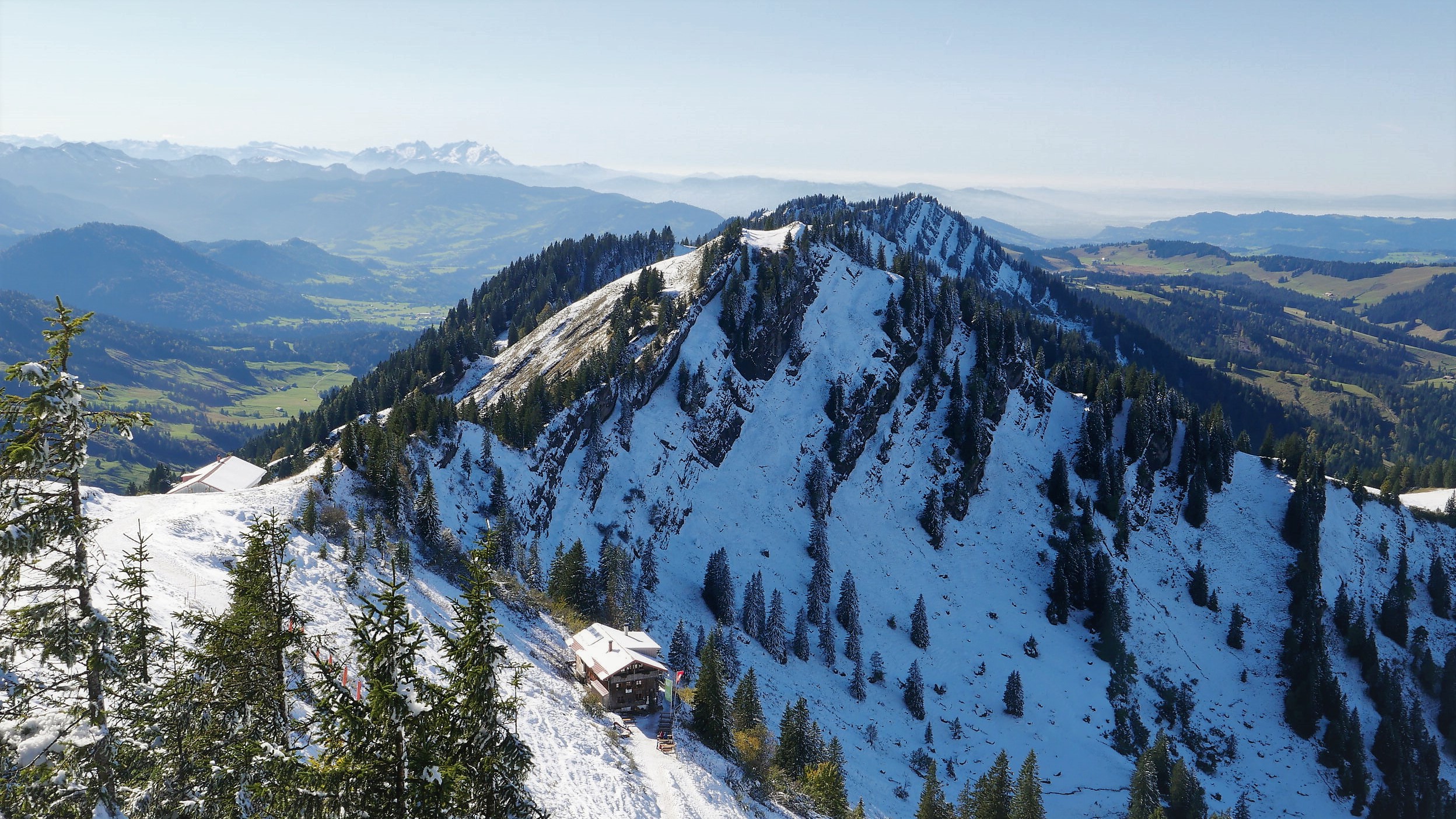
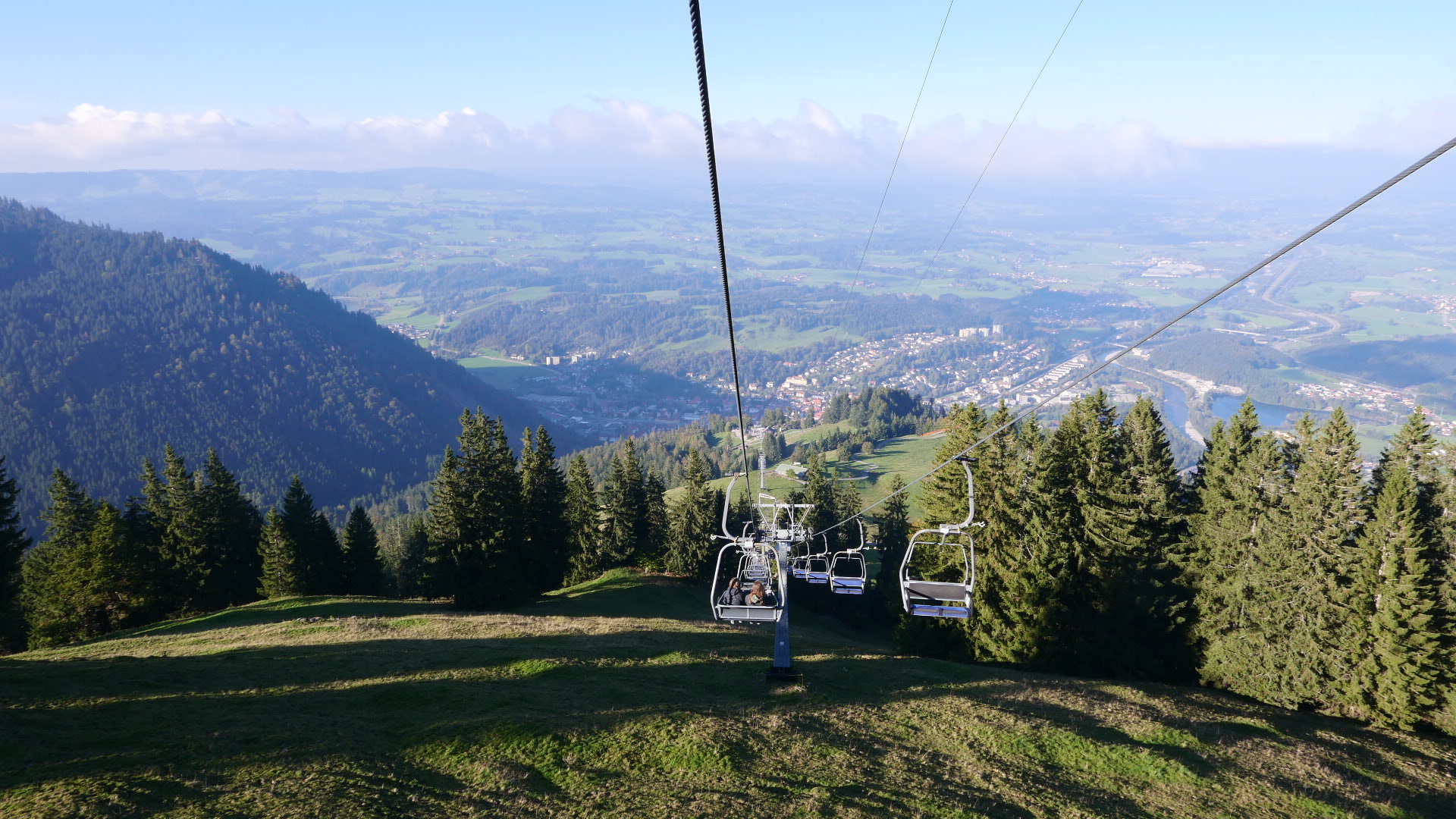
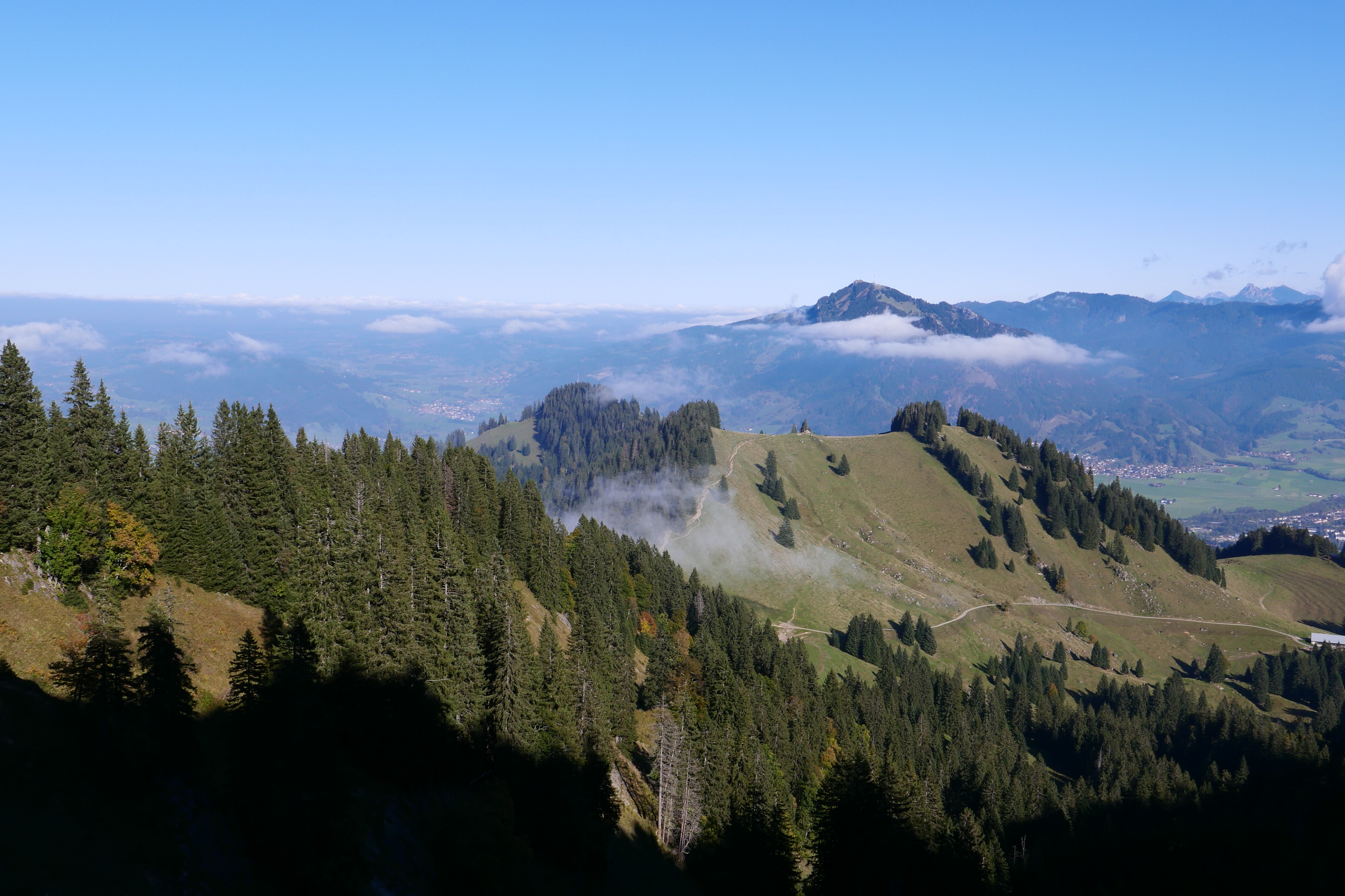
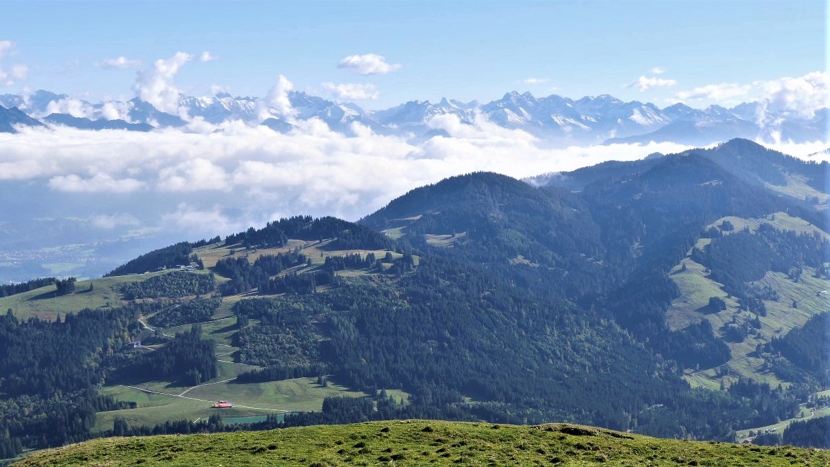
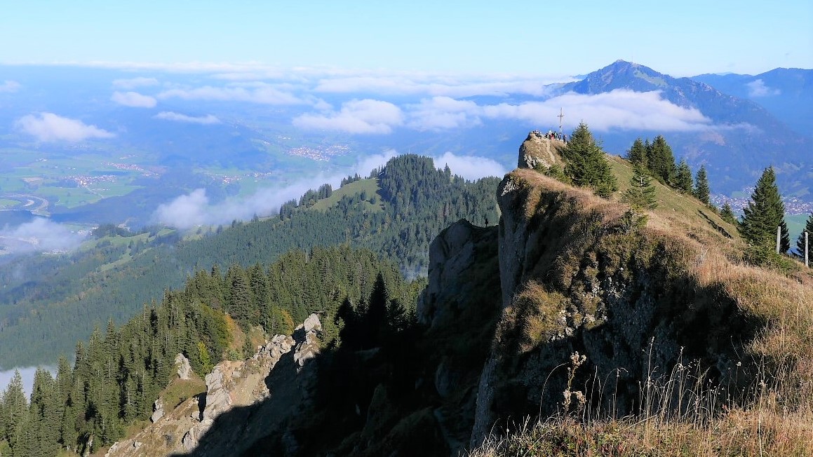
We visited the area in the autumn holidays in 2021 and despite predicted bed weather (which fortunately only actually materialised for one day) and the ongoing Corona Pandemic restrictions, we had a great time. The highlight must surely have been the view from the Hochgrat ridge itself, which is accessible by characterful vintage gondola, followed by brief a 20 minute hike to the summit. Like some Scottish peaks, the view, in all directions, is surely out of all proportion to the height of the peak itself. On this occassion, it was further enhanced by an unseasonably early fall of autumn snowfall.
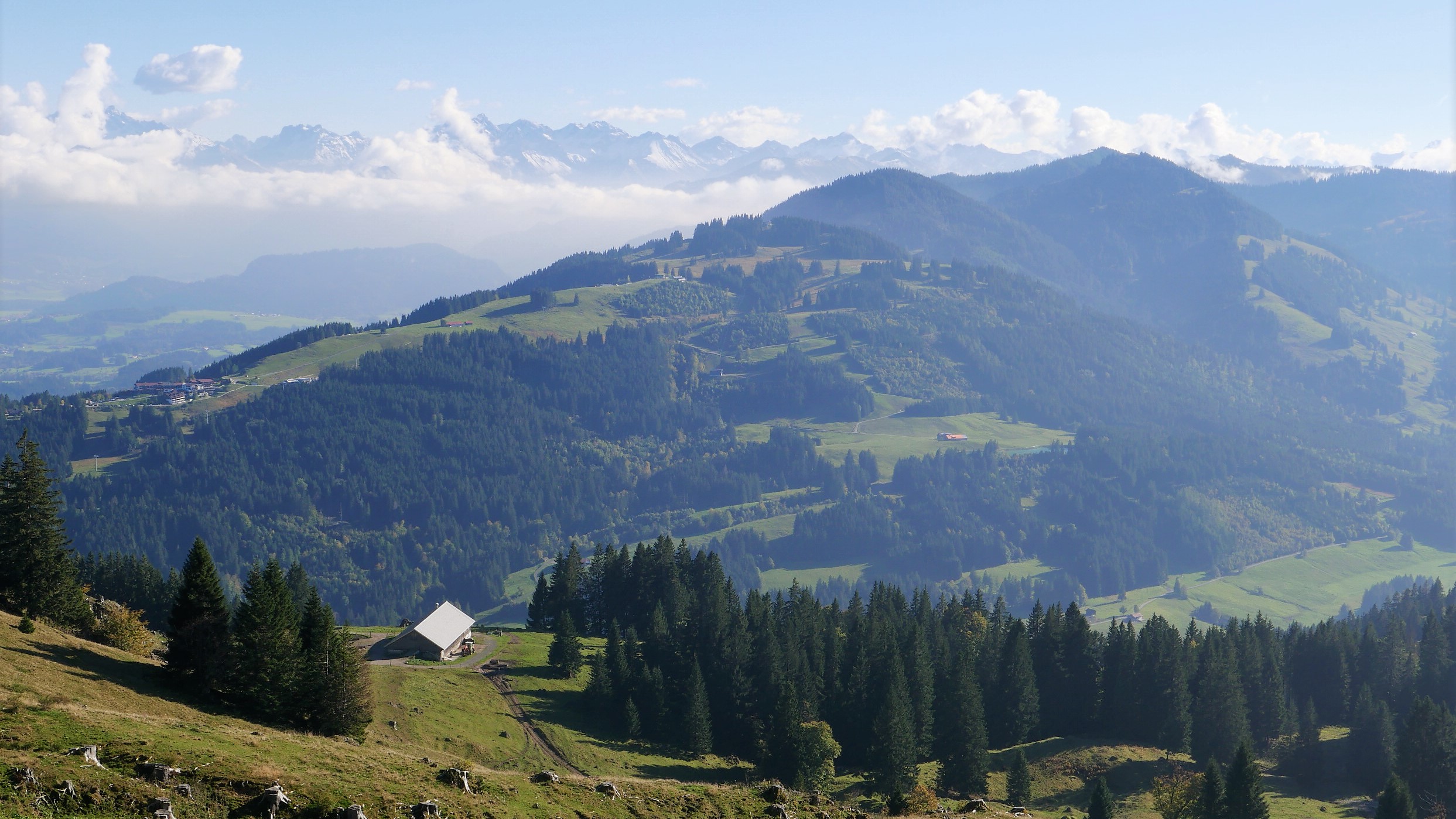
What a great vantage point !! The scenery round about is just beautiful; alpine – but not in any kind of threatening “North Wall of the Eiger” way (maybe more like softer “Sound of Music” terrain; though we never actually caught a glimpse of Julie Andrews this time). From the Hochgrat, it’s possible to undertake a long panoramic hike, right along the undulating spine of the Nagelfluhkette, in the direction of Immenstadt; with optional overnight breaks in characterful mountain huts to enjoy Kaiserschmarrn, Apfel Strudel and Rösti (of course washed down with some local Allgäu beer or “Almdudler”) – sounds good to me – bring me my Lederhosen immediately !
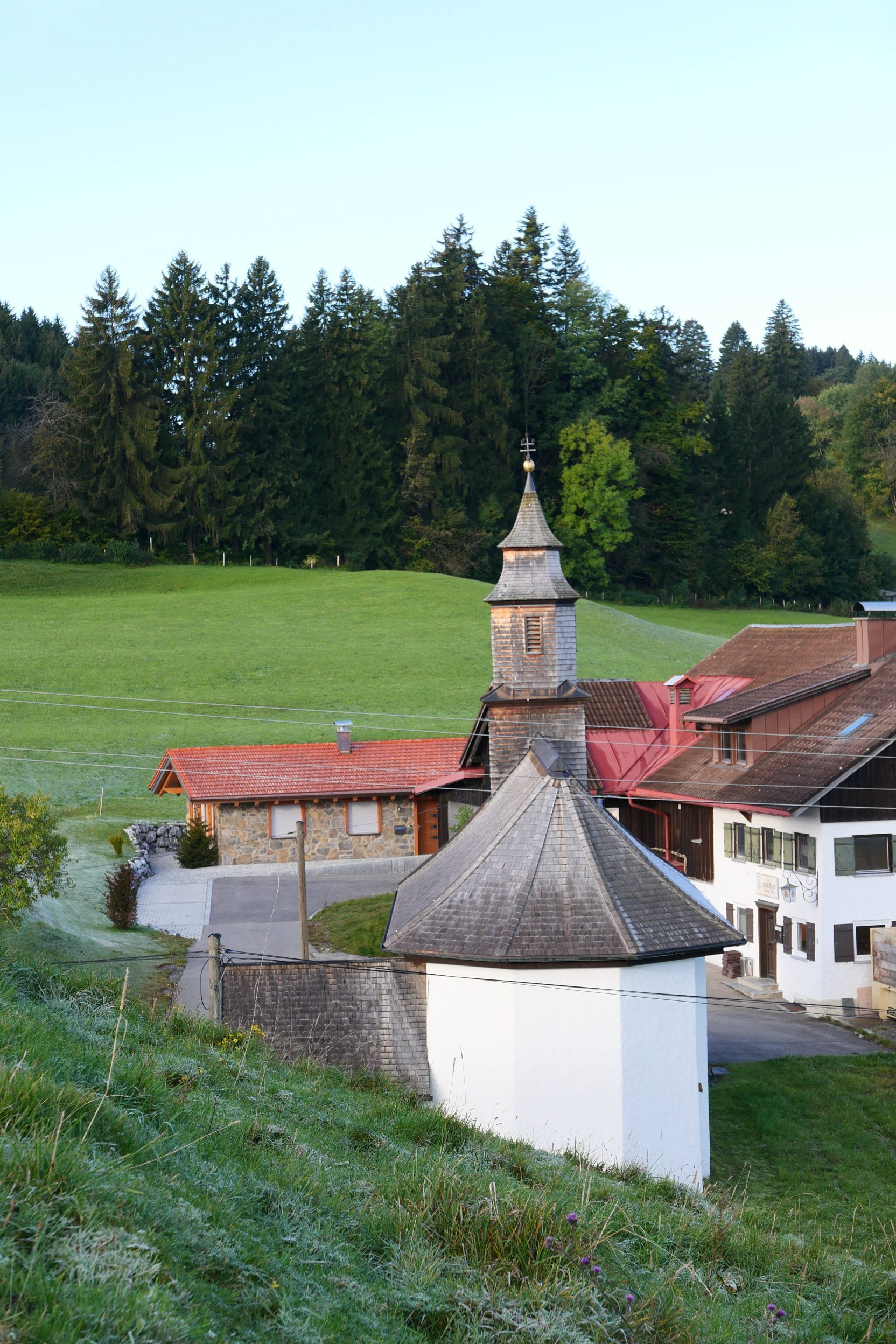
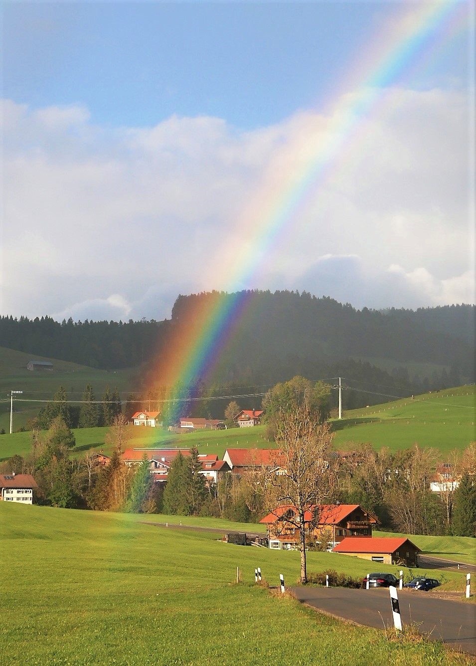
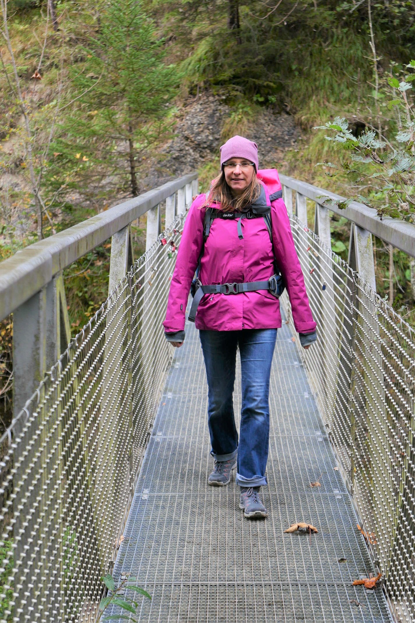
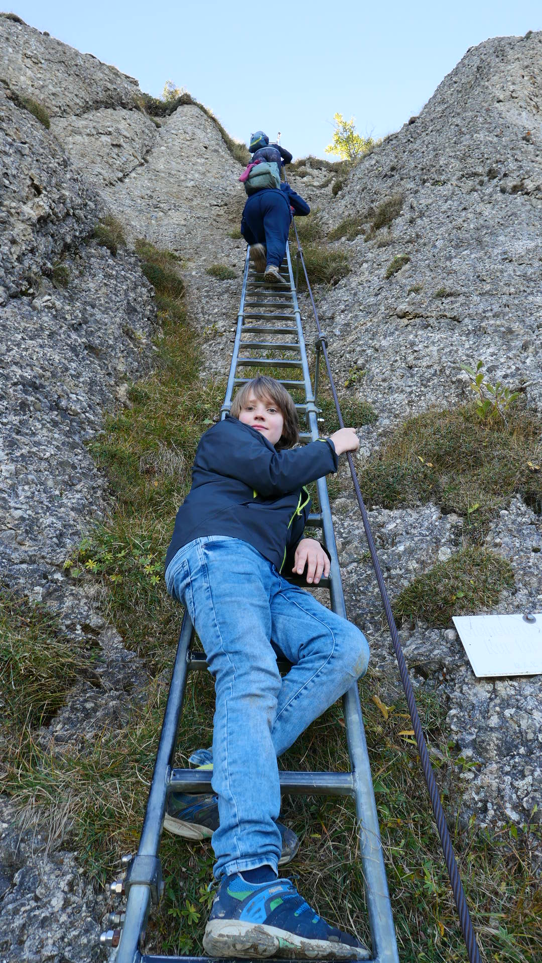
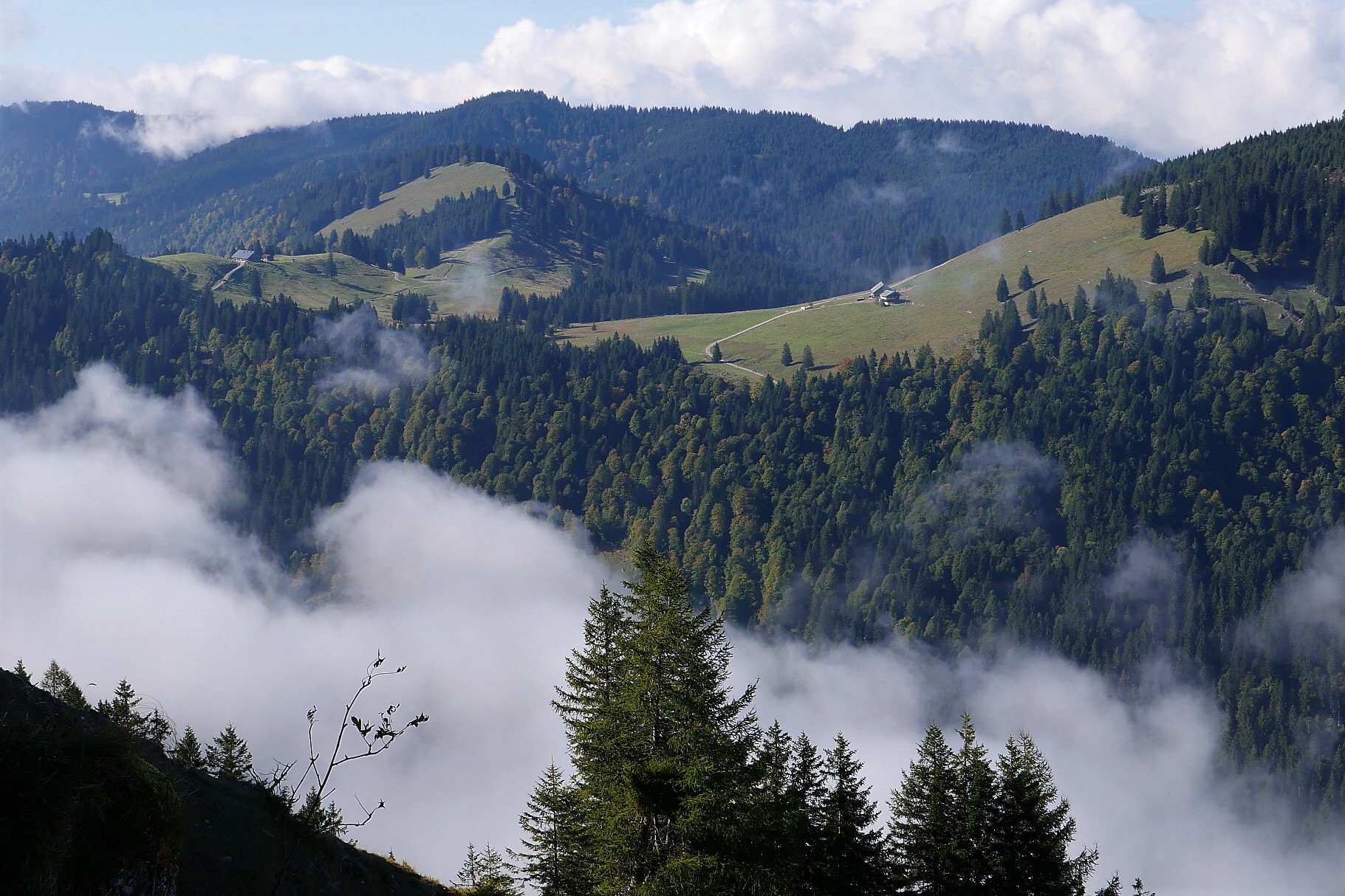
See the gallery photos below for a few highlights from a very pleasant week; we’ll be back there soon…


